Mori Atlas logo
Wildlife reserveAin Elshakika Wetland

Mapping the ecological intersection of Mediterranean coastal sabkhas and freshwater springs

Ain Elshakika Wetland: A Coastal Wildlife Reserve and Hypersaline Landscape in Northern Libya

(Ain Elshakika)

Ain Elshakika Wetland serves as an ecologically significant wildlife reserve situated along the Mediterranean coast of Libya. This protected landscape is characterized by a hypersaline coastal sabkha system, bordered by limestone formations, shifting dunes, and specialized vegetation such as tamarix and juncus. As an internationally recognized Ramsar site, the area provides essential habitat for migratory waterbirds within the larger El Kouf National Park region.

wetlandRamsar sitecoastal sabkhahypersaline habitatmigratory birdsMediterranean coast

Ain Elshakika Wetland

Wildlife reserve

Park overview

Structured park overview, official facts, and landscape profile for Ain Elshakika Wetland

Ain Elshakika Wetland park facts, protected area profile, and essential visitor context

Review the core facts for Ain Elshakika Wetland, including designation, size, terrain, visitor scale, habitats, and operating context in one park-focused overview.

About Ain Elshakika Wetland

Ain Elshakika Wetland is a small coastal protected area on the northeastern Mediterranean shore of Libya, recognized internationally as a Ramsar site and forming an integral component of El Kouf National Park. Though modest in size, the wetland carries considerable ecological significance within the Libyan coastal zone, where intact wetland habitat is relatively scarce. Its Ramsar designation in 2000 reflects both its role in sustaining waterbird populations and the distinctiveness of its saline-freshwater hydrology.

The wetland's defining physical feature is a hypersaline sabkha, the broad, flat salt flat that defines much of the North African coastal fringe. South of the sabkha, low limestone rock formations create a structural boundary, while westward and eastward the site opens into dune systems and expansive mudflats. Inland margins host a thin vegetation fringe dominated by tamarix, with freshwater-associated species such as juncus emerging in zones where local groundwater conditions permit. This vegetation pattern produces a transitional landscape where saline and fresher environments meet within a small area.

Ain Elshakika is also notable for its unusual hydrological behavior. During winter, high tides push seawater inland and raise the water level of the sabkha to around one meter. In summer, the water table recedes below sea level but does not disappear entirely. Freshwater springs within the site locally moderate salinity, producing a gradient of conditions that supports diverse bird and plant communities. Together, these attributes make Ain Elshakika one of Libya's most ecologically distinctive small wetlands and an important component of the broader El Kouf National Park landscape.

Quick facts and research context for Ain Elshakika Wetland

Ain Elshakika Wetland is a Ramsar-listed site located in Libya and contained within El Kouf National Park. Designated on 5 April 2000 under reference number 1026, it covers roughly 33 hectares of coastal habitat. The site's defining feature is a hypersaline sabkha, a flat saline depression characteristic of North African coasts, bordered by limestone formations inland and shifting dune systems and mudflats toward the coast.

Despite its small size, the wetland maintains a permanent water presence, fed by coastal seawater incursion in winter and moderated by freshwater springs. This unusual combination of saline and fresh water influences, along with seasonally shifting water levels, supports a habitat mosaic that attracts a wide range of waterbirds and makes the site ecologically distinctive within Libya's coastal landscape.

Protection and recognition

Documented conservation history, mixed protection scope, and official international wetland designation records.

Ain Elshakika Wetland Protection Status and International Ramsar Recognition Data

Ain Elshakika Wetland maintains a documented mixed protection scope backed by official Ramsar designation records established in 2000. Verified administrative sources provide structured context regarding international recognition history and designation framing.

International recognition

Protection details

Protection scope
Mixed
Designated year
2000
Transboundary protection
No
Park context

Deeper park guide and search-rich context for Ain Elshakika Wetland

Ain Elshakika Wetland history, landscape, wildlife, and travel context

Explore Ain Elshakika Wetland through its history, landscape character, ecosystems, wildlife, conservation priorities, cultural context, and seasonal travel timing in a structured park guide built for atlas discovery and search intent.

Why Ain Elshakika Wetland stands out

Ain Elshakika is best known for its hypersaline coastal sabkha system and its importance as a refuge for migratory and resident waterbirds on the Libyan coast. The wetland's rare combination of persistent saline flats, freshwater spring influence, and seasonal tidal connection to the Mediterranean creates conditions that sustain regionally significant bird populations. Its international recognition as a Ramsar site underscores its value for species such as the redshank, for which it holds national significance, as well as curlew, dunlin, and slender-billed gulls, which find important seasonal habitat within its shifting mosaic of mudflats, dunes, and vegetated margins.

Ain Elshakika Wetland history and protected-area timeline

Ain Elshakika was formally recognized as a wetland of international importance when it was designated under the Ramsar Convention on 5 April 2000. The designation established site reference number 1026 and placed the wetland within the global network of protected wetlands focused on habitat conservation, waterbird support, and long-term ecological monitoring.

Prior to international recognition, the wetland existed as part of the natural coastal landscape of northeastern Libya. Its inclusion within El Kouf National Park provided an institutional framework for protection, integrating the site into broader national-level conservation efforts. The 2000 Ramsar designation effectively formalized its importance and anchored it in ongoing habitat and waterbird conservation frameworks.

Ain Elshakika Wetland landscape and geographic character

The physical landscape of Ain Elshakika is shaped by the interplay of salt, sea, sediment, and a thin layer of vegetation. The central feature is a hypersaline coastal sabkha, a broad, nearly flat salt depression that reflects the dominant geological processes of this stretch of Libya's Mediterranean shore. To the south, low limestone formations form a subtle backdrop and inland boundary, giving the site a clear structural edge against the sabkha flats.

West of the sabkha and extending east toward the coast, the landscape transitions into a varied mosaic of dunes and mudflats covered with extensive shrub vegetation. These areas are shaped by wind-driven sand movement, seasonal sediment exchange with the sea, and the influence of fluctuating water levels. The result is a landscape of soft, shifting edges where saline flats give way to vegetated dunes and tidal flats.

Inland margins of the wetland are marked by a contrasting vegetated fringe. Tamarix shrubs form a low band adapted to saline conditions, while freshwater-loving plants such as juncus appear where groundwater and spring outflow create less saline microhabitats. This border zone between saltpan and vegetation is one of the most visually distinct features of the site.

Ain Elshakika Wetland ecosystems, habitats, and plant life

Ain Elshakika represents a distinctive ecological combination of saline, brackish, and freshwater-influenced habitats within a very small spatial area. The hypersaline conditions of the sabkha support specialized salt-tolerant habitats, while the surrounding dunes and mudflats provide substrates for shrubland vegetation. Together, these features create a highly zoned environment where changes in salinity and elevation translate into visible ecological transitions.

The vegetation pattern of the site reflects this gradient. Tamarix dominates inland fringes, forming a shrub band adapted to saline soils and periodic flooding. Within and adjacent to these shrub areas, freshwater-associated plants such as juncus appear, exploiting zones where springs reduce local salinity. The vegetation is not lush, but it is ecologically meaningful, structuring habitat availability for birds and other wetland species.

Hydrology is central to the ecological identity of the site. Seasonal tidal incursion in winter raises water levels and refreshes the system with marine input, while freshwater springs moderate conditions locally. In summer, water levels drop below sea level, but the site retains moisture, ensuring that ecological processes continue year-round. This subtle but persistent water presence distinguishes Ain Elshakika from purely seasonal coastal flats.

Ain Elshakika Wetland wildlife and species highlights

Wildlife at Ain Elshakika centers on its importance as a wetland for migratory and resident waterbirds. The site's combination of saline flats, mudflats, and vegetated margins provides feeding and resting habitat for shorebirds and waterfowl, particularly during seasonal migrations along the North African Mediterranean coast.

Among the most significant species recorded at the site is the redshank, a shorebird for which the wetland holds national importance. Curlew and dunlin (Calidris alpina) are also recorded in the area, with potential significance for regional populations given the limited availability of suitable habitat along this stretch of coast. Slender-billed gulls (Chroicocephalus genei) add further ornithological interest, exploiting the shallow saline waters and surrounding flats.

The presence of these species reflects the broader ecological role of the site as a stepping-stone and refuge within the Mediterranean flyway. Although Ain Elshakika is small, its hydrological stability and habitat diversity allow it to support bird life year-round and to offer particular value during migration periods.

Ain Elshakika Wetland conservation status and protection priorities

Ain Elshakika's principal conservation significance lies in its formal designation as a Ramsar Wetland, placing it within the global framework for the protection of wetlands of international importance. Designated in 2000, the site was recognized for its ecological value, its role in supporting migratory and resident waterbirds, and the distinctiveness of its hypersaline habitat.

Located within El Kouf National Park, Ain Elshakika benefits from integration into a broader national protected-area framework, which supports coordinated management of habitats, wildlife, and hydrological systems. Its Ramsar status also embeds it in international monitoring and conservation networks, raising its profile beyond national conservation priorities.

The site's combination of small size, rare habitat character, and disproportionate ecological value makes it a high-priority location for continued waterbird habitat protection, saline wetland preservation, and monitoring of seasonal ecological processes on the Libyan coast.

Top sights and standout views in Ain Elshakika Wetland

Ain Elshakika is distinguished by its hypersaline coastal sabkha, its seasonal tidal connection to the Mediterranean, and its persistent freshwater spring influence. These features combine to create a rare and tightly zoned wetland landscape.

The site stands out for its Ramsar status, its role as habitat for migratory shorebirds including the nationally important redshank population, and its integration into El Kouf National Park. Together, these factors make a small coastal wetland ecologically far more significant than its size alone would suggest.

Best time to visit Ain Elshakika Wetland

Ain Elshakika experiences the strongest seasonal variation in winter, when high tides push seawater inland and raise the water level of the sabkha to roughly one meter. This period typically corresponds with increased migratory waterbird activity, making winter and the broader migration seasons the most ecologically dynamic times in the wetland's annual cycle.

In summer, the water level recedes below sea level, exposing more of the sabkha and mudflat surface, and the wetland takes on a drier, more saline character. Although bird activity is reduced, the site retains its unique landscape qualities. For ecological observation, the cooler months and seasonal transitions offer the richest experience of the wetland's distinctive character.
Monthly climate preview

Track long-term representative temperature ranges and monthly precipitation patterns across the year

Ain Elshakika Wetland Climate Normals, Annual Temperature, and Monthly Precipitation

Ain Elshakika Wetland experiences recorded long-term mean temperatures shifting from moderate winter marks to higher summer values alongside seasonal precipitation changes. Examining the complete twelve-month dataset reveals broader meteorological patterns and detailed temperature averages at the sampled coordinate.
Annual mean20 °C
14 °C26 °C
Jan15°
Feb14°
Mar15°
Apr17°
May20°
Jun23°
Jul26°
Aug26°
Sep25°
Oct23°
Nov20°
Dec16°
Warmest month
August

26.4 °C

Coolest month
February

14.1 °C

Wettest month
December

2.4 mm/day

Driest month
July

0 mm/day

Park location guide

Geography guide, regional context, and park location map for Ain Elshakika Wetland

Ain Elshakika Wetland park geography, regions, and map view in Libya

Understand where Ain Elshakika Wetland sits in Libya through a broader geographic reading of the surrounding landscape, nearby location context, and its mapped position within the national park landscape.

How Ain Elshakika Wetland fits into Libya

Libya is a country in North Africa along the Mediterranean coast. Formerly ruled by Italy, it gained independence in 1951 as the Kingdom of Libya and later became famous for Muammar Gaddafi's rule from 1969 to 2011. The country has experienced significant instability since the 2011 civil war. It is known for its vast desert landscapes, oil resources, and strategic geopolitical position in the Sahara.

Wider geography shaping Ain Elshakika Wetland in Libya

Libya occupies a large territory in North Africa along the Mediterranean Sea. It borders Egypt, Sudan, Chad, Niger, Algeria, and Tunisia. The terrain is predominantly desert with the Sahara covering much of the country. The coastal region in the north is more fertile.

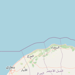
Map view of Ain Elshakika Wetland

Use this park location map to pinpoint Ain Elshakika Wetland in Libya, understand its exact geographic position, and read its mapped placement within the surrounding landscape more clearly.

Pigeon | © OpenStreetMap contributors
Park atlas

Compare regional coastal habitats, salt flats, and protected areas across the Mediterranean shore.

Exploring Parks Near Ain Elshakika Wetland and Surrounding Protected Landscapes

Continue geographic discovery by comparing Ain Elshakika Wetland with other protected areas located across the surrounding regional terrain. Browsing adjacent conservation zones reveals broader patterns in coastal wetland geography and regional habitat distribution.
National parkLibya
About 14 km away#1 closest

West

El-Kouf National Park: Protected Landscape Discovery within Libya's Geography

Explore the mapped natural terrain of this Libyan national park.

El-Kouf National Park serves as a significant protected area, offering a detailed look at its geographic identity within Libya and the wider North African region. This park detail page provides essential atlas-style context, highlighting its status as a national park and its contribution to the mapped protected landscapes. Users can explore its regional geographic placement and understand its unique natural terrain characteristics, serving as a vital point of discovery.

Area
350 km²
Established
1975
IUCN
II
Visitors
300K annual
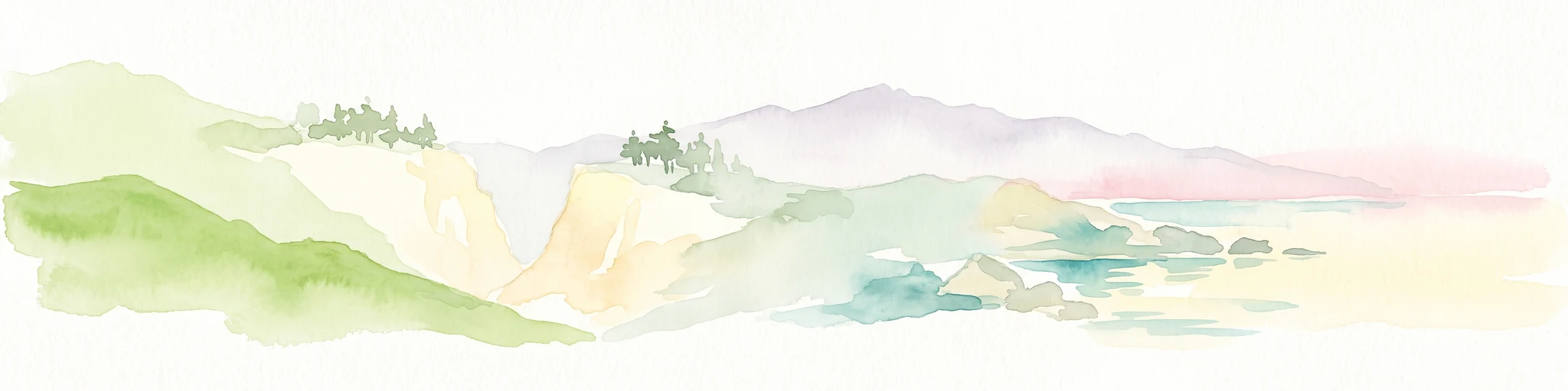
Watercolor painting of a coastal landscape featuring green rolling hills, distant landmasses, and stylized shrubs and trees in the foreground against a white background.
Nature reserveCrete
About 343 km away#2 closest

Northeast

Elafonisi Nature Reserve: Geography and Protected Landscape Analysis in Crete

Coastal dunes and limestone formations in southwestern Crete.

Elafonisi is a protected nature reserve situated in the southwestern reaches of Crete. This site encompasses a complex landscape of sand dunes, juniper-covered scrub, and rugged limestone terrain. By providing a clear look at the area, this atlas entry helps users understand the geographic setting, the ecological significance of the island, and the natural boundaries of this noteworthy Mediterranean conservation area.

Area
1.5 km²
Relief
Lowland
Climate
Mediterranean
Access
Easy access
A watercolor painting showing a panoramic landscape with green hills, distant mountains, and water, set against a plain white background.
National parkGreece
About 368 km away#3 closest

Northeast

Samaria National Park: Geological Landscape and Protected Area Atlas in Crete, Greece

Mapping the dramatic White Mountain canyon and coastal descent

Samaria National Park stands as a major protected landmark in Greece, defined by a tectonic gorge that bisects the White Mountains. This atlas entry covers the park boundary, the distinct vertical limestone cliffs of the Iron Gates, and the transition from mountain plateau to the Mediterranean coastline.

Area
4.848 km²
Established
1962
Relief
Mountain
Climate
Mediterranean
A soft watercolor illustration of green rolling hills and flat land against a pale, hazy background, representing a coastal island environment.
Nature reserveCrete
About 389 km away#4 closest

Northeast

Agioi Theodoroi Nature Reserve: Protected Island Landscapes off the Coast of Crete

A vital wildlife sanctuary and historical island terrain

The nature reserve of Agioi Theodoroi comprises two small, rocky islands off the northwestern shore of Crete. Known for a long-established population of the rare kri-kri wild goat and breeding colonies of Eleonora's falcons, these islets maintain strict conservation status. Explore the mapped boundaries of this unique protected area and its significance within the coastal geography of the Chania region.

Area
0.697 km²
Established
1930
Relief
Upland
Climate
Mediterranean
A horizontal watercolor painting showing soft, rolling mountains and sparse desert-like shrubbery in shades of light green, pale pink, and yellow.
Biosphere reserveCrete
About 423 km away#5 closest

Northeast

Psiloritis Natural Park: Protected Karstic Mountains and Cultural Landscapes in Crete

Geological exploration and regional mountain geography

Psiloritis Natural Park encompasses the central massif of Crete, featuring the famous Mount Ida range. Its protected territory serves as an essential site for understanding karstic geology, from deep underground cave systems to high-altitude steppes. The region perfectly highlights the intersection between large-scale tectonic history and the long-standing human traditions that shape the mountainous interior of the island.

Area
1,159 km²
Established
2001
Relief
Mountain
Climate
Mediterranean
Protected areaLibya
About 451 km away#6 closest

Southeast

Al Jaghbub Oasis Protected Area: Mapping the Libyan Desert Basin and Fossil Landscapes

A distinct sub sea level ecosystem within the Sahara

The Al Jaghbub Oasis encompasses a significant protected landscape in northeastern Libya, set within a rare depression below sea level. Its geography is characterized by layered limestone and sandstone formations containing a wealth of marine fossils. This isolated desert refuge supports a specialized brackish water habitat, contrasting sharply with the surrounding arid expanse of the North African plateau.

Relief
Lowland
Climate
Arid
Access
Access unknown
Scope
Terrestrial
A horizontal watercolor painting depicting a pale blue coastal landscape with low green vegetation in the foreground and soft mountainous ridges in the distance.
Protected areaLasithi
About 466 km away#7 closest

Northeast

Chrysi Protected Area: Mapping the Juniper Forests and Beaches of Lasithi, Greece

A coastal island sanctuary in the Libyan Sea

Chrysi presents a distinct landscape characterized by a mature juniper forest and golden-sand beaches. Situated within the Lasithi regional unit, this island remains a primary example of a protected Mediterranean woodland environment, preserving a unique set of coastal terrain, shallow sea ecosystems, and archaeological history on a small geographic footprint.

Area
4.743 km²
Relief
Lowland
Climate
Mediterranean
Access
Easy access
A watercolor painting of a rolling mountainous landscape in Crete, featuring soft green hills, wildflowers, and pale mountain outlines against a light sky.
Biosphere reserveCrete
About 517 km away#8 closest

Northeast

Sitia Nature Park: Geographic Atlas of Crete's Eastern Protected Mountain Landscapes

Mapping gorges, karst caves, and the eastern Cretan coastline.

Sitia Nature Park represents a vast protected territory across eastern Crete, characterized by its complex mountain spine and profound geological formations. This atlas entry provides geographic insights into the park's canyon systems, including the Valley of the Dead, and the karst caves that define its UNESCO Global Geopark status and regional natural terrain.

Established
2015
Relief
Mountain
Climate
Mediterranean
Access
Moderate access

Common questions about visiting, size, designation, and location context for Ain Elshakika Wetland

Ain Elshakika Wetland FAQs for park facts, access, geography, and protected area context

Find quick answers about Ain Elshakika Wetland, including protected-area facts, park geography, trail and visitor context, and how the park fits into its surrounding country and regional landscape.
MoriAtlas Explorer

Continue Your Protected Areas Search Across the Global Atlas

Deepen your exploration by continuing the structured search for national parks and protected areas worldwide. Utilize the comprehensive filtering capabilities to compare different conservation landscapes and refine your understanding of global park geography. Discover more about the distribution and characteristics of protected natural areas.

Global natural geography