Why Aketajawe-Lolobata National Park stands out
Aketajawe-Lolobata is best known as one of the most important bird conservation areas in Wallacea, supporting at least 24 endemic bird species found nowhere else on Earth. The park protects populations of Wallace's standardwing, Halmahera cuckooshrike, sombre kingfisher, white cockatoo, invisible rail, and ivory-breasted pitta, among many others. This extraordinary avian endemism, coupled with the presence of endemic mammals including the ornate cuscus, makes the park a globally significant biodiversity stronghold. The park also preserves substantial tracts of lowland and montane rainforest that contain valuable timber species such as Agathis and Intsia bijuga.
Aketajawe-Lolobata National Park history and protected-area timeline
The protection of Aketajawe-Lolobata evolved through a series of formal conservation proposals spanning over two decades. The 1981 National Conservation Plan for Indonesia first identified the need to protect four areas on Halmahera: Aketajawe, Lolobata, Saketa, and Gunung Gamkonora. In 1993, the Indonesian Biodiversity Action Plan recommended designation of an integrated protected area covering these forest zones. BirdLife International's field surveys between 1994 and 1996 provided the scientific foundation for proposing the area as an Important Bird Area, documenting the exceptional concentration of endemic species. The formal proposal for national park status came in 1995, and in 1999 a large forest area of over 7.2 million hectares was classified as State Forest Area, encompassing the Aketajawe and Lolobata Forest Groups. After years of coordination between local governments and national conservation authorities, the park was officially established on October 18, 2004, through Ministry of Forestry Decree SK.397/Menhut-II/2004, with a total area of 167,300 hectares.
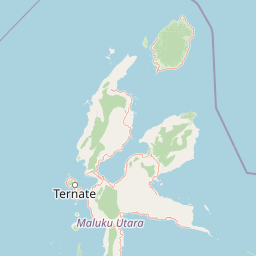
Aketajawe-Lolobata National Park landscape and geographic character
The park's physical geography is defined by Halmahera's volcanic origin and complex terrain. The island itself is shaped by a series of volcanic peaks and is surrounded by smaller islands and coastal waters. Within the park, the landscape transitions from coastal lowlands through rolling hills to steeper montane areas. The two-block structure of the park creates a discontinuous protected area, with the Aketajawe Block covering the central-western portion of the island and the Lolobata Block extending along the northeastern peninsula. The landscape includes notable features such as limestone cliffs, hidden caves, and waterfalls that add topographic diversity to the predominantly forested terrain. The forest groups that comprise the park occupy watersheds and ridgelines that channel rainfall into the island's extensive river systems, supporting both terrestrial and freshwater ecosystems.
Aketajawe-Lolobata National Park ecosystems, habitats, and plant life
The ecological character of Aketajawe-Lolobata is defined by its position within Wallacea, a biogeographic region known for extraordinary endemism resulting from its position between the Asian and Australian continental shelves. The park protects extensive lowland and montane rainforest ecosystems that have been relatively well-preserved compared to similar habitats on more populated Indonesian islands. The forest vegetation includes a diverse array of tree species, with prominent representations of Agathis, Calophyllum inophyllum, Octomeles sumatrana, Koordersiodendron pinnatum, Pometia pinnata, Intsia bijuga, Canarium mehenbethene, and Palaquium obtusifolium. These species form a complex forest structure with multiple canopy layers that support the rich biodiversity the park is known to harbor. The transition between lowland and montane zones creates ecological zonation that increases the overall habitat diversity within the park's boundaries.
Aketajawe-Lolobata National Park wildlife and species highlights
The wildlife of Aketajawe-Lolobata is remarkable for its level of endemism, particularly among birds. Of the 243 bird species recorded in North Maluku province, 211 have been documented on Halmahera Island, and 24 of these are endemic to the island. Notable endemic birds include Wallace's standardwing, Halmahera cuckooshrike, sombre kingfisher, white cockatoo, invisible rail, blue-and-white kingfisher, dusky-brown oriole, Moluccan goshawk, dusky scrubfowl, long-billed crow, grey-headed fruit dove, ivory-breasted pitta, and azure dollarbird. Mammal diversity includes 28 species recorded on Halmahera out of 51 found in North Maluku, with seven endemic to the region and one, the ornate cuscus, endemic to Halmahera itself. The park also supports reptile and amphibian populations including Callulops dubia, Caphixalus montanus, and Hydrosaurus werneri, along with endemic invertebrates including two grasshopper species, three dragonfly species, one butterfly species, and twenty land mollusc species.
Aketajawe-Lolobata National Park conservation status and protection priorities
Aketajawe-Lolobata's conservation significance is recognized internationally through its designation as an Important Bird Area by BirdLife International and its inclusion in the Wallacea biodiversity hotspot. The park protects habitat critical for the survival of at least 23 endemic bird species, making it one of the most important bird conservation areas in Indonesia. However, the park faces significant threats from illegal logging and mining activities that have accelerated forest loss across North Maluku. Between 1990 and 2003, forest cover in the province declined from 86 percent to just under 70 percent, with much of the loss occurring in lowland areas below 400 meters elevation. Species with ranges concentrated at low elevations have been most affected by this habitat destruction. The park's dual-block structure, while reflecting historical conservation planning, presents management challenges for maintaining connectivity and protecting species that require continuous habitat.
Aketajawe-Lolobata National Park cultural meaning and human context
The park is home to the Togutil people, also known as Tobelo Dalam or Forest Tobelo, a semi-nomadic indigenous community whose traditional territory overlaps with the park's boundaries. Numbering approximately 2,000 individuals, with an estimated 300 to 500 living in complete isolation within the forest, the Togutil maintain a lifestyle centered on hunting, fishing, and sago collection. They share linguistic and cultural connections with the coastal Tobelo people but have retained their forest-based traditions. This community represents one of the last remaining semi-nomadic groups in Indonesia and embodies a relationship with the land that predates modern conservation frameworks. Their presence within the park underscores the importance of recognizing indigenous land rights and traditional ecological knowledge in conservation planning.
Top sights and standout views in Aketajawe-Lolobata National Park
Aketajawe-Lolobata stands as a beacon of Wallacean biodiversity, protecting one of the densest concentrations of endemic species found anywhere on Earth. The park's 24 endemic bird species, including the striking Wallace's standardwing and the elusive invisible rail, make it a priority destination for birdwatchers and ornithologists. The park's two-block structure encompassing both Aketajawe and Lolobata preserves diverse forest types from sea level to montane elevations. The landscape features limestone cliffs, waterfalls, and hidden caves that add scenic variety to the forest experience. Home to the Togutil people, the park also maintains living cultural heritage of a semi-nomadic forest community. The park's establishment in 2004 represents a significant achievement in protecting one of Indonesia's most biodiverse forest ecosystems.
Best time to visit Aketajawe-Lolobata National Park
The optimal time to visit Aketajawe-Lolobata coincides with the dry season, typically from May to October, when rainfall is reduced and trail conditions are more favorable for exploration. The wet season, from November through April, brings heavier precipitation that can make forest trails difficult to navigate and may limit access to some areas of the park. Halmahera's equatorial location produces relatively consistent temperatures throughout the year, with the primary seasonal variation being rainfall patterns rather than temperature extremes. Visitors interested in birdwatching should note that many endemic species are more readily observable during the dry season when birds congregate around remaining water sources. The park's remote location requires careful planning, including arrangements for internal transport on Halmahera and coordination with local authorities or tour operators familiar with access logistics.