Why Bunaken National Park stands out
Bunaken National Park is best known for its extraordinary coral reef biodiversity and world-class scuba diving. The park sits within the Coral Triangle, the global center of marine biodiversity, and hosts approximately 390 coral species and over 2,000 fish species. A defining feature is the dramatic vertical coral wall reaching 25 to 50 meters in depth, inhabited by 13 coral genera. The park claims seven times more coral genera than Hawaii and hosts more than 70% of all known fish species in the Indo-Western Pacific. The Indonesian coelacanth, a living fossil species, was first filmed in situ off Manado Tua Island in 2009.
Bunaken National Park history and protected-area timeline
Bunaken National Park was formally established in 1991 as one of Indonesia's pioneering marine protected areas. The creation of the park reflected growing recognition of the need to protect the exceptional marine biodiversity of the Coral Triangle region. In 2005, Indonesia submitted an application to UNESCO for including the park on the World Heritage List, acknowledging its global significance as a marine ecosystem. The park has faced ongoing conservation challenges despite its protected status, with threats including coral mining, anchor damage from vessels, blast fishing, cyanide fishing, and increasing tourism-related impacts. The World Wildlife Fund has provided conservation support through the Sulu Sulawesi Marine Eco-region Action Plan, which includes participatory enforcement and patrol efforts that have resulted in significant reductions in blast fishing. More recently, the 2024 No-Trash Triangle Initiative established river barriers in nearby Manila to reduce plastic waste inflow into park waters, addressing the growing problem of marine debris.
Bunaken National Park landscape and geographic character
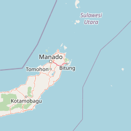
The landscape of Bunaken National Park encompasses both terrestrial and marine environments of remarkable diversity. The terrestrial landscape is dominated by five volcanic islands rising from the Celebes Sea. Manila Tua Island, the most prominent feature, is an inactive volcano with a classical cone shape reaching over 600 meters above sea level, making it the highest elevation in the park. Bunaken Island also bears volcanic origins and features significant uplifted fossil coral formations on its slopes. Nain Island presents as a dome-shaped formation reaching 139 meters in height. Mantehage Island contrasts sharply as a relatively flat, low-lying island that appears to be gradually sinking into the sea, characterized by extensive mangrove forest flats separated by saltwater channels. Siladen is the lowest of the islands, composed entirely of coral sand with minimal topography. The marine landscape is equally dramatic, with the absence of a continental shelf causing the coastal waters to drop directly down the continental slope. The sea depth between islands ranges from 200 to 1,840 meters, creating steep underwater walls and drop-offs that support rich coral growth. A distinctive 25 to 50-meter vertical coral wall runs through the park, providing a unique underwater topography that attracts divers from around the world.
Bunaken National Park ecosystems, habitats, and plant life
The nature of Bunaken National Park is defined by its extraordinarily rich coral reef ecosystem, which dominates the marine environment. The park features both fringing reef and barrier reef coral formations that support remarkable biodiversity. With approximately 390 coral species recorded, the park claims seven times more coral genera than Hawaii and represents over 70% of all known fish species in the Indo-Western Pacific. The seagrass plains within the park, particularly around Mantehage and Nain islands, are dominated by Thalassia hemprichii, Enhallus acoroides, and Thalassodendron ciliatum. These seagrass meadows provide crucial habitat for marine species and contribute to the overall ecological complexity. The marine algae present includes Caulerpa, Halimeda, and Padina pavonica species, adding to the primary productivity of the ecosystem. On land, the islands support palm species, sago, woka, silar, and coconut palms, while the extensive mangrove forests contain Rhizophora and Sonneratia species that stabilize coastlines and provide nursery habitat for marine life.
Bunaken National Park wildlife and species highlights
The wildlife of Bunaken National Park is exceptionally diverse, with the park supporting approximately 2,000 species of fish along with numerous other marine organisms. The fish population includes emperor angelfish, Almaco jack, spotted seahorse, bluestripe snapper, pinkish basslet, and two-lined monocle bream among many others. The park is notable for the presence of the Indonesian coelacanth, a living fossil species that was first filmed in situ off Manila Tua Island in 2009, representing one of the most significant marine biological discoveries in recent decades. Mollusks found within the park include the giant clam, horned helmet shells, and chambered nautilus, while the waters also support various species of marine mammals and reptiles. The terrestrial wildlife includes the Celebes crested macaque, Timor Deer, and Sulawesi bear cuscus on the islands. The mangrove forests provide critical habitat for crabs, lobsters, and mollusks, while bird species including gulls, herons, sea doves, and storks frequent the coastal areas. The vertical coral wall is inhabited by 13 coral genera, creating a unique vertical habitat that supports specialized marine life.
Bunaken National Park conservation status and protection priorities
Bunaken National Park holds significant conservation importance as one of Indonesia's first marine parks and a flagship protected area within the Coral Triangle. Despite its national park status and substantial funding, the park has experienced slow but continuous degradation from multiple threats including coral mining, anchor damage, blast fishing, cyanide fishing, diving impacts, and accumulating trash. The Indonesian government submitted a World Heritage application to UNESCO in 2005, acknowledging the park's global significance. The World Wildlife Fund provides ongoing conservation support through the Sulu Sulawesi Marine Eco-region Action Plan, which includes participatory enforcement and patrol programs that have achieved measurable success in reducing blast fishing. The 2024 No-Trash Triangle Initiative represents a newer conservation effort addressing plastic pollution, with river barriers installed in nearby Manila to prevent waste from reaching park waters. The park's coral reefs, which host 390 coral species and support over 2,000 fish species, remain under pressure from both local human activities and broader environmental challenges.
Bunaken National Park cultural meaning and human context
Bunaken National Park is home to approximately 35,000 people distributed across 22 villages within its boundaries, making it one of the more densely populated marine protected areas in Indonesia. The local communities primarily engage in fishing and agriculture, cultivating coconut, sweet potato, banana, and seaweed for export. A smaller but growing portion of the population is employed in tourism, working as dive guides, boat operators, and accommodation staff. The region has a long history of human interaction with the marine environment, with traditional fishing practices shaping local culture and livelihoods. Tourism development has created economic opportunities while also introducing pressures on the marine ecosystem. The accommodation options range from budget backpacker cottages to luxury five-star resorts, reflecting the diverse visitor market the park attracts. The integration of human communities within the park boundaries presents ongoing management challenges balancing conservation objectives with sustainable development and traditional livelihoods.
Top sights and standout views in Bunaken National Park
Bunaken National Park's standout features include its position at the center of the Coral Triangle, the global hotspot of marine biodiversity. The park's 390 coral species and 2,000+ fish species create an underwater environment of unparalleled richness in the region. The dramatic vertical coral wall reaching 25 to 50 meters provides a unique diving experience that attracts enthusiasts globally. The discovery of the Indonesian coelacanth off Manila Tua in 2009 added to the park's scientific significance, connecting it to one of the most mysterious living fossils in the ocean. The five volcanic islands with their varied topographies, from Manila Tua's 600-meter peak to Siladen's low-lying coral sand, create scenic above-water landscapes. The coexistence of approximately 35,000 residents within the park across 22 villages demonstrates a model of human-nature interaction that continues to evolve as conservation management develops.
Best time to visit Bunaken National Park
The best time to visit Bunaken National Park is influenced by Indonesia's tropical climate, with the dry season typically offering the most favorable conditions for diving and snorkeling. The park can be visited year-round, but conditions may vary with seasonal weather patterns affecting visibility and water conditions underwater. The period between March and October generally offers more stable weather and better dive conditions. Water temperatures remain warm throughout the year, typically ranging from 26 to 29 degrees Celsius, making diving comfortable in any season. Visitors interested in seeing specific marine species may want to consider seasonal patterns, though the park's biodiversity means marine life is abundant throughout the year. The park's proximity to Manila makes it accessible throughout the year, with the city serving as the main gateway for international visitors arriving by air.