
Mori Atlas logo
National parkArikok National Park

Examining the geological terrain, coastal boundaries, and endemic habitats across a major Caribbean reserve.

Arikok National Park: A Comprehensive Geographic Overview of Aruba's Protected Natural Landscapes

Arikok National Park serves as the principal protected area on the Caribbean island of Aruba, safeguarding roughly 20 percent of its landmass. The park encompasses a distinct mosaic of volcanic formations, ancient limestone terraces, and dry interior forests. By mapping the interaction between these geological foundations and the local flora and fauna, this content provides a detailed look at the island's primary wilderness area and its cultural history.

arid landscapelimestone plateauvolcanic geologycactus habitatendemic reptilesendemic bird subspecies
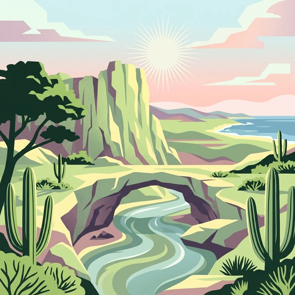
A stylized, flat-design illustration depicting a desert landscape with large rock cliffs, a natural stone archway over a stream, and several cacti under a sunny sky near the coast.

Arikok National Park

National park

Park overview

Structured park overview, official facts, and landscape profile for Arikok National Park

Arikok National Park park facts, protected area profile, and essential visitor context

Review the core facts for Arikok National Park, including designation, size, terrain, visitor scale, habitats, and operating context in one park-focused overview.

About Arikok National Park

Arikok National Park is the centerpiece of Aruba's conservation geography, a contiguous block of dry-Caribbean wilderness that stretches across roughly one-fifth of the island. Unlike the highly developed western coastline where most of Aruba's resort infrastructure is concentrated, the park protects the rugged and sparsely inhabited northeastern interior, where volcanic ridges, limestone plateaus, cactus-studded hills, arroyos, sea cliffs, and pocket beaches form an unusually varied mosaic within a relatively small area.

The park's identity is strongly shaped by its geological foundation. The Aruba Lava Formation, the Aruba Batholith, and a cap of limestone terraces together produce a landscape of contrasting textures and colors, from dark volcanic rock along the central ridges to pale, weathered limestone in the south. Gold-bearing quartz veins cutting through the Batholith gave rise to short-lived mining activity, most famously at Miralamar, whose abandoned workings are now reclaimed by vegetation. Coastal erosion has sculpted additional landmarks such as the Moro promontory, the Conchi Natural Pool surrounded by pillow lava, and the dunes of Daimari, where seasonal rainfall rebuilds the white sand beach after each storm surge.

Ecologically, the park functions as a refuge for Aruba's arid-adapted flora and fauna. Its seven mapped vegetation types range from coastal Fofoti-Druif-Cocorobana dune scrub, to cactus-rich Hubada communities on windward hills, to the specialized limestone-plateau assemblages dominated by Beishi di baranca, Cadushi (the towering Aruba cactus), and Tuna prickly-pear. These habitats shelter endemic reptiles including the Aruban rattlesnake (Crotalus unicolor) and the Aruban whiptail, as well as iconic birds such as the burrowing owl and parakeet. Cultural heritage is equally central: Arawak cave paintings in Fontein Cave, restored cunucu farmsteads, and historic plantation outbuildings anchor the park's identity as a place where natural and human history are visibly intertwined.

Today, Arikok National Park is part of a broader conservation network that the Aruba Conservation Foundation oversees, including Spanish Lagoon and Marine Park Aruba, combined coverage of roughly 25% of the island. The park's official designation as an IUCN Category II protected area reflects Aruba's commitment to maintaining a single large, ecologically representative reserve at the heart of one of the most tourist-intensive islands in the southern Caribbean.

Quick facts and research context for Arikok National Park

Arikok National Park occupies the northeastern interior of Aruba in the southern Caribbean, and represents about 20% of the island's land surface. It was officially established by Ministerial Order in 2000 after a planning process that began in the late 1960s, with the first formal proposal emerging in 1980 and a Nature Protection Regulation in 1995 providing the legal basis for its creation.

The park is managed by the Aruba Conservation Foundation (ACF), formerly known as Fundacion Parke Nacional Aruba, and is classified as an IUCN Category II national park. Its landscape is defined by the contrast between the volcanic Batholith in the north and central areas and the limestone terraces of the south, supporting seven mapped vegetation types, populations of endemic reptiles and birds, and cultural sites including Arawak rock art in Fontein Cave and historic cunucu plantation houses.

Protection and recognition

Documented protection scope and international recognition framework

Arikok National Park Protection Status and Conservation Recognition

Arikok National Park maintains a documented mixed protection status within its regional conservation framework. Official records outline the governing management scope and associated protected area designations without external recognition sources.

Protection details

Protection scope
Mixed
Transboundary protection
No
Park context

Deeper park guide and search-rich context for Arikok National Park

Arikok National Park history, landscape, wildlife, and travel context

Explore Arikok National Park through its history, landscape character, ecosystems, wildlife, conservation priorities, cultural context, and seasonal travel timing in a structured park guide built for atlas discovery and search intent.

Why Arikok National Park stands out

Arikok National Park is best known for protecting Aruba's most concentrated assembly of arid-Caribbean natural and cultural heritage within a single landscape. It is the island's stronghold for endemic species such as the Aruban rattlesnake (cascabel), the Aruban whiptail lizard, the Aruban burrowing owl (shoco), and the Aruban parakeet (prikichi), all of which depend on the park's rocky microclimates and largely undisturbed cactus and thorn-scrub habitat. Equally distinctive is the park's geological and coastal scenery, where ancient volcanic and Batholith formations give way to limestone terraces, sea-carved cliffs, and iconic coastal landmarks such as the Conchi Natural Pool with its pillow-lava surroundings, the twin bays of Boca Keto and Boca Fluit at Moro, and the turtle-nesting beach of Boca Prins. Layered on top of this natural setting is a deep human history visible in Arawak pictographs inside Fontein Cave, restored plantation farmsteads such as Cunucu Arikok, and the overgrown ruins of the early twentieth-century Miralamar gold mine.
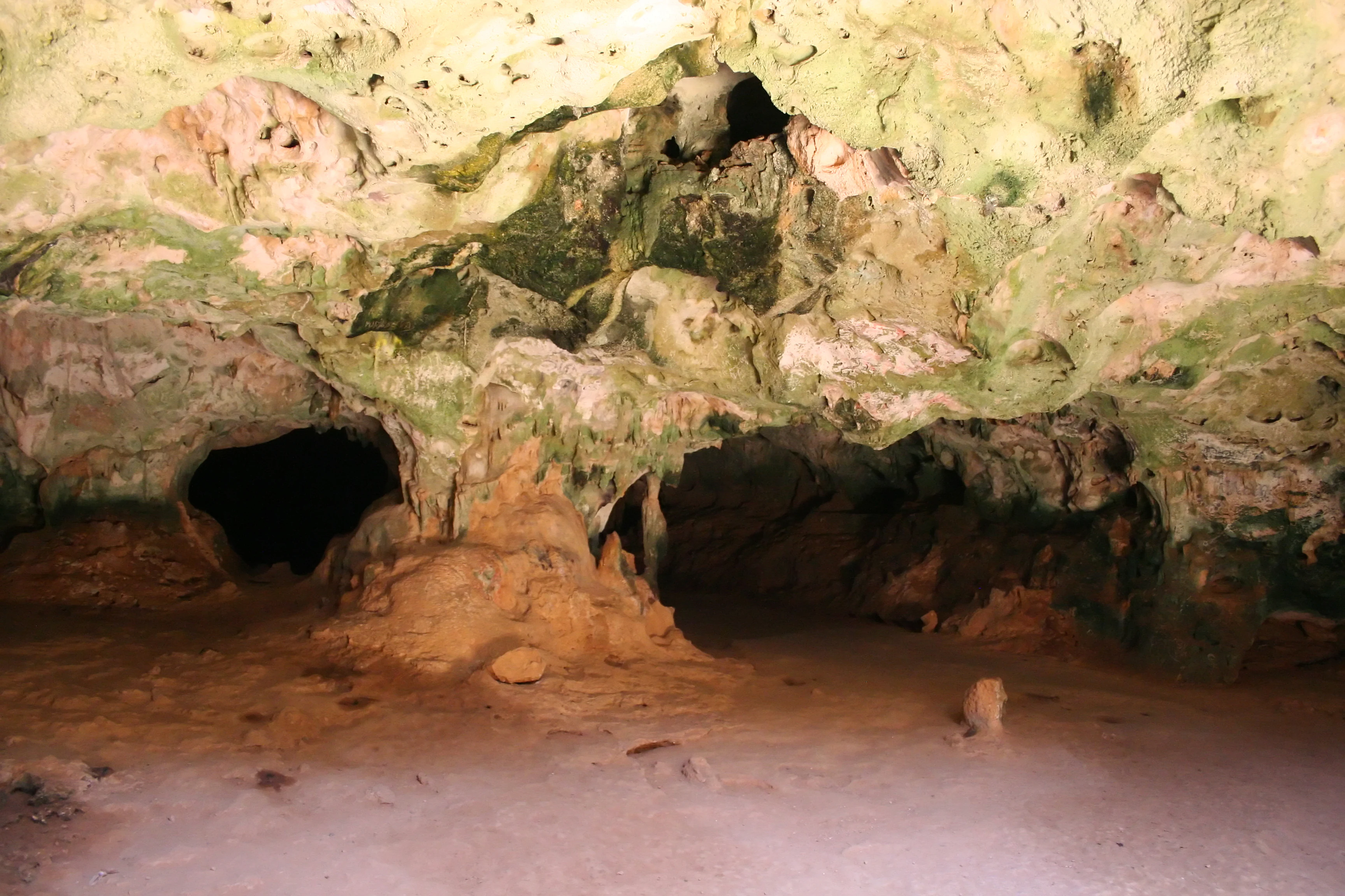
Guadirikiri Cave
View of the interior of Guadirikiri Cave in Arikok National Park

Arikok National Park history and protected-area timeline

The history of Arikok National Park is rooted in both human settlement and modern conservation planning. The area's name, and the heart of the park's central zone, derives from a former rural plantation known as Cunucu Arikok, owned by Arie Kok, whose nineteenth-twentieth-century adobe farmhouse, the Cas di torto, still stands in a restored state within the reserve. Around this farmhouse, a traditional Aruban garden of native plants was cultivated, and nearby dolerite boulders are decorated with indigenous rock paintings, one of which now serves as the park's logo.

The idea of formally protecting Aruba's interior as a national park took root in the late 1960s but advanced slowly. In 1980, a plan was introduced to develop the Arikok-Jamanota area as a national park; only a partial version of that plan was realized, resulting in the establishment of Cunucu Arikok as an initial protected site. A decisive moment came in 1995, when the Aruban government enacted the Nature Protection Regulation, providing a legal framework for nature conservation on the island. The following year, the Nature and Landscape Structure Memorandum was approved, leading to the formation of a commission that, in 1997, produced a policy document for managing a future national park.

In 2000, Arikok National Park was officially established by Ministerial Order, formalizing its status as Aruba's primary protected terrestrial reserve. By 2003, governance had shifted to an independent foundation, initially called Fundacion Parke Nacional Aruba and later reorganized as the Aruba Conservation Foundation (ACF), which remains the park's governing body. Earlier human history is preserved within the park landscape itself: Arawak cave drawings in Fontein Cave attest to pre-Columbian occupation, colonial-era graffiti documents the arrival of European settlers, abandoned nineteenth- and early twentieth-century gold mines at Miralamar recall a brief mining era that ended around 1916, and historic cunucu plantations such as Prins Plantation illustrate Aruba's rural agricultural past.

Arikok National Park landscape and geographic character

The landscape of Arikok National Park is a compact but strikingly varied expression of Aruba's geological history. Three principal formations define its terrain: the ancient Aruba Lava Formation beneath the surface, the intrusive Aruba Batholith that makes up much of the central and northern rock, and a cap of younger limestone terraces that dominate the southern plateau. Quartz veins cutting through the Batholith, once mined for gold, are still visible in outcrops and old workings such as Miralamar.

The resulting scenery mixes rolling volcanic hills with broad, pale limestone plains, dry river valleys (arroyos or rooi), cactus-covered ridges, and dramatic coastal cliffs. Along the north coast, erosion by seasonal rainfall and waves has carved landmarks such as the Daimari bay and the Moro promontory, sometimes called "Little Aruba" for its island-shaped outline, which is flanked by the twin bays of Boca Keto and Boca Fluit. Along the south coast and within the interior, conical hills such as Jamanota provide high viewpoints across the island, while the Conchi Natural Pool sits in a striking setting of dark pillow lava beside an open coastal basin.

Karst features add another layer to the landscape. Limestone caves such as Fontein and Guadirikiri, sheltered overhangs, and small natural bridges reflect the slow dissolution of the southern plateau. Together these features give Arikok an unusually dense concentration of geological expression for an island of its size, within a single continuous protected boundary.
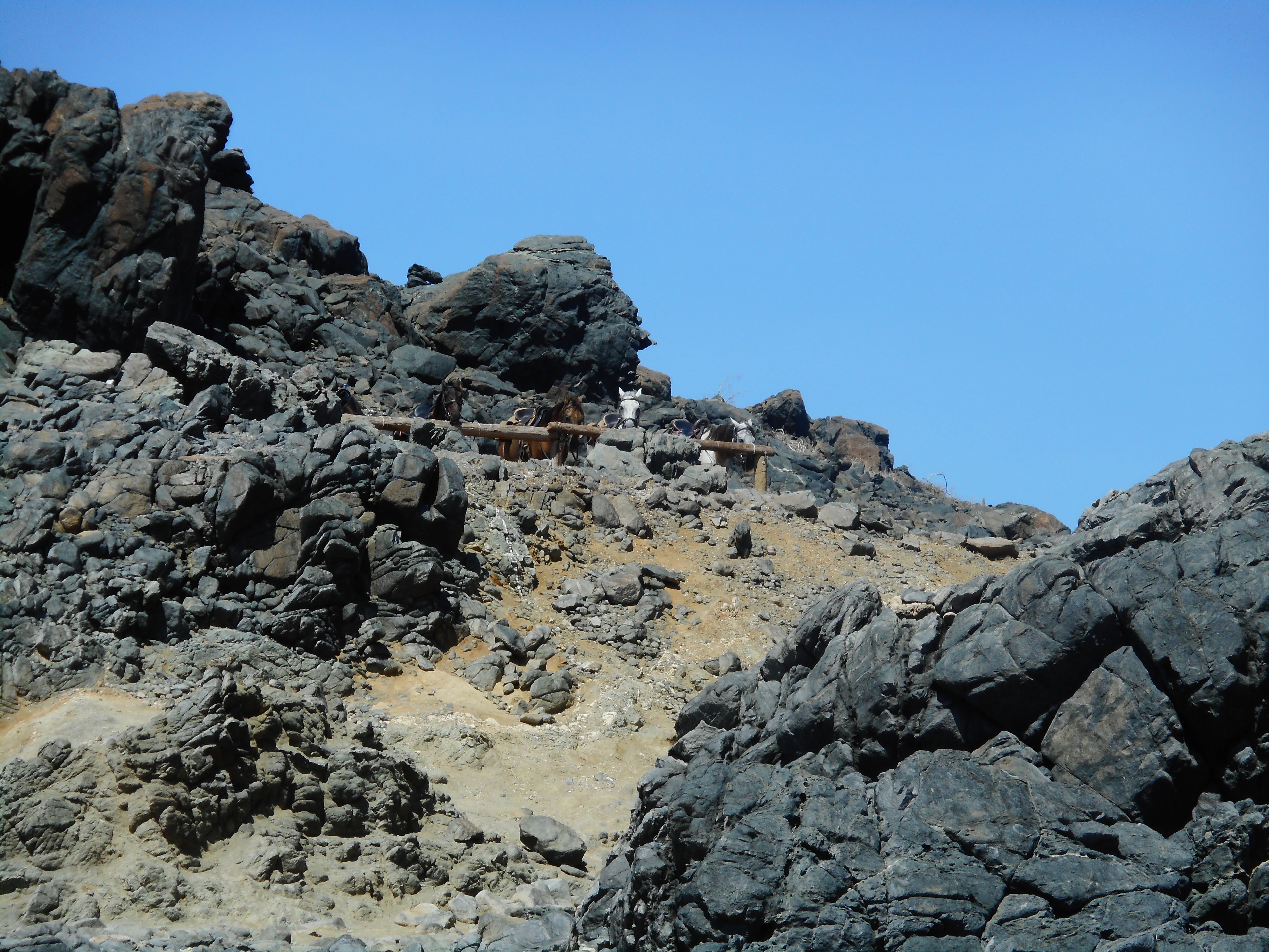
A rocky, arid landscape with dark volcanic lava rocks and lighter, sandy ground under a clear blue sky.
Rugged volcanic terrain near the Natural Pool in Arikok National Park.

Arikok National Park ecosystems, habitats, and plant life

Arikok National Park protects the most ecologically representative slice of Aruba's arid-Caribbean environment. Its seven mapped vegetation types, each named after locally familiar indicator species, reflect the interplay of geology, exposure to trade winds, and microclimatic conditions around rock outcrops and arroyos.

Coastal and dune areas are dominated by the Fofoti-Druif-Cocorobana association, adapted to salt spray and shifting sand, with species such as Banana di rif, Mansaniya, and Bai no bolbera strongly tied to this habitat. Inland, on the windward sides of hills and across the northern part of the park, dry cactus-dominated communities prevail, especially the Hubada-Breba-Camari type and its variants, where drought-tolerant trees, Cereus-like cacti, and Melocactus (Bushi) thrive.

The southern limestone plateau supports two specialized vegetation types, Beishi di baranca-Seida-Funfun and Beishi di baranca-Walishali-Basora preto-Mata di piska, characterized by Palo cayente, Cadushi, Tuna, and accompanying shrubs. Across most types, vegetation is sparser and lower than in wetter Caribbean ecosystems, reflecting the constant influence of trade winds, limited rainfall, and thin soils, yet the diversity of microhabitats sustains an unusual concentration of endemic and range-restricted species within a relatively small area.
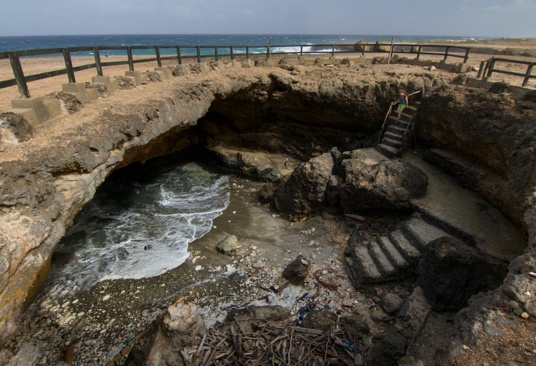
A wide angle shot of a large limestone sinkhole at the coast, with stairs leading down to a small sandy beach where waves enter a sea cave, protected by a wooden railing above.
A natural limestone sinkhole at Arikok National Park featuring a coastal cave with ocean access.

Arikok National Park wildlife and species highlights

Wildlife within Arikok National Park is shaped by the island's arid climate and the rocky microclimates created by its varied geology. Reptiles are among the park's most distinctive and best-studied fauna, including several endemics that are otherwise restricted to Aruba. The Aruban rattlesnake, locally known as cascabel (Crotalus unicolor), is found nowhere else in the world and depends on the rocky refugia preserved inside the park. Two other endemic reptiles, the santanero or Aruban Baker's cat-eyed snake (Leptodeira bakeri) and the kododo blauw or Aruban whiptail lizard (Cnemidophorus arubensis), share this dependence on undisturbed rocky habitat.

Birds are another highlight of the park. The shoco, the Aruban subspecies of burrowing owl (Athene cunicularia arubensis), nests in open, dry terrain and is closely associated with protected expanses like Arikok. The prikichi, the Aruban parakeet (Aratinga pertinax arubensis), a subspecies of the brown-throated parakeet adapted to arid environments, is among the island's most recognizable birds and is sustained by the park's cactus and thorn-scrub vegetation.

Beyond these headline species, the park supports a broader arid-Caribbean fauna, including smaller lizards, geckos, and iguanas, seasonally present seabirds and shorebirds along the coast, and nesting sea turtles on beaches such as Boca Prins. Because the park concentrates a large share of the island's least-disturbed habitat, its role in maintaining populations of these species is disproportionate to its size.
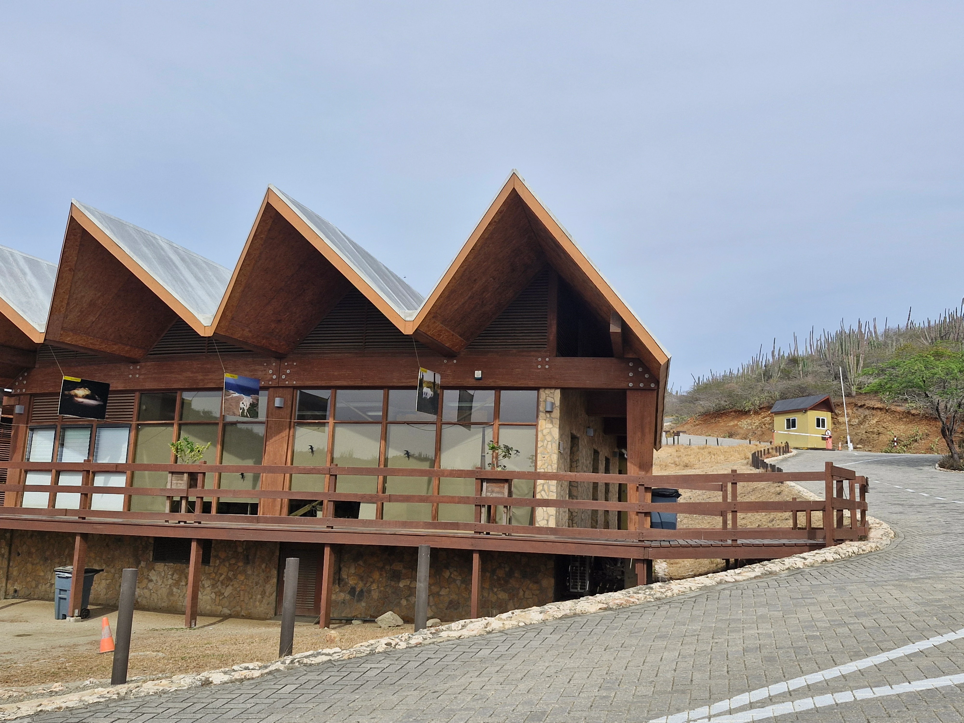
A modern building with a multi peaked, angular wooden roof serves as the visitor center at Arikok National Park in Aruba, with a paved road leading past it.
The visitor center at Arikok National Park in Aruba, featuring a distinctively angular roof design.

Arikok National Park conservation status and protection priorities

Arikok National Park is the cornerstone of Aruba's terrestrial conservation strategy. Established under the Nature Protection Regulation of 1995 and formally created in 2000, it represents about 20% of the island's total land area, an unusually large proportion for a small, densely developed Caribbean island. Its IUCN Category II designation underscores its role as a strictly protected reserve managed primarily for ecosystem preservation and ecological processes.

From a conservation standpoint, the park's significance lies in its role as the principal refuge for Aruba's endemic and range-restricted species, especially reptiles like the Aruban rattlesnake and birds such as the Aruban parakeet and burrowing owl, which depend on the rocky outcrops, cactus communities, and undisturbed dry forest that remain inside the park boundary. The seven mapped vegetation types also preserve critical genetic and ecological diversity for an island ecosystem that has otherwise been heavily modified by agriculture, grazing, and tourism development.

The park faces ongoing pressures that are themselves central to its conservation profile. Free-ranging livestock, including goats, sheep, and donkeys, contribute to trampling, overgrazing, and soil erosion, while off-road driving generates dust clouds that degrade vegetation within a wide buffer along unpaved routes and poses a documented risk of desertification in sensitive areas such as the road toward Conchi. Engine-oil pollution from off-road vehicles further affects soil quality and seedling establishment. Managing these threats is therefore a defining conservation challenge, alongside the foundation's broader mandate that now also encompasses Spanish Lagoon and Marine Park Aruba, covering roughly 25% of Aruba's total surface area.

Arikok National Park cultural meaning and human context

Arikok National Park is deeply embedded in Aruba's cultural and human history. Its central zone surrounds Cunucu Arikok, a restored nineteenth- and early twentieth-century farmstead with a traditional adobe house known as a Cas di torto, which gives the park its name and remains a tangible reminder of the island's rural, agricultural cunucu past. Protective stone walls and cactus hedges built by earlier generations to keep out goats, sheep, and donkeys still shape the landscape, offering insight into traditional land management in an arid environment.

Pre-Columbian heritage is equally visible. Fontein Cave preserves brownish-red pictographs attributed to the Arawak, providing evidence of early indigenous presence and offering a rare inland glimpse of Aruba's first inhabitants alongside older European and contemporary markings whose presence has prompted protective gating and restricted access by guided tour. The park's rocky outcrops also include dolerite boulders with indigenous rock paintings, one of which was chosen as the park's logo, bridging ancient cultural signals with modern conservation identity.

A more recent chapter of cultural significance comes from the early twentieth century. Abandoned gold mines in the Miralamar area, closed around 1916, are largely overgrown but still legible in the terrain, reflecting a brief mining era that is now part of the park's preserved industrial heritage. Sites such as Prins Plantation and other cunucu farms collectively turn the park into an open-air record of how successive generations of Arawak, colonial, and Aruban communities have shaped and been shaped by the same arid interior landscape.

Top sights and standout views in Arikok National Park

Arikok National Park's standout features include a striking contrast between volcanic Batholith terrain in the north and pale limestone terraces in the south, both visible within a single visit. The Conchi Natural Pool, encircled by pillow-lava formations, and the twin bays of Boca Keto and Boca Fluit at the Moro promontory rank among the park's most photogenic coastal landmarks, while the viewpoint at Arikok Hill (Seroe Arikok) and the climb of Jamanota provide panoramic perspectives across the entire island.

Equally distinctive are the park's cultural anchors: Fontein Cave with its Arawak pictographs, the restored Cunucu Arikok farmstead, and the atmospheric ruins of the Miralamar gold mine. Ecologically, the park is unrivaled in Aruba as the last major stronghold of species such as the Aruban rattlesnake, the Aruban whiptail, the burrowing owl, and the Aruban parakeet, making it central to the island's biodiversity heritage as well as its geological and cultural story.

Best time to visit Arikok National Park

Arikok National Park's character shifts subtly with Aruba's two main seasonal periods. The cooler, relatively drier months from roughly January through April typically bring calmer seas, clearer skies, and the best conditions for hiking and reaching coastal sites such as Conchi Natural Pool and Daimari beach. Vegetation is at its least lush during this period, but trade-wind-driven haze is reduced and viewpoints such as Seroe Arikok and Jamanota reward visitors with broad, clear vistas across the interior and coastline.

The warmer and slightly wetter months, from about May through December, bring occasional short tropical showers that can briefly revive vegetation and transform the normally muted desert palette into a more green-toned landscape. These rains also mean rougher seas along the north coast and the possibility of temporarily limited access to some coastal areas, while dust impacts along unpaved roads can be more pronounced. Overall, both seasons offer distinct appeals: drier months favor geological scenery and coastal exploration, while the brief green-up periods reveal more of the park's botanical and wildlife activity.
Monthly climate preview

Long-term monthly temperature and precipitation rhythm measured across the protected landscape

Arikok National Park Climate Normals, Annual Temperature and Precipitation Profiles

Representative coordinates record steady annual temperatures paired with distinct monthly precipitation shifts across the protected landscape. Examining the complete twelve-month record reveals deeper patterns in long-term temperature ranges and precipitation variations.
Annual mean27 °C
26 °C29 °C
Jan26°
Feb26°
Mar26°
Apr27°
May27°
Jun28°
Jul28°
Aug28°
Sep29°
Oct28°
Nov28°
Dec27°
Warmest month
September

28.6 °C

Coolest month
February

26.2 °C

Wettest month
November

2.7 mm/day

Driest month
March

0.3 mm/day

Park location guide

Geography guide, regional context, and park location map for Arikok National Park

Arikok National Park park geography, regions, and map view in Aruba

Understand where Arikok National Park sits in Aruba through a broader geographic reading of the surrounding landscape, nearby location context, and its mapped position within the national park landscape.

How Arikok National Park fits into Aruba

Aruba is a Caribbean island country and constituent realm of the Kingdom of the Netherlands, located in the southern Caribbean Sea near the Venezuelan coast. It gained country status within the Kingdom in 1986 and is part of the ABC islands alongside Bonaire and Curaçao. The island features a dry, arid climate contrasting with typical humid tropical Caribbean conditions, and operates as a parliamentary democracy under a constitutional monarchy with Dutch citizenship.

Wider geography shaping Arikok National Park in Aruba

Aruba is situated in the southern Caribbean Sea, approximately 29 kilometres north of the Paraguaná Peninsula in Venezuela and 80 kilometres northwest of Curaçao. The island measures 32 kilometres in length and 10 kilometres at its widest point. Geologically, it lies on the South American continental shelf, placing it within the continent of South America geographically. As part of the ABC islands, Aruba forms the westernmost of the three islands along with Bonaire and Curaçao.

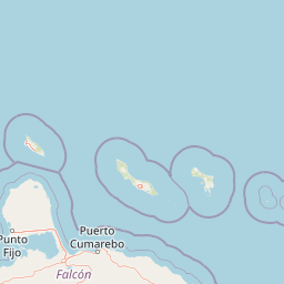
Map view of Arikok National Park

Use this park location map to pinpoint Arikok National Park in Aruba, understand its exact geographic position, and read its mapped placement within the surrounding landscape more clearly.

Pigeon | © OpenStreetMap contributors

Explore protected area photography, coastal cliffs, and arid park terrain.

Arikok National Park Photos and Landscapes: Visual Guide to Scenery

Visual documentation reveals the striking contrast between volcanic batholith hills, limestone terraces, and cactus thorn scrub across the protected terrain. Examining these detailed landscape photographs provides clear insight into the fragile microclimates and geological formations that define the region.

Guadirikiri Cave

A panoramic view of the Conchi natural pool in Arikok National Park, featuring clear turquoise water contained by dark, rugged volcanic rock formations surrounded by the rough ocean.

A rocky, arid landscape with dark volcanic lava rocks and lighter, sandy ground under a clear blue sky.

A wide angle shot of a large limestone sinkhole at the coast, with stairs leading down to a small sandy beach where waves enter a sea cave, protected by a wooden railing above.

A modern building with a multi peaked, angular wooden roof serves as the visitor center at Arikok National Park in Aruba, with a paved road leading past it.

A wide, high-angle view of a desert-like landscape with rolling hills, sparse vegetation, a few scattered cacti, and the distant ocean under a clear sky.

Park atlas

Compare surrounding regional geography and connected protected landscapes

Explore Protected Areas and Other Parks Near Arikok National Park

Browse related protected areas and neighboring natural reserves that share similar arid Caribbean terrain and volcanic geology. Comparing these regional conservation landscapes helps place the volcanic hills and limestone terraces of Arikok National Park into a broader ecological context.
Watercolor painting of mangrove trees with exposed prop roots lining a sandy shore.
Marine protected areaAruba
About 4.4 km away#1 closest

West

Marine Park Aruba: An Atlas of Protected Coastal Waters and Marine Conservation Zones

Mapping the four-part reserve network across the island coastline

Marine Park Aruba consists of four separate marine protected areas that safeguard the most ecologically significant coastal waters of the island. The reserves protect a diverse array of marine landscapes, ranging from calm mangrove lagoons and seagrass beds to intricate fringing coral reefs. This data-driven overview tracks the park boundaries and regional distribution of these critical Caribbean habitats.

Area
60.2 km²
Established
2019
Relief
Lowland
Climate
Tropical
National parkFalcón State
About 79 km away#2 closest

South

Médanos de Coro National Park: Venezuela's Unique Arid Landscape and Protected Dune System

Explore the mapped geography of this coastal desert in Falcón State.

Médanos de Coro National Park represents a remarkable protected area within Venezuela's Falcón State, renowned for its spectacular and active sand dune systems. This national park encompasses approximately 91 square kilometers of unique terrain, including large sand formations, salt marshes, and mangrove swamps, contributing to its designation as a key conservation site for arid coastal ecosystems. Users can explore the park's distinctive landscape, understand its geographic context, and discover the patterns of wind-sculpted dunes that define this Venezuelan national park.

Area
91 km²
Established
1974
IUCN
II
Relief
Lowland
Watercolor painting of a landscape featuring green trees, hills, and cacti under a light blue sky
National parkCuracao
About 90 km away#3 closest

East

Christoffelpark National Park: Curacao's Volcanic Terrain and Protected Landscape Atlas

Explore mapped boundaries and unique dry forest ecosystems.

Christoffelpark represents Curacao's most vital protected natural area, offering a deep dive into its unique geography and landscape. This national park preserves the island's highest peak, Christoffelberg, alongside distinctive dry forest ecosystems, endemic species, and the remnants of colonial plantations. Explore the mapped terrain, understand the regional context, and appreciate the rich natural and cultural heritage that defines this important protected landscape on Curacao.

Area
10.4 km²
Established
1978
IUCN
II
Relief
Mixed relief
A watercolor painting of a gentle landscape featuring a stream flowing through a grassy meadow bordered by trees with soft pastel colors.
National parkFalcón
About 151 km away#4 closest

South

Parque nacional Juan Crisóstomo Falcón: Karst Geology and Sierra de Falcón Geography

Protected karst mountains, cave systems, and water networks in northern Venezuela.

Parque nacional Juan Crisóstomo Falcón encompasses a distinct limestone landscape within the Sierra de Falcón. This protected area is recognized for vertical sinkholes, sprawling subterranean galleries, and the Fosa de San Luis. As a key water source for the region, the park presents a compact mosaic of varied mountain terrain, encompassing both cloud forest and arid woodland zones across its mountainous expanse.

Area
200 km²
Established
1987
IUCN
II
Relief
Mountain
National parkVenezuela
About 151 km away#5 closest

South

Juan Crisóstomo Falcón National Park: Venezuela's Protected Area and Landscape Geography

Mapped boundaries and regional context for this Venezuelan national park.

Juan Crisóstomo Falcón National Park represents a distinct protected area within Venezuela, offering specific insights into its geographic identity and mapped landscape. This entry facilitates a deeper understanding of the park's protected boundaries and its place within the national and regional atlas of South America. Explore the terrain and natural context that define this significant Venezuelan national park for structured geographic discovery.

National parkLa Guajira
About 157 km away#6 closest

West

Serranía de Macuira National Park: Protected Landscape and Regional Geography Atlas

Explore mapped boundaries of Serranía de Macuira.

Delve into the geography and protected status of Serranía de Macuira National Park, situated in the La Guajira region. This entity offers insight into the mapped terrain and the distribution of protected lands within Colombia. Understand its unique landscape context and its role within a broader geographic atlas.

Area
250 km²
Relief
Mountain
Climate
Arid
Access
Moderate access
National parkBonaire
About 165 km away#7 closest

East

Washington-Slagbaai National Park: Mapping the Protected Terrain of Northern Bonaire

Saline wetlands, volcanic peaks, and coastal ecology

Washington-Slagbaai National Park represents a cornerstone of Bonaire's conservation identity. The protected area features a striking blend of salt-tolerant mangrove systems, expansive salinas, and the rising slopes of Brandaris. This geographic overview highlights the physical characteristics and ecological distribution within one of the oldest national parks in the Dutch Caribbean, mapping the convergence of arid scrubland and marine environments.

Area
56.43 km²
Established
1969
Relief
Upland
Water
Major water bodies
National parkVenezuela
About 210 km away#8 closest

Southeast

Cueva de la Quebrada del Toro National Park: Venezuelan National Park Protected Landscape

Explore its mapped boundaries and regional geographic context.

This page details Cueva de la Quebrada del Toro National Park, highlighting its status as a national park within Venezuela. Understand the park's geographic setting, its role as a protected landscape, and its mapped presence within the country's natural reserves. It provides essential context for exploring its protected boundaries and regional significance for atlas-based discovery.

Area
48.85 km²
Established
1961
IUCN
II
Relief
Upland

Common questions about visiting, size, designation, and location context for Arikok National Park

Arikok National Park FAQs for park facts, access, geography, and protected area context

Find quick answers about Arikok National Park, including protected-area facts, park geography, trail and visitor context, and how the park fits into its surrounding country and regional landscape.
MoriAtlas Explorer

Continue Your Protected Areas Search Across the Global Atlas

Deepen your exploration by continuing the structured search for national parks and protected areas worldwide. Utilize the comprehensive filtering capabilities to compare different conservation landscapes and refine your understanding of global park geography. Discover more about the distribution and characteristics of protected natural areas.

Global natural geography