Mori Atlas logo
National parkBarra Honda National Park

Discover the mapped boundaries and regional geography of this significant national park in Costa Rica.

Barra Honda National Park: Protected Landscape, National Park Atlas & Geographic Context

Barra Honda National Park represents a key protected natural area within Costa Rica's diverse geography. As a national park, its mapped boundaries offer a specific focus for understanding conservation landscapes and regional terrain. This page provides essential context for exploring the park's geographic identity and its role within the atlas of protected lands.

cave systemskarst landscapelimestone formationssubterranean ecosystemsdry tropical forestGuanacaste Province

Barra Honda National Park

National park

Park overview

Structured park overview, official facts, and landscape profile for Barra Honda National Park

Barra Honda National Park park facts, protected area profile, and essential visitor context
Review the core facts for Barra Honda National Park, including designation, size, terrain, visitor scale, habitats, and operating context in one park-focused overview.

About Barra Honda National Park

Barra Honda National Park represents a unique intersection of geology, ecology, and human history in Costa Rica's protected area network. The park's defining feature is Barra Honda Peak, a limestone formation that emerged from the ancient sea when Miocene-era islets were uplifted above the river plains millions of years ago. Subsequent rainfall gradually dissolved the limestone, creating the extensive cave system that exists today. These caverns represent over 70 million years of geological process, with water slowly carving passages through the soluble rock to form the labyrinthine underground network that now attracts scientists and visitors alike. The park's surface landscape consists of tropical dry forest growing on the karst substrate, creating an environment where surface and underground ecosystems are intimately connected. Visitor facilities include a Ranger Station with potable water and restrooms, open from 8am to dusk. The caves remain partially unexplored, with estimates suggesting only half of the system has been documented, leaving opportunities for ongoing scientific discovery.

Quick facts and research context for Barra Honda National Park

Barra Honda National Park lies in the Guanacaste Province of western Costa Rica, near the town of Nicoya and the Nicoya Gulf. The park was formally established in 1974 to protect its exceptional limestone cave formations, which date back to the Miocene era. Managed by Costa Rica's National System of Conservation Areas (SINAC), the park covers 23 square kilometers of karst terrain. The cave system beneath Barra Honda Peak remains approximately 50% explored, with depths reaching over 240 meters in some passages. The park is notable for both its geological significance and its ecological adaptations, with blind salamanders and cave-adapted fish among the endemic species found here.

Park context

Deeper park guide and search-rich context for Barra Honda National Park

Barra Honda National Park history, landscape, wildlife, and travel context
Explore Barra Honda National Park through its history, landscape character, ecosystems, wildlife, conservation priorities, cultural context, and seasonal travel timing in a structured park guide built for atlas discovery and search intent.

Why Barra Honda National Park stands out

Barra Honda National Park is best known for its spectacular network of limestone caves, one of the most extensive and scientifically significant cave systems in Central America. The caves feature remarkable calcareous formations including stalactites, stalagmites, and massive columns that have developed over millions of years. The Santa Ana cave, reaching depths of 240 meters, contains particularly impressive formations and represents the deepest known passage in the complex. The Nicoa cave holds archaeological significance, having yielded pre-Columbian human remains and artifacts dating to approximately 300 BC. Beyond the caves, the park is famous for its population of blind salamanders and endemic cave fish, species that have evolved remarkable adaptations to survive in complete darkness.

Barra Honda National Park history and protected-area timeline

Barra Honda National Park was established in 1974 with the primary purpose of protecting its extraordinary cave system. The caves themselves were largely forgotten until their rediscovery during the 1960s and 1970s, when systematic exploration revealed the extent of the underground network. Prior to this, the caves had been known to local communities but had not been formally documented or protected. The establishment of the park marked an important recognition of Costa Rica's underground geological heritage, joining a growing network of protected areas that encompassed both surface and subsurface environments. In March 1997, approximately five percent of the park was affected by wildfire, an event that also impacted several other Costa Rican national parks. Fire suppression efforts were complicated by limited resources, communication challenges, and visibility issues from smoke. Recovery from this fire has been ongoing, with the park continuing to manage the impacts on both its surface vegetation and cave ecosystems.

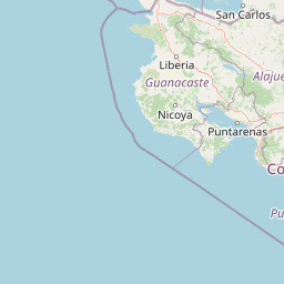
Barra Honda National Park landscape and geographic character

The landscape of Barra Honda National Park is dominated by karst topography, a geological formation characterized by soluble limestone that has been extensively eroded by water over millions of years. Barra Honda Peak rises from the surrounding plains as a prominent limestone hill, its surface marked by sinkholes and fissures that provide entry points to the underground cave system. The limestone bedrock is composed of calcareous material that dissolves readily in slightly acidic rainwater, creating the conditions for cave formation. The terrain above ground features rolling hills and valleys carved by water that has already penetrated into the subterranean passages. The park's location near the Nicoya Gulf places it within a broader landscape of tropical dry forest, though the specific karst substrate creates specialized conditions for vegetation. Surface exposures of limestone create a patchy environment where soils are thin and water drainage is rapid, supporting drought-resistant plant species adapted to the challenging substrate.

Barra Honda National Park ecosystems, habitats, and plant life

The nature of Barra Honda National Park encompasses two distinct but interconnected environments: the surface tropical dry forest and the unique cave ecosystem. The surface environment features vegetation adapted to seasonal dry conditions, with trees that lose leaves during the dry season and species capable of surviving on the thin, rocky soils that develop over limestone. The cave environment, however, represents the park's most distinctive ecological feature. The underground passages maintain stable temperature and humidity conditions that support specialized species adapted to life in constant darkness. The caves provide habitat for various bat colonies, which play important roles in cave ecology as both residents and contributors to nutrient cycles. Most remarkable are the blind salamanders and endemic fish species that have evolved in complete darkness, having lost their eyes over generations of isolation in the underground waters. These species represent remarkable examples of adaptation to subterranean environments, with scientific significance far exceeding their limited distribution.

Barra Honda National Park wildlife and species highlights

The wildlife of Barra Honda National Park is characterized by two contrasting communities: the surface-dwelling fauna of the tropical dry forest and the specialized cave-adapted species of the underground passages. Above ground, the forest supports typical Guanacaste fauna including various bird species, small mammals, and reptiles adapted to the seasonal environment. Within the cave system, the most remarkable wildlife includes blind salamanders that have evolved without eyes, navigating and hunting in complete darkness using other sensory mechanisms. Endemic fish species also inhabit the underground waters, having adapted to the unique conditions of permanent darkness and limited food resources. Various bat species roost within the caverns, using the caves as daytime shelter and emerging at night to feed. These bats connect the cave ecosystem to the surface environment, bringing nutrients into the caves and contributing to the unusual food webs that exist in this underground world. The presence of these rare and endemic species makes the park significant for conservation biology, as they represent unique evolutionary trajectories found nowhere else on Earth.

Barra Honda National Park conservation status and protection priorities

Barra Honda National Park holds significant conservation value as a protected example of karst landscape and subterranean ecosystem in Central America. The park protects a cave system that remains only partially explored, with perhaps half of the passages still undocumented, suggesting that additional species and geological features await scientific discovery. The protection of this cave system ensures the preservation of unique geological formations that represent over 70 million years of natural process. The endemic cave species, including blind salamanders and fish adapted to darkness, represent irreplaceable genetic resources and evolutionary case studies that cannot be found anywhere else in the world. The park also protects surface dry forest habitat within a region that has experienced significant agricultural conversion, making the protected area an important refuge for native species. Conservation challenges include managing visitor impact on the fragile cave formations and addressing the recovery from the 1997 fire that damaged portions of the park.

Barra Honda National Park cultural meaning and human context

Barra Honda National Park contains meaningful archaeological significance through the discoveries made within its cave system. The Nicoa cave has yielded pre-Columbian human remains, artifacts, and jewelry dating to approximately 300 BC, providing evidence of human use of these caves long before European contact. These findings suggest that the caves held cultural or spiritual significance for the indigenous peoples who lived in this region, possibly serving as burial sites or locations for ceremonial activities. The discovery of these artifacts during modern explorations connects the geological wonder of the caves to the human history of the Nicoya Peninsula, a region known for its pre-Columbian settlements and cultural significance. This archaeological dimension adds depth to the park's value beyond its geological and ecological importance, creating a cultural landscape where natural and human histories intertwine.

Top sights and standout views in Barra Honda National Park

Barra Honda National Park offers visitors the opportunity to explore one of Central America's most impressive underground cave systems, with formations that have developed over tens of millions of years. The calcareous formations within the caves rank among the most beautiful in the region, featuring elaborate stalactites, stalagmites, and columns that create otherworldly landscapes. The Santa Ana cave, descending 240 meters into the earth, provides a sense of scale that emphasizes the magnitude of the underground world. Visitors may observe bat colonies and potentially encounter the park's rare cave-adapted species. The park's location near the Nicoya Gulf also provides scenic views from elevated viewpoints, where the gulf's waters create a backdrop to the karst landscape. The combination of geological wonder, ecological uniqueness, and archaeological significance makes Barra Honda a distinctive destination within Costa Rica's national park system.

Best time to visit Barra Honda National Park

The best time to visit Barra Honda National Park coincides with Costa Rica's dry season, typically from December through April, when visitor access is most convenient and trail conditions are optimal. During this period, the weather is generally sunny and rainfall is minimal, making exploration of the cave system more comfortable. However, the dry season also means that some surface water features may be reduced, and the landscape can appear more parched. The wet season from May through November brings more lush vegetation but also periods of rain that may affect cave access and trail conditions. Visitors interested in wildlife viewing should note that the dry season often concentrates animals around remaining water sources, while the wet season provides greener landscapes but more challenging viewing conditions. The park's caves maintain relatively stable temperatures year-round, making them accessible in any season, though visitors should check with ranger stations regarding any seasonal access restrictions.

Park location guide

Geography guide, regional context, and park location map for Barra Honda National Park

Barra Honda National Park park geography, regions, and map view in Costa Rica
Understand where Barra Honda National Park sits in Costa Rica through a broader geographic reading of the surrounding landscape, nearby location context, and its mapped position within the national park landscape.

How Barra Honda National Park fits into Costa Rica

Costa Rica is a Central American country with coastlines on both the Caribbean Sea and Pacific Ocean. It gained independence from Spain in 1821 and operates as a unitary presidential republic with no standing military. The economy has diversified from agriculture into finance, pharmaceuticals, and ecotourism.

Wider geography shaping Barra Honda National Park in Costa Rica

Costa Rica is located in Central America, bordered by Nicaragua to the north, the Caribbean Sea to the northeast, Panama to the southeast, and the Pacific Ocean to the southwest. It shares a maritime boundary with Ecuador. The terrain includes coastal plains, mountain ranges, and volcanic landscapes.

Map view of Barra Honda National Park

Use this park location map to pinpoint Barra Honda National Park in Costa Rica, understand its exact geographic position, and read its mapped placement within the surrounding landscape more clearly.

Pigeon | © OpenStreetMap contributors

Location context for Barra Honda National Park

Guanacaste Province
Park atlas

Trace more protected areas across Costa Rica's Guanacaste Province and its distinctive karst landscapes.

Discover Other National Parks and Protected Areas Near Barra Honda National Park
After exploring Barra Honda National Park, browse other national parks and protected areas in Costa Rica's surrounding Guanacaste Province. Compare diverse protected landscapes, trace conservation efforts across the regional geography, and discover how parks preserve varied ecosystems and geological formations.
National parkCosta Rica

Palo Verde National Park: Costa Rica's Protected Landscape Geography and Map Context

Explore mapped park boundaries and regional natural landscapes.

Delve into the geographic identity of Palo Verde National Park, a protected area within Costa Rica. This detail entry focuses on its mapped landscape, providing context for its protected boundaries and regional setting. Understand how Palo Verde National Park fits into the broader atlas of Costa Rican geography, offering a factual basis for exploring its specific natural terrain and its significance as a national park within Central America's rich biodiversity.

Area
184 km²
Established
1978
IUCN
II
Relief
Lowland
National parkGuanacaste Province

Diriá National Park: Protected Landscape Atlas within Guanacaste Province

National Park geographic context and mapped terrain.

Examine Diriá National Park as a distinct protected area within Guanacaste Province. This detailed entry focuses on its geographic identity, mapped boundaries, and natural landscape characteristics. Understand how this national park contributes to the regional atlas, offering a clear view of its protected status and natural terrain features for focused discovery.

Area
28 km²
Established
1991
IUCN
II
Relief
Mountain
National parkGuanacaste Province

Las Baulas Marine National Park: Protected Marine Landscape Atlas in Guanacaste Province

Explore its mapped boundaries and regional geographic context.

Las Baulas Marine National Park represents a vital protected marine territory within Costa Rica. This entry offers an atlas-oriented perspective, detailing the park's geographic scope and its specific mapped boundaries. Users can explore its significance as a protected landscape, understand its relationship to the broader regional geography of Guanacaste Province, and utilize this information for structured natural landscape discovery.

Area
175 km²
Established
1991
IUCN
II
Relief
Mixed relief
National parkCosta Rica

Miravalles Jorge Manuel Dengo National Park: Costa Rica National Park Geographic Context

Mapped protected landscape and regional park geography.

Miravalles Jorge Manuel Dengo National Park offers a focused lens for understanding protected natural areas within Costa Rica. Explore its specific geographic footprint and the surrounding regional context to appreciate its significance as a mapped protected landscape. This detailed view supports a structured discovery of the park's identity, helping users grasp its place within the national atlas.

Area
43 km²
Established
2019
IUCN
II
Relief
Mountain
National parkCosta Rica

Arenal Volcano National Park: Costa Rica National Park Atlas and Mapped Terrain

Detailed geography and protected landscape context for a Costa Rican national park.

Gain a structured understanding of Arenal Volcano National Park, a protected natural area situated in Costa Rica. This page provides detailed geographic information, focusing on its mapped boundaries and landscape characteristics. It serves as a key resource for exploring the park's specific regional context and its role within the country's network of protected lands.

Area
121.24 km²
Established
1991
IUCN
II
Relief
Mountain
National parkGuanacaste Province

Rincón de la Vieja National Park: Costa Rican National Park Atlas Entry

Mapped protected landscape and regional geography.

Gain a structured understanding of Rincón de la Vieja National Park as a key protected area within Guanacaste Province. This detail page offers an atlas-focused perspective, highlighting its mapped boundaries and regional geographic significance. Explore how this national park contributes to the protected landscapes of Costa Rica, providing essential context for geographic discovery.

Area
141.61 km²
Established
1973
IUCN
II
Climate
Tropical
National parkGuanacaste Province

Guanacaste National Park: A Protected Landscape within Guanacaste Province's Geography

Explore mapped park boundaries and regional natural landscape context.

Delve into the protected landscape of Guanacaste National Park, a significant national park located within Guanacaste Province. This entry provides a focused view of its geographic features, mapped protected areas, and its role within the regional terrain. Understand the park's specific natural landscape character and its placement in the broader atlas of conservation lands.

Area
340 km²
Established
1991
IUCN
II
Relief
Mixed relief
National parkCosta Rica

Carara National Park: Protected Landscape Geography in Costa Rica

Explore the mapped terrain and park boundaries.

Carara National Park offers a focused exploration of protected landscape geography within Costa Rica. As a National Park, its mapped boundaries are integral to understanding its role in the country's natural atlas. This detail page provides specific geographic context and details relevant to atlas-based discovery, highlighting the park's unique position and protected-area identity for users interested in detailed mapping and regional natural context.

Area
52 km²
Established
1978
IUCN
II
Relief
Mixed relief

Common questions about visiting, size, designation, and location context for Barra Honda National Park

Barra Honda National Park FAQs for park facts, access, geography, and protected area context
Find quick answers about Barra Honda National Park, including protected-area facts, park geography, trail and visitor context, and how the park fits into its surrounding country and regional landscape.
MoriAtlas Explorer

Continue Your Protected Areas Search Across the Global Atlas

Deepen your exploration by continuing the structured search for national parks and protected areas worldwide. Utilize the comprehensive filtering capabilities to compare different conservation landscapes and refine your understanding of global park geography. Discover more about the distribution and characteristics of protected natural areas.

Global natural geography