

Mori Atlas logo
State or regional parkBents Basin State Conservation Area

Mapping the natural features and protected river basin terrain of Greater Western Sydney

Bents Basin State Conservation Area: A Protected River Gorge and Cumberland Plain Landscape

Bents Basin State Conservation Area serves as a vital protected reserve in New South Wales, centered on a unique circular river basin where the Nepean River exits a steep sandstone gorge. This landscape captures a rare intersection of Hawkesbury Sandstone outcrops and Cumberland Plain bushland, creating a distinct ecological corridor. Through this digital atlas, discover the topography, riverine dynamics, and heritage features that define this protected area near the edge of the Sydney metropolitan region.

river basinswimming holesandstone gorgeeucalyptus woodlandCumberland Plainnepean river
A stylized vector-style illustration of a river flowing through a rocky valley between steep cliffs, surrounded by trees.

Bents Basin State Conservation Area

State or regional park

Park overview

Structured park overview, official facts, and landscape profile for Bents Basin State Conservation Area

Bents Basin State Conservation Area park facts, protected area profile, and essential visitor context

Review the core facts for Bents Basin State Conservation Area, including designation, size, terrain, visitor scale, habitats, and operating context in one park-focused overview.

About Bents Basin State Conservation Area

Bents Basin State Conservation Area occupies a slender but characterful stretch of the Nepean River in western Sydney, where the river breaks free of the Hawkesbury Sandstone and spreads into a circular basin before continuing northeast toward the Hawkesbury and the coast. The reserve centres on this lagoon-like pool, more than a hundred metres across and over 20 metres at its deepest, and extends across the surrounding sandstone, floodplain, and plateau country.

Although its area is modest, the park carries an unusual concentration of values for such a small footprint. The basin itself is a popular swimming, kayaking and picnicking destination; the surrounding bushland shelters wombats, glossy black cockatoos, powerful and sooty owls, and a rich bat fauna; and the site preserves more than two dozen plant communities on the boundary between sandstone and Cumberland Plain environments. Beyond ecology, the reserve carries cultural weight as a traditional gathering place for Aboriginal groups along the Nepean and as one of the earliest documented botanical sites in the greater Sydney region.

Geologically, the basin is a sandstone erosion hollow enlarged by an earth-fill dam built by the Army's 17th Construction Squadron in the late 1980s. Culturally, the grounds still preserve traces of an 1860s inn that served the early rural communities of western Sydney. Today the reserve is administered by the NSW National Parks and Wildlife Service and is widely used by local school groups through its on-site education centre, while continuing to function as a regional swimming hole and picnic park for residents of Greater Western Sydney.

The combination of accessibility, recreation, ecology, and layered history makes Bents Basin an unusually dense pocket of protected landscape within an otherwise heavily urbanised metropolitan region.

Quick facts and research context for Bents Basin State Conservation Area

Bents Basin lies in New South Wales, within Greater Western Sydney, roughly between Silverdale and Wallacia on the Nepean River. It is a state conservation area managed by NSW National Parks and Wildlife Service and covers a compact footprint centred on a sandstone lagoon where the Nepean flows out of its sandstone gorge.

The reserve contains around 360 plant species across 25 plant communities, including regionally rare eucalypts and shrubs, and supports a range of native mammals and birds. Although small and heavily used for recreation, it carries local heritage significance through its Aboriginal history, a 19th-century inn site, and its early documentation by the botanist George Caley.

Protection and recognition

Terrestrial protected area established in 1994 with documented management scope.

Bents Basin State Conservation Area Protection Status and Designation History

Bents Basin State Conservation Area maintains a terrestrial protection status established in 1994 within its regional landscape. Structured records outline the documented designation history and administrative scope without imported international recognition sources.

Protection details

Protection scope
Terrestrial
Designated year
1994
Transboundary protection
No
Park context

Deeper park guide and search-rich context for Bents Basin State Conservation Area

Bents Basin State Conservation Area history, landscape, wildlife, and travel context

Explore Bents Basin State Conservation Area through its history, landscape character, ecosystems, wildlife, conservation priorities, cultural context, and seasonal travel timing in a structured park guide built for atlas discovery and search intent.

Why Bents Basin State Conservation Area stands out

Bents Basin is best known for the circular, lagoon-like swimming hole where the Nepean River pours out of a Sydney sandstone gorge, framed by sandstone outcrops and eucalyptus woodland. The reserve's combination of a popular water-based picnic park, the only formal picnic area on the Nepean, and a surprisingly species-rich patch of Cumberland Plain bushland makes it distinctive within Greater Western Sydney. It is also notable for its layered history: a traditional meeting place for Aboriginal groups, an early botanical site named "Dovedale" by George Caley in 1804, a rural inn from the 1860s that is listed on the NSW State Heritage Inventory, and a modern recreation reserve established through a partnership between the Army engineers and the state park system.
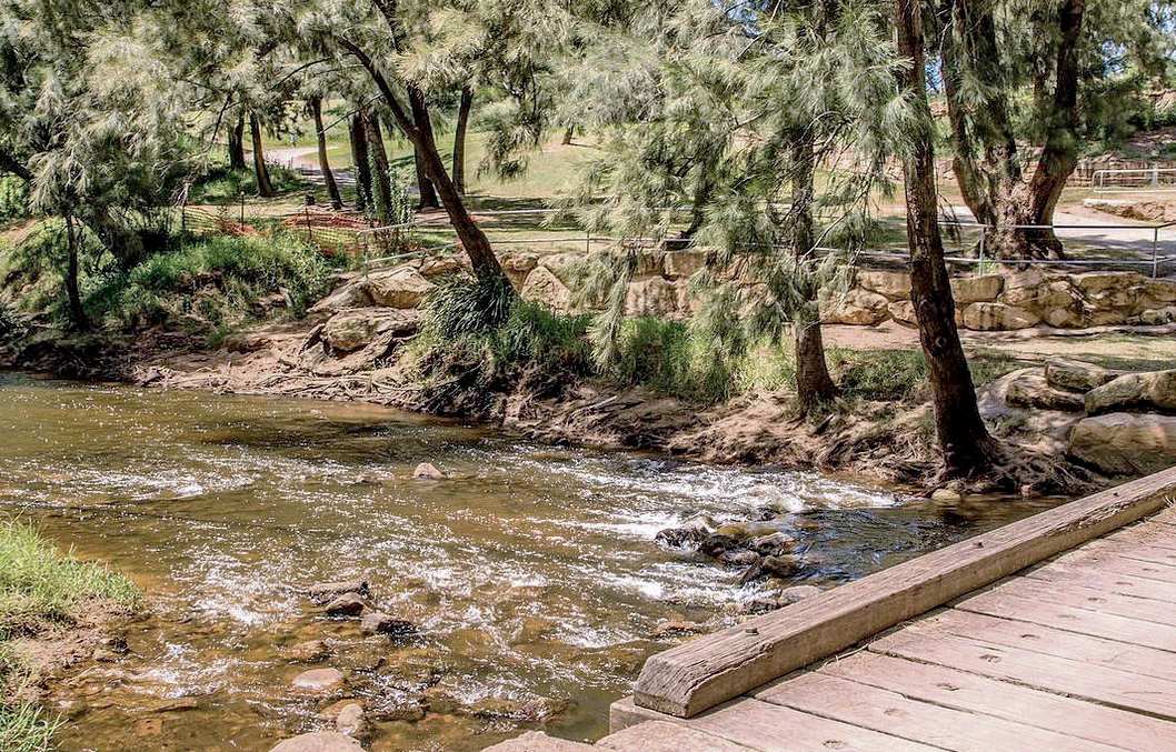
A view of the Nepean River flowing past a wooden bridge and wooded riverbank at Bents Basin State Conservation Area.
The Nepean River flowing through Bents Basin State Conservation Area.

Bents Basin State Conservation Area history and protected-area timeline

Long before it became a formal park, the basin was a meeting point for Aboriginal Australians along the Nepean River, which provided food, water, and a corridor between groups. The site is believed to have functioned as a traditional meeting and trading place, and the river flats near the basin were used as camps that allowed Aboriginal people to maintain cultural connections across the region.

In 1804 the botanist George Caley visited the area and named it "Dovedale," establishing an early link between the site and Sydney's botanical history. Throughout the nineteenth century the locality supported rural settlement, and an inn built in the 1860s became a local landmark for travellers on the early western roads. The inn is listed on the NSW State Heritage Inventory because it documents the road networks, rural communities, and land-use history of western Sydney before the area was swallowed by suburban expansion. Although the building was destroyed in the 1950s, its position is still marked by a mature pepper tree.

The basin's modern form took shape in 1987 and 1988, when the Australian Army's 17th Construction Squadron built a large earth-fill dam that significantly widened what had been a natural erosion hollow in the sandstone. The area was reserved as a state recreation area in 1994 and has since operated as Bents Basin State Conservation Area, managed by NSW National Parks and Wildlife Service. The transition from a secluded river pool to a structured public park reflects both the growing population of western Sydney and the desire to retain a publicly accessible stretch of the Nepean within the metropolitan area.

Bents Basin State Conservation Area landscape and geographic character

The defining landform of Bents Basin is the circular basin itself, a lagoon-like pool roughly 120 metres across and over 20 metres at its deepest, set where the Nepean River exits a steep-sided gorge cut into Hawkesbury Sandstone. Rocky rapids on the southern side feed water into the basin, while the northern outlet sends the Nepean streaming away toward the Hawkesbury and eventually the Central Coast, about 150 kilometres downstream.

Around the basin the terrain shifts quickly. The surrounding ground rises into a plateau carrying the clay soils of the Wianamatta Shale, part of the broader Cumberland Plain landscape that characterises much of western Sydney. To the east of the basin a cleared, undulating paddock sits on these shale clays, while lower-lying areas take the form of a floodplain that is regularly inundated. The reserve adjoins Gulguer Nature Reserve to the south, extending the network of protected bushland along this part of the Nepean.

Sandstone outcrops, rocky riverbeds, and small creeks break up the otherwise gentle topography, and walking tracks such as Caley's Lookout Track climb toward Little Mountain, a scenic lookout at about 160 metres elevation. Flooding is a recurring feature of the landscape: large parts of the reserve are flood-prone, and after major events the basin takes on the swollen, debris-strewn character visible in many of the park's photographs.
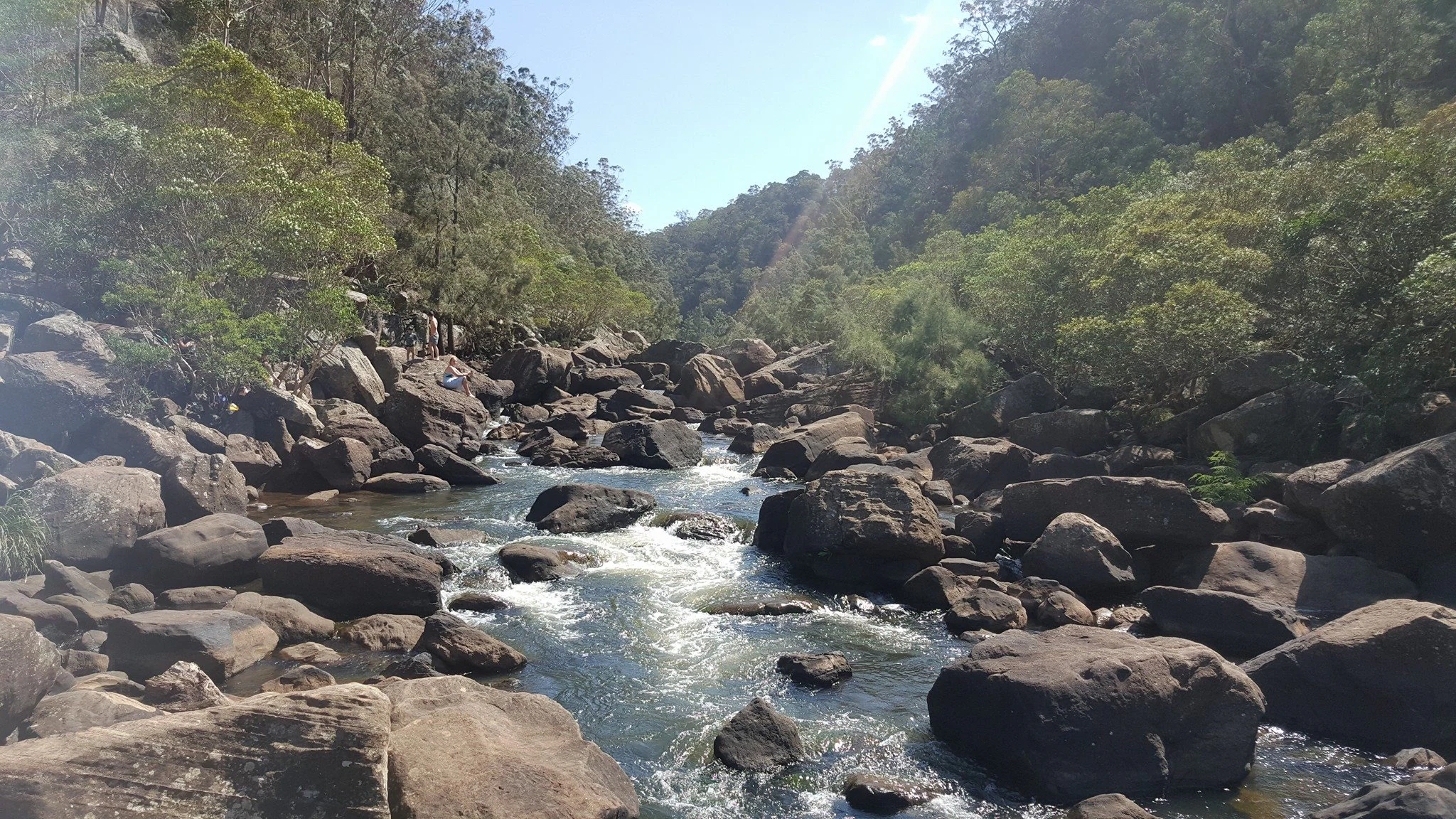
A rocky river flowing through a forested gorge with large boulders filling the riverbed.
The Nepean River flowing through the rocky basin at Bents Basin State Conservation Area.

Bents Basin State Conservation Area ecosystems, habitats, and plant life

Ecologically, Bents Basin sits at the meeting point of two contrasting Sydney landscapes: the sandstone heath and woodland of the Hawkesbury Sandstone and the grassy, clay-based woodlands of the Cumberland Plain. The reserve spans roughly 25 plant communities and supports around 360 plant species within a very compact area, which gives it a botanical density well above what its size would suggest.

Among the eucalypts and angophoras, the canopy includes Angophora subvelutina, Eucalyptus pilularis, and Eucalyptus eugenioides, often associated with understorey species such as Acacia parramattensis, Backhousia myrtifolia, Tristaniopsis laurina, and Ceratopetalum apetalum. Swamp and river-edge vegetation adds further diversity through species such as Casuarina cunninghamiana and Syncarpia glomulifera, while ground-layer plants include Pratia purpurascens, Microlaena stipoides, Cynodon dactylon, and ferns such as Asplenium flabellifolium and Adiantum aethiopicum.

The reserve is notable for the presence of rare and locally significant flora, including Hibbertia hermanniifolia and the vulnerable Eucalyptus benthamii, often called the Camden white gum. The juxtaposition of sandstone and shale substrates, combined with the damp margins of the basin, produces the wide variety of vegetation types that makes the small reserve act almost as an ecological sampler for the surrounding region.
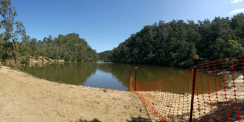
A wide view of a calm river basin with a sandy beach in the foreground and a orange safety fence bordering the water.
The swimming hole at Bents Basin State Conservation Area.

Bents Basin State Conservation Area wildlife and species highlights

Despite its small size and heavy recreational use, Bents Basin retains a community of native animals typical of riverine sandstone and Cumberland Plain bushland. Mammals recorded in the park include the common wombat, while bats are conspicuous: the area shelters the common bent-wing bat, the east-coast free-tailed bat, and the less common large-eared pied bat, reflecting the importance of old trees and rocky overhangs as roosting habitat.

Birdlife is a particular highlight, with owls and cockatoos among the more distinctive species. The reserve supports both the powerful owl and the sooty owl, large forest predators that depend on extensive tracts of hollow-bearing trees, and also hosts the glossy black cockatoo, a species of conservation concern that feeds primarily on casuarina seeds. These species indicate that, even within the Sydney metropolitan area, the park retains habitat of a quality sufficient for fauna that is sensitive to disturbance.

The basin's mix of open water, fringing woodland, and plateau grassy areas means that smaller birds, reptiles, and invertebrates also find habitat here, although the dramatic undercurrents of the swimming hole make the water itself more of a hazard for animals than a refuge. Wildlife observation is best pursued in the bushland tracks around Caley's Lookout and in the quieter stretches of woodland away from the main picnic areas.
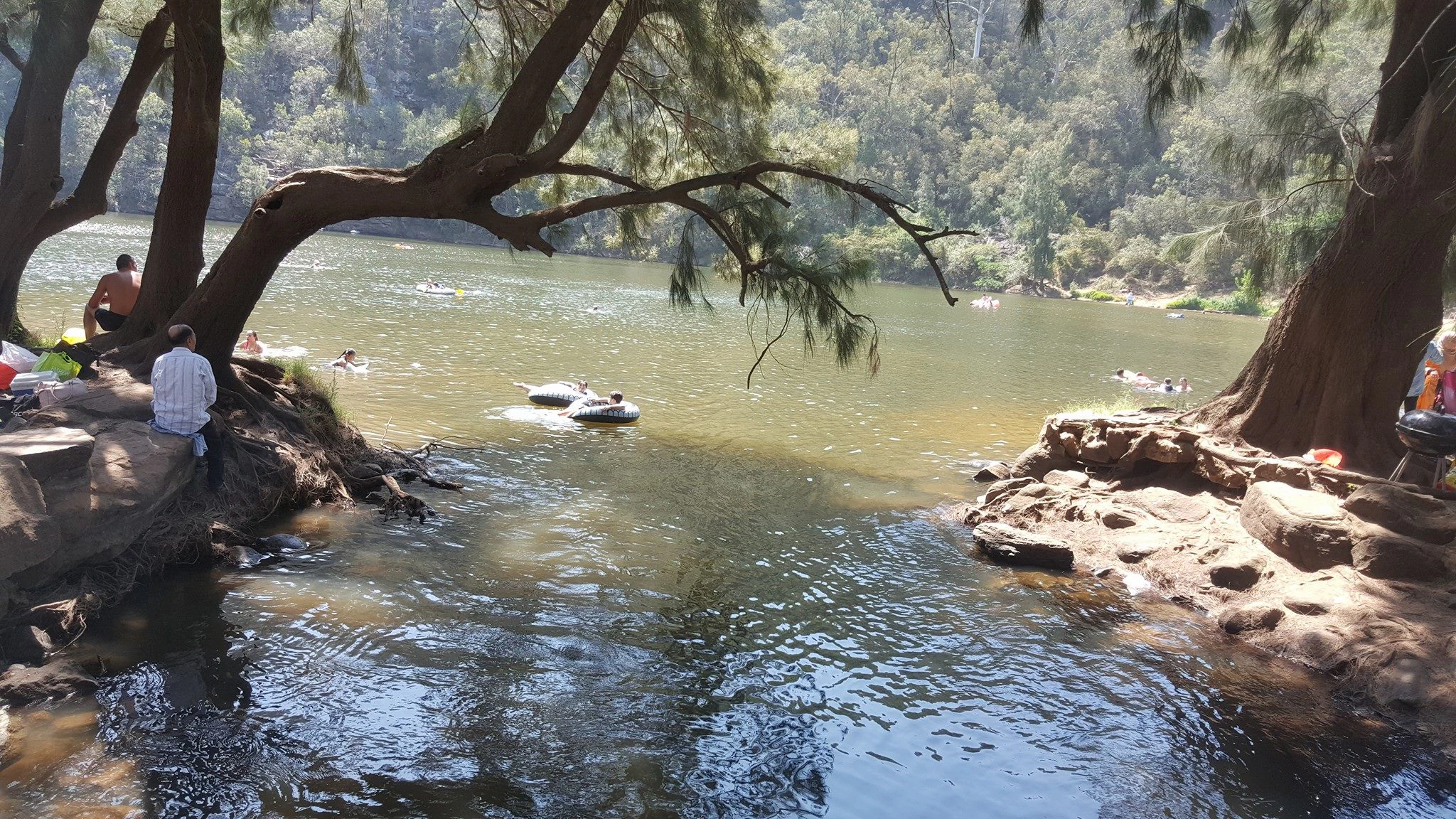
A group of people relaxing and swimming in a wide river section, with large trees overhanging the riverbank.
Visitors swimming and relaxing in the Nepean River at Bents Basin State Conservation Area.

Bents Basin State Conservation Area conservation status and protection priorities

Bents Basin's conservation significance lies less in its size than in the diversity of ecological communities it packs into a small area at a key geological transition. Straddling sandstone and shale substrates along a major river, the reserve supports around 25 plant communities and rare flora such as Eucalyptus benthamii and Hibbertia hermanniifolia, making it an important site for the protection of Cumberland Plain and Sydney sandstone biodiversity in closer proximity to suburbia.

The park also contributes to a network of protected habitat along the Nepean because it adjoins Gulguer Nature Reserve to the south, reinforcing a continuous block of bushland for wildlife such as the glossy black cockatoo and powerful owl. Beyond biodiversity, the reserve contains heritage values recognised at state level: the nineteenth-century inn site is listed on the NSW State Heritage Inventory for its significance to the early road networks and rural communities of western Sydney.

Management by the NSW National Parks and Wildlife Service balances heavy day-use recreation with environmental protection, including periodic closures of the basin during floods and safety responses to drowning incidents linked to the basin's powerful undercurrents. The reserve's central message for conservation is that even a small park embedded in a metropolitan region can shelter disproportionate ecological and heritage value when it sits at a landscape transition and is connected to neighbouring reserves.

Bents Basin State Conservation Area cultural meaning and human context

Long before it was gazetted as a reserve, the basin country was Aboriginal country, with the Nepean River functioning as both a food source and a corridor for movement and exchange. The site is believed to have acted as a traditional meeting and trading place between Aboriginal groups, and the surrounding river flats were used as camps that supported ongoing cultural connection, an association that remains significant to Aboriginal communities connected to the area.

European-era layers of culture arrived quickly after contact. The botanist George Caley named the locality "Dovedale" in 1804, linking the place to early scientific exploration of the Sydney region, and an inn built in the 1860s made the basin a roadside focus for travellers on the early western road network. The rise and decline of that inn, which was ultimately destroyed in the 1950s, mirrors the broader transformation of western Sydney from rural settlement to suburban metropolis.

In its modern form Bents Basin has become a cultural touchstone for residents of Greater Western Sydney, valued as a regional swimming spot, an outdoor classroom through its education centre, and a recognisable green landmark on the edge of a densely populated area. The pepper tree that still marks the inn site ties that local memory to the living landscape of the reserve.
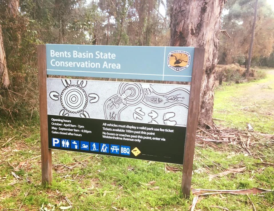
A metal park entrance sign for Bents Basin State Conservation Area standing in a wooded area, featuring informational text, icons for park facilities, and Indigenous-style artwork.
The entrance sign for Bents Basin State Conservation Area.

Top sights and standout views in Bents Basin State Conservation Area

Bents Basin's defining highlight is the sandstone basin itself, where the Nepean River explodes from a narrow gorge into a circular pool more than 120 metres across, flanked by rocky rapids and ringed by walking tracks and picnic areas. Combined with the eucalyptus woodland climbing toward the Caley's Lookout Track and Little Mountain lookout, the reserve offers a compressed but vivid cross-section of western Sydney's natural scenery.

Equally distinctive is the park's layered history: a meeting place for Aboriginal groups, an early nineteenth-century botanical site, a 19th-century inn listed on the NSW State Heritage Inventory, and a modern conservation area built around a dam constructed by military engineers. Together these strands make Bents Basin at once a swimming hole, a heritage site, and a pocket of Cumberland Plain biodiversity on the edge of Sydney.
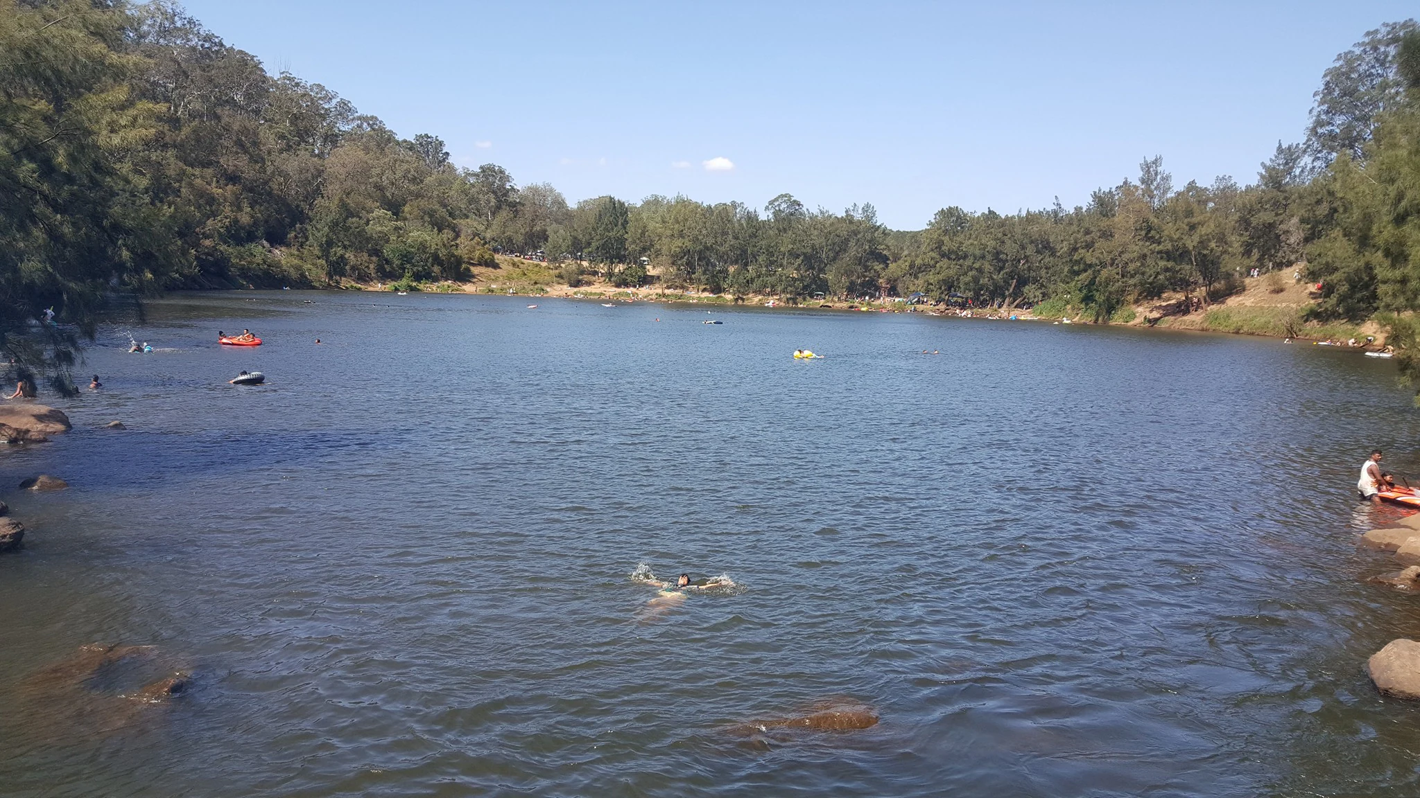
A wide view of a large natural water basin surrounded by dense trees and rocky shores, with several people swimming and using small inflatables in the water.
Swimmers and small recreational crafts in the natural basin at Bents Basin State Conservation Area.

Best time to visit Bents Basin State Conservation Area

As a recreational reserve within Greater Western Sydney, Bents Basin is used year-round, but the character of a visit shifts with the seasons and with river conditions. Warmer months draw most visitors to the basin for swimming, kayaking, and picnicking, when the lagoon is most inviting and the surrounding woodland offers shaded camping.

Wet periods can dramatically reshape the experience. The Nepean floodplain floods regularly, and after heavy rain parts of the reserve are closed and the basin takes on a swollen, turbulent appearance with visible debris lines and stronger currents. Cooler, drier months are better suited to bushwalking along Caley's Lookout Track, wildlife observation in the eucalyptus woodland, and visiting the education centre, while the swimming hole itself is more hazardous outside of calm, dry conditions because of persistent undercurrents.

Monthly climate preview

Long-term representative monthly temperature and precipitation data for New South Wales

Bents Basin State Conservation Area Climate Normals and Annual Weather Rhythm

Historical coordinate measurements trace a measured annual cycle of shifting thermal averages and daily precipitation rates across Bents Basin State Conservation Area. Examining the full twelve-month profile reveals granular monthly variations that clarify long-term regional climate patterns.
Annual mean16 °C
9 °C23 °C
Jan23°
Feb22°
Mar19°
Apr16°
May12°
Jun10°
Jul
Aug10°
Sep13°
Oct16°
Nov19°
Dec21°
Warmest month
January

22.9 °C

Coolest month
July

8.6 °C

Wettest month
February

4.6 mm/day

Driest month
September

1.9 mm/day

Park location guide

Geography guide, regional context, and park location map for Bents Basin State Conservation Area

Bents Basin State Conservation Area park geography, regions, and map view in Australia

Understand where Bents Basin State Conservation Area sits in Australia through a broader geographic reading of the surrounding landscape, nearby location context, and its mapped position within the national park landscape.

How Bents Basin State Conservation Area fits into Australia

Australia is a constitutional monarchy and federal parliamentary democracy comprising six states and ten territories. With a population of nearly 28 million, it is one of the world's most urbanised countries, with most people concentrated on the eastern seaboard. The country has a high Human Development Index and is known for its cultural diversity, ancient Aboriginal heritage, and unique wildlife.

Wider geography shaping Bents Basin State Conservation Area in Australia

Australia occupies the entire Australian continent, the island of Tasmania, and numerous smaller islands. It is the world's flattest and driest inhabited continent, featuring vast deserts in the interior (the Outback), tropical rainforests along the eastern coast, and a coastline bordering the Indian and Pacific Oceans.

Map view of Bents Basin State Conservation Area

Use this park location map to pinpoint Bents Basin State Conservation Area in Australia, understand its exact geographic position, and read its mapped placement within the surrounding landscape more clearly.

Pigeon | © OpenStreetMap contributors

Location context for Bents Basin State Conservation Area

New South Wales

Visualizing sandstone gorges, river pools, and eucalyptus woodlands

Bents Basin State Conservation Area Photos and Landscape Scenery

Visual records reveal the striking sandstone gorges, circular river pools, and eucalyptus woodlands that define Bents Basin State Conservation Area. Examining these protected landscapes provides a clearer understanding of the varied terrain and native plant communities preserved along the Nepean River corridor.

A view of the Nepean River flowing past a wooden bridge and wooded riverbank at Bents Basin State Conservation Area.

A wooden boardwalk bridge crosses a section of dark water, leading toward a shaded riverbank with large trees.

A rocky river flowing through a forested gorge with large boulders filling the riverbed.

A wide view of a calm river basin with a sandy beach in the foreground and a orange safety fence bordering the water.

A group of people relaxing and swimming in a wide river section, with large trees overhanging the riverbank.

A wide shot of a swimming hole surrounded by forest, with many people swimming and playing in the water on a sunny day.

A metal park entrance sign for Bents Basin State Conservation Area standing in a wooded area, featuring informational text, icons for park facilities, and Indigenous-style artwork.

A wide view of a large natural water basin surrounded by dense trees and rocky shores, with several people swimming and using small inflatables in the water.

Park atlas

Compare adjacent river reserves, sandstone gorges, and regional protected areas in New South Wales.

Exploring Parks Near Bents Basin State Conservation Area and Surrounding Protected Landscapes

Continue exploring regional protected areas by comparing nearby national parks and connected river reserves around Bents Basin State Conservation Area. Evaluating adjacent terrain helps place local sandstone gorges and eucalyptus woodlands into a broader geographic context.
State or regional parkNew South Wales
About 23 km away#1 closest

Northeast

Western Sydney Parklands: Mapped Protected Landscapes and Regional Geography

An expansive 27-kilometre urban corridor in New South Wales

Western Sydney Parklands stands as one of the most significant urban park systems in Australia, connecting numerous recreational precincts across a unique linear geography. This protected area preserves rare Cumberland Plain Woodland while serving as a vital hydrological link within the Greater Western Sydney landscape. Discover the detailed topography, ridgeline vistas, and ecological structure that define this metropolitan reserve's 27-kilometre span.

Area
52.8 km²
Established
1968
Visitors
790K annual
Relief
Lowland
National parkNew South Wales
About 24 km away#2 closest

Southeast

Georges River Koala National Park: A Protected Landscape for Critical Koala Habitat in New South Wales

Mapped geography and unique wildlife sanctuary.

Georges River Koala National Park represents a key protected area within New South Wales, specifically designated for safeguarding critical koala populations. This national park offers an invaluable insight into the region's undulating woodland terrain and the Georges River corridor's role in providing essential habitat. Understand the park's landscape character, its mapped boundaries, and its importance as a sanctuary for chlamydia-free koala colonies.

Area
18.3 km²
Established
2023
IUCN
II
Relief
Lowland
National parkNew South Wales
About 25 km away#3 closest

Southwest

Nattai National Park: Protected Landscape Within New South Wales Geography

Mapped boundaries and regional context for this national park.

Nattai National Park represents a distinct protected landscape within the broader geographic context of New South Wales, Australia. This entry focuses on its identity as a national park, detailing its mapped boundaries and its significance for structured geographic and atlas exploration. Users can uncover the specific park identity and its role within the regional mapped terrain.

Area
489.84 km²
Established
1991
IUCN
II
Visitors
1K annual
National parkNew South Wales
About 29 km away#4 closest

Southeast

Dharawal National Park: Sandstone Landscapes and Upland Swamp Ecosystem Atlas

Discover mapped protected area boundaries and unique biodiversity.

Dharawal National Park, situated in New South Wales, is a significant protected area distinguished by its globally important upland swamp ecosystems, which exhibit the highest species richness of shrub and sedge communities found anywhere on Earth. This national park features a varied terrain, from steep gorges and waterfalls to sandstone woodlands and rainforest valleys, all contributing to its exceptional biodiversity and status as a crucial koala habitat within southern Sydney. Its landscape context on the Woronora Plateau provides a unique geographic perspective for understanding protected Australian natural areas.

Area
65.08 km²
Established
2012
IUCN
II
Relief
Mixed relief
State or regional parkNew South Wales
About 29 km away#5 closest

North

Yellomundee Regional Park: Mapped Escarpment Boundaries and Nepean River Geography

A significant bushland reserve in New South Wales, Australia

Yellomundee Regional Park serves as a protected bushland buffer on the Blue Mountains escarpment, where ridge topography meets the Nepean River. With a landscape largely untouched by human development, this reserve offers a window into the natural bushland ecosystems and riverine corridors of the Great Dividing Range in New South Wales. Use this atlas to visualize the park's ridgelines, gullies, and vertical transition from mountain slopes to river valley flats.

Area
4.85 km²
Established
2000
IUCN
V
Relief
Mountain
Wildlife reserveNew South Wales
About 30 km away#6 closest

East

Chipping Norton Islands Wildlife Reserve: Mapped Landscapes and Geographic Overview

A vital wetland refuge in the Georges River floodplain

The Chipping Norton Islands comprise four distinct islets within a reclaimed lake landscape, serving as a sanctuary for over fifty bird species. This protected reserve illustrates the intersection of human-modified terrain and native ecosystems, featuring fringing mangroves, reed beds, and remnants of alluvial woodland that define this unique western Sydney habitat.

Relief
Lowland
Climate
Temperate
Access
Highly restricted
Scope
Terrestrial
National parkAustralia
About 32 km away#7 closest

South

Thirlmere Lakes National Park: Explore Australia's National Park Geography

Mapped boundaries and protected landscape context.

Thirlmere Lakes National Park offers a focused view into Australia's network of protected natural areas. This atlas-oriented content details the park's specific geographic identity, its mapped boundaries, and its significance as a conserved landscape. Engage with the structured data to understand the terrain and regional context of this unique Australian national park.

Area
6.29 km²
Established
1972
IUCN
II
Climate
Temperate
Nature reserveNew South Wales
About 33 km away#8 closest

North

Agnes Banks Natural Area Nature Reserve and Geological Landscape in New South Wales

Rare inland sand dunes and native flora habitats

The Agnes Banks Natural Area preserves an ancient, wind-reworked sand deposit that supports coastal-style woodland communities far from the ocean. This site serves as a crucial ecological link within the Cumberland Plain, offering significant value for studying sand-dune evolution, geological history, and rare flora species unique to this protected landscape in New South Wales.

Established
1999
Relief
Lowland
Scope
Terrestrial
Water
Minor water

Common questions about visiting, size, designation, and location context for Bents Basin State Conservation Area

Bents Basin State Conservation Area FAQs for park facts, access, geography, and protected area context

Find quick answers about Bents Basin State Conservation Area, including protected-area facts, park geography, trail and visitor context, and how the park fits into its surrounding country and regional landscape.
MoriAtlas Explorer

Continue Your Protected Areas Search Across the Global Atlas

Deepen your exploration by continuing the structured search for national parks and protected areas worldwide. Utilize the comprehensive filtering capabilities to compare different conservation landscapes and refine your understanding of global park geography. Discover more about the distribution and characteristics of protected natural areas.

Global natural geography