
Mori Atlas logo
National parkBiebrzański Park Narodowy

A comprehensive atlas exploration of the largest national park in Poland and its river-carved basin.

Biebrzański Park Narodowy: Mapping the Vast Wetland and Peatland Landscapes of Northeast Poland

Biebrzański Park Narodowy represents one of the most significant lowland peatland complexes remaining in Central Europe. Situated within the Podlaskie Voivodeship, this protected area follows the winding course of the Biebrza River, creating a vast mosaic of marshes, sedgebeds, and riparian forests. The park geography offers a unique study of floodplain dynamics, oxbow lakes, and the rare ecological refuge provided by these expansive, water-dominated natural terrains.

wetlandspeatlandspeat bogsmarshlandfloodplainriver valley
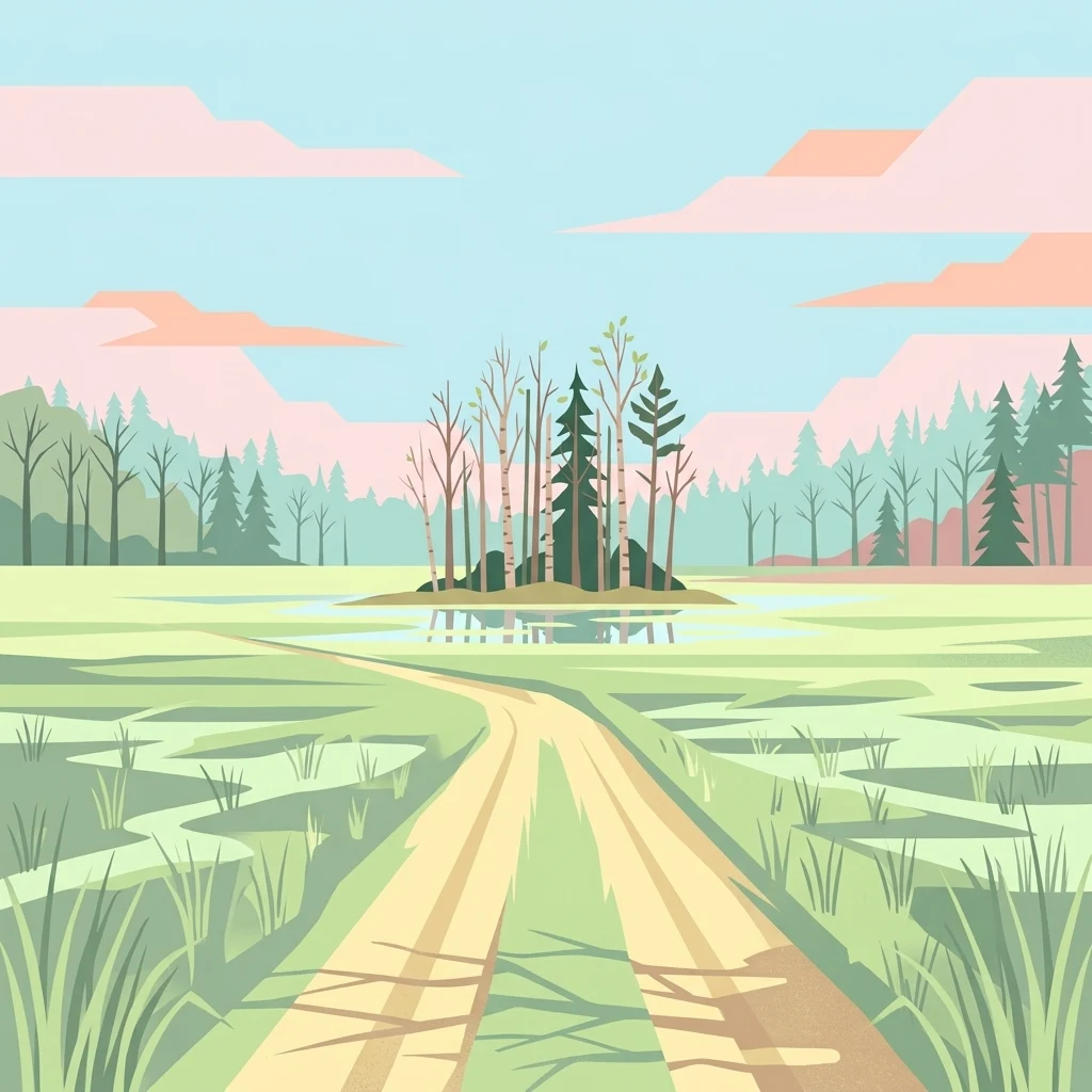
A flat-style vector illustration depicting a dirt road leading towards a small island of trees amidst a flat, green, marshy landscape under a pale sky with pink-hued clouds.

Biebrzański Park Narodowy

National park

Park overview

Structured park overview, official facts, and landscape profile for Biebrza National Park

Biebrza National Park park facts, protected area profile, and essential visitor context

Review the core facts for Biebrza National Park, including designation, size, terrain, visitor scale, habitats, and operating context in one park-focused overview.

About Biebrza National Park

Biebrza National Park occupies a long, narrow corridor of wet lowland in northeastern Poland, defined by the broad, gently sloping valley of the Biebrza River. Almost the entire course of this slow, meandering lowland river runs inside the park, producing a landscape dominated by peat-forming wetlands rather than by forests or mountains. The terrain is largely flat, with subtle elevation differences that nonetheless create distinct ecological zones from riverbank through sedge marsh and raised bog to bog woodland.

The park's identity is inseparable from water. Spring floods regularly inundate enormous sections of the valley, replenishing the peat soils, sustaining the characteristic sedge and reed communities, and providing the high water table on which the entire ecosystem depends. Drier raised bog fragments, including the famous Czerwone Bagno, support relict and sub-arctic plant species such as dwarf birch, Lapland willow, and sundews, alongside rich orchid populations. Surrounding the open peatlands are alder carrs (olsy), wet birch woodlands, and riparian willow thickets, creating a mosaic of wetland habitats unusual in modern European landscapes.

This ecological richness translates directly into exceptional wildlife value. The open marshes and floodplains host internationally important breeding populations of waders and marsh-nesting passerines, while the surrounding woodlands shelter larger mammals including elk, red deer, and wild boar. Although the park is not a wilderness in the dramatic, mountainous sense, it represents one of Europe's most important surviving examples of a large, naturally functioning wetland valley, and it draws naturalists, birdwatchers, researchers, and paddlers from across Europe.

Quick facts and research context for Biebrza National Park

Located in the Podlaskie Voivodeship of northeastern Poland, Biebrza National Park covers around 590 square kilometres and is the largest of Poland's national parks by area. It lies within the Kotlina Biebrzańska (Biebrza Basin) and protects roughly 155 kilometres of the Biebrza River valley.

The park was designated in 1993, evolving from a landscape park created in 1989 by the Towarzystwo Biebrzańskie, and from earlier interwar nature reserves such as Czerwone Bagno and Grzędy. In 1995 it was listed as a Ramsar wetland of international importance, and in 2010 it was fully incorporated into BirdLife International's Important Bird Areas inventory.

Its core ecological role is the protection of extensive lowland peatlands, a habitat type largely destroyed elsewhere in Poland and much of Europe. The park is recognised as a key European stronghold for waders, wetland songbirds, and the Eurasian elk.

Protection and recognition

Explore the documented terrestrial conservation framework established in 1995

Biebrzański Park Narodowy Protection Status and Designation History

Biebrzański Park Narodowy maintains a documented terrestrial protection status established in 1995, encompassing foundational conservation records. Review the official designation history and management scope details associated with this protected natural area.

Protection details

Protection scope
Terrestrial
Designated year
1995
Transboundary protection
No
Buffer area
668.24 km²
Park context

Deeper park guide and search-rich context for Biebrza National Park

Biebrza National Park history, landscape, wildlife, and travel context

Explore Biebrza National Park through its history, landscape character, ecosystems, wildlife, conservation priorities, cultural context, and seasonal travel timing in a structured park guide built for atlas discovery and search intent.

Why Biebrza National Park stands out

Biebrza National Park is best known for harbouring one of the largest and best-preserved lowland peatland complexes in Central Europe, with marshlands, sedgebeds, reedbeds, and bog woodland that have largely disappeared from more intensively developed landscapes. It is also renowned as a critical refuge for wetland birds, including rare breeding waders such as the aquatic warbler, the ruff, and the great snipe, as well as terns, cranes, and eagle species. Many ornithologists regard the Biebrza basin as one of the most important inland bird areas in the European Union. The park additionally serves as the most significant Polish refuge of the Eurasian elk (moose), with a population of several hundred animals centred on the Biebrza floodplain.
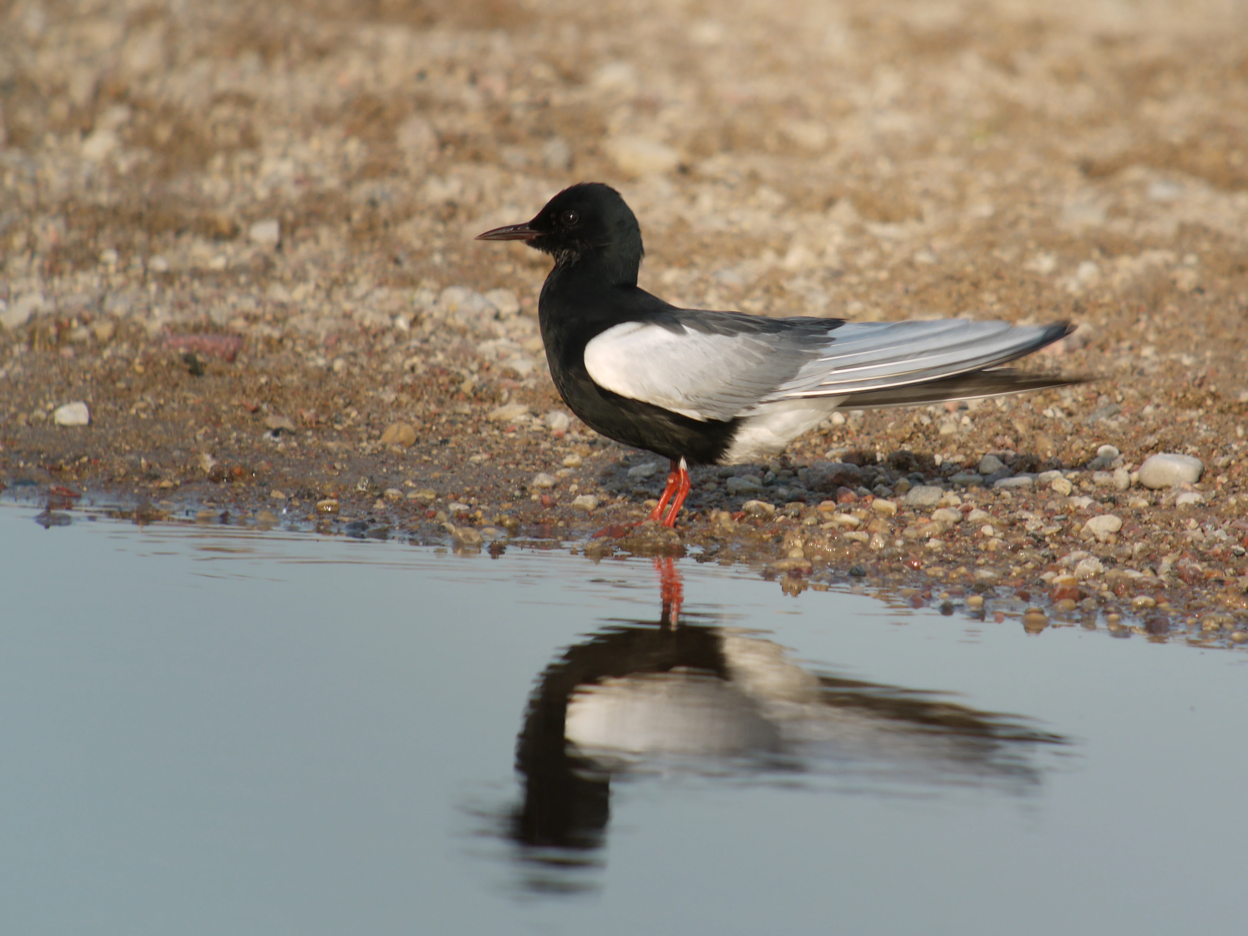
A white-winged tern, a small bird with a black head and chest and pale grey wings, standing on a pebbly shoreline with its reflection clearly visible in the calm water.
A white-winged tern perched at the water's edge in the wetlands of Biebrza National Park.

Biebrza National Park history and protected-area timeline

Conservation of the Biebrza valley began in the interwar period with the creation of two strict nature reserves: Czerwone Bagno, which still exists today in modified boundaries, and Grzędy. After decades of limited protection, the Towarzystwo Biebrzańskie spearheaded the establishment of the Biebrzański Park Krajobrazowy in 1989, covering the lower and middle basins of the Biebrza. Just four years later, in September 1993, this landscape park was upgraded into a full national park, giving its peatlands and wildlife long-term legal protection.

The park quickly acquired international recognition. In 1995 it was inscribed on the list of wetlands of international importance under the Ramsar Convention, affirming its global value as one of Europe's most significant peatland systems. In 2010 BirdLife International incorporated the entire park area into its inventory of Important Bird Areas, reflecting its exceptional concentration of breeding and migrating wetland birds.

The park has also faced major challenges. In April 2020 a large fire, ignited by arson and worsened by drought, burned around 5,280 hectares, nearly 9.5 percent of the park's area, including ecologically valuable sections near Czerwone Bagno. Subsequent monitoring documented significant declines in fourteen bird species, including the aquatic warbler, the Savi's warbler, and the common grasshopper warbler. A further fire in April 2025 affected around 450 hectares, mainly sedge and reedbeds, though intensive firefighting limited the spread into the strict protection zone of Czerwone Bagno. In 2023 the park celebrated the thirtieth anniversary of its establishment with a year of public programming on its natural and cultural heritage.

Biebrza National Park landscape and geographic character

The landscape of Biebrza National Park is defined by its flat, water-soaked topography. The Biebrza River winds slowly across the peat-filled basin of the Kotlina Biebrzańska, and its minor shifts in course over millennia have created a complex network of oxbows, abandoned channels, and shallow floodplain lakes. These features give the valley a layered, gently undulating character rather than dramatic relief.

Open peatlands dominate the visual scenery. In spring and early summer the valley becomes a sheet of shallow water edged by tall sedges and reedbeds; later in the season the same areas turn into expansive green and rust-coloured meadows. Raised bog sections, particularly around Czerwone Bagno, break the monotony with darker, drier surfaces of Sphagnum moss, low shrubs, and stunted bog vegetation. Small dunes and sandy ridges, such as Góra Skobla, rise above the surrounding marshes and offer panoramic viewpoints over the floodplains.

Woodland plays a smaller but important visual role. Alder carrs line active channels and depressions, willow thickets colonise abandoned riverbeds, and patches of boggy birch forest occupy intermediate ground between the wettest peatlands and drier mineral soils. Together these elements form a recognisably wetland landscape, where sky, water, and vegetation meet along endless horizons, and where human structures generally remain limited to the historical earthworks of the Osowiec Fortress and the remnants of old military and trade roads such as the Carska Droga.
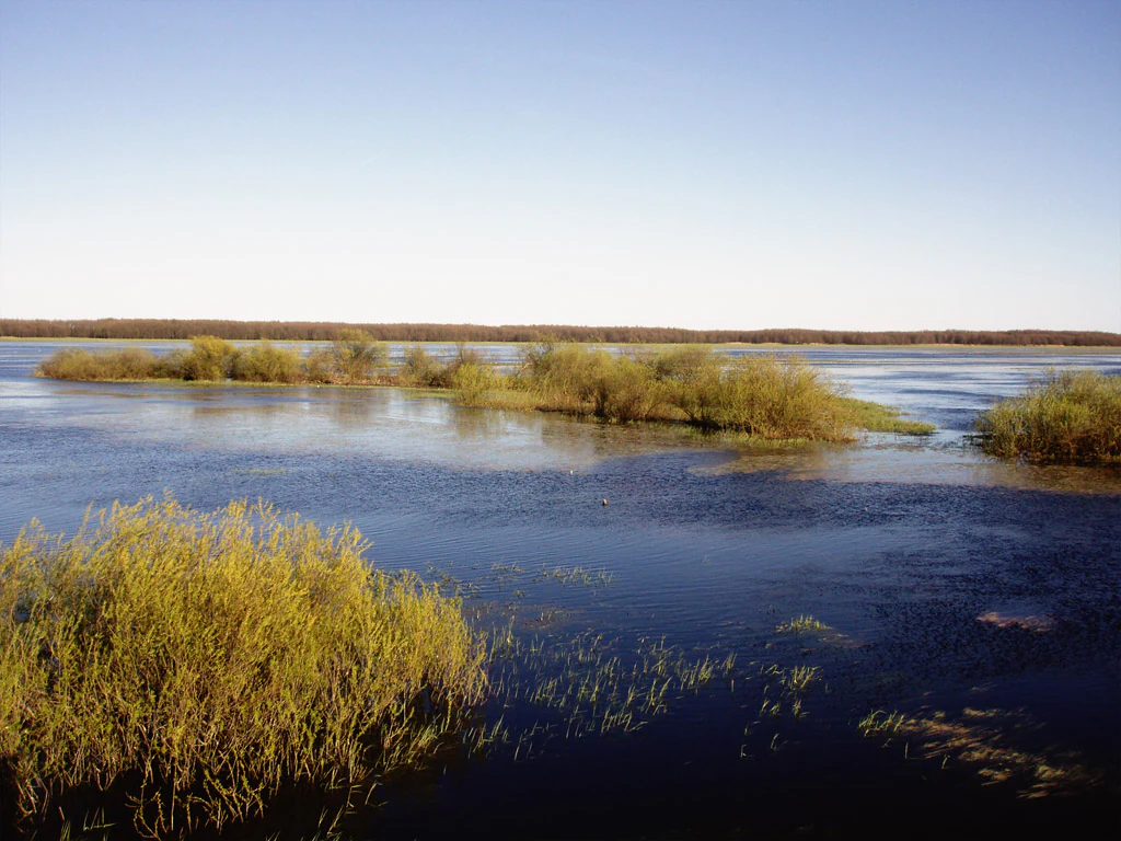
Wide landscape view of the Biebrza River floodplains featuring islands of low-lying shrubs and tall grasses surrounded by shallow, calm water under a clear sky.
The expansive floodplains and marshy river basin of the Biebrza River.

Biebrza National Park ecosystems, habitats, and plant life

Ecologically, Biebrza National Park is a stronghold for peat-forming wetland communities that have largely vanished from the rest of Poland and from much of lowland Europe. The park protects extensive communities of aquatic vegetation, true marshes, peatlands, reedbeds, sedge meadows, and a range of forest types including alder carrs, birch bogs, and fragments of riverine floodplain forest. Among the most ecologically distinctive features are the rich fen and brown-moss communities (mechowiska), which harbour relict and rare plant species that no longer survive in more disturbed regions.

The flora is notably diverse and unusually natural in character. Orchids, including the early purple orchid, the common lady's slipper, the white helleborine, and two species of Epipactis, occur alongside carnivorous sundews and several clubmosses. Dwarf birch, Lapland willow, and the royal lousewort add a sub-boreal element to the flora. The combination of open, waterlogged habitats and ancient peat soils creates conditions for a flora that mixes temperate forest species with true bog and tundra specialists.

Hydrology is the controlling factor of the entire system. Seasonal flooding by the Biebrza and its tributaries maintains the high water table on which peat formation depends, supports the marsh and reed communities, and shapes the nutrient balance of the soils. Disruption of this hydrological regime, whether through drainage in surrounding areas or climate-driven drought, is widely recognised as the principal threat to the park's ecological integrity. The continued survival of the system is therefore closely linked to the protection of the broader water catchment.
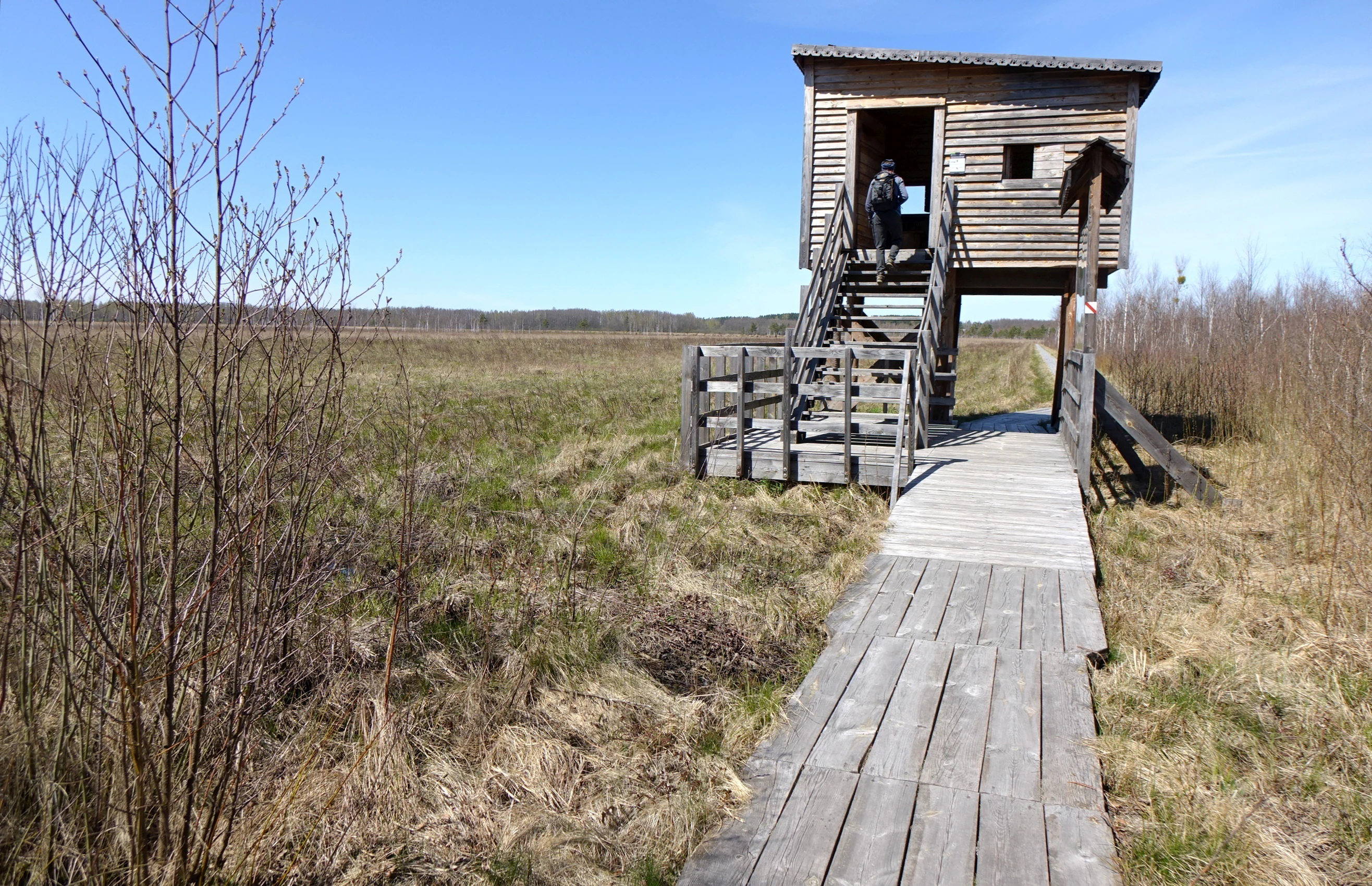
A wooden bird watching tower with stairs and a wooden boardwalk path leading through open, grassy wetlands under a clear blue sky.
A wooden observation tower and boardwalk on the Szuszalewo-Nowy Lipsk nature trail in Biebrza National Park.

Biebrza National Park wildlife and species highlights

The wetland mosaic of Biebrza National Park supports an exceptionally rich fauna. The park is documented as hosting forty-nine mammal species, 271 bird species, 36 fish species, 12 amphibian species, and 5 reptile species. Invertebrate diversity is also high, with more than 700 species of butterflies, nearly 500 spider species, over 500 beetle species, and significant populations of leeches and caddisflies.

For birds, the Biebrza basin functions as an internationally important breeding, feeding, and staging area. The valley hosts isolated breeding populations of boreal and tundra-associated species, including the ruff, the great snipe, the common snipe, the jack snipe, and the black-tailed godwit, as well as marsh terns such as the white-winged tern and the whiskered tern. Raptors such as the lesser spotted eagle and short-eared owl are also part of the breeding avifauna. Beyond the breeding season, the open, flooded surfaces are crucial for migrating waders, for which Biebrza is one of the most important refuges in Central Europe.

The Eurasian elk is the park's most iconic mammal. The floodplain mosaic, with abundant willow and birch browse and extensive hiding cover, supports the largest elk population in Poland, numbering in the low hundreds. Other large mammals typical of the area include red deer, roe deer, and wild boar, while carnivores and smaller wetland mammals also occur in the forested fringes and undisturbed peatlands.
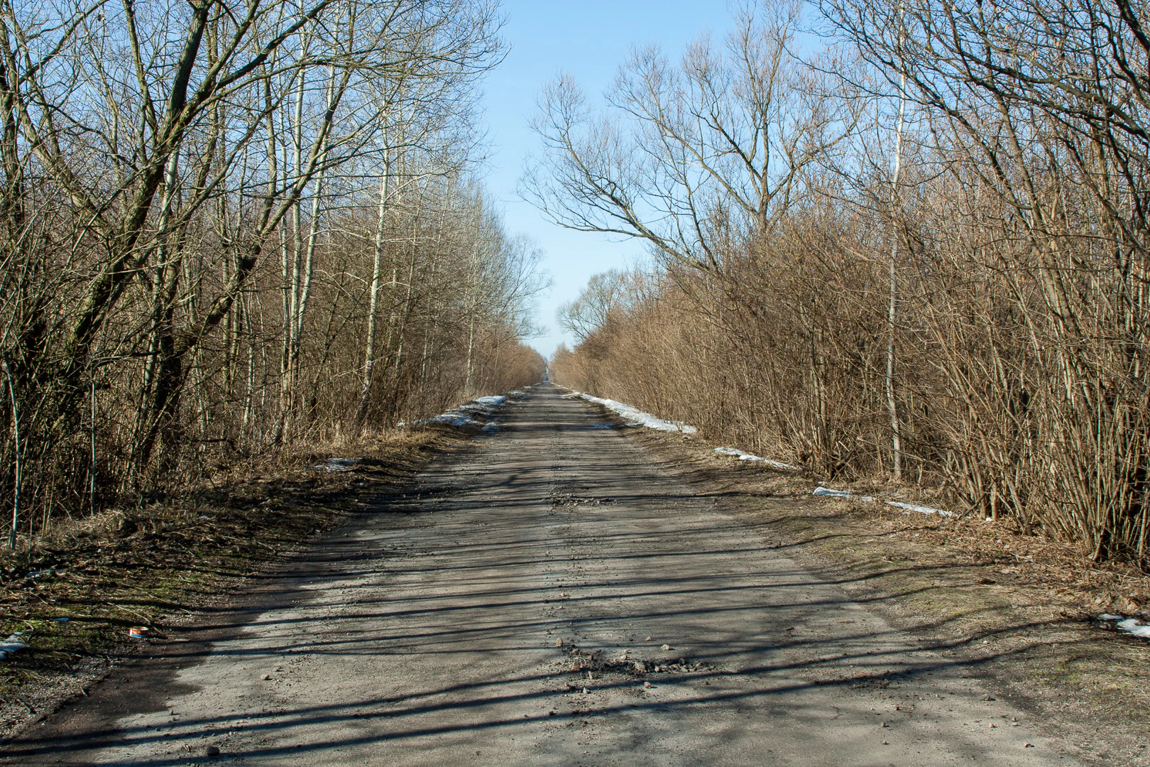
A long, straight, paved road stretches into the distance, framed on both sides by bare, leafless trees and brush typical of early spring; patches of melting snow are visible along the road edges.
The Carska Droga, a historic route running through the wetlands of Biebrza National Park.

Biebrza National Park conservation status and protection priorities

Biebrza National Park is of major national and international conservation significance because it protects one of the last large-scale lowland peatland systems in Central Europe. Lowland peatlands have been almost entirely drained and converted in neighbouring countries, making the Biebrza basin effectively a refuge ecosystem for an entire suite of peat-dependent species and processes, including active peat formation.

Its Ramsar designation in 1995 reflects the park's role within the global network of wetlands of international importance, while its full incorporation into BirdLife International's Important Bird Area inventory in 2010 underscores its exceptional ornithological value. Internally, the park is zoned into strict protection areas, active protection areas, and landscape protection areas, allowing sensitive core zones to be shielded from direct human pressure while still permitting research, traditional land use, and controlled public access in surrounding sectors.

Conservation priorities for the park focus heavily on hydrology. Maintaining the natural flood regime of the Biebrza, preventing further drainage of the broader catchment, and managing post-fire recovery are central concerns, particularly after the major 2020 fire, which affected sensitive bog and meadow habitats. Ongoing debate also surrounds expansion of the park by an additional several thousand hectares to bring additional ecologically valuable buffer zones under formal protection, further strengthening the integrity of the wetland system.

Biebrza National Park cultural meaning and human context

The Biebrza valley carries deep cultural and historical layers alongside its ecological value. Within the park lies the Twierdza Osowiec, a nineteenth-century Russian imperial fortress built to defend the approaches to the Prussian and later German border, and the better known Fort IV of this system can be explored via a dedicated nature-and-history trail. The historic earthwork road known as Carska Droga, originally laid as a military route, also passes through the park and remains a tangible element of the region's past.

The communities along the Biebrza have long traditions of life shaped by the rhythm of the marshes, including seasonal use of meadows, haymaking on the floodplain, and small-scale river transport. The traditional local culture of Podlasie, with its mix of Polish, Belarusian, and Orthodox Christian influences, continues to frame the human context of the surrounding villages such as Goniądz and Osowiec-Twierdza. Modern cultural programming around the park, including the thirtieth-anniversary initiatives of 2023, has increasingly emphasised the interaction between this regional heritage and the protected landscape.
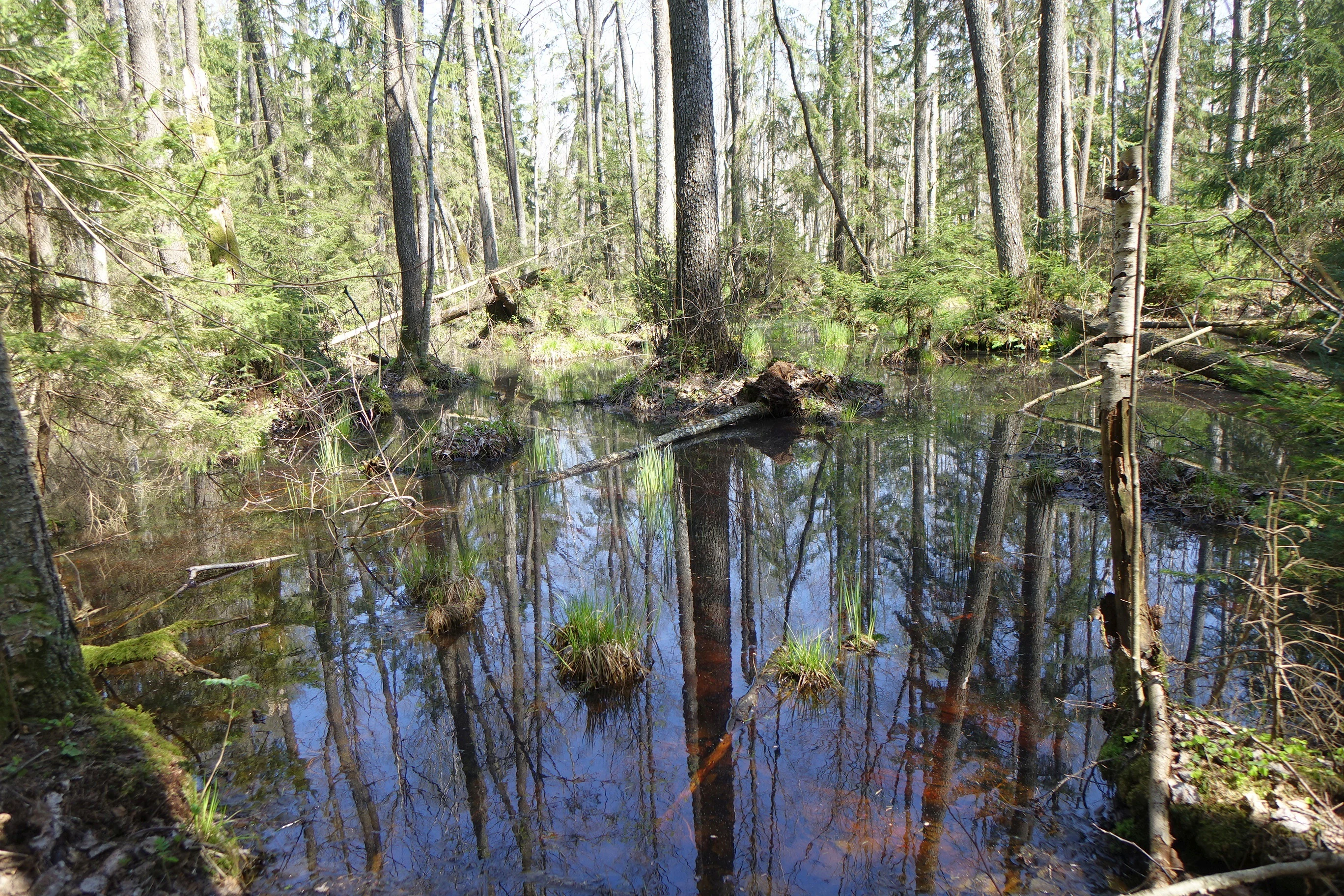
A pool of still water surrounded by trees in a forest, reflecting the blue sky and surrounding vegetation.
A tranquil flooded forest scene in the Czerwone Bagno nature reserve of Biebrza National Park.

Top sights and standout views in Biebrza National Park

The park's strongest highlights are visible at the landscape scale: the seemingly endless floodplains of the Biebrza in spring, the dark expanse of Czerwone Bagno, and the modest but striking dunes and viewpoints such as Góra Skobla. These open, expansive scenes are increasingly rare in modern Europe and give the park an immediate visual identity.

Ecologically, the park's highlights include the breeding populations of aquatic warbler and other marsh-nesting songbirds, the seasonal concentrations of waders on migration, and the regular presence of elk moving through the willow and birch thickets. Each of these features has made the park a reference site for European wetland conservation.

Practical highlights for visitors include a dense network of nature trails, over 100 kilometres of cycling routes such as the Podlaski Szlak Bociani and the Green Velo trail, the option of paddling down the Biebrza, and the integration of natural and human history through sites such as Fort IV of the Osowiec Fortress.
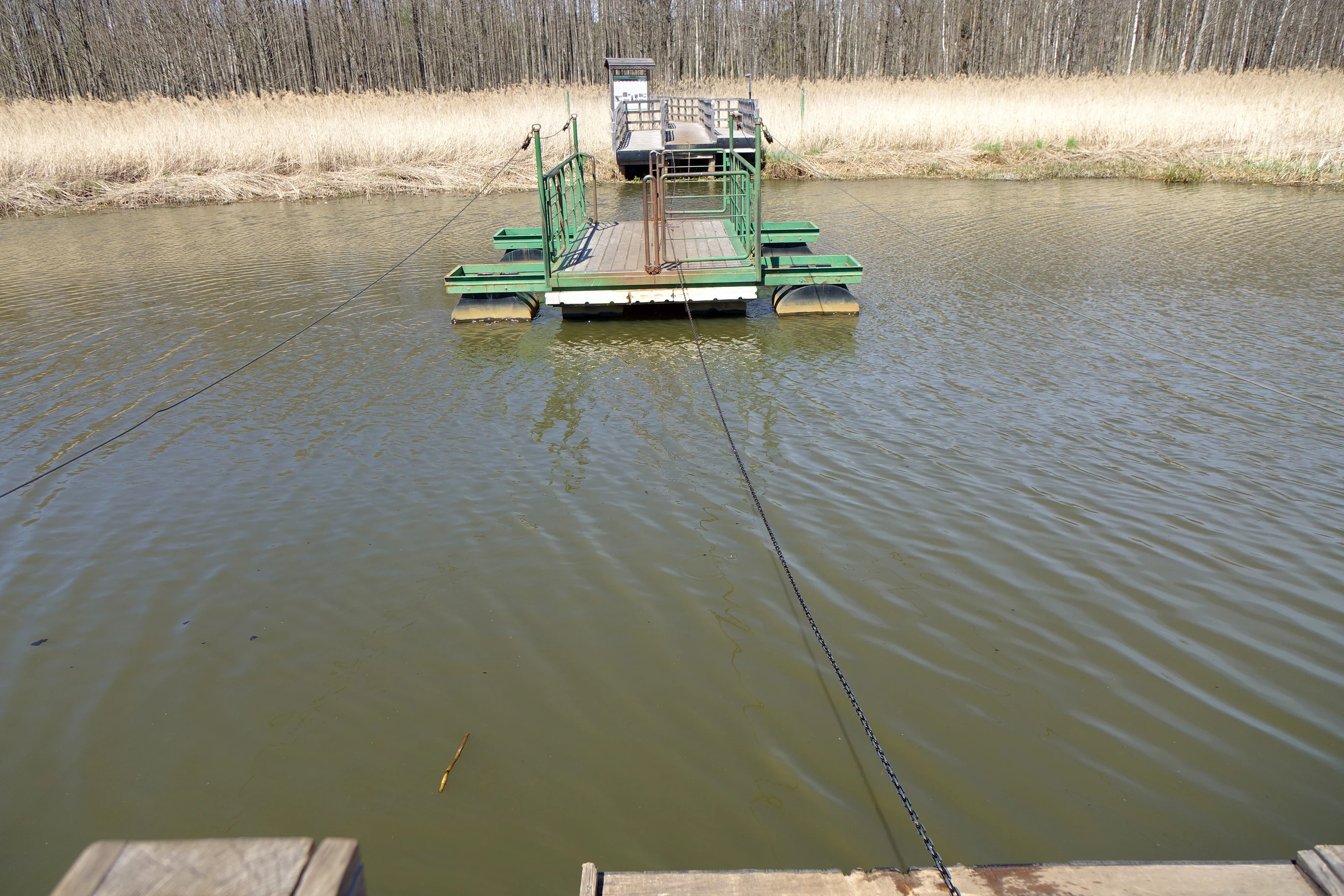
A small green metal ferry boat tethered to steel cables is floating on a calm river, positioned between two grassy banks.
A hand-operated cable ferry crossing the Biebrza River on the Szuszalewo-Nowy Lipsk nature trail.

Best time to visit Biebrza National Park

Late spring is widely regarded as the most evocative season in Biebrza, when snowmelt and seasonal floods turn the valley into a broad sheet of shallow water. This period brings peak breeding activity for many marsh birds and the chance to see waders establishing territories across the open fens. Early mornings at this time of year can be particularly rewarding for birdwatching.

Summer reveals the full vegetation of the park, with extensive sedge flowering, active insect life, and easier walking conditions on the educational trails. The longer days and warmer temperatures also support canoe trips along the Biebrza, though water levels can be lower later in the season. In autumn the park becomes quieter, the colours of the birch and willow woodlands shift, and elk are often more visible.

Winter conditions can be harsh, with deep snow, frozen peatlands, and limited access to certain trails, and visits at this time of year are best suited to experienced observers. Across the year, the park's character is shaped strongly by water and season, and visits at different times offer very different impressions of the same wetland landscape.
Monthly climate preview

Representative long term temperature and monthly precipitation averages

Biebrzański Park Narodowy Climate Normals and Annual Weather Rhythm

Biebrzański Park Narodowy records measured long term temperature variations and monthly precipitation rates across representative coordinate sampling. Analyzing the complete twelve month climate profile reveals detailed thermal ranges and multi seasonal meteorological distributions.
Annual mean7 °C
-5 °C19 °C
Jan-5°
Feb-4°
Mar1°
Apr7°
May13°
Jun16°
Jul19°
Aug18°
Sep13°
Oct7°
Nov2°
Dec-3°
Warmest month
July

18.8 °C

Coolest month
January

-4.9 °C

Wettest month
July

2.7 mm/day

Driest month
March

1.4 mm/day

Park location guide

Geography guide, regional context, and park location map for Biebrza National Park

Biebrza National Park park geography, regions, and map view in Poland

Understand where Biebrza National Park sits in Poland through a broader geographic reading of the surrounding landscape, nearby location context, and its mapped position within the national park landscape.

How Biebrza National Park fits into Poland

Poland, officially the Republic of Poland, is a Central European country spanning from the Baltic Sea in the north to the Carpathian Mountains in the south. It borders Germany, Czech Republic, Slovakia, Ukraine, Belarus, Lithuania, and Kaliningrad Oblast. The country has a temperate climate, diverse landscapes, and is known for its rich history, cultural heritage, and strong economic position within the EU.

Wider geography shaping Biebrza National Park in Poland

Poland occupies 312,696 km2 in Central Europe, extending from the Baltic Sea coast in the north to the Sudetes and Carpathian Mountains in the south. It borders Germany to the west, Czech Republic and Slovakia to the south, Ukraine and Belarus to the east, and Lithuania and Kaliningrad Oblast to the northeast. The landscape includes lowland plains, uplands, and mountain ranges.

Map view of Biebrza National Park

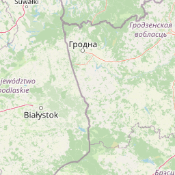
Use this park location map to pinpoint Biebrza National Park in Poland, understand its exact geographic position, and read its mapped placement within the surrounding landscape more clearly.

Pigeon | © OpenStreetMap contributors

Location context for Biebrza National Park

Podlaskie Voivodeship
Natural feature types

Explore the Natural Geography and Named Landforms of Biebrzański Park Narodowy

Deepen your understanding of the marshland ecology and river valley terrain of Biebrzański Park Narodowy by browsing this collection of identified natural features. MoriAtlas provides a structured path for examining the specific physical components that shape this protected Polish region, from its peat bogs to its elevated sandy ridges.

Visual reference collection showcasing lowland peatlands, river floodplains, and wetland habitats.

Biebrzański Park Narodowy Photos and Landscape Scenery

Examine high-resolution photography documenting the expansive marshes, winding river channels, and unique peatland habitats of Biebrzański Park Narodowy. Visual archives reveal the flat topography, seasonal floodwaters, and protected wilderness character defining Central Europe's premier wetland basin.

A white-winged tern, a small bird with a black head and chest and pale grey wings, standing on a pebbly shoreline with its reflection clearly visible in the calm water.

A person walking away along a wooden plank trail cutting through tall, dry golden marsh grass under an overcast sky.

Wide landscape view of the Biebrza River floodplains featuring islands of low-lying shrubs and tall grasses surrounded by shallow, calm water under a clear sky.

A wooden bird watching tower with stairs and a wooden boardwalk path leading through open, grassy wetlands under a clear blue sky.

A long, straight, paved road stretches into the distance, framed on both sides by bare, leafless trees and brush typical of early spring; patches of melting snow are visible along the road edges.

An expansive view of a flat wetland landscape with tussocky grasses, scattered low shrubs, and distant woodland under a pale sky.

A pool of still water surrounded by trees in a forest, reflecting the blue sky and surrounding vegetation.

A small green metal ferry boat tethered to steel cables is floating on a calm river, positioned between two grassy banks.

A high-angle view looking down at a wooden boardwalk path surrounded by sparse, leafless trees and wetland vegetation. A wooden interpretive sign structure stands in the foreground.

A wide, eye-level view of a lush green wetland landscape featuring a small stream, surrounded by tall grasses, shrubs, and scattered deciduous trees with a forest line in the distance under a pale sky.

A wide view of a bright green, flooded marshland or wet meadow with standing water and patches of mud reflecting the sky.

A wide, elevated view of a winding river flowing through green marshlands and golden fields under a pale blue sky, framed by branches in the foreground.

Park atlas

Compare surrounding regional geography and related wetland reserves in northeastern Poland.

Parks Near Biebrzański Park Narodowy and Connected Protected Landscapes

Browsing other protected areas near Biebrzański Park Narodowy reveals broader ecological patterns across the surrounding lowland river basins. Comparing these neighboring habitats provides essential regional context for understanding wetland conservation across northeastern Poland.
Watercolor painting showing a wetland scene with reeds, patches of water, and trees under a light sky
National parkPodlaskie Voivodeship
Park boundaries overlap#1 closest

Southwest

Biebrza National Park: Protected Fenlands and River Basin Geography in Northeastern Poland

Tracing the largest lowland peat bog complex in the European landscape

Biebrza National Park serves as the premier protected wetland area in Poland, characterized by its vast, intact marshlands and the meandering Biebrza River valley. This geographic profile details the park's critical fen ecosystems, floodplain dynamics, and distinctive habitats that support diverse avian and mammalian populations within the Podlaskie region.

Area
592.23 km²
Established
1993
IUCN
II
Relief
Lowland
Watercolor painting of a tranquil marshland scene with reeds in the foreground, rolling green hills, and a pale sky.
Nature reservePodlaskie Voivodeship
Park boundaries overlap#2 closest

Northeast

Ostoja Augustowska Nature Reserve: Protected Forest and Wetland Atlas of Podlaskie

Mapped wilderness corridors in the Polish lowlands

Ostoja Augustowska serves as a major ecological hub in Podlaskie Voivodeship, comprising extensive pine and spruce woodlands linked with diverse peatland systems. The site provides a critical corridor for rare forest wildlife while preserving ancient stands of old-growth timber. Gain insights into the complex geography of this Natura 2000 protected territory through its documented terrain, hydrological networks, and mosaic of rare boreal habitat types.

Area
1,070.69 km²
Established
2009
Relief
Lowland
Climate
Temperate
Nature reservePodlaskie Voivodeship
About 13 km away#3 closest

Southwest

Rezerwat przyrody Bagno Wizna II: Protected Peatland and Bog Terrain in Podlaskie Voivodeship

Mapped nature reserve and raised bog geography in northeastern Poland.

Rezerwat przyrody Bagno Wizna II functions as a specialized nature reserve in the Kotlina Biebrzańska, protecting rare raised bog vegetation. The site illustrates the intersection of active conservation efforts and regional drainage history, serving as a distinct geographic landmark within the wider protected land network of Podlaskie Voivodeship.

Area
0.796 km²
Established
1967
Relief
Lowland
Climate
Temperate
Nature reservePodlaskie Voivodeship
About 14 km away#4 closest

Northeast

Rezerwat przyrody Mały Borek: Pine Bore Forest and Peatland Geography in Podlaskie

Protected nature reserve in the Augustów Primeval Forest

Rezerwat przyrody Mały Borek is a significant nature reserve located in the Podlaskie Voivodeship of Poland. The area is defined by its extensive pine bore forests, central raised bogs, and transition zones of alder swamp. As part of the Natura 2000 network, it provides essential habitat and stands as a key scientific reference for the natural forest landscape of the Augustów Plain.

Area
0.905 km²
Established
1959
Relief
Lowland
Scope
Terrestrial
Watercolor painting showing a winding river through marshy fields with distant hills
National parkPodlaskie Voivodeship
17 km away#5 closest

Southwest

Narew National Park: Discover Poland's Premier Wetland National Park with Unique River Geography

Explore its mapped boundaries and rich protected landscape.

Narew National Park represents a significant protected area within the Podlaskie Voivodeship, distinguished by its one-of-a-kind anastomosing river system where the Narew River splits into numerous interconnected channels. This dynamic wetland environment provides critical habitat and showcases a complex interplay of water, land, and diverse ecosystems. Users can explore the park's geographic features, understand its protected landscape status, and appreciate its vital role within the regional atlas through detailed mapping and factual context.

Area
73.5 km²
Established
1996
IUCN
II
Relief
Lowland
A horizontal watercolor illustration showing a wooden boardwalk winding through a green and marshy landscape with soft hills in the background.
National parkPodlaskie Voivodeship
17 km away#6 closest

South

Narwiański Park Narodowy: Mapped Wetland Geography and Protected Floodplain Landscapes

Examining the hydrologic patterns and marshland terrain of the Narew River valley.

Narwiański Park Narodowy features a unique, water-dominated geography in Podlaskie Voivodeship. This protected area centers on the anastomosing Narew River, creating a shifting mosaic of streams, oxbows, and managed grasslands that serves as a vital refuge for wetland birds and aquatic species within the broader Polish landscape.

Area
68.1 km²
Established
1996
Visitors
15K annual
Relief
Lowland
Nature reservePodlaskie Voivodeship
About 26 km away#7 closest

Southwest

Rezerwat przyrody Dębowe Góry: Protected Sessile Oak Forest in Podlaskie Voivodeship

Ecologically intact lowland forest and rare plant habitat

Rezerwat przyrody Dębowe Góry stands as a protected sanctuary for light-loving sessile oak communities in Podlaskie Voivodeship. Its rolling lowland terrain and rich understory flora represent an essential fragment of Poland's natural woodland heritage, functioning as a key study area within the broader Czerwony Bór forest landscape context.

Area
0.993 km²
Established
2001
Relief
Lowland
Scope
Terrestrial
National parkPodlaskie Voivodeship
27 km away#8 closest

North

Wigierski Park Narodowy: Mapped Protected Landscapes of Northeastern Poland

A regional atlas of postglacial terrain and lake ecosystems.

Wigierski Park Narodowy represents a vital expanse of protected land in the Podlaskie Voivodeship. This profile offers insights into its glacial moraine ridges, kettle hole topography, and the specific distribution of forest-fringed bog habitats that define this distinct segment of the Lithuanian Lake District.

Area
150.898 km²
Established
1989
Visitors
110K annual
Relief
Upland

Common questions about visiting, size, designation, and location context for Biebrza National Park

Biebrza National Park FAQs for park facts, access, geography, and protected area context

Find quick answers about Biebrza National Park, including protected-area facts, park geography, trail and visitor context, and how the park fits into its surrounding country and regional landscape.
MoriAtlas Explorer

Continue Your Protected Areas Search Across the Global Atlas

Deepen your exploration by continuing the structured search for national parks and protected areas worldwide. Utilize the comprehensive filtering capabilities to compare different conservation landscapes and refine your understanding of global park geography. Discover more about the distribution and characteristics of protected natural areas.

Global natural geography