
Why Biosfera Val Müstair stands out
Biosfera Val Müstair is best known for being part of the first high-alpine UNESCO biosphere reserve in Switzerland, where a strictly protected Alpine core area meets a still-inhabited cultural valley. The park is distinctive for its combination of dry, continental inner-Alpine climate, exceptionally low precipitation, and a richly varied glacial geology that includes hanging valleys, alluvial fans, roches moutonnées, and the cirque lake Lai da Rims. It also stands out for its cultural dimension: the valley is a stronghold of the Romansh language, in particular the Jauer dialect, and for centuries has maintained an alpine farming economy based on hay meadows, dry-stone walls, hedgerows, and traditional wood-use. The partnership with the Swiss National Park and Scuol gives the reserve a unique triplet structure: a no-use core, a buffer care zone, and a development zone for sustainable settlement and regional economy.
Biosfera Val Müstair history and protected-area timeline
The history of Biosfera Val Müstair begins with the long-settled character of the upper Münstertal, whose villages have been organized for centuries around alpine farming, transhumance, and the cultural sphere of the Romansh-speaking Jauer dialect. The modern protected-area history starts with the municipal merger of 1 January 2009, when the formerly independent communities of Tschierv, Fuldera, Lü, Valchava, Sta. Maria, and Müstair united into the single political municipality of Val Müstair, creating a territorial unit large enough to host a regional nature park.
In 2011, the municipality was formally designated a Regional Nature Park under the name Biosfera Val Müstair, providing an institutional framework for managing the valley's natural and cultural assets in an integrated way. From the beginning, the park framed its mission under the motto Armonia jaura, an expression expressing the aspiration that society, culture, nature, ecology, and economy should work together effectively. A second key development came on 1 January 2016, when the municipality of Scuol became a cooperation partner of the biosphere reserve, contributing the care zone and a portion of development zone needed to fully surround the Swiss National Park core.
This cooperation enabled the joint UNESCO application, and in June 2017 the area was awarded the UNESCO biosphere reserve label under the name Engiadina Val Müstair, meaning Biosfera Val Müstair now operates within a larger transnational framework of approximately 448.73 km². Its current 2021 to 2030 charter, adopted after years of practical experience, refines the original concepts into seven clearly defined objectives covering landscape quality, sustainable tourism, regional economy, cultural identity, sustainability education, research, and park management, marking the park's transition from a nascent protected area to a mature institution of regional development.
Biosfera Val Müstair landscape and geographic character
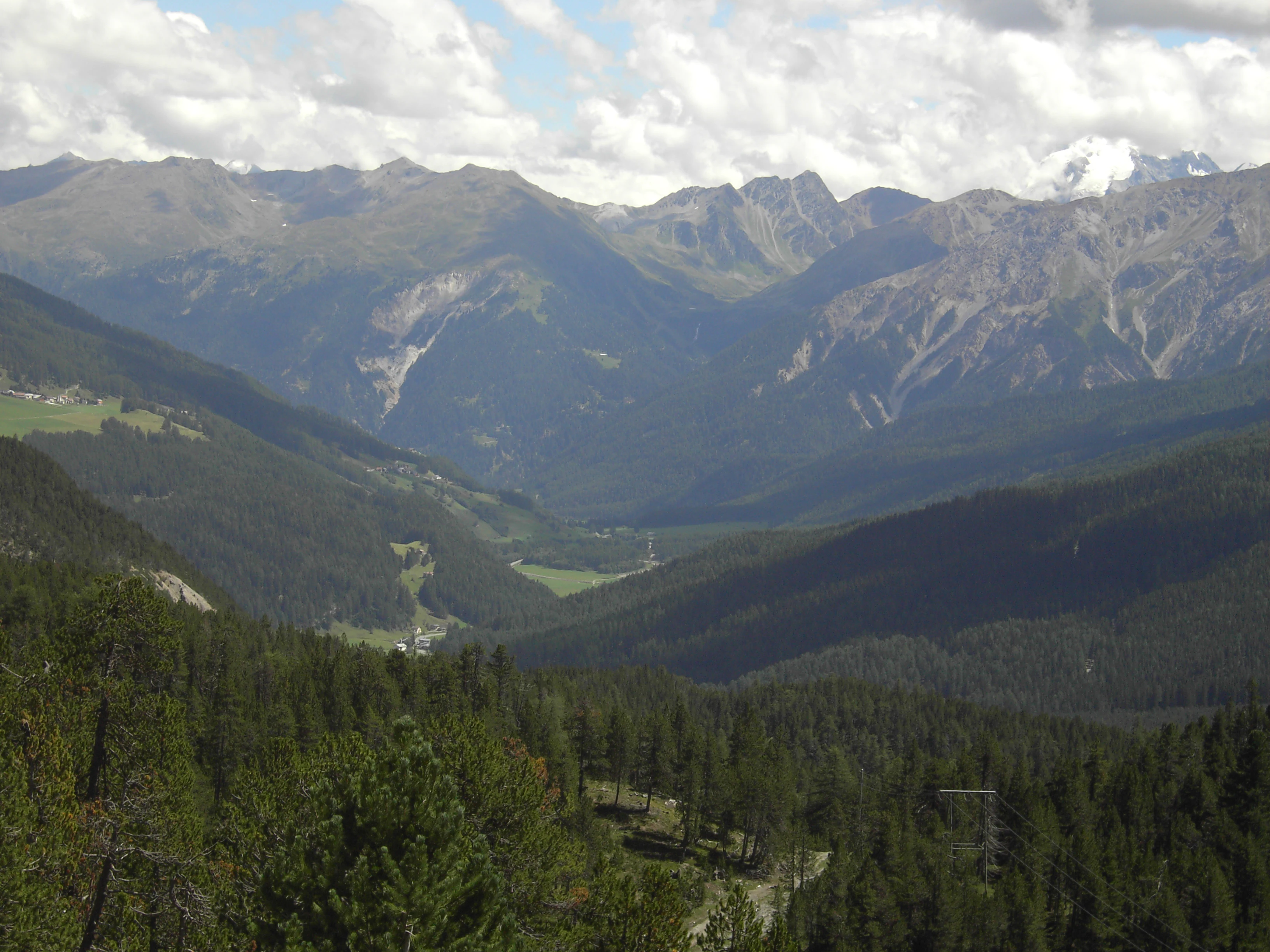
The landscape of Biosfera Val Müstair is characterized by a long, west-to-east oriented Alpine valley that gradually steps down from the Ofenpass to the deep Vinschgau. At the western end, the Ofenpass sits at 2,149 m above sea level; from there the valley drops past Tschierv and Fuldera, then through Valchava and Sta. Maria to the village of Müstair at 1,247 m, before continuing into Italy through Taufers and Glurns. The valley is bordered on the south by a mountain chain whose peaks reach about 3,000 m at the western end and decrease in height eastward, including the Piz Chavalatsch at 2,763 m, which marks the easternmost point of Switzerland.
Geologically, the park lies within the East Alpine nappe system and is embedded in the old crystalline S-charl nappe. The region is strongly subdivided into multiple crystalline and sedimentary slices, with a complicated folding history that includes unusual west- and south-directed overthrusts. Large volumes of the sedimentary rocks are schistose and easily weathered, so the side streams carry enormous amounts of debris, which they deposit at the valley floor as broad alluvial fans. These fans cover almost the entire valley bottom and provide some of the most favorable agricultural sites in the valley. Above the valley, glacial features are abundant: the cirque lake Lai da Rims at roughly 2,400 m is surrounded by roches moutonnées and glacially smoothed bedrock thresholds that highlight the erosive power of Pleistocene ice.
A defining landscape feature is the continental watershed that crosses the park between the Val Vau and the Val Mora. South of this line, the Rom river (catchment of 130.6 km²) carries the valley's waters through the Etsch to the Adriatic Sea, while the Aua da Val Mora (catchment of 40 km²) drains northward via the Spöl, Inn, and Danube to the Black Sea. This single ridgeline thus separates two of Europe's major seas, and the surrounding topography of cirques, glacial thresholds, broad debris fans, and sun-exposed south-facing slopes gives the park a remarkable variety of landscape types within a compact area.
Biosfera Val Müstair ecosystems, habitats, and plant life
The natural environment of Biosfera Val Müstair reflects its position in the inner-Alpine dry zone, an exceptionally arid climatic band within the Alps. The valley lies in a continental zone with slight Mediterranean influence, producing mild conditions and low rainfall: at 1,400 m above sea level, the mean annual temperature is about 5.6 °C and annual precipitation is around 800 mm, values rarely matched for dryness elsewhere in the Alps outside of the neighboring Vinschgau, the central Valais, and the Aosta Valley.
This climate supports a distinctive combination of habitats. The valley floor is dominated by settlement, meadows, dry grasslands, and larch forests, while the alluvial zones along the Rom and its tributaries provide dynamic riparian and wetland ecosystems. Above, the slopes carry a mosaic of montane and subalpine forests that give way to alpine pastures and, higher still, to the largely barren rock and scree environment of peaks above 3,000 m. The 2021 to 2030 park charter specifically calls for the maintenance of hedges, dry-stone walls, and individual trees, as well as ecological connectivity across these habitats, recognizing that the cultural landscape itself is a key element of the park's biodiversity.
A particularly rich intersection of nature and landscape is found around Lai da Rims at about 2,400 m, where the cirque lake, associated roches moutonnées, and surrounding alpine meadows form a compact zone of high conservation value. Combined with the strictly protected Swiss National Park core that adjoins the biosphere reserve to the north, this habitat mosaic places Biosfera Val Müstair in a continuum that runs from intensively used valley land all the way to untouched high-alpine wilderness within a few kilometers.
Biosfera Val Müstair conservation status and protection priorities
Biosfera Val Müstair is one of the cornerstones of Swiss Alpine conservation, primarily through its role as the development and buffer zone of the UNESCO Biosphere Reserve Engiadina Val Müstair. The reserve's conservation architecture follows the UNESCO model of three nested zones: a strict core zone in which economic use is excluded, a surrounding care zone that limits disturbance and is managed through near-natural forestry and agriculture, and a development zone where sustainable settlement, tourism, and regional economy take place. In Biosfera Val Müstair specifically, the valley contributes about 8.29 km² (4.9%) to the core zone, 86.34 km² (49.7%) to the care zone, and roughly 104 km² (99.5%) to the development zone, while the adjacent Swiss National Park supplies 162.04 km² (95.1%) of the core area.
This zoning makes the park unusual because it integrates an inhabited, working cultural landscape into the buffer of one of Europe's strictest national parks. The 2021 to 2030 charter reinforces this role by prioritizing the protection of native species, ecological connectivity, and the continued care of small but ecologically critical structures such as hedges, dry-stone walls, and solitary trees. The park also coordinates volunteer landscape-care days and works closely with the Swiss National Park and local research institutions, supporting monitoring, species protection, and studies of ecosystems and regional sustainability. The conservation significance of Biosfera Val Müstair therefore lies not only in the habitats it protects but in the working example it provides of how a traditional Alpine valley can act as a long-term buffer and laboratory for an adjacent strict nature reserve.
Biosfera Val Müstair cultural meaning and human context
The cultural identity of Biosfera Val Müstair is inseparable from the valley itself. The park encompasses six historic valley settlements, Tschierv, Fuldera, Lü, Valchava, Sta. Maria, and Müstair, whose combined population forms the political municipality of Val Müstair. The valley is a recognized stronghold of Romansh, the regional language of Graubünden, and specifically of the Jauer dialect, which is increasingly rare and explicitly listed in the park charter as a protected element of the regional culture.
Cultural priorities in the charter include the preservation of local traditions, historic townscapes, and everyday cultural practices, and the park positions itself as a coordinating cultural space that links residents and visitors alike. Traditional land use continues to structure the visible landscape: hay meadows, alpine pastures, dry-stone terracing, larch woodlands, and the scattered farmsteads of the valley all reflect centuries of adaptation to the dry inner-Alpine climate. The cultural crown of the valley is the Convent of St. John at Müstair, a UNESCO World Heritage Site that anchors the broader regional identity, while the broader biosphere reserve connects the valley to the Engadin and to the Swiss National Park as part of a shared Alpine cultural and ecological landscape.
Top sights and standout views in Biosfera Val Müstair
Biosfera Val Müstair combines the appeal of an inhabited Alpine valley with the rigor of a UNESCO biosphere reserve. Its standout qualities include the dry inner-Alpine climate that makes the valley unusually sunny and arid for the Alps, the dramatic descent from the Ofenpass at 2,149 m to the Italian border, and the glacially sculpted terrain around the Lai da Rims cirque lake and the surrounding roches moutonnées. The continental watershed between Val Vau and Val Mora, where waters split between the Adriatic and the Black Sea, is a rare and memorable geographic feature.
Equally distinctive is the cultural fabric: a working Romansh-speaking valley of six traditional villages, complete with alpine meadows, dry-stone walls, and the UNESCO-listed Convent of St. John, all organized into one integrated nature park. The partnership with the Swiss National Park and Scuol means that within a single visit one can move from an untouched strict nature reserve core to a valley where people still farm, speak Romansh, and produce regional goods under the UNESCO biosphere label.
Best time to visit Biosfera Val Müstair
Biosfera Val Müstair is at its most appealing in late spring through early autumn, when the valley's dry, mild climate makes hiking comfortable and the cultural landscape is fully alive. From roughly May to October, the alpine meadows and pastures around Tschierv, Fuldera, Valchava, Sta. Maria, and Müstair are accessible, the Ofenpass road is open, and the higher trails toward Lai da Rims and the southern peaks generally become snow-free.
Summer is the most rewarding time for landscape viewing, with stable weather, long daylight hours, and the chance to experience both the actively farmed valley and the high-alpine terrain of the adjacent Swiss National Park. Early autumn brings harvest traditions, haymaking, and quieter trails, while winter brings deep snow to much of the valley and transforms Müstair into a quieter cultural destination rather than an alpine hiking one. Visitors planning trips focused on the high-alpine geology and the glacial landforms near Lai da Rims should target the snow-free window, typically from June to early October.