
Mori Atlas logo
Regional parkBiosfera Val Müstair

A high-alpine landscape of glacial features, continental watersheds, and preserved cultural heritage.

Biosfera Val Müstair Regional Park and UNESCO Biosphere in the Swiss Alps of Graubünden

(Biosfera Val Müstair (Regionaler Naturpark))

Biosfera Val Müstair represents a unique integration of strictly protected nature and living cultural landscapes in the canton of Graubünden. Encompassing a vast valley between the Ofenpass and the Italian border, the region showcases dramatic geological variety, including glacial cirques, alluvial fans, and the critical continental watershed separating the Adriatic and Black Sea drainage basins. This regional park serves as a model for alpine biodiversity and sustainable land management.

biosphere reserveUNESCO biosphere reservealpine valleyinner-alpine dry zoneglacial landscapecirque lake
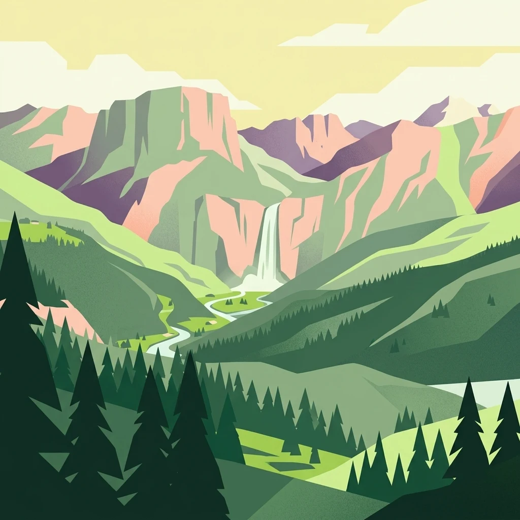
Digital illustration of a high alpine valley in Biosfera Val Müstair, featuring jagged peaks, a central waterfall, a meandering river, and a foreground of evergreen trees.

Biosfera Val Müstair

Regional park

Park overview

Structured park overview, official facts, and landscape profile for Biosfera Val Müstair

Biosfera Val Müstair park facts, protected area profile, and essential visitor context

Review the core facts for Biosfera Val Müstair, including designation, size, terrain, visitor scale, habitats, and operating context in one park-focused overview.

About Biosfera Val Müstair

Biosfera Val Müstair is a regional nature park and biosphere reserve that wraps an entire inhabited Alpine valley into a single integrated conservation framework. Located at the far eastern end of Switzerland in the canton of Graubünden, it occupies the upper Münstertal, the roadless-feeling high valley that descends from the Ofenpass (2,149 m) eastward past Tschierv, Fuldera, Lü, Valchava, Sta. Maria, and the village of Müstair (1,247 m), continuing across the border into the Italian Vinschgau. The park was officially recognized as a Regional Nature Park in 2011 and, in June 2017, was awarded the UNESCO biosphere label together with the Swiss National Park and the municipality of Scuol, becoming the first high-alpine UNESCO biosphere reserve in Switzerland.

The territory of Biosfera Val Müstair corresponds to the political municipality of Val Müstair, which was formed on 1 January 2009 by merging the six valley communities. Covering about 198.65 km², the park stretches from valley floors and agricultural land near 1,225 m up to peaks above 3,180 m, and includes a section of the Swiss National Park in the Val Nüglia area along with numerous landscape protection zones, alluvial areas, and locally protected settlement cores. Although small in absolute terms, the park plays an outsized role because it anchors the development and buffer zones of the larger biosphere reserve while the Swiss National Park supplies the strictly protected core.

The reserve is built around the guiding vision of Armonia jaura, an idea of living harmony that links the everyday life of the valley population to nature, culture, and regional economy. The current 2021 to 2030 charter lists seven interlocking goals, ranging from protecting native species and maintaining hedges, dry-stone walls, and solitary trees, to supporting sustainable tourism, regional products and crafts, the Romansh cultural space, sustainability education, research partnerships with universities and the Swiss National Park, and professional park management and spatial planning. This combination of ecological, cultural, economic, and educational goals is what gives Biosfera Val Müstair its identity as a model for integrated regional development in an Alpine setting.

For visitors and researchers alike, the park is a place where the concepts of UNESCO biosphere reserves, core, care, and development zones can be read on the ground: the uninhabited high Alps of the Swiss National Park visible to the north, the actively farmed meadows and larch forests of the valley between, and the historic settlements of Müstair with the famous Benedictine Convent of St. John forming the cultural heart below.

Quick facts and research context for Biosfera Val Müstair

Biosfera Val Müstair is a Regional Nature Park in the canton of Graubünden, Switzerland, designated in 2011 and recognized as part of the UNESCO Biosphere Reserve Engiadina Val Müstair in 2017. It covers the full municipal territory of Val Müstair, spanning approximately 199 km² and ranging in elevation from about 1,225 meters to 3,180 meters above sea level. The reserve lies at the eastern edge of Switzerland, bordering the Italian Vinschgau in South Tyrol, and is connected to the rest of Switzerland only through the Ofenpass.

Its territory includes the six historic villages of Tschierv, Fuldera, Lü, Valchava, Sta. Maria, and Müstair, portions of the Swiss National Park such as Val Nüglia, multiple landscape protection areas, alluvial zones, and protected settlement cores. The climate is mild and dry, placing the valley among the most arid inner-Alpine regions of Europe, and the area sits on a continental watershed that separates waters draining to the Adriatic from those draining to the Black Sea.

Protection and recognition

Examine the terrestrial protection scope and 2017 designation timeline for Biosfera Val Müstair.

Biosfera Val Müstair Protection Status and Designated History

Biosfera Val Müstair maintains a documented terrestrial protection scope established in the designated year 2017. Structured conservation data outlines the official management framework and historical designation records associated with the protected area.

Protection details

Protection scope
Terrestrial
Designated year
2017
Transboundary protection
No
Park context

Deeper park guide and search-rich context for Biosfera Val Müstair

Biosfera Val Müstair history, landscape, wildlife, and travel context

Explore Biosfera Val Müstair through its history, landscape character, ecosystems, wildlife, conservation priorities, cultural context, and seasonal travel timing in a structured park guide built for atlas discovery and search intent.

Why Biosfera Val Müstair stands out

Biosfera Val Müstair is best known for being part of the first high-alpine UNESCO biosphere reserve in Switzerland, where a strictly protected Alpine core area meets a still-inhabited cultural valley. The park is distinctive for its combination of dry, continental inner-Alpine climate, exceptionally low precipitation, and a richly varied glacial geology that includes hanging valleys, alluvial fans, roches moutonnées, and the cirque lake Lai da Rims. It also stands out for its cultural dimension: the valley is a stronghold of the Romansh language, in particular the Jauer dialect, and for centuries has maintained an alpine farming economy based on hay meadows, dry-stone walls, hedgerows, and traditional wood-use. The partnership with the Swiss National Park and Scuol gives the reserve a unique triplet structure: a no-use core, a buffer care zone, and a development zone for sustainable settlement and regional economy.
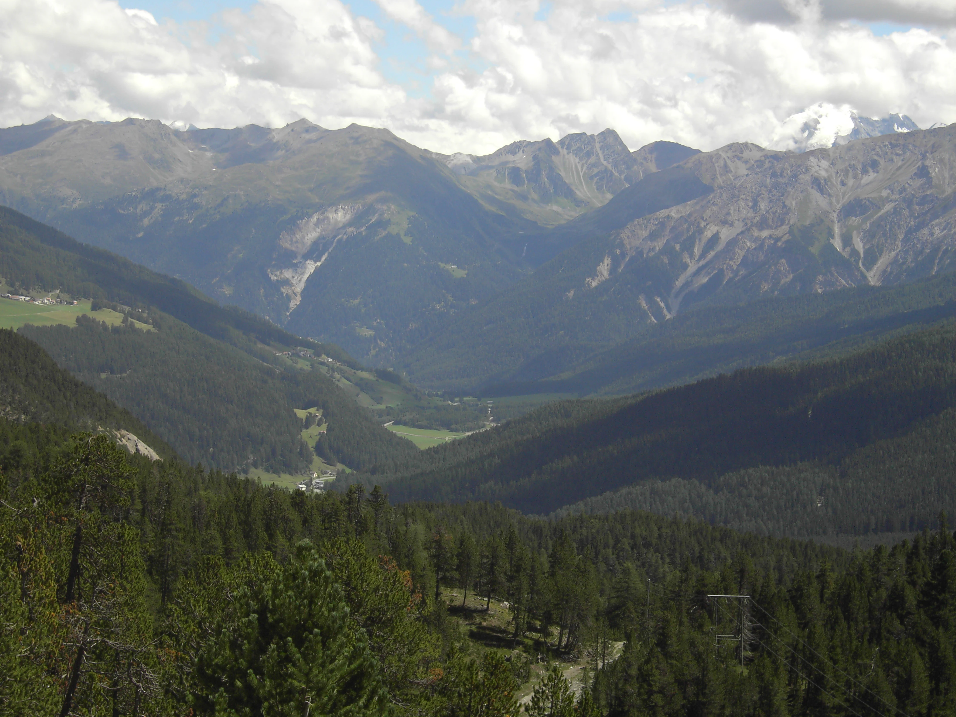
Wide angle view of an alpine valley in Switzerland, with dense coniferous forests on the foreground slopes and high, rugged mountain ranges under a cloudy sky in the background.
A wide view of the alpine valley within Biosfera Val Müstair, showcasing the region's characteristic mountain ranges and forested slopes.

Biosfera Val Müstair history and protected-area timeline

The history of Biosfera Val Müstair begins with the long-settled character of the upper Münstertal, whose villages have been organized for centuries around alpine farming, transhumance, and the cultural sphere of the Romansh-speaking Jauer dialect. The modern protected-area history starts with the municipal merger of 1 January 2009, when the formerly independent communities of Tschierv, Fuldera, Lü, Valchava, Sta. Maria, and Müstair united into the single political municipality of Val Müstair, creating a territorial unit large enough to host a regional nature park.

In 2011, the municipality was formally designated a Regional Nature Park under the name Biosfera Val Müstair, providing an institutional framework for managing the valley's natural and cultural assets in an integrated way. From the beginning, the park framed its mission under the motto Armonia jaura, an expression expressing the aspiration that society, culture, nature, ecology, and economy should work together effectively. A second key development came on 1 January 2016, when the municipality of Scuol became a cooperation partner of the biosphere reserve, contributing the care zone and a portion of development zone needed to fully surround the Swiss National Park core.

This cooperation enabled the joint UNESCO application, and in June 2017 the area was awarded the UNESCO biosphere reserve label under the name Engiadina Val Müstair, meaning Biosfera Val Müstair now operates within a larger transnational framework of approximately 448.73 km². Its current 2021 to 2030 charter, adopted after years of practical experience, refines the original concepts into seven clearly defined objectives covering landscape quality, sustainable tourism, regional economy, cultural identity, sustainability education, research, and park management, marking the park's transition from a nascent protected area to a mature institution of regional development.

Biosfera Val Müstair landscape and geographic character

The landscape of Biosfera Val Müstair is characterized by a long, west-to-east oriented Alpine valley that gradually steps down from the Ofenpass to the deep Vinschgau. At the western end, the Ofenpass sits at 2,149 m above sea level; from there the valley drops past Tschierv and Fuldera, then through Valchava and Sta. Maria to the village of Müstair at 1,247 m, before continuing into Italy through Taufers and Glurns. The valley is bordered on the south by a mountain chain whose peaks reach about 3,000 m at the western end and decrease in height eastward, including the Piz Chavalatsch at 2,763 m, which marks the easternmost point of Switzerland.

Geologically, the park lies within the East Alpine nappe system and is embedded in the old crystalline S-charl nappe. The region is strongly subdivided into multiple crystalline and sedimentary slices, with a complicated folding history that includes unusual west- and south-directed overthrusts. Large volumes of the sedimentary rocks are schistose and easily weathered, so the side streams carry enormous amounts of debris, which they deposit at the valley floor as broad alluvial fans. These fans cover almost the entire valley bottom and provide some of the most favorable agricultural sites in the valley. Above the valley, glacial features are abundant: the cirque lake Lai da Rims at roughly 2,400 m is surrounded by roches moutonnées and glacially smoothed bedrock thresholds that highlight the erosive power of Pleistocene ice.

A defining landscape feature is the continental watershed that crosses the park between the Val Vau and the Val Mora. South of this line, the Rom river (catchment of 130.6 km²) carries the valley's waters through the Etsch to the Adriatic Sea, while the Aua da Val Mora (catchment of 40 km²) drains northward via the Spöl, Inn, and Danube to the Black Sea. This single ridgeline thus separates two of Europe's major seas, and the surrounding topography of cirques, glacial thresholds, broad debris fans, and sun-exposed south-facing slopes gives the park a remarkable variety of landscape types within a compact area.

Biosfera Val Müstair ecosystems, habitats, and plant life

The natural environment of Biosfera Val Müstair reflects its position in the inner-Alpine dry zone, an exceptionally arid climatic band within the Alps. The valley lies in a continental zone with slight Mediterranean influence, producing mild conditions and low rainfall: at 1,400 m above sea level, the mean annual temperature is about 5.6 °C and annual precipitation is around 800 mm, values rarely matched for dryness elsewhere in the Alps outside of the neighboring Vinschgau, the central Valais, and the Aosta Valley.

This climate supports a distinctive combination of habitats. The valley floor is dominated by settlement, meadows, dry grasslands, and larch forests, while the alluvial zones along the Rom and its tributaries provide dynamic riparian and wetland ecosystems. Above, the slopes carry a mosaic of montane and subalpine forests that give way to alpine pastures and, higher still, to the largely barren rock and scree environment of peaks above 3,000 m. The 2021 to 2030 park charter specifically calls for the maintenance of hedges, dry-stone walls, and individual trees, as well as ecological connectivity across these habitats, recognizing that the cultural landscape itself is a key element of the park's biodiversity.

A particularly rich intersection of nature and landscape is found around Lai da Rims at about 2,400 m, where the cirque lake, associated roches moutonnées, and surrounding alpine meadows form a compact zone of high conservation value. Combined with the strictly protected Swiss National Park core that adjoins the biosphere reserve to the north, this habitat mosaic places Biosfera Val Müstair in a continuum that runs from intensively used valley land all the way to untouched high-alpine wilderness within a few kilometers.

Biosfera Val Müstair conservation status and protection priorities

Biosfera Val Müstair is one of the cornerstones of Swiss Alpine conservation, primarily through its role as the development and buffer zone of the UNESCO Biosphere Reserve Engiadina Val Müstair. The reserve's conservation architecture follows the UNESCO model of three nested zones: a strict core zone in which economic use is excluded, a surrounding care zone that limits disturbance and is managed through near-natural forestry and agriculture, and a development zone where sustainable settlement, tourism, and regional economy take place. In Biosfera Val Müstair specifically, the valley contributes about 8.29 km² (4.9%) to the core zone, 86.34 km² (49.7%) to the care zone, and roughly 104 km² (99.5%) to the development zone, while the adjacent Swiss National Park supplies 162.04 km² (95.1%) of the core area.

This zoning makes the park unusual because it integrates an inhabited, working cultural landscape into the buffer of one of Europe's strictest national parks. The 2021 to 2030 charter reinforces this role by prioritizing the protection of native species, ecological connectivity, and the continued care of small but ecologically critical structures such as hedges, dry-stone walls, and solitary trees. The park also coordinates volunteer landscape-care days and works closely with the Swiss National Park and local research institutions, supporting monitoring, species protection, and studies of ecosystems and regional sustainability. The conservation significance of Biosfera Val Müstair therefore lies not only in the habitats it protects but in the working example it provides of how a traditional Alpine valley can act as a long-term buffer and laboratory for an adjacent strict nature reserve.

Biosfera Val Müstair cultural meaning and human context

The cultural identity of Biosfera Val Müstair is inseparable from the valley itself. The park encompasses six historic valley settlements, Tschierv, Fuldera, Lü, Valchava, Sta. Maria, and Müstair, whose combined population forms the political municipality of Val Müstair. The valley is a recognized stronghold of Romansh, the regional language of Graubünden, and specifically of the Jauer dialect, which is increasingly rare and explicitly listed in the park charter as a protected element of the regional culture.

Cultural priorities in the charter include the preservation of local traditions, historic townscapes, and everyday cultural practices, and the park positions itself as a coordinating cultural space that links residents and visitors alike. Traditional land use continues to structure the visible landscape: hay meadows, alpine pastures, dry-stone terracing, larch woodlands, and the scattered farmsteads of the valley all reflect centuries of adaptation to the dry inner-Alpine climate. The cultural crown of the valley is the Convent of St. John at Müstair, a UNESCO World Heritage Site that anchors the broader regional identity, while the broader biosphere reserve connects the valley to the Engadin and to the Swiss National Park as part of a shared Alpine cultural and ecological landscape.

Top sights and standout views in Biosfera Val Müstair

Biosfera Val Müstair combines the appeal of an inhabited Alpine valley with the rigor of a UNESCO biosphere reserve. Its standout qualities include the dry inner-Alpine climate that makes the valley unusually sunny and arid for the Alps, the dramatic descent from the Ofenpass at 2,149 m to the Italian border, and the glacially sculpted terrain around the Lai da Rims cirque lake and the surrounding roches moutonnées. The continental watershed between Val Vau and Val Mora, where waters split between the Adriatic and the Black Sea, is a rare and memorable geographic feature.

Equally distinctive is the cultural fabric: a working Romansh-speaking valley of six traditional villages, complete with alpine meadows, dry-stone walls, and the UNESCO-listed Convent of St. John, all organized into one integrated nature park. The partnership with the Swiss National Park and Scuol means that within a single visit one can move from an untouched strict nature reserve core to a valley where people still farm, speak Romansh, and produce regional goods under the UNESCO biosphere label.

Best time to visit Biosfera Val Müstair

Biosfera Val Müstair is at its most appealing in late spring through early autumn, when the valley's dry, mild climate makes hiking comfortable and the cultural landscape is fully alive. From roughly May to October, the alpine meadows and pastures around Tschierv, Fuldera, Valchava, Sta. Maria, and Müstair are accessible, the Ofenpass road is open, and the higher trails toward Lai da Rims and the southern peaks generally become snow-free.

Summer is the most rewarding time for landscape viewing, with stable weather, long daylight hours, and the chance to experience both the actively farmed valley and the high-alpine terrain of the adjacent Swiss National Park. Early autumn brings harvest traditions, haymaking, and quieter trails, while winter brings deep snow to much of the valley and transforms Müstair into a quieter cultural destination rather than an alpine hiking one. Visitors planning trips focused on the high-alpine geology and the glacial landforms near Lai da Rims should target the snow-free window, typically from June to early October.

Monthly climate preview

Long-term monthly temperature and precipitation averages for Graubünden

Biosfera Val Müstair Climate Normals and Annual Temperature Rhythm

Representative coordinates record sustained sub-zero winter minimums alongside moderate summer warmth and steady precipitation across twelve measured intervals. Examining the complete monthly climate dataset provides deeper comparative context on long-term regional weather patterns.
Annual mean2 °C
-9 °C12 °C
Jan-9°
Feb-8°
Mar-4°
Apr
May
Jun10°
Jul12°
Aug12°
Sep
Oct
Nov-3°
Dec-8°
Warmest month
July

11.8 °C

Coolest month
January

-9.1 °C

Wettest month
August

3.9 mm/day

Driest month
February

1.2 mm/day

Park location guide

Geography guide, regional context, and park location map for Biosfera Val Müstair

Biosfera Val Müstair park geography, regions, and map view in Switzerland

Understand where Biosfera Val Müstair sits in Switzerland through a broader geographic reading of the surrounding landscape, nearby location context, and its mapped position within the national park landscape.

How Biosfera Val Müstair fits into Switzerland

Switzerland is a landlocked federal republic in Central Europe comprising 26 cantons, with Bern as the federal city and Zurich as the largest city. The country features the Swiss Alps, Swiss Plateau, and Jura Mountains, with German, French, Italian, and Romansh as official languages. It is noted for its political neutrality, direct democracy traditions, and strong economy.

Wider geography shaping Biosfera Val Müstair in Switzerland

Switzerland is located in Central Europe at the intersection of Western and Southern Europe. It is bordered by Germany to the north, France to the west, Austria and Liechtenstein to the east, and Italy to the south. The country is geographically divided among the Swiss Alps (covering most of the territory), the Swiss Plateau (where most of the population resides), and the Jura Mountains. Switzerland is landlocked.

Map view of Biosfera Val Müstair

Use this park location map to pinpoint Biosfera Val Müstair in Switzerland, understand its exact geographic position, and read its mapped placement within the surrounding landscape more clearly.

Pigeon | © OpenStreetMap contributors

Location context for Biosfera Val Müstair

Graubünden

Visualizing glacial terrain, alpine habitats, and protected valley character

Biosfera Val Müstair Photos and Landscape Scenery

Visual documentation of Biosfera Val Müstair reveals the rugged glacial terrain, dry inner-Alpine valleys, and high-altitude habitats of the protected landscape. Examining authentic field photography helps researchers and travelers understand the diverse topography, remote cirques, and traditional cultural structures defining the Swiss reserve.

Wide angle view of an alpine valley in Switzerland, with dense coniferous forests on the foreground slopes and high, rugged mountain ranges under a cloudy sky in the background.

Park atlas

Compare alpine reserves and regional nature parks across eastern Switzerland

Other Parks Near Biosfera Val Müstair and Surrounding Protected Landscapes

Browse nearby national parks and connected protected landscapes to compare regional terrain features. Extending exploration beyond Biosfera Val Müstair reveals wider alpine valley ecosystems and adjacent conservation zones.
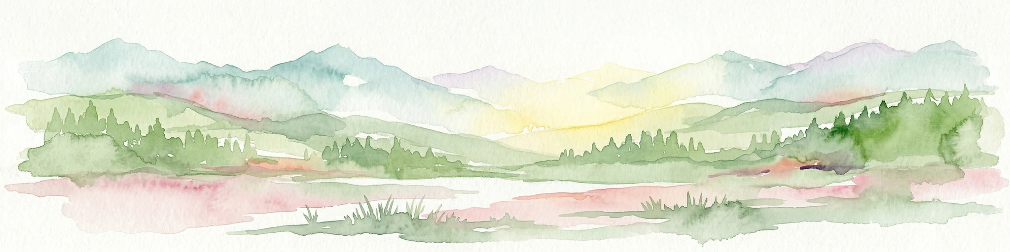
Watercolor painting of a mountain range with a lake, green hills, and a sunset sky
National parkTrentino-Alto Adige/Südtirol
About 5.7 km away#1 closest

Southeast

Stelvio National Park National Park: Protected Landscape and Regional Geographic Context

Explore its mapped boundaries and natural terrain.

Navigate Stelvio National Park, a designated national park in Italy's Trentino-Alto Adige/Südtirol region, through a map-centric lens. This page provides critical context for understanding the park's protected landscape, its geographic position within the Alps, and its mapped terrain. Utilize MoriAtlas to grasp the park's boundaries and its place in regional geography for structured natural landscape discovery.

Established
1935
IUCN
II
Relief
Mountain
Scope
Terrestrial
National parkGraubünden
About 7.9 km away#2 closest

Northwest

Swiss National Park: Geographic Context and Protected Alpine Wilderness in Graubünden

A comprehensive look at the Engadin valley's premier wilderness sanctuary

Spanning over 170 square kilometers in the canton of Graubünden, the Swiss National Park offers an unparalleled example of a strictly protected Alpine ecosystem. This atlas profile details the park's distinct topography, from the subalpine pine forests near the Ofenpass to the delicate karst lake basins at Macun, providing a deep look into its history as a central reference site for wilderness restoration and geological research.

Area
170.3 km²
Established
1914
IUCN
Ia
Relief
Mountain
A soft watercolor painting showing a wide, high-altitude alpine plateau with rolling hills, scattered small lakes, and distant mountain ridgelines.
Nature reserveGraubünden
About 23 km away#3 closest

Northwest

Macun-Seen Nature Reserve: Protected Alpine Plateau and Cirque Lake Landscape

High-altitude basin and crystalline geological features in Graubünden

Located in the Lower Engadine region of Graubünden, the Macun-Seen nature reserve is a significant high-altitude basin formed by glacial action. This protected exclave contains 23 small cirque lakes across a silicate plateau, offering a distinct ecological profile and expansive views of peaks approaching 3000 metres. It stands as a prime example of preserved alpine terrain within the broader Swiss National Park context.

Area
3.6 km²
Established
2000
Relief
Mountain
Climate
Alpine
A soft watercolor painting of a river winding through a valley with green trees, grassy plains, and distant purple hills against a white background.
Nature reserveGraubünden
About 36 km away#4 closest

West

Naturschutzgebiet Isla Glischa-Arvins-Seglias Nature Reserve in Graubünden

Mapped alluvial terrain and alpine river geography

Situated in the broad valley floor of the Upper Engadin, this nature reserve protects one of the most significant alpine floodplain zones in the Swiss canton of Graubünden. The area features a complex network of river channels, gravel lakes, and marshes that are currently undergoing active revitalization to restore natural riverine processes and support rare riparian ecosystems.

Area
0.867 km²
Established
1992
IUCN
IV
Relief
Upland
A horizontal watercolor illustration showing stylized, overlapping mountain ridges in shades of soft green, pink, and yellow against a white background.
Natural monumentGraubünden
About 48 km away#5 closest

Southwest

Roseggletscher Natural Monument: Alpine Glacier Geography and Proglacial Lake Mapping

Protected landscape data for the Bernina range in Graubünden.

Examine the geographic boundaries and terrain of the Roseggletscher, a protected natural monument situated in the upper Val Roseg. This record captures its glacial extent, the emergence of the Lej da Vadret proglacial lake, and its role within the wider Bernina glacier ensemble of southeastern Switzerland.

Area
6.38 km²
Relief
Mountain
Climate
Alpine
Access
Moderate access
Watercolor illustration of a panoramic mountain landscape with soft green hills, rolling ridgelines in shades of pink and purple, and small patches of blue water in the foreground.
Regional parkCanton of Graubünden
About 52 km away#6 closest

West

Parc Ela: Regional Nature Park and Alpine Geography in the Canton of Graubünden

A vertical protected landscape in the Swiss Alpine arc.

Parc Ela encompasses a remarkable span of Swiss Alpine geography, protecting everything from low-lying forested gorges at seven hundred meters to high-altitude peaks over three thousand meters. The park serves as a vital refuge for threatened insect species and large alpine mammals, while preserving the linguistic and architectural heritage of the Albula and Oberhalbstein valleys. Explore the mapped terrain where paleontological treasures meet historic trade routes.

Area
659 km²
Established
2012
Relief
Mountain
Climate
Alpine
Regional parkGraubünden
About 65 km away#7 closest

West

Naturpark Beverin: Exploring Alpine Gorges and Cultural Landscapes in Graubünden

A regional nature park shaped by high alpine ridges and ancient settlement traditions.

Naturpark Beverin encompasses a vast, multi-layered environment in the Swiss Alps. The area is defined by the sharp vertical contrast between carved river gorges like the Viamala and high-elevation ridges. Beyond the rugged mountain terrain, this protected landscape preserves centuries of pastoral history through the distinct settlement traditions of its Romanesque and Walser valleys.

Area
515 km²
Established
2013
Relief
Mountain
Climate
Alpine
Nature reserveLombardia
About 68 km away#8 closest

Southwest

Val di Mello Nature Reserve: Mapping the Granitic Geography of the Italian Alps in Lombardia

A study of protected vertical relief, glacial cirques, and Alpine terrain.

Val di Mello offers a profound look at high-altitude Alpine geography, characterized by its immense, light-colored granitic walls and deeply carved tributary valleys. This protected nature reserve acts as a gateway to the broader mountainous terrain of the Lombardia region, showcasing the geological evolution of the Italian Alps through its steep gullies, high summits, and expansive valley floor.

Established
2009
Relief
Mountain
Access
Moderate access
Scope
Terrestrial

Common questions about visiting, size, designation, and location context for Biosfera Val Müstair

Biosfera Val Müstair FAQs for park facts, access, geography, and protected area context

Find quick answers about Biosfera Val Müstair, including protected-area facts, park geography, trail and visitor context, and how the park fits into its surrounding country and regional landscape.
MoriAtlas Explorer

Continue Your Protected Areas Search Across the Global Atlas

Deepen your exploration by continuing the structured search for national parks and protected areas worldwide. Utilize the comprehensive filtering capabilities to compare different conservation landscapes and refine your understanding of global park geography. Discover more about the distribution and characteristics of protected natural areas.

Global natural geography