
Mori Atlas logo
National parkStelvio National Park

Discover the mapped boundaries and natural terrain of this national park in Trentino-Alto Adige/Südtirol.

Stelvio National Park: Explore Its Protected Landscape and Regional Geography

(Parco Nazionale dello Stelvio)

Stelvio National Park stands as a significant national park entity within Italy, located in the Trentino-Alto Adige/Südtirol region. This page serves as a gateway to understanding its protected landscape, mapped terrain, and role within the broader geographic context of the Alps. Explore how its boundaries define a unique area for atlas-based discovery and regional landscape appreciation.

Alpine Protected AreasMountain ParksIUCN Category IITransboundary ConservationItalian National ParksCentral Alps
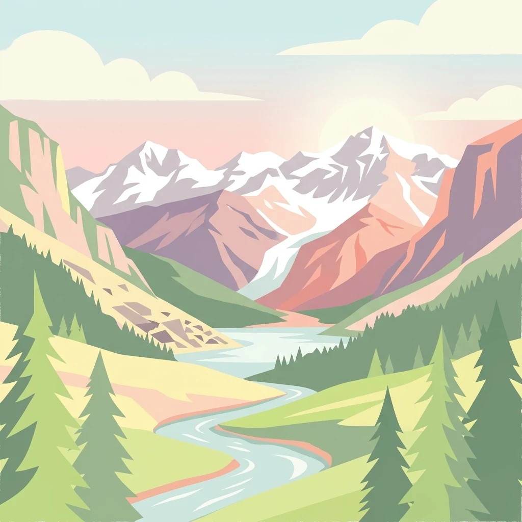
Stylized illustration of a mountain valley with snow-capped peaks, winding river, coniferous forests, and green meadows

Stelvio National Park

National park

Park overview

Structured park overview, official facts, and landscape profile for Stelvio National Park

Stelvio National Park park facts, protected area profile, and essential visitor context

Review the core facts for Stelvio National Park, including designation, size, terrain, visitor scale, habitats, and operating context in one park-focused overview.

About Stelvio National Park

Stelvio National Park represents a cornerstone of Alpine conservation in Italy, protecting a vast and varied mountain environment that spans the transition between two of the country's northeastern regions. The park's territory encompasses dramatic Alpine scenery, from the lush valley floors that support forested slopes and meadows to the stark, rocky terrain of high-mountain zones. This altitudinal diversity creates conditions for remarkable ecological variation, with different vegetation zones arranged according to elevation and aspect. The park's establishment in 1935 reflected growing recognition of the Alpine region's ecological significance and the need to preserve its natural landscapes for future generations. Today, the park serves not only as a conservation area but also as a living landscape where traditional Alpine land use practices continue alongside ecological protection. The park's administrative structure involves coordination across 24 municipalities, reflecting the complex governance required for a protected area that spans regional boundaries and encompasses multiple local communities.

Quick facts and research context for Stelvio National Park

Stelvio National Park occupies a strategic position in the Central Alps, bordering Switzerland and connecting to adjacent Italian protected areas including Adamello Brenta Natural Park and Adamello Regional Park. The park protects an extensive territory of interconnected valleys and high peaks, with elevations ranging from valley floors at roughly 650 meters to the summit zones approaching 3,900 meters. Established in 1935 under the Italian Ministry of Environment, the park is classified as an IUCN Category II protected area. The multilingual naming reflects its location at the intersection of Italian and Austrian cultural heritage, with the Italian name Parco nazionale dello Stelvio and the German designation Nationalpark Stilfserjoch both in official use.

Protection and recognition

Documenting terrestrial protection boundaries and European Natura 2000 network integration

Protection Status and Natura 2000 Designation of Stelvio National Park

Explore the official terrestrial protection framework and documented European designations that define the conservation footprint of Stelvio National Park. Verifiable records outline the park boundaries within the continental Natura 2000 network to support precise geographic analysis of its protected Alpine landscapes.

International recognition

Protection details

Protection scope
Terrestrial
Transboundary protection
No
Park context

Deeper park guide and search-rich context for Stelvio National Park

Stelvio National Park history, landscape, wildlife, and travel context

Explore Stelvio National Park through its history, landscape character, ecosystems, wildlife, conservation priorities, cultural context, and seasonal travel timing in a structured park guide built for atlas discovery and search intent.

Why Stelvio National Park stands out

Stelvio National Park is particularly known for its exceptional Alpine diversity and the dramatic contrast between its deep valley systems and towering peaks. The park protects one of the most extensive contiguous mountain landscapes in Italy, with a network of valleys that have shaped both natural and human history in this border region. A remarkable recent discovery within the park near the Swiss border revealed approximately 20,000 dinosaur footprints dating back roughly 210 million years to the Triassic period, representing one of the largest and most significant Mesozoic trace fossil sites in the Alps. These fossil trackways preserved on high Alpine cliffs document the movement of long-necked bipedal herbivores and constitute a paleontological find of international importance.
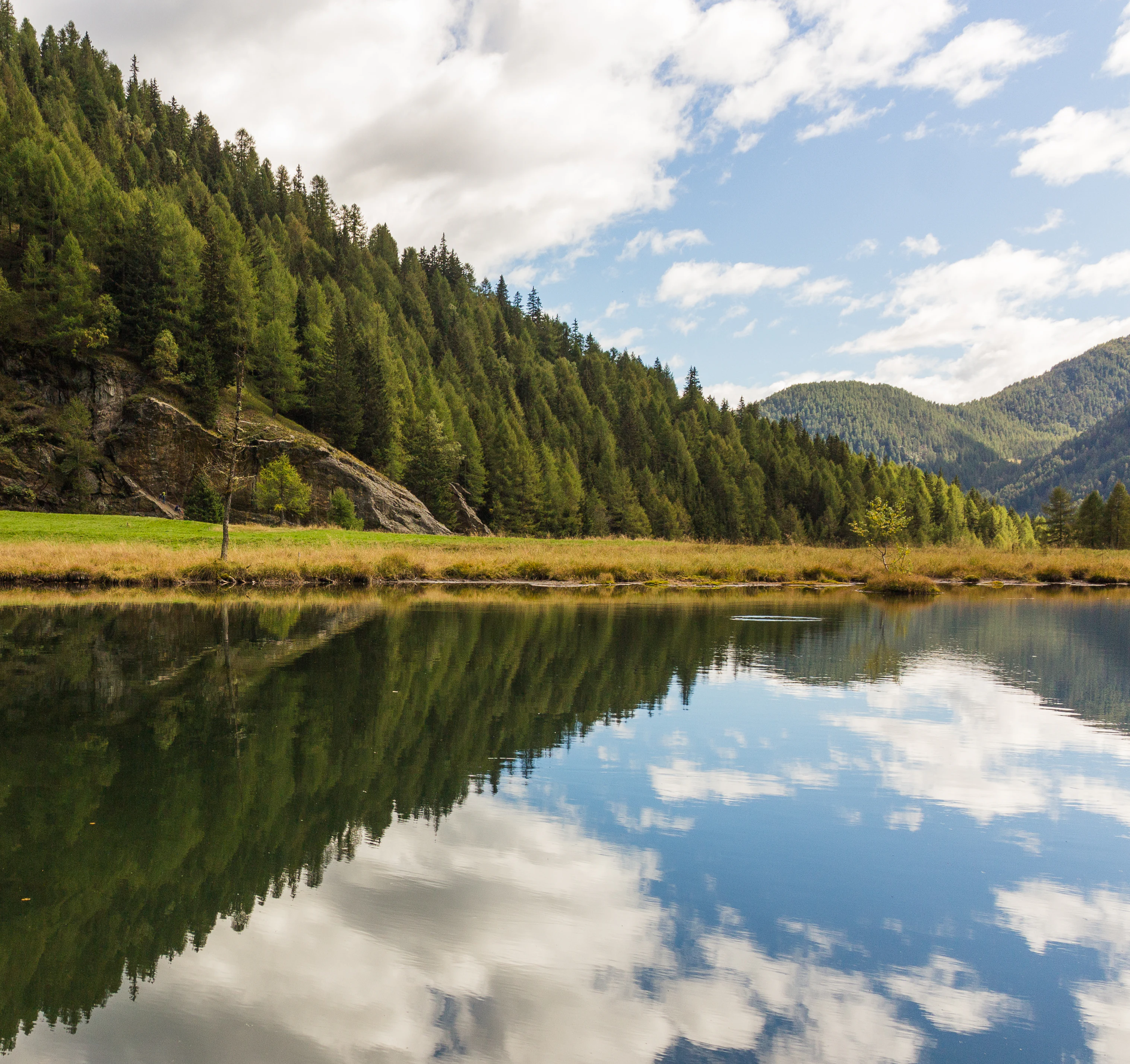
A lake reflecting a forested mountain landscape with clear blue sky and clouds
Calm lake reflecting forested mountains and sky in Stelvio National Park

Stelvio National Park history and protected-area timeline

Stelvio National Park was established in 1935, making it one of Italy's earlier national park designations and reflecting a period when the country began systematically creating protected areas to preserve its most significant natural landscapes. The park's creation recognized the exceptional Alpine environment of this border region, where Italy meets Switzerland in the central Alps. Over the decades, the park's management framework has evolved, with current governance resting with the Italian Ministry of Environment. The park's boundaries encompass areas with deep historical ties to both Italian and Austrian cultural traditions, a legacy of the region's complex political history before and after World War I when this portion of the Alps shifted from Austro-Hungarian administration to Italian control. The park's development has included recognition of its importance within a broader transboundary conservation context, particularly through its connection to the Swiss National Park and adjacent Italian regional parks, creating one of the largest protected-area complexes in the Alps.

Stelvio National Park landscape and geographic character

The landscape of Stelvio National Park is defined by its dramatic Alpine character, featuring a complex topography of valleys, ridges, peaks, and high-altitude terrain. The park protects an extensive territory where valley systems penetrate deep into the mountains, creating diverse microclimates and ecological conditions across relatively short distances. The elevation range from approximately 650 meters to 3,905 meters encompasses multiple distinct landscape zones, from forested valley bottoms through Alpine meadows to rocky summit regions. The terrain includes dramatic cliffs and rock faces that have preserved the recent dinosaur trackway discoveries, testament to the ancient geological history embedded in the park's岩石 formations. The landscape's visual character varies with season, from spring and summer Alpine meadows to winter snow coverage that transforms the high terrain into an extensive winter sports and wilderness zone.
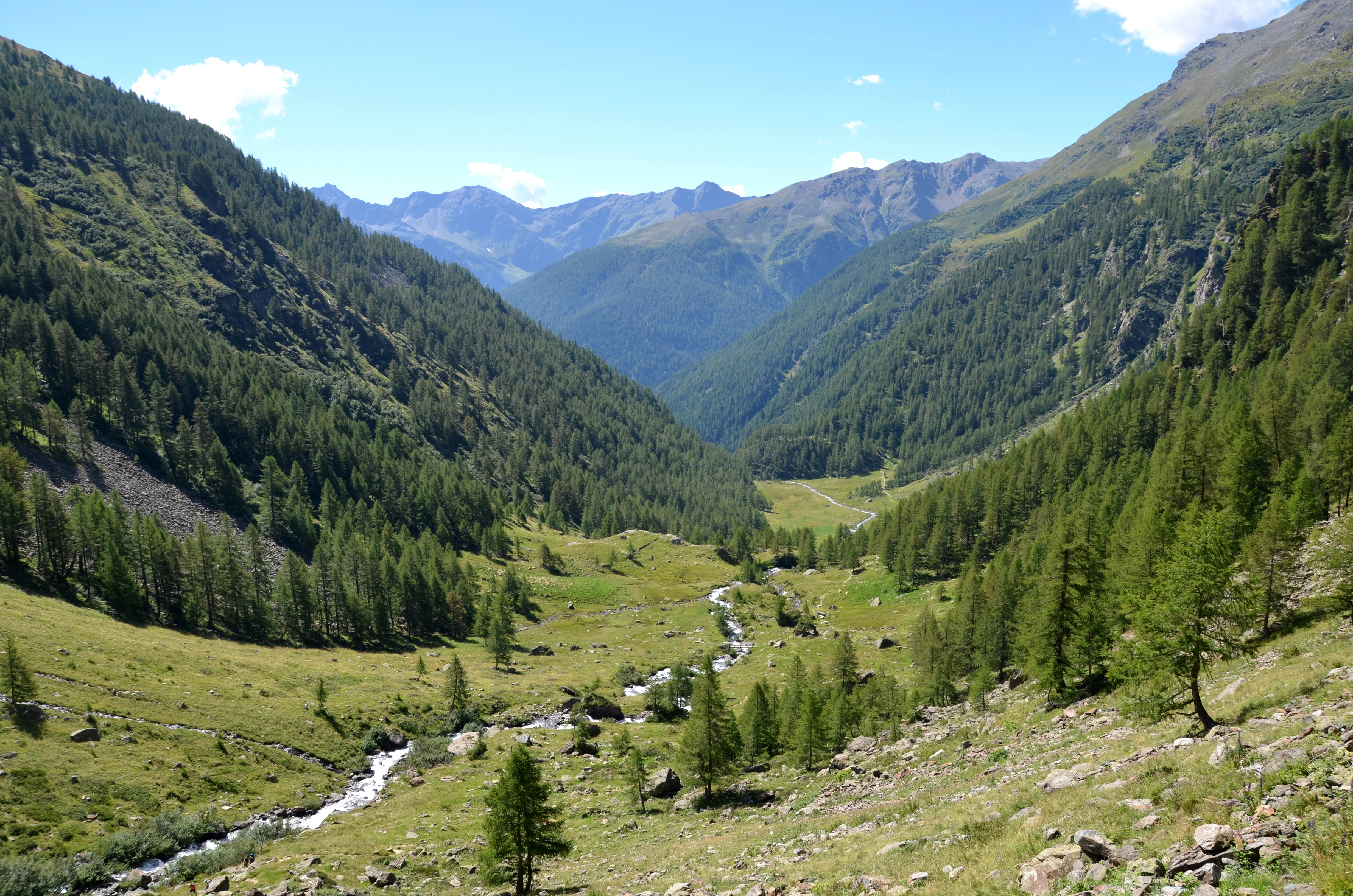
Wide alpine valley with a meandering river, forested slopes, and mountain peaks under a clear blue sky
Val di Rabbi valley within Stelvio National Park

Stelvio National Park ecosystems, habitats, and plant life

The ecological character of Stelvio National Park reflects its remarkable altitudinal range and position within the Central Alps. The park protects a gradient of habitats that transitions from montane forest communities in the lower valleys through subalpine zones to Alpine meadows and ultimately to high-altitude rock and ice environments. This vertical zonation creates conditions for significant biodiversity, with different species assemblages adapted to each elevation band. The park's position within a larger complex of protected areas, including the Swiss National Park and Italian regional parks, contributes to landscape-scale conservation that enables wildlife movements across broader territories. The protection of this extensive Alpine landscape helps preserve ecological processes and species that depend on high-elevation habitats, making the park significant for conservation at both national and European scales.
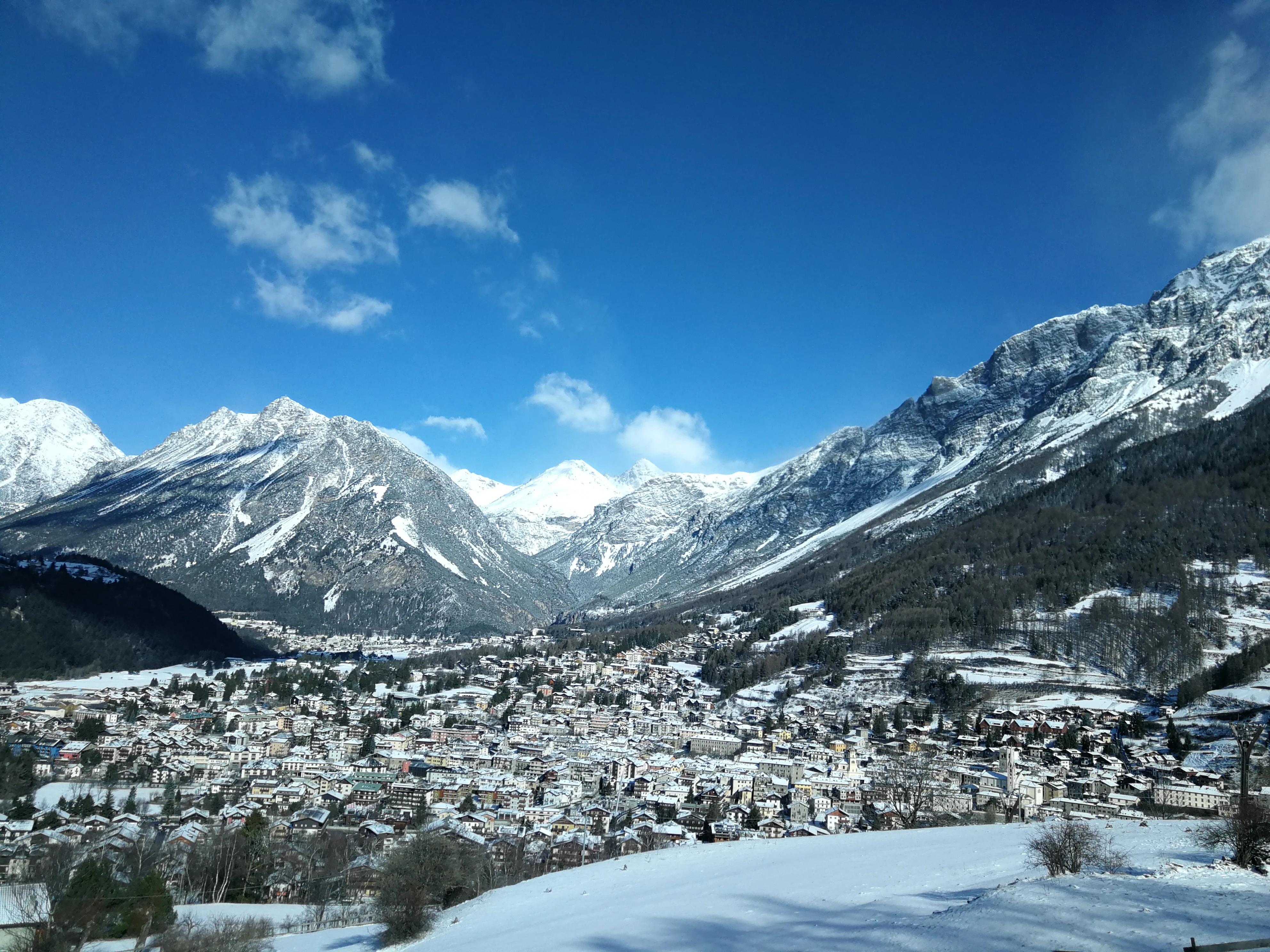
Panoramic view of Bormio town with snow-capped mountains under a clear blue sky
Panoramic view of Bormio town nestled in the Alpine mountains

Stelvio National Park wildlife and species highlights

Stelvio National Park provides habitat for Alpine wildlife adapted to the mountain environment's seasonal extremes and varied terrain. The park's diverse elevation range supports different species communities, from forest-dwelling species in the lower valleys to high-altitude specialists that thrive in the Alpine zone. The protected status of this extensive mountain landscape helps maintain corridors for wildlife movement, particularly important for species that require large territories or seasonal migration routes. The transboundary conservation context, with connections to the Swiss National Park and adjacent Italian parks, supports broader wildlife populations that depend on landscape-scale habitat connectivity. While specific species details would require more detailed source material, the park's Alpine setting supports characteristic mountain fauna including various bird species, Alpine mammals, and species adapted to the rugged high-elevation environment.
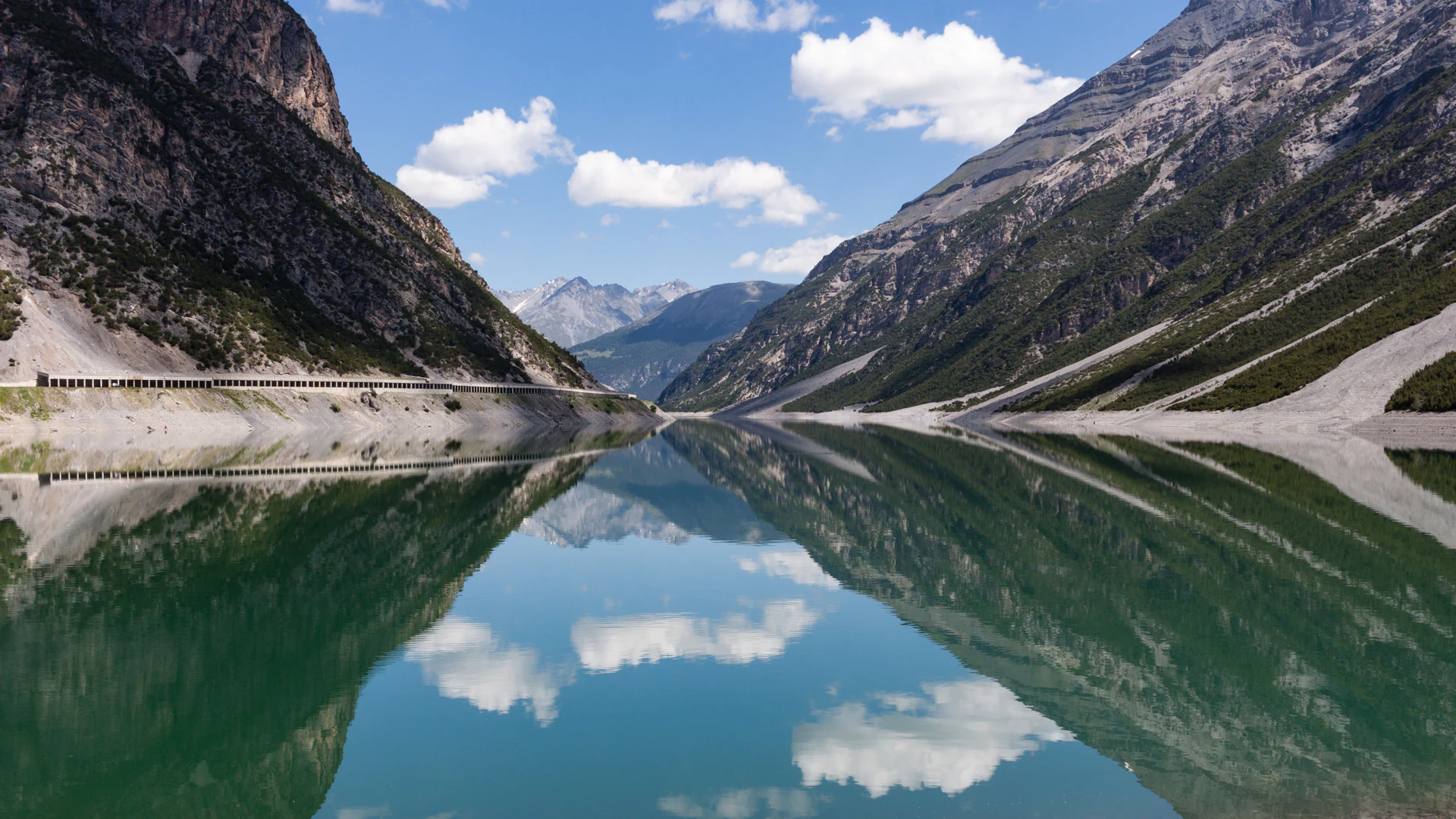
Calm lake reflecting steep rocky mountains and white clouds under a clear blue sky
Lago di Livigno reflecting mountains under a clear blue sky in Stelvio National Park

Stelvio National Park conservation status and protection priorities

Stelvio National Park contributes significantly to Italian and European Alpine conservation, protecting one of the country's largest and most ecologically diverse mountain protected areas. The park's designation as an IUCN Category II area reflects its primary purpose of protecting natural ecosystems while allowing for compatible visitor use and scientific study. Its integration within a larger transboundary complex that includes the Swiss National Park and adjacent Italian parks creates a conservation network spanning approximately 400,000 hectares, representing one of the most significant protected-area complexes in the Alps. The discovery of extensive Triassic dinosaur trackways near the park's Swiss border has added a new dimension to the park's conservation significance, highlighting its paleontological value and the importance of protecting these irreplaceable fossil resources. This recent finding demonstrates that the park preserves not only contemporary biodiversity but also significant geological and paleontological heritage.

Stelvio National Park cultural meaning and human context

Stelvio National Park occupies a region with deep historical ties to both Italian and Austrian cultural traditions, reflecting its position in a border area that underwent political changes following World War I. The park's bilingual naming in Italian and German reflects this heritage, with the Italian designation Parco nazionale dello Stelvio and the German Nationalpark Stilfserjoch both in official use. The territory encompasses 24 municipalities whose communities have maintained traditional relationships with the mountain landscape over generations. Alpine pastoral practices, valley settlements, and historical trade routes through the mountains all contribute to the cultural fabric of the park region. The landscape itself bears evidence of this human history, with trails, settlements, and land-use patterns that reflect centuries of interaction between local communities and the Alpine environment.
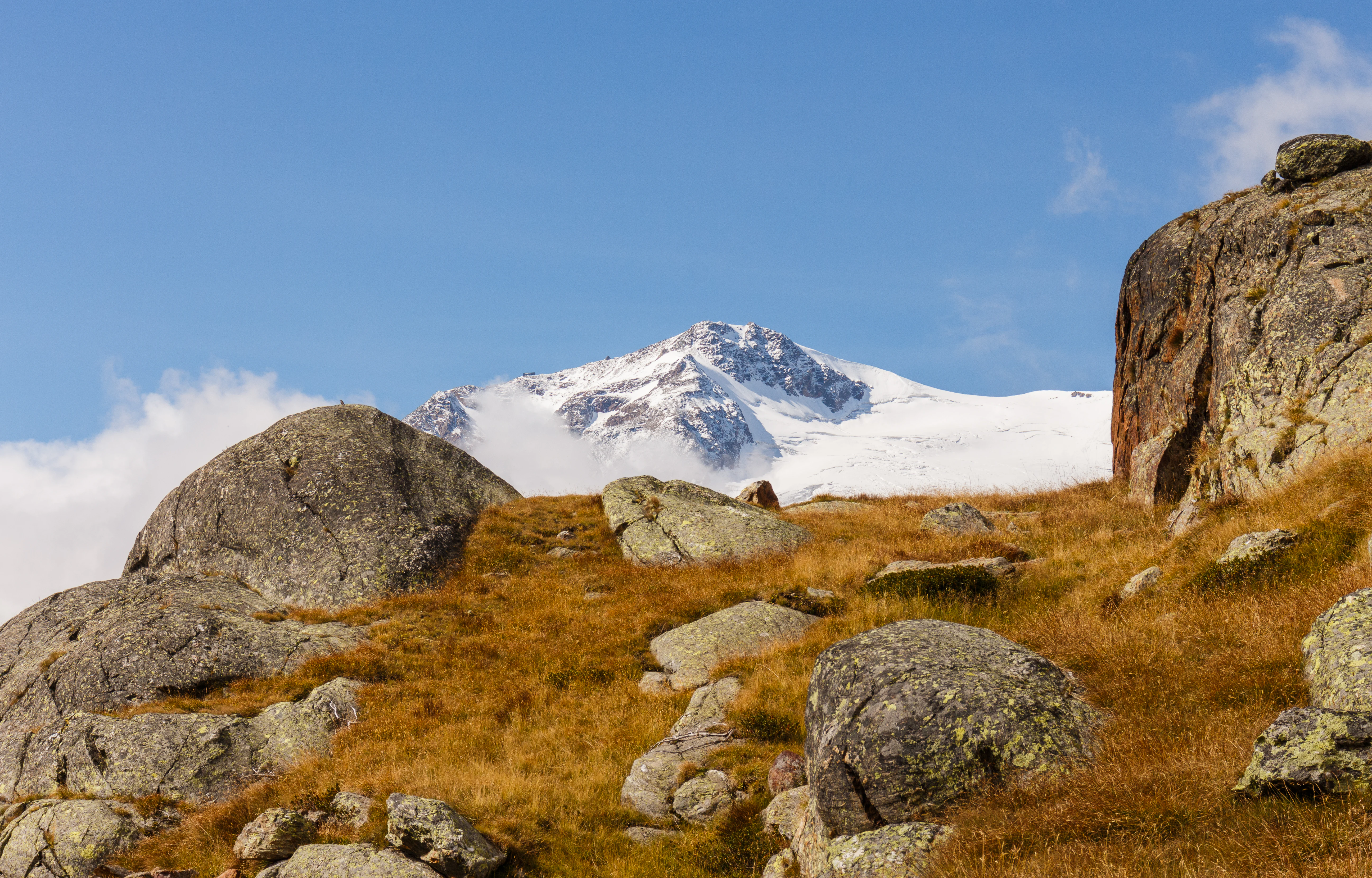
Rocky hillside with patches of brown grass under a clear blue sky, featuring a snow-capped mountain peak in the background
Snow-capped mountain peak with rocky alpine terrain under clear blue sky

Top sights and standout views in Stelvio National Park

Stelvio National Park stands out for its combination of scale, ecological diversity, and transboundary conservation significance within the Alps. The park's extensive territory encompasses dramatic mountain terrain with remarkable elevational diversity, creating conditions for varied ecosystems and scenic landscapes. The recent discovery of approximately 20,000 Triassic dinosaur footprints near the Swiss border represents a paleontological find of international importance, adding remarkable scientific value to the park's already significant conservation credentials. The park's position connecting to the Swiss National Park and several Italian regional parks creates one of Europe's largest mountain conservation complexes, enabling landscape-scale ecological processes and wildlife movement across international boundaries. The intersection of Italian and Austrian cultural heritage in this border region adds historical depth to the natural landscape.
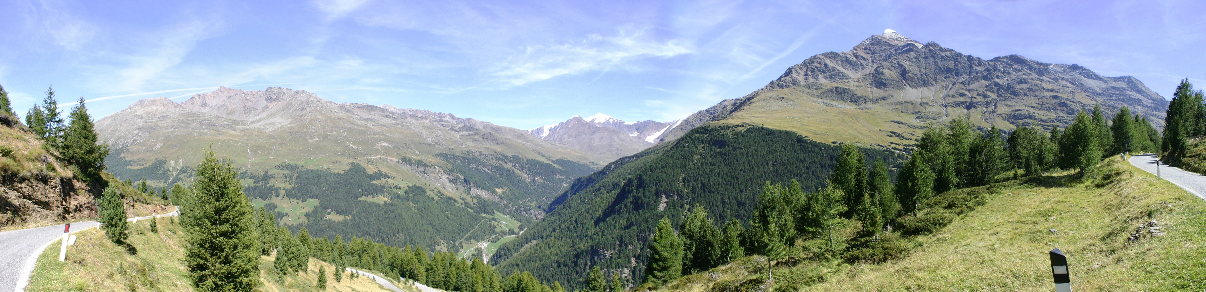
Panoramic view of Gavia Pass with mountain ranges, green valleys, and a winding road under a clear blue sky
Northern approach to Gavia Pass in Stelvio National Park

Best time to visit Stelvio National Park

Stelvio National Park offers distinct seasonal experiences reflecting its Alpine setting and varied elevation range. The summer months typically bring the most accessible conditions for exploring valley trails and higher-elevation hiking routes, with Alpine meadows in bloom and generally stable weather. Autumn offers changing foliage colors in the forested zones and potentially fewer visitors, though conditions become increasingly variable as winter approaches. Winter transforms the park into an extensive snowy landscape suitable for winter sports, though high-elevation access may be limited by snow conditions and avalanche risk. The best time for any visit depends on specific interests and tolerance for different seasonal conditions, with each period offering distinct advantages for experiencing the park's varied landscapes.

Monthly climate preview

Monthly precipitation averages and temperature ranges mapped for high-elevation Alpine landscapes

Stelvio National Park Climate Profile and Long-Term Weather by Month

Representative measurements from the 1991 to 2020 period highlight the alpine temperature transition from cold sub-zero winters to mild summers alongside shifting daily precipitation levels. Accessing the complete monthly database reveals detailed minimum and maximum temperature spreads that help map the regional climate geography.
Annual mean2 °C
-9 °C12 °C
Jan-9°
Feb-8°
Mar-4°
Apr
May
Jun10°
Jul12°
Aug12°
Sep
Oct
Nov-3°
Dec-8°
Warmest month
July

11.8 °C

Coolest month
January

-9.1 °C

Wettest month
August

3.9 mm/day

Driest month
February

1.2 mm/day

Park location guide

Geography guide, regional context, and park location map for Stelvio National Park

Stelvio National Park park geography, regions, and map view in Italy

Understand where Stelvio National Park sits in Italy through a broader geographic reading of the surrounding landscape, nearby location context, and its mapped position within the national park landscape.

How Stelvio National Park fits into Italy

Italy is a unitary parliamentary republic in Southern and Western Europe, located on the Italian Peninsula with the Alps to the north. It borders France, Switzerland, Austria, Slovenia, Vatican City, and San Marino, and shares maritime boundaries with several Mediterranean countries. The country has approximately 59 million residents and uses the Euro as its currency.

Wider geography shaping Stelvio National Park in Italy

Italy occupies a boot-shaped peninsula in southern Europe, bordered by the Alps to the north. It shares land borders with France, Switzerland, Austria, Slovenia, Vatican City, and San Marino. The country includes the Mediterranean islands of Sicily and Sardinia, along with approximately 800 smaller islands.

Map view of Stelvio National Park

Use this park location map to pinpoint Stelvio National Park in Italy, understand its exact geographic position, and read its mapped placement within the surrounding landscape more clearly.

Pigeon | © OpenStreetMap contributors

Location context for Stelvio National Park

LombardiaTrentino-Alto Adige/Südtirol
Natural feature types

Explore the Named Natural Features and Geography of Stelvio National Park

Continue browsing the detailed natural terrain of Stelvio National Park. Use this collection to identify specific mountain peaks, geological landmarks, and landforms mapped through MoriAtlas to better understand the regional geography of this protected Alpine area.
Recorded earthquake history

Review Historical Seismic Activity Associated with Stelvio National Park

Explore the documented seismic history of Stelvio National Park through this structured catalogue. Access event records, including magnitude and distance metrics, to understand the historical context of seismic activity recorded across this vast Alpine region.

Stelvio National Park Earthquake History

Catalogued events

112 events

Strongest magnitude

Magnitude 4.8

Most recent event

Aug 1, 2015

This history includes earthquakes recorded inside the park or within 50 km of its borders

Visual Guide to Stelvio National Park's Alpine Terrain, Habitats, and Protected-Area Character

Stelvio National Park Landscapes and Scenery: Visual Exploration of Alpine Protected Areas

View extensive photography of Stelvio National Park, showcasing its dramatic Alpine landscapes, towering peaks, and diverse valley systems. These images provide essential visual context for understanding the park's unique protected-area environment, its varied habitats, and the vast scale of its conservation geography across the Italian Alps.

A lake reflecting a forested mountain landscape with clear blue sky and clouds

Winding mountain road with multiple hairpin turns on a steep slope, surrounded by alpine terrain and a blue sign

Wide alpine valley with a meandering river, forested slopes, and mountain peaks under a clear blue sky

Panoramic view of Bormio town with snow-capped mountains under a clear blue sky

Calm lake reflecting steep rocky mountains and white clouds under a clear blue sky

Stone mountain hut with dark roof and prayer flags strung across, rocky terrain, clear blue sky.

Rocky hillside with patches of brown grass under a clear blue sky, featuring a snow-capped mountain peak in the background

Panoramic view of Gavia Pass with mountain ranges, green valleys, and a winding road under a clear blue sky

Panoramic view of mountainous terrain with valleys, scattered clouds, and distant peaks under a partly cloudy sky

Mountain hut Rifugio Larcher on rocky terrain with snow-covered mountains in the background

Wooden cabin-like structure with fence in mountain valley, snow-capped peaks in background

Hikers walking on a glacier with mountain peaks in the background

Sign indicating 'Passo Gavia' and 'Rifugio Bonetta' at a mountain pass with snow-covered peaks, road, and Italian and regional flags

Traditional alpine houses on a grassy hillside in Stelvio National Park, surrounded by dense forests and mountainous terrain

Stream flowing through grassy alpine meadows with rocky mountain slopes in the background

Mountain river flowing through a grassy valley with snow-capped peaks in the background under a partly cloudy sky

Park atlas

Compare diverse mountain terrain and conservation landscapes contiguous with Stelvio National Park and its wider Alpine region.

Discover Nearby National Parks and Alpine Protected Areas Surrounding Stelvio National Park

Browse an extended atlas of national parks and significant protected areas adjacent to Stelvio National Park, including a broader regional context of the Central Alps. This comparative overview helps map the interconnected protected landscapes and diverse mountain ecosystems spanning Italy and the wider Alpine transboundary region.
National parkGraubünden
Park boundaries overlap#1 closest

Northwest

Swiss National Park: Geographic Context and Protected Alpine Wilderness in Graubünden

A comprehensive look at the Engadin valley's premier wilderness sanctuary

Spanning over 170 square kilometers in the canton of Graubünden, the Swiss National Park offers an unparalleled example of a strictly protected Alpine ecosystem. This atlas profile details the park's distinct topography, from the subalpine pine forests near the Ofenpass to the delicate karst lake basins at Macun, providing a deep look into its history as a central reference site for wilderness restoration and geological research.

Area
170.3 km²
Established
1914
IUCN
Ia
Relief
Mountain
A soft, horizontal watercolor painting showing rolling green hills, a winding river or lake, and misty mountain silhouettes in the background against a white backdrop.
Regional parkGraubünden
About 5.7 km away#2 closest

Northwest

Biosfera Val Müstair Regional Park: Alpine Landscapes and UNESCO Biosphere Geography

Protected glacial terrain and cultural alpine valleys in eastern Switzerland.

Discover the distinctive natural geography of Biosfera Val Müstair, where a dry inner-Alpine climate meets high-altitude glacial features like the Lai da Rims. This regional park protects an extensive area of Graubünden, balancing rare ecosystems, broad alluvial fans, and the traditional alpine economy of the Romansh-speaking community.

Area
198.65 km²
Established
2011
Relief
Mountain
Climate
Alpine
A soft watercolor painting showing a wide, high-altitude alpine plateau with rolling hills, scattered small lakes, and distant mountain ridgelines.
Nature reserveGraubünden
About 12 km away#3 closest

Northwest

Macun-Seen Nature Reserve: Protected Alpine Plateau and Cirque Lake Landscape

High-altitude basin and crystalline geological features in Graubünden

Located in the Lower Engadine region of Graubünden, the Macun-Seen nature reserve is a significant high-altitude basin formed by glacial action. This protected exclave contains 23 small cirque lakes across a silicate plateau, offering a distinct ecological profile and expansive views of peaks approaching 3000 metres. It stands as a prime example of preserved alpine terrain within the broader Swiss National Park context.

Area
3.6 km²
Established
2000
Relief
Mountain
Climate
Alpine
A soft watercolor painting of a river winding through a valley with green trees, grassy plains, and distant purple hills against a white background.
Nature reserveGraubünden
About 13 km away#4 closest

West

Naturschutzgebiet Isla Glischa-Arvins-Seglias Nature Reserve in Graubünden

Mapped alluvial terrain and alpine river geography

Situated in the broad valley floor of the Upper Engadin, this nature reserve protects one of the most significant alpine floodplain zones in the Swiss canton of Graubünden. The area features a complex network of river channels, gravel lakes, and marshes that are currently undergoing active revitalization to restore natural riverine processes and support rare riparian ecosystems.

Area
0.867 km²
Established
1992
IUCN
IV
Relief
Upland
A horizontal watercolor illustration showing stylized, overlapping mountain ridges in shades of soft green, pink, and yellow against a white background.
Natural monumentGraubünden
About 29 km away#5 closest

West

Roseggletscher Natural Monument: Alpine Glacier Geography and Proglacial Lake Mapping

Protected landscape data for the Bernina range in Graubünden.

Examine the geographic boundaries and terrain of the Roseggletscher, a protected natural monument situated in the upper Val Roseg. This record captures its glacial extent, the emergence of the Lej da Vadret proglacial lake, and its role within the wider Bernina glacier ensemble of southeastern Switzerland.

Area
6.38 km²
Relief
Mountain
Climate
Alpine
Access
Moderate access
Watercolor illustration of a panoramic mountain landscape with soft green hills, rolling ridgelines in shades of pink and purple, and small patches of blue water in the foreground.
Regional parkCanton of Graubünden
About 30 km away#6 closest

West

Parc Ela: Regional Nature Park and Alpine Geography in the Canton of Graubünden

A vertical protected landscape in the Swiss Alpine arc.

Parc Ela encompasses a remarkable span of Swiss Alpine geography, protecting everything from low-lying forested gorges at seven hundred meters to high-altitude peaks over three thousand meters. The park serves as a vital refuge for threatened insect species and large alpine mammals, while preserving the linguistic and architectural heritage of the Albula and Oberhalbstein valleys. Explore the mapped terrain where paleontological treasures meet historic trade routes.

Area
659 km²
Established
2012
Relief
Mountain
Climate
Alpine
A horizontal watercolor illustration depicting soft, rolling green hills and distant mountain ridgelines against a pale yellow sky.
Nature reserveLombardia
36 km away#7 closest

Southwest

Riserva naturale Boschi del Giovetto di Paline: Protected Forest and Mountain Geography

A mapped nature reserve across Lombardy mountain slopes

Situated between the provinces of Bergamo and Brescia, this nature reserve offers a detailed look at old-growth coniferous woodlands and subalpine pasture management. The site serves as a vital ecological bridge within the Orobic Prealps, defined by its steep altitudinal transition, glacial landforms, and the distinctive dome-shaped ant colonies that shape the local forest ecology.

Area
5.97 km²
Established
1985
IUCN
IV
A watercolor painting showing a panoramic view of a green wetland landscape with soft purple mountains in the background.
Nature reserveTrentino-Alto Adige
About 37 km away#8 closest

South

Biotopo Fiavé: A Protected Wetland and Archaeological Landscape in Trentino-Alto Adige

Mapping glacial lake basins and ancient prehistoric heritage sites

Located at the foot of Monte Cogorna, Biotopo Fiavé functions as a vital wetland reserve characterized by extensive peat bogs and mixed willow-alder thickets. This area offers a unique intersection of natural hydrological evolution and UNESCO-protected archaeological history, serving as a rare, compact cross-section of alpine valley ecosystems and prehistoric human settlement patterns.

Area
1.373 km²
Established
1988
IUCN
IV

Common questions about visiting, size, designation, and location context for Stelvio National Park

Stelvio National Park FAQs for park facts, access, geography, and protected area context

Find quick answers about Stelvio National Park, including protected-area facts, park geography, trail and visitor context, and how the park fits into its surrounding country and regional landscape.
MoriAtlas Explorer

Continue Your Protected Areas Search Across the Global Atlas

Deepen your exploration by continuing the structured search for national parks and protected areas worldwide. Utilize the comprehensive filtering capabilities to compare different conservation landscapes and refine your understanding of global park geography. Discover more about the distribution and characteristics of protected natural areas.

Global natural geography