Mori Atlas logo
National parkVal Grande National Park

Understand the geographic context and mapped boundaries of this national park.

Val Grande National Park: A Protected Landscape in the Piedmont Region of Italy

(Parco Nazionale della Val Grande)

Val Grande National Park stands as a significant protected area within Italy's Piedmont region, offering a unique lens for geographic discovery. This page provides an atlas-style overview of the park, focusing on its designated boundaries, its place within the regional landscape, and the structured geographic data available for exploration. Delve into the mapped terrain and conservation context of Val Grande National Park, a key feature in the atlas of Italian protected lands.

Alpine wildernessNational parkProtected forestMountain landscapeItalian AlpsNature reserve
Illustration of a mountain valley with a waterfall, dense forests, and distant snow-capped peaks under a partly cloudy sky

Val Grande National Park

National park

Park overview

Structured park overview, official facts, and landscape profile for Val Grande National Park

Val Grande National Park park facts, protected area profile, and essential visitor context
Review the core facts for Val Grande National Park, including designation, size, terrain, visitor scale, habitats, and operating context in one park-focused overview.

About Val Grande National Park

Val Grande National Park represents one of the most significant conservation achievements in the Italian Alps, protecting a landscape that embodies the concept of wilderness in the European context. The park's territory encompasses a complex system of valleys and ridges situated between the historic Vigezzo, Cannobina, and Ossola valleys, with the dramatic backdrop of the Lepontine Alps. The terrain is characterized by steep-walled valleys carved by ancient glaciers, with the Val Grande and Val Pogallo serving as the park's two principal drainages. These valleys converge to form the Torrente San Bernardino, which carries the park's waters southeastward to Lake Maggiore. The park's elevation range supports diverse habitats, from the beech and chestnut forests of the lower slopes through coniferous zones to the Alpine meadows and rocky summits above the treeline. The visual character of the park is defined by the interplay between the returning forest, which has colonized former pastures and logging areas since the 1940s, and the stark mountain ridges that have remained essentially unchanged for millennia. Views from the park's higher points often encompass the massive form of Monte Rosa, Italy's second-highest peak, adding a superlative element to the already dramatic Alpine scenery. The park is administered by the Ente Parco Nazionale della Val Grande, headquartered in Vogogna, and operates visitor centers in Santa Maria Maggiore, Cossogno, and Premosello-Chiovenda.

Quick facts and research context for Val Grande National Park

Val Grande National Park covers approximately 17,000 hectares in the Italian Alps, making it the largest wilderness area in Italy and the Alps. The park is situated in the Province of Verbano-Cusio-Ossola in Piedmont, bordered by the Valle Vigezzo to the north, the Cannobina valley to the northwest, the Ossola valley to the southwest, and Lake Maggiore to the southeast. The park's drainage basin feeds into the Po River system via the Torrente San Bernardino. Major peaks within the park include Monte Togano (2310m), Cima della Laurasca (2195m), Monte Zeda (2157m), and Cima Pedum (2111m), all part of the Lepontine Alps. The park was established in 1992 following decades of conservation advocacy and became part of the UNESCO Ticino Val Grande Verbano Biosphere Reserve in 2018.

Park context

Deeper park guide and search-rich context for Val Grande National Park

Val Grande National Park history, landscape, wildlife, and travel context
Explore Val Grande National Park through its history, landscape character, ecosystems, wildlife, conservation priorities, cultural context, and seasonal travel timing in a structured park guide built for atlas discovery and search intent.

Why Val Grande National Park stands out

Val Grande National Park is most renowned for being the largest wilderness area in the Italian Alps, a distinction that sets it apart from other protected areas in the region. The park is celebrated for its extensive tracts of largely untouched forest, dramatic glacial valleys, and the absence of permanent human settlement within its core boundaries. Its landscape character is defined by the stark contrast between the wild, overgrown valley floors where abandoned villages and logging infrastructure have been consumed by returning forest, and the rocky ridgelines offering sweeping views toward the Monte Rosa massif. The park's ecological significance is further enhanced by its designation as a Natura 2000 site and its role as an Important Bird Area, protecting habitats for species including the golden eagle, peregrine falcon, and black woodpecker. The historical dimension of the park adds another layer of distinction, as the landscape bears the imprint of Iron Age settlements, medieval alpine farming, and intensive timber operations that ceased abruptly at the end of World War II.

Mountainous landscape with valleys, dry grass in foreground, and clear blue sky
Panoramic mountain view of Val Grande National Park from Pizzo Pernice

Val Grande National Park history and protected-area timeline

The human history of Val Grande spans many centuries and has left a distinctive imprint on the landscape that visitors encounter today. Archaeological evidence, including rock carvings and artifacts from necropolises at Malesco and Miazzina, indicates that the surrounding region was inhabited during the Iron Age, with the famous Celtic "mask" of Vogogna suggesting connections to Celtic religious traditions dating to approximately 450-15 BCE. Permanent settlement within the Val Grande itself appears to have begun between the 10th and 11th centuries, when shepherds began transforming the wilderness into summer pastures. By the 13th century, seasonal grazing was well established, and timber production became significant from the 15th century onward. The early 20th century saw intensive logging operations centered on the hamlet of Pogallo, where an engineer named Carlo Sutermeister developed infrastructure including a village with services, a road known as the Sutermeister mule track, and a network of cable systems to transport timber. This period of intense human activity ceased abruptly at the end of World War II, when the entire population fled the valley following German anti-partisan operations in June 1944 that resulted in approximately 300 partisan deaths and the destruction of 208 alpine huts. The valley subsequently became part of the short-lived partisan Republic of Ossola and has remained essentially uninhabited since 1944. The idea for a national park was first proposed in 1953, leading to the area's designation as a Strict Nature Reserve in 1967, the first such protected area in the Italian Alps. After decades of advocacy by Italia Nostra and others, the park was officially established on March 2, 1992, expanded in 1998, and further enlarged in 2023.

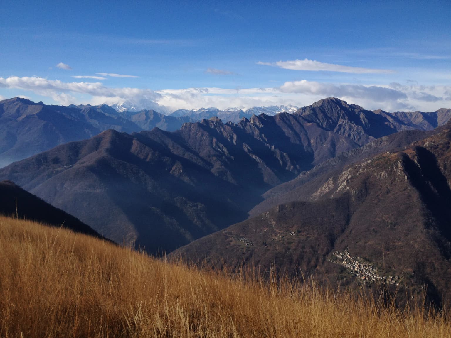
Val Grande National Park landscape and geographic character

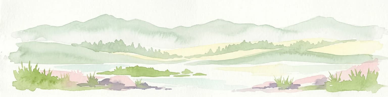
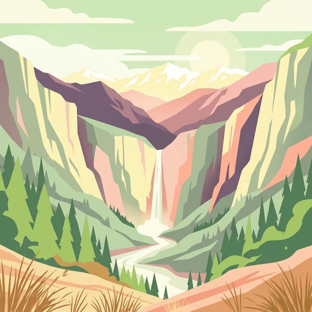
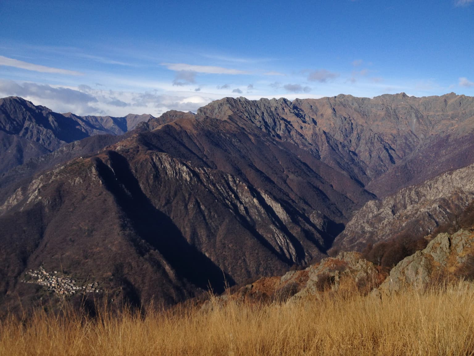
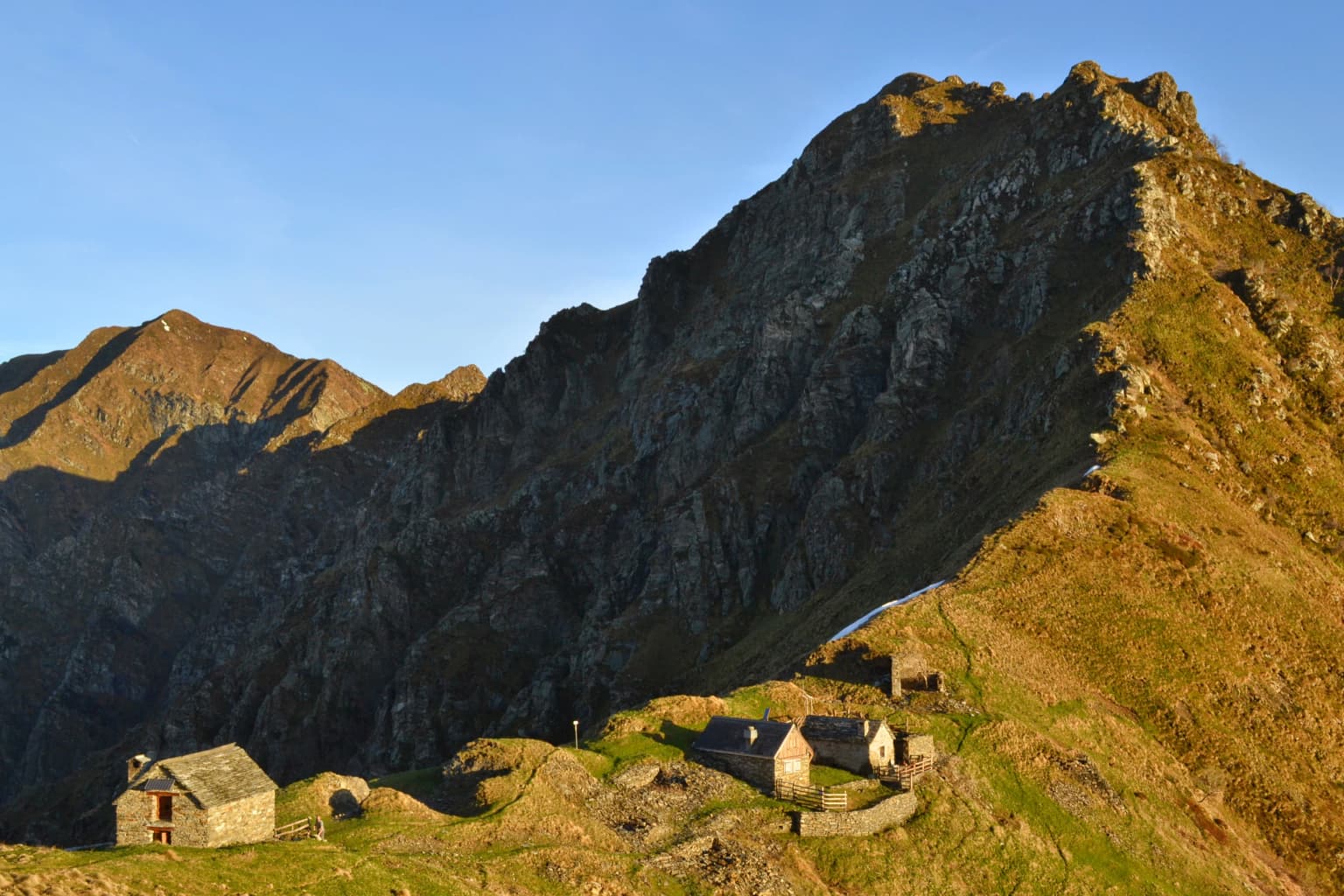
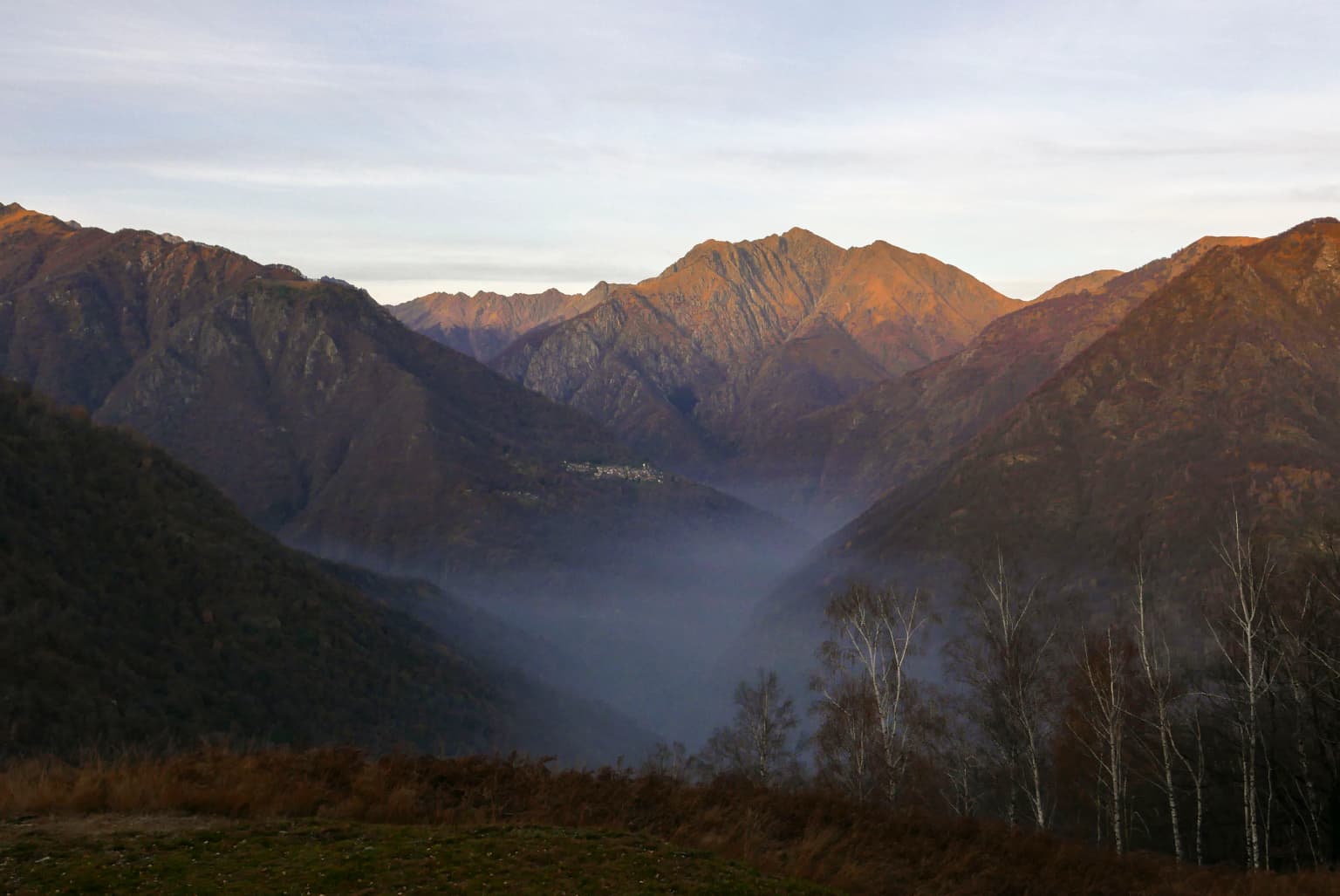
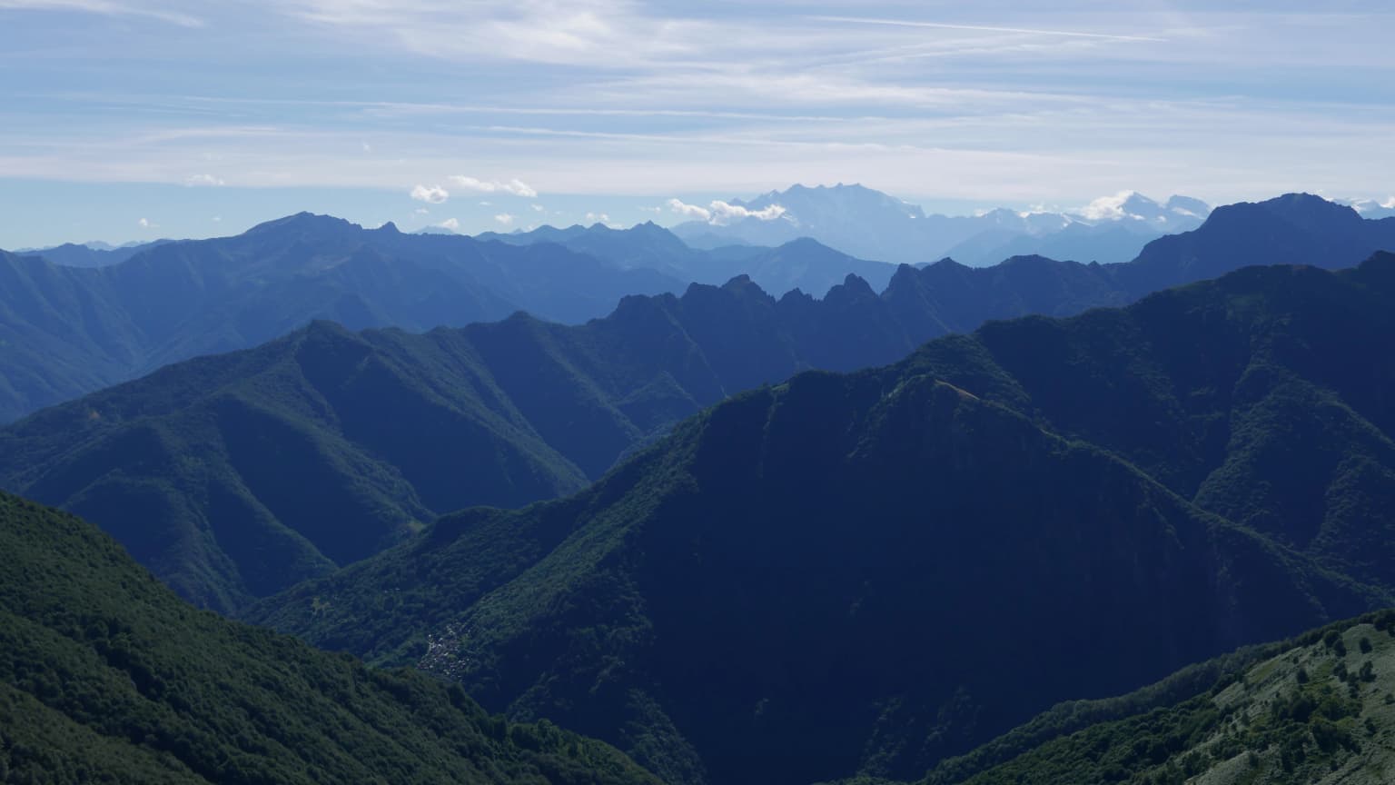
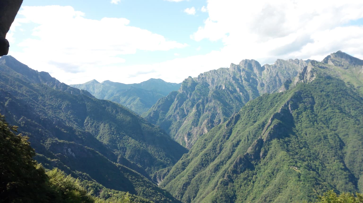
The landscape of Val Grande National Park exemplifies the dramatic terrain of the southern Alps, characterized by deep glacial valleys, steep rocky ridges, and extensive forested slopes. The park's two principal valleys, Val Grande and Val Pogallo, run roughly parallel before converging to form the San Bernardino torrent drainage system. These valleys are lined with steep walls of granitic and metamorphic rock, with elevations ranging from approximately 200 meters where the park meets the Lake Maggiore plain to summits exceeding 2300 meters. The highest peaks, including Monte Togano (2310m), Pizzo Nona (2271m), and Cima della Laurasca (2195m), form part of the Lepontine Alps and are composed of ancient crystalline rocks. The valley floors, once cleared for pastures and timber operations, have been substantially reclaimed by forest during the decades since human abandonment, creating a distinctive landscape of abandoned structures swallowed by vegetation. The park also includes portions of the lower Toce River floodplain near Vogogna and Ornavasso, adding wetland habitat diversity to the predominantly mountainous terrain. The ridge lines separating the various valleys offer spectacular viewpoints, with the Dorsale crest between Val Grande and Val Pogallo providing particularly striking perspectives on the surrounding mountain landscape.

Stone bivouac hut with sloped roof on grassy mountain slope, surrounded by rocky peaks under clear blue sky
Bivouac hut 'La Colma di Premosello' in Val Grande National Park

Val Grande National Park ecosystems, habitats, and plant life

The ecological character of Val Grande National Park reflects both its Alpine setting and its unique history of human abandonment. The park's forests, which now cover the majority of its surface, are predominantly composed of species typical of the lower mountain zone, including chestnut, beech, and hazel, reflecting the relatively modest elevations and the park's position at the southern margin of the Alpine range. These forests are relatively young, having developed rapidly since the cessation of logging and grazing in the 1940s, and now form a nearly continuous blanket covering the valley floors and lower slopes. The park's ecological significance is underscored by its inclusion in the Natura 2000 network as a Site of Community Interest, protecting both the forest ecosystems and the water systems that drain toward Lake Maggiore. Within the park boundaries lie two important reserves: the Val Grande Integral Nature Reserve (973 hectares) and the Monte Mottac Oriented Nature Reserve (2,410 hectares), both established in 1971 and representing some of the earliest strict protection in the Italian Alps. The park's elevation range supports habitat transitions from broadleaf forest through coniferous zones to Alpine meadows, creating ecological diversity within a relatively compact area.

Wide view of mountain valley with mist, forested slopes, and distant ridges under a partly cloudy sky
Mountain valley with mist in Val Grande National Park

Val Grande National Park wildlife and species highlights

The wildlife community of Val Grande National Park reflects the park's position at the interface between the Alps and the pre-Alpine zone, supporting both typical mountain species and species more characteristic of lower elevations. The park's ungulate populations include chamois, roe deer, red deer, and wild boar, with the chamois particularly associated with the rocky ridgelines and Alpine meadows above the treeline. Carnivore species present in the park include wolves, which have recolonized the area in recent decades, along with foxes, martens, stone martens, badgers, and weasels. The bird fauna is particularly noteworthy, with the park designated as an Important Bird Area. Golden eagles and peregrine falcons nest on the rocky cliffs, while the forest interior supports species including the black woodpecker, a specialist of old-growth forest, along with grouse, ptarmigan, and various passerines. The smaller mammals include dormice, wood mice, and red squirrels, while the streams support brown trout and bullhead. The park also hosts several rare insect species, including Carabus lepontinus, an endemic beetle of the region, along with Rosalia alpina and Gnorimus variabilis, both species associated with decaying wood in old-growth forests.

Wide panoramic view of mountain ranges, valleys, and green slopes in Val Grande National Park under a partly cloudy sky
Panoramic view of Val Grande National Park from Pian Cavallone showing mountain ranges and valleys

Val Grande National Park conservation status and protection priorities

Val Grande National Park represents a landmark in Italian conservation, protecting what is recognized as the largest wilderness area in both Italy and the Alps. The park's conservation significance derives from multiple factors: its extensive relatively unmodified forest ecosystems, its role in protecting watersheds that feed into the Po River basin, and its populations of species including wolves and golden eagles that require large, connected territories. The park's designation as a Natura 2000 Site of Community Interest integrates it into the European network of protected areas, while its inclusion in the UNESCO Ticino Val Grande Verbano Biosphere Reserve in 2018 links it to a larger transregional conservation framework spanning over 3,300 square kilometers between Lombardy and Piedmont. The park's management approach acknowledges the historical dimension of the landscape, recognizing that the current wilderness character emerged from the specific historical circumstances of post-war abandonment rather than from natural processes alone. This understanding informs conservation strategies that seek to maintain the park's wilderness character while also protecting the cultural heritage embedded in the landscape. The 2023 expansion added approximately 2,400 hectares to the park, incorporating new municipalities and strengthening ecological connectivity.

Val Grande National Park cultural meaning and human context

The cultural context of Val Grande National Park is deeply intertwined with the landscape's historical transformation and its emergence as a wilderness area. The surrounding region shows evidence of human presence dating to the Iron Age, with the Celtic cultural influence reflected in artifacts such as the Vogogna mask, a stone face believed to represent the deity Cernunnos and dating to approximately 450-15 BCE. Rock carvings found within the park, including one incorporated into the park's logo, provide further evidence of ancient human presence. The medieval and early modern periods saw the gradual development of alpine pastoral economy, with seasonal settlements and logging operations shaping the valley landscapes. The intensive timber operations of the early 20th century, centered on the hamlet of Pogallo, represent the peak of human modification of the landscape, with infrastructure including roads, cable systems, and a substantial village. The traumatic events of World War II, when the valley served as a refuge for partisans and was subsequently subjected to a major Nazi-fascist offensive, led to permanent human abandonment. This history has created a landscape where the remains of human activity are being progressively reclaimed by forest, creating a unique combination of cultural heritage and wild nature.

Panoramic mountain landscape with green valleys, rocky peaks, and scattered clouds under a bright sky
Panoramic view of mountain peaks and valleys in Val Grande National Park

Top sights and standout views in Val Grande National Park

Val Grande National Park offers visitors a distinctive Alpine experience centered on wilderness exploration and backcountry hiking. The park's network of trails, including the famous Bove Path, provides access to remote valleys and scenic ridgelines, though many routes require navigation skills and are best attempted with local guides. The views from points such as Cima Sasso (1916m) encompass the Monte Rosa massif and the surrounding Lepontine peaks, while the valleys themselves offer intimate encounters with the reclaimed forest and abandoned structures. The small settlement of Cicogna, with approximately 17 permanent residents, serves as the park's primary inhabited center and offers basic visitor services. The park's four mountain huts, open during the summer season, provide access to the higher terrain, while numerous backcountry bivouacs support overnight explorations. The combination of dramatic mountain scenery, ecological significance, and historical depth creates a multifaceted destination that appeals to those seeking a wilderness experience within relatively easy reach of Italy's populated north.

Grassy hillside leading to a valley surrounded by mountain ranges under a clear blue sky
Panoramic view of Val Grande National Park's mountainous landscape with rolling peaks under a clear blue sky

Best time to visit Val Grande National Park

The optimal time to visit Val Grande National Park centers on the summer and early autumn months, from June through September, when the mountain trails are fully accessible and the weather generally permits extended outdoor activities. During this period, the Alpine meadows are in flower, the higher ridgelines are snow-free, and the mountain huts operate their seasonal schedules. Spring and early summer snowmelt creates vigorous stream flows, while autumn offers the opportunity to experience the forest in its most colorful season and benefits from reduced crowding. The winter months present challenging conditions, with heavy snowfall and limited access, making the park essentially a backcountry destination for experienced winter mountaineers. The park's elevation range means that weather conditions can change rapidly, and visitors should be prepared for mountain weather regardless of the season. The visitor centers in the surrounding villages provide current information on trail conditions and can advise on the best timing for specific objectives.

Park location guide

Geography guide, regional context, and park location map for Val Grande National Park

Val Grande National Park park geography, regions, and map view in Italy
Understand where Val Grande National Park sits in Italy through a broader geographic reading of the surrounding landscape, nearby location context, and its mapped position within the national park landscape.

How Val Grande National Park fits into Italy

Italy is a unitary parliamentary republic in Southern and Western Europe, located on the Italian Peninsula with the Alps to the north. It borders France, Switzerland, Austria, Slovenia, Vatican City, and San Marino, and shares maritime boundaries with several Mediterranean countries. The country has approximately 59 million residents and uses the Euro as its currency.

Wider geography shaping Val Grande National Park in Italy

Italy occupies a boot-shaped peninsula in southern Europe, bordered by the Alps to the north. It shares land borders with France, Switzerland, Austria, Slovenia, Vatican City, and San Marino. The country includes the Mediterranean islands of Sicily and Sardinia, along with approximately 800 smaller islands.

Map view of Val Grande National Park

Use this park location map to pinpoint Val Grande National Park in Italy, understand its exact geographic position, and read its mapped placement within the surrounding landscape more clearly.

Pigeon | © OpenStreetMap contributors

Location context for Val Grande National Park

PiedmontVerbano-Cusio-Ossola

Visualize the rugged terrain, deep glacial valleys, and reclaimed forested slopes within this premier Italian Alpine protected area.

Val Grande National Park Photos: Explore Alpine Wilderness and Dramatic Mountain Landscapes
Browse a curated collection of Val Grande National Park imagery to witness its distinctive Alpine wilderness, dramatic mountain scenery, and unique protected landscapes. These photographs provide essential visual context for comprehending the park's untouched environment, challenging terrain, and the character of its deep valleys now reclaimed by dense forest.

Mountainous landscape with valleys, dry grass in foreground, and clear blue sky

Mountain landscape with multiple peaks, misty valleys, and clear blue sky, viewed from a rocky hilltop with sparse vegetation

Stone bivouac hut with sloped roof on grassy mountain slope, surrounded by rocky peaks under clear blue sky

Wide view of mountain valley with mist, forested slopes, and distant ridges under a partly cloudy sky

Wide panoramic view of mountain ranges, valleys, and green slopes in Val Grande National Park under a partly cloudy sky

Abandoned stone farmhouses on a grassy hillside, mountain peaks in background

Panoramic mountain landscape with green valleys, rocky peaks, and scattered clouds under a bright sky

Grassy hillside leading to a valley surrounded by mountain ranges under a clear blue sky

Panoramic landscape view of mountain ranges, valleys, and a distant lake under a blue sky with scattered clouds.

Rock face with circular cupmarks and ring marks, set against a mountainous backdrop with trees

Park atlas

Browse other Alpine wilderness areas and protected landscapes across the Piedmont region and beyond, tracing their geographic context.

Discover More National Parks and Protected Areas Near Val Grande National Park, Italy
After exploring Val Grande National Park, discover other national parks and significant protected areas located across the Italian Alps and surrounding regions of northern Italy. Compare their unique geographic features, conservation focuses, and regional spread to deepen your understanding of the protected landscapes connected to Val Grande's dramatic Alpine wilderness.
Watercolor illustration depicting green valleys, forests, and distant mountain peaks
National park

Gran Paradiso National Park: Italy's National Park Protected Landscape Atlas

Mapped boundaries and regional geography for a key Italian protected area.

Gran Paradiso National Park is a distinct national park entity within Italy, offering rich potential for atlas-driven geographic discovery. This MoriAtlas profile focuses on its protected landscape identity, providing essential context for understanding its mapped boundaries and its role within the regional geography of Italy. Explore the structured geographic details that make Gran Paradiso National Park a valuable component of any mapped landscape analysis.

Area
703 km²
Established
1922
IUCN
II
Relief
Mountain
National parkSavoie

Vanoise National Park: Explore France's Original National Park in the Savoie Alps

Mapped Alpine geography, glacial terrain, and protected landscape.

Vanoise National Park is France's pioneering national park, a protected landscape of immense alpine beauty situated in the Savoie department. Renowned for its dramatic glacial terrain, over 100 peaks above 3,000 meters, and the iconic Alpine ibex, this park offers a profound geographic context. Explore its mapped boundaries and discover the unique atlas-level insights into France's mountainous protected areas and their ecological significance.

Area
534 km²
Established
1963
IUCN
II
Relief
Mountain
National parkTrentino-Alto Adige/Südtirol

Stelvio National Park National Park: Protected Landscape and Regional Geographic Context

Explore its mapped boundaries and natural terrain.

Navigate Stelvio National Park, a designated national park in Italy's Trentino-Alto Adige/Südtirol region, through a map-centric lens. This page provides critical context for understanding the park's protected landscape, its geographic position within the Alps, and its mapped terrain. Utilize MoriAtlas to grasp the park's boundaries and its place in regional geography for structured natural landscape discovery.

Established
1935
IUCN
II
Relief
Mountain
Scope
Terrestrial
National park

Écrins National Park: Alpine Glaciated Terrain and Protected Landscape Details

Mapped boundaries and regional geography of a major French National Park.

Delve into Écrins National Park, a defining national park within the French Alps. This page provides a comprehensive overview of its protected landscape, focusing on its dramatic glaciated terrain, significant peaks such as the Barre des Écrins, and its position within the regional geographic context. Explore the mapped extent and understand the unique alpine environment of this protected area.

Area
925 km²
Established
1973
IUCN
II
National parkLiguria

Cinque Terre National Park: Protected Area Geography and Mapped Landscape

Explore its regional context in Liguria, Italy.

Examine Cinque Terre National Park as a key protected area within the rugged geography of Italy's Liguria region. This dedicated atlas entry provides essential geographic context, detailing the park's mapped boundaries and its significance as a national park. Understand how this protected landscape fits within the broader regional terrain, offering a structured view for geographic discovery and map-based exploration of Italy's protected areas.

Area
22 km²
Established
1999
IUCN
V
Relief
Mountain
Watercolor illustration of a mountainous landscape featuring a river, rolling hills, and green vegetation
National park

Mercantour National Park: Mapped Alpine Protected Landscape and Regional Geography

Explore France's dramatic Alps, park boundaries, and unique ecotones.

Mercantour National Park stands as a premier protected area within the French Alps, distinguished by its remarkable geographic diversity and ecological significance. This national park encompasses mountainous terrain featuring dramatic peaks, deep glacial valleys, and a unique ecotone where Mediterranean and Alpine ecosystems converge. MoriAtlas facilitates a detailed atlas-style exploration of Mercantour National Park, highlighting its mapped protected boundaries, varied natural landscapes, and its pivotal role in regional geography and conservation efforts.

Area
679 km²
Established
1979
IUCN
II
Visitors
800K annual
Watercolor painting of rolling green hills under a sunset sky with soft color transitions
National parkEmilia-Romagna

Appennino Tosco-Emiliano National Park: Explore Its National Park Boundaries and Geography

Discover the mapped landscape and regional context of this protected area.

Appennino Tosco-Emiliano National Park is a designated national park offering a rich area for geographic exploration. This MoriAtlas entry details the park's protected landscape, providing insights into its mapped boundaries and its contribution to the natural terrain of the Emilia-Romagna region. Understand its significance within the broader atlas of Italian protected areas, focusing on its unique geographic identity and landscape context.

Area
227.92 km²
Established
2001
IUCN
II
Relief
Mountain
National parkProvince of Belluno

Dolomiti Bellunesi National Park: National Park, Province of Belluno Protected Landscape

Explore mapped boundaries and regional geography

This entry details Dolomiti Bellunesi National Park, a distinct national park situated within the Province of Belluno. It provides essential geographic context and protected landscape information, enabling users to understand the park's boundaries and its role within the regional terrain. Dive into the mapped features and discover the atlas-driven details of this significant Italian protected area.

Area
32 km²
Established
1988
IUCN
II
Relief
Mountain

Common questions about visiting, size, designation, and location context for Val Grande National Park

Val Grande National Park FAQs for park facts, access, geography, and protected area context
Find quick answers about Val Grande National Park, including protected-area facts, park geography, trail and visitor context, and how the park fits into its surrounding country and regional landscape.
MoriAtlas Explorer

Continue Your Protected Areas Search Across the Global Atlas

Deepen your exploration by continuing the structured search for national parks and protected areas worldwide. Utilize the comprehensive filtering capabilities to compare different conservation landscapes and refine your understanding of global park geography. Discover more about the distribution and characteristics of protected natural areas.

Global natural geography