Mori Atlas logo
National parkAppennino Tosco-Emiliano National Park

Discover the geographic identity and park boundaries of this significant national park in Emilia-Romagna.

Appennino Tosco-Emiliano National Park: Mapped Protected Landscape and Regional Geography

(Parco Nazionale Appennino Tosco-Emiliano)

Appennino Tosco-Emiliano National Park stands as a key protected national park within the Emilia-Romagna region of northern Italy. This atlas-focused page provides detailed geographic context for the park's mapped boundaries, helping users understand its landscape character and its place within the broader Italian geography. Explore how this protected area contributes to the regional natural terrain and offers a unique point for atlas-based discovery.

National parksMountain landscapesBeech forestsWolf habitatAlpine environmentsEndemic species
Stylized illustration of a rainbow over a waterfall in a mountainous landscape with forests and a winding road with guardrails

Appennino Tosco-Emiliano National Park

National park

Park overview

Structured park overview, official facts, and landscape profile for Appennino Tosco-Emiliano National Park

Appennino Tosco-Emiliano National Park park facts, protected area profile, and essential visitor context
Review the core facts for Appennino Tosco-Emiliano National Park, including designation, size, terrain, visitor scale, habitats, and operating context in one park-focused overview.

About Appennino Tosco-Emiliano National Park

Appennino Tosco-Emiliano National Park occupies a critical position along the Apennine mountain chain where Tuscany meets Emilia-Romagna. The park's territory extends from the Cisa Pass to the Forbici Pass, following the main ridge that has long served as a geographic and cultural boundary between these two Italian regions. The landscape presents an extraordinary variety of environments within a relatively compact area, from the chestnut-dominated lower slopes through extensive beech forests to the alpine meadows and bare summits above the tree line. The Pietra di Bismantova stands as the park's most recognizable geological feature, its sheer vertical walls rising beside the Secchia River and serving as a landmark for hikers and climbers alike. The park lies in close proximity to other protected areas, including Cinque Terre National Park to the south and Foreste Casentinesi to the southeast, forming a network of protected mountain landscapes across the northern Apennines. Local communities have shaped this landscape for centuries through activities such as transhumant sheep grazing, chestnut cultivation, and forest management, creating a cultural landscape that remains evident in traditional settlements, mountain pastures, and historic trail systems.

Quick facts and research context for Appennino Tosco-Emiliano National Park

Appennino Tosco-Emiliano National Park stretches across four provinces: Massa and Carrara, Lucca, Reggio Emilia, and Parma, spanning both Emilia-Romagna and Tuscany regions. The park was established in 2001 through the merger of former regional parks and previously unprotected territories, making it one of Italy's younger national parks. Major peaks include Monte Cusna (2,121m), Monte Prado (2,053m), and Alpe di Succiso (2,017m), while the distinctive Pietra di Bismantova rises as a dramatic vertical monolith on the Emilian side. The park features glacial lakes, waterfalls, and ancient beech forests spanning elevations from roughly 900 to over 2,000 meters. Thirteen municipalities lie partially within the park's boundaries.

Park context

Deeper park guide and search-rich context for Appennino Tosco-Emiliano National Park

Appennino Tosco-Emiliano National Park history, landscape, wildlife, and travel context
Explore Appennino Tosco-Emiliano National Park through its history, landscape character, ecosystems, wildlife, conservation priorities, cultural context, and seasonal travel timing in a structured park guide built for atlas discovery and search intent.

Why Appennino Tosco-Emiliano National Park stands out

The park is best known for its remarkable ecological diversity, spanning the transition between Mediterranean and continental climates, and for protecting some of Italy's most significant wolf habitat. The dramatic summit of Monte Cusna and the surrounding alpine grasslands host golden eagle nesting sites, while the ancient beech forests below shelter populations of red deer and roe deer. The endemic Primula apennina, a rare pink primrose found only on silica-rich rock faces between 1,500 and 2,000 meters, represents the park's botanical significance. The Abetina Reale, one of the few remaining white fir forests in the Apennines, provides a tangible link to the region's historical forest cover.

Lush green forests in the foreground with rolling mountain ranges extending into the distance under a blue sky with scattered clouds
Panoramic view of Monte La Nuda and surrounding mountain valleys under a clear blue sky

Appennino Tosco-Emiliano National Park history and protected-area timeline

The park was officially established by Presidential Decree on May 21, 2001, making it one of Italy's youngest national parks. Its creation followed the consolidation of territories from two former regional parks: the Parco Regionale del Gigante in the Reggio Emilia area and the Parco Regionale dei Cento Laghi in the Parma region. Additional areas that had never previously been included in protected areas were incorporated into the new national park, such as portions of the municipality of Corniglio. The Parco dei Cento Laghi was subsequently redesignated as the Parco Regionale delle Valli del Cedra e del Parma with revised boundaries defined by regional law in 2004. The Parco del Gigante was dissolved and incorporated into the national park through regional legislation in 2005. The final territories were added to the park in 2010, completing its current extent. The park is governed by the Ente Parco Nazionale Appennino Tosco-Emiliano, a public body operating under Italy's framework law for protected areas (Law 394 of 1991) and under the supervision of the Ministry of the Environment.

Appennino Tosco-Emiliano National Park landscape and geographic character

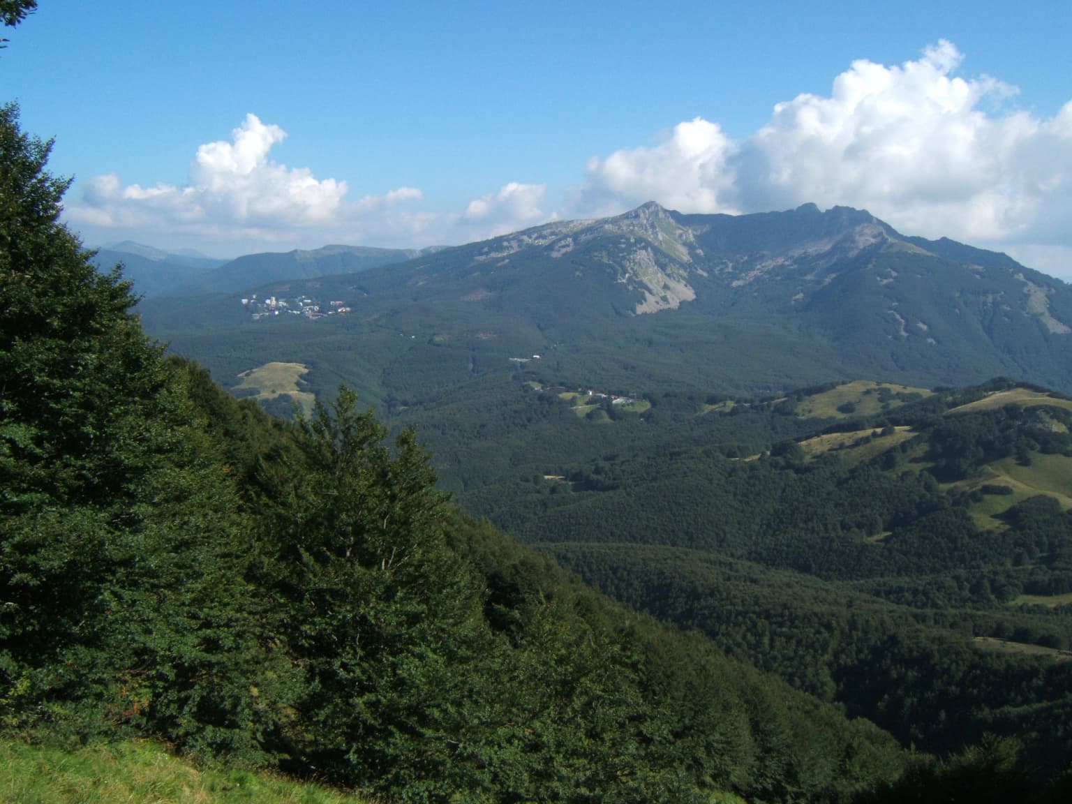
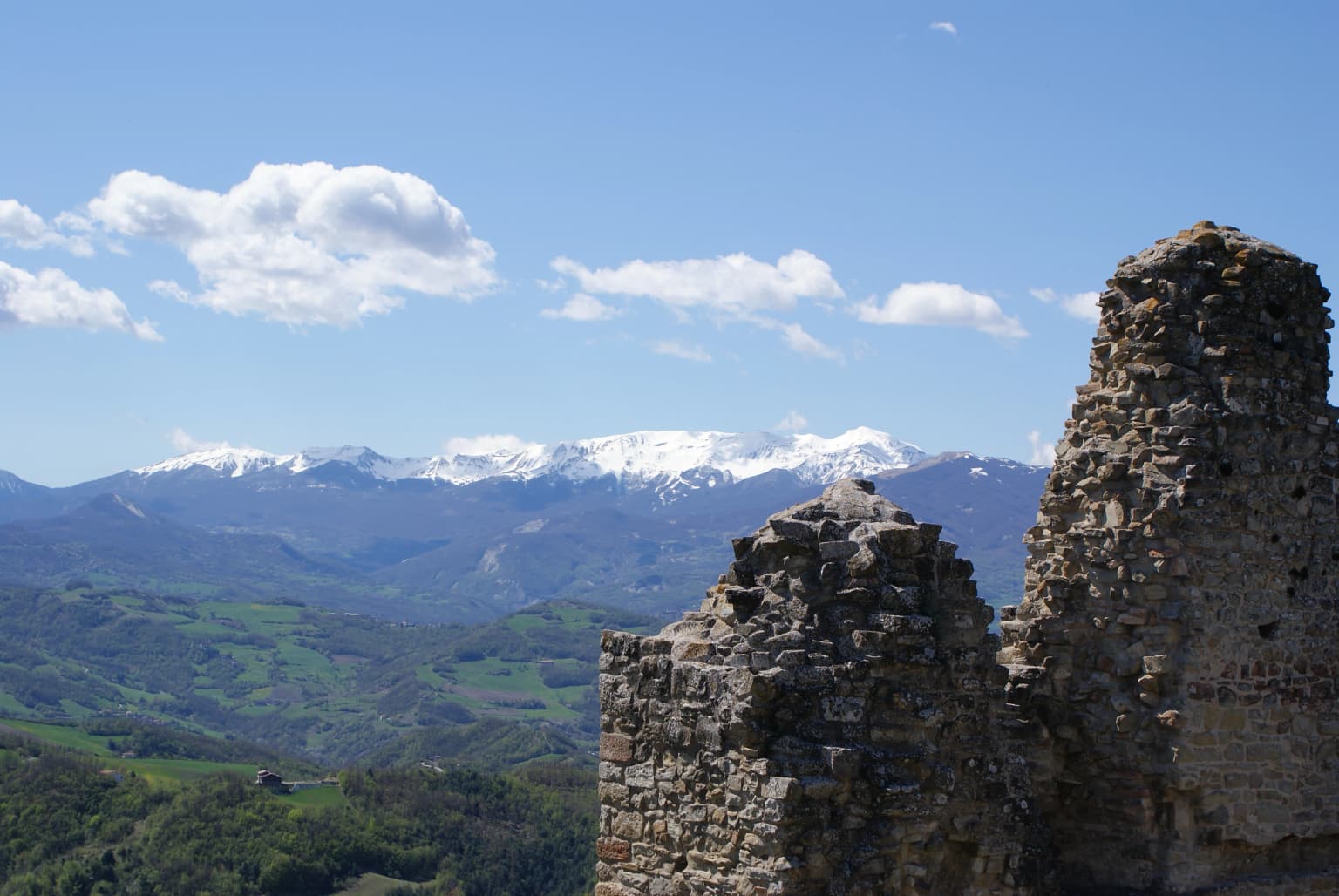
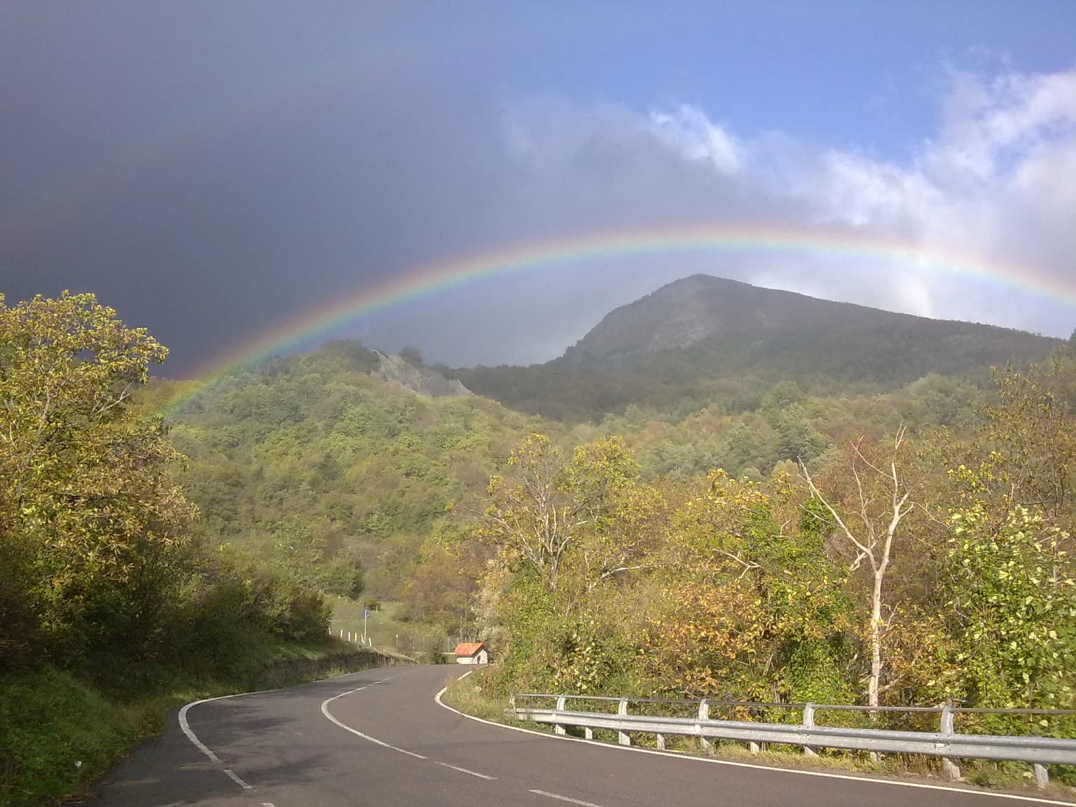
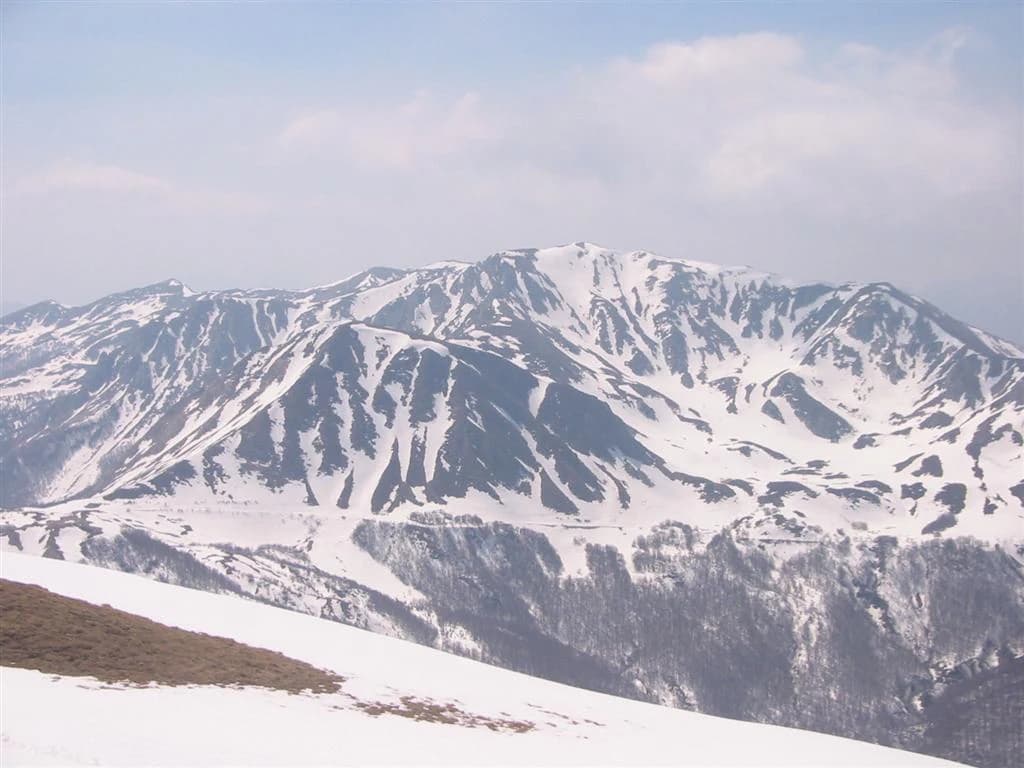
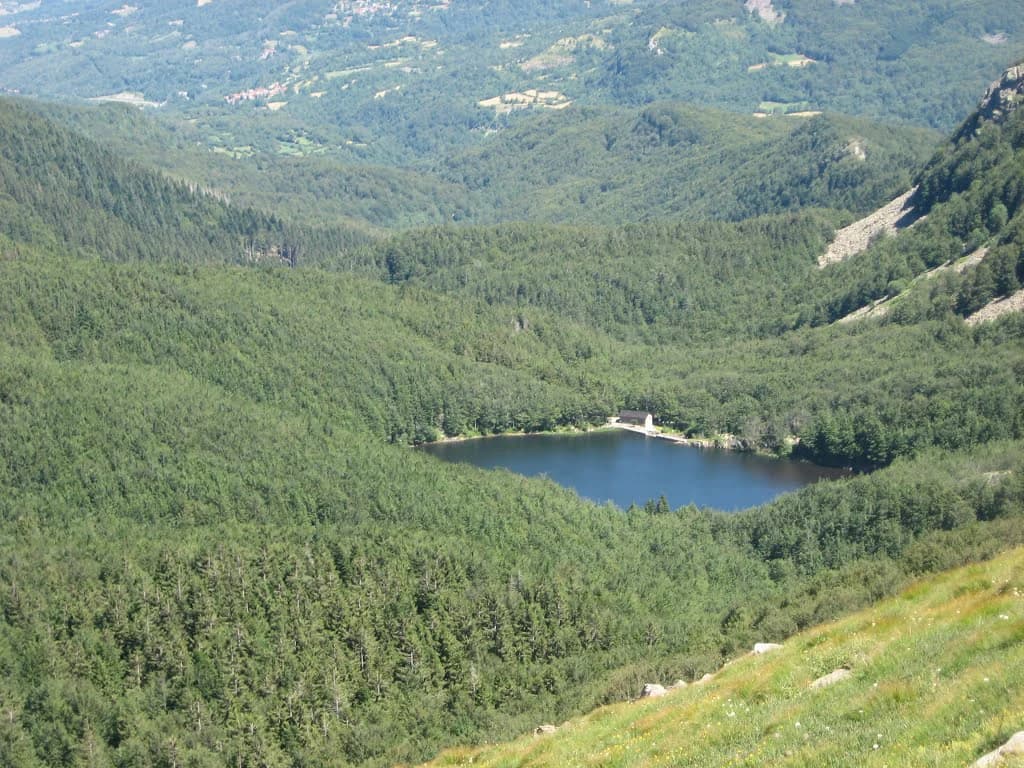
The park's landscape is defined by the high Apennine ridge and its associated landforms. The principal peaks include Monte Cusna at 2,121 meters, Monte Prado at 2,053 meters, and Alpe di Succiso at 2,017 meters, all exceeding 2,000 meters and forming a dramatic alpine skyline. Lower peaks such as Monte la Nuda, Monte Sillara, Monte Marmagna, and Monte Orsaro complete a cluster of summits exceeding 1,800 meters. On the Emilian flank, the Pietra di Bismantova presents a striking contrast to the surrounding terrain, its isolated limestone mass rising with vertical cliffs to over 1,000 meters above sea level. Glacial valleys dissect the mountain mass, carved by ice age glaciers and now carved by streams flowing toward the Po basin. Small lakes of glacial origin dot the high terrain, while waterfalls cascade down rock faces in several locations. The landscape also includes the Triassic Gypsum formations (Gessi Triassici), rare geological features in the Apennines.

Stone ruins of Carpineti Castle with green valleys and snow-covered mountains under a clear blue sky
Ruins of Carpineti Castle overlooking Mount Cusna with snow-capped peaks under a clear blue sky

Appennino Tosco-Emiliano National Park ecosystems, habitats, and plant life

The park's ecological character reflects its position at the convergence of Mediterranean and continental climate influences, creating unusual diversity in a mountain setting. The vegetation follows a clear altitudinal sequence, with chestnut forests dominating the lower slopes, giving way to extensive beech forests in the montane zone between 900 and 1,800 meters, and transitioning to alpine grasslands and bilberry moorlands at higher elevations. The Abetina Reale represents one of the few remaining white fir forests in the Apennines, with historical connections to both the Canossa and Este families. The park contains remarkable botanical diversity including endemic species found nowhere else, such as Primula apennina (the only pink-flowered primrose in the northern Apennines), Vicia cusnae, Festuca riccerii, and Brachypodium genuense. Relict species from the glacial period survive in the highest areas, including Arctic-Alpine species that persisted after the ice ages retreated. The seasonal display of daffodils (giunchiglie) in the meadows around Logarghena at around 1,000 meters creates a notable spring spectacle.

Alpine Newt (Triturus alpestris) on a light-colored rock with blurred background
Alpine Newt resting on a light-colored rock

Appennino Tosco-Emiliano National Park wildlife and species highlights

The park supports significant populations of large mammals, with the Italian wolf (Canis lupus italicus) being the most notable conservation priority. After being nearly exterminated in the early twentieth century and reduced to remnant populations in the central and southern Apennines by the 1970s, the wolf has naturally recolonized the entire Apennine chain and now maintains stable populations within the park. Red deer and roe deer occupy the forest zones, while European mouflon inhabit more open terrain. The golden eagle nests in several locations throughout the park, with approximately five breeding pairs confirmed. The birds hunt over the high-altitude grasslands and can be observed soaring in the valleys of Bràtica, Parma, Cedra, and Ozola. The snow vole represents an important glacial relict species occupying the highest grasslands around Monte Prado. Other notable species include the peregrine falcon, the alpine newt, and several bat species including the greater horseshoe bat, Blyth's myotis, and the common bent-wing bat.

Winding road with guardrail, surrounded by trees and hills, with a rainbow arching over a mountain peak under partly cloudy sky
Rainbow over Monte Ventasso viewed from SS 63 road in Busana

Appennino Tosco-Emiliano National Park conservation status and protection priorities

The park plays a crucial role in conserving Apennine biodiversity and connecting fragmented protected areas across the mountain chain. As a Category II protected area under IUCN classification, it provides formal protection to habitats and species that have faced significant pressure from human activities. The wolf population benefits from the park's protected status and from Life projects aimed at reducing conflicts between wolves and livestock husbandry. The Italian Ministry of Environment oversees the park's management through the Ente Parco, which coordinates conservation activities with regional authorities and the local communities within its boundaries. The park's position connecting to other protected areas, including four state nature reserves (Pania di Corfino, Guadine Pradaccio, Lamarossa, and Orecchiella), helps maintain ecological corridors for species requiring large territories. The presence of rare and endemic plant species, many of which are legally protected from collection, underscores the park's botanical significance.

Appennino Tosco-Emiliano National Park cultural meaning and human context

The landscape of Appennino Tosco-Emiliano bears the marks of centuries of human activity, particularly transhumant pastoralism and chestnut cultivation. The high meadows were historically grazed by large flocks of sheep, and while this activity has declined, it continues in modified form with flocks of the distinctive Massese breed still visible in some areas. The chestnut forests represent a fundamental element of the cultural landscape and traditional economy of the Apennines, though many chestnut groves have suffered from disease and abandonment. The park encompasses territories in thirteen municipalities, five in Emilia-Romagna and eight in Tuscany, each with distinct historical identities tied to the mountain environment. Traditional products of the region include Prosciutto di Parma and Parmigiano Reggiano from the Emilian side, and Miele della Lunigiana (a DOP honey) and Farro della Garfagnana (an IGP ancient grain) from the Tuscan slopes. The park administration maintains visitor centers at various locations throughout the territory, collaborating with local farmsteads, mountain shelters, and inns to provide information and accommodation.

Snow-covered mountain peaks with rocky ridges under a partly cloudy sky
Snow-covered Monte Prado viewed from Monte Cusna

Top sights and standout views in Appennino Tosco-Emiliano National Park

The summit traverse along the Apennine ridge offers spectacular views spanning both the Emilian and Tuscan slopes, with Monte Cusna and Monte Prado providing the highest points for panoramic landscapes. The beech forests of the Abetina Reale and the Bosco delle Veline represent some of the most impressive forest areas remaining in the Apennines. The spring bloom of daffodils in the Logarghena meadows creates a remarkable natural spectacle visible from the trail to Monte Orsaro and Monte Marmagna. The Pietra di Bismantova provides both geological interest and climbing opportunities, its vertical limestone walls standing apart from the surrounding terrain. The chance to observe wolves, though difficult given their elusive nature, represents a major attraction for wildlife enthusiasts visiting the park.

Panoramic view of a lake surrounded by dense green forests and mountain slopes in a national park
Lago Predaccio in Appennino Tosco-Emiliano National Park, Italy

Best time to visit Appennino Tosco-Emiliano National Park

The park can be visited throughout the year, with each season offering distinct experiences. Summer and early autumn provide the most reliable access to the high mountain trails, with warm temperatures in the valleys and cool conditions on the summits. The alpine grasslands are at their most vibrant during June and July when wildflowers bloom extensively. Autumn brings the beech forests into color and offers good wildlife viewing opportunities as animals become more active during the cooler hours. Winter transforms the park into a snow-covered alpine landscape suitable for ski touring and winter hiking, though conditions can be challenging and some trails may be impassable. Spring arrives later at higher elevations and is characterized by the dramatic display of daffodils in the subalpine meadows. The shoulder seasons of late spring and early autumn generally offer the best combination of accessible trails and pleasant weather for most visitors.

Park location guide

Geography guide, regional context, and park location map for Appennino Tosco-Emiliano National Park

Appennino Tosco-Emiliano National Park park geography, regions, and map view in Italy
Understand where Appennino Tosco-Emiliano National Park sits in Italy through a broader geographic reading of the surrounding landscape, nearby location context, and its mapped position within the national park landscape.

How Appennino Tosco-Emiliano National Park fits into Italy

Italy is a unitary parliamentary republic in Southern and Western Europe, located on the Italian Peninsula with the Alps to the north. It borders France, Switzerland, Austria, Slovenia, Vatican City, and San Marino, and shares maritime boundaries with several Mediterranean countries. The country has approximately 59 million residents and uses the Euro as its currency.

Wider geography shaping Appennino Tosco-Emiliano National Park in Italy

Italy occupies a boot-shaped peninsula in southern Europe, bordered by the Alps to the north. It shares land borders with France, Switzerland, Austria, Slovenia, Vatican City, and San Marino. The country includes the Mediterranean islands of Sicily and Sardinia, along with approximately 800 smaller islands.

Map view of Appennino Tosco-Emiliano National Park

Use this park location map to pinpoint Appennino Tosco-Emiliano National Park in Italy, understand its exact geographic position, and read its mapped placement within the surrounding landscape more clearly.

Pigeon | © OpenStreetMap contributors

Location context for Appennino Tosco-Emiliano National Park

Emilia-RomagnaTuscany

Trace the visual identity of Appennino Tosco-Emiliano through its iconic mountain peaks, lush forest habitats, and distinct protected terrain.

Appennino Tosco-Emiliano National Park: Mountain Landscapes, Forest Habitats, and Protected Area Views
Explore a curated visual collection offering detailed insights into Appennino Tosco-Emiliano National Park's diverse terrain, encompassing high Apennine summits, ancient beech forests, and glacial valleys. These images provide essential context for understanding the park's distinct ecological habitats, significant protected landscapes, and its overall mountain environment, aiding deeper geographic discovery.

Lush green forests in the foreground with rolling mountain ranges extending into the distance under a blue sky with scattered clouds

Golden eagle head in close-up showing brown feathers, yellow eye, and hooked beak

Stone ruins of Carpineti Castle with green valleys and snow-covered mountains under a clear blue sky

Alpine Newt (Triturus alpestris) on a light-colored rock with blurred background

Winding road with guardrail, surrounded by trees and hills, with a rainbow arching over a mountain peak under partly cloudy sky

Tall white fir tree with green needles and branches surrounded by other trees

Snow-covered mountain peaks with rocky ridges under a partly cloudy sky

Panoramic view of a lake surrounded by dense green forests and mountain slopes in a national park

Red-tiled roofs of residential buildings overlooking a valley with distant mountains under clear blue sky

Park atlas

Trace connected protected landscapes across the Apennine mountain range and surrounding regions of Emilia-Romagna.

Explore National Parks and Protected Areas Near Appennino Tosco-Emiliano National Park
Continue exploration of Italy's protected areas, comparing national parks and regional reserves across the Apennine Mountains beyond Appennino Tosco-Emiliano National Park. Examine diverse mountain landscapes, alpine environments, and unique forest ecosystems to understand broader conservation efforts in northern central Italy.
National parkLiguria

Cinque Terre National Park: Protected Area Geography and Mapped Landscape

Explore its regional context in Liguria, Italy.

Examine Cinque Terre National Park as a key protected area within the rugged geography of Italy's Liguria region. This dedicated atlas entry provides essential geographic context, detailing the park's mapped boundaries and its significance as a national park. Understand how this protected landscape fits within the broader regional terrain, offering a structured view for geographic discovery and map-based exploration of Italy's protected areas.

Area
22 km²
Established
1999
IUCN
V
Relief
Mountain
National parkForlì-Cesena Province

Foreste Casentinesi, Monte Falterona, Campigna National Park: A Mapped Protected Landscape in Italy

National Park within Forlì-Cesena Province, Emilia-Romagna

Foreste Casentinesi, Monte Falterona, Campigna National Park is an important protected natural area situated in Forlì-Cesena Province, northeastern Italy. As a designated national park, it serves as a key landmark for exploring mapped protected land boundaries and understanding its specific contribution to the regional geography. This page provides an atlas-centric view, highlighting the park's geographic context and its identity as a significant protected landscape for discovery and reference.

Area
368 km²
Established
1993
IUCN
II
Relief
Mountain
National parkTuscany

Arcipelago Toscano National Park: Protected Islands and Mediterranean Landscape Atlas

Explore Tuscany's unique archipelago geography and protected natural terrain.

Arcipelago Toscano National Park offers a unique perspective on Mediterranean island ecosystems through its comprehensive atlas and mapped landscape context. Covering seven main islands and surrounding marine areas off the coast of Tuscany, this park protects dramatic granite cliffs, endemic flora, and vital habitats for marine and avian life. Understand its geographic scope, protected boundaries, and the distinctive natural terrain that defines this significant Italian conservation landscape.

Area
746.63 km²
Established
1996
IUCN
II
Relief
Mixed relief
Watercolor illustration showing green mountains, forests, a river, and snow-capped peaks in the distance
National parkPiedmont

Val Grande National Park: National Park Protected Landscape in Piedmont

Explore its mapped boundaries and regional geographic context.

Val Grande National Park represents a key protected landscape within the Piedmont region of northwest Italy. This canonical page offers detailed insights into the park's designated status as a national park, its specific geographic placement, and its mapped protected boundaries. Users can navigate its atlas-level details to understand its role in the regional geography and conservation landscape, providing a structured foundation for further discovery of Italy's natural protected areas.

Area
170.21 km²
Established
1992
IUCN
II
Relief
Mountain
National parkTrentino-Alto Adige/Südtirol

Stelvio National Park National Park: Protected Landscape and Regional Geographic Context

Explore its mapped boundaries and natural terrain.

Navigate Stelvio National Park, a designated national park in Italy's Trentino-Alto Adige/Südtirol region, through a map-centric lens. This page provides critical context for understanding the park's protected landscape, its geographic position within the Alps, and its mapped terrain. Utilize MoriAtlas to grasp the park's boundaries and its place in regional geography for structured natural landscape discovery.

Established
1935
IUCN
II
Relief
Mountain
Scope
Terrestrial
Watercolor illustration of a mountainous landscape featuring a river, rolling hills, and green vegetation
National park

Mercantour National Park: Mapped Alpine Protected Landscape and Regional Geography

Explore France's dramatic Alps, park boundaries, and unique ecotones.

Mercantour National Park stands as a premier protected area within the French Alps, distinguished by its remarkable geographic diversity and ecological significance. This national park encompasses mountainous terrain featuring dramatic peaks, deep glacial valleys, and a unique ecotone where Mediterranean and Alpine ecosystems converge. MoriAtlas facilitates a detailed atlas-style exploration of Mercantour National Park, highlighting its mapped protected boundaries, varied natural landscapes, and its pivotal role in regional geography and conservation efforts.

Area
679 km²
Established
1979
IUCN
II
Visitors
800K annual
National parkProvince of Belluno

Dolomiti Bellunesi National Park: National Park, Province of Belluno Protected Landscape

Explore mapped boundaries and regional geography

This entry details Dolomiti Bellunesi National Park, a distinct national park situated within the Province of Belluno. It provides essential geographic context and protected landscape information, enabling users to understand the park's boundaries and its role within the regional terrain. Dive into the mapped features and discover the atlas-driven details of this significant Italian protected area.

Area
32 km²
Established
1988
IUCN
II
Relief
Mountain
Watercolor illustration depicting green valleys, forests, and distant mountain peaks
National park

Gran Paradiso National Park: Italy's National Park Protected Landscape Atlas

Mapped boundaries and regional geography for a key Italian protected area.

Gran Paradiso National Park is a distinct national park entity within Italy, offering rich potential for atlas-driven geographic discovery. This MoriAtlas profile focuses on its protected landscape identity, providing essential context for understanding its mapped boundaries and its role within the regional geography of Italy. Explore the structured geographic details that make Gran Paradiso National Park a valuable component of any mapped landscape analysis.

Area
703 km²
Established
1922
IUCN
II
Relief
Mountain

Common questions about visiting, size, designation, and location context for Appennino Tosco-Emiliano National Park

Appennino Tosco-Emiliano National Park FAQs for park facts, access, geography, and protected area context
Find quick answers about Appennino Tosco-Emiliano National Park, including protected-area facts, park geography, trail and visitor context, and how the park fits into its surrounding country and regional landscape.
MoriAtlas Explorer

Continue Your Protected Areas Search Across the Global Atlas

Deepen your exploration by continuing the structured search for national parks and protected areas worldwide. Utilize the comprehensive filtering capabilities to compare different conservation landscapes and refine your understanding of global park geography. Discover more about the distribution and characteristics of protected natural areas.

Global natural geography