

Mori Atlas logo
National parkBlackbraes National Park

Discover the geographic boundaries and regional context of this Australian national park.

Blackbraes National Park: Protected Area Atlas and Mapped Landscape Geography in Queensland

Blackbraes National Park represents a significant protected area within the vast geographic expanse of Queensland, Australia. This page serves as an entry point for understanding the park's unique landscape context and its role as a mapped natural reserve. Explore the protected boundaries and regional geography that define Blackbraes National Park, providing essential data for atlas-driven discovery and a clear view of its natural landscape.

ironbark woodlandselevated terrainGregory RangeFar North QueenslandAustralian national parksriver catchments

Blackbraes National Park

National park

Park overview

Structured park overview, official facts, and landscape profile for Blackbraes National Park

Blackbraes National Park park facts, protected area profile, and essential visitor context
Review the core facts for Blackbraes National Park, including designation, size, terrain, visitor scale, habitats, and operating context in one park-focused overview.

About Blackbraes National Park

Blackbraes National Park represents a significant protected area in the inland tropics of Queensland, preserving a landscape of considerable ecological and geographical distinction. The park sits at an elevation of approximately 900 metres, placing it above the surrounding tropical savanna lowlands and creating a unique microclimate that supports vegetation communities not found in the adjacent countryside. This elevation also places the park at the hydrological heart of the region, where the Gilbert-Einasleigh Rivers system has its origins in the park's upland streams and springs.

The protected area encompasses portions of two bioregions, the Einasleigh Uplands and the Gulf Plains, creating a transitional landscape that incorporates elements of both formations. The dominant vegetation type is ironbark woodland, a distinctive Australian eucalyptus formation that thrives in the cooler, moister conditions created by the park's altitude. These woodlands form a connected habitat corridor that supports populations of gray kangaroos and provides foraging and nesting sites for an abundance of bird species. The park's position within the Gregory Range adds topographic diversity, with ridgelines and valleys creating varied microhabitats throughout the protected area.

Quick facts and research context for Blackbraes National Park

Blackbraes National Park spans 520 square kilometres in Far North Queensland, positioned about 280 kilometres west of Townsville and 170 kilometres north of Hughenden. The park encompasses portions of two major bioregions, the Einasleigh Uplands and the Gulf Plains, and contains the highest peak of the Gregory Range. The Gilbert-Einasleigh River rises within the park, feeding downstream water systems. Camping is permitted near Emu Swamp from March through November, coinciding with the dry season when the landscape is most accessible.

Park context

Deeper park guide and search-rich context for Blackbraes National Park

Blackbraes National Park history, landscape, wildlife, and travel context
Explore Blackbraes National Park through its history, landscape character, ecosystems, wildlife, conservation priorities, cultural context, and seasonal travel timing in a structured park guide built for atlas discovery and search intent.

Why Blackbraes National Park stands out

Blackbraes National Park is best known for its elevated ironbark woodlands that create a stark contrast to the surrounding lower-lying savanna landscapes of inland Queensland. The park protects some of the highest terrain in the region, with the summit of the Gregory Range providing panoramic views across the bioregional transition zone. Its significance as a hydrological source area, where major river systems originate, combined with its unusual climate regime created by elevation, makes it an important ecological island within the broader tropical savanna landscape.

Blackbraes National Park history and protected-area timeline

Blackbraes National Park was established as part of Queensland's protected area network under the management of the Queensland Parks and Wildlife Service. The park protects what was historically part of the Lyndhurst pastoral lease and surrounding grazing lands, with the land reserved for conservation due to its ecological significance, watershed importance, and the distinctive character of its upland environments. While specific establishment dates are not detailed in available sources, the park's formal protection reflects a broader movement in Queensland to preserve representative examples of the state's diverse bioregions, particularly areas with unusual ecological characteristics such as the elevated ironbark landscapes of the Blackbraes region.

Blackbraes National Park landscape and geographic character

The landscape of Blackbraes National Park is defined by its position within the Gregory Range, a mountain system that rises abruptly from the surrounding savanna plains of inland Far North Queensland. The park contains the highest point of this range, providing elevated terrain that contrasts sharply with the lower-lying country typical of the region. The terrain incorporates ridgelines, slopes, and valley systems that channel water into the headwaters of the Gilbert-Einasleigh Rivers. The ironbark woodlands dominate the slopes and elevated plateaus, while the higher ridgelines and exposed areas create visual variety in the vegetation structure. The landscape's elevation of approximately 900 metres above sea level creates a noticeable topographical island effect within the broader region.

Blackbraes National Park ecosystems, habitats, and plant life

The nature of Blackbraes National Park centers on its ironbark woodland ecosystems, which flourish in the cooler, wetter conditions created by the park's elevation. These woodlands form a structurally complex habitat with tall ironbark trees creating a canopy layer that shades the understory, supporting a distinctive set of plant and animal species adapted to this microclimate. The Einasleigh Uplands and Gulf Plains bioregions overlap within the park boundaries, creating an ecological transition zone that increases biodiversity by incorporating species from both formations. The park's role as a water catchment area, feeding the Gilbert-Einasleigh Rivers system, adds ecological significance beyond its immediate boundaries, as these water systems support downstream ecosystems across considerable distances.

Blackbraes National Park wildlife and species highlights

Blackbraes National Park supports populations of gray kangaroos that inhabit the ironbark woodlands and adjacent grassy areas within the protected area. The woodland canopy and ground layer provide foraging resources and shelter for these marsupials, which are a prominent feature of the park's fauna. Beyond the kangaroos, the park is noted for an abundance of birdlife, with the ironbark woodlands and surrounding areas supporting diverse avian communities. The varied elevation and habitat structure create conditions suitable for both woodland bird species and species associated with more open environments, contributing to the park's ornithological significance within the region.

Blackbraes National Park conservation status and protection priorities

Blackbraes National Park contributes to the conservation of Queensland's bioregional diversity by protecting a portion of the transition zone between the Einasleigh Uplands and Gulf Plains. The ironbark woodlands represent a vegetation formation that is adapted to the park's unusual cooler and wetter microclimate, making this area a conservation island within the broader savanna landscape. Protection of the headwaters and catchment areas of the Gilbert-Einasleigh Rivers adds watershed conservation value, as these water systems support ecosystems and communities downstream. The park also conserves habitat for gray kangaroo populations and the diverse bird communities that inhabit the woodland environments.

Blackbraes National Park cultural meaning and human context

Blackbraes National Park lies within the traditional Country of First Nations peoples of the Etheridge region, though specific cultural heritage details are not extensively documented in available sources. The park's position within the Gregory Range and its role as a water source for major river systems would have held significance for Indigenous communities historically, as water sources and elevated terrain often feature in Aboriginal connection to Country. The subsequent pastoral use of the land prior to national park declaration represents a more recent layer of human interaction with the landscape.

Top sights and standout views in Blackbraes National Park

The elevated ironbark woodlands of Blackbraes National Park stand as the park's defining natural feature, creating a landscape that differs markedly from the surrounding tropical savanna. The highest peak of the Gregory Range offers scenic values and ecological interest, while the park's position as the source area for the Gilbert-Einasleigh Rivers highlights its importance as a hydrological catchment. The abundance of birdlife within the woodland habitats provides wildlife observation opportunities, and the presence of gray kangaroos in the park's ecosystems adds to its faunal significance. Camping access at Emu Swamp during the dry season provides the primary visitor engagement with this remote protected area.

Best time to visit Blackbraes National Park

The optimal time to visit Blackbraes National Park aligns with the dry season months from March to November, when camping near Emu Swamp is permitted and conditions are most favourable for exploring the park. During this period, the landscape is predominantly dry and accessible, with cooler temperatures at the park's elevation making outdoor activities comfortable. The wet season months from December through February typically bring higher rainfall to the region, which can affect access to some areas and create less favourable conditions for camping and bushwalking. Visitors seeking to experience the park's distinctive character should plan their trips during the dry season to take advantage of available amenities and easier navigation of the track systems.
Park location guide

Geography guide, regional context, and park location map for Blackbraes National Park

Blackbraes National Park park geography, regions, and map view in Australia
Understand where Blackbraes National Park sits in Australia through a broader geographic reading of the surrounding landscape, nearby location context, and its mapped position within the national park landscape.

How Blackbraes National Park fits into Australia

Australia is a constitutional monarchy and federal parliamentary democracy comprising six states and ten territories. With a population of nearly 28 million, it is one of the world's most urbanised countries, with most people concentrated on the eastern seaboard. The country has a high Human Development Index and is known for its cultural diversity, ancient Aboriginal heritage, and unique wildlife.

Wider geography shaping Blackbraes National Park in Australia

Australia occupies the entire Australian continent, the island of Tasmania, and numerous smaller islands. It is the world's flattest and driest inhabited continent, featuring vast deserts in the interior (the Outback), tropical rainforests along the eastern coast, and a coastline bordering the Indian and Pacific Oceans.

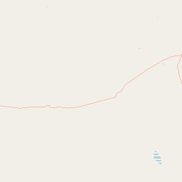
Map view of Blackbraes National Park

Use this park location map to pinpoint Blackbraes National Park in Australia, understand its exact geographic position, and read its mapped placement within the surrounding landscape more clearly.

Pigeon | © OpenStreetMap contributors

Location context for Blackbraes National Park

Far North QueenslandQueensland
Park atlas

Trace the varied protected landscapes and unique geographical features across Far North Queensland's inland regions.

Explore Nearby Protected Areas, National Parks, and Regional Geography Around Blackbraes National Park
Explore other national parks and protected areas geographically relevant to Blackbraes National Park, encompassing the unique elevated terrains, ironbark woodlands, and significant river catchments of Far North Queensland. Compare their distinct landscapes and conservation priorities to gain a broader understanding of Australia's diverse protected natural areas and regional park geography.
National parkQueensland

Porcupine Gorge National Park: Protected Area Geography and Landscape Context in Queensland

Explore mapped boundaries of this Australian national park.

Porcupine Gorge National Park serves as a focal point for understanding protected landscapes within Queensland. This entry provides detailed geographic context, focusing on the park's mapped boundaries and its natural terrain. Discover its identity as a national park and its contribution to the regional geography of northeastern Australia, essential for any atlas-focused exploration.

Area
54.1 km²
Established
1970
IUCN
II
Relief
Mountain
National parkQueensland

Kirrama National Park: Protected National Park in Queensland's Natural Landscape

Explore mapped boundaries and regional geography.

Kirrama National Park is a protected national park located in Queensland, Australia. This page details its specific geographic footprint and role as a preserved natural landscape. Users can explore its mapped boundaries and understand its contribution to the regional geography of northeastern Australia, providing context for atlas-based discovery of protected lands. Understand Kirrama National Park as a distinct protected area within the Australian conservation landscape.

Area
75.8 km²
Established
2006
IUCN
II
Relief
Mountain
National parkQueensland

Undara Volcanic National Park: Mapped Volcanic Terrain and Protected Landscape in Queensland

Explore Queensland's unique volcanic geography and national park boundaries.

Undara Volcanic National Park stands as a significant protected landscape within Queensland, Australia. This entry provides detailed geographic context, focusing on the park's notable volcanic terrain and its officially mapped boundaries. It is designed to aid users in understanding the park's unique geological features and its role within the regional atlas, highlighting the importance of protected areas for geographic discovery and landscape study.

Area
615 km²
Established
2009
IUCN
II
Relief
Mixed relief
National parkQueensland

Great Basalt Wall National Park: Queensland National Park Protected Area and Geography Explorer

Mapped boundaries and regional landscape context.

Delve into the detailed protected landscape of Great Basalt Wall National Park, a designated national park situated in Queensland, Australia. This page provides insights into its specific geographic features and mapped boundaries, offering a foundational understanding for regional park discovery. Explore how this protected area fits into the broader natural landscape and atlas of Queensland.

Area
352 km²
Established
1987
IUCN
II
Relief
Upland
National parkQueensland

Forty Mile Scrub National Park: Queensland National Park Atlas Exploration

Discover protected terrain shaped by ancient volcanic streams.

Forty Mile Scrub National Park is a national park in Queensland, Australia, recognized for its unique protected landscape defined by ancient volcanic stream systems and a rare semi-evergreen vine thicket. This isolated pocket of relict vegetation, sustained by permanent spring-fed waterways, stands as a significant ecological refuge within the Mulga Lands bioregion. Exploring this park offers a deep dive into regional geography and the mapped context of one of Australia's important conservation areas, highlighting its evolutionary significance and distinct natural terrain.

Area
63.3 km²
Established
1970
IUCN
II
Relief
Lowland
National parkQueensland

Dalrymple National Park: Queensland National Park Atlas and Protected Landscape

Explore mapped boundaries and regional park geography.

Dalrymple National Park stands as a distinct national park entity, offering valuable insights into Queensland's protected landscapes. This page serves as a gateway to understanding its specific geographic characteristics, mapped outlines, and its place within the structured atlas of Australia's natural areas. Discover the park's contribution to regional conservation and landscape context.

Area
16.6 km²
Established
1990
IUCN
II
Relief
Mixed relief
National parkQueensland

Bulleringa National Park: Queensland National Park Mapped Landscape and Regional Geography

Explore protected terrain and mapped boundaries in Queensland.

Bulleringa National Park represents a distinct protected landscape within Queensland, Australia. This national park offers critical insight into its mapped geographic features and its role within the state's protected area network. Users can explore the specific park boundaries and understand its environmental context for detailed atlas-driven discovery and a richer understanding of Australian regional geography.

Area
544 km²
Established
1992
IUCN
II
Relief
Lowland
National parkQueensland

Girringun National Park: Queensland Protected Area Atlas and Geographic Exploration

Discover mapped terrain and natural landscapes within northeastern Australia.

Girringun National Park stands as a significant protected landscape within Queensland, Australia, contributing to the nation's network of conservation areas. This park offers a focused lens through which to examine the geography of northeastern Australia, providing insights into its mapped boundaries and natural terrain. Users can leverage this park detail page to understand its role within the broader regional atlas and explore its distinct protected-area identity.

Area
1,538 km²
Established
1994
Relief
Mountain
Climate
Tropical

Common questions about visiting, size, designation, and location context for Blackbraes National Park

Blackbraes National Park FAQs for park facts, access, geography, and protected area context
Find quick answers about Blackbraes National Park, including protected-area facts, park geography, trail and visitor context, and how the park fits into its surrounding country and regional landscape.
MoriAtlas Explorer

Continue Your Protected Areas Search Across the Global Atlas

Deepen your exploration by continuing the structured search for national parks and protected areas worldwide. Utilize the comprehensive filtering capabilities to compare different conservation landscapes and refine your understanding of global park geography. Discover more about the distribution and characteristics of protected natural areas.

Global natural geography