

Mori Atlas logo
National parkGreat Basalt Wall National Park

Discover the mapped boundaries and regional context of this Australian national park.

Great Basalt Wall National Park: Queensland National Park Protected Landscape and Geography

Great Basalt Wall National Park represents a significant protected area within Queensland, Australia, offering a distinct geographic profile for atlas-based exploration. This national park provides an opportunity to study its unique protected landscape and its placement within the broader regional geography of northeastern Australia. Understanding its mapped boundaries and natural terrain context is key to appreciating its role in the national park atlas.

Volcanic LandscapeGeological HeritageSemi-Arid WildernessBasalt FormationsNorthern QueenslandProtected Area

Great Basalt Wall National Park

National park

Park overview

Structured park overview, official facts, and landscape profile for Great Basalt Wall National Park

Great Basalt Wall National Park park facts, protected area profile, and essential visitor context
Review the core facts for Great Basalt Wall National Park, including designation, size, terrain, visitor scale, habitats, and operating context in one park-focused overview.

About Great Basalt Wall National Park

Great Basalt Wall National Park protects a distinctive volcanic landscape in the Charters Towers region of Queensland. The park's defining feature is the Great Basalt Wall itself, a imposing geological formation created when the Toomba volcano erupted approximately 20,000 years ago. This relatively recent volcanic event in geological terms produced massive volumes of viscous lava that flowed across the terrain for approximately 120 kilometers before solidifying into the dark basalt formations visible today. The protected area encompasses 35,200 hectares of semi-arid landscape featuring rolling plains interrupted by dramatic basalt ridges and the distinctive dark rock formations that characterize the region. The park remains relatively inaccessible to visitors due to the nature of the terrain, with the blocky, uneven basalt lava flows creating challenging walking conditions across much of the park. The landscape represents a unique chapter in Queensland's geological history, preserving in relatively pristine condition the remains of one of the state's most significant volcanic events.

Quick facts and research context for Great Basalt Wall National Park

Great Basalt Wall National Park covers 352 square kilometers in northern Queensland, Australia. The park was established in 1987 and is managed by the Queensland Parks and Wildlife Service. The Great Basalt Wall itself represents the frozen remains of a massive lava flow from the Toomba volcano, which erupted approximately 20,000 years ago. The terrain reaches an elevation of approximately 498 meters above sea level. Despite its ecological significance, the park remains closed to the public due to the challenging nature of the viscous basalt terrain.

Park context

Deeper park guide and search-rich context for Great Basalt Wall National Park

Great Basalt Wall National Park history, landscape, wildlife, and travel context
Explore Great Basalt Wall National Park through its history, landscape character, ecosystems, wildlife, conservation priorities, cultural context, and seasonal travel timing in a structured park guide built for atlas discovery and search intent.

Why Great Basalt Wall National Park stands out

Great Basalt Wall National Park is best known for its exceptional volcanic geology and the Great Basalt Wall formation that gives the park its name. This massive lava flow created a nearly continuous wall of dark basalt rock that stretches across the landscape, serving as a dramatic reminder of Queensland's volcanic past. The Toomba eruption that formed this terrain was one of the most recent volcanic events in the region, making the park significant for understanding Australia's more recent geological history. The park preserves a rare example of a relatively young volcanic landscape in Queensland, with the preserved lava flows providing scientists with valuable insights into eruption patterns and lava behavior in the area.

Great Basalt Wall National Park history and protected-area timeline

Great Basalt Wall National Park was officially established in 1987 as part of Queensland's protected area network. The creation of the park reflected growing recognition of the geological significance of the Great Basalt Wall formation and the need to preserve this unique volcanic landscape. The Toomba eruption that created the basalt wall occurred approximately 20,000 years ago, making it one of the most recent volcanic events in Queensland. Prior to national park designation, the land served various purposes, but the establishment of formal protection ensured the preservation of this significant geological feature. The Queensland Parks and Wildlife Service assumed management responsibility for the park, implementing conservation measures to protect both the geological formations and the biodiversity they support.

Great Basalt Wall National Park landscape and geographic character

The landscape of Great Basalt Wall National Park is defined by its volcanic origins, featuring dramatic basalt formations resulting from the Toomba lava flow. The terrain consists largely of dark, blocky basalt rock that forms a nearly continuous wall-like ridge across the park. The ancient lava flows created a distinctive topography of undulating plains punctuated by rocky ridges and exposed basalt formations. The volcanic rock varies in texture and arrangement, reflecting the complex patterns of the cooling lava as it traveled across the landscape thousands of years ago. The semi-arid environment supports a landscape of scattered vegetation growing on the volcanic soils, with the dark basalt providing a stark contrast to the surrounding terrain. The park reaches an elevation of approximately 498 meters, offering subtle topographical variation across its extent.

Great Basalt Wall National Park ecosystems, habitats, and plant life

The nature of Great Basalt Wall National Park reflects the intersection of volcanic geology and semi-arid ecological systems. The park's volcanic soils and unique terrain support distinctive plant communities adapted to the basalt-derived substrates. The landscape supports a mix of woodland and shrubland vegetation adapted to the semi-arid conditions of northern Queensland. Despite the challenging terrain, the park supports ecological communities that have developed in association with the ancient lava flows, with specialized species occupying niches created by the volcanic rock formations. The combination of relatively recent volcanic origin and semi-arid climate creates a distinctive natural environment that differs from the surrounding landscapes.

Great Basalt Wall National Park wildlife and species highlights

Great Basalt Wall National Park is home to approximately 249 animal species, reflecting the biodiversity supported by this semi-arid volcanic landscape. The protected area provides habitat for various vertebrate groups including mammals, birds, and reptiles adapted to the harsh conditions of inland Queensland. The diverse terrain created by the basalt formations and the vegetation they support creates microhabitats that allow different species to occupy different parts of the landscape. While the park is not specifically known for any particular flagship species, the presence of nearly 250 animal species demonstrates the ecological value of preserving this volcanic landscape. The varied topography and vegetation patterns across the park contribute to species diversity, with different habitats supporting different assemblages of wildlife.

Great Basalt Wall National Park conservation status and protection priorities

Great Basalt Wall National Park serves an important conservation function by protecting one of Queensland's most significant volcanic geological features. The park preserves the Great Basalt Wall and associated lava flow formations in a relatively undisturbed state, allowing ongoing scientific study of volcanic processes and Queensland's geological history. The protection of this relatively young volcanic landscape represents a unique opportunity to preserve geological processes and landforms that would otherwise face pressures from development or resource extraction. The park's conservation value extends beyond geology to include the biodiversity supported by the semi-arid ecosystem, with the protected area ensuring the long-term survival of the plant and animal communities that depend on this distinctive landscape.

Great Basalt Wall National Park cultural meaning and human context

Great Basalt Wall National Park does not have significant documented cultural context in available sources. The park's establishment in 1987 and its geological focus mean that there is limited information about indigenous heritage or historical human use of the area. The landscape's challenging terrain and relative remoteness likely limited extensive historical occupation or use. Any cultural significance the area may hold for local Indigenous communities is not well-documented in the available source material.

Top sights and standout views in Great Basalt Wall National Park

The primary highlight of Great Basalt Wall National Park is the Great Basalt Wall itself, a dramatic geological formation representing one of Queensland's most recent volcanic eruptions. The nearly continuous basalt ridge created by the Toomba lava flow approximately 20,000 years ago stands as a striking reminder of the region's volcanic past. The park protects a rare example of youthful volcanic landscape in Queensland, with the preserved lava flows extending for approximately 120 kilometers and covering roughly 670 square kilometers. The combination of geological significance, biodiversity value, and relative wilderness character makes this park important for both scientific study and conservation. The park remains one of Queensland's more inaccessible protected areas due to the challenging basalt terrain, preserving a sense of wild remoteness.
Park location guide

Geography guide, regional context, and park location map for Great Basalt Wall National Park

Great Basalt Wall National Park park geography, regions, and map view in Australia
Understand where Great Basalt Wall National Park sits in Australia through a broader geographic reading of the surrounding landscape, nearby location context, and its mapped position within the national park landscape.

How Great Basalt Wall National Park fits into Australia

Australia is a constitutional monarchy and federal parliamentary democracy comprising six states and ten territories. With a population of nearly 28 million, it is one of the world's most urbanised countries, with most people concentrated on the eastern seaboard. The country has a high Human Development Index and is known for its cultural diversity, ancient Aboriginal heritage, and unique wildlife.

Wider geography shaping Great Basalt Wall National Park in Australia

Australia occupies the entire Australian continent, the island of Tasmania, and numerous smaller islands. It is the world's flattest and driest inhabited continent, featuring vast deserts in the interior (the Outback), tropical rainforests along the eastern coast, and a coastline bordering the Indian and Pacific Oceans.

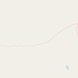
Map view of Great Basalt Wall National Park

Use this park location map to pinpoint Great Basalt Wall National Park in Australia, understand its exact geographic position, and read its mapped placement within the surrounding landscape more clearly.

Pigeon | © OpenStreetMap contributors

Location context for Great Basalt Wall National Park

Queensland
Park atlas

Explore more Queensland protected areas, tracing volcanic landscapes and semi-arid wilderness through nearby park geography.

Discover Other National Parks and Protected Areas Near Great Basalt Wall National Park
Explore other national parks and protected areas that share geographic context or similar volcanic landscapes near Great Basalt Wall National Park in Northern Queensland. This regional view provides essential atlas context, allowing you to compare protected-area spread and unique geological heritage across the surrounding Australian wilderness.
National parkQueensland

Dalrymple National Park: Queensland National Park Atlas and Protected Landscape

Explore mapped boundaries and regional park geography.

Dalrymple National Park stands as a distinct national park entity, offering valuable insights into Queensland's protected landscapes. This page serves as a gateway to understanding its specific geographic characteristics, mapped outlines, and its place within the structured atlas of Australia's natural areas. Discover the park's contribution to regional conservation and landscape context.

Area
16.6 km²
Established
1990
IUCN
II
Relief
Mixed relief
National parkQueensland

Pinnacles National Park: Queensland's Iconic Granite Formations and Protected Landscape

Explore mapped terrain and endangered species habitats.

Pinnacles National Park, situated in Queensland, Australia, is renowned for its spectacular granite batholith formations that create a distinctive rocky terrain. This national park, established in 2011, plays a crucial role in conserving the dry tropical woodland ecosystem and protecting species such as the Sannantha papillosa plant and the black-throated finch. Explore the mapped landscape of this significant protected area within the Hervey Range, offering a unique contrast of ancient geology and natural bushland.

Area
13.37 km²
Established
2011
IUCN
II
Relief
Mountain
Watercolor illustration of rolling green hills, a winding river, and distant mountains with trees and grassy areas
National parkQueensland

Paluma Range National Park: Queensland National Park Landscape & Geography

Explore protected area boundaries and regional context.

Paluma Range National Park represents a key protected landscape within Queensland, Australia, ideal for atlas-style exploration of its natural geography. Understanding this national park involves examining its mapped boundaries and appreciating its role in the regional geographic context of northeastern Australia. This entry serves as a primary point for discovering the park's protected status and its specific landscape identity within the vast Queensland region.

Area
172 km²
Established
1994
IUCN
II
Relief
Mountain
National parkQueensland

Halifax Bay Wetlands National Park: Queensland's Vital Spawning Grounds and Coastal Wetlands

Mapped protected boundaries and tropical wetland ecosystems.

Halifax Bay Wetlands National Park represents a crucial component of Queensland's protected areas, focusing on the conservation of coastal wetland and shallow marine habitats. This national park is renowned for its role as a primary spawning ground for numerous fish species of significant ecological and economic importance, such as barramundi. Its landscape, characterized by mangrove ecosystems and tidal flats, offers a distinct perspective on tropical coastal environments within the Australian geographic atlas. Discover the mapped extent and ecological value of this important marine conservation site.

Area
4.47 km²
Established
1994
IUCN
II
Relief
Lowland
National parkQueensland

Porcupine Gorge National Park: Protected Area Geography and Landscape Context in Queensland

Explore mapped boundaries of this Australian national park.

Porcupine Gorge National Park serves as a focal point for understanding protected landscapes within Queensland. This entry provides detailed geographic context, focusing on the park's mapped boundaries and its natural terrain. Discover its identity as a national park and its contribution to the regional geography of northeastern Australia, essential for any atlas-focused exploration.

Area
54.1 km²
Established
1970
IUCN
II
Relief
Mountain
National parkQueensland

Bowling Green Bay National Park: Queensland National Park and Protected Landscape Atlas

Mapped geographic context and protected area information for Queensland.

Bowling Green Bay National Park represents a distinct national park entity within the northeastern Australian state of Queensland. This page provides essential geographic context, focusing on the park's mapped boundaries and its identity as a protected landscape. Understand its regional setting and contribute to a structured atlas of Australia's natural and protected areas through detailed park geography.

Area
554 km²
Established
1977
IUCN
II
Relief
Mountain
National parkQueensland

Orpheus Island National Park: Protected Landscape in Northeastern Australia

Explore Queensland's island geography and park boundaries.

Orpheus Island National Park serves as a significant protected area within Queensland, Australia, offering a focused entry point for atlas and geographic exploration. This national park's distinct island landscape provides context for understanding protected territories in northeastern Australia, contributing detailed mapped boundaries and regional geographic information. Users interested in Australia's protected natural areas will find this an essential component for mapping landscape distributions.

Area
13 km²
Established
1960
IUCN
II
Relief
Lowland
National parkQueensland

Blackbraes National Park: National Park Atlas and Protected Landscape Exploration

Explore its mapped geography and regional context within Queensland.

Blackbraes National Park offers a distinct protected landscape within Queensland, Australia, inviting detailed atlas exploration. This page focuses on its specific geographic footprint and its mapped boundaries, providing structured data for understanding the park's place in the broader regional context. Discover the natural terrain and conservation significance of Blackbraes National Park, ideal for those seeking a deeper understanding of Australia's protected areas.

Area
520 km²
IUCN
II
Relief
Mixed relief
Access
Moderate access

Common questions about visiting, size, designation, and location context for Great Basalt Wall National Park

Great Basalt Wall National Park FAQs for park facts, access, geography, and protected area context
Find quick answers about Great Basalt Wall National Park, including protected-area facts, park geography, trail and visitor context, and how the park fits into its surrounding country and regional landscape.
MoriAtlas Explorer

Continue Your Protected Areas Search Across the Global Atlas

Deepen your exploration by continuing the structured search for national parks and protected areas worldwide. Utilize the comprehensive filtering capabilities to compare different conservation landscapes and refine your understanding of global park geography. Discover more about the distribution and characteristics of protected natural areas.

Global natural geography
