Mori Atlas logo
National parkBowling Green Bay National Park

Trace the geographic boundaries and natural terrain of this Queensland national park.

Bowling Green Bay National Park: Queensland National Park Atlas and Protected Landscape

Bowling Green Bay National Park is a significant protected area within Queensland, Australia, offering a key point of reference for atlas-based geographic discovery. This entry serves as the primary gateway to understanding the park's specific national park designation, its mapped boundaries, and its place within the diverse landscapes of northeastern Australia. Engage with detailed geographic context that supports exploration of the park's natural terrain and regional setting.

wetlandscoastal landscapebirdwatchingmountain peaksRamsar siteNorth Queensland

Bowling Green Bay National Park

National park

Park overview

Structured park overview, official facts, and landscape profile for Bowling Green Bay National Park

Bowling Green Bay National Park park facts, protected area profile, and essential visitor context
Review the core facts for Bowling Green Bay National Park, including designation, size, terrain, visitor scale, habitats, and operating context in one park-focused overview.

About Bowling Green Bay National Park

Bowling Green Bay National Park represents a remarkable ecological interface where the slopes of the Mount Elliot mountain range meet extensive coastal wetland systems along the Coral Sea. The park's 554-square-kilometre extent encompasses diverse habitats that reflect its position in the dry tropics of North Queensland. The Mount Elliot section features rugged, forested terrain rising to 1,342 metres, with numerous creek systems descending the eastern slopes. Alligator Creek stands as the most significant watercourse, cutting through the mountains to emerge near the coastal plain. The wetland component of the park arose as coastal streams deposited sediments into the calm, protected waters of Bowling Green Bay, creating one of the largest wetland complexes on Australia's eastern seaboard. This wetland system comprises an intricate mosaic of mud and sand flats, freshwater and brackish swamps, isolated rocky hills, dense mangrove forests, and inter-tidal zones. Behind the mangrove belts, distinctive salt pans stretch across the landscape, their existence reflecting the relatively low rainfall and short wet season that fails to flush accumulated salts from the soil. The park extends along the coastline from Cape Cleveland to Cape Bowling Green, incorporating the estuarine environments that serve as critical feeding and breeding grounds for coastal wildlife. The Ramsar Convention designation underscores the international importance of this coastal wetland system and the biological communities it supports.

Quick facts and research context for Bowling Green Bay National Park

Located 28 kilometres south of Townsville in Queensland, Bowling Green Bay National Park protects a coastal landscape that combines mountain terrain with extensive wetland systems. The park was established in 1977 and covers 554 square kilometres, straddling the City of Townsville and Shire of Burdekin. Mount Elliot serves as the park's dominant geographic feature, while the surrounding floodplains form one of the largest wetland systems on the east coast of Australia. The area holds Ramsar Convention status recognizing its international significance as a coastal wetland. Access is via the Bruce Highway, with camping available at Alligator Creek campground and bush camping at Cape Bowling Green.

Park context

Deeper park guide and search-rich context for Bowling Green Bay National Park

Bowling Green Bay National Park history, landscape, wildlife, and travel context
Explore Bowling Green Bay National Park through its history, landscape character, ecosystems, wildlife, conservation priorities, cultural context, and seasonal travel timing in a structured park guide built for atlas discovery and search intent.

Why Bowling Green Bay National Park stands out

Bowling Green Bay is best known for its exceptional combination of mountain and wetland ecosystems within a single protected area. The park protects one of the largest coastal wetlands on Australia's east coast, a complex system of mangroves, mudflats, salt pans, and sedge swamps that provides crucial habitat for waterbirds including brolga and magpie goose. The standout feature is Mount Elliot, a dramatic peak with forested slopes and numerous creek systems, most notably Alligator Creek with its popular swimming spot and birdwatching opportunities. The Ramsar-listed wetland is distinguished by its extensive salt pan landscape behind mangrove zones, a characteristic unique to North Queensland's low-rainfall coastal wetlands.

Bowling Green Bay National Park history and protected-area timeline

Bowling Green Bay National Park was established in 1977 through the dedication of protected area status to this significant coastal landscape in North Queensland. The park was created to protect both the mountain environments of Mount Elliot and Saddle Mountain and the extensive wetland systems of the Haughton River floodplain. Recognition of the wetland's international significance came through the Ramsar Convention on Wetlands, which designates sites of international importance based on ecological, botanical, zoological, limnological, or hydrological criteria. The Queensland Parks and Wildlife Service assumed management responsibility for the park, overseeing its protection and visitor facilities. The creation of the park reflected growing awareness in the 1970s of the need to preserve Australia's unique coastal and tropical environments, particularly the increasingly rare wetland ecosystems that support diverse birdlife and other wildlife. The park's establishment also acknowledged the cultural and ecological values of the coastline between Cape Cleveland and Cape Bowling Green, an area with connections to local indigenous communities and significant natural heritage.

Bowling Green Bay National Park landscape and geographic character

The landscape of Bowling Green Bay National Park presents a dramatic transition from mountainous terrain to coastal wetland. Mount Elliot dominates the western boundary of the park, rising 1,342 metres as a prominent peak in the Mount Elliot Range. Its slopes are heavily vegetated with open forest and woodland, and numerous creek lines descend from the summit through deeply incised valleys. Alligator Creek emerges as the most significant watercourse, creating a popular recreation area with natural swimming holes surrounded by riparian vegetation. The mountain terrain gives way to an extensive coastal plain formed by the floodplain of the Haughton River. This floodplain represents one of the largest wetland systems on Australia's east coast, covering vast areas with a distinctive combination of habitats. The wetland system includes extensive mud and sand flats that are exposed at low tide, brackish and freshwater swamps dominated by sedge vegetation, dense mangrove forests along tidal channels, and broad inter-tidal zones where terrestrial and marine environments merge. A particularly distinctive landscape feature is the salt pan ecosystem that lies behind the mangrove zones, creating wide expanses of bare salt-crusted ground that characterize North Queensland's tropical coastal wetlands. Isolated hills and rocky outcrops emerge from the otherwise flat coastal plain, adding topographic diversity to the wetland landscape.

Bowling Green Bay National Park ecosystems, habitats, and plant life

The ecological character of Bowling Green Bay National Park is defined by the intersection of tropical mountain and coastal wetland ecosystems. The wetland system represents one of the most significant coastal wetlands in eastern Australia, supporting remarkable biodiversity across its various habitat types. The mangroves form a critical buffer between terrestrial and marine environments, providing nursery habitat for fish and crustaceans while stabilizing shorelines and filtering sediments from flowing waters. The mud and sand flats exposed at low tide support abundant invertebrate communities that sustain large populations of shorebirds and waterbirds. Sedge swamps and freshwater areas provide different habitat conditions suited to particular bird species and other wildlife. The salt pan environment behind the mangroves creates an extreme habitat characterized by high salinity and periodic flooding, supporting specialized organisms adapted to these challenging conditions. The mountain forests of Mount Elliot provide a contrasting environment with different species assemblages suited to the slopes, gullies, and creek lines of the elevated terrain. This combination of diverse habitats within a single protected area creates an ecological mosaic that supports high biodiversity.

Bowling Green Bay National Park wildlife and species highlights

The wildlife of Bowling Green Bay National Park is particularly notable for its waterbird populations and the presence of species associated with both wetland and forest environments. The park provides excellent habitat for brolga, the iconic Australian crane that frequents the sedge swamps and shallow wetlands throughout the park. The magpie goose, a distinctive Australian waterbird, also finds suitable habitat in these wetland areas. The park has gained recognition as one of the best locations to observe the zitting cisticola, a small warbler that is notoriously difficult to spot elsewhere in its range. Other waterbirds abundant in the park include whistling duck, Pacific black duck, various spoonbill species, ibis, and the jabiru, also known as the black-necked stork. The estuarine and swamp areas support populations of crocodiles, both estuarine species in the tidal waters and freshwater crocodiles in the creek systems and swamps. The forest environments of Mount Elliot support their own complement of terrestrial birds, mammals, and reptiles adapted to the subtropical woodland and open forest of the slopes.

Bowling Green Bay National Park conservation status and protection priorities

Bowling Green Bay National Park holds significant conservation value as a Ramsar Convention listed site, recognizing its international importance as a coastal wetland. The Ramsar designation reflects the park's role in protecting one of the largest wetland complexes on Australia's east coast, a system that supports internationally significant populations of waterbirds and provides crucial habitat for species listed under migratory bird agreements. The park conserves a complete ecological gradient from mountain to sea, protecting the watersheds that feed the coastal wetland system and the downstream estuarine environments that depend on these freshwater inputs. The diverse array of habitats, from mangrove forest to salt pan to freshwater swamp to mountain woodland, represents a comprehensive representation of coastal tropical ecosystems in Queensland. The protected area also serves as a buffer against development pressures that could otherwise impact this sensitive coastal environment, preserving water quality in the Haughton River system and maintaining the natural processes that sustain the wetland ecosystem.

Bowling Green Bay National Park cultural meaning and human context

The landscape of Bowling Green Bay National Park lies within the traditional country of local Aboriginal peoples, and the coastal areas between Cape Cleveland and Cape Bowling Green have been important to indigenous communities for thousands of years. The wetlands and coastal waters provided abundant resources including fish, crabs, shellfish, and waterbirds that supported sustainable food gathering practices. The mountain environments of Mount Elliot held cultural significance as elevated landmarks visible across the coastal landscape. The park encompasses coastline that has historical significance for European settlement of the Townsville region, with the Bruce Highway providing long-standing access along this section of the Queensland coast. The place name Bowling Green Bay reflects the historical naming of this coast by early European explorers and settlers. Contemporary management by Queensland Parks and Wildlife Service works to balance conservation of natural values with opportunities for visitors to experience and appreciate this coastal landscape.

Top sights and standout views in Bowling Green Bay National Park

The defining highlights of Bowling Green Bay National Park include the spectacular contrast between Mount Elliot's forested peaks and the vast coastal wetlands stretching to the Coral Sea. Alligator Creek Falls and the surrounding swimming area represent the park's most accessible natural attraction, where visitors can cool off in clear mountain waters while watching birds drink and feed along the riparian corridor. The wetland system itself offers exceptional birdwatching opportunities, with the chance to see brolga and magpie goose in their natural habitat among the sedge swamps. The salt pan landscape behind the mangroves provides a distinctive visual character unique to North Queensland's tropical coast. The Ramsar-listed status confirms the wetland's international significance as a habitat for migratory waterbirds and underscores the park's conservation importance.

Best time to visit Bowling Green Bay National Park

The optimal time to experience Bowling Green Bay National Park coincides with the cooler, drier months from April to October when temperatures are more comfortable for outdoor activities and wildlife is more readily observable around remaining water sources. The winter dry season brings lower humidity and clearer skies, making this the most popular period for visitors. During the wet season from November to March, rainfall can be substantial and some access routes may become difficult, though the wetland environment transforms with increased water levels and the landscape becomes lush and green. Birdwatching can be productive throughout the year, though concentrations of waterbirds around shrinking water holes during the dry season can provide exceptional viewing opportunities. The mountain environment of Mount Elliot is generally more accessible during the cooler months when trail conditions are better and heat stress is reduced.


Park location guide

Geography guide, regional context, and park location map for Bowling Green Bay National Park

Bowling Green Bay National Park park geography, regions, and map view in Australia
Understand where Bowling Green Bay National Park sits in Australia through a broader geographic reading of the surrounding landscape, nearby location context, and its mapped position within the national park landscape.

How Bowling Green Bay National Park fits into Australia

Australia is a constitutional monarchy and federal parliamentary democracy comprising six states and ten territories. With a population of nearly 28 million, it is one of the world's most urbanised countries, with most people concentrated on the eastern seaboard. The country has a high Human Development Index and is known for its cultural diversity, ancient Aboriginal heritage, and unique wildlife.

Wider geography shaping Bowling Green Bay National Park in Australia

Australia occupies the entire Australian continent, the island of Tasmania, and numerous smaller islands. It is the world's flattest and driest inhabited continent, featuring vast deserts in the interior (the Outback), tropical rainforests along the eastern coast, and a coastline bordering the Indian and Pacific Oceans.

Map view of Bowling Green Bay National Park

Use this park location map to pinpoint Bowling Green Bay National Park in Australia, understand its exact geographic position, and read its mapped placement within the surrounding landscape more clearly.

Pigeon | © OpenStreetMap contributors

Location context for Bowling Green Bay National Park

Queensland
Park atlas

Trace the regional geography of North Queensland, comparing similar coastal wetlands, mountain ranges, and protected landscapes.

Discover Other National Parks and Protected Areas Near Bowling Green Bay National Park
After exploring Bowling Green Bay National Park, discover other national parks and protected areas, mapping the regional spread of coastal wetlands and mountain ecosystems across North Queensland. Compare these diverse conservation landscapes, from Ramsar-listed sites to rugged peaks, for deeper geographic insight into Australia's unique protected heritage.
National parkQueensland

Pinnacles National Park: Queensland's Iconic Granite Formations and Protected Landscape

Explore mapped terrain and endangered species habitats.

Pinnacles National Park, situated in Queensland, Australia, is renowned for its spectacular granite batholith formations that create a distinctive rocky terrain. This national park, established in 2011, plays a crucial role in conserving the dry tropical woodland ecosystem and protecting species such as the Sannantha papillosa plant and the black-throated finch. Explore the mapped landscape of this significant protected area within the Hervey Range, offering a unique contrast of ancient geology and natural bushland.

Area
13.37 km²
Established
2011
IUCN
II
Relief
Mountain
National parkQueensland

Orpheus Island National Park: Protected Landscape in Northeastern Australia

Explore Queensland's island geography and park boundaries.

Orpheus Island National Park serves as a significant protected area within Queensland, Australia, offering a focused entry point for atlas and geographic exploration. This national park's distinct island landscape provides context for understanding protected territories in northeastern Australia, contributing detailed mapped boundaries and regional geographic information. Users interested in Australia's protected natural areas will find this an essential component for mapping landscape distributions.

Area
13 km²
Established
1960
IUCN
II
Relief
Lowland
National parkQueensland

Halifax Bay Wetlands National Park: Queensland's Vital Spawning Grounds and Coastal Wetlands

Mapped protected boundaries and tropical wetland ecosystems.

Halifax Bay Wetlands National Park represents a crucial component of Queensland's protected areas, focusing on the conservation of coastal wetland and shallow marine habitats. This national park is renowned for its role as a primary spawning ground for numerous fish species of significant ecological and economic importance, such as barramundi. Its landscape, characterized by mangrove ecosystems and tidal flats, offers a distinct perspective on tropical coastal environments within the Australian geographic atlas. Discover the mapped extent and ecological value of this important marine conservation site.

Area
4.47 km²
Established
1994
IUCN
II
Relief
Lowland
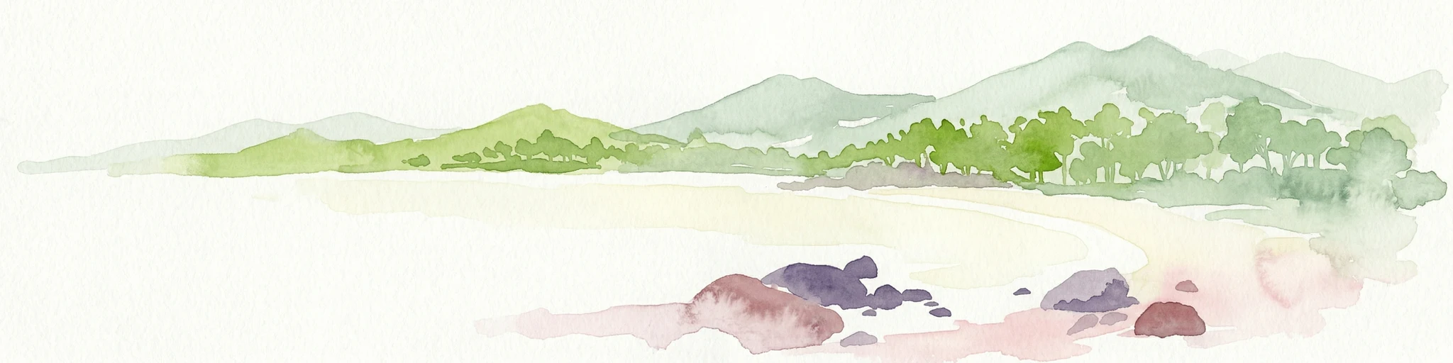
Watercolor painting showing a coastal scene with sand, rocks, green trees, and mountains in the background
National parkQueensland

Cape Upstart National Park: Dramatic Queensland Coastal Protected Landscape

Explore Indigenous heritage and mapped terrain of this national park.

Cape Upstart National Park is a distinguished protected area in North Queensland, notable for its spectacular coastal headland that serves as a landmark against the Coral Sea. This park is a testament to the enduring connection between Indigenous heritage and natural landscapes, holding profound cultural significance for the Juru People whose ancestral lands it encompasses. Users can explore its mapped boundaries, diverse terrain from sandstone ridges to coastal dunes, and the intersection of geological features with deep cultural narratives, making it a crucial point for understanding protected area identity and regional geography.

Area
84.8 km²
Established
1969
IUCN
II
Relief
Lowland
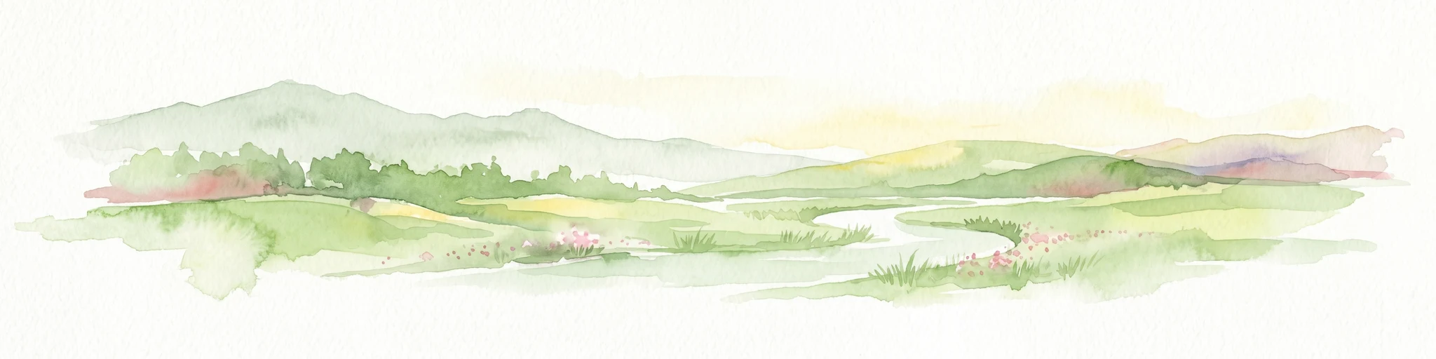
Watercolor illustration of rolling green hills, a winding river, and distant mountains with trees and grassy areas
National parkQueensland

Paluma Range National Park: Queensland National Park Landscape & Geography

Explore protected area boundaries and regional context.

Paluma Range National Park represents a key protected landscape within Queensland, Australia, ideal for atlas-style exploration of its natural geography. Understanding this national park involves examining its mapped boundaries and appreciating its role in the regional geographic context of northeastern Australia. This entry serves as a primary point for discovering the park's protected status and its specific landscape identity within the vast Queensland region.

Area
172 km²
Established
1994
IUCN
II
Relief
Mountain
National parkQueensland

Dalrymple National Park: Queensland National Park Atlas and Protected Landscape

Explore mapped boundaries and regional park geography.

Dalrymple National Park stands as a distinct national park entity, offering valuable insights into Queensland's protected landscapes. This page serves as a gateway to understanding its specific geographic characteristics, mapped outlines, and its place within the structured atlas of Australia's natural areas. Discover the park's contribution to regional conservation and landscape context.

Area
16.6 km²
Established
1990
IUCN
II
Relief
Mixed relief
National parkQueensland

Hinchinbrook Island National Park: Queensland Protected Landscape and National Park Atlas Exploration

Mapped protected area boundaries and regional Queensland geography.

Dive into the specifics of Hinchinbrook Island National Park, a notable national park situated within Queensland, Australia. This entry focuses on its protected landscape identity, providing essential details for atlas-based exploration. Users can discover its geographic significance, understand its mapped protected area status, and gain context on its natural terrain relative to the broader Queensland region and its diverse geography.

Area
399 km²
Established
1932
IUCN
II
Relief
Mountain
National parkQueensland

Brook Islands National Park: Queensland's Critically Important Seabird Habitat & Island Ecosystems

Explore mapped protected lands and tropical rainforest island ecology.

Brook Islands National Park stands as a vital protected area in Queensland, comprising three small islands dedicated to preserving critical seabird breeding habitat. The park is particularly celebrated for its immense colonies of Torresian imperial-pigeons and several tern species, showcasing a remarkable aspect of island ecology. Its lush notophyll vine forests represent a significant natural landscape, offering a distinct contrast to mainland terrain and highlighting the importance of these coastal protected lands for regional biodiversity within the Great Barrier Reef region.

Area
0.9 km²
Established
1994
IUCN
II
Relief
Lowland

Common questions about visiting, size, designation, and location context for Bowling Green Bay National Park

Bowling Green Bay National Park FAQs for park facts, access, geography, and protected area context
Find quick answers about Bowling Green Bay National Park, including protected-area facts, park geography, trail and visitor context, and how the park fits into its surrounding country and regional landscape.
MoriAtlas Explorer

Continue Your Protected Areas Search Across the Global Atlas

Deepen your exploration by continuing the structured search for national parks and protected areas worldwide. Utilize the comprehensive filtering capabilities to compare different conservation landscapes and refine your understanding of global park geography. Discover more about the distribution and characteristics of protected natural areas.

Global natural geography