

Mori Atlas logo
National parkPorcupine Gorge National Park

Understand the mapped geographic boundaries and landscape context of this Queensland protected natural area.

Porcupine Gorge National Park: A Detailed Protected Area and National Park in Queensland, Australia

Porcupine Gorge National Park represents a significant protected landscape within Queensland, Australia. This national park offers a distinct geographic focus for atlas-based exploration, allowing users to trace its mapped boundaries and comprehend its place within the state's varied terrain. Discover the natural identity of Porcupine Gorge National Park through structured data and a geographic lens, highlighting its role as a key protected area.

National ParkGeological WonderOutback QueenslandSedimentary RocksGorge and CanyonRemote Wilderness

Porcupine Gorge National Park

National park

Park overview

Structured park overview, official facts, and landscape profile for Porcupine Gorge National Park

Porcupine Gorge National Park park facts, protected area profile, and essential visitor context
Review the core facts for Porcupine Gorge National Park, including designation, size, terrain, visitor scale, habitats, and operating context in one park-focused overview.

About Porcupine Gorge National Park

Porcupine Gorge National Park represents a significant protected area within Queensland's extensive network of national parks, preserving a distinctive segment of the state's outback landscape. The park's core feature is the gorge itself, a natural incision that has been carved over geological timescales by water acting upon softer sedimentary layers, creating a landscape of considerable visual drama. The sedimentary rocks exposed in the gorge walls contain a record of ancient environments, with different strata representing distinct periods of geological time and varying depositional conditions. This makes the gorge not only a scenic asset but also a natural laboratory for geological study and interpretation. The park is situated in a region characterized by semi-arid conditions and sparse vegetation, where the contrast between the rugged terrain and the sometimes subtle green of hardy plant life creates a starkly beautiful environment. Being relatively remote from major population centers, the park offers a wilderness experience quite different from more accessible coastal and mountain parks, appealing to visitors interested in geology, photography, and the solitude of outback landscapes.

Quick facts and research context for Porcupine Gorge National Park

Porcupine Gorge National Park is located in North West Queensland, Australia, near the small town of Porcupine. The park was established in 1970 and covers an area of approximately 54.1 square kilometers. It is classified as an IUCN Category II protected area and is managed by the Queensland Parks and Wildlife Service. The defining feature of the park is the gorge itself, which exposes dramatic layers of sedimentary rock that tell a story of geological epochs. The nearest settlement of any size is Hughenden, located about 60 kilometers to the south, making this a truly remote wilderness destination.

Park context

Deeper park guide and search-rich context for Porcupine Gorge National Park

Porcupine Gorge National Park history, landscape, wildlife, and travel context
Explore Porcupine Gorge National Park through its history, landscape character, ecosystems, wildlife, conservation priorities, cultural context, and seasonal travel timing in a structured park guide built for atlas discovery and search intent.

Why Porcupine Gorge National Park stands out

Porcupine Gorge National Park is best known for its spectacular geological formations and the dramatic gorge that serves as the park's centerpiece. The sedimentary rock strata exposed along the gorge walls span hundreds of millions of years, making this a significant site for understanding the ancient geological history of outback Queensland. The visual impact of the gorge, with its layered cliffs and eroded passages, creates one of the more visually striking desert landscapes in northern Australia. The park also provides habitat for several notable wildlife species, including rock-wallabies that navigate the steep terrain, colorful parrots, waterfowl such as the Pacific black duck, and the secretive black bittern.

Porcupine Gorge National Park history and protected-area timeline

Porcupine Gorge National Park was officially established in 1970, entering Queensland's system of protected areas during a period of growing environmental awareness in Australia. The creation of the park recognized the geological and scenic significance of the gorge, ensuring that this distinctive landscape would be preserved for future generations. Management of the park falls to the Queensland Parks and Wildlife Service, which administers numerous protected areas across the state. The establishment of the park also reflected increasing recognition of the importance of preserving Australia's unique inland landscapes, which had often been overlooked in favor of more accessible coastal regions. The park's history as a protected area is intertwined with the broader development of conservation thinking in Queensland, which has seen the reservation of significant landscapes ranging from rainforests to deserts.

Porcupine Gorge National Park landscape and geographic character

The landscape of Porcupine Gorge National Park is defined by its dramatic gorge, a deep valley cut through ancient sedimentary terrain. The gorge features prominent cliff faces and exposed rock layers that reveal the geological structure of the region in vivid cross-section. The sedimentary rocks vary in color and hardness, creating a layered appearance that marks different periods of deposition and erosion. The terrain surrounding the gorge consists of undulating hills and ridges typical of North West Queensland, with vegetation adapted to the semi-arid climate. The overall impression is one of ancient, weathered landscape where geological forces have sculpted a visually compelling environment over immense periods of time. The gorge provides shade and habitat corridors that contrast with the more exposed ridgelines, creating microenvironments that support specialized plant and animal life.

Porcupine Gorge National Park ecosystems, habitats, and plant life

The natural environment of Porcupine Gorge National Park reflects the harsh but ecologically interesting conditions of inland Queensland. Vegetation in the area consists primarily of sparse grassland and hardy shrubs adapted to the semi-arid climate, with denser growth occurring along watercourses and in the gorge itself where moisture persists longer. The gorge creates a protected microenvironment that supports species more typical of wetter environments, including various birds and the rock-wallabies that inhabit the cliff faces. The park sits within a broader landscape of outback Queensland that, despite its apparent harshness, supports a surprising diversity of life adapted to seasonal variations and irregular rainfall patterns.

Porcupine Gorge National Park wildlife and species highlights

Porcupine Gorge National Park provides habitat for several wildlife species that have adapted to the rocky outcrop environment. Rock-wallabies are particularly associated with the steep, boulder-strewn terrain of the gorge, where they find shelter among the cliffs and feed on vegetation growing in the area. The park also supports birdlife including the Pacific black duck, which may be found near any permanent water sources, and the colorful red-winged parrot that adds splashes of color to the landscape. The black bittern, a more secretive bird species, also occurs in the park, typically favoring dense vegetation near water or in sheltered gorge sections. These species represent a cross-section of the wildlife that inhabits Queensland's inland rocky environments, each having evolved behaviors and adaptations suited to the challenges of the semi-arid landscape.

Porcupine Gorge National Park conservation status and protection priorities

As an IUCN Category II protected area, Porcupine Gorge National Park is managed primarily for ecosystem conservation and protection of its natural values. The park's geological significance is a key conservation consideration, as the exposed sedimentary strata provide irreplaceable records of ancient environments. The protection of the gorge and its surrounding terrain also preserves habitat for the species that depend on this specialized environment, including rock-wallabies and the various bird species present. Management by Queensland Parks and Wildlife Service ensures that the park is maintained in a natural state while allowing for appropriate public enjoyment through activities compatible with conservation objectives. The designation as a national park provides formal recognition of the area's importance within Queensland's protected area network.

Porcupine Gorge National Park cultural meaning and human context

The broader region surrounding Porcupine Gorge National Park has been inhabited by Aboriginal peoples for thousands of years, though the available source material does not provide specific detail about indigenous connections to this particular area. The landscape would have held cultural and practical significance for local Aboriginal groups, as the gorge and any permanent water sources would have provided resources important for survival in the outback environment. The area around Hughenden and further north in Queensland contains numerous sites of Aboriginal cultural importance, though specific details about Traditional Owner connections to Porcupine Gorge itself would require more detailed local sources.

Top sights and standout views in Porcupine Gorge National Park

The primary highlight of Porcupine Gorge National Park is the gorge itself, a dramatic incision through ancient sedimentary rock that offers spectacular views and geological interest. The layered rock walls reveal hundreds of millions of years of geological history in a visually compelling display. Rock-wallabies inhabit the cliff faces, providing wildlife viewing opportunities for patient observers. The remote outback setting offers a wilderness experience quite different from more accessible parks, with the solitude and silence of the interior adding to the sense of ancient landscape. The park represents one of the more accessible examples of Queensland's inland geological wonders.

Best time to visit Porcupine Gorge National Park

The best time to visit Porcupine Gorge National Park is during the cooler months of autumn and winter in Queensland, from around April through September. During this period, temperatures are more comfortable for exploring the park, particularly during the middle of the day when summer heat can be intense. The dry season typically sees clearer skies and more stable weather conditions, making it easier to access and enjoy the park's features. Visitors should be aware that the park's remote location means that supplies and services must be arranged in advance, with Hughenden serving as the nearest town for fuel, food, and basic necessities. Summer months can bring very high temperatures that make extended outdoor activity uncomfortable or risky.
Park location guide

Geography guide, regional context, and park location map for Porcupine Gorge National Park

Porcupine Gorge National Park park geography, regions, and map view in Australia
Understand where Porcupine Gorge National Park sits in Australia through a broader geographic reading of the surrounding landscape, nearby location context, and its mapped position within the national park landscape.

How Porcupine Gorge National Park fits into Australia

Australia is a constitutional monarchy and federal parliamentary democracy comprising six states and ten territories. With a population of nearly 28 million, it is one of the world's most urbanised countries, with most people concentrated on the eastern seaboard. The country has a high Human Development Index and is known for its cultural diversity, ancient Aboriginal heritage, and unique wildlife.

Wider geography shaping Porcupine Gorge National Park in Australia

Australia occupies the entire Australian continent, the island of Tasmania, and numerous smaller islands. It is the world's flattest and driest inhabited continent, featuring vast deserts in the interior (the Outback), tropical rainforests along the eastern coast, and a coastline bordering the Indian and Pacific Oceans.

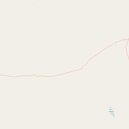
Map view of Porcupine Gorge National Park

Use this park location map to pinpoint Porcupine Gorge National Park in Australia, understand its exact geographic position, and read its mapped placement within the surrounding landscape more clearly.

Pigeon | © OpenStreetMap contributors

Location context for Porcupine Gorge National Park

Queensland
Park atlas

Explore surrounding protected areas, comparing regional park geography and Outback Queensland's unique landscapes.

Discover Nearby National Parks and Protected Areas Beyond Porcupine Gorge National Park
Browse other national parks and protected areas near Porcupine Gorge National Park, comparing their unique geological features and remote outback landscapes. This geographic comparison allows users to trace the regional spread of conservation efforts and understand connected protected landscapes across North West Queensland.
National parkQueensland

Blackbraes National Park: National Park Atlas and Protected Landscape Exploration

Explore its mapped geography and regional context within Queensland.

Blackbraes National Park offers a distinct protected landscape within Queensland, Australia, inviting detailed atlas exploration. This page focuses on its specific geographic footprint and its mapped boundaries, providing structured data for understanding the park's place in the broader regional context. Discover the natural terrain and conservation significance of Blackbraes National Park, ideal for those seeking a deeper understanding of Australia's protected areas.

Area
520 km²
IUCN
II
Relief
Mixed relief
Access
Moderate access
National parkQueensland

Moorrinya National Park: Queensland Protected Landscape Exploration

Mapped boundaries and regional park geography.

Moorrinya National Park represents a distinct protected landscape within Queensland, Australia, offering valuable insights into the region's natural terrain and geographic distribution of conservation areas. This national park serves as a focal point for understanding local environmental context and the broader atlas of Australian protected lands. Delve into the mapped outlines and regional setting to grasp its unique ecological position.

Area
326.07 km²
Established
1993
IUCN
II
Scope
Terrestrial
National parkQueensland

Great Basalt Wall National Park: Queensland National Park Protected Area and Geography Explorer

Mapped boundaries and regional landscape context.

Delve into the detailed protected landscape of Great Basalt Wall National Park, a designated national park situated in Queensland, Australia. This page provides insights into its specific geographic features and mapped boundaries, offering a foundational understanding for regional park discovery. Explore how this protected area fits into the broader natural landscape and atlas of Queensland.

Area
352 km²
Established
1987
IUCN
II
Relief
Upland
National parkQueensland

Dalrymple National Park: Queensland National Park Atlas and Protected Landscape

Explore mapped boundaries and regional park geography.

Dalrymple National Park stands as a distinct national park entity, offering valuable insights into Queensland's protected landscapes. This page serves as a gateway to understanding its specific geographic characteristics, mapped outlines, and its place within the structured atlas of Australia's natural areas. Discover the park's contribution to regional conservation and landscape context.

Area
16.6 km²
Established
1990
IUCN
II
Relief
Mixed relief
National parkQueensland

Forest Den National Park: Queensland's Protected Landscape and Geographic Atlas

Explore mapped boundaries and regional park geography.

Forest Den National Park stands as a distinct protected landscape within Queensland, Australia. This MoriAtlas entry provides detailed geographic context, focusing on the park's mapped boundaries and its position within the regional atlas. Discover the specific terrain and landscape characteristics that define this national park, aiding in structured geographic exploration and understanding its protected status within northeastern Australia.

Area
58.9 km²
Established
1991
IUCN
II
Relief
Upland
National parkQueensland

Kirrama National Park: Protected National Park in Queensland's Natural Landscape

Explore mapped boundaries and regional geography.

Kirrama National Park is a protected national park located in Queensland, Australia. This page details its specific geographic footprint and role as a preserved natural landscape. Users can explore its mapped boundaries and understand its contribution to the regional geography of northeastern Australia, providing context for atlas-based discovery of protected lands. Understand Kirrama National Park as a distinct protected area within the Australian conservation landscape.

Area
75.8 km²
Established
2006
IUCN
II
Relief
Mountain
Watercolor illustration of rolling green hills, a winding river, and distant mountains with trees and grassy areas
National parkQueensland

Paluma Range National Park: Queensland National Park Landscape & Geography

Explore protected area boundaries and regional context.

Paluma Range National Park represents a key protected landscape within Queensland, Australia, ideal for atlas-style exploration of its natural geography. Understanding this national park involves examining its mapped boundaries and appreciating its role in the regional geographic context of northeastern Australia. This entry serves as a primary point for discovering the park's protected status and its specific landscape identity within the vast Queensland region.

Area
172 km²
Established
1994
IUCN
II
Relief
Mountain
National parkQueensland

Undara Volcanic National Park: Mapped Volcanic Terrain and Protected Landscape in Queensland

Explore Queensland's unique volcanic geography and national park boundaries.

Undara Volcanic National Park stands as a significant protected landscape within Queensland, Australia. This entry provides detailed geographic context, focusing on the park's notable volcanic terrain and its officially mapped boundaries. It is designed to aid users in understanding the park's unique geological features and its role within the regional atlas, highlighting the importance of protected areas for geographic discovery and landscape study.

Area
615 km²
Established
2009
IUCN
II
Relief
Mixed relief

Common questions about visiting, size, designation, and location context for Porcupine Gorge National Park

Porcupine Gorge National Park FAQs for park facts, access, geography, and protected area context
Find quick answers about Porcupine Gorge National Park, including protected-area facts, park geography, trail and visitor context, and how the park fits into its surrounding country and regional landscape.
MoriAtlas Explorer

Continue Your Protected Areas Search Across the Global Atlas

Deepen your exploration by continuing the structured search for national parks and protected areas worldwide. Utilize the comprehensive filtering capabilities to compare different conservation landscapes and refine your understanding of global park geography. Discover more about the distribution and characteristics of protected natural areas.

Global natural geography