

Mori Atlas logo
National parkMoorrinya National Park

Mapping the boundaries and natural terrain of this Australian national park.

Moorrinya National Park: Queensland's Protected Landscape and Geographic Context

Moorrinya National Park stands as a significant protected area within northeastern Australia's Queensland region. As a designated national park, it offers a unique lens for exploring Australia's diverse geography, with a focus on its mapped protected lands and natural terrain. Understanding Moorrinya National Park provides essential context for appreciating the regional landscape and its place within the broader atlas of Australian natural areas.

semi-arid landscapeQueensland national parkAustralian outbacksavanna ecosystemsprotected areaNorth Queensland

Moorrinya National Park

National park

Park overview

Structured park overview, official facts, and landscape profile for Moorrinya National Park

Moorrinya National Park park facts, protected area profile, and essential visitor context
Review the core facts for Moorrinya National Park, including designation, size, terrain, visitor scale, habitats, and operating context in one park-focused overview.

About Moorrinya National Park

Moorrinya National Park represents a significant conservation reserve in the inland tropics of Queensland, protecting a landscape that exemplifies the transition between the mesic coastal systems of northern Australia and the arid interior. The park's establishment in 1993 reflected growing recognition that the semi-arid woodlands and grasslands of central Queensland warranted formal protection, as previous conservation efforts had focused primarily on the wetter coastal and mountain environments. The reserve encompasses flat to gently rolling terrain characterised by soils that support open savanna woodland and tussock grasslands, with vegetation patterns responding strongly to seasonal moisture availability. This region experiences a pronounced dry season each year, yet receives sufficient rainfall during the summer months to sustain productive grasslands that support diverse fauna communities. The park remains relatively unmodified by intensive agriculture compared to surrounding lands that have been cleared for livestock production, making it an important island of intact habitat in a broadly altered landscape.

Quick facts and research context for Moorrinya National Park

Moorrinya National Park is located in central-north Queensland, Australia, within the semi-arid interior region. The protected area spans 326.07 square kilometres and was established in 1993. It is classified as an IUCN Category II protected area, reflecting its national park status. The park lies at coordinates 21°23′39″S 144°56′26″E, placing it in a landscape of flat to gently undulating terrain typical of the Mitchell grass downs and cracking clay soils of inland Queensland. The region experiences hot, dry conditions for much of the year with episodic rainfall that supports ephemeral wetlands and waterholes.

Park context

Deeper park guide and search-rich context for Moorrinya National Park

Moorrinya National Park history, landscape, wildlife, and travel context
Explore Moorrinya National Park through its history, landscape character, ecosystems, wildlife, conservation priorities, cultural context, and seasonal travel timing in a structured park guide built for atlas discovery and search intent.

Why Moorrinya National Park stands out

Moorrinya National Park is recognized for protecting representative samples of semi-arid Queensland savanna and woodland ecosystems that have become increasingly rare in the region. The park preserves critical habitat for various native species in an area where extensive cattle grazing has transformed much of the surrounding landscape. Its significance lies in maintaining ecological connectivity in a pastoral-dominated region, providing refuge for species that depend on intact native vegetation communities.

Moorrinya National Park history and protected-area timeline

Moorrinya National Park was formally declared as a protected area in 1993, representing the culmination of conservation advocacy that recognised the ecological values of inland Queensland's semi-arid environments. Prior to formal protection, the land had been subject to pastoral use, though the nature and intensity of that use appears limited relative to more heavily modified portions of the region. The establishment of the park aligned with broader Queensland and national strategies to expand protected area coverage across diverse bioregions, ensuring representation of ecological communities that had previously received little formal protection. Management responsibility was assigned to the Queensland Parks and Wildlife Service, which continues to oversee the reserve under the framework applicable to Queensland's national park estate.

Moorrinya National Park landscape and geographic character

The terrain of Moorrinya National Park consists predominantly of flat to gently undulating plains typical of the cracking clay downs of inland Queensland. The landscape presents an open character with scattered trees and shrubs above a ground layer of grasses and forbs that fluctuate in abundance with seasonal rainfall patterns. The soils are predominantly heavy cracking clays that develop deep surface fissures during dry periods and become highly productive when moisture infiltrates following summer rains. Watercourses within the park are typically ephemeral, flowing only during periods of sufficient rainfall to generate runoff from the surrounding catchment. These drainage lines support denser vegetation corridors that contrast with the more open savanna surroundings, creating subtle but ecologically important habitat variation across the reserve.

Moorrinya National Park ecosystems, habitats, and plant life

The ecological character of Moorrinya National Park reflects the semi-arid savanna and woodland systems that dominate much of inland northern Australia. The park supports a mix of tree species adapted to the pronounced seasonal climate, with the canopy typically open and allowing substantial light to reach the ground layer. Grasslands dominate the understory, with species composition varying across subtle environmental gradients related to soil type and drainage. The park contributes to conservation of biodiversity in a bioregion where extensive pastoral development has reduced the extent of intact native ecosystems. While the source material provides limited specific detail on the park's full species complement, the area would be expected to support native reptiles, birds, and mammals adapted to semi-arid conditions, with fauna communities responding to the seasonal availability of resources such as flowering plants, seeding grasses, and surface water.

Moorrinya National Park wildlife and species highlights

Moorrinya National Park provides habitat for native wildlife in a region where much of the surrounding landscape has been modified by pastoral activities. The semi-arid savanna environment supports reptile species including various skinks, dragons, and goannas that are characteristic of inland Queensland. Birdlife would include parrots, cockatoos, and honeyeaters that utilise the woodland and grassland habitats, with seasonal movements influenced by resource availability. Mammals native to the region include various marsupials such as kangaroos and wallabies, along with smaller species that occupy ground layer and arboreal niches. The availability of temporary water sources following rainfall influences wildlife distribution and activity patterns across the park.

Moorrinya National Park conservation status and protection priorities

The establishment of Moorrinya National Park reflects conservation priorities in Queensland to protect representative examples of semi-arid ecosystems that had historically received less protection attention than wetter bioregions. The park contributes to the statewide protected area network by preserving an inland landscape that would otherwise be vulnerable to ongoing pastoral expansion and associated land clearing. Maintaining connectivity between remnant native habitats is particularly important in this region, where pastoral properties have fragmented the original vegetation cover. The reserve protects watercourses and riparian zones that serve as refuge areas during dry periods and provide important ecological functions within the broader catchment. Conservation management focuses on maintaining ecological integrity while acknowledging the park's pastoral history.

Moorrinya National Park cultural meaning and human context

The cultural context of Moorrinya National Park is not detailed in the available source material. The region has been subject to pastoral settlement since the nineteenth century, with European settlement transforming much of inland Queensland into grazing country. Indigenous associations with the landscape in the pre-colonial period likely involved Aboriginal groups whose traditional Country encompassed the area now within the park, though specific cultural heritage information is not provided in the available source.

Top sights and standout views in Moorrinya National Park

Moorrinya National Park offers visitors an authentic outback experience in a landscape of expansive skies and semi-arid savanna that represents a different aspect of Queensland's natural heritage compared to the wet tropics and coastal parks that attract most visitors. The park provides opportunities to observe native wildlife in relatively unmodified habitats, with the changing seasons bringing variation in landscape appearance as grasslands green following summer rains or take on golden hues during the dry season. The sense of isolation and minimal infrastructure contributes to a wilderness experience valued by those seeking to explore less-visited portions of Australia's national park system.

Best time to visit Moorrinya National Park

The optimal time to visit Moorrinya National Park coincides with the cooler months from April to September, when daytime temperatures are more moderate and comfortable for outdoor exploration. Summer months from October to March bring hot conditions typical of inland Queensland, with temperatures regularly exceeding thirty degrees Celsius and occasional thunderstorm activity that can make access difficult. The park receives most of its annual rainfall during the summer period, which can result in temporary road closures and影响 accessibility, though this seasonal precipitation also brings the landscape to life with green growth and increased wildlife activity. The dry season from May through October generally provides more reliable access and comfortable conditions for experiencing the park's natural values.
Park location guide

Geography guide, regional context, and park location map for Moorrinya National Park

Moorrinya National Park park geography, regions, and map view in Australia
Understand where Moorrinya National Park sits in Australia through a broader geographic reading of the surrounding landscape, nearby location context, and its mapped position within the national park landscape.

How Moorrinya National Park fits into Australia

Australia is a constitutional monarchy and federal parliamentary democracy comprising six states and ten territories. With a population of nearly 28 million, it is one of the world's most urbanised countries, with most people concentrated on the eastern seaboard. The country has a high Human Development Index and is known for its cultural diversity, ancient Aboriginal heritage, and unique wildlife.

Wider geography shaping Moorrinya National Park in Australia

Australia occupies the entire Australian continent, the island of Tasmania, and numerous smaller islands. It is the world's flattest and driest inhabited continent, featuring vast deserts in the interior (the Outback), tropical rainforests along the eastern coast, and a coastline bordering the Indian and Pacific Oceans.

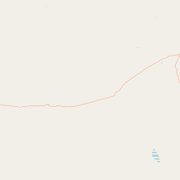
Map view of Moorrinya National Park

Use this park location map to pinpoint Moorrinya National Park in Australia, understand its exact geographic position, and read its mapped placement within the surrounding landscape more clearly.

Pigeon | © OpenStreetMap contributors

Location context for Moorrinya National Park

Queensland
Park atlas

Trace the regional spread of Queensland's semi-arid savanna and woodland conservation landscapes.

Explore Other National Parks and Protected Areas Near Moorrinya National Park, Queensland
Continue your park exploration beyond Moorrinya National Park by browsing other protected areas across North Queensland, comparing savanna ecosystems and vital dryland conservation landscapes. Explore the mapped park geography of the Australian outback, understanding how regional protected areas maintain ecological connectivity within vast pastoral zones.
National parkQueensland

Forest Den National Park: Queensland's Protected Landscape and Geographic Atlas

Explore mapped boundaries and regional park geography.

Forest Den National Park stands as a distinct protected landscape within Queensland, Australia. This MoriAtlas entry provides detailed geographic context, focusing on the park's mapped boundaries and its position within the regional atlas. Discover the specific terrain and landscape characteristics that define this national park, aiding in structured geographic exploration and understanding its protected status within northeastern Australia.

Area
58.9 km²
Established
1991
IUCN
II
Relief
Upland
National parkQueensland

Porcupine Gorge National Park: Protected Area Geography and Landscape Context in Queensland

Explore mapped boundaries of this Australian national park.

Porcupine Gorge National Park serves as a focal point for understanding protected landscapes within Queensland. This entry provides detailed geographic context, focusing on the park's mapped boundaries and its natural terrain. Discover its identity as a national park and its contribution to the regional geography of northeastern Australia, essential for any atlas-focused exploration.

Area
54.1 km²
Established
1970
IUCN
II
Relief
Mountain
National parkQueensland

Blackwood National Park: Queensland National Park Protected Landscape and Geography

Mapped protected area boundaries in northeastern Australia.

Blackwood National Park, identified as a national park, offers a distinct protected landscape within Queensland's expansive geography. This entry focuses on its specific mapped boundaries and its role as a conservation area in northeastern Australia. Users can delve into the park's geographic context, understanding its significance as part of Queensland's diverse natural heritage and contributing to a comprehensive atlas of protected lands in the region.

Area
16 km²
Established
1991
IUCN
II
Relief
Upland
National parkQueensland

Great Basalt Wall National Park: Queensland National Park Protected Area and Geography Explorer

Mapped boundaries and regional landscape context.

Delve into the detailed protected landscape of Great Basalt Wall National Park, a designated national park situated in Queensland, Australia. This page provides insights into its specific geographic features and mapped boundaries, offering a foundational understanding for regional park discovery. Explore how this protected area fits into the broader natural landscape and atlas of Queensland.

Area
352 km²
Established
1987
IUCN
II
Relief
Upland
National parkQueensland

Epping Forest National Park: Queensland National Park Protected Landscape Identity

Explore its mapped boundaries and regional geography.

Delve into the protected landscape of Epping Forest National Park, a designated national park situated in Queensland, Australia. This entry provides critical atlas-level information, focusing on the park's geographic setting and its role within the regional landscape. Understand its precise location, mapped protected area boundaries, and its contribution to the natural geography of northeastern Australia, offering a factual basis for geographic discovery.

Area
31.6 km²
Established
1971
IUCN
Ia
Relief
Lowland
National parkQueensland

Dalrymple National Park: Queensland National Park Atlas and Protected Landscape

Explore mapped boundaries and regional park geography.

Dalrymple National Park stands as a distinct national park entity, offering valuable insights into Queensland's protected landscapes. This page serves as a gateway to understanding its specific geographic characteristics, mapped outlines, and its place within the structured atlas of Australia's natural areas. Discover the park's contribution to regional conservation and landscape context.

Area
16.6 km²
Established
1990
IUCN
II
Relief
Mixed relief
National parkQueensland

Cudmore National Park: Mapped Protected Area in Queensland's Geography

Explore the unique landscape and regional context.

Cudmore National Park represents a distinct protected landscape within the vast geographic expanse of Queensland, Australia. This national park offers a valuable point of entry for understanding regional conservation efforts and the mapped distribution of protected lands. Examine its specific location within Queensland's natural terrain and appreciate its role in the broader atlas of Australian protected areas, focusing on its geographic identity and landscape features.

Area
204 km²
Established
1998
IUCN
II
Climate
Arid
National parkQueensland

Blackbraes National Park: National Park Atlas and Protected Landscape Exploration

Explore its mapped geography and regional context within Queensland.

Blackbraes National Park offers a distinct protected landscape within Queensland, Australia, inviting detailed atlas exploration. This page focuses on its specific geographic footprint and its mapped boundaries, providing structured data for understanding the park's place in the broader regional context. Discover the natural terrain and conservation significance of Blackbraes National Park, ideal for those seeking a deeper understanding of Australia's protected areas.

Area
520 km²
IUCN
II
Relief
Mixed relief
Access
Moderate access

Common questions about visiting, size, designation, and location context for Moorrinya National Park

Moorrinya National Park FAQs for park facts, access, geography, and protected area context
Find quick answers about Moorrinya National Park, including protected-area facts, park geography, trail and visitor context, and how the park fits into its surrounding country and regional landscape.
MoriAtlas Explorer

Continue Your Protected Areas Search Across the Global Atlas

Deepen your exploration by continuing the structured search for national parks and protected areas worldwide. Utilize the comprehensive filtering capabilities to compare different conservation landscapes and refine your understanding of global park geography. Discover more about the distribution and characteristics of protected natural areas.

Global natural geography