

Mori Atlas logo
National parkForest Den National Park

Discover the mapped terrain and regional park geography of this key Australian protected area.

Forest Den National Park National Park: Geographic Boundaries and Protected Landscape Context in Queensland

Forest Den National Park represents a significant protected land entity within Queensland, Australia. This page offers a detailed atlas-centric view, focusing on the park's geographic scope, mapped boundaries, and its role as a protected natural landscape. Users can explore how Forest Den National Park fits into the broader regional geography of northeastern Australia, understanding its unique place through a lens of structured discovery and mapped context.

Queensland national parksAustralian woodland ecosystemsAcacia forestsProtected areasCentral QueenslandInland Australia

Forest Den National Park

National park

Park overview

Structured park overview, official facts, and landscape profile for Forest Den National Park

Forest Den National Park park facts, protected area profile, and essential visitor context

Review the core facts for Forest Den National Park, including designation, size, terrain, visitor scale, habitats, and operating context in one park-focused overview.

About Forest Den National Park

Forest Den National Park is a Category II protected area located in the central interior of Queensland, Australia. The park was officially established in 1991 and is administered by the Queensland Parks and Wildlife Service, which manages it as part of Queensland's national park system. The park occupies an inland position at approximately 243 meters above sea level, situated in a region characterized by woodland and semi-natural vegetation communities. With an area of 58.90 square kilometers, the park represents a meaningful but concentrated example of inland Queensland conservation, focusing specifically on protecting black gidgee woodland ecosystems. The location, approximately 991 kilometers from Brisbane by road, places the park in a remote section of Queensland's interior where large contiguous areas of natural vegetation remain relatively intact. The park contributes to Queensland's protected area network by preserving a distinct woodland type that might otherwise face pressures from pastoral development or land clearing in the region.

Quick facts and research context for Forest Den National Park

Forest Den National Park is located in Queensland, Australia, roughly 991 kilometers northwest of Brisbane. The protected area spans 58.90 square kilometers and was formally established in 1991, managed by the Queensland Parks and Wildlife Service. At 243 meters above sea level, the park occupies an inland woodland setting. The park is recognized primarily for its role in preserving black gidgee (Acacia pruinocarpa) woodland communities, representing an important example of this distinctive inland Queensland ecosystem type.

Protection and recognition

Analyzing the official terrestrial conservation boundaries established in 1991

Forest Den National Park Protection Status and Designation History

Forest Den National Park represents a dedicated terrestrial protected area established in 1991 to safeguard regional forest geography. Reviewing the documented conservation framework clarifies the official management scope and baseline designation history for the preserve.

Protection details

Protection scope
Terrestrial
Designated year
1991
Park context

Deeper park guide and search-rich context for Forest Den National Park

Forest Den National Park history, landscape, wildlife, and travel context

Explore Forest Den National Park through its history, landscape character, ecosystems, wildlife, conservation priorities, cultural context, and seasonal travel timing in a structured park guide built for atlas discovery and search intent.

Why Forest Den National Park stands out

Forest Den National Park is best known for its role as a dedicated preservation area for black gidgee (Acacia pruinocarpa), a characteristic tree species of inland Queensland woodland environments. The park protects one of the significant remaining examples of black gidgee dominated woodland in the region, making it botanically notable despite its relatively modest size. This particular acacia species is recognized for its distinctive appearance and ecological adaptations to the semi-arid interior conditions of central Queensland.

Forest Den National Park history and protected-area timeline

Forest Den National Park was formally established in 1991 as part of Queensland's expanding national park network during the late twentieth century. The creation of the park reflected a growing recognition in Australian conservation policy of the need to protect representative examples of inland woodland ecosystems, particularly those dominated by distinctive species such as black gidgee. The Queensland Parks and Wildlife Service assumed management responsibility for the area upon its dedication as a national park, incorporating it into the state's system of protected areas. The establishment of Forest Den contributed to Queensland's conservation estate at a time when inland woodland communities were increasingly understood to warrant formal protection.

Forest Den National Park landscape and geographic character

The landscape of Forest Den National Park consists of inland Queensland woodland terrain at an elevation of approximately 243 meters above sea level. The terrain supports a semi-arid to sub-humid woodland character typical of central Queensland's interior regions. The park's vegetation is dominated by black gidgee (Acacia pruinocarpa), which forms the primary woodland canopy in the protected area. The landscape represents the broader inland Queensland region characterized by gently undulating terrain, scattered vegetation cover, and the distinctive silvery-green foliage of acacia woodland communities.

Forest Den National Park ecosystems, habitats, and plant life

The ecological character of Forest Den National Park is defined by its black gidgee (Acacia pruinocarpa) woodland community, which forms the dominant vegetation type within the protected area. Black gidgee is a species of acacia native to inland Queensland and neighboring regions, adapted to the environmental conditions of the semi-arid interior. The park is noted for containing a great variety of plants, representing the biodiversity associated with this particular woodland ecosystem type. The preservation of this black gidgee community constitutes the most important ecological role of the national park, protecting a vegetation association that characterizes the inland Queensland landscape.

Forest Den National Park conservation status and protection priorities

Forest Den National Park's conservation significance centers on the preservation of black gidgee (Acacia pruinocarpa) woodland, which the park was specifically established to protect. This black gidgee dominated woodland represents a distinctive inland Queensland ecosystem type that has conservation value as a representative example of central Queensland woodland communities. The protected area contributes to the broader Queensland conservation network by maintaining this particular habitat type, ensuring that the black gidgee woodland ecosystem remains represented within the state's protected area estate.

Top sights and standout views in Forest Den National Park

The primary highlight of Forest Den National Park is its role as a dedicated preserve for black gidgee (Acacia pruinocarpa) woodland, a distinctive inland Queensland vegetation community. The park provides protection for what is described as the most important role of the national park, namely the preservation of this characteristic acacia species and its associated woodland ecosystem. Visitors and researchers interested in Queensland's inland woodland environments will find Forest Den offers a representative example of black gidgee dominated vegetation in a relatively protected setting.

Best time to visit Forest Den National Park

Forest Den National Park can be visited year-round, though the cooler winter months from May through September typically offer more comfortable conditions for exploring the inland Queensland environment. Summer months can bring high temperatures to the central Queensland interior, making outdoor activity less pleasant during midday. The park's woodland setting can be appreciated in different seasons, with the black gidgee trees providing visual interest throughout the year.
Monthly climate preview

Long term temperature records and precipitation trends mapped at 267 meters elevation

Forest Den National Park Average Temperature and Weather by Month

Three decades of climate data for Forest Den National Park show average maximum temperatures exceeding 41 degrees Celsius alongside limited rainfall peaking at 3.77 millimeters per day. Comparing the full twelve-month climate profile reveals the precise timing of annual temperature fluctuations and precipitation shifts.
Annual mean24 °C
17 °C30 °C
Jan30°
Feb29°
Mar27°
Apr24°
May20°
Jun17°
Jul17°
Aug19°
Sep23°
Oct27°
Nov29°
Dec30°
Warmest month
December

29.9 °C

Coolest month
July

16.6 °C

Wettest month
February

3.8 mm/day

Driest month
July

0.3 mm/day

Park location guide

Geography guide, regional context, and park location map for Forest Den National Park

Forest Den National Park park geography, regions, and map view in Australia

Understand where Forest Den National Park sits in Australia through a broader geographic reading of the surrounding landscape, nearby location context, and its mapped position within the national park landscape.

How Forest Den National Park fits into Australia

Australia is a constitutional monarchy and federal parliamentary democracy comprising six states and ten territories. With a population of nearly 28 million, it is one of the world's most urbanised countries, with most people concentrated on the eastern seaboard. The country has a high Human Development Index and is known for its cultural diversity, ancient Aboriginal heritage, and unique wildlife.

Wider geography shaping Forest Den National Park in Australia

Australia occupies the entire Australian continent, the island of Tasmania, and numerous smaller islands. It is the world's flattest and driest inhabited continent, featuring vast deserts in the interior (the Outback), tropical rainforests along the eastern coast, and a coastline bordering the Indian and Pacific Oceans.

Map view of Forest Den National Park

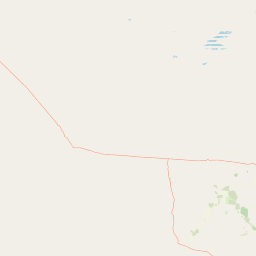
Use this park location map to pinpoint Forest Den National Park in Australia, understand its exact geographic position, and read its mapped placement within the surrounding landscape more clearly.

Pigeon | © OpenStreetMap contributors

Location context for Forest Den National Park

Queensland
Park atlas

Compare other protected areas and mapped landscapes in Central Queensland's inland woodland regions.

Discover More National Parks and Protected Areas Near Forest Den National Park

After exploring Forest Den National Park's unique black gidgee woodlands, browse other national parks and protected areas across the diverse inland Queensland region. Compare their geographic context, conservation values, and distinct landscape features to deepen your understanding of Australia's protected natural areas.
National parkQueensland
63 km away#1 closest

North

Moorrinya National Park: Queensland Protected Landscape Exploration

Mapped boundaries and regional park geography.

Moorrinya National Park represents a distinct protected landscape within Queensland, Australia, offering valuable insights into the region's natural terrain and geographic distribution of conservation areas. This national park serves as a focal point for understanding local environmental context and the broader atlas of Australian protected lands. Delve into the mapped outlines and regional setting to grasp its unique ecological position.

Area
326.07 km²
Established
1993
IUCN
II
Scope
Terrestrial
National parkQueensland
130 km away#2 closest

Southeast

Cudmore National Park: Mapped Protected Area in Queensland's Geography

Explore the unique landscape and regional context.

Cudmore National Park represents a distinct protected landscape within the vast geographic expanse of Queensland, Australia. This national park offers a valuable point of entry for understanding regional conservation efforts and the mapped distribution of protected lands. Examine its specific location within Queensland's natural terrain and appreciate its role in the broader atlas of Australian protected areas, focusing on its geographic identity and landscape features.

Area
204 km²
Established
1998
IUCN
II
Climate
Arid
National parkQueensland
About 151 km away#3 closest

East

Epping Forest National Park: Queensland National Park Protected Landscape Identity

Explore its mapped boundaries and regional geography.

Delve into the protected landscape of Epping Forest National Park, a designated national park situated in Queensland, Australia. This entry provides critical atlas-level information, focusing on the park's geographic setting and its role within the regional landscape. Understand its precise location, mapped protected area boundaries, and its contribution to the natural geography of northeastern Australia, offering a factual basis for geographic discovery.

Area
31.6 km²
Established
1971
IUCN
Ia
Relief
Lowland
National parkQueensland
About 166 km away#4 closest

Northeast

Blackwood National Park: Queensland National Park Protected Landscape and Geography

Mapped protected area boundaries in northeastern Australia.

Blackwood National Park, identified as a national park, offers a distinct protected landscape within Queensland's expansive geography. This entry focuses on its specific mapped boundaries and its role as a conservation area in northeastern Australia. Users can delve into the park's geographic context, understanding its significance as part of Queensland's diverse natural heritage and contributing to a comprehensive atlas of protected lands in the region.

Area
16 km²
Established
1991
IUCN
II
Relief
Upland
National parkQueensland
190 km away#5 closest

Southeast

Narrien Range National Park: Queensland's Protected Landscape for Geographic Exploration

Understand its mapped terrain and regional park context.

Narrien Range National Park represents a vital protected landscape within Queensland, Australia, offering a deep dive into regional geography and conservation lands. As a designated national park, it serves as a crucial point for atlas-based exploration, detailing its specific mapped boundaries and ecological context. Understanding Narrien Range National Park means appreciating its contribution to the diverse natural geography of northeastern Australia, providing a concrete example of protected land within the Sunshine State.

Area
40.2 km²
IUCN
II
Access
Access unknown
Scope
Terrestrial
National parkQueensland
About 197 km away#6 closest

North

White Mountains National Park: Queensland National Park Geographic Overview and Protected Boundaries

Mapped protected area context within northeastern Australia.

Discover White Mountains National Park, a significant protected area designated as a national park within Queensland, Australia. This entry offers a focused exploration of its geographic features, mapped boundaries, and its role within the regional landscape. Users interested in the atlas representation of conservation lands and the specific geography of Australian national parks will find detailed information here, emphasizing mapped protected areas and their national park status.

Area
1,122 km²
Established
1990
IUCN
II
Relief
Mountain
National parkQueensland
About 202 km away#7 closest

North

Porcupine Gorge National Park: Protected Area Geography and Landscape Context in Queensland

Explore mapped boundaries of this Australian national park.

Porcupine Gorge National Park serves as a focal point for understanding protected landscapes within Queensland. This entry provides detailed geographic context, focusing on the park's mapped boundaries and its natural terrain. Discover its identity as a national park and its contribution to the regional geography of northeastern Australia, essential for any atlas-focused exploration.

Area
54.1 km²
Established
1970
IUCN
II
Relief
Mountain
National parkShire of Winton
207 km away#8 closest

West

Bladensburg National Park: An Australian National Park in Shire of Winton

Explore its protected landscape and regional geographic context.

This detail view for Bladensburg National Park provides structured geographic information, highlighting its status as a national park within the Shire of Winton, Australia. Gain insight into the park's mapped boundaries and its role within the broader regional landscape. It is designed for users seeking specific atlas-level data and geographic understanding of protected natural areas.

Area
849 km²
Established
1984
IUCN
II
Relief
Upland

Common questions about visiting, size, designation, and location context for Forest Den National Park

Forest Den National Park FAQs for park facts, access, geography, and protected area context

Find quick answers about Forest Den National Park, including protected-area facts, park geography, trail and visitor context, and how the park fits into its surrounding country and regional landscape.
MoriAtlas Explorer

Continue Your Protected Areas Search Across the Global Atlas

Deepen your exploration by continuing the structured search for national parks and protected areas worldwide. Utilize the comprehensive filtering capabilities to compare different conservation landscapes and refine your understanding of global park geography. Discover more about the distribution and characteristics of protected natural areas.

Global natural geography