

Mori Atlas logo
National parkDalrymple National Park

Discover protected landscape context and regional park geography within Queensland.

Dalrymple National Park: A Mapped National Park in Queensland's Diverse Geography

Dalrymple National Park represents a significant protected area within the expansive geography of Queensland, Australia. As a national park, its mapped boundaries and landscape identity offer crucial context for understanding the region's protected lands. This dedicated page provides an atlas-style exploration, focusing on the park's geographic setting and its contribution to the natural landscape atlas of northeastern Australia.

Volcanic landscapesHistoric sitesQueenslandRiparian ecosystemsGold rush historyProtected marsupials

Dalrymple National Park

National park

Park overview

Structured park overview, official facts, and landscape profile for Dalrymple National Park

Dalrymple National Park park facts, protected area profile, and essential visitor context
Review the core facts for Dalrymple National Park, including designation, size, terrain, visitor scale, habitats, and operating context in one park-focused overview.

About Dalrymple National Park

Dalrymple National Park occupies a significant position in Queensland's protected area estate, combining geological preservation, ecological values, and historical significance within a relatively compact 16.6-square-kilometer boundary. The park's landscape reflects a complex geological history, with the Burdekin River serving as both a defining natural feature and a corridor of ecological importance. The river, as Queensland's largest, has carved a path through the ancient volcanic terrain, creating diverse habitats along its banks and influencing the distribution of vegetation and wildlife throughout the region. The park's establishment in 1990 recognized the importance of preserving both the unique geological formations, including the Toomba lava flows and Mount Keelbottom, and the cultural landscape that includes Gudjal Aboriginal heritage and colonial-era settlement remnants. The combination of ancient geological features, ongoing ecological processes, and historical layers makes Dalrymple National Park a distinctive protected area that offers insight into the natural and human history of inland Queensland.

Quick facts and research context for Dalrymple National Park

Dalrymple National Park covers 16.6 square kilometers of Queensland's interior, protecting a unique combination of volcanic geology and riparian environments at an elevation of approximately 275 meters above sea level. The park lies within the traditional territory of the Gudjal Aboriginal people and contains the historic remains of Dalrymple township, established in 1864 as the first inland town in the former British colony of North Australia. The geological significance centers on three distinct lava flow sequences, the youngest originating from the Toomba volcano eruption around 13,000 years ago, while older flows date to 1.3 million and 2.4 million years respectively. Notable geological features include Mount Keelbottom, rising 130 meters above the surrounding flatlands, and exposures of 385-million-year-old coral limestone containing Devonian fossils.

Park context

Deeper park guide and search-rich context for Dalrymple National Park

Dalrymple National Park history, landscape, wildlife, and travel context
Explore Dalrymple National Park through its history, landscape character, ecosystems, wildlife, conservation priorities, cultural context, and seasonal travel timing in a structured park guide built for atlas discovery and search intent.

Why Dalrymple National Park stands out

Dalrymple National Park is best known for its exceptional geological heritage, preserving a sequence of ancient lava flows that tell the story of volcanic activity in northern Queensland over the past 2.4 million years. The park protects the confluence of dramatically different rock formations, where 385-million-year-old coral limestone with Devonian fossils can be found alongside relatively recent basalt columns formed from volcanic eruptions. The park also preserves the physical remains of Dalrymple township, a once-thriving gold rush settlement that was established in 1864 and now stands as a testament to the boom-and-bust nature of colonial settlement in inland Australia. The Burdekin River corridor provides critical habitat for several threatened species, including the bridled nailtail wallaby, greater glider, and koala.

Dalrymple National Park history and protected-area timeline

The history of Dalrymple National Park encompasses both ancient geological processes and more recent human settlement history. The geological history is written in the volcanic rock layers that form the park's foundation, with the oldest lava flows dating back approximately 2.4 million years and the most recent eruption occurring around 13,000 years ago from the Toomba volcano. These volcanic events shaped the terrain that now characterizes the park and created the diverse substrate upon which current ecosystems have developed. The human history of the area centers on the establishment of Dalrymple township in 1864 on the west bank of the Burdekin River, becoming the first inland town in the British colony of North Australia. The settlement grew rapidly following gold discoveries on the Cape River in 1867 and the Gilbert River in 1869, expanding to include five hotels and numerous commercial establishments. However, a devastating flood in 1870 and subsequent gold discoveries at Ravenswood and Charters Towers led to the town's decline. By 1901, only the cemetery, fences, and old mine shafts remained as evidence of the once-thriving settlement. The Gudjal Aboriginal people maintain ongoing connection to this landscape, which forms part of their traditional territory.

Dalrymple National Park landscape and geographic character

The physical landscape of Dalrymple National Park is defined by the interplay between volcanic geology and the Burdekin River corridor. To the north of the river, Mount Keelbottom rises to approximately 380 meters, standing 130 meters above the surrounding flat terrain and providing a prominent topographic feature within the park. The southwestern side of the Burdekin contains three distinct lava flow sequences, each representing different volcanic events. The youngest flow originated from the Toomba volcano approximately 13,000 years ago, while the two older flows date to 1.3 million and 2.4 million years ago respectively. Streams such as Fletcher Creek and Lolworth Creek have cut deep channels through these volcanic layers, exposing the geological history in their banks. A particularly notable geological feature occurs where basalt columns line one creek bank while directly opposite, 385-million-year-old coral limestone containing Devonian fossils is exposed. This juxtaposition of ancient marine fossils with relatively recent volcanic formations illustrates the complex geological story preserved within the park.

Dalrymple National Park ecosystems, habitats, and plant life

The ecological character of Dalrymple National Park reflects the combination of riparian environments along the Burdekin River and the surrounding volcanic plains and woodlands. The river corridor provides a critical water source and habitat connecting the park's diverse geological environments, supporting vegetation communities that differ markedly from the drier surrounding terrain. The basalt-derived soils and ancient lava flow surfaces support distinct vegetation patterns, with different plant communities occurring on the various rock substrates. The landscape's complexity, combining floodplain, rocky rises, and volcanic terrain, creates diverse microhabitats that support the park's wildlife populations.

Dalrymple National Park wildlife and species highlights

Dalrymple National Park supports several notable mammal species that represent both common Australian wildlife and species of conservation concern. The bridled nailtail wallaby, a small macropod species listed as near-threatened, inhabits the park's grassy woodland and forest edges, finding shelter in the dense understory and foraging in open areas. The greater glider, a marsupial adapted to arboreal life in eucalyptus forests, occupies hollow-bearing trees in the park's woodland areas, where it feeds on eucalyptus leaves and occupies hollows in mature trees. Koalas are also present within the park, utilizing suitable eucalypt woodland for feeding and shelter. These three species represent the park's ecological significance beyond its geological values, demonstrating how the protected area serves as habitat for both widespread and more specialized fauna.

Dalrymple National Park conservation status and protection priorities

Dalrymple National Park contributes to Queensland's conservation estate by protecting a unique combination of geological and ecological values that are not well-represented in other protected areas. The park's geological significance lies in its clear demonstration of volcanic history spanning 2.4 million years, with well-preserved lava flow sequences and the associated fossil deposits in ancient limestone. The protection of Burdekin River habitat supports wildlife populations including species of conservation concern such as the bridled nailtail wallaby. The park also preserves cultural heritage, including both Gudjal Aboriginal connections to the landscape and the physical remains of colonial-era settlement. Management by the Queensland Parks and Wildlife Service ensures that these values are maintained while allowing appropriate public access to understand and appreciate this distinctive protected area.

Dalrymple National Park cultural meaning and human context

The cultural context of Dalrymple National Park encompasses both Indigenous heritage and colonial history. The land within the park and surrounding region has been traditionally owned by the Gudjal Aboriginal people, whose connection to this landscape predates European settlement by thousands of years. The Burdekin River and the volcanic terrain provided resources and spiritual significance to Indigenous communities. Following European colonization, the area became the site of Dalrymple township, established in 1864 as a service center for the developing pastoral and mining industries in inland Queensland. The town's subsequent rise and fall reflects broader patterns of colonial expansion, resource exploitation, and the transitory nature of settlements dependent on rapidly depleting mineral resources. The park now preserves this layered cultural landscape, where Indigenous heritage and colonial history intersect within a protected natural environment.

Top sights and standout views in Dalrymple National Park

The highlights of Dalrymple National Park center on its remarkable geological diversity, where volcanic lava flows of vastly different ages are exposed alongside ancient marine fossils in a relatively compact area. The visible contrast between basalt columns and 385-million-year-old Devonian fossil limestone in the creek banks provides a striking geological display. The historic township remains, including the cemetery and mine shafts, offer tangible connection to Queensland's gold rush era and the establishment of the colony's first inland town. The presence of threatened species including bridled nailtail wallaby, greater glider, and koala demonstrates the park's ecological values. The Burdekin River, as Queensland's largest, provides a defining natural feature and corridor of biodiversity through the park.

Best time to visit Dalrymple National Park

The best time to visit Dalrymple National Park is during the cooler dry season from April to October, when temperatures are more comfortable for outdoor exploration and the risk of flooding along the Burdekin River is reduced. The winter months from June to August typically offer pleasant daytime temperatures and lower humidity, making it suitable for walking through the park's geological features and examining the historic township remains. Visitors should be aware that the wet season from November to March can bring heavy rainfall to the region, potentially affecting access and increasing river levels. Regardless of season, visitors should check current conditions with Queensland Parks and Wildlife Service before traveling, as the park's remote location means that access can be affected by seasonal conditions and road maintenance schedules.
Park location guide

Geography guide, regional context, and park location map for Dalrymple National Park

Dalrymple National Park park geography, regions, and map view in Australia
Understand where Dalrymple National Park sits in Australia through a broader geographic reading of the surrounding landscape, nearby location context, and its mapped position within the national park landscape.

How Dalrymple National Park fits into Australia

Australia is a constitutional monarchy and federal parliamentary democracy comprising six states and ten territories. With a population of nearly 28 million, it is one of the world's most urbanised countries, with most people concentrated on the eastern seaboard. The country has a high Human Development Index and is known for its cultural diversity, ancient Aboriginal heritage, and unique wildlife.

Wider geography shaping Dalrymple National Park in Australia

Australia occupies the entire Australian continent, the island of Tasmania, and numerous smaller islands. It is the world's flattest and driest inhabited continent, featuring vast deserts in the interior (the Outback), tropical rainforests along the eastern coast, and a coastline bordering the Indian and Pacific Oceans.

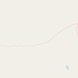
Map view of Dalrymple National Park

Use this park location map to pinpoint Dalrymple National Park in Australia, understand its exact geographic position, and read its mapped placement within the surrounding landscape more clearly.

Pigeon | © OpenStreetMap contributors

Location context for Dalrymple National Park

Queensland
Park atlas

Compare protected areas and their diverse landscapes surrounding Dalrymple National Park, exploring the broader Queensland geography.

Explore Other National Parks and Protected Areas Near Dalrymple National Park
Continue exploring beyond Dalrymple National Park by browsing other protected areas throughout Queensland, offering a direct comparison of the region's diverse conservation landscapes and significant geological formations. Explore a wider selection of national parks and reserves, mapping their geographic spread and contrasting their volcanic features, riparian ecosystems, and historic sites.
National parkQueensland

Great Basalt Wall National Park: Queensland National Park Protected Area and Geography Explorer

Mapped boundaries and regional landscape context.

Delve into the detailed protected landscape of Great Basalt Wall National Park, a designated national park situated in Queensland, Australia. This page provides insights into its specific geographic features and mapped boundaries, offering a foundational understanding for regional park discovery. Explore how this protected area fits into the broader natural landscape and atlas of Queensland.

Area
352 km²
Established
1987
IUCN
II
Relief
Upland
National parkQueensland

Pinnacles National Park: Queensland's Iconic Granite Formations and Protected Landscape

Explore mapped terrain and endangered species habitats.

Pinnacles National Park, situated in Queensland, Australia, is renowned for its spectacular granite batholith formations that create a distinctive rocky terrain. This national park, established in 2011, plays a crucial role in conserving the dry tropical woodland ecosystem and protecting species such as the Sannantha papillosa plant and the black-throated finch. Explore the mapped landscape of this significant protected area within the Hervey Range, offering a unique contrast of ancient geology and natural bushland.

Area
13.37 km²
Established
2011
IUCN
II
Relief
Mountain
Watercolor illustration of rolling green hills, a winding river, and distant mountains with trees and grassy areas
National parkQueensland

Paluma Range National Park: Queensland National Park Landscape & Geography

Explore protected area boundaries and regional context.

Paluma Range National Park represents a key protected landscape within Queensland, Australia, ideal for atlas-style exploration of its natural geography. Understanding this national park involves examining its mapped boundaries and appreciating its role in the regional geographic context of northeastern Australia. This entry serves as a primary point for discovering the park's protected status and its specific landscape identity within the vast Queensland region.

Area
172 km²
Established
1994
IUCN
II
Relief
Mountain
National parkQueensland

Halifax Bay Wetlands National Park: Queensland's Vital Spawning Grounds and Coastal Wetlands

Mapped protected boundaries and tropical wetland ecosystems.

Halifax Bay Wetlands National Park represents a crucial component of Queensland's protected areas, focusing on the conservation of coastal wetland and shallow marine habitats. This national park is renowned for its role as a primary spawning ground for numerous fish species of significant ecological and economic importance, such as barramundi. Its landscape, characterized by mangrove ecosystems and tidal flats, offers a distinct perspective on tropical coastal environments within the Australian geographic atlas. Discover the mapped extent and ecological value of this important marine conservation site.

Area
4.47 km²
Established
1994
IUCN
II
Relief
Lowland
National parkQueensland

Bowling Green Bay National Park: Queensland National Park and Protected Landscape Atlas

Mapped geographic context and protected area information for Queensland.

Bowling Green Bay National Park represents a distinct national park entity within the northeastern Australian state of Queensland. This page provides essential geographic context, focusing on the park's mapped boundaries and its identity as a protected landscape. Understand its regional setting and contribute to a structured atlas of Australia's natural and protected areas through detailed park geography.

Area
554 km²
Established
1977
IUCN
II
Relief
Mountain
National parkQueensland

Orpheus Island National Park: Protected Landscape in Northeastern Australia

Explore Queensland's island geography and park boundaries.

Orpheus Island National Park serves as a significant protected area within Queensland, Australia, offering a focused entry point for atlas and geographic exploration. This national park's distinct island landscape provides context for understanding protected territories in northeastern Australia, contributing detailed mapped boundaries and regional geographic information. Users interested in Australia's protected natural areas will find this an essential component for mapping landscape distributions.

Area
13 km²
Established
1960
IUCN
II
Relief
Lowland
National parkQueensland

Hinchinbrook Island National Park: Queensland Protected Landscape and National Park Atlas Exploration

Mapped protected area boundaries and regional Queensland geography.

Dive into the specifics of Hinchinbrook Island National Park, a notable national park situated within Queensland, Australia. This entry focuses on its protected landscape identity, providing essential details for atlas-based exploration. Users can discover its geographic significance, understand its mapped protected area status, and gain context on its natural terrain relative to the broader Queensland region and its diverse geography.

Area
399 km²
Established
1932
IUCN
II
Relief
Mountain
Watercolor painting showing a coastal scene with sand, rocks, green trees, and mountains in the background
National parkQueensland

Cape Upstart National Park: Dramatic Queensland Coastal Protected Landscape

Explore Indigenous heritage and mapped terrain of this national park.

Cape Upstart National Park is a distinguished protected area in North Queensland, notable for its spectacular coastal headland that serves as a landmark against the Coral Sea. This park is a testament to the enduring connection between Indigenous heritage and natural landscapes, holding profound cultural significance for the Juru People whose ancestral lands it encompasses. Users can explore its mapped boundaries, diverse terrain from sandstone ridges to coastal dunes, and the intersection of geological features with deep cultural narratives, making it a crucial point for understanding protected area identity and regional geography.

Area
84.8 km²
Established
1969
IUCN
II
Relief
Lowland

Common questions about visiting, size, designation, and location context for Dalrymple National Park

Dalrymple National Park FAQs for park facts, access, geography, and protected area context
Find quick answers about Dalrymple National Park, including protected-area facts, park geography, trail and visitor context, and how the park fits into its surrounding country and regional landscape.
MoriAtlas Explorer

Continue Your Protected Areas Search Across the Global Atlas

Deepen your exploration by continuing the structured search for national parks and protected areas worldwide. Utilize the comprehensive filtering capabilities to compare different conservation landscapes and refine your understanding of global park geography. Discover more about the distribution and characteristics of protected natural areas.

Global natural geography
