Mori Atlas logo
National parkBunya Mountains National Park

Trace the mapped boundaries and unique regional terrain of this important national park.

Bunya Mountains National Park: Queensland Protected Landscape and Geographic Atlas

Bunya Mountains National Park stands as a key protected landscape within Queensland, offering a distinct point of focus for geographic exploration. This national park's presence contributes to the mapped mosaic of natural areas in northeastern Australia, providing structured data for understanding its place within the regional geography. Discover the park's specific terrain and its contribution to the wider atlas of protected lands in Queensland, Australia.

Subtropical RainforestAncient TreesIndigenous HeritageNational ParkMountain LandscapeBirdwatching

Bunya Mountains National Park

National park

Park overview

Structured park overview, official facts, and landscape profile for Bunya Mountains National Park

Bunya Mountains National Park park facts, protected area profile, and essential visitor context
Review the core facts for Bunya Mountains National Park, including designation, size, terrain, visitor scale, habitats, and operating context in one park-focused overview.

About Bunya Mountains National Park

Bunya Mountains National Park protects a distinctive mountain environment in South Queensland that stands apart from the surrounding pastoral and agricultural landscapes. The range rises as an isolated island of forest and grassland, creating ecological communities found nowhere else in the region. The park's significance extends beyond its ecological values to encompass one of Australia's most important Indigenous cultural landscapes. For thousands of years, the Bunya Mountains served as a gathering place for multiple Aboriginal nations, who came to participate in the Bunya Feasts, a major cultural event that brought together people from across Queensland and New South Wales. These gatherings involved not only ceremonial activities but also the harvest of native yams and other bush foods, all managed through sophisticated fire-based land management practices. The grassland balds that characterize the mountaintops are a direct product of this Indigenous fire regime, which prevented the encroachment of forest and maintained open grassy areas. European settlement from the 1860s brought logging to the mountain, with red cedar, bunya pine, and hoop pine extraction occurring before the area was protected in 1908. Today the park offers visitors the opportunity to experience this unique blend of ancient natural heritage and continuing Indigenous cultural significance through its network of walking tracks, campgrounds, and scenic lookouts.

Quick facts and research context for Bunya Mountains National Park

Bunya Mountains National Park covers approximately 117 square kilometers in the South Burnett and Toowoomba regions of Queensland, Australia. The park was established in 1908, making it the second-oldest national park in Queensland. The mountains reach elevations that create a mild climate distinct from the surrounding lowlands, supporting unique ecosystems including subtropical rainforest, tall open forest, and the distinctive grassy balds. The park contains the most westerly populations of many rainforest-dwelling species in southern Queensland and supports more than 200 species of frogs and reptiles alongside over 120 recorded bird species. The area was historically important for timber extraction, with sawmills operating from 1883 until 1961.

Park context

Deeper park guide and search-rich context for Bunya Mountains National Park

Bunya Mountains National Park history, landscape, wildlife, and travel context
Explore Bunya Mountains National Park through its history, landscape character, ecosystems, wildlife, conservation priorities, cultural context, and seasonal travel timing in a structured park guide built for atlas discovery and search intent.

Why Bunya Mountains National Park stands out

The park is best known for its ancient bunya pine forests, which represent the largest remaining population of this species anywhere in the world. The bunya pines, some reaching 25 metres in height and 600 years of age, create a distinctive and majestic landscape. Equally significant is the network of grassy balds, which are natural clearings maintained through centuries of Indigenous fire management. These balds support higher biodiversity than the surrounding rainforests and represent one of the most important cultural landscapes in Australia. The mountains also contain permanent waterfalls and support populations of rare species including the black-breasted button-quail, considered to have its largest population in the park.

Bunya Mountains National Park history and protected-area timeline

The Bunya Mountains have been a place of profound Indigenous significance for thousands of years, serving as the largest pan-tribal gathering site in eastern Australia. The Wakka Wakka, Jarowair, and Barrumgum peoples are the traditional owners of this landscape and maintained it through sophisticated traditional land-use management practices for millennia. The Bunya Feasts drew thousands of people from surrounding tribes across Queensland and New South Wales, making these mountains one of the most important cultural landscapes on the continent. Archaeological evidence, including core samples, confirms that Indigenous fire management was practiced on the Bunya Mountains as far back as 9,000 years during the Holocene era. This practice of fire-stick farming created what is considered the largest estate management system in Australia, performed through ceremonies for land control, food production, and native yam harvesting. The arrival of European settlers in the 1860s brought dramatic change, with Indigenous communities forcibly removed from the mountains and logging operations commencing for red cedar, bunya pine, and hoop pine. The Bunya Sawmill opened in 1883, and by 1908 the 9,112-hectare national park was declared, making it Queensland's second-oldest national park. An additional area was donated by WA Russell MLA in 1927. Timber extraction continued within the park until approximately 1917, with the last sawmill closing in 1961. The first walking tracks were constructed in 1939, beginning the park's transition from a timber resource to a protected area and visitor destination.

Bunya Mountains National Park landscape and geographic character

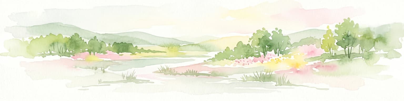
The Bunya Mountains form a prominent mountain range rising from the South Burnett agricultural region of Queensland. The park encompasses the mountain's ridgelines, steep valleys, and rocky outcrops, creating a landscape dramatically different from the surrounding plains. The topography is characterized by steep and winding mountain roads that access the higher elevations where the park's most distinctive features are found. The most unusual landscape elements are the grassy balds, approximately 100 natural clearings scattered throughout the mountain forests. These balds are caused by a combination of bushfires and geological conditions, particularly where slabs of unfractured basalt create conditions where root penetration is impossible, leaving patches of open grassland within the forest. The park contains permanent waterfalls, including Tim Shea Falls and Mcgrory Falls, which add to the scenic character of the mountain environment. Views from the mountain lookouts extend across the South Burnett region and Darling Downs, taking in the surrounding agricultural landscapes that contrast sharply with the forested mountain slopes.

Bunya Mountains National Park ecosystems, habitats, and plant life

The Bunya Mountains support a remarkable diversity of ecosystems within a relatively small area. The park contains the most westerly extent of subtropical rainforest in southern Queensland, a vegetation type that is unusual so far inland and at this latitude. The rainforests contain pockets of ferns, vines, stinging nettles, and wild raspberries, with canopy species including white beech and silky oaks. The bunya pine forests represent a dominant feature of the landscape, with some trees estimated to be up to 600 years old and reaching 25 metres in height. These conifers are among the oldest living organisms in the Australian subtropics. The grassy balds, while seemingly unusual in a forest environment, are of significant ecological importance, supporting higher biodiversity than the dense rainforests because they provide habitat for bird and rodent species not found in the forest interior. Grass trees growing on Mount Kiangarow can reach nearly 5 metres tall, with some individuals being several hundred years old. The interaction between fire-maintained grasslands and fire-excluded rainforest creates a complex mosaic of habitats that supports the park's exceptional species diversity.

Bunya Mountains National Park wildlife and species highlights

Bunya Mountains National Park supports an exceptional diversity of wildlife, with more than 200 species of frogs and reptiles recorded within its boundaries. The marsupial fauna includes pademelons, rock wallabies, swamp wallabies, and an endemic subspecies of ringtail possum found only on the mountain peaks. Reptile species present include blue-tongued skinks, land mullets, carpet snakes, red-bellied black snakes, and brown tree snakes. The avifauna is particularly notable, with 120 species recorded in the park. The mountains are part of an Important Bird Area containing what is thought to be the largest population of the black-breasted button-quail. Significant bird species include wedge-tailed eagles, peregrine falcons, grey goshawks, brown cuckoo-doves, rose robins, eastern yellow robins, large-billed gerygones, and Australian golden whistlers. The park supports the most westerly populations of many rainforest-dwelling species including green catbirds, regent bowerbirds, paradise riflebirds, eastern whipbirds, noisy pittas, and Australian logrunners. More commonly observed species include pied currawongs, laughing kookaburras, Australian king parrots, crimson rosellas, sulphur-crested cockatoos, and brush turkeys.

Bunya Mountains National Park conservation status and protection priorities

Bunya Mountains National Park represents a significant conservation area due to its unique combination of ancient landscapes, rare species, and Indigenous cultural values. The park protects the largest remaining population of bunya pines in the world, a species of ancient evolutionary origin. The grassy balds, created and maintained through thousands of years of Indigenous fire management, are considered a cultural landscape and an enduring symbol of Indigenous land management. These grasslands have persisted since the last ice age but are now under threat due to the cessation of traditional burning practices since the 1860s. Current conservation efforts focus on restoring the fire regime through prescribed burning, with 27 percent of unburnt balds being burnt for the first time in many years during the late 1990s. There have been difficulties in recovering some balds that have developed established forest canopies due to decades of non-burning. Management priorities include partnerships with traditional owners using traditional fire techniques, supported by Australian Government initiatives such as the Working on Country Program. The park's significance as an Important Bird Area and its role in protecting the most westerly populations of many rainforest species add to its conservation importance.

Bunya Mountains National Park cultural meaning and human context

The Bunya Mountains hold exceptional significance in Indigenous Australian heritage as the largest pan-tribal gathering place in eastern Australia. The Wakka Wakka, Jarowair, and Barrumgum peoples are the traditional owners of this landscape and have inhabited and managed the mountains through traditional land-use management for thousands of years. The Bunya Feasts were major cultural events that would see thousands of people from surrounding tribes in Queensland and New South Wales gather in the mountains. These gatherings involved ceremonial activities, food harvesting, and social exchange across Indigenous nations. The grasslands, known as balds, are a product of Indigenous fire management practices, created through a technique called fire-stick farming or fire farming. Recent core samples have confirmed Indigenous fire management was occurring on the Bunya Mountains as far back as 9,000 years during the Holocene. This fire management created what is considered the largest estate management system in the world in the Australian continent, performed for ceremonies, land control, food production, and native yam harvesting. The balds remain culturally significant to Indigenous people today, representing an enduring symbol of their land management practices. The arrival of European settlers ended active Indigenous fire management from the 1860s onwards.

Top sights and standout views in Bunya Mountains National Park

The ancient bunya pine forests represent the park's most distinctive natural feature, with some trees reaching 600 years of age and 25 metres in height. The network of grassy balds, created through thousands of years of Indigenous fire management, is both a remarkable landscape feature and an important conservation priority. The park supports exceptional biodiversity including over 120 bird species and more than 200 frog and reptile species. Permanent waterfalls such as Tim Shea Falls and Mcgrory Falls add to the scenic appeal. The mountain's cultural significance as a historic Indigenous gathering place equals its ecological importance. The park's establishment in 1908 makes it Queensland's second-oldest national park, reflecting its long-recognized conservation and cultural value.

Best time to visit Bunya Mountains National Park

The Bunya Mountains can be visited throughout the year, though the climate is cooler than the surrounding lowlands due to the elevation. The mild climate means morning and evening temperatures are noticeably lower than daytime highs, and visitors should be prepared for these temperature variations. The park is accessible via steep and winding roads from Toowoomba, Kingaroy, Dalby, and Nanango, though travel with caravans and trailers is not recommended due to the gradients. The best time to experience the park's natural features depends on what visitors hope to see; the wetter months typically bring enhanced waterfall flows, while the drier periods may offer better conditions for walking and wildlife viewing. The campgrounds at Dandabah, Burton's Well, and Westcott, along with the visitor information centre, provide facilities for those wishing to explore the network of walking tracks and scenic lookouts.

Park location guide

Geography guide, regional context, and park location map for Bunya Mountains National Park

Bunya Mountains National Park park geography, regions, and map view in Australia
Understand where Bunya Mountains National Park sits in Australia through a broader geographic reading of the surrounding landscape, nearby location context, and its mapped position within the national park landscape.

How Bunya Mountains National Park fits into Australia

Australia is a constitutional monarchy and federal parliamentary democracy comprising six states and ten territories. With a population of nearly 28 million, it is one of the world's most urbanised countries, with most people concentrated on the eastern seaboard. The country has a high Human Development Index and is known for its cultural diversity, ancient Aboriginal heritage, and unique wildlife.

Wider geography shaping Bunya Mountains National Park in Australia

Australia occupies the entire Australian continent, the island of Tasmania, and numerous smaller islands. It is the world's flattest and driest inhabited continent, featuring vast deserts in the interior (the Outback), tropical rainforests along the eastern coast, and a coastline bordering the Indian and Pacific Oceans.

Map view of Bunya Mountains National Park

Use this park location map to pinpoint Bunya Mountains National Park in Australia, understand its exact geographic position, and read its mapped placement within the surrounding landscape more clearly.

Pigeon | © OpenStreetMap contributors

Location context for Bunya Mountains National Park

QueenslandSouth Burnett RegionToowoomba Region
Park atlas

Compare mapped geography and diverse protected landscapes across the surrounding South Queensland region.

Explore National Parks and Protected Areas Adjacent to Bunya Mountains National Park
Discover additional national parks and protected areas in Queensland, expanding your exploration beyond Bunya Mountains National Park into a wider regional context. Users can browse these adjacent conservation landscapes to understand the varied ecosystems and geographic features across South Burnett.
National parkToowoomba Region

The Palms National Park: National Park Atlas and Mapped Landscape Context

Explore its geographic setting and protected area features.

The Palms National Park, designated as a national park within Australia's Toowoomba Region, provides a specific focus for atlas-based geographic exploration. Understanding this protected area involves appreciating its unique landscape characteristics and its position within the broader regional geography. This entry highlights the park's mapped boundaries and its role in a structured overview of natural landscapes, offering valuable context for researchers and explorers focused on protected lands.

Area
0.124 km²
Established
1950
IUCN
II
Relief
Lowland
National parkAustralia

Mount Binga National Park National Park: Protecting South East Queensland's Araucarian Vine Forest

Explore its mapped terrain and significant protected landscape.

Mount Binga National Park stands as a crucial protected area within Australia's South East Queensland, recognized for its conservation of the rare araucarian vine forest. This national park preserves a significant remnant of this vital vegetation type, offering habitat to multiple endangered species. Delve into its specific geographic context and the importance of its mapped boundaries for maintaining regional biodiversity and ecological integrity.

Area
10.667 km²
Established
2006
IUCN
II
Relief
Lowland
National parkQueensland

Crows Nest National Park: Queensland National Park Geography and Protected Landscape Atlas

Mapped terrain and protected area context within Queensland, Australia.

Delve into Crows Nest National Park, a protected natural area recognized as a national park within Queensland. This destination offers detailed geographic context, focusing on its mapped boundaries and landscape identity. Understand its place within the regional geography of northeastern Australia and explore its significance as a component of the country's protected lands network.

Area
17.9 km²
Established
1967
IUCN
II
Relief
Mountain
National parkQueensland

Beeron National Park: National Park Protected Landscape in Queensland, Australia

Discover its geographic context and mapped natural terrain.

Delve into Beeron National Park, a distinct national park located in Queensland, Australia. This protected area offers a unique perspective on the region's natural landscapes and geography. By examining its mapped boundaries and its position within Queensland's broader environmental context, users can gain a structured understanding of this significant conservation landscape.

Area
70.5 km²
Established
2009
IUCN
II
Scope
Terrestrial
Watercolor illustration of a river flowing through a valley with trees and hills under a light sky
National parkQueensland

Ravensbourne National Park: Queensland's National Park Landscape and Geographic Atlas

Mapped protected area features and regional context.

Ravensbourne National Park is a key protected landscape in Queensland, Australia, offering valuable insights for geographic exploration and atlas-style discovery. As a designated national park, it contributes to the understanding of regional terrain and protected land distribution within northeastern Australia. This page focuses on the park's specific geographic identity and its role in the mapped natural areas of Queensland, providing a clear point of reference for its protected landscape characteristics.

Area
4.4 km²
Established
1922
IUCN
II
Relief
Mountain
National parkQueensland

Lockyer National Park: A National Park in Queensland with Distinct Geographic Features

Mapped protected boundaries and regional landscape context.

Lockyer National Park is a designated national park providing a critical lens into Queensland's varied geography and protected landscapes. Understanding this park involves exploring its mapped boundaries and how it contributes to the region's natural terrain. This entry serves as a detailed geographic context for Lockyer National Park, supporting structured discovery within the Australian state's protected areas.

Area
110.79 km²
Established
2008
IUCN
II
Relief
Mountain
National parkQueensland

Conondale National Park: Protected Landscape, Biodiversity Hotspot in Queensland

Explore its rugged terrain and subtropical rainforests within regional geography.

Conondale National Park offers a deep dive into protected landscape geography, showcasing one of Queensland's most significant subtropical rainforests and a vital refuge for numerous threatened species. Its rugged mountain terrain, deep gorges, and scenic creeks form a pronounced catchment divide, contributing essential regional context. This national park is an Important Bird Area and a stronghold for threatened amphibians and the Richmond birdwing butterfly, highlighting its ecological significance.

Area
368 km²
Established
1977
IUCN
II
Relief
Mountain
National parkQueensland

Bellthorpe National Park: Queensland National Park Map and Protected Landscape

Explore mapped boundaries and regional geography in Queensland.

Bellthorpe National Park is a key protected area within Queensland, Australia, offering a unique lens for understanding regional geography and landscape context. As a national park, its mapped boundaries are integral to appreciating its role in the Sunshine State's protected lands. This resource provides detailed atlas-style information, focusing on the geographic identity and mapped terrain that define Bellthorpe National Park for focused exploration.

Area
75.5 km²
IUCN
II
Relief
Highland
Access
Moderate access

Common questions about visiting, size, designation, and location context for Bunya Mountains National Park

Bunya Mountains National Park FAQs for park facts, access, geography, and protected area context
Find quick answers about Bunya Mountains National Park, including protected-area facts, park geography, trail and visitor context, and how the park fits into its surrounding country and regional landscape.
MoriAtlas Explorer

Continue Your Protected Areas Search Across the Global Atlas

Deepen your exploration by continuing the structured search for national parks and protected areas worldwide. Utilize the comprehensive filtering capabilities to compare different conservation landscapes and refine your understanding of global park geography. Discover more about the distribution and characteristics of protected natural areas.

Global natural geography