Mori Atlas logo
National parkRavensbourne National Park

Explore the mapped boundaries and regional geography of this Australian national park.

Ravensbourne National Park: Queensland's Protected Landscape Identity and Geographic Context

Ravensbourne National Park represents a significant protected area within the diverse geography of Queensland, Australia. This national park offers a distinct perspective on the state's natural landscapes, providing users with detailed insights into its mapped boundaries and regional context. Understanding Ravensbourne National Park's place within Queensland's broader geographic atlas is crucial for appreciating its unique environmental significance and exploring its protected land features.

RainforestWet Eucalypt ForestGreat Dividing RangeBirdwatchingQueenslandSouth East Queensland
Stylized illustration showing a waterfall cascading into a canyon with trees, a river, and colorful rock formations under a sunny sky

Ravensbourne National Park

National park

Park overview

Structured park overview, official facts, and landscape profile for Ravensbourne National Park

Ravensbourne National Park park facts, protected area profile, and essential visitor context
Review the core facts for Ravensbourne National Park, including designation, size, terrain, visitor scale, habitats, and operating context in one park-focused overview.

About Ravensbourne National Park

Ravensbourne National Park occupies a mountainous position on the Great Dividing Range in South East Queensland, roughly midway between Toowoomba and the Brisbane River valley. The park's setting on the range divide places it within the catchments of two significant river systems, the Brisbane River to the east and Lockyer Creek to the west. This geographical positioning gives the park ecological importance beyond its modest 4.40 square kilometre extent, as it preserves forest communities that function as wildlife corridors and watershed protection in a landscape largely converted to farming. The vegetation patterns within the park reflect the underlying geology and soil conditions. The western and south-western portions feature red soils that support rainforest communities, where eucalypts occur alongside palms, vines and ferns in a more shaded, moisture-retentive environment. The eastern sections of the park have sandy soils that foster open eucalypt forest, a more sunlight-dominated community with a different structure and species composition. This mosaic of forest types within such a small area demonstrates how soil and aspect combine to create habitat diversity. The park's proximity to the Lockyer Valley, which has experienced extensive land clearing for agriculture and rural settlement, makes the preserved forest remnants within the park increasingly valuable as reference ecosystems and biodiversity refuges.

Quick facts and research context for Ravensbourne National Park

Ravensbourne National Park covers 4.40 square kilometres along the Great Dividing Range in South East Queensland. The park was established in 1922 and is managed by the Queensland Parks and Wildlife Service. Two distinct vegetation communities occur within the park, shaped by differing soil types: red soils in the western and south-western sections support rainforest containing eucalypts, palms, vines and ferns, while sandy soils in the eastern areas support open eucalypt forest. The park lies within the catchment areas of both the Brisbane River and Lockyer Creek systems.

Park context

Deeper park guide and search-rich context for Ravensbourne National Park

Ravensbourne National Park history, landscape, wildlife, and travel context
Explore Ravensbourne National Park through its history, landscape character, ecosystems, wildlife, conservation priorities, cultural context, and seasonal travel timing in a structured park guide built for atlas discovery and search intent.

Why Ravensbourne National Park stands out

Ravensbourne National Park is best known for preserving small but significant remnants of rainforest and wet eucalypt forest on the Great Dividing Range, ecosystems that once covered this part of Queensland but have been extensively cleared for agriculture. The park's exceptional bird diversity, with over 80 species recorded, makes it notable for birdwatching and ornithological interest. Its location on the range overlooking the Lockyer Valley provides scenic values, while the presence of four rare or threatened species underscores its conservation importance despite the park's modest size.

Open grassy field with scattered trees and buildings under clear blue sky
Grassy picnic area with trees and buildings in Ravensbourne National Park

Ravensbourne National Park history and protected-area timeline

Ravensbourne National Park was established in 1922, placing it among the earliest national parks in Queensland and reflecting a period when the state began systematic reservation of significant natural areas. The establishment of the park occurred during an era of growing recognition that the unique forests of the Great Dividing Range warranted protection against the accelerating land clearing occurring throughout South East Queensland. The park was created to preserve the scenic and ecological values of this section of the range, which forms a natural dividing line between the Brisbane River basin and the Lockyer Creek system. Management of the park falls to the Queensland Parks and Wildlife Service, which continues to oversee conservation of its forest communities and visitor access facilities.

Ravensbourne National Park landscape and geographic character

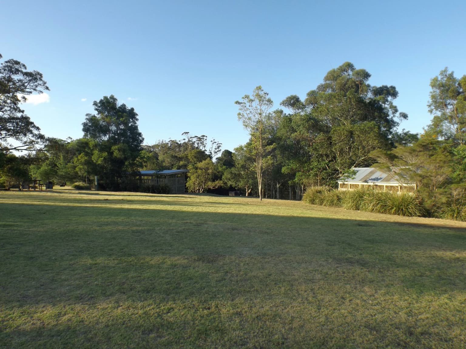
The landscape of Ravensbourne National Park is characterised by undulating terrain on the western slopes of the Great Dividing Range, with elevations that place it in the montane elevation band of South East Queensland. The park's position on the range creates an environment of moderate relief, with slopes and ridgelines that channel drainage toward either the Brisbane River catchment to the east or the Lockyer Creek catchment to the west. The contrast between the red soils of the western areas and the sandy soils of the east creates subtle but noticeable differences in the forest character across the park. The park overlooks the Lockyer Valley to the west, providing visitors with views across this agricultural valley from various points within the protected area. The forest canopy, whether in the rainforest remnants or the open eucalypt forest, forms an essential visual and ecological component of the landscape character.

Ravensbourne National Park ecosystems, habitats, and plant life

The nature of Ravensbourne National Park revolves around two primary forest communities that represent what once covered much of this part of the Great Dividing Range. The wet eucalypt forest and rainforest remnants preserved within the park contain species including various eucalypts, palms, vines and ferns that thrive in the moister conditions retained by the red soils in the western sections. This rainforest community represents a vegetation type that has been extensively cleared from the surrounding lowlands and lower slopes, making the park's remnants increasingly significant for biodiversity conservation. The open eucalypt forest on the sandy eastern soils represents a more fire-tolerant community that grades into the surrounding rural landscapes. Together, these forest types support a diversity of wildlife despite the park's relatively small size, with the intact forest canopy and relatively undisturbed understory providing habitat for species that cannot survive in the fragmented agricultural landscape surrounding the reserve.

Ravensbourne National Park wildlife and species highlights

Ravensbourne National Park supports notable wildlife diversity, particularly for birds, with over 80 species recorded within its boundaries. This avian richness reflects the variety of forest habitats present, from the more densely vegetated rainforest areas to the more open eucalypt forest. Four rare or threatened species have been identified in the park, highlighting its conservation significance beyond what its small size might suggest. The forest communities provide breeding habitat, foraging resources and shelter for both resident bird species and seasonal migrants. The presence of threatened species indicates that the park serves as an important refuge in a landscape where native vegetation has been heavily cleared, functioning as a stepping stone or core area for species dependent on old-growth forest elements.

Ravensbourne National Park conservation status and protection priorities

The conservation significance of Ravensbourne National Park derives from its role in preserving remnants of forest types that have suffered extensive clearance across South East Queensland. The rainforest and wet eucalypt forest communities within the park represent ecosystems that once covered substantial portions of the Great Dividing Range in this region but now exist only in fragmented patches. By maintaining these forest communities, the park contributes to watershed protection for both the Brisbane River and Lockyer Creek catchments, with the vegetation helping to regulate water flow and filter runoff. The presence of four rare or threatened species within such a modest area underscores the park's disproportionate conservation value, as these species rely on the intact forest habitat that the park maintains. As one of Queensland's older national parks established in 1922, Ravensbourne represents an early recognition of the need to preserve representative samples of the state's natural landscapes.

Ravensbourne National Park cultural meaning and human context

Ravensbourne National Park takes its name from the nearby locality of Ravensbourne, a small community situated in the Ravensbourne and Buaraba district of South East Queensland. The park lies within the traditional landscape of the Lockyer Valley region, an area with Aboriginal heritage extending back thousands of years. While the park's management documentation does not extensively detail indigenous cultural associations, the broader Lockyer Valley contains significant Aboriginal sites and cultural places. The European settlement of the Ravensbourne area occurred in the nineteenth century, with the establishment of the national park in 1922 reflecting early conservation values in the region. The park's name connects it to the local community and the historical settlement pattern of this part of the Great Dividing Range.

Top sights and standout views in Ravensbourne National Park

The highlights of Ravensbourne National Park include its preserved rainforest and wet eucalypt forest remnants on the Great Dividing Range, a landscape context that provides both ecological and scenic values. The Gus Beutel Lookout offers visitors panoramic views across the Lockyer Valley, making the park a destination for those seeking to appreciate the relationship between the range and the valley below. The birdlife, with over 80 species recorded, represents a significant draw for ornithologists and nature enthusiasts, particularly given the presence of rare or threatened species within the park. The diversity of forest types, shaped by differing soil conditions across the park, provides ecological interest and demonstrates how local geology influences vegetation patterns. The park's establishment in 1922 gives it historical significance as one of Queensland's pioneering national parks.

Best time to visit Ravensbourne National Park

The best time to visit Ravensbourne National Park depends on the experience sought, but the cooler months of autumn and winter in Queensland, from April through September, generally offer comfortable conditions for walking and nature observation in the park. During these seasons, the forest environments are typically pleasant for exploring the walking tracks, and bird activity remains good as species go about their daily activities. The spring period from September to November brings warmer temperatures and can offer excellent birdwatching as breeding activity peaks and migratory species return. Summer months, from December to March, can be hot and may see reduced activity during the hottest parts of the day, though early morning visits can still be rewarding. The park's forest environment provides shade that makes walking more comfortable during warmer periods, but visitors should be prepared for the seasonal conditions typical of South East Queensland.

Park location guide

Geography guide, regional context, and park location map for Ravensbourne National Park

Ravensbourne National Park park geography, regions, and map view in Australia
Understand where Ravensbourne National Park sits in Australia through a broader geographic reading of the surrounding landscape, nearby location context, and its mapped position within the national park landscape.

How Ravensbourne National Park fits into Australia

Australia is a constitutional monarchy and federal parliamentary democracy comprising six states and ten territories. With a population of nearly 28 million, it is one of the world's most urbanised countries, with most people concentrated on the eastern seaboard. The country has a high Human Development Index and is known for its cultural diversity, ancient Aboriginal heritage, and unique wildlife.

Wider geography shaping Ravensbourne National Park in Australia

Australia occupies the entire Australian continent, the island of Tasmania, and numerous smaller islands. It is the world's flattest and driest inhabited continent, featuring vast deserts in the interior (the Outback), tropical rainforests along the eastern coast, and a coastline bordering the Indian and Pacific Oceans.

Map view of Ravensbourne National Park

Use this park location map to pinpoint Ravensbourne National Park in Australia, understand its exact geographic position, and read its mapped placement within the surrounding landscape more clearly.

Pigeon | © OpenStreetMap contributors

Location context for Ravensbourne National Park

Queensland

A visual atlas to understand the park's montane environment, diverse forest habitats, and significant protected-area character.

Ravensbourne National Park Landscapes: Explore Photos of Rainforests, Wet Eucalypt Forests, and Valley Views
Browse a rich collection of images showcasing Ravensbourne National Park's preserved rainforests, wet eucalypt forests, and panoramic views across the Lockyer Valley. These photos provide essential visual context for understanding the park's montane terrain, distinct habitats, and crucial role as a protected area on Queensland's Great Dividing Range.

Open grassy field with scattered trees and buildings under clear blue sky

Park atlas

Compare protected areas and trace the regional geography of parks surrounding Ravensbourne.

Discover Other National Parks and Protected Areas Near Ravensbourne National Park
Continue exploring national parks and protected areas similar to Ravensbourne National Park, tracing Queensland's diverse montane environments and Great Dividing Range landscapes. Comparing these regional conservation areas provides deeper insights into their ecological significance and geographic spread across the Lockyer Valley catchment.
National parkQueensland

Lockyer National Park: A National Park in Queensland with Distinct Geographic Features

Mapped protected boundaries and regional landscape context.

Lockyer National Park is a designated national park providing a critical lens into Queensland's varied geography and protected landscapes. Understanding this park involves exploring its mapped boundaries and how it contributes to the region's natural terrain. This entry serves as a detailed geographic context for Lockyer National Park, supporting structured discovery within the Australian state's protected areas.

Area
110.79 km²
Established
2008
IUCN
II
Relief
Mountain
National parkQueensland

Crows Nest National Park: Queensland National Park Geography and Protected Landscape Atlas

Mapped terrain and protected area context within Queensland, Australia.

Delve into Crows Nest National Park, a protected natural area recognized as a national park within Queensland. This destination offers detailed geographic context, focusing on its mapped boundaries and landscape identity. Understand its place within the regional geography of northeastern Australia and explore its significance as a component of the country's protected lands network.

Area
17.9 km²
Established
1967
IUCN
II
Relief
Mountain
National parkQueensland

Gatton National Park: A Queensland Protected Landscape for Atlas Exploration

Mapped geographic identity and protected area context.

Gatton National Park offers a distinct entry point for exploring Australia's protected lands through a geographic lens. As a designated national park within Queensland, its mapped boundaries and regional setting are crucial for understanding the broader atlas of Australian natural landscapes. This page facilitates discovery of the park's specific geographic character and its role within the country's protected area network, providing essential context for natural landscape exploration.

Area
4.26 km²
Relief
Lowland
Climate
Subtropical
Access
Moderate access
National parkAustralia

Mount Binga National Park National Park: Protecting South East Queensland's Araucarian Vine Forest

Explore its mapped terrain and significant protected landscape.

Mount Binga National Park stands as a crucial protected area within Australia's South East Queensland, recognized for its conservation of the rare araucarian vine forest. This national park preserves a significant remnant of this vital vegetation type, offering habitat to multiple endangered species. Delve into its specific geographic context and the importance of its mapped boundaries for maintaining regional biodiversity and ecological integrity.

Area
10.667 km²
Established
2006
IUCN
II
Relief
Lowland
National parkToowoomba Region

The Palms National Park: National Park Atlas and Mapped Landscape Context

Explore its geographic setting and protected area features.

The Palms National Park, designated as a national park within Australia's Toowoomba Region, provides a specific focus for atlas-based geographic exploration. Understanding this protected area involves appreciating its unique landscape characteristics and its position within the broader regional geography. This entry highlights the park's mapped boundaries and its role in a structured overview of natural landscapes, offering valuable context for researchers and explorers focused on protected lands.

Area
0.124 km²
Established
1950
IUCN
II
Relief
Lowland
National parkQueensland

D'Aguilar National Park: A Queensland National Park with Diverse Mountain Landscapes and Scenic Views

Explore its mapped protected area boundaries and regional geography.

D'Aguilar National Park presents a compelling geographic profile within Queensland, featuring the rugged terrain of the D'Aguilar Range. This national park is notable for its impressive biodiversity and the distinct ecological zones, ranging from arid eucalyptus forests to lush subtropical rainforests. The park's mapped landscape offers significant interest for atlas exploration, providing context on its role as a protected area and its contribution to the regional natural heritage.

Area
20.5 km²
Established
1938
IUCN
II
Visitors
812K annual
National parkQueensland

Bellthorpe National Park: Queensland National Park Map and Protected Landscape

Explore mapped boundaries and regional geography in Queensland.

Bellthorpe National Park is a key protected area within Queensland, Australia, offering a unique lens for understanding regional geography and landscape context. As a national park, its mapped boundaries are integral to appreciating its role in the Sunshine State's protected lands. This resource provides detailed atlas-style information, focusing on the geographic identity and mapped terrain that define Bellthorpe National Park for focused exploration.

Area
75.5 km²
IUCN
II
Relief
Highland
Access
Moderate access
National parkQueensland

Main Range National Park: Queensland National Park Atlas and Geographic Context

Mapped park boundaries and protected landscape details.

Gain a deep understanding of Main Range National Park, a vital component of Queensland's protected areas. This resource focuses on the park's geographic setting, providing mapped boundaries and regional context essential for atlas exploration. Analyze its placement within the broader Queensland landscape to appreciate its significance as a protected natural area.

Area
301.7 km²
Established
1965
IUCN
II
Relief
Mountain

Common questions about visiting, size, designation, and location context for Ravensbourne National Park

Ravensbourne National Park FAQs for park facts, access, geography, and protected area context
Find quick answers about Ravensbourne National Park, including protected-area facts, park geography, trail and visitor context, and how the park fits into its surrounding country and regional landscape.
MoriAtlas Explorer

Continue Your Protected Areas Search Across the Global Atlas

Deepen your exploration by continuing the structured search for national parks and protected areas worldwide. Utilize the comprehensive filtering capabilities to compare different conservation landscapes and refine your understanding of global park geography. Discover more about the distribution and characteristics of protected natural areas.

Global natural geography