
Mori Atlas logo
National parkBuzuluksky Bor National Park

Explore the distinct sandy riverine depression and ancient pine ecosystems of this Russian federal sanctuary

Buzuluksky Bor National Park: A Protected Island Forest Landscape in Samara Oblast

(National Park Buzuluksky Bor)

Buzuluksky Bor National Park serves as a striking ecological sanctuary, characterized by its deep sandy riverine depression that supports a rare, massive island of ancient pine forest. Stretching across the border of Samara Oblast and Orenburg Oblast, this federal protected area provides a dramatic contrast between thick, mossy pine stands and the open, rolling steppes of the surrounding trans-Volga and Cis-Ural foothills.

pine foreststeppeisland forestrelict pinebore forestbroadleaf woodland

Buzuluksky Bor National Park

National park

Park overview

Structured park overview, official facts, and landscape profile for Buzuluksky Bor National Park

Buzuluksky Bor National Park park facts, protected area profile, and essential visitor context

Review the core facts for Buzuluksky Bor National Park, including designation, size, terrain, visitor scale, habitats, and operating context in one park-focused overview.

About Buzuluksky Bor National Park

Buzuluksky Bor National Park is one of the largest and most ecologically distinctive protected forests in the southern half of European Russia. It stretches across a sizable tract on the Samara-Orenburg regional border, with its heart being the Buzuluk Pine Forest massif, a roughly 60,000-hectare island of predominantly Scots pine woodland embedded within the surrounding steppe landscape. The park's registered area lies within five administrative districts and is administered through twelve forest districts that together form the protected territory.

The defining physical feature of the area is its deep, broad riverine depression along the Borovka River, which collects the small Chertalyk River inside the forest. This depression is filled with Quaternary sands in places reaching roughly 90 meters in depth, creating impoverished, well-drained substrates that favor pine above most other tree species. The result is a striking ecological island: more than two thirds of the core massif is occupied by pine forests, while the margins transition into a narrow band of deciduous woodland, including oak, poplar, and alder stands along the river, with scattered aspen and birch patches through the interior.

The climate of the park is continental, with cold winters and warm summers, and the natural setting sits at the meeting point of the trans-Volga steppe zone and the Cis-Ural foothills, a region otherwise dominated by open grassland and cropland. Surrounding transport context includes the Kinel-Orenburg railway crossing the southwestern part of the park and several paved roads; the settlement of Koltubanovsky in the south hosts the park administration and a museum about the Bor.

Quick facts and research context for Buzuluksky Bor National Park

Buzuluksky Bor National Park is a federal Russian national park (IUCN Category II) located on the border of Samara and Orenburg Oblasts, with its core centered on the Buzuluk Pine Forest massif north of the city of Buzuluk.

The park covers a substantial protected territory organized into twelve forest districts, and it includes the historic Borovoe Experimental Forestry established in 1903, which still operates a dendrological garden. Although officially designated as a national park in January 2008, the underlying forest massif has been a focus of state protection on and off since 1932, and the broader woodland has been under systematic forest management since the late 18th century.

Protection and recognition

Examine the documented terrestrial protection framework and formal designation records

Buzuluksky Bor National Park Protection Status and Administrative Scope

Buzuluksky Bor National Park maintains a documented terrestrial protection scope within its designated conservation boundaries. Structured administrative data outlines the official management framework and historical designation records for the protected area.

Protection details

Protection scope
Terrestrial
Transboundary protection
No
Park context

Deeper park guide and search-rich context for Buzuluksky Bor National Park

Buzuluksky Bor National Park history, landscape, wildlife, and travel context

Explore Buzuluksky Bor National Park through its history, landscape character, ecosystems, wildlife, conservation priorities, cultural context, and seasonal travel timing in a structured park guide built for atlas discovery and search intent.

Why Buzuluksky Bor National Park stands out

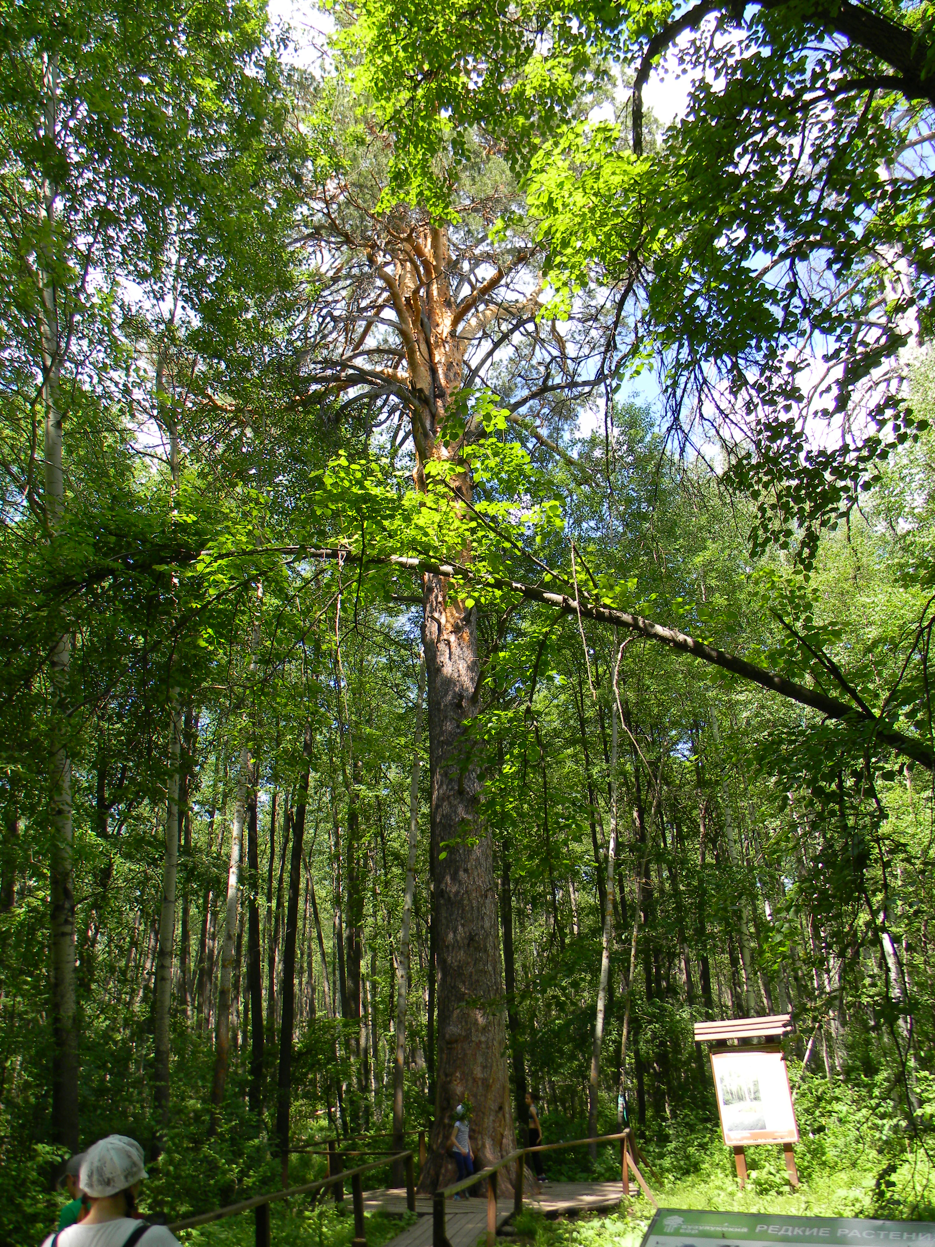
Buzuluksky Bor is best known as one of the largest surviving island pine forests amid the open steppes of the trans-Volga and Cis-Ural region, a deep sandy depression holding ancient pines and a striking ecological contrast with the surrounding grasslands. The forest's defining patterns include its classic Russian bore forest types: mossy pine forests, complex structured pine stands, and herb-rich variants, fringed by a narrow ribbon of broadleaf woodland along the Borovka River and bordered further out by true steppe. Its old-growth character, including pines of 300 to 350 years old, gives the park notable scientific and conservation value as a relic of Postglacial forest cover that survived outside the main taiga belt.
Buzuluksky Bor National Park history and protected-area timeline

The forest now protected as Buzuluksky Bor has been the subject of human use and management for centuries, with regular forest exploitation recorded since the late 18th century, but it also gained formal protection at several points in the 20th century. In 1903, the Borovoe Experimental Forestry was established within the Bor, accompanied by a dendrological garden that still operates today and contributes to the park's research and educational role. From 1932 to 1948, a state nature reserve existed on part of the Bor, and in May 1939 its area was significantly expanded. After the reserve was dissolved, the territory reverted to management as a state wildlife sanctuary, or zakaznik, for several decades.

Higher-level recognition followed in 1977, when part of the forest massif was granted the status of a particularly valuable forest stand. The decisive step came when, on 9 January 2008, by order of the Government of the Russian Federation of 2 June 2007, the Buzuluksky Bor was formally established as a federal national park and placed under the supervision of Rosprirodnadzor, Russia's federal environmental oversight agency. In parallel, the surrounding region has experienced recurring wildfire events, including a major fire in June 2013 that burned roughly 90 hectares and displaced residents, and a large August 2021 fire that damaged around 700 hectares, primarily pine plantations, shaping ongoing conservation priorities.

Buzuluksky Bor National Park landscape and geographic character

The landscape of Buzuluksky Bor is defined by the unusual combination of a deep sandy lowland, set within an otherwise flat to gently rolling steppe environment of the trans-Volga region and the Cis-Ural foothills. The Bor nestles in an extensive and pronounced riverine depression along the Borovka River, with depths on the order of 100 to 150 meters relative to the surrounding terrain, filled to substantial thickness by Quaternary sands. These sands are the substrate beneath the pine-dominated forests that dominate more than two thirds of the core massif.

Within the Bor, the terrain presents a mosaic of pine forest types, including mossy, complex, and herb-rich pine bore forests, broken by the corridors of the Borovka and Chertalyk rivers. A narrow strip of broadleaf forest, made up of oak, poplar, and alder, runs along the Borovka, while isolated patches of aspen and birch punctuate the broader pine cover. Beyond this forest envelope, the protected area transitions into classic steppe, making the Bor's forest margin unusually abrupt and ecologically conspicuous within the wider Russian steppe.

Buzuluksky Bor National Park ecosystems, habitats, and plant life

Buzuluksky Bor represents a classic example of an isolated pine forest ecosystem embedded within a much broader steppe matrix, with the park's overall protected territory spanning twelve forest districts. The dominant biological character is set by its Scots pine forests and their various forest types, including mossy pine bore forests, structurally complex mixed pine stands, and herb-rich variants that reflect local moisture and soil gradients.

Along the Borovka River and its tributary Chertalyk, the park maintains a contrasting ribbon of broadleaf woodland, with oak, poplar, and alder stands, while scattered patches of aspen and birch add further structural variety across the massif. The juxtaposition of dry pine forest, riverine broadleaf woodland, and adjacent steppe vegetation creates a compact but ecologically rich interface of forest and grassland habitats within a single protected landscape.

Buzuluksky Bor National Park wildlife and species highlights

The wildlife of Buzuluksky Bor is shaped by its position at the meeting point of forest and steppe, providing habitat for a wide variety of both forest and open-landscape species. The park's overall fauna includes 55 mammal species and 180 bird species, alongside reptiles, amphibians, and a rich insect fauna, with the forest hosting particularly representative large mammal and raptor populations.

Among mammals, characteristic species include elk, roe deer, wild boar, Eurasian lynx, pine marten, European badger, red squirrel, and beaver. The bird community is notable for large forest raptors such as the golden eagle and the imperial eagle, which reflect the park's open-country edges, as well as boreal forest species like the black grouse and the capercaillie inhabiting the pine interior. The combination of ungulates, mesocarnivores, large raptors, and forest grouse gives the park an unusually complete representation of steppe-edge forest fauna within southern European Russia.

Buzuluksky Bor National Park conservation status and protection priorities

Buzuluksky Bor is a nationally significant Russian site for the conservation of relict pine forest outside the main taiga belt and is classified as a national park under IUCN Category II. A substantial portion of the Bor has been legally recognized as a particularly valuable forest stand since 1977, and the broader forest massif has been a focus of formal protection on and off since 1932, including an earlier state reserve that operated from 1932 to 1948.

The contemporary conservation framework dates from 2008, when the forest was constituted as a federal national park under Rosprirodnadzor, formalizing management for nature protection alongside research, environmental education, and regulated recreation. The park's research infrastructure includes the long-running Borovoe Experimental Forestry and its dendrological garden, while ongoing management must contend with recurring wildfire pressure, including damaging events in 2013 and 2021, and with debates over oil exploration activities in and around the forested massif.

Buzuluksky Bor National Park cultural meaning and human context

Buzuluksky Bor carries deep regional and cultural weight as one of the most storied forests of the Russian steppe borderland, with its name long serving as a geographic marker across the Samara and Orenburg regions. The forest has been embedded in local identity since the late 18th century through forest use, and from the early 20th century onward through the establishment of the Borovoe Experimental Forestry and a dendrological garden that framed the Bor as both a working landscape and a place of scientific interest.

The area also has a notable cultural footprint in Russian documentary cinema, with a 1988 short documentary by Lennauchfilm devoted to the Bor and a later documentary film project initiated in 2015 that drew public attention to environmental pressures on the forest and was recognized with the Crystal Compass award of the Russian Geographical Society in 2019 for civic engagement.

Top sights and standout views in Buzuluksky Bor National Park

The standout quality of Buzuluksky Bor is its status as an ancient island of pine forest amid the steppes of southeastern European Russia, a striking ecological contrast that defines both its scientific value and its visual character. Within the park, the old-growth character of the forest is one of its strongest draws, particularly the rare pines of 300 to 350 years old and the diversity of pine forest types from mossy and complex to herb-rich bore forests.

Additional highlights include the Borovka River and its tributary Chertalyk, whose narrow corridor of oak, poplar, and alder woodland breaks up the pine matrix; the presence of steppe-edge raptors such as the golden eagle and imperial eagle alongside forest grouse like capercaillie and black grouse; and the park's research and educational infrastructure, anchored by the Borovoe Experimental Forestry and its dendrological garden, as well as the park museum in Koltubanovsky.

Best time to visit Buzuluksky Bor National Park

Buzuluksky Bor's continental climate, with cold winters and warm summers, shapes how the forest and steppe margins of the park can be experienced. Summer and early autumn are the most accessible periods for appreciating both the interior pine stands and the surrounding steppe vegetation, when the herb-rich pine forest types and deciduous fringes along the Borovka River are most biologically active.

Winter brings freezing conditions that limit internal travel but can offer a quieter experience of the old pine forest, while spring and autumn transitions can be particularly rewarding for observing birdlife, including raptors and boreal grouse species that are characteristic of the park's forest-steppe interface.
Monthly climate preview

Long-term temperature and monthly precipitation averages for Samara Oblast

Buzuluksky Bor National Park Climate Normals and Annual Temperature Patterns

Buzuluksky Bor National Park records a measured annual rhythm ranging from severe winter minimums to warm summer maximums alongside steady monthly precipitation. Reviewing the complete twelve-month dataset reveals the full scope of long-term temperature swings across a representative coordinate.
Annual mean4 °C
-14 °C22 °C
Jan-14°
Feb-12°
Mar-5°
Apr
May14°
Jun19°
Jul22°
Aug20°
Sep14°
Oct
Nov-4°
Dec-11°
Warmest month
July

22 °C

Coolest month
January

-13.6 °C

Wettest month
June

1.9 mm/day

Driest month
February

1.2 mm/day

Park location guide

Geography guide, regional context, and park location map for Buzuluksky Bor National Park

Buzuluksky Bor National Park park geography, regions, and map view in Russia

Understand where Buzuluksky Bor National Park sits in Russia through a broader geographic reading of the surrounding landscape, nearby location context, and its mapped position within the national park landscape.

How Buzuluksky Bor National Park fits into Russia

Russia is a transcontinental nation spanning eleven time zones, bordered by fourteen countries. It is the world's largest country by area, covering 17,098,246 km². Moscow is the capital and largest city, while Saint Petersburg is the second-largest and a major cultural centre.

Wider geography shaping Buzuluksky Bor National Park in Russia

Russia spans Eastern Europe and North Asia, covering 17,098,246 km². It shares land borders with fourteen countries, more than any other nation, and spans eleven time zones. The landscape includes vast plains, mountain ranges such as the Urals and Caucasus, and extensive coastlines along the Arctic Ocean, Pacific Ocean, Baltic Sea, Black Sea, and Caspian Sea.

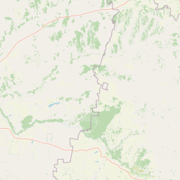
Map view of Buzuluksky Bor National Park

Use this park location map to pinpoint Buzuluksky Bor National Park in Russia, understand its exact geographic position, and read its mapped placement within the surrounding landscape more clearly.

Pigeon | © OpenStreetMap contributors

Location context for Buzuluksky Bor National Park

Orenburg OblastSamara Oblast
Park atlas

Compare regional geography, surrounding steppes, and adjacent conservation areas.

Parks Near Buzuluksky Bor National Park and Related Protected Landscapes

Browsing other protected areas near Buzuluksky Bor National Park reveals broader ecological patterns across the trans-Volga and Cis-Ural region. Evaluating adjacent park geography helps place isolated island pine forests into wider continental conservation contexts.
National parkRussia
About 0.5 km away#1 closest

South

Buzuluksky Bor National Park: Mapping an Isolated Forest in the Russian Steppe

Examining the unique geomorphology and forest-steppe ecological boundaries.

Buzuluksky Bor National Park serves as an extraordinary natural laboratory in Russia, defined by its 106,000 hectares of pine forest set against a backdrop of open grasslands. This protected area features deep sandy substrates of marine origin, undulating dune landscapes, and the deeply incised Borovka River valley, providing a vital study site for forest-steppe dynamics and long-term conservation research.

Area
1,060 km²
Established
2007
IUCN
II
Relief
Lowland
Watercolor illustration of a river flowing through a valley with green hills and scattered trees in the background
National parkSamara Oblast
About 134 km away#2 closest

West

Samarskaya Luka National Park: Mapped Geography and Protected Area Landscape Context

An atlas-focused overview of the Zhiguli Mountains and Volga River meander.

Samarskaya Luka National Park covers 134,000 hectares of diverse terrain in Samara Oblast. This overview examines the protected area's karst limestone uplands, dense forests, and river floodplains. Access map-integrated data on the Volga River bend and the unique geological formations defining this regional ecosystem.

Area
1,340 km²
Established
1984
IUCN
II
Relief
Mixed relief
National parkSamara Oblast
About 134 km away#3 closest

West

Samarskaya Luka National Park: Geography, Karst Terrain, and Volga River Boundaries

Protected mountain, forest, and floodplain landscapes in Samara Oblast

Samarskaya Luka National Park anchors the Middle Volga Biosphere Reserve with its rugged limestone cliffs, extensive karst sinkholes, and rare steppe-forest habitats. The park represents a key geographic transition zone where high-elevation mountain terrain meets the expansive Volga floodplains and reservoirs, providing a vital study area for regional forest-steppe ecosystems.

Area
1,319 km²
Established
1984
IUCN
II
Relief
Mountain
Wildlife reserveWest Kazakhstan Region
About 178 km away#4 closest

South

Kirsanov Sanctuary: Protected Floodplain Landscapes and Ural River Geography

Wildlife reserve and riverine corridor in West Kazakhstan

Spanning 50 kilometers along the Ural River, Kirsanov Sanctuary preserves a rich mix of floodplain meadows, gallery forests, and oxbow lakes. Originally established for beaver conservation, this wildlife reserve now functions as a complex ecosystem refuge, representing a key protected landscape within the West Kazakhstan regional geography.

Area
610 km²
Established
1967
IUCN
IV
Relief
Lowland
Watercolor painting of a meadow with wildflowers and rolling hills under a soft sky
National parkRussia
About 266 km away#5 closest

Northwest

Sengileevskie Mountains National Park: National Park Protected Area and Mapped Landscape Context

Explore protected boundaries and regional geography.

Uncover the geographic specifics of Sengileevskie Mountains National Park, a designated national park. This entry provides detailed insights into its protected area status, mapped landscape features, and regional context, serving as a foundational element for atlas-based exploration and understanding of Russia's conservation areas.

IUCN
II
Watercolor illustration of green hills, a body of water, and pink and yellow vegetation
National parkSaratov Oblast
About 277 km away#6 closest

West

Khvalynsky National Park: Protected Landscape and Regional Geography Atlas

Discover mapped park boundaries in Saratov Oblast

Khvalynsky National Park is a significant protected area designated as a national park within the Saratov Oblast. This entry provides detailed atlas-based insights into its geographic scope, protected landscape features, and its context within the wider regional geography of Southeastern European Russia. Explore the mapped terrain and understand how this park contributes to the conservation landscape of the Volga region.

Area
255 km²
Established
1994
IUCN
II
Visitors
35K annual
Watercolor painting showing a scenic landscape with mountains, a river, and trees
National parkBashkortostan
About 296 km away#7 closest

East

Bashkiriya National Park: Mapping Karst Landscapes and Ural Forest Geography

Exploring protected terrain in the Bashkortostan region

Bashkiriya National Park anchors a critical conservation area along the southern Ural Mountains, characterized by its deep canyons, limestone grottoes, and vast subterranean cave networks. The park serves as a bridge for biodiversity at the continental edge, where river-carved valleys and dense taiga forests create a distinct, protected landscape for regional research and geographic study.

Area
920 km²
Established
1986
IUCN
II
Relief
Mixed relief
National parkBashkortostan
About 296 km away#8 closest

East

Bashkiriya National Park: Protected Karst Landscapes and Ural Mountain Geography

Southern Ural forest ecosystems and karst cave networks

Bashkiriya National Park protects over 900 square kilometers of mountainous terrain and river valleys in the Republic of Bashkortostan. The park serves as a prime example of the Southern Ural transition, featuring an intricate mix of karst sinkholes, surface streams, and mature broadleaf forests that support diverse temperate wildlife and avian communities.

Area
920 km²
Established
1986
IUCN
II
Visitors
30K annual

Common questions about visiting, size, designation, and location context for Buzuluksky Bor National Park

Buzuluksky Bor National Park FAQs for park facts, access, geography, and protected area context

Find quick answers about Buzuluksky Bor National Park, including protected-area facts, park geography, trail and visitor context, and how the park fits into its surrounding country and regional landscape.
MoriAtlas Explorer

Continue Your Protected Areas Search Across the Global Atlas

Deepen your exploration by continuing the structured search for national parks and protected areas worldwide. Utilize the comprehensive filtering capabilities to compare different conservation landscapes and refine your understanding of global park geography. Discover more about the distribution and characteristics of protected natural areas.

Global natural geography