Mori Atlas logo
National parkCoalstoun Lakes National Park

Discover the mapped boundaries and regional geographic context of Coalstoun Lakes National Park.

Coalstoun Lakes National Park: Queensland's Protected Landscape and National Park Atlas Entry

Coalstoun Lakes National Park stands as a distinct protected area within the vast geography of Queensland, Australia. This page serves as a canonical entry point for understanding the park's national park identity, its mapped natural landscape, and its place within the broader Queensland regional atlas. Explore the fundamental geographic context and protected area characteristics that define Coalstoun Lakes National Park for structured discovery.

Volcanic landscapeCrater lakesQueensland national parksGeological heritageSmall parksIUCN Category II

Coalstoun Lakes National Park

National park

Park overview

Structured park overview, official facts, and landscape profile for Coalstoun Lakes National Park

Coalstoun Lakes National Park park facts, protected area profile, and essential visitor context
Review the core facts for Coalstoun Lakes National Park, including designation, size, terrain, visitor scale, habitats, and operating context in one park-focused overview.

About Coalstoun Lakes National Park

Coalstoun Lakes National Park occupies a modest footprint in the Wide Bay-Burnett region of Queensland, protecting a volcanic landscape of considerable geological interest. The park's central feature is Mount Le Brun, a steep-sided volcanic cone that rises from the surrounding terrain. Within the volcanic structure lie two crater depressions that periodically fill with water to form the Coalstoun Lakes. These crater lakes are intermittent, meaning their presence and extent vary depending on rainfall and groundwater conditions. The volcanic rocks that comprise Mount Le Brun are among the younger volcanic formations in Australia, providing insight into the region's geological past when volcanic activity was more prevalent. The park's establishment in 1929 reflected early recognition of the area's natural significance, preserving this volcanic landscape for future generations. Despite its small size, the park contributes to Queensland's network of protected areas by safeguarding a distinctive geological formation that would otherwise face potential degradation.

Quick facts and research context for Coalstoun Lakes National Park

Coalstoun Lakes National Park covers an area of 26 hectares (64 acres), making it Queensland's smallest national park. The park was officially established in 1929 and is managed by the Queensland Parks and Wildlife Service. The average terrain elevation is approximately 277 metres above sea level. The volcanic formation, Mount Le Brun, contains two craters that periodically fill with water to form the park's namesake lakes. The park is classified under IUCN Category II as a national park, reflecting its primary purpose of protecting natural ecosystems and geological features.

Park context

Deeper park guide and search-rich context for Coalstoun Lakes National Park

Coalstoun Lakes National Park history, landscape, wildlife, and travel context
Explore Coalstoun Lakes National Park through its history, landscape character, ecosystems, wildlife, conservation priorities, cultural context, and seasonal travel timing in a structured park guide built for atlas discovery and search intent.

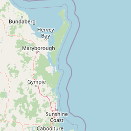
Why Coalstoun Lakes National Park stands out

Coalstoun Lakes National Park is best known for its unique volcanic crater lake system. The twin craters of Mount Le Brun represent one of Australia's younger volcanic formations, and the intermittent lakes that form within them create a distinctive landscape not commonly found in Queensland's protected areas. The combination of volcanic geology and the seasonal presence of water-filled craters makes this park a notable example of volcanic landscape preservation in eastern Australia. The park's small size belies its geological significance, as it preserves a relatively rare volcanic formation in a region where such features are uncommon.

Coalstoun Lakes National Park history and protected-area timeline

Coalstoun Lakes National Park was established in 1929, making it one of Queensland's older protected areas. The park's naming carries a complex history tied to local pioneer Nugent Wade Brown, who first applied the name to the lakes in 1894. Several theories exist regarding the name's origin. One suggests that Coalstoun derives from an Aboriginal word, Goanalganai, though the precise meaning of this term is not widely documented. Another theory proposes that the name is a corruption of Colstoun, the ancestral Brown family home in Scotland near Edinburgh. A third account indicates the lakes were named after Coalstoun in Scotland by Wade Brun, who managed the nearby Ban Ban Station. Nugent Wade Brown and Wade Brun are believed to be the same person, and his connection to the area dates to the late nineteenth century. The naming history reflects the interplay between Indigenous heritage and European settlement that characterizes many places in regional Queensland.

Coalstoun Lakes National Park landscape and geographic character

The landscape of Coalstoun Lakes National Park is defined by its volcanic origins. Mount Le Brun rises as a prominent conical hill from the surrounding plains, its slopes formed from volcanic rock and weathered material. The mountain's summit contains two distinct crater depressions, each representing a collapsed volcanic vent. These craters, when filled with water, create the park's namesake lakes, with the water depth and surface area fluctuating according to seasonal conditions. The surrounding terrain features gentle slopes and valleys that drain toward the craters, with the overall elevation of the park averaging around 277 metres. The volcanic geology creates a landscape that stands in contrast to the more typical eucalyptus woodlands and pastoral lands that surround the protected area.

Coalstoun Lakes National Park ecosystems, habitats, and plant life

The nature of Coalstoun Lakes National Park reflects its volcanic setting and relatively small area. The park preserves a distinctive habitat type centred on the volcanic crater system, with the intermittent lakes providing seasonal wetland conditions. The surrounding slopes and crater rims support vegetation communities adapted to the volcanic soils and the unique hydrological conditions created by the craters. While not a large biodiversity reserve, the park contributes to protecting a localized volcanic ecosystem that includes species adapted to the specific conditions found in and around the crater lakes. The intermittent nature of the lakes means that the park's wetland character varies throughout the year, creating dynamic ecological conditions.

Coalstoun Lakes National Park wildlife and species highlights

The wildlife at Coalstoun Lakes National Park is adapted to the park's volcanic landscape and seasonal wetland conditions. The intermittent crater lakes attract waterbirds during periods when water is present, with various species using the wetlands as feeding and resting habitat. The surrounding volcanic slopes and woodlands provide habitat for common Queensland bird species and small mammals. While the park is not renowned for rare or endemic species, it serves as a small but functional component of the broader regional ecosystem, supporting native fauna that move through the protected area and the surrounding pastoral and woodland landscapes.

Coalstoun Lakes National Park conservation status and protection priorities

Coalstoun Lakes National Park represents Queensland's smallest national park, yet its conservation significance lies in preserving an unusual volcanic landscape. The protection of Mount Le Brun and its crater lakes ensures that this geological formation remains intact and is not subject to development or degradation. The park's IUCN Category II classification reflects its national park status, emphasizing the preservation of natural ecosystems alongside geological heritage. The long-standing protection since 1929 demonstrates early recognition of the area's value, and the ongoing management by Queensland Parks and Wildlife Service maintains the park's integrity as a protected volcanic landscape.

Coalstoun Lakes National Park cultural meaning and human context

The cultural context of Coalstoun Lakes National Park reflects the intersection of Indigenous Australian heritage and European colonial history. The proposed Aboriginal origin of the name Goanalganai indicates the area's significance to local Indigenous peoples prior to European settlement. The European naming in 1894 by Nugent Wade Brown ties the park to the broader pastoral development of the Wide Bay-Burnett region in the late nineteenth century. The various theories surrounding the name's origin, whether from Scottish family heritage or Indigenous language, illustrate the layered history that characterizes many Queensland place names. The park exists within a landscape shaped by both Indigenous land management practices and subsequent European agricultural expansion.

Top sights and standout views in Coalstoun Lakes National Park

The primary highlight of Coalstoun Lakes National Park is the opportunity to visit a volcanic crater lake system in Queensland, one of the younger volcanic formations in Australia. The twin craters of Mount Le Brun, containing intermittent lakes, create a distinctive landscape that is unusual for the region. As Queensland's smallest national park, it offers an intimate exploration experience focused on geological heritage. The park provides a compact yet meaningful example of volcanic landscape preservation, with the crater system offering visual evidence of the ancient volcanic processes that shaped this part of southeastern Queensland.

Best time to visit Coalstoun Lakes National Park

The best time to visit Coalstoun Lakes National Park is generally during the cooler months of autumn and winter in southern Queensland, from April through September. During this period, the weather is typically mild and comfortable for walking to the crater viewpoints. The condition of the crater lakes themselves depends significantly on recent rainfall, as they are intermittent features fed by groundwater and surface runoff. Visiting after periods of adequate rainfall increases the likelihood of seeing water in the craters, while prolonged dry periods may result in empty or nearly empty crater basins. The dry winter season often provides the most stable conditions for park exploration.

Park location guide

Geography guide, regional context, and park location map for Coalstoun Lakes National Park

Coalstoun Lakes National Park park geography, regions, and map view in Australia
Understand where Coalstoun Lakes National Park sits in Australia through a broader geographic reading of the surrounding landscape, nearby location context, and its mapped position within the national park landscape.

How Coalstoun Lakes National Park fits into Australia

Australia is a constitutional monarchy and federal parliamentary democracy comprising six states and ten territories. With a population of nearly 28 million, it is one of the world's most urbanised countries, with most people concentrated on the eastern seaboard. The country has a high Human Development Index and is known for its cultural diversity, ancient Aboriginal heritage, and unique wildlife.

Wider geography shaping Coalstoun Lakes National Park in Australia

Australia occupies the entire Australian continent, the island of Tasmania, and numerous smaller islands. It is the world's flattest and driest inhabited continent, featuring vast deserts in the interior (the Outback), tropical rainforests along the eastern coast, and a coastline bordering the Indian and Pacific Oceans.

Map view of Coalstoun Lakes National Park

Use this park location map to pinpoint Coalstoun Lakes National Park in Australia, understand its exact geographic position, and read its mapped placement within the surrounding landscape more clearly.

Pigeon | © OpenStreetMap contributors

Location context for Coalstoun Lakes National Park

Queensland
Park atlas

Explore adjacent national parks and conservation landscapes across Queensland's unique volcanic terrain.

Discover Other Protected Areas Near Coalstoun Lakes National Park
Explore a curated list of protected areas, national parks, and conservation landscapes located near Coalstoun Lakes National Park. Continue your geographic park exploration by comparing features and regional context of other significant protected areas across Queensland and Eastern Australia.
Watercolor illustration of a mountainous landscape with green fields and distant peaks
National parkQueensland

Mount Walsh National Park: Mapped Granite Landscape and Protected Area in Queensland

Explore Queensland's unique volcanic terrain and regional park geography.

Mount Walsh National Park in Queensland, Australia, offers a compelling study in landscape contrasts, defined by its striking granite bluff and rugged topography. This protected area features dramatic exposed rock formations, steep forested slopes, and sheltered gullies, a direct result of ancient geological processes. The park's unique terrain, from bare granite summits to vegetated ridges, provides essential habitat and illustrates the intricate relationship between geology and ecology. For those interested in atlas-style geographic discovery, Mount Walsh National Park serves as a prime example of a distinctive Australian protected landscape.

Area
52.4 km²
Established
1947
IUCN
II
Relief
Mountain
National parkQueensland

Fairlies Knob National Park: Queensland National Park Protected Landscape Explorer

Mapped protected areas and regional geography in Queensland.

Fairlies Knob National Park offers a unique point of entry into Queensland's atlas of protected areas. This detailed view focuses on the park's identity as a national park, providing insights into its mapped boundaries and its geographical context within the Australian state. Explore the fundamental protected landscape features and understand its place within the broader regional geography.

Area
0.56 km²
Established
1910
IUCN
II
Relief
Lowland
National parkQueensland

Goodnight Scrub National Park: Protected Dry Rainforest and Hoop Pine Ecosystems

Explore the mapped terrain and conservation significance of this Queensland park.

Goodnight Scrub National Park safeguards a rare dry rainforest ecosystem, a significant ecological asset within Queensland's protected area network. Dominated by iconic hoop pine trees, this national park showcases a unique landscape characterized by its distinct vegetation and geographic setting. The park's conservation value is highlighted by its role in preserving a habitat type uncommon in Australia, offering insights into regional landscape dynamics and protected land importance.

Area
63.3 km²
IUCN
II
Relief
Lowland
Access
Moderate access
National parkQueensland

Mount Bauple National Park: Queensland National Park's Protected Landscape and Map Context

Discover its mapped boundaries and regional geography.

Mount Bauple National Park, designated as a national park in Queensland, Australia, offers a unique focus within the state's rich protected area network. This entry provides detailed insight into the park's specific geographic identity and its landscape characteristics. Understanding Mount Bauple National Park is key to grasping the diversity of Queensland's natural terrain and its role in the broader Australian geography. Explore its mapped boundaries and the regional context that defines this significant protected landscape.

Area
5 km²
Established
1935
IUCN
Ia
Relief
Mountain
National parkQueensland

Beeron National Park: National Park Protected Landscape in Queensland, Australia

Discover its geographic context and mapped natural terrain.

Delve into Beeron National Park, a distinct national park located in Queensland, Australia. This protected area offers a unique perspective on the region's natural landscapes and geography. By examining its mapped boundaries and its position within Queensland's broader environmental context, users can gain a structured understanding of this significant conservation landscape.

Area
70.5 km²
Established
2009
IUCN
II
Scope
Terrestrial
National parkNorth Burnett Region

Auburn River National Park: A Protected Landscape Defined by River Gorge and Hardwood Forests

Explore the mapped terrain and protected area geography of this Queensland national park.

Auburn River National Park, designated a national park in Australia, showcases a remarkable protected landscape sculpted by the Auburn River. Its geography is characterized by a steep, dramatic river gorge and extensive hardwood forests, creating a visually striking and ecologically significant area. This park provides crucial insight into riparian ecosystems and their role within the regional geographic context of the North Burnett Region, inviting detailed exploration of its mapped terrain and conservation value.

Area
3.9 km²
Established
1964
IUCN
II
Water
Major water bodies
National parkAustralia

Burrum Coast National Park: An Atlas View of Australia's Protected Landscape

Explore the mapped terrain and regional geography of this national park.

Burrum Coast National Park in Australia serves as a key node for understanding protected landscapes through a geographic lens. This entry provides detailed context on the park's mapped boundaries and natural terrain, contributing to a structured atlas of Australia's conservation areas. Discover the specific geographic identity and landscape characteristics that define Burrum Coast National Park as a significant protected natural area.

Area
225 km²
Established
1995
IUCN
II
Relief
Lowland
National parkFraser Coast Region

Poona National Park: Coastal Wetland Refuge and Protected Landscape Exploration

Discover the mapped terrain and regional geography of this national park.

Poona National Park protects a critical coastal wetland ecosystem in Queensland's Fraser Coast Region, renowned for its role as a refuge for endangered trees and threatened animal species. The park's landscape is characterized by extensive marshy areas and coastal forests situated between river systems and the ocean. This undeveloped protected area provides essential habitat, highlighting the unique geographic context and conservation importance of these coastal environments within Australia.

Area
53.68 km²
Established
1991
IUCN
II
Relief
Lowland

Common questions about visiting, size, designation, and location context for Coalstoun Lakes National Park

Coalstoun Lakes National Park FAQs for park facts, access, geography, and protected area context
Find quick answers about Coalstoun Lakes National Park, including protected-area facts, park geography, trail and visitor context, and how the park fits into its surrounding country and regional landscape.
MoriAtlas Explorer

Continue Your Protected Areas Search Across the Global Atlas

Deepen your exploration by continuing the structured search for national parks and protected areas worldwide. Utilize the comprehensive filtering capabilities to compare different conservation landscapes and refine your understanding of global park geography. Discover more about the distribution and characteristics of protected natural areas.

Global natural geography