Mori Atlas logo
National parkCoiba National Park

Discover the rugged island terrain and expansive marine boundaries of this Central American wilderness

Coiba National Park: Mapped Geography and Protected Landscapes in the Gulf of Chiriqui

(Coiba National Park and its Special Zone of Marine Protection)

Coiba National Park comprises the largest island in Central America and an extensive network of 38 surrounding islands within the Gulf of Chiriqui. This protected area preserves a diverse landscape featuring ancient tropical forests, rocky Pacific coastlines, and thriving coral reef ecosystems. By studying its unique geographic isolation and significant evolutionary history, you can understand how this wilderness sustains endemic species and vital marine habitats.

Island ParkMarine Protected AreaUNESCO World Heritage SiteCoral ReefsEndemic SpeciesWhale Watching

Coiba National Park

National park

Park overview

Structured park overview, official facts, and landscape profile for Coiba National Park

Coiba National Park park facts, protected area profile, and essential visitor context

Review the core facts for Coiba National Park, including designation, size, terrain, visitor scale, habitats, and operating context in one park-focused overview.

About Coiba National Park

Coiba National Park represents one of Central America's most significant protected areas, combining exceptional terrestrial and marine ecological value within a single coherent boundary. The park was established in 1992 following the closure of a penal colony that had operated on the island since 1919, allowing the relatively pristine environment to be protected rather than developed. The UNESCO World Heritage designation in 2005 recognized the outstanding universal value of both the island's terrestrial ecosystems and the surrounding marine environments.

The park encompasses Coiba Island together with 38 smaller islands scattered along Panama's southwestern Pacific coast, creating a complex marine protected area within the Gulf of Chiriquí. This marine component provides critical habitat for species ranging from sea turtles and manta rays to numerous shark species and large cetaceans. The coral reef systems within the park boundaries represent some of the most biodiverse in the eastern Pacific, supported by the gulf's capacity to moderate temperature fluctuations that would otherwise stress reef communities during El Niño events.

The island's history as a penal colony, particularly during the periods of dictatorship under Omar Torrijos and Manuel Noriega, gave Coiba a dark reputation for brutal conditions and political repression. This historical period left the island largely undeveloped and indirectly contributed to the preservation of its natural environments, as the terrain and isolation made the prison a place of punishment rather than a location for broader exploitation of natural resources.

Quick facts and research context for Coiba National Park

Coiba National Park covers approximately 1,042 square miles of terrestrial and marine environments in Veraguas Province, Panama. The park protects the largest island in Central America, which remains about 75% forested with a substantial portion of ancient growth forest. The surrounding Gulf of Chiriquí provides a buffer against El Niño temperature fluctuations, supporting remarkably diverse marine ecosystems. The park has been recognized as an Important Bird Area due to its significant populations of brown-backed doves, Coiba spinetails, and three-wattled bellbirds.

Protection and recognition

Documented protection records and official international recognition listings

Coiba National Park Protection Status and International Recognition

Coiba National Park brings together documented protection status and official international recognition records. Official sources include UNESCO World Heritage designation for the protected marine zone.
Park context

Deeper park guide and search-rich context for Coiba National Park

Coiba National Park history, landscape, wildlife, and travel context

Explore Coiba National Park through its history, landscape character, ecosystems, wildlife, conservation priorities, cultural context, and seasonal travel timing in a structured park guide built for atlas discovery and search intent.

Why Coiba National Park stands out

Coiba National Park is renowned for its extraordinary marine biodiversity, hosting 760 species of marine fishes, 33 shark species, and 20 cetacean species including humpback whales, pilot whales, killer whales, and dolphins. The island is one of the last strongholds of the scarlet macaw in Central America, with large populations still thriving in the wild. The park's isolation produced unique endemic species including the Coiba Island howler monkey and Coiba spinetail, which have diverged significantly from their mainland relatives over millennia of separation.

Coiba National Park history and protected-area timeline

Coiba Island's natural history begins with its geological separation from continental Panama between 12,000 and 18,000 years ago, when rising sea levels created the island's current island status. This separation initiated an evolutionary experiment, as plant and animal populations on the island became isolated from mainland gene pools. Over the millennia, many species diverged significantly from their mainland counterparts, giving rise to endemic subspecies adapted to the island's specific conditions.

Human history on the island took a darker turn in 1919 with the establishment of a penal colony. The prison's notoriety grew particularly during the latter half of the twentieth century when Panama was under dictatorial rule, and the facility became associated with brutal conditions, torture, executions, and political murders. Estimates suggest hundreds of prisoners may have died during this period. The island was largely avoided by local populations, and aside from the prison facilities, the island remained completely undeveloped.

The prison officially closed in 2004, opening the possibility for the island's conversion to protected area status. The pristine condition of the island's forests and the surrounding marine environments, maintained in part due to the isolation imposed by the prison's dark reputation, made Coiba ideal for conservation. The creation of Coiba National Park in 1992 had already provided formal protection, but post-closure development has focused on sustainable management and ecological restoration.

Coiba National Park landscape and geographic character

The landscape of Coiba National Park is defined by the island's mountainous interior rising from the Pacific coast, with terrain that supports dense tropical forest coverage spanning approximately 75% of the island's surface. A significant portion of this forest comprises ancient growth stands, representing ecosystems that have persisted largely undisturbed for centuries. The island's coastline features diverse beach formations, rocky shores, and mangrove systems that transition between terrestrial and marine environments.

The surrounding marine environment within the Gulf of Chiriquí encompasses coral reef formations, open water habitats, and the productive waters surrounding the 38 smaller islands included within the park boundaries. This marine landscape supports the exceptional biodiversity that distinguishes Coiba from other protected areas in Central America. The gulf's geographic configuration provides natural protection and temperature buffering that supports thriving coral communities despite regional climate variability.

Coiba National Park ecosystems, habitats, and plant life

The ecological character of Coiba National Park reflects both its island isolation and its position within the Gulf of Chiriquí marine ecosystem. The terrestrial environment supports old-growth tropical forest that has remained largely intact despite regional deforestation pressures on the Panamanian mainland. This forest provides habitat for endemic species that evolved in isolation following the island's separation from the continent, creating a unique biological community found nowhere else on Earth.

The marine environments within the park represent outstanding biodiversity, supported by the gulf's capacity to resist temperature extremes that affect other eastern Pacific locations during El Niño events. This environmental stability allows coral reef communities and associated fish populations to maintain higher diversity than might otherwise occur. The park's designation as an Important Bird Area recognizes its significance for species including brown-backed doves, Coiba spinetails, and three-wattled bellbirds.

Coiba National Park wildlife and species highlights

Coiba National Park supports remarkable wildlife populations both on land and in the surrounding waters. The island's endemic species include the Coiba Island howler monkey and the Coiba spinetail, both of which have developed distinct characteristics from their mainland relatives following millennia of evolutionary isolation. The park is also one of the last locations in Central America where the scarlet macaw persists in significant wild populations, a species that has been eliminated from much of its historical range.

The marine wildlife within the park's protected waters includes exceptional diversity, with 760 species of marine fishes, 33 shark species, and 20 species of cetaceans documented within the park boundaries. Humpback whales, pilot whales, killer whales, and dolphins regularly inhabit the park's marine zones, while sea turtles and manta rays utilize the protected coral reef and open water habitats. This concentration of marine species within a single protected area makes Coiba exceptionally significant for conservation.

Coiba National Park conservation status and protection priorities

Coiba National Park's conservation significance stems from its dual protection of both terrestrial and marine ecosystems of exceptional value. The UNESCO World Heritage designation in 2005 recognized the outstanding universal value of the island's endemic species, ancient forests, and the surrounding marine environments. The park's marine protection zone provides critical habitat for species of international conservation concern, including numerous cetaceans, sea turtles, and shark species.

The island's history as an isolated penal colony inadvertently contributed to its conservation value, as the difficult terrain and dark reputation kept development pressures minimal while maintaining relatively intact forest ecosystems. The transition from penal facility to protected area has required management approaches that balance ecological restoration with the legacy of the island's human history. The park's classification as an Important Bird Area further reinforces its international conservation importance.

Coiba National Park cultural meaning and human context

Coiba Island carries a complex cultural legacy shaped by its history as a penal colony. The facility operated from 1919 until 2004, gaining particular notoriety during periods of political repression under dictatorial rule when the prison became synonymous with torture, political murder, and brutal conditions. This history left deep scars in local memory and contributed to the island's avoidance by surrounding communities.

The prison's closure in 2004 transformed the island's identity from a place of punishment to one of conservation and discovery. Local communities in the Veraguas Province now engage with the island primarily through the lens of environmental protection and sustainable tourism. The park management works to acknowledge the island's difficult history while focusing on its ecological restoration and the economic opportunities that sustainable visitation may provide to the region.

Top sights and standout views in Coiba National Park

Coiba National Park stands out as Central America's largest island park with UNESCO World Heritage status, protecting 38 islands and extensive marine environments within the Gulf of Chiriquí. The island's evolutionary isolation produced unique endemic species including the Coiba Island howler monkey and Coiba spinetail, while the surrounding waters host 760 fish species, 33 shark species, and 20 cetacean species including regular humpback whale sightings. The park retains approximately 75% forest cover with significant ancient growth stands, and supports one of Central America's last significant wild populations of scarlet macaws.

Best time to visit Coiba National Park

Coiba National Park can be visited year-round given its tropical location, though the dry season from December through April typically offers more comfortable conditions for outdoor exploration. Marine wildlife viewing, particularly whale watching, is most productive during the humpback whale migration season which peaks between July and November when whales pass through the Gulf of Chiriquí. The park's marine ecosystems maintain relatively stable conditions due to the gulf's buffering capacity, though sea conditions may vary with seasonal weather patterns.
Monthly climate preview

Track measured monthly weather averages, temperature ranges, and precipitation totals for Coiba National Park

Coiba National Park Climate Normals: Long Term Temperature and Precipitation Patterns

Historical climate data reveals measured monthly temperature averages between 26.6 degrees and 28.87 degrees Celsius alongside shifting precipitation totals across the representative coordinate. Complete twelve-month records provide deeper analysis of long-term temperature ranges and monthly rainfall patterns.
Annual mean28 °C
27 °C29 °C
Jan28°
Feb28°
Mar29°
Apr29°
May28°
Jun27°
Jul27°
Aug27°
Sep27°
Oct27°
Nov27°
Dec27°
Warmest month
March

28.9 °C

Coolest month
November

26.6 °C

Wettest month
September

12 mm/day

Driest month
February

0.7 mm/day

Park location guide

Geography guide, regional context, and park location map for Coiba National Park

Coiba National Park park geography, regions, and map view in Panama

Understand where Coiba National Park sits in Panama through a broader geographic reading of the surrounding landscape, nearby location context, and its mapped position within the national park landscape.

How Coiba National Park fits into Panama

Panama is a presidential republic located at the southern end of Central America in North America. It gained independence from Spain in 1821 and from Colombia in 1903, the latter enabling the construction of the Panama Canal under U.S. supervision between 1904 and 1914. The canal was transferred to Panamanian control in 1999 following the Torrijos-Carter Treaties. With a population of approximately 4.3 million and an area of about 75,400 km², Panama has a high-income economy driven primarily by canal tolls, banking, commerce, and tourism.

Wider geography shaping Coiba National Park in Panama

Panama is located at the southern end of the Central American isthmus, stretching from the Caribbean coast in the north to the Pacific coast in the south. The country shares land borders with Costa Rica to the west and Colombia to the southeast. The terrain consists of coastal plains, mountain ranges including the Cordillera Central and Cordillera de Talamanca, and river valleys. The Panama Canal bisects the country, connecting the Atlantic and Pacific Oceans.

Map view of Coiba National Park

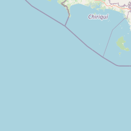
Use this park location map to pinpoint Coiba National Park in Panama, understand its exact geographic position, and read its mapped placement within the surrounding landscape more clearly.

Pigeon | © OpenStreetMap contributors
Park atlas

Compare surrounding marine reserves and tropical forest sanctuaries across the region

Explore Parks Near Coiba National Park and Connected Regional Protected Landscapes

Browsing other protected areas near Coiba National Park reveals distinct coastal ecosystems and island habitats. Comparing these regional environments expands geographic understanding and deepens conservation analysis.
National parkVeraguas Province
Mapped park locations coincide#1 closest

Coiba National Park: Geographic and Protected Landscape Atlas of the Gulf of Chiriquí

Extensive marine and tropical island terrain in Veraguas Province

Coiba National Park spans a significant portion of the Pacific Ocean and islands, representing one of the most important conservation landscapes in Panama. Its geography features the vast main island, forested hills, sandy beaches, and complex submerged reef structures. This detailed record provides insight into the park's terrestrial and marine boundaries, illustrating the ecological significance of this largely isolated archipelago.

Area
2,698.78 km²
Established
1992
IUCN
II
Relief
Lowland
Marine protected areaPanama
About 90 km away#2 closest

Northwest

Gulf of Chiriquí National Marine Park: Panama's Protected Marine Landscape

Discover its mapped boundaries and regional geographic context.

The Gulf of Chiriquí National Marine Park is a crucial marine protected area located in Panama, offering unique insights into coastal and marine geography. This page provides detailed atlas-level information on its protected landscape, mapped extent, and conservation significance, essential for understanding its place within the region's natural geography and protected areas.

IUCN
II
National parkPanama
About 122 km away#3 closest

East

Cerro Hoya National Park: Panama's Protected Landscape with Mapped Geographic Detail

Explore the national park's mapped boundaries and regional atlas context.

Cerro Hoya National Park presents a unique opportunity for geographic discovery, focusing on its role as a protected landscape within Panama. This park detail page allows for an in-depth atlas-style exploration of its mapped boundaries and its contribution to the regional geography of Central America. Understand the protected-area identity and the natural context that defines this significant national park, providing valuable data for landscape analysis and map-based research.

Area
333.4 km²
Established
1984
IUCN
II
Relief
Mountain
Wildlife reserveChiriquí Province
About 142 km away#4 closest

North

Fortuna Forest Reserve: Protected Mountain Landscapes and Volcanic Terrain in Chiriqui Province

A critical wildlife reserve and biodiversity center in the Panamanian highlands

Situated in the rugged mountains of western Panama, Fortuna Forest Reserve offers an expansive view of high-elevation cloud forests and steep watersheds. This wildlife reserve is defined by its extreme endemic species concentration and specialized volcanic soils, serving as a primary research site for tropical mountain ecosystem studies. Its boundaries integrate dense forest cover with operational hydroelectric energy systems within the broader Chiriqui Province landscape.

Area
206.54 km²
Established
1976
IUCN
VI
Relief
Mountain
National parkHerrera Province
About 157 km away#5 closest

Northeast

Sarigua National Park: A Protected National Park Landscape in Herrera Province

Explore mapped boundaries and regional geographic context.

Sarigua National Park represents a significant protected area within Herrera Province, Panama. This page details its identity as a national park, emphasizing its mapped geography and the regional context it inhabits. Users seeking to understand the specific protected landscape, its boundaries, and its place within the broader atlas of natural areas will find comprehensive discovery-oriented content.

IUCN
II
Relief
Lowland
Climate
Tropical
Access
Access unknown
National parkPanama
About 182 km away#6 closest

Northeast

Omar Torrijos "El Cope" National Park: Mapped Boundaries and Protected Landscape in Panama

Explore the geographic setting and natural terrain of this Panamanian national park.

Omar Torrijos "El Cope" National Park is a designated protected area offering rich opportunities for geographic discovery. Users can explore its mapped boundaries, understand its place within Panama's natural landscapes, and gain insight into the park's regional geographic context. This page provides a structured atlas-style view, highlighting the park's identity as a significant protected landform within Central America.

IUCN
II
Scope
Terrestrial
Wildlife reserveLos Santos Province
About 198 km away#7 closest

East

Isla Iguana Wildlife Refuge: A Protected Island and Coral Reef Sanctuary in Los Santos Province

Mapping the terrestrial and marine boundaries of a key Panamanian wildlife refuge.

Isla Iguana Wildlife Refuge encompasses a unique blend of tropical dry forest and expansive coral reef systems. Located off the coast of the Los Santos Province, the refuge serves as an important Pacific habitat for nesting sea turtles and migratory whales. This detailed overview covers the island's layered coastal topography, reef structures, and its role as a critical protected area within the marine geography of Panama.

Area
0.53 km²
Established
1981
Relief
Lowland
Scope
Mixed
Marine protected areaBocas del Toro Province
About 203 km away#8 closest

North

Isla Bastimentos National Marine Park: Marine Protected Area Geography and Atlas Context

Explore the protected landscape within Bocas del Toro Province.

Isla Bastimentos National Marine Park represents a critical marine protected area offering essential geographic data for atlas-based research. Situated in Panama's Bocas del Toro Province, this entity provides a focal point for understanding protected marine territories and their mapped extent. Discover the park's specific location within the province, contributing to a detailed regional geography and a broader understanding of conservation landscapes.

Area
132.26 km²
Established
1988
IUCN
II
Relief
Lowland

Common questions about visiting, size, designation, and location context for Coiba National Park

Coiba National Park FAQs for park facts, access, geography, and protected area context

Find quick answers about Coiba National Park, including protected-area facts, park geography, trail and visitor context, and how the park fits into its surrounding country and regional landscape.
MoriAtlas Explorer

Continue Your Protected Areas Search Across the Global Atlas

Deepen your exploration by continuing the structured search for national parks and protected areas worldwide. Utilize the comprehensive filtering capabilities to compare different conservation landscapes and refine your understanding of global park geography. Discover more about the distribution and characteristics of protected natural areas.

Global natural geography