
Mori Atlas logo
Protected landscapeDiemtigtal

A classic Bernese Oberland valley defined by forested ridges, pastoral alpine meadows, and traditional mountain hamlets.

Diemtigtal Regional Nature Park: Alpine Valley Geography and Protected Landscape Mapping

(Regionaler Naturpark Diemtigtal)

The Diemtigtal serves as a distinct regional nature park within the Swiss Bernese Oberland, encompassing a U-shaped valley that opens toward the Simmental. This protected landscape is framed by the Niesenkette mountain chain and characterized by its layered topography of forested slopes and high-altitude pastures. Through this atlas entry, explore the valley configuration, the convergence of its mountain streams, and the spatial distribution of settlements like Grimmialp that define this preserved Alpine corridor.

alpine valleynature parkBernese OberlandSwiss Alpsalpine pasturesmountain streams
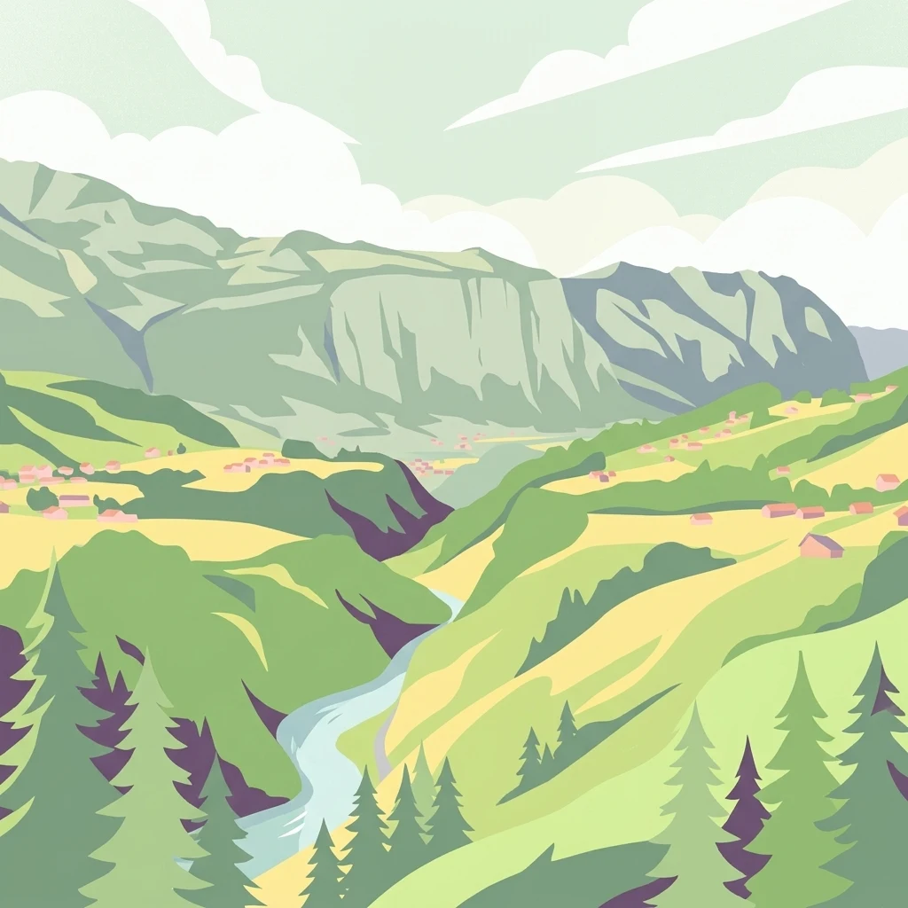
An illustrative style digital artwork showing a lush green mountain valley with pine trees in the foreground, a winding river, and small houses nestled on the slopes beneath steep cliffs.

Diemtigtal

Protected landscape

Park overview

Structured park overview, official facts, and landscape profile for Diemtigtal Nature Park

Diemtigtal Nature Park park facts, protected area profile, and essential visitor context

Review the core facts for Diemtigtal Nature Park, including designation, size, terrain, visitor scale, habitats, and operating context in one park-focused overview.

About Diemtigtal Nature Park

Diemtigtal Nature Park is one of the recognized regional nature parks of Switzerland, encompassing a substantial side valley of the Simmental in the Berner Oberland. The protected landscape stretches from the higher alpine pastures near the head of the valley down to the entry point at Oey, where the local waters join the Simme. The park's identity rests on a balance between inhabited traditional landscape and surrounding mountainous terrain, with orchards, hamlets, and open meadows set against forested flanks and a backdrop of prominent Alpine ridges.

The valley's geography has strongly shaped its character. The Fildrich runs through much of the main valley, joined by the Chirel, while smaller side valleys such as the Meniggrund and Riedere add further depth and ecological variety. The southeastern wall of the Niesenkette, including the Fromberghorn and Gsür, defines a strong natural boundary, while the opposing slopes around Turnen and Niderhorn create an enclosed, intimate alpine setting. The result is a landscape that reads as a coherent whole: a working agricultural valley wrapped in distinctly Alpine topography.

Culturally, the park is anchored by its connection to Albert Schweitzer. The high pasture hamlet of Grimmialp, deep in the upper Diemtigtal, became one of his favored retreats in the early 1900s. Letters published by his daughter document extended stays during 1902 to 1912, where the peaceful setting supported his literary work and personal reflections before his later humanitarian career. This layered heritage, pastoral and biographical, adds a human depth to the park alongside its ecological mission.

For visitors and regional users, the park functions as both a quiet nature destination and a gateway area within the broader Bernese Oberland. Trails lead across the Grimmifurggi pass into the Obersimmental and over the Otterepass toward the Engstligental, linking Diemtigtal into surrounding landscapes. A road from the Simmental and a PostAuto service into the valley ensure access, while the settlement pattern preserves the dispersed village character that has defined the valley for generations.

Quick facts and research context for Diemtigtal Nature Park

Diemtigtal is a side valley of the Simmental in the Bernese Oberland, Switzerland, broadly aligning with the municipality of Diemtigen. It has been a recognized Regional Nature Park since 2009. The valley is drained by the Fildrich, which joins the Chirel and ultimately flows into the Simme near Oey. It is bordered by the Niesenkette range to the southeast, with peaks such as Fromberghorn and Gsür, and by the Turnen and Niderhorn chain to the northwest. The valley connects to neighboring landscapes via the Grimmifurggi into the Obersimmental and via the Otterepass into the Engstligental.

Protection and recognition

Explore the documented terrestrial conservation scope and official designation timeline for Diemtigtal.

Diemtigtal Protection Status and Designated Area Recognition History

Territorial protection records for Diemtigtal outline the established terrestrial framework and designation history originating from 2009. Official documentation details the recognized conservation scope and administrative context governing the protected landscape.

Protection details

Protection scope
Terrestrial
Designated year
2009
Transboundary protection
No
Park context

Deeper park guide and search-rich context for Diemtigtal Nature Park

Diemtigtal Nature Park history, landscape, wildlife, and travel context

Explore Diemtigtal Nature Park through its history, landscape character, ecosystems, wildlife, conservation priorities, cultural context, and seasonal travel timing in a structured park guide built for atlas discovery and search intent.

Why Diemtigtal Nature Park stands out

Diemtigtal is best known for its tranquil Alpine valley scenery and its role as a regional nature park protecting classic Bernese Oberland landscapes. The valley is defined by steep forested slopes opening into broad grassy floors threaded by mountain streams, with the Niesenkette forming a dramatic southeastern skyline. The highland village of Grimmialp gives the park particular cultural weight as a long-term retreat of Albert Schweitzer, who spent extended working stays there in the early twentieth century and described the valley as a place of quiet concentration and writing.
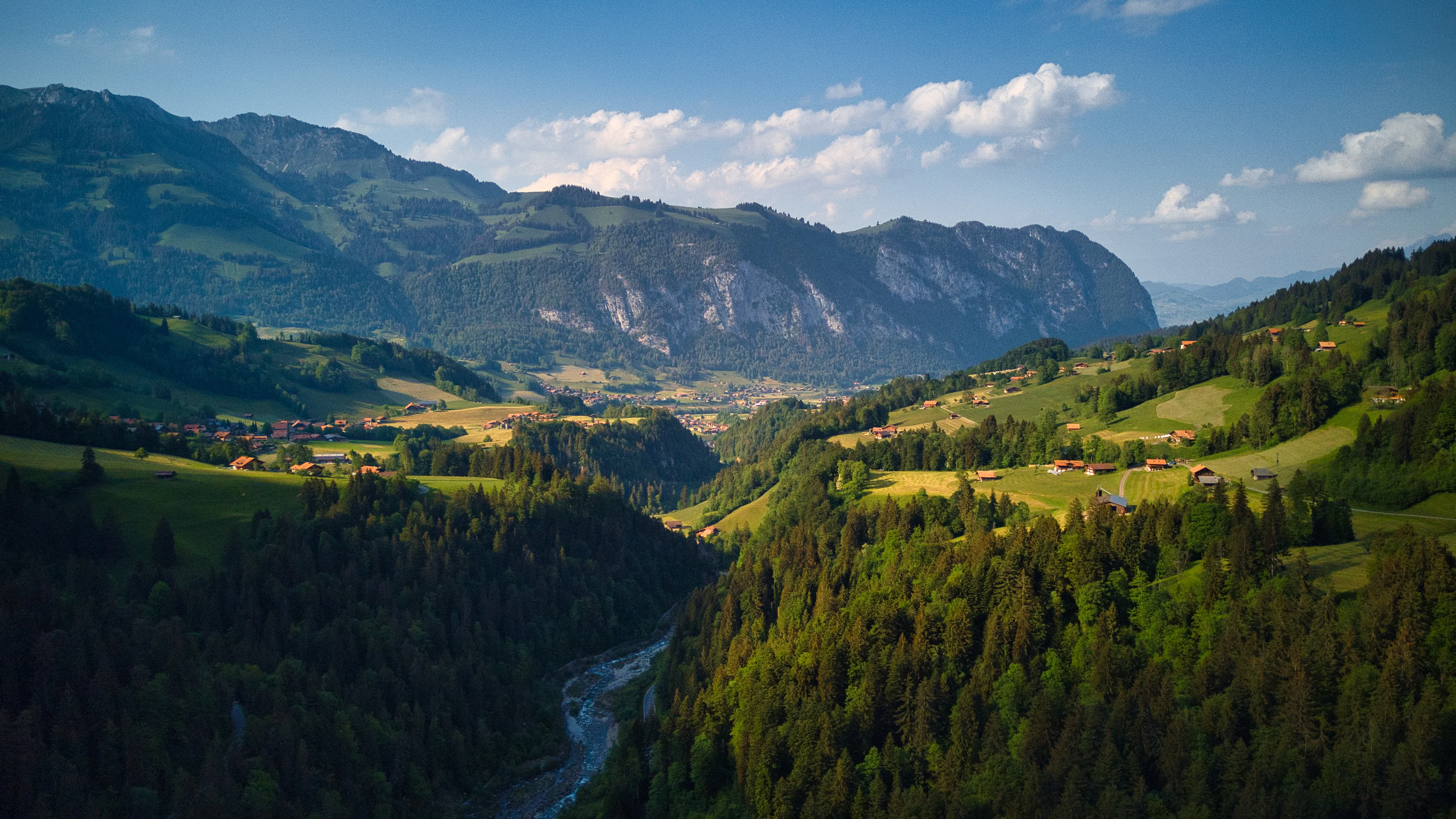
A wide landscape view of a deep mountain valley with pine forests, green alpine meadows, and small houses, under a bright blue sky.
A scenic view of the valley in the Diemtigtal region, looking toward Wimmis.

Diemtigtal Nature Park history and protected-area timeline

The Diemtigtal has long functioned as a pastoral side valley of the Simmental, shaped by traditional Alpine agriculture, forestry, and small-scale settlement. Its modern identity as a conservation landscape began in 2009, when the Regional Nature Park Diemtigtal was officially designated across much of the municipality of Diemtigen. This formal recognition integrated the valley into Switzerland's broader network of regional nature parks, supporting managed coexistence of farming, tourism, and habitat preservation.

Beyond institutional protection history, the valley carries a notable biographical chapter through Albert Schweitzer. During the years 1902 to 1912, Schweitzer repeatedly retreated to the high hamlet of Grimmialp, where he worked on writing and conceived ideas that would shape his later ethical and humanitarian path. Correspondence with Helene Bresslau, later published by his daughter, reflects on the calm and intellectual productivity he found in this Bernese Oberland valley, marking Diemtigtal as a place of cultural as well as natural significance.

Diemtigtal Nature Park landscape and geographic character

The Diemtigtal unfolds as a classic U-shaped Alpine valley, opening at Oey toward the Simmental and narrowing as it rises toward the south. Steep lower slopes give way to broader, flatter pasture floors in the upper valley around Grimmialp, where the terrain opens into highland meadows. The valley's defining topographical frame is the Niesenkette to the southeast, a ridge running from the Fromberghorn through to the Gsür, while the northwest flank is shaped by the Turnen and Niderhorn chain.

To the southwest, the Seehore, Spillgerte, and Rauflihorn close off the upper valley, creating a sense of containment that gives the landscape its enclosed, intimate atmosphere. Side valleys add further variety: the Meniggrund descends from the northwest between the Meniggrat and Stand ridge, drained by the Menigbach and Narebach, while the Riedere branch extends toward the east along the Chirel. Together, these branches create a textured terrain of ridges, sinks, and converging stream channels.

Throughout the valley, the Fildrich dominates the main watercourse, gathering tributaries before joining the Simme at Oey. Lakes, marshes, and moist meadows are absent at a large scale, but smaller floodplain stretches and wet hollows along these streams punctuate the cultivated floor. The visible scenery remains strongly vertical: layered forest belts ascending to open pasture and bare upper ridges, with dispersed farmsteads and hamlets providing scale.

Diemtigtal Nature Park ecosystems, habitats, and plant life

The protected landscape of Diemtigtal reflects a classic Bernese Oberland gradient, with broadleaf and conifer forests blanketing the lower and middle slopes and open alpine pastures occupying higher elevations. The valley's forests transition from mixed montane woodland along the slopes around Diemtigen and Horben to more conifer-dominated stands as elevation increases toward Zwischenflüh and the upper valley around Grimmialp. This vertical zonation supports a corresponding variety of habitats along the catchment of the Fildrich and its tributaries.

The maintained alpine meadows and pastures around Grimmialp, Schwenden, and Riedern are central to the park's ecological identity. These grasslands have been shaped by long-standing traditional use and continue to harbor wildflower-rich swards, wetland transitions near stream margins, and rough pasture margins that function as ecological edges. The combination of open pasture, forest fringe, and steep rocky terrain creates a mosaic of habitat types along relatively short distances, supporting diverse plant communities and the wildlife associated with them.

Hydrological features also shape the park's natural profile. The Simme tributary system, anchored by the Fildrich and joined by the Chirel near Oey, defines a clear drainage axis. Smaller streams descending from the Niesenkette and the northwest ridges contribute to localized wetland pockets, stream-bank vegetation, and riparian habitats. The varied exposure of slopes across the valley, from sun-facing openings to shaded forest hollows, contributes further to ecological complexity characteristic of mid-elevation Alpine valleys.

Diemtigtal Nature Park wildlife and species highlights

The habitats of Diemtigtal support a typical range of mid-elevation Alpine wildlife, with forest, pasture, and rocky ridge environments each contributing distinctive species. The forested slopes are home to common Bernese Oberland mammals such as red deer, roe deer, and chamois, while the rougher upper terrain near the Niesenkette and the southeastern ridges provides additional space for ibex and smaller Alpine ungulates. Smaller carnivores and forest mammals typical of the region are present within the valley's mixed woodland mosaic.

Diemtigtal Nature Park conservation status and protection priorities

The conservation significance of the Diemtigtal lies in its formal status as a Swiss Regional Nature Park, established in 2009, which aims to sustain the valley's traditional cultural landscape alongside its natural value. The designation recognizes the importance of protecting the mosaic of alpine pastures, forested slopes, and traditional settlements that together define the character of this Bernese Oberland side valley. By integrating working agriculture with habitat preservation, the park supports the long-term continuity of open grasslands, forest communities, and hydrological features that would otherwise face gradual fragmentation.

Diemtigtal Nature Park cultural meaning and human context

The cultural identity of Diemtigtal is closely tied to its dispersed village pattern and traditional Alpine land use, with small settlements like Grimmialp, Horben, Bächlen, and Diemtigen set among cultivated pastures and forests. The valley's most distinctive cultural marker is its deep connection to Albert Schweitzer, who spent repeated working retreats at the Grimmialp high pasture hamlet. Letters exchanged with his future wife Helene Bresslau during the early twentieth century describe the valley's quiet as central to his writing and reflection, lending Diemtigtal a recognized place in early twentieth-century intellectual history.

Top sights and standout views in Diemtigtal Nature Park

The Diemtigtal offers a coherent Alpine experience defined by its enclosed side-valley geography, traditional Bernese Oberland settlement pattern, and well-preserved mix of pasture and forest. Its most striking physical feature is the southeastern Niesenkette skyline, visible from much of the valley floor. The high hamlet of Grimmialp stands out both as a seasonal alpine landscape and as the well-documented retreat of Albert Schweitzer between 1902 and 1912. Connections over the Grimmifurggi and Otterepass passes extend the park's scope into the broader Bernese Oberland network of valleys.

Best time to visit Diemtigtal Nature Park

Diemtigtal's character shifts notably with elevation and season. Late spring and early summer bring fresh green pastures and active highland farming near the upper hamlets such as Grimmialp and Zwischenflüh. Mid to late summer is generally the most reliable period for full access across the valley, with stable weather, vibrant wildflower meadows, and fully operational alpine pastures. Autumn brings quieter trails, harvest activity, and clearer views toward the Niesenkette ridge, while winter emphasizes the peaceful, snow-covered character of the valley, though higher trails become more demanding and parts of the upper terrain may be snow-bound.

Monthly climate preview

Monthly temperature ranges and precipitation averages for Diemtigtal, Switzerland

Diemtigtal Climate Normals, Long-Term Temperature and Precipitation Patterns

Long-term representative records outline the annual temperature progression and monthly precipitation rhythm across Diemtigtal elevations. Exploring the complete twelve-month profile provides a structured look at multi-year averages without relying on live forecasts.
Annual mean4 °C
-6 °C13 °C
Jan-6°
Feb-5°
Mar-1°
Apr
May
Jun11°
Jul13°
Aug13°
Sep
Oct
Nov
Dec-4°
Warmest month
July

13.3 °C

Coolest month
January

-5.5 °C

Wettest month
June

4 mm/day

Driest month
February

2.5 mm/day

Park location guide

Geography guide, regional context, and park location map for Diemtigtal Nature Park

Diemtigtal Nature Park park geography, regions, and map view in Switzerland

Understand where Diemtigtal Nature Park sits in Switzerland through a broader geographic reading of the surrounding landscape, nearby location context, and its mapped position within the national park landscape.

How Diemtigtal Nature Park fits into Switzerland

Switzerland is a landlocked federal republic in Central Europe comprising 26 cantons, with Bern as the federal city and Zurich as the largest city. The country features the Swiss Alps, Swiss Plateau, and Jura Mountains, with German, French, Italian, and Romansh as official languages. It is noted for its political neutrality, direct democracy traditions, and strong economy.

Wider geography shaping Diemtigtal Nature Park in Switzerland

Switzerland is located in Central Europe at the intersection of Western and Southern Europe. It is bordered by Germany to the north, France to the west, Austria and Liechtenstein to the east, and Italy to the south. The country is geographically divided among the Swiss Alps (covering most of the territory), the Swiss Plateau (where most of the population resides), and the Jura Mountains. Switzerland is landlocked.

Map view of Diemtigtal Nature Park

Use this park location map to pinpoint Diemtigtal Nature Park in Switzerland, understand its exact geographic position, and read its mapped placement within the surrounding landscape more clearly.

Pigeon | © OpenStreetMap contributors

Visualizing alpine valley terrain, protected habitats, and mountain panoramas

Diemtigtal Photos and Landscape Scenery in the Swiss Alps

Visual records capture the steep forested slopes, high alpine pastures, and dramatic ridges defining the Diemtigtal protected area. Studying these protected-area views reveals the topography, stream corridors, and pastoral character shaping the Bernese Oberland regional nature park.

A wide landscape view of a deep mountain valley with pine forests, green alpine meadows, and small houses, under a bright blue sky.

A wide, eye-level landscape shot of a green mountain valley with rolling hills, dense forest patches, and traditional wooden farmhouses under a clear blue sky.

Park atlas

Compare surrounding Bernese Oberland alpine landscapes and regional valley reserves

Explore Protected Areas and Parks Near Diemtigtal

Browse other parks near Diemtigtal to discover connected protected landscapes and adjacent Alpine valleys. Comparing regional terrain helps place individual mountain reserves within a broader geographical context.
A soft watercolor painting of a mountain landscape with rolling hills, pine forests, and a meadow in light green and muted earth tones.
Regional parkCanton of Bern
About 22 km away#1 closest

Northwest

Regionaler Naturpark Gantrisch: Protected Terrain and Map Exploration in Canton of Bern

A diverse transition zone from glacial moraines to high mountain ridges.

Spanning over 400 square kilometers, Regionaler Naturpark Gantrisch offers a unique look at the Swiss landscape. Its boundaries encompass everything from low-lying agricultural valleys and historic castles to the steep, forested gorges of the Sense and Schwarzwasser rivers and the high-altitude vistas of the southern Gantrisch mountain range.

Area
414 km²
Established
2012
Relief
Mountain
Climate
Alpine
A soft watercolor painting of a river flowing through a green landscape with rolling hills and trees in the distance.
Protected landscapeKanton Bern
About 25 km away#2 closest

North

Aarelandschaft zwischen Thun und Bern: Protected Landscape and River Corridor Geography

Mapping the floodplain remnants of the Aare river corridor

The Aarelandschaft zwischen Thun und Bern protects a unique corridor of riparian forest, wet meadows, and springs along the Aare river. Situated in the Kanton Bern, this landscape retains evidence of historic river engineering alongside ongoing restoration programs that reconnect vital lowland ecosystems. It stands as a significant natural corridor in a densely populated region, marked by its molasse hills and varied alluvial topography.

Area
10.4 km²
Established
1983
Relief
Lowland
Climate
Temperate
A soft watercolor painting of rolling hills and distant mountains in light green and muted tones.
Biosphere reserveLucerne
About 38 km away#3 closest

Northeast

Entlebuch Biosphere Reserve: Mapped Protected Landscapes in the Canton of Lucerne

Exploring karst formations and alpine wetland ecosystems

Entlebuch stands as a pioneering example of community-driven conservation in the Swiss Alps. This protected landscape encompasses extensive peatlands, forested slopes, and the iconic Schrattenfluh karst massif. Use this geographic entry to understand the regional topography and the spatial distribution of protected habitats throughout this central Swiss valley.

Area
397 km²
Established
2001
Relief
Mountain
Climate
Alpine
Nature reserveKanton Luzern
About 43 km away#4 closest

Northeast

Naturschutzgebiet Laubersmad - Salwidili: Exploring a Vast Swiss Moorland and Alpine Reserve

A critical moorland complex in the heart of Kanton Luzern

Spanning over 1,300 hectares, this protected nature reserve in Kanton Luzern constitutes the largest contiguous moorland landscape in Switzerland. The area is defined by a unique geological flysch trough that supports a rich diversity of peatland types, including raised bogs and fens, alongside spruce forest and alpine pasture. As an IUCN Category IV area, it provides essential habitat for endangered mire flora and high-altitude wildlife in a remarkably intact hydrological setting.

Area
13.76 km²
IUCN
IV
Relief
Mountain
Scope
Terrestrial
A watercolor illustration of a river landscape with a gentle bend, shoreline greenery, and distant low hills, rendered with soft, faded edges.
Protected landscapeCanton of Bern
About 44 km away#5 closest

Northwest

Stausee Niederried Protected Landscape: A Geographic Map and Atlas of Swiss Floodplains

Mapped alluvial terrain and sandstone cliffs in the Canton of Bern.

Stausee Niederried functions as a vital protected landscape, blending a historic hydroelectric reservoir with a four-kilometer riverine floodplain. The area is characterized by high geomorphic contrast, ranging from the vast Runtigenfluh molasse cliff to critical riparian marshes and orchid-rich pine forests. This entry provides a structured look at the park boundaries, geological features, and the wider fluvial mosaic found near the confluence of the Aare and the Saane.

Area
2.97 km²
Established
1991
IUCN
V
Relief
Mixed relief
A watercolor painting of a panoramic mountain landscape featuring a foreground of green trees and distant purple mountain ridges under a soft light.
Nature reserveValais
About 47 km away#6 closest

Southeast

Aletschwald Nature Reserve: Geographic Insights and Protected Alpine Landscape Context

An ancient high-elevation forest ecosystem in the Swiss Valais.

Situated between 1,600 and 2,200 meters, Aletschwald represents one of the few remaining managed-free subalpine forests in the Alps. The reserve maps the interaction between glacial retreat and forest advancement, featuring a dense mosaic of Arolla pines, larch, and pioneer mosses across diverse lateral moraine formations.

Area
4 km²
Established
1933
Relief
Mountain
Climate
Alpine
A soft watercolor painting of a green landscape featuring rolling hills and a winding river with distant mountains in the background.
Nature reserveBern
About 51 km away#7 closest

East

Naturschutzgebiet Gauligletscher: Glacial Landscape and Nature Reserve in Bern

A high-alpine protected area in the Bernese Oberland

Discover the unique geography of Naturschutzgebiet Gauligletscher, a protected area in Bern featuring a wide amphitheater of moraines, glacial lakes, and retreating ice. This site functions as an active laboratory for river dynamics and alpine vegetation colonization across an expansive, mineral-dominated valley floor.

Area
5.7 km²
Established
2001
IUCN
IV
Relief
Mountain
A watercolor illustration of a soft, rolling alpine landscape with a winding path and distant mountain peaks against a pale yellow sky.
Regional parkValais
About 59 km away#8 closest

Southeast

Landschaftspark Binntal: Alpine Geography and Regional Protected Area in Valais, Switzerland

Mapping deep mountain valleys and glacial alpine terrain

Landschaftspark Binntal serves as a vital protected area in the Valais Alps, showcasing a vertical sequence of ecosystems from river gorges to 3000 meter peaks. The park preserves a living cultural landscape alongside significant mineralogical heritage, offering a detailed view into the high-altitude geography and remote valleys that define this distinctive corner of the Swiss mountain landscape.

Area
180 km²
Established
2008
Relief
Mountain
Climate
Alpine

Common questions about visiting, size, designation, and location context for Diemtigtal Nature Park

Diemtigtal Nature Park FAQs for park facts, access, geography, and protected area context

Find quick answers about Diemtigtal Nature Park, including protected-area facts, park geography, trail and visitor context, and how the park fits into its surrounding country and regional landscape.
MoriAtlas Explorer

Continue Your Protected Areas Search Across the Global Atlas

Deepen your exploration by continuing the structured search for national parks and protected areas worldwide. Utilize the comprehensive filtering capabilities to compare different conservation landscapes and refine your understanding of global park geography. Discover more about the distribution and characteristics of protected natural areas.

Global natural geography