
Mori Atlas logo
Protected landscapeStausee Niederried

A mapped overview of alluvial forest mosaics, molasse cliffs, and critical wetland reservoirs.

Stausee Niederried Protected Landscape and Floodplain Geography in the Canton of Bern

(Landschaftsschutzgebiet Stausee Niederried)

The Stausee Niederried protected landscape forms a unique geographic intersection between the Aare and Saane river basins within the Canton of Bern. Defined by its shallow reservoir, expansive reedbeds, and the towering Runtigenfluh sandstone cliff, this area represents a cornerstone of Swiss floodplain conservation. The terrain encompasses a complex network of alluvial forests, fens, and open water habitats that support significant biological variety across the plateau landscape.

floodplainreservoirRamsar wetlandriparian forestfenalluvial landscape
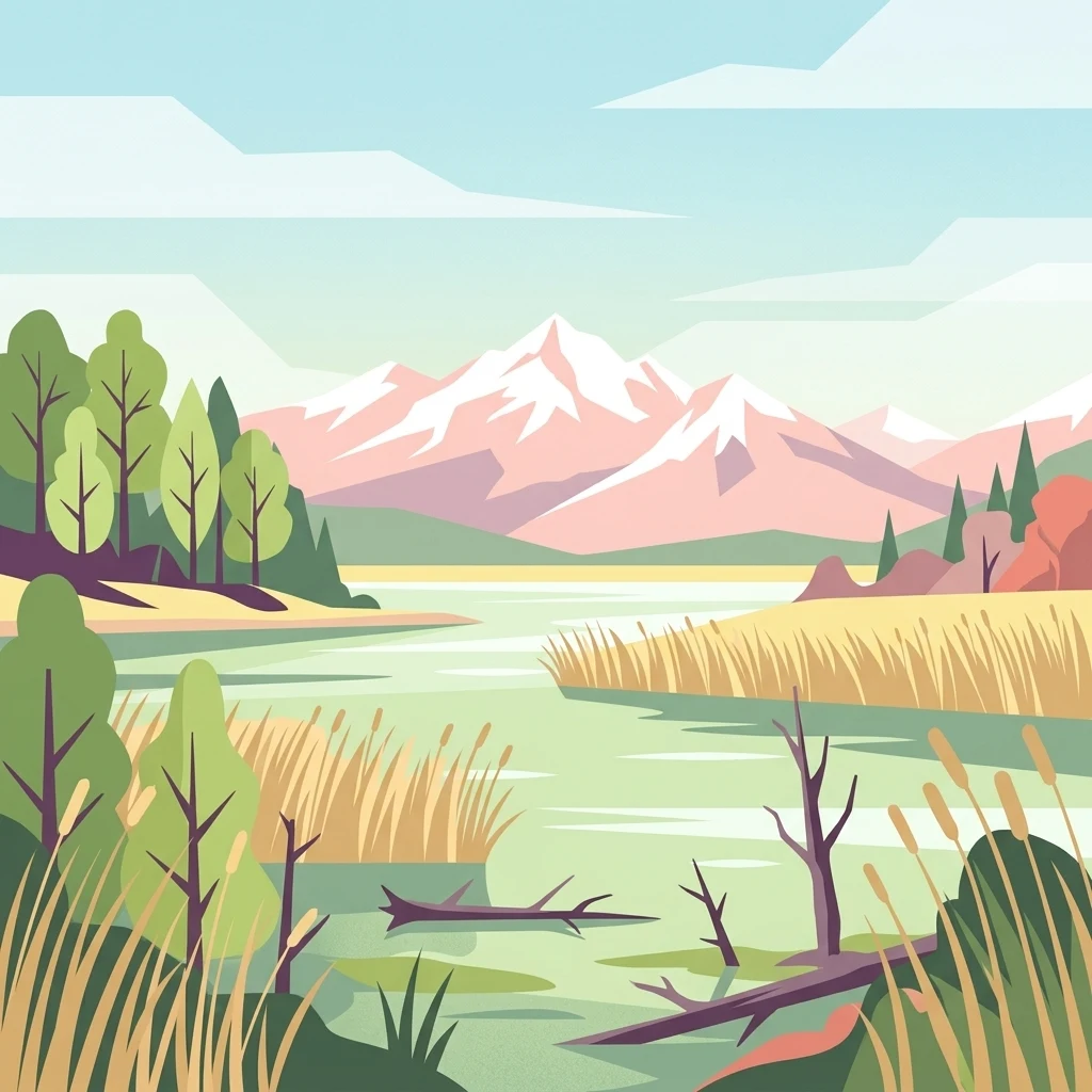
A flat vector-style illustration of a wetland lake with reeds in the foreground; deciduous and evergreen trees on the banks; and a series of snow-capped mountains in the background under a pale sky.

Stausee Niederried

Protected landscape

Park overview

Structured park overview, official facts, and landscape profile for Stausee Niederried Protected Landscape

Stausee Niederried Protected Landscape park facts, protected area profile, and essential visitor context

Review the core facts for Stausee Niederried Protected Landscape, including designation, size, terrain, visitor scale, habitats, and operating context in one park-focused overview.

About Stausee Niederried Protected Landscape

Stausee Niederried sits in a glacially carved section of the Aare valley where the river meets the Saane. The valley floor here is unusually wide; it is filled with gravel terraces, side streams, and a network of former arms and gravel pits, and it is bordered by sandstone ridges that rise steeply above the flat floodplain. The setting is the result of Quaternary erosion, which shaped a broad trough between molasse hills and laid the geological basis for both the modern reservoir and the wetlands that follow.

The current landscape is largely the product of hydroelectric development. The reservoir was impounded in 1913 for the Kalnach power plant, and a second dam at Niederried-Radelfingen followed in 1963. These works removed the natural meandering of both rivers, confined them between levees, and altered the groundwater table. In response, the area was progressively shielded by protective law, beginning with a cantonal hunting ban in 1956 and expanding through federal landscape and alluvial inventories, a cantonal nature reserve of 171 hectares, a nationally designated amphibian spawning ground of 80 hectares, and a 18-hectare fen.

Quick facts and research context for Stausee Niederried Protected Landscape

Stausee Niederried lies in the Canton of Bern within the municipalities of Radelfingen, Kallnach, Mühleberg, Wileroltigen, and Golaten, in a broad valley carved by the Aare and its largest upstream tributary, the Saane. The combined protected zone spans roughly 297 hectares of landscape and about 171 hectares of strict nature reserve, including an 80-hectare amphibian spawning site and an 18-hectare fen.

The reservoir itself dates to 1913 and covers approximately 154 hectares. The site has carried Ramsar status since 1990 and has been registered as a federal waterbird and migratory bird reserve since 2001, while long-term winter waterbird counts have been conducted here since 1951. It is part of the broader Important Bird Area "Grosses Moos und Stausee Niederried," which links the Aare floodplain to Lake Murten and Lake Biel.

Protection and recognition

Documented terrestrial protection history and Ramsar wetland designation details

Stausee Niederried Protection Status and International Recognition Record

Stausee Niederried maintains a documented terrestrial protection status established in 1983 alongside official international Ramsar wetland recognition. Official records outline the formal designation timeline and management scope for this protected area.

International recognition

Protection details

Protection scope
Terrestrial
Designated year
1983
Transboundary protection
No
WDPA ID
347480
Park context

Deeper park guide and search-rich context for Stausee Niederried Protected Landscape

Stausee Niederried Protected Landscape history, landscape, wildlife, and travel context

Explore Stausee Niederried Protected Landscape through its history, landscape character, ecosystems, wildlife, conservation priorities, cultural context, and seasonal travel timing in a structured park guide built for atlas discovery and search intent.

Why Stausee Niederried Protected Landscape stands out

The Stausee Niederried reserve is best known for its exceptionally shallow reservoir, which functions as a Ramsar wetland and a wintering site for up to roughly ten thousand waterbirds each year. More than 170 bird species have been recorded, with seventy-five breeding locally, and standardized ornithological counts here have been running since the early 1950s. It is equally recognized for its floodplain mosaic, where willows, ash and elm alluvial forests, marshy meadows, fens, and oxbow arms coexist with running water along four kilometers of the Aare. The dramatic Runtigenfluh, a molasse cliff that forms the largest sandstone rock face along the Aare on the Swiss Plateau, adds a geological dimension that complements the wetland values and supports orchid-rich pine woodland on its dry ledges.
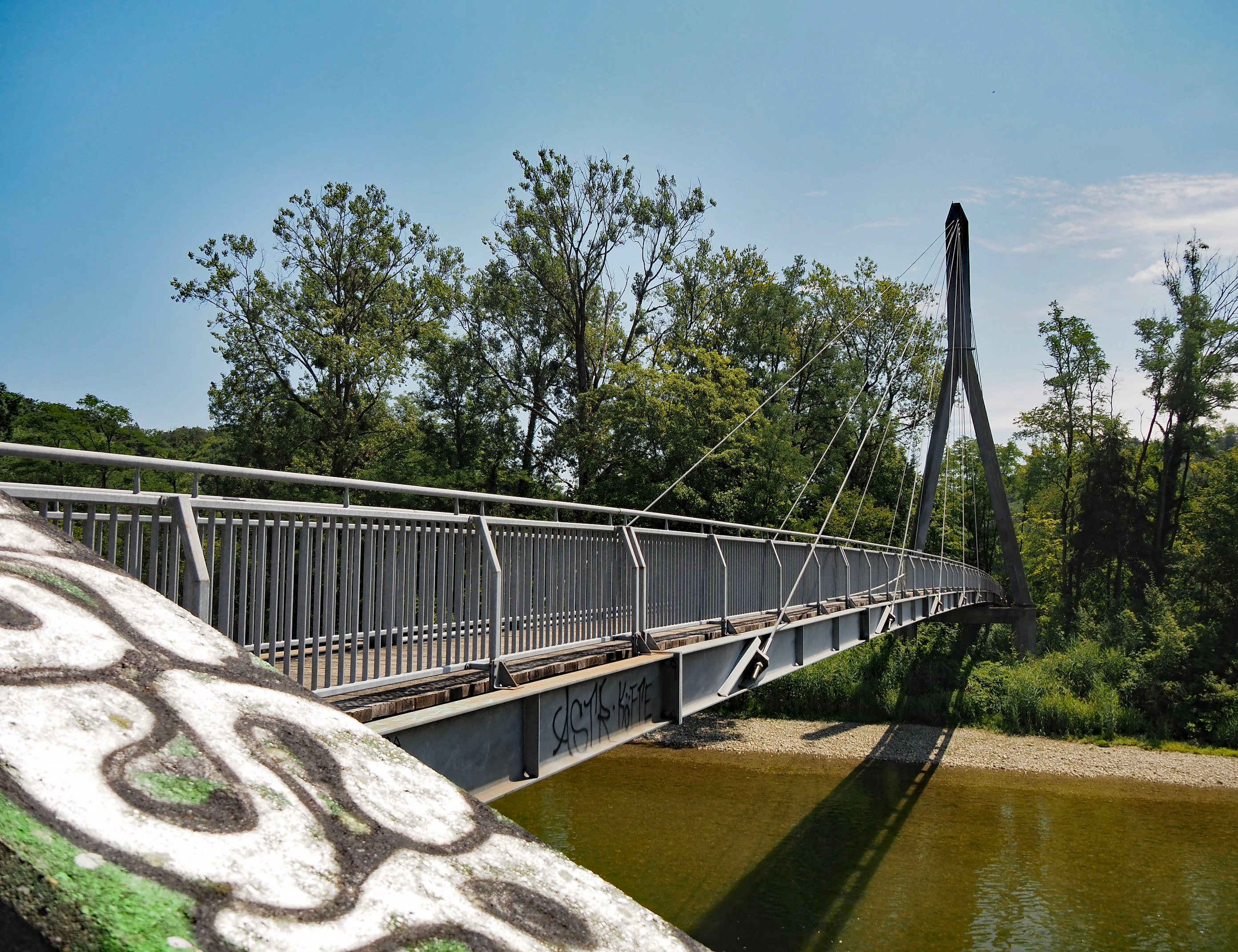
A modern grey metal suspension footbridge crossing a river; the bridge is angled from the foreground toward a tall, A-frame central pylon surrounded by green trees under a clear blue sky.
A metal footbridge spanning the Saane river in the Oltigenmatt area of the Stausee Niederried nature reserve.

Stausee Niederried Protected Landscape history and protected-area timeline

The landscape that today forms the reserve has long been shaped by flooding and human effort to control it. After a devastating Aare flood in October 1888, levees were built along the lower Saane with federal support, displacing natural flood dynamics from the meadows. In 1913 the Bernische Kraftwerke impounded the Aare for the Kalnach plant, and in 1963 a second dam was added at Niederried-Radelfingen to exploit residual flow. The reservoir and tightened river regime transformed the valley floor, swallowed agricultural land in the Golatenau, and created the shallow lake whose ecological value only became apparent through later monitoring.

Protection history began with a cantonal hunting ban in 1956, followed in 1966 by the canton's designation of the area as a nature reserve. In 1983 the federal government added the broader valley reach to the Inventory of Landscapes and Natural Monuments of National Significance (BLN), creating the present-day 297-hectare Landscape Protected Area. The Ramsar designation was confirmed in 1990, and in 2001 the zone received status as both an amphibian spawning area and a waterbird and migratory bird reserve of national importance. A decisive conservation update came in November 2013, when the cantonal directorate of economic affairs consolidated floodplain, fen, and amphibian protections into a single cantonal nature reserve called Niederried-Oltigenmatt. Parallel hydroelectric concessions required operators to carry out habitat enhancement; the foundation Landscape Protection Switzerland recognized the corridor from Niederriedsee to Bielersee as Landscape of the Year 2017.

Stausee Niederried Protected Landscape landscape and geographic character

The valley reaches a kilometer wide where the Aare and the Saane converge between the communities of Mühleberg, Kallnach, Radelfingen, and Golaten. At the heart of the area lies the shallow Niederriedsee, created in 1913 and roughly 154 hectares in surface. A long peninsula, the remnant of an old embankment, divides the lake; near the Saane mouth, the original Golatenau was flooded against the initial plan, producing the flat, reed-fringed shoreline that is now critical for waterbirds.

Above the lake, the terrain rises sharply into molasse country. On the east bank opposite the Saane confluence, the Runtigenfluh forms an almost kilometer-long sandstone cliff up to 120 meters high, with its rock rim reaching 580 meters in elevation and constituting the highest point of the protected area. On the west bank the Golaten and Mannewil slopes rise about 50 meters, forested and rocky. Smaller distinct land units include the Rewag floodplain with its former Aare oxbow, the Oltigenmatt, the Oberruntigenau, the Auli, the Brättelenteich pond, and flat alluvial surfaces such as the Wilerau.
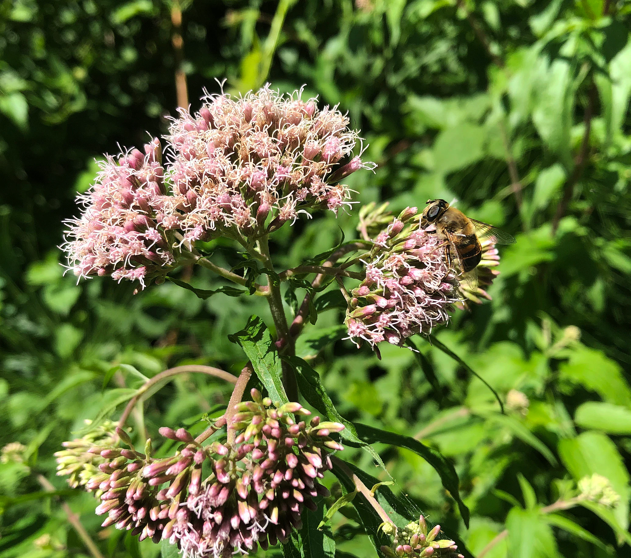
Close-up view of light pink hemp-agrimony flowers in bloom with a bee resting on one of the flower clusters, set against a background of blurred green foliage.
A bee pollinating hemp-agrimony within the Stausee Niederried nature reserve.

Stausee Niederried Protected Landscape ecosystems, habitats, and plant life

The reserve is a mosaic of aquatic, amphibious, and terrestrial biotopes. The shallow lake supports reeds, submerged vegetation, and exposed mudflats, while the riverbanks hold softwood alluvial forest of white willow, one of the largest such stands in Switzerland, alongside hard alluvial communities of ash and elm, alder woods, willow thickets, and mixed stands containing Gewöhnlicher Wasserdost and tall horsetails.

Drier microhabitats occur along the Runtigenfluh, where pine woods with orchids grow on sandstone and marl outcrops of the lower freshwater molasse. The Oltigenmatt holds the largest fen, with large sedge reed, tall-herb fen, and wet meadows. Toward the margins of the protected area, cultivated forest dominates, but rare communities such as yew-bearing beech woods, oak woods, and mixed forests of ash, pine, spruce, and poplar persist on steep slopes, including parts of the Rewagholz forest in the municipality of Mühleberg.
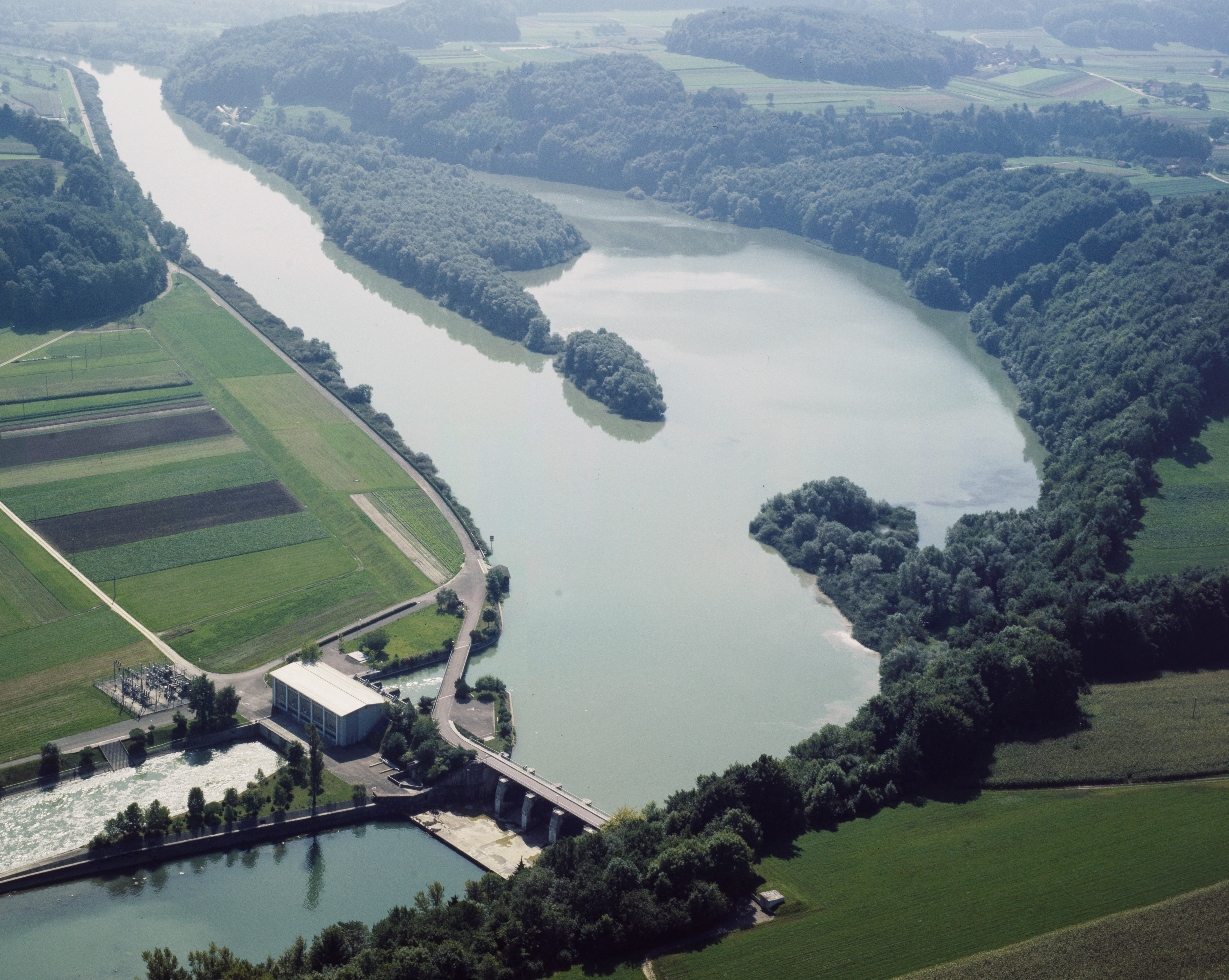
An aerial perspective of a reservoir on a river surrounded by forested banks and farmland, with a hydroelectric dam structure visible in the foreground.
Aerial view of the Stausee Niederried reservoir and the adjacent hydroelectric power plant along the Aare river.

Stausee Niederried Protected Landscape wildlife and species highlights

The reservoir is one of Switzerland's key waterbird sites, historically tracked through standardized winter counts begun in 1951 by the Bernese conservationist Ernst Niggeler. More than 170 species have been recorded, seventy-five breeding locally, and up to roughly ten thousand waterbirds winter here annually. Ducks, grebes, cormorants, grey herons, great crested grebes, and coots are the long-documented core, with later additions including great egret, bittern, water rail, snipe, curlew, common sandpiper, and kingfisher.

The river and side arms support a rich fish fauna, with current-loving species spawning in the flowing Aare, while calmer waters host the threatened Bitterling along with trout, burbot, perch, and pike. The waters are important habitats for dragonflies and other insects, and the beaver has reclaimed several territories. A diverse amphibian community, including alpine newt, palmate newt, water frog, common frog, common toad, and the endangered European tree frog, uses the Oltigenmatt mosaic; in 2020 seven new amphibian ponds were created to support the tree frog. The dry cliff and slope along the Runtigenfluh attract raptors, occasionally storks, and reptiles such as the threatened grass snake. Mammals such as roe deer, badger, red fox, and wild boar are present in surrounding woodland.
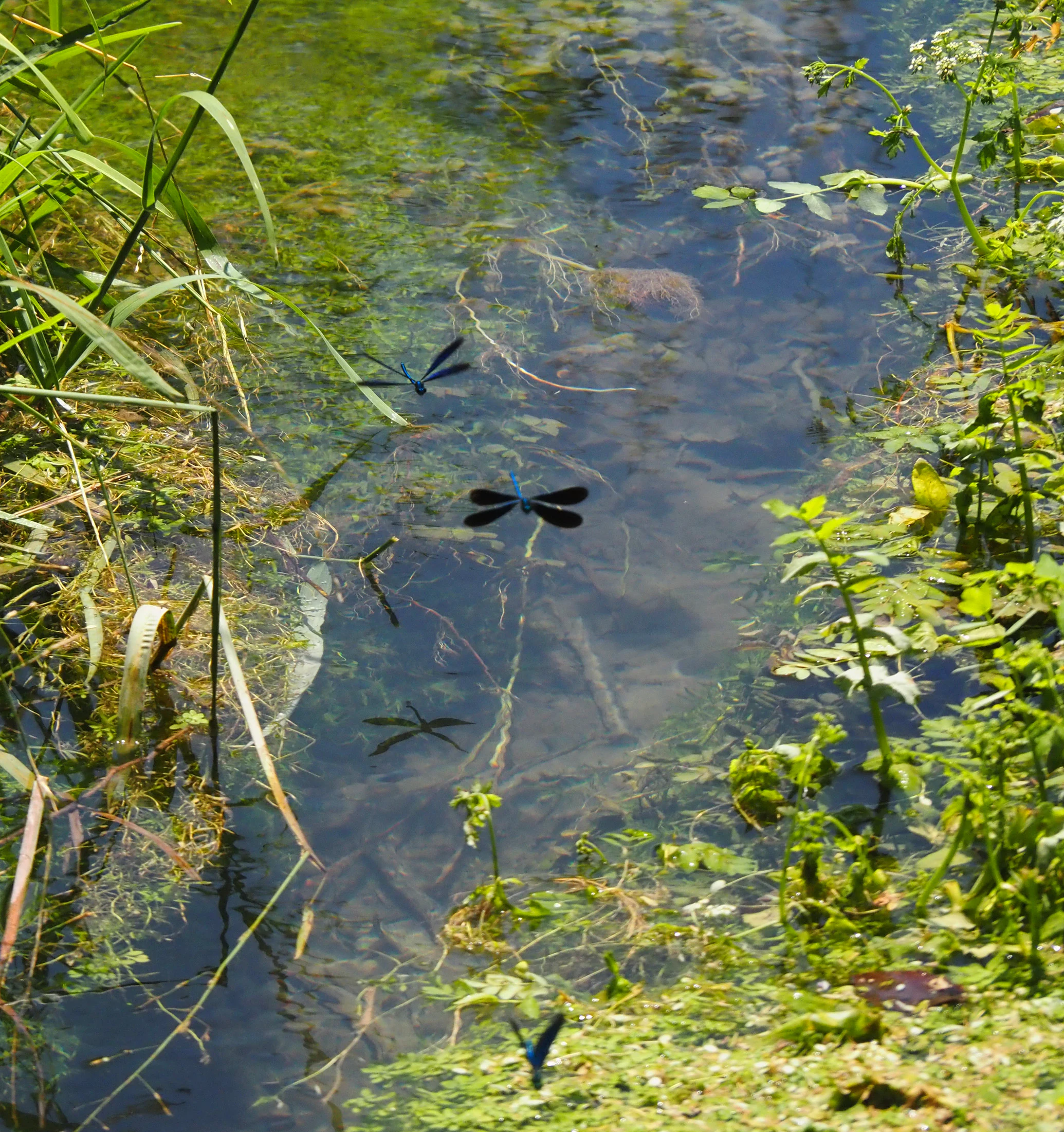
Several dark-winged demoiselle damselflies flying above a small, shallow stream flanked by green riparian vegetation and aquatic plants.
Demoiselle damselflies hovering over the clear, shallow waters of the Giessekanal in the Oltigenmatt area of Stausee Niederried.

Stausee Niederried Protected Landscape conservation status and protection priorities

The site's profile as a conservation landscape rests on multiple overlapping designations. At the federal level it counts as a BLN landscape (Object 1316), a Ramsar wetland since 1990, and a federal waterbird and migratory bird reserve of national importance since 2001. At the cantonal level it is a hunting ban zone since 1956, a cantonal nature reserve since 1966, and, since the November 2013 consolidated decree, the 171-hectare nature reserve "Niederried-Oltigenmatt," complemented by an 80-hectare nationally designated amphibian spawning ground and an 18.5-hectare federal fen.

Habitat enhancement has been tied explicitly to hydroelectric licensing. Operators of the Niederried-Radelfingen and Mühleberg plants have funded ecological upgrades, including new fishways, an innovative fish lift at Mühleberg (2021), and proposed new side channels in the Brättelenmatte. A long-running monitoring program run by the Federal Office for the Environment has nonetheless identified significant need for further floodplain restoration, particularly in response to the artificial daily water level fluctuations from upstream hydropower on the Saane. National conservation inventories recognize the zone as one of the country's richest floodplain sites for waterbirds and amphibians, and in 2017 the corridor from the Niederriedsee down to Lake Biel was named Landscape of the Year by the Stiftung Landschaftsschutz Schweiz.

Stausee Niederried Protected Landscape cultural meaning and human context

The valley carries a layered human history that goes back centuries. The medieval ruins of Burg Oltigen still crown the head of the Runtigenfluh, while historical farms, including the abandoned Hofsiedlung "Einiger" in the Oltigenmatt, were lost when the reservoir was raised. The floodplain's names, mowed fields, and seasonal use illustrate how much of the area was once regular agricultural land shaped by recurring floods before the levees built after the 1888 disaster confined the rivers.

Modern cultural ties are largely recreational and infrastructural. Long-distance cycle and hiking routes, including the Aare Route, the Areuse-Emme-Sihl route, and the Via Berna, cross the floodplain via the Saanesteg cable-stayed bridge near Oltigenmatt, allowing slow travel through the conserved landscape while retaining the industrial presence of high-voltage power lines, the former Mühleberg nuclear plant (decommissioned in 2019), and active hydroelectric infrastructure. Land still in private agricultural use is grazed by Scottish Highland cattle, reflecting a deliberate shift from mowing toward extensive use that supports the wetland vegetation.
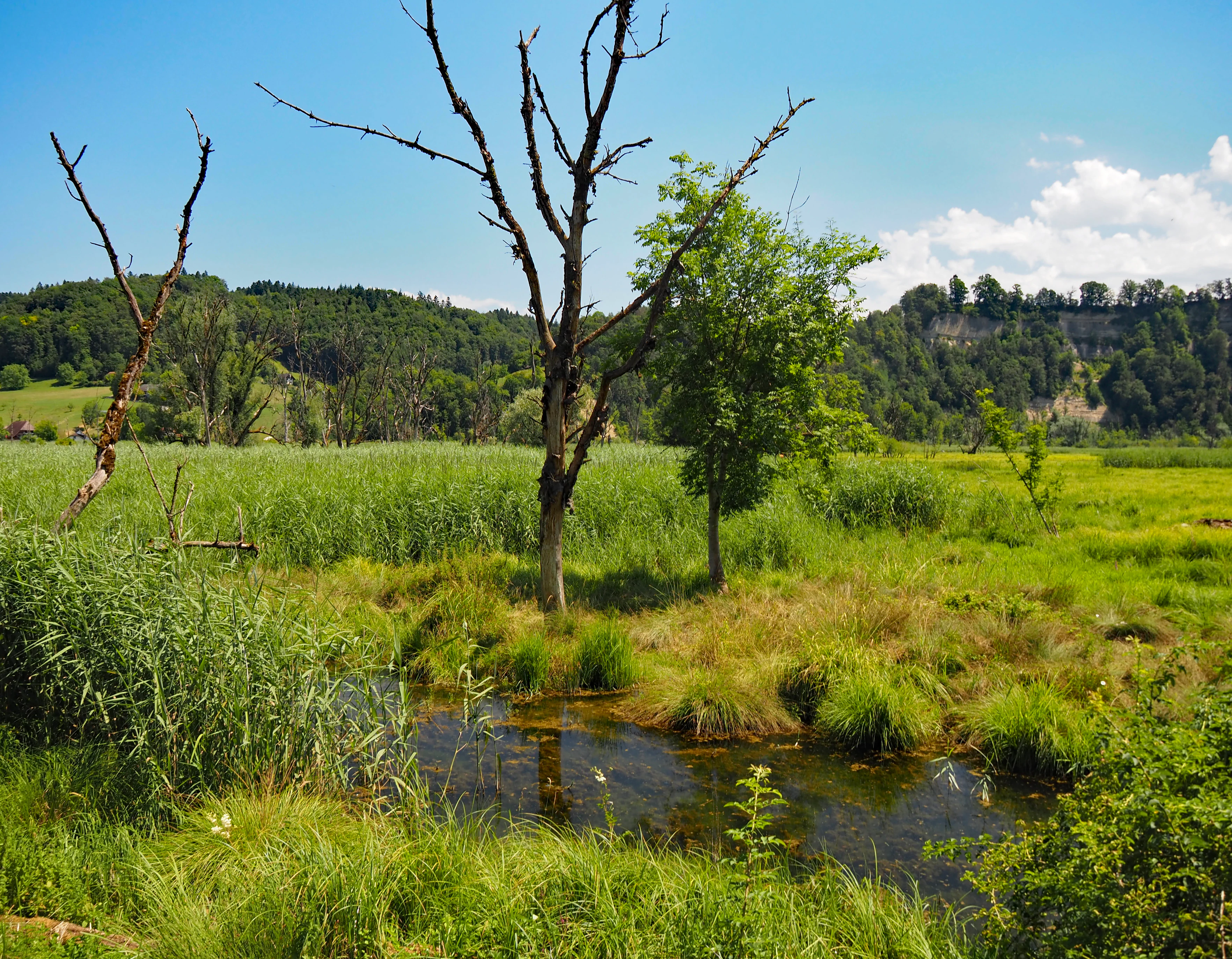
A green wetland landscape under a clear blue sky, featuring a small winding stream in the foreground, tall grasses, a few dead trees, and a low forested hill in the distance.
The Oltigenmatt Nature Reserve within the Stausee Niederried protected area, showing wetland vegetation and a small water channel.

Top sights and standout views in Stausee Niederried Protected Landscape

The Niederriedsee combines unusually shallow water with a Ramsar-level wetland at the doorstep of a major Swiss city, making it possible to observe large flocks of wintering ducks, grebes, and herons within easy reach of Bern. The Saanesteg bridge links visitors into a network of long-distance cycling and walking trails that pass through the Oltigenmatt meadows and the Rewag.

The Runtigenfluh provides a sharp geological counterpoint: the largest molasse cliff along the Aare on the Plateau, holding orchid-rich pine woodland on its dry sandstone ledges and serving as both a backdrop for raptors and a defining mark of the protected landscape. Together, the reservoir, the alluvial forests, the fen, and the cliff compose a compact unit that is unusually rich for a small area.
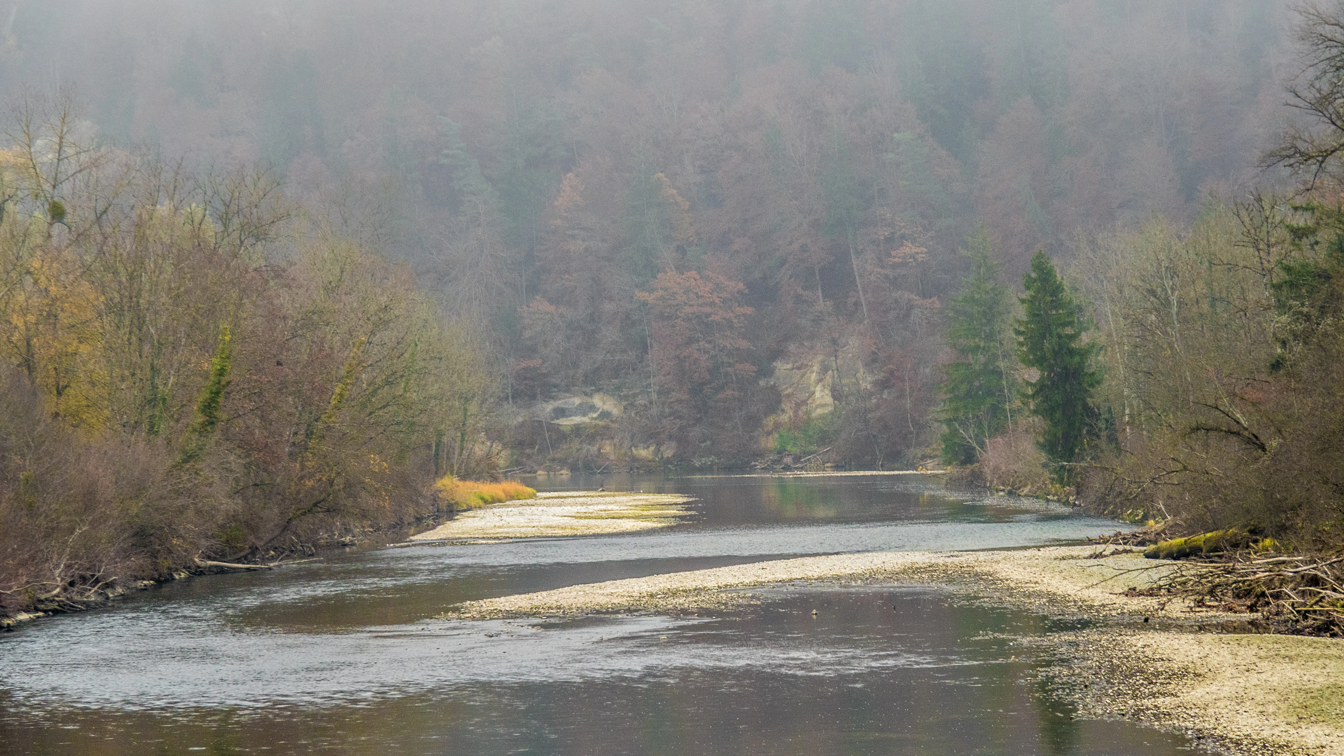
A wide, calm river flowing through a deciduous forest with light fog obscuring the trees in the background and exposed gravel riverbanks in the foreground.
A serene, misty view of the Aare river and its gravel banks within the Stausee Niederried protected area.

Best time to visit Stausee Niederried Protected Landscape

The protected landscape's character changes with the seasons in ways that are sharply visible rather than subtle. The mild, wetter months from late spring through early autumn are when wetland vegetation, dragonflies, and amphibians are most active, and when flowers in the fens and fern-rich alluvial forests are at their best. Late summer and early autumn floods can occasionally reshape shallows and sediment flats, while the autumn drawdown of the reservoir leaves grazing land damp after the seasonal lowering.

The colder months transform the lake into a major waterbird wintering area, when standardized counts record their peak numbers of ducks, grebes, herons, and cormorans; this is the period ornithologists associate most closely with the site. Winter and early spring also make the Runtigenfluh cliffs easier to read on the landscape, as deciduous trees lose their leaves and the molasse walls and exposed mudflats on the lake draw the eye.

Monthly climate preview

Long-term temperature ranges and monthly precipitation data for the Canton of Bern protected area.

Stausee Niederried Climate Normals and Measured Annual Weather Patterns

Stausee Niederried exhibits a measured annual temperature rhythm alongside consistent monthly precipitation patterns based on historical coordinates. Examining the complete twelve-month climatology profile reveals detailed fluctuations across all seasons.
Annual mean8 °C
-1 °C18 °C
Jan-1°
Feb
Mar
Apr
May12°
Jun16°
Jul18°
Aug18°
Sep13°
Oct
Nov
Dec
Warmest month
July

17.8 °C

Coolest month
January

-0.8 °C

Wettest month
May

4 mm/day

Driest month
February

2.3 mm/day

Park location guide

Geography guide, regional context, and park location map for Stausee Niederried Protected Landscape

Stausee Niederried Protected Landscape park geography, regions, and map view in Switzerland

Understand where Stausee Niederried Protected Landscape sits in Switzerland through a broader geographic reading of the surrounding landscape, nearby location context, and its mapped position within the national park landscape.

How Stausee Niederried Protected Landscape fits into Switzerland

Switzerland is a landlocked federal republic in Central Europe comprising 26 cantons, with Bern as the federal city and Zurich as the largest city. The country features the Swiss Alps, Swiss Plateau, and Jura Mountains, with German, French, Italian, and Romansh as official languages. It is noted for its political neutrality, direct democracy traditions, and strong economy.

Wider geography shaping Stausee Niederried Protected Landscape in Switzerland

Switzerland is located in Central Europe at the intersection of Western and Southern Europe. It is bordered by Germany to the north, France to the west, Austria and Liechtenstein to the east, and Italy to the south. The country is geographically divided among the Swiss Alps (covering most of the territory), the Swiss Plateau (where most of the population resides), and the Jura Mountains. Switzerland is landlocked.

Map view of Stausee Niederried Protected Landscape

Use this park location map to pinpoint Stausee Niederried Protected Landscape in Switzerland, understand its exact geographic position, and read its mapped placement within the surrounding landscape more clearly.

Pigeon | © OpenStreetMap contributors

Location context for Stausee Niederried Protected Landscape

Canton of Bern
Recorded earthquake history

Review the Stausee Niederried Earthquake History and Historical Seismic Catalogue

Deepen your understanding of the geography surrounding the reservoir by accessing the recorded earthquake history associated with this region. MoriAtlas provides a clear, structured database of historical seismic events localized to the Stausee Niederried floodplain for geographic researchers and those interested in the area's geological past.

Stausee Niederried Earthquake History

Catalogued events

71 events

Strongest magnitude

Magnitude 4.7

Most recent event

May 25, 2006

This history includes earthquakes recorded inside the park or within 50 km of its borders

Visual exploration of wetland habitats, river floodplains, and sandstone cliffs

Stausee Niederried Photos and Protected Landscape Scenery

Visual documentation captures the shallow waters, reedbeds, and alluvial forests that define the Stausee Niederried reserve. Photographic records reveal the striking contrast between open reservoir wetlands and the dramatic sandstone walls of the Runtigenfluh.

A modern grey metal suspension footbridge crossing a river; the bridge is angled from the foreground toward a tall, A-frame central pylon surrounded by green trees under a clear blue sky.

A close-up view of the feathery green stems of a giant horsetail plant, showing its whorled branches and segment structure.

Close-up view of light pink hemp-agrimony flowers in bloom with a bee resting on one of the flower clusters, set against a background of blurred green foliage.

An aerial perspective of a reservoir on a river surrounded by forested banks and farmland, with a hydroelectric dam structure visible in the foreground.

Several dark-winged demoiselle damselflies flying above a small, shallow stream flanked by green riparian vegetation and aquatic plants.

A peaceful view of Stausee Niederried with a calm lake, shoreline reeds, and a forested hillside in the background.

A green wetland landscape under a clear blue sky, featuring a small winding stream in the foreground, tall grasses, a few dead trees, and a low forested hill in the distance.

A wide, calm river flowing through a deciduous forest with light fog obscuring the trees in the background and exposed gravel riverbanks in the foreground.

A view of steep, wooded cliffs rising above a grassy wetland and meadow under a cloudy sky.

A wide view of the Niederried reservoir with blue water in the foreground, golden reeds along the bank, and snow-covered mountains on the horizon under a clear blue sky.

A group of people swimming in a calm green lake surrounded by dense forest and trees, under an overcast sky.

Park atlas

Compare nearby wetland reserves and regional conservation landscapes

Other Parks Near Stausee Niederried and Surrounding Protected Areas

Visitors exploring Stausee Niederried can browse other protected areas and wetland reserves across the surrounding Swiss region. Comparing adjacent park geography provides broader context for regional floodplain ecosystems and conservation networks.
A horizontal watercolor illustration depicting rolling green hills, a winding lake shore, and distant mountains in a soft, muted palette.
Protected landscapeCanton of Bern
About 12 km away#1 closest

Northwest

Linkes Bielerseeufer Protected Landscape: Map and Regional Geography in Canton of Bern

Protected Jura lakeshore and vineyard terrain

Investigate the precise boundaries and varied micro-landscape of Linkes Bielerseeufer. This protected area showcases a dramatic rise from Lake Biel into the Jura range, encompassing karst topography, historic dry-stone terraces, and diverse forest ecosystems within the Canton of Bern.

Area
7.079 km²
Relief
Mountain
Climate
Temperate
Access
Easy access
A pale, abstract watercolor painting showing rolling green hills and distant mountain ridgelines on a white background.
Nature reserveCanton of Bern
About 22 km away#2 closest

Northwest

Combe Grède Nature Reserve: Geological Gorge and Protected Mountain Landscape in Bern

Folded Jura limestone terrain and biodiversity hotspots.

The Combe Grède nature reserve presents a striking half-cluse gorge carved into Cretaceous limestone. This protected area within the Canton of Bern showcases an instructive geological sequence, ancient pine stands, and diverse mountain habitats that span from shaded cliffs to alpine pastures.

Area
12 km²
Established
1932
Relief
Mountain
Climate
Temperate
A soft watercolor painting of a mountain landscape with rolling hills, pine forests, and a meadow in light green and muted earth tones.
Regional parkCanton of Bern
About 22 km away#3 closest

Southeast

Regionaler Naturpark Gantrisch: Protected Terrain and Map Exploration in Canton of Bern

A diverse transition zone from glacial moraines to high mountain ridges.

Spanning over 400 square kilometers, Regionaler Naturpark Gantrisch offers a unique look at the Swiss landscape. Its boundaries encompass everything from low-lying agricultural valleys and historic castles to the steep, forested gorges of the Sense and Schwarzwasser rivers and the high-altitude vistas of the southern Gantrisch mountain range.

Area
414 km²
Established
2012
Relief
Mountain
Climate
Alpine
A soft watercolor painting depicting a calm river winding through a green, hazy floodplain environment.
Nature reserveSolothurn
About 25 km away#4 closest

Northeast

Naturschutzgebiet Aare bei Altreu: Protecting Aare Valley Floodplains and Alluvial Forest

Riverine meander habitat in the Solothurn canton landscape.

Naturschutzgebiet Aare bei Altreu serves as a vital refuge for floodplain flora and fauna, standing out for its intact meander loops and silver willow gallery forests. Located in the Solothurn region, this protected area preserves a rare stretch of the Aare river ecosystem that contrasts sharply with adjacent canalized banks. Studying its terrain reveals the importance of alluvial corridors in maintaining wetland connectivity within the Swiss Mittelland.

Area
0.205 km²
Established
1992
IUCN
IV
Relief
Lowland
A soft watercolor painting of a river flowing through a green landscape with rolling hills and trees in the distance.
Protected landscapeKanton Bern
About 27 km away#5 closest

Southeast

Aarelandschaft zwischen Thun und Bern: Protected Landscape and River Corridor Geography

Mapping the floodplain remnants of the Aare river corridor

The Aarelandschaft zwischen Thun und Bern protects a unique corridor of riparian forest, wet meadows, and springs along the Aare river. Situated in the Kanton Bern, this landscape retains evidence of historic river engineering alongside ongoing restoration programs that reconnect vital lowland ecosystems. It stands as a significant natural corridor in a densely populated region, marked by its molasse hills and varied alluvial topography.

Area
10.4 km²
Established
1983
Relief
Lowland
Climate
Temperate
Watercolor painting of a green forested landscape with rolling hills under a soft pink and yellow sunrise sky.
Nature reserveJura
About 31 km away#6 closest

Northwest

Franches-Montagnes Nature Reserve: A Detailed Atlas of Jura Plateau and Peat Bog Geography

Protected karst limestone landscapes and highland pasture geography.

The Franches-Montagnes nature reserve spans a unique high plateau in the Swiss Jura, characterized by its complex karst substrate and iconic raised bog systems like the Etang de la Gruère. This protected area supports a mosaic of traditional wooded pastures and wetlands, serving as a primary site for understanding the intersection of human pastoral heritage and sensitive highland ecology.

Area
39.57 km²
Established
1977
Relief
Upland
Climate
Temperate
A pale, minimalist watercolor painting depicting rolling hills and mountains in shades of soft green, purple, and yellow against a white background.
Natural monumentNeuchâtel
About 37 km away#7 closest

West

Creux du Van et Gorges de l’Areuse Natural Monument and Regional Protected Landscape

Geological exploration of the Folded Jura and Areuse river valley

Spanning the Cantons of Neuchâtel and Vaud, this protected area unites the dramatic rock bowl of the Creux du Van with the narrow, cascading passages of the Gorges de l’Areuse. The site provides a comprehensive view of Jura mountain landforms, highlighting millions of years of river erosion, glacial activity, and karst weathering in a singular, well-defined geographic corridor.

Area
21.21 km²
Established
1876
Relief
Mountain
Climate
Temperate
A watercolor painting showing a panoramic view of layered rolling hills and mountains in purple, green, and yellow hues against a white background.
Protected landscapeSwitzerland
About 44 km away#8 closest

Southeast

Diemtigtal: Protected Alpine Landscape in the Bernese Oberland, Switzerland

Mapped valley geography and mountain terrain context

Explore the structured geography of Diemtigtal, a regional nature park in the Bernese Oberland. This valley landscape is defined by its enclosed U-shaped topography, the Niesenkette skyline, and a network of traditional settlements nested between mountain ridges and alpine streams. Gain insight into the protected boundaries and the distinctive terrain of this Swiss Alpine region.

Established
2009
Relief
Mountain
Climate
Alpine
Scope
Terrestrial

Common questions about visiting, size, designation, and location context for Stausee Niederried Protected Landscape

Stausee Niederried Protected Landscape FAQs for park facts, access, geography, and protected area context

Find quick answers about Stausee Niederried Protected Landscape, including protected-area facts, park geography, trail and visitor context, and how the park fits into its surrounding country and regional landscape.
MoriAtlas Explorer

Continue Your Protected Areas Search Across the Global Atlas

Deepen your exploration by continuing the structured search for national parks and protected areas worldwide. Utilize the comprehensive filtering capabilities to compare different conservation landscapes and refine your understanding of global park geography. Discover more about the distribution and characteristics of protected natural areas.

Global natural geography