
Mori Atlas logo
Nature reserveFranches-Montagnes

Mapping the karst limestone terrain, raised bogs, and traditional wooded pastures of this Swiss heritage site.

Franches-Montagnes Protected Nature Reserve: An Atlas of Jura Plateau Landscapes and Geography

(BLN-Gebiet Nr. 1008 Franches-Montagnes)

The Franches-Montagnes represents a nationally protected landscape set upon an undulating limestone plateau at 1000 metres above sea level. This high-altitude mosaic of dense forest, open pasture, and rare peat bog ecosystems showcases the distinctive karst hydrology of the Jura range. By examining the mapped boundaries and natural features of this reserve, users can trace the unique coexistence of century-old transhumance farming practices and significant wetland conservation sites.

plateau landscapeupland pasturesJura mountainsFolded Jurakarst landscaperaised bogs
A digital illustration of a scenic valley with evergreen trees in the foreground, a winding river, mountains in the distance, and a small waterfall on the right.

Franches-Montagnes

Nature reserve

Park overview

Structured park overview, official facts, and landscape profile for Franches-Montagnes

Franches-Montagnes park facts, protected area profile, and essential visitor context

Review the core facts for Franches-Montagnes, including designation, size, terrain, visitor scale, habitats, and operating context in one park-focused overview.

About Franches-Montagnes

Franches-Montagnes is a nationally designated landscape in the north-western Swiss Jura, protected under the Federal Inventory of Landscapes and Natural Monuments of National Importance (BLN; Bundesinventar der Landschaften und Naturdenkmäler von nationaler Bedeutung). It represents the protected core of the larger Franches-Montagnes district, a high plateau region in the Folded Jura that has long been defined by a distinctive interplay of geology, hydrology and pastoral land use.

Geologically, the area differs from the more dramatic folded ranges of the central Jura. Instead of tightly packed ridges and long longitudinal valleys, the Franches-Montagnes occupies a relatively flat limestone plateau, built on Upper Jurassic (Malm) limestone. In the north-west of the area rocks of the Saint-Ursanne Formation are exposed at the surface, while most of the south-eastern part lies on the Pichoux Formation, named after the Gorges du Pichoux far to the east, which is itself another BLN site. Locally, near Les Genevez, layers of Nagelfluh conglomerate overlie the limestone.

The plateau's most striking hydrological feature is its near-total lack of surface drainage in many sectors. Rainwater disappears into sinkholes (dolines) in the karstified limestone and resurfaces at distant karst springs. The area around Saignelégier drains underground towards the Doubs at Theusseret, placing it technically in the Rhône basin, whereas eastern parts belong to the Birs catchment and thus the Rhine. The BLN area therefore straddles the European main watershed in a way that is essentially invisible on the surface.

Culturally, the landscape is shaped by centuries of dairy and horse farming. Open pastures, large solitary conifers scattered across the meadows, small hamlets and isolated farmsteads form a traditional Jura cultural landscape described in the BLN protection objectives. Settlements such as Les Rouges-Terres, Le Prépetitjean, La Theurre and La Prédame lie within or near the protected area, while the larger villages of Saignelégier, Les Genevez, Montfaucon and Tramelan sit outside the BLN perimeter.

Two iconic ponds, the Etang de la Gruère and the Etang des Royes, once served as mill ponds and water reservoirs for sawmills and are now tourism highlights and nature reserves. Together with surrounding raised bogs, fens and wet forests, they anchor the ecological identity of the Franches-Montagnes and give the area its special significance at the national level.

Quick facts and research context for Franches-Montagnes

Listed as BLN object No. 1008 since 1977, the Franches-Montagnes covers roughly 3,957 hectares across the cantons of Jura and Bern. It sits on the Folded Jura plateau at an average elevation of around 1000 metres above sea level, on limestone bedrock of the Upper Jurassic series.

The larger part of the area lies within the regional Parc du Doubs and a smaller section within the Parc régional Chasseral. The landscape hosts the nationally important Etang de la Gruère peat bog complex, designated under the Emerald Network of the Bern Convention, and the cross-border La Chaux-des-Breuleux peat moor that extends from the Jura into the Bernese Jura.

Protection and recognition

Documented terrestrial protection scope, designation history, and management context.

Franches-Montagnes Protection Status and Conservation Recognition Data

Franches-Montagnes maintains a recorded terrestrial protection scope alongside associated conservation management frameworks. Structured records outline the official status, governing parameters, and international recognition data available for the protected area.

Protection details

Protection scope
Terrestrial
Transboundary protection
No
Park context

Deeper park guide and search-rich context for Franches-Montagnes

Franches-Montagnes history, landscape, wildlife, and travel context

Explore Franches-Montagnes through its history, landscape character, ecosystems, wildlife, conservation priorities, cultural context, and seasonal travel timing in a structured park guide built for atlas discovery and search intent.

Why Franches-Montagnes stands out

Franches-Montagnes is best known for its extensive peat bog systems nestled into a karst limestone plateau, with the Etang de la Gruère standing as one of Switzerland's most famous raised bog and pond landscapes. The region is also strongly associated with the iconic Franches-Montagnes horse, a breed that has shaped the open pasture character of the landscape over centuries of transhumance farming. The mosaic of pasture, forest and wetland on a gently undulating high plateau, drained almost entirely underground through a heavily karstified substrate, gives the area its distinctive combination of cultural and natural heritage value, recognised at the federal level since 1977.
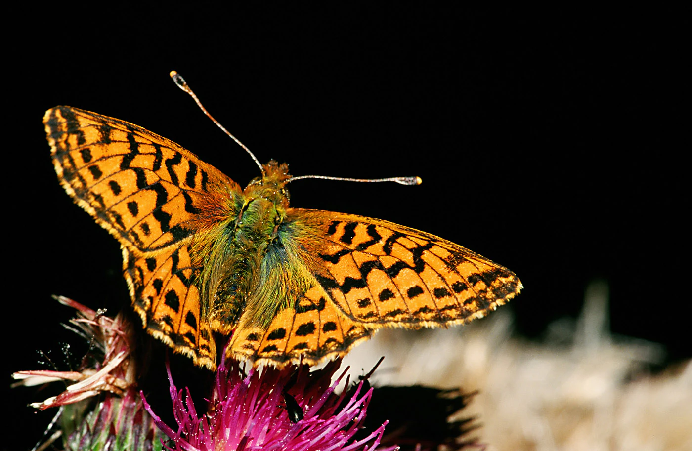
A close-up view of an orange and black Cranberry Fritillary butterfly perched on a vibrant purple flower against a dark background.
A Cranberry Fritillary butterfly, a characteristic species of the wetland ecosystems found in the Franches-Montagnes region.

Franches-Montagnes history and protected-area timeline

The Franches-Montagnes landscape has been shaped by long-standing patterns of pastoral farming that date back centuries, with the famous Franches-Montagnes horse breed representing one of the most enduring cultural products of the plateau. The two main ponds of the region, the Etang de la Gruère and the Etang des Royes, were originally built to power mills and sawmills and only later acquired their modern role as natural and scenic landmarks.

The peat bogs of the region have a long exploitation history. From the nineteenth century onward, large parts of the raised bogs were cut for peat and drained for pasture, with trampling by livestock adding further pressure. As a result, most of the high moors on the plateau are now reduced to small remnants or have transitioned to other vegetation types, although the largest surviving peat complexes retain national importance.

Modern legal protection began in the second half of the twentieth century. The Franches-Montagnes landscape was entered in the Federal Inventory of Landscapes and Natural Monuments of National Importance (BLN) in 1977. The military history of the moor at La Chaux-des-Breuleux is closely intertwined with Swiss nature conservation: a plan prepared by the Swiss Army in the 1940s to build a major training ground in the Freiberge, which contributed to the so-called Jura conflict over the political fate of the Bernese Jura, provoked a stronger environmental response in the region. Live-fire exercises of the Swiss Air Force at Chaux des Breuleux ended in 1972, and in 1974 the canton of Bern and the municipality of La Chaux-des-Breuleux placed the peat moor under protection; the canton of Jura followed for the part north of the cantonal border in 1980.

Around 2020 the Swiss Army's ordnance disposal service removed remaining munitions from the area between Tramelan and La Chaux-des-Breuleux. A multi-year revitalisation programme, supported by the federal government, both cantons, and the Fonds Landschaft Schweiz, ran until 2022, and by around 2027 the canton of Jura plans to gradually close drainage ditches in dried-out peat areas east of the Etang de la Gruère and near La Prédame to allow wetland habitats to recover. The nature centre at Les Cerlatez, founded in 1993, has long provided public information on the region's moorlands and was integrated into the regional natural park along the Doubs from 2020 onwards.

Franches-Montagnes landscape and geographic character

The Franches-Montagnes is defined by a gently undulating high plateau that lies, on average, at roughly 1000 metres above sea level between the Montagne du Droit ridge to the south and the deep Doubs valley to the north-west. Unlike the more rugged folded chains further south, the plateau presents a calm, open skyline of rounded hills, shallow depressions and broad pasture horizons that is unusual within the Jura range.

The substrate is dominated by Upper Jurassic limestone, locally covered near Les Genevez by blocks of Nagelfluh conglomerate. Karstification is intense, and the landscape is dotted with sinkholes; the same geological conditions that produce the dry plateau surface also drive the regional hydrology, with most precipitation vanishing underground and only re-emerging far from the plateau itself.

The vegetation structure further shapes the visual character of the area. Tall solitary conifers stand in the middle of wide pastures within a so-called 'Waldweide' tradition of wooded pasture, while compact forest blocks occupy the higher and steeper sections. Two named ponds, the Etang de la Gruère and the Etang des Royes, together with the smaller Etang de Pouleyo, form focal points within the wide open scenery, surrounded by raised bog, fen and wet forest that frame the views. Small hamlets and isolated farmsteads, rather than large villages, are nested among the fields and forests.
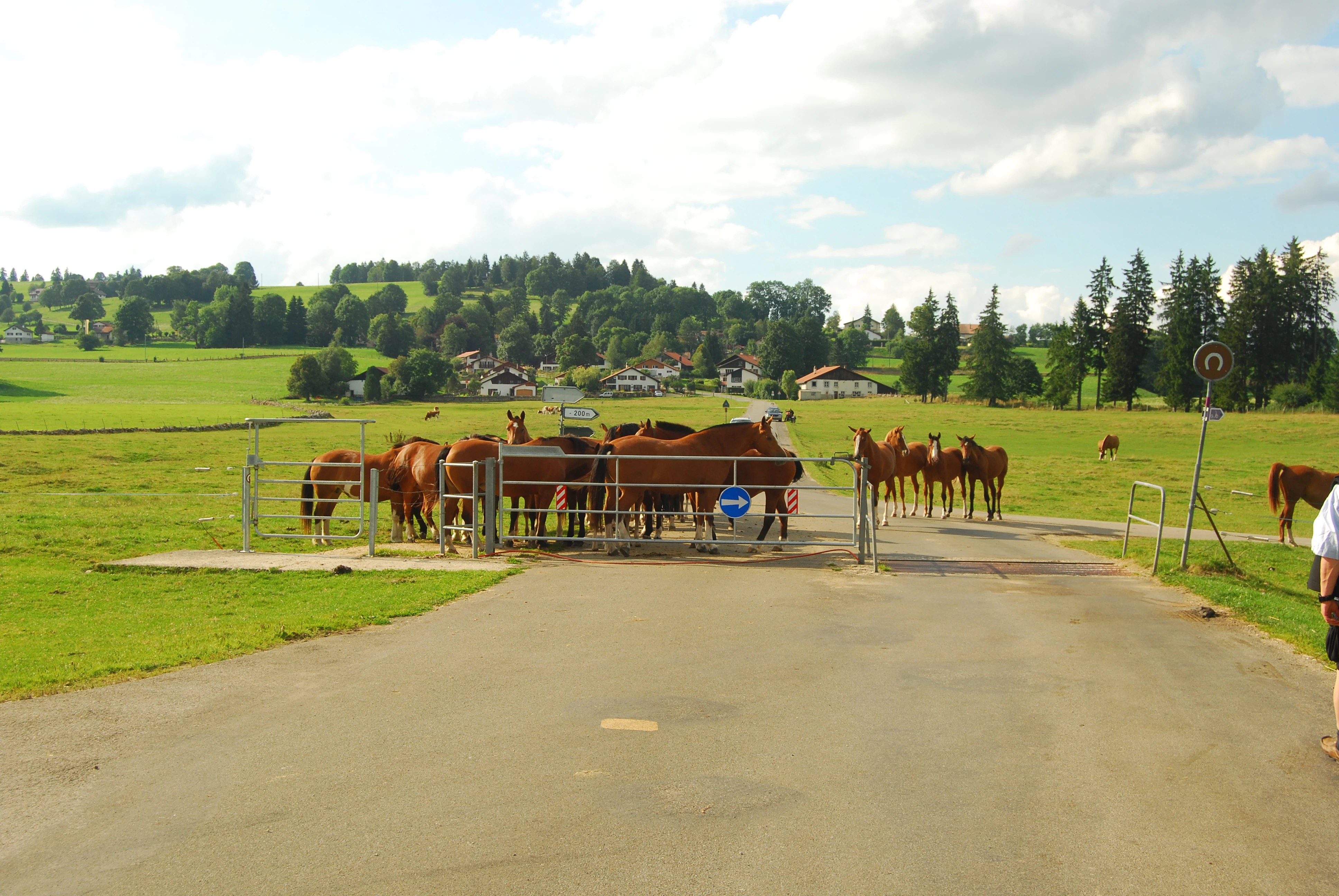
A rural scene in the Jura mountains with a group of brown horses standing behind a metal gate that crosses a paved road in a green meadow, with a small village and forested hills in the background.
A herd of horses congregates near a pasture gate in the village of Le Bemont, within the Franches-Montagnes landscape.

Franches-Montagnes ecosystems, habitats, and plant life

Ecologically, the Franches-Montagnes is defined by a tightly interwoven mosaic of forests, pastures and peatlands that has developed in the shallow basins of the limestone plateau since the end of the Ice Age. When the Rhône glacier still reached as far as Tramelan, the conditions for peat formation were first established in the depressions where water could not drain freely through the underlying karst.

Today, the surviving raised bogs are concentrated around the Etang de la Gruère and the Etang des Royes, with other important examples nearby at Bellelay and the Tourbière de La Chaux d'Abel. Where impermeable layers such as loam from the Bärschwil Formation or molasse impede vertical drainage, peat bodies have accumulated over large areas; these habitats are now nationally inventoried and form some of the most significant Raised bog remnants of their kind in Switzerland.

The forests include blueberry-spruce-fir stands on many slopes, scattered remnants of the original beech-fir forests of the Jura that once covered larger areas, and near the Etang de la Gruère a notable relict stand of dwarf birch reflecting former alpine tundra conditions. Bog pine woodlands border some of the peat bogs, creating a particularly diverse transition between forest and open mire.
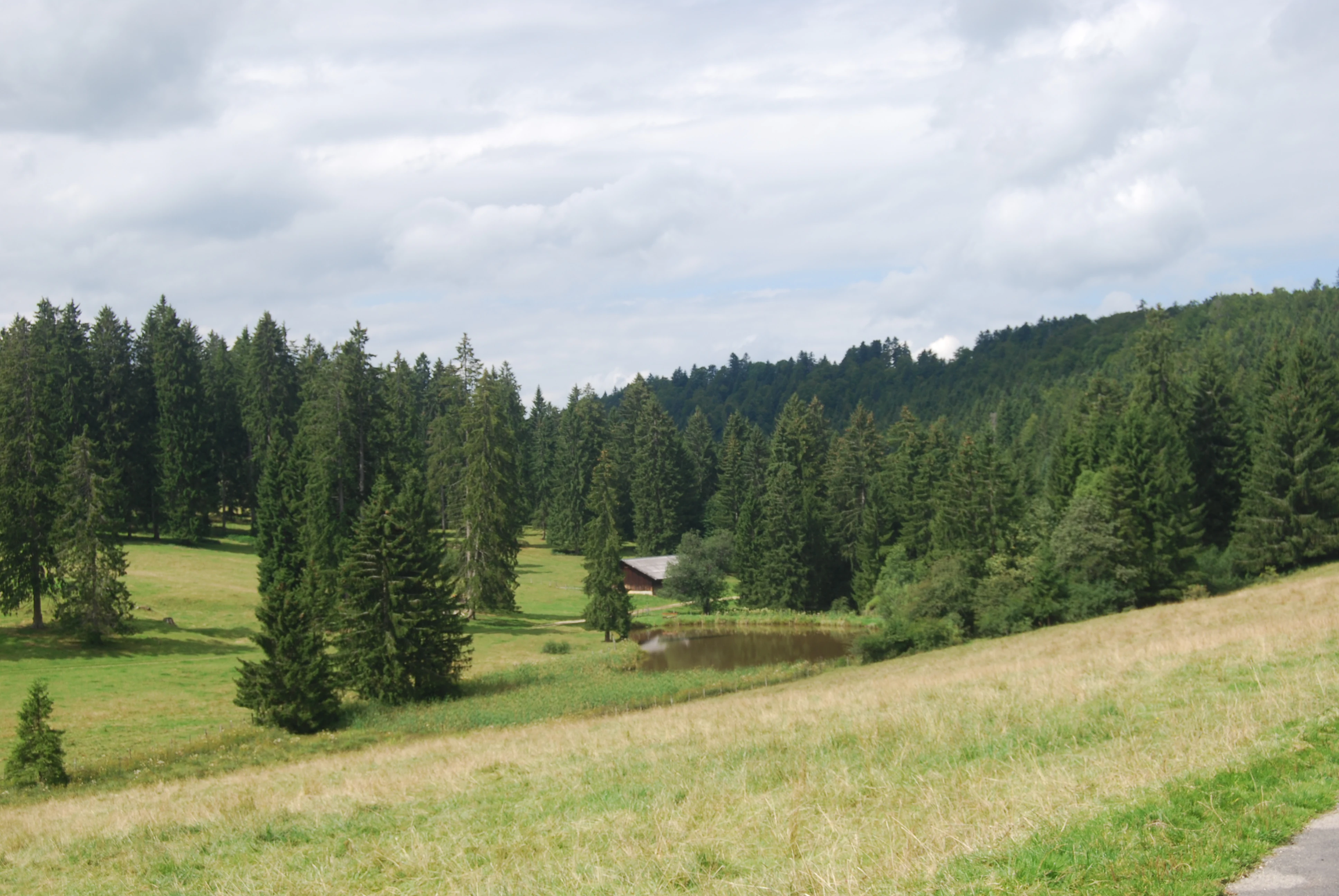
A small pond set in a rural Jura landscape, surrounded by open meadows and dense evergreen coniferous forests under a cloudy sky.
A peaceful pond situated in the meadows and forests of the Franches-Montagnes plateau near Lajoux.

Franches-Montagnes wildlife and species highlights

The mosaic of woodland, meadow and bog in the Franches-Montagnes supports a wide range of fauna, from common meadow birds such as the meadow pipit to highly specialised bog species. The peat bogs and the surrounding bog pine forests are nationally designated amphibian spawning areas, and the Etang de la Gruère is one of the documented strongholds of the endangered northern crested newt.

Dragonflies such as the large whiteface and other bog-associated species breed in the still-water habitats and surrounding marshes, while the open meadows and scattered veteran trees attract a diversity of butterflies and other insects. The rare and threatened bog fritillary butterfly is closely tied to the remaining undisturbed peatland vegetation.

Larger forest blocks and the wooded pasture provide habitat for typical Jura forest bird species, and the mix of semi-open landscape and extensive forest supports a balanced insect population that in turn sustains bats, small mammals and a healthy bird community. The combination of extensive pasture and minimally disturbed bog habitat is what gives the Franches-Montagnes its strong wildlife value within the Swiss context.
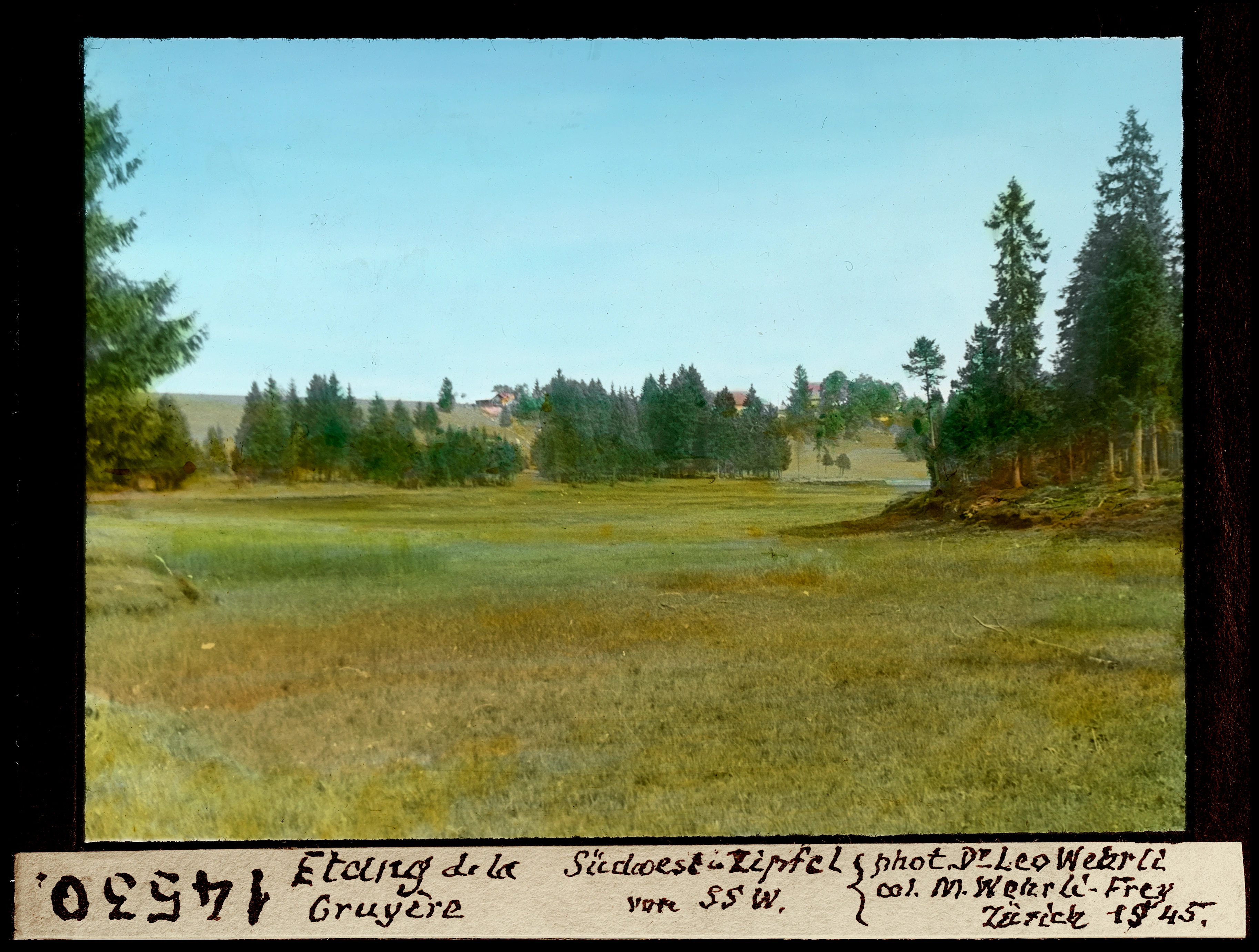
A vintage, colorized landscape photograph of a grassy wetland plateau bordered by pine forests, with a handwritten label at the bottom describing the location as Etang de la Gruere.
An archival view of the Etang de la Gruere, a notable peat bog site in the Franches-Montagnes region, captured in 1945.

Franches-Montagnes conservation status and protection priorities

Franches-Montagnes is protected at multiple, overlapping levels. The landscape itself has been part of the Federal Inventory of Landscapes and Natural Monuments of National Importance (BLN) since 1977. The Etang de la Gruère is registered in Switzerland's national list of particularly valuable natural habitats under the Emerald Network established by the Bern Convention, and the area around it forms a 120-hectare nature reserve managed jointly by the canton of Jura and Pro Natura.

Other formal reserves within the BLN area include the Réserve naturelle de l'Etang des Royes, the Réserve naturelle de Plain de Saigne and the Réserve naturelle tourbière de La Chaux des Breuleux. The Chaux-des-Breuleux peat moor, which extends across the cantonal boundary into the Bernese Jura, has been under cantonal protection since 1974 (Bern) and 1980 (Jura), and has benefited from a long-term revitalisation programme led jointly by the federal government, both cantons, and the Fonds Landschaft Schweiz.

The BLN protection goals emphasise maintaining the mosaic character of the traditional pasture-and-forest landscape, preserving karst landforms, sustaining the characteristic species and habitats, supporting traditional agricultural use, and safeguarding rural architecture and small landscape features such as hedges and dry-stone walls. Restoration work in the formerly drained peat areas east of the Etang de la Gruère and around La Prédame is intended to allow wetland habitats to regenerate in the coming years.

Franches-Montagnes cultural meaning and human context

Franches-Montagnes is closely tied to a centuries-old pastoral culture of the Jura plateau, marked by transhumance-style dairy farming and, most famously, the breeding of the Franches-Montagnes horse, the last native horse breed of Switzerland. The traditional 'Waldweide' or wooded-pasture system, with its large solitary conifers scattered across open meadows, is one of the most recognisable cultural signatures of the region and is explicitly mentioned in the BLN protection objectives.

The landscape also bears traces of more recent political history. The mid-twentieth-century conflict between the canton of Bern and the francophone Jura communities that ultimately led to the creation of the canton of Jura in 1979 was partly shaped by a Swiss Army plan to build a large weapons training ground in the Freiberge. The public controversy around this plan, and the need to protect the peat moors from further deterioration, helped strengthen the local nature conservation movement and shaped the conservation landscape we see today.

Small hamlets and farmsteads, vernacular rural architecture, dry-stone walls and traditional hedges all remain part of the everyday fabric of the plateau, supporting an identity that ties natural and cultural heritage together across the cantonal boundary between Jura and Bern.

Top sights and standout views in Franches-Montagnes

Franches-Montagnes is remarkable for the close coexistence of nationally protected peat bogs, traditional Jura pastoral farming and a karst high-plateau landscape that straddles the European main watershed underground.

The Etang de la Gruère and its surrounding 120-hectare nature reserve form the single most iconic focal point of the area, complemented by the Etang des Royes and the cross-border Chaux-des-Breuleux peat moor. Beyond ecology, the region is defined by the open, gently rolling plateau scenery, the wooded-pasture landscape with its lone veteran trees, and the enduring presence of the Franches-Montagnes horse, all of which combine natural and cultural significance in a single, nationally valuable landscape.

Best time to visit Franches-Montagnes

Summer is the classic season for visiting the Franches-Montagnes, when the broad pastures are vibrant green, the bog vegetation around the Etang de la Gruère is most accessible on foot, and the higher elevations of the plateau are at their most inviting under long daylight hours.

Late spring and early autumn also offer rewarding conditions, with softer light over the limestone plateau and fewer visitors, while winter transforms the open landscape into a snow-covered expanse that emphasises the contrast between dark conifer blocks and pale pasture. Seasonal character matters less for the ponds and bogs, which are accessible year round, than for the surrounding cultural pastures that change most visibly with the agricultural calendar.

Monthly climate preview

Track monthly temperature ranges and precipitation patterns across the Jura protected landscape.

Franches-Montagnes Climate Normals and Long-Term Weather by Month

Historical NASA POWER data spanning 1991 to 2000 reveals measured baseline temperature swings and daily precipitation averages for Franches-Montagnes. Opening the complete monthly record provides a detailed examination of temperature extremes and rainfall distributions across the coordinate point.
Annual mean9 °C
0 °C18 °C
Jan
Feb
Mar
Apr
May13°
Jun16°
Jul18°
Aug18°
Sep14°
Oct
Nov
Dec
Warmest month
July

18.3 °C

Coolest month
January

-0.1 °C

Wettest month
May

3.3 mm/day

Driest month
March

2.2 mm/day

Park location guide

Geography guide, regional context, and park location map for Franches-Montagnes

Franches-Montagnes park geography, regions, and map view in Switzerland

Understand where Franches-Montagnes sits in Switzerland through a broader geographic reading of the surrounding landscape, nearby location context, and its mapped position within the national park landscape.

How Franches-Montagnes fits into Switzerland

Switzerland is a landlocked federal republic in Central Europe comprising 26 cantons, with Bern as the federal city and Zurich as the largest city. The country features the Swiss Alps, Swiss Plateau, and Jura Mountains, with German, French, Italian, and Romansh as official languages. It is noted for its political neutrality, direct democracy traditions, and strong economy.

Wider geography shaping Franches-Montagnes in Switzerland

Switzerland is located in Central Europe at the intersection of Western and Southern Europe. It is bordered by Germany to the north, France to the west, Austria and Liechtenstein to the east, and Italy to the south. The country is geographically divided among the Swiss Alps (covering most of the territory), the Swiss Plateau (where most of the population resides), and the Jura Mountains. Switzerland is landlocked.

Map view of Franches-Montagnes

Use this park location map to pinpoint Franches-Montagnes in Switzerland, understand its exact geographic position, and read its mapped placement within the surrounding landscape more clearly.

Pigeon | © OpenStreetMap contributors

Location context for Franches-Montagnes

BernJura

Explore the protected high plateau, peat bogs, and wooded pastures of the Jura range.

Franches-Montagnes Photos and Landscape Scenery Visual Guide

Visual documentation of Franches-Montagnes reveals the distinct topography of its rolling limestone plateau, raised bogs, and traditional pastoral habitats. Examining these protected landscapes provides clear insight into the geography, vegetation structure, and environmental character of the region.

A close-up view of an orange and black Cranberry Fritillary butterfly perched on a vibrant purple flower against a dark background.

A serene lake reflects a bright blue sky with wispy clouds and a dense dark forest line on the horizon.

A rural scene in the Jura mountains with a group of brown horses standing behind a metal gate that crosses a paved road in a green meadow, with a small village and forested hills in the background.

A small pond set in a rural Jura landscape, surrounded by open meadows and dense evergreen coniferous forests under a cloudy sky.

A vintage, colorized landscape photograph of a grassy wetland plateau bordered by pine forests, with a handwritten label at the bottom describing the location as Etang de la Gruere.

Park atlas

Compare regional Jura reserves, karst plateaus, and connected natural habitats

Explore Parks Near Franches-Montagnes and Surrounding Protected Landscapes

Browse protected areas near Franches-Montagnes to examine similar upland pastures, peat bog systems, and limestone terrain across the wider region. Continuing into adjacent regional parks provides broader geographic context for the unique natural and cultural heritage of north-western Switzerland.
A pale, abstract watercolor painting showing rolling green hills and distant mountain ridgelines on a white background.
Nature reserveCanton of Bern
About 13 km away#1 closest

South

Combe Grède Nature Reserve: Geological Gorge and Protected Mountain Landscape in Bern

Folded Jura limestone terrain and biodiversity hotspots.

The Combe Grède nature reserve presents a striking half-cluse gorge carved into Cretaceous limestone. This protected area within the Canton of Bern showcases an instructive geological sequence, ancient pine stands, and diverse mountain habitats that span from shaded cliffs to alpine pastures.

Area
12 km²
Established
1932
Relief
Mountain
Climate
Temperate
A horizontal watercolor illustration depicting rolling green hills, a winding lake shore, and distant mountains in a soft, muted palette.
Protected landscapeCanton of Bern
About 19 km away#2 closest

South

Linkes Bielerseeufer Protected Landscape: Map and Regional Geography in Canton of Bern

Protected Jura lakeshore and vineyard terrain

Investigate the precise boundaries and varied micro-landscape of Linkes Bielerseeufer. This protected area showcases a dramatic rise from Lake Biel into the Jura range, encompassing karst topography, historic dry-stone terraces, and diverse forest ecosystems within the Canton of Bern.

Area
7.079 km²
Relief
Mountain
Climate
Temperate
Access
Easy access
A pale, soft-focus watercolor illustration depicting a limestone cliff landscape with gentle rolling hills and light vegetation.
Nature reserveBourgogne-Franche-Comté
About 25 km away#3 closest

Northwest

Réserve naturelle régionale du Crêt des Roches: Protected Landscape and Geography Atlas

Lomont range limestone corniche and regional nature reserve map

Situated southeast of Pont-de-Roide-Vermondans, this regional nature reserve preserves a compact forty-three hectare area of Jurassic limestone cliffs and mesophilic forests. The site provides a critical reference point for studying Mediterranean-margin flora, including rare relict plant populations, and stands as a major topographical observation corridor for autumn bird migrations in eastern France.

Area
0.434 km²
Established
2009
IUCN
IV
Relief
Upland
A soft watercolor painting depicting a calm river winding through a green, hazy floodplain environment.
Nature reserveSolothurn
About 29 km away#4 closest

East

Naturschutzgebiet Aare bei Altreu: Protecting Aare Valley Floodplains and Alluvial Forest

Riverine meander habitat in the Solothurn canton landscape.

Naturschutzgebiet Aare bei Altreu serves as a vital refuge for floodplain flora and fauna, standing out for its intact meander loops and silver willow gallery forests. Located in the Solothurn region, this protected area preserves a rare stretch of the Aare river ecosystem that contrasts sharply with adjacent canalized banks. Studying its terrain reveals the importance of alluvial corridors in maintaining wetland connectivity within the Swiss Mittelland.

Area
0.205 km²
Established
1992
IUCN
IV
Relief
Lowland
A watercolor illustration of a river landscape with a gentle bend, shoreline greenery, and distant low hills, rendered with soft, faded edges.
Protected landscapeCanton of Bern
About 31 km away#5 closest

Southeast

Stausee Niederried Protected Landscape: A Geographic Map and Atlas of Swiss Floodplains

Mapped alluvial terrain and sandstone cliffs in the Canton of Bern.

Stausee Niederried functions as a vital protected landscape, blending a historic hydroelectric reservoir with a four-kilometer riverine floodplain. The area is characterized by high geomorphic contrast, ranging from the vast Runtigenfluh molasse cliff to critical riparian marshes and orchid-rich pine forests. This entry provides a structured look at the park boundaries, geological features, and the wider fluvial mosaic found near the confluence of the Aare and the Saane.

Area
2.97 km²
Established
1991
IUCN
V
Relief
Mixed relief
A wide watercolor painting depicting a calm river or lake flanked by green and purple vegetation, with distant mountains under a soft pink and yellow sky.
Nature reserveDoubs
About 34 km away#6 closest

Northwest

Réserve naturelle régionale de la basse vallée de la Savoureuse: Regional Nature Reserve

Protected alluvial floodplain geography in Doubs, France.

This nature reserve safeguards a significant fragment of the Savoureuse river floodplain. The protected area offers a complete alluvial sequence within 42 hectares, including active gravel bars and mature ash-alder woodlands, providing a high-density ecological core amidst an industrial landscape in the Doubs department.

Area
0.419 km²
Established
2008
IUCN
IV
Relief
Lowland
A pale, minimalist watercolor painting depicting rolling hills and mountains in shades of soft green, purple, and yellow against a white background.
Natural monumentNeuchâtel
About 42 km away#7 closest

Southwest

Creux du Van et Gorges de l’Areuse Natural Monument and Regional Protected Landscape

Geological exploration of the Folded Jura and Areuse river valley

Spanning the Cantons of Neuchâtel and Vaud, this protected area unites the dramatic rock bowl of the Creux du Van with the narrow, cascading passages of the Gorges de l’Areuse. The site provides a comprehensive view of Jura mountain landforms, highlighting millions of years of river erosion, glacial activity, and karst weathering in a singular, well-defined geographic corridor.

Area
21.21 km²
Established
1876
Relief
Mountain
Climate
Temperate
A soft watercolor painting depicting a gentle, rolling landscape with green hills, forests, and abstract meadows against a white background.
Regional parkSolothurn
About 46 km away#8 closest

East

Regionaler Naturpark Thal: Protected Jura Landscapes and Regional Geography in Solothurn

Examining the folded ridges and pastoral terrain of the Swiss Jura

The Regionaler Naturpark Thal encompasses the entire Thal district, presenting a cohesive regional environment defined by the eastern Jura chain. This protected area features a unique mosaic of cattle-grazed heights, biodiversity-rich dry meadows, and dense mixed forests that anchor the Solothurn landscape. The terrain showcases the classic Jura topography of parallel ridges, secluded valleys, and dramatic klus incisions, providing a rich area for understanding regional mountain ecology.

Area
139 km²
Established
2009
Relief
Mountain
Climate
Temperate

Common questions about visiting, size, designation, and location context for Franches-Montagnes

Franches-Montagnes FAQs for park facts, access, geography, and protected area context

Find quick answers about Franches-Montagnes, including protected-area facts, park geography, trail and visitor context, and how the park fits into its surrounding country and regional landscape.
MoriAtlas Explorer

Continue Your Protected Areas Search Across the Global Atlas

Deepen your exploration by continuing the structured search for national parks and protected areas worldwide. Utilize the comprehensive filtering capabilities to compare different conservation landscapes and refine your understanding of global park geography. Discover more about the distribution and characteristics of protected natural areas.

Global natural geography