Mori Atlas logo
Nearby park discovery

Map-based regional geography and proximity analysis for surrounding protected lands

Protected Areas and Natural Landscapes Situated Near Franches-Montagnes in the Jura

Examine the geographic distribution of protected areas located within the vicinity of the Franches-Montagnes nature reserve. This regional overview highlights the spatial relationships between diverse Jura plateau landscapes, offering a clear perspective on how protected zones and natural terrain features connect across the local topography.

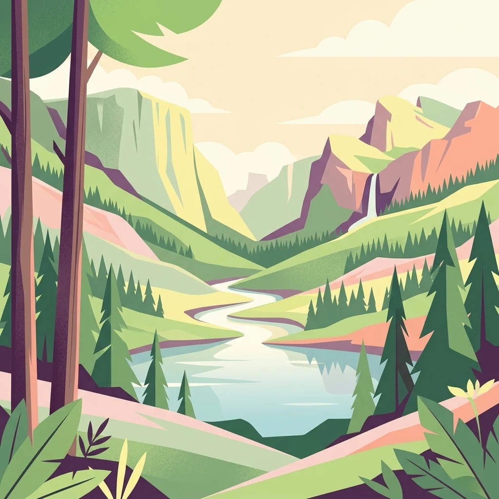
A digital illustration of a scenic valley with evergreen trees in the foreground, a winding river, mountains in the distance, and a small waterfall on the right.

A high plateau of the Swiss Jura with open pasture, forests and nationally important peatlands.

Franches-Montagnes

Franches-Montagnes, known in German as the Freiberge, is a protected natural and cultural landscape of north-western Switzerland that has been listed since 1977 in the Federal Inventory of Landscapes and Natural Monuments of National Importance (BLN). It represents a core area of the larger Franches-Montagnes region within the Folded Jura, situated on a broad limestone plateau between the Montagne du Droit ridge to the south and the deeply incised Doubs valley to the north-west. The landscape is characterised by a mosaic of open pastures, woodlands and peat bogs, with most of the area sitting at around 1000 metres above sea level. A significant portion lies within the regional Parc du Doubs, while a smaller part falls under the Parc régional Chasseral, reinforcing the area's strong connection to regional nature park policy. Among its defining features are the peat bogs around the Etang de la Gruère and the Etang des Royes, the large ponds once used to power mills and sawmills, and the traditional Franches-Montagnes horse pastures that have shaped the cultural identity of the region for centuries.

Location
Switzerland
Park type
Nature reserve
Established
1977
Area
39.6 km²
Franches-Montagnes Nature Reserve Geography
Regional park map

See the ranked park cluster in its geographic setting

Nearby parks around Franches-Montagnes

This regional map shows the same 20 nearby parks ranked below around Franches-Montagnes. Select a ranked marker to highlight that park’s boundary where boundary data is available.
Reference park: Franches-MontagnesRanked nearby park20 nearby parks shown
20 nearby parks

Distance-sorted regional park geography and surrounding protected landscapes

Ranked Parks and Protected Areas Geographically Near Franches-Montagnes

Spatial proximity rankings evaluate the separation between Franches-Montagnes and surrounding protected territories across the regional plateau. Recorded environmental characteristics and country context establish structured comparison signals for analyzing adjacent conservation landscapes.
A pale, abstract watercolor painting showing rolling green hills and distant mountain ridgelines on a white background.
Nature reserveCanton of Bern
About 13 km away#1 closest

South

Combe Grède Nature Reserve: Geological Gorge and Protected Mountain Landscape in Bern

Folded Jura limestone terrain and biodiversity hotspots.

The Combe Grède nature reserve presents a striking half-cluse gorge carved into Cretaceous limestone. This protected area within the Canton of Bern showcases an instructive geological sequence, ancient pine stands, and diverse mountain habitats that span from shaded cliffs to alpine pastures.

Area
12 km²
Established
1932
Relief
Mountain
Climate
Temperate
A horizontal watercolor illustration depicting rolling green hills, a winding lake shore, and distant mountains in a soft, muted palette.
Protected landscapeCanton of Bern
About 19 km away#2 closest

South

Linkes Bielerseeufer Protected Landscape: Map and Regional Geography in Canton of Bern

Protected Jura lakeshore and vineyard terrain

Investigate the precise boundaries and varied micro-landscape of Linkes Bielerseeufer. This protected area showcases a dramatic rise from Lake Biel into the Jura range, encompassing karst topography, historic dry-stone terraces, and diverse forest ecosystems within the Canton of Bern.

Area
7.079 km²
Relief
Mountain
Climate
Temperate
Access
Easy access
A pale, soft-focus watercolor illustration depicting a limestone cliff landscape with gentle rolling hills and light vegetation.
Nature reserveBourgogne-Franche-Comté
About 25 km away#3 closest

Northwest

Réserve naturelle régionale du Crêt des Roches: Protected Landscape and Geography Atlas

Lomont range limestone corniche and regional nature reserve map

Situated southeast of Pont-de-Roide-Vermondans, this regional nature reserve preserves a compact forty-three hectare area of Jurassic limestone cliffs and mesophilic forests. The site provides a critical reference point for studying Mediterranean-margin flora, including rare relict plant populations, and stands as a major topographical observation corridor for autumn bird migrations in eastern France.

Area
0.434 km²
Established
2009
IUCN
IV
Relief
Upland
A soft watercolor painting depicting a calm river winding through a green, hazy floodplain environment.
Nature reserveSolothurn
About 29 km away#4 closest

East

Naturschutzgebiet Aare bei Altreu: Protecting Aare Valley Floodplains and Alluvial Forest

Riverine meander habitat in the Solothurn canton landscape.

Naturschutzgebiet Aare bei Altreu serves as a vital refuge for floodplain flora and fauna, standing out for its intact meander loops and silver willow gallery forests. Located in the Solothurn region, this protected area preserves a rare stretch of the Aare river ecosystem that contrasts sharply with adjacent canalized banks. Studying its terrain reveals the importance of alluvial corridors in maintaining wetland connectivity within the Swiss Mittelland.

Area
0.205 km²
Established
1992
IUCN
IV
Relief
Lowland
A watercolor illustration of a river landscape with a gentle bend, shoreline greenery, and distant low hills, rendered with soft, faded edges.
Protected landscapeCanton of Bern
About 31 km away#5 closest

Southeast

Stausee Niederried Protected Landscape: A Geographic Map and Atlas of Swiss Floodplains

Mapped alluvial terrain and sandstone cliffs in the Canton of Bern.

Stausee Niederried functions as a vital protected landscape, blending a historic hydroelectric reservoir with a four-kilometer riverine floodplain. The area is characterized by high geomorphic contrast, ranging from the vast Runtigenfluh molasse cliff to critical riparian marshes and orchid-rich pine forests. This entry provides a structured look at the park boundaries, geological features, and the wider fluvial mosaic found near the confluence of the Aare and the Saane.

Area
2.97 km²
Established
1991
IUCN
V
Relief
Mixed relief
A wide watercolor painting depicting a calm river or lake flanked by green and purple vegetation, with distant mountains under a soft pink and yellow sky.
Nature reserveDoubs
About 34 km away#6 closest

Northwest

Réserve naturelle régionale de la basse vallée de la Savoureuse: Regional Nature Reserve

Protected alluvial floodplain geography in Doubs, France.

This nature reserve safeguards a significant fragment of the Savoureuse river floodplain. The protected area offers a complete alluvial sequence within 42 hectares, including active gravel bars and mature ash-alder woodlands, providing a high-density ecological core amidst an industrial landscape in the Doubs department.

Area
0.419 km²
Established
2008
IUCN
IV
Relief
Lowland
A pale, minimalist watercolor painting depicting rolling hills and mountains in shades of soft green, purple, and yellow against a white background.
Natural monumentNeuchâtel
About 42 km away#7 closest

Southwest

Creux du Van et Gorges de l’Areuse Natural Monument and Regional Protected Landscape

Geological exploration of the Folded Jura and Areuse river valley

Spanning the Cantons of Neuchâtel and Vaud, this protected area unites the dramatic rock bowl of the Creux du Van with the narrow, cascading passages of the Gorges de l’Areuse. The site provides a comprehensive view of Jura mountain landforms, highlighting millions of years of river erosion, glacial activity, and karst weathering in a singular, well-defined geographic corridor.

Area
21.21 km²
Established
1876
Relief
Mountain
Climate
Temperate
A soft watercolor painting depicting a gentle, rolling landscape with green hills, forests, and abstract meadows against a white background.
Regional parkSolothurn
About 46 km away#8 closest

East

Regionaler Naturpark Thal: Protected Jura Landscapes and Regional Geography in Solothurn

Examining the folded ridges and pastoral terrain of the Swiss Jura

The Regionaler Naturpark Thal encompasses the entire Thal district, presenting a cohesive regional environment defined by the eastern Jura chain. This protected area features a unique mosaic of cattle-grazed heights, biodiversity-rich dry meadows, and dense mixed forests that anchor the Solothurn landscape. The terrain showcases the classic Jura topography of parallel ridges, secluded valleys, and dramatic klus incisions, providing a rich area for understanding regional mountain ecology.

Area
139 km²
Established
2009
Relief
Mountain
Climate
Temperate
Nature reserveGrand Est
About 47 km away#9 closest

North

Réserve naturelle régionale Im'Berg: Mapping a Unique Protected Nature Reserve in France

A rare calcareous grassland habitat in the Grand Est region.

Réserve naturelle régionale Im'Berg preserves a sun-drenched limestone slope in the commune of Tagolsheim. Known as the Buxberg, this protected area guards one of the most significant natural boxwood populations in Europe alongside specialized dry-habitat flora. The reserve functions as an essential geographic reference for studying how steep, calcareous terrain creates isolated, warm microclimates within the broader Alsatian landscape.

Area
0.017 km²
Established
2013
IUCN
IV
A horizontal watercolor illustration showing a winding river through a flat, green landscape with distant hills under a soft pink and yellow sky.
Nature reserveHaut-Rhin
About 54 km away#10 closest

Northeast

Réserve naturelle nationale de la Petite Camargue alsacienne: Protected Rhine Floodplain Geography

A unique wetland and alluvial forest habitat in Haut-Rhin

Investigate the geographic significance of the Réserve naturelle nationale de la Petite Camargue alsacienne. This site acts as a protected reference for Upper Rhine floodplain ecology, showcasing a rare intersection of relict river meanders, marshy depressions, and diverse vegetation types near the French, Swiss, and German borders.

Area
9.04 km²
Established
1982
IUCN
IV
Relief
Lowland
A horizontal watercolor painting of a winding river flowing through green rolling hills and wooded areas, with soft-colored mountain silhouettes in the background.
Protected landscapeSwitzerland
About 56 km away#11 closest

East

Aareknie Wolfwil-Wynau: Geographic Profile of a Swiss Protected River Landscape

Mapping dynamic river bends and lowland floodplains in the Swiss Mittelland.

Aareknie Wolfwil-Wynau preserves a rare, non-engineered river reach where the Aare cuts through molasse rock. The area is defined by its active gravel bars, rapids, and federally protected floodplain habitats. This site provides a critical look at how lowland river ecosystems function alongside historic cultural landmarks like the medieval church at Wynau.

Area
1.1 km²
Established
1996
Relief
Lowland
Climate
Temperate
Nature reserveBourgogne-Franche-Comté
About 57 km away#12 closest

Northwest

Réserve naturelle régionale des Grottes du Cirque: Regional Nature Reserve and Karst Network

Protected limestone valley and bat hibernation site in Bourgogne-Franche-Comté

Located in the pre-Jura hills, this regional nature reserve features a compact reculée landscape defined by six limestone caves. These protected underground habitats serve as vital wintering grounds for various bat species and contain significant prehistoric fossil remains, marking the site as a key area for both geological and ecological study in eastern France.

Area
0.153 km²
Established
2015
IUCN
IV
Relief
Upland
A soft watercolor painting of a mountain landscape with rolling hills, pine forests, and a meadow in light green and muted earth tones.
Regional parkCanton of Bern
About 57 km away#13 closest

Southeast

Regionaler Naturpark Gantrisch: Protected Terrain and Map Exploration in Canton of Bern

A diverse transition zone from glacial moraines to high mountain ridges.

Spanning over 400 square kilometers, Regionaler Naturpark Gantrisch offers a unique look at the Swiss landscape. Its boundaries encompass everything from low-lying agricultural valleys and historic castles to the steep, forested gorges of the Sense and Schwarzwasser rivers and the high-altitude vistas of the southern Gantrisch mountain range.

Area
414 km²
Established
2012
Relief
Mountain
Climate
Alpine
A panoramic watercolor painting depicting a calm wetland or marsh with pink and yellow reeds in the foreground, green trees in the midground, and soft purple mountains in the background.
Nature reserveHaut-Rhin
About 59 km away#14 closest

North

Réserve naturelle régionale des marais et landes du Rothmoos Protected Landscape and Geography

Regional nature reserve in the Haut-Rhin department of Alsace

The Réserve naturelle régionale des marais et landes du Rothmoos encompasses a rare inland saline habitat complex within the Nonnenbruch forest. Its terrain is defined by stable pools created from mining subsidence, transitioning into heathland and oak forests. This protected area stands as an ecological refuge for migratory waterbirds and specialized aquatic species within an industrial-legacy environment.

Area
1.457 km²
Established
1988
IUCN
IV
Relief
Lowland
A soft watercolor painting of a river flowing through a green landscape with rolling hills and trees in the distance.
Protected landscapeKanton Bern
About 60 km away#15 closest

Southeast

Aarelandschaft zwischen Thun und Bern: Protected Landscape and River Corridor Geography

Mapping the floodplain remnants of the Aare river corridor

The Aarelandschaft zwischen Thun und Bern protects a unique corridor of riparian forest, wet meadows, and springs along the Aare river. Situated in the Kanton Bern, this landscape retains evidence of historic river engineering alongside ongoing restoration programs that reconnect vital lowland ecosystems. It stands as a significant natural corridor in a densely populated region, marked by its molasse hills and varied alluvial topography.

Area
10.4 km²
Established
1983
Relief
Lowland
Climate
Temperate
Wildlife reserveBourgogne-Franche-Comté
About 61 km away#16 closest

Southwest

Tourbières et lacs de la montagne jurassienne: Mapping High-Altitude Wetlands and Glacial Landscapes

A vast protected wildlife reserve in the Bourgogne-Franche-Comté region

Covering more than 12,000 hectares, this wildlife reserve forms a crucial conservation benchmark for peatland and glacial lake systems in the Jura Massif. The landscape encompasses deep combes, broad plateaus, and clear-water basins like Lac de Saint-Point, providing a vital habitat mosaic for diverse flora and fauna across the French highlands.

Area
121.56 km²
Established
2021
Relief
Mountain
Climate
Temperate
A soft watercolor painting of a rolling landscape with green hills, light blue distant mountains, and patches of pink and yellow vegetation.
Nature reserveGrand Est
About 64 km away#17 closest

North

Réserve naturelle régionale de la forêt des volcans de Wegscheid: Geological Protected Area

Mapping volcanic terrain in the Grand Est region of eastern France.

Located in the Haut-Rhin, this regional nature reserve preserves a distinct volcanic landscape characterized by rocky promontories, basalt columns, and mature forest stands. The protected terrain features varied elevation from 700 meters to the Rossberg ridge, showcasing geological formations that have remained largely untouched by intensive historical forestry.

Area
1.015 km²
Established
2008
IUCN
IV
Relief
Mountain
A wide watercolor painting showing a body of water in the foreground, green trees along the banks, and rolling hills and mountains in soft pink, yellow, and green hues in the background.
Nature reserveFrance
About 68 km away#18 closest

Northwest

Réserve naturelle régionale de la tourbière de la Grande Pile: Regional Nature Reserve

Protected peatland ecosystems and climate archive in eastern France

This regional nature reserve provides a compact study of peatland development and palaeo-environmental history. It preserves diverse wetland habitats at the edge of the Vosges saônoises, offering a rich environment for rare flora and dragonfly species within the wider Région des Mille étangs.

Area
0.593 km²
Established
2016
Relief
Lowland
Climate
Temperate
A horizontal watercolor painting depicting a landscape with soft rolling hills, green meadows, and wild grasses under a pale sky.
Nature reserveBaden-Württemberg
About 69 km away#19 closest

Northeast

Dinkelberg und Röttler Wald: Geographic Overview of this Baden-Württemberg Nature Reserve

Protected karst landscapes and mature beech forest habitat

Uncover the ecological and physical geography of Dinkelberg und Röttler Wald, a protected area stretching across diverse limestone plateaus and sandstone slopes in Germany. This site offers a valuable look at managed cultural landscapes that bridge the gap between rural meadows and wild forest reserves, providing critical habitat for European bat populations and rare flora across its varied elevational zones.

Area
46.47 km²
Established
2015
A soft watercolor painting of rolling hills and distant mountains in light green and muted tones.
Biosphere reserveLucerne
About 71 km away#20 closest

Southeast

Entlebuch Biosphere Reserve: Mapped Protected Landscapes in the Canton of Lucerne

Exploring karst formations and alpine wetland ecosystems

Entlebuch stands as a pioneering example of community-driven conservation in the Swiss Alps. This protected landscape encompasses extensive peatlands, forested slopes, and the iconic Schrattenfluh karst massif. Use this geographic entry to understand the regional topography and the spatial distribution of protected habitats throughout this central Swiss valley.

Area
397 km²
Established
2001
Relief
Mountain
Climate
Alpine
Distance methodology

Geographic measurements, not driving distances

How nearby park distances are calculated

Distances use park boundaries whenever the available geometry allows it. When one or both boundaries are missing, the mapped park locations provide a clearly labelled estimate. Every value represents straight-line geographic separation and does not use roads or routing.

Boundary distance

Calculated between the nearest points of both park boundaries.

Location-to-boundary estimate

Estimated from one mapped park location to the nearest boundary of the other park.

Mapped-location estimate

Estimated between the mapped locations of both parks.

MoriAtlas Explorer

Continue Exploring the Franches-Montagnes Nature Reserve Protected Landscape

Trace the boundaries and ecological features of the Franches-Montagnes, a vital nature reserve within the Swiss Jura. MoriAtlas provides a comprehensive view of this karst plateau, highlighting its peat bogs and historic pastureland as part of a wider regional geographic discovery.