
Mori Atlas logo
Wildlife reserveTourbières et lacs de la montagne jurassienne

A comprehensive look at the glacial lake chains and peatland ecosystems of eastern France

Tourbières et lacs de la montagne jurassienne: Mapping the High-Altitude Wetlands of the Jura Massif

(Tourbières et lacs de la montagne jurassienne (site Ramsar no. 1266))

Tourbières et lacs de la montagne jurassienne represents a massive protected landscape spanning over 12,000 hectares across the Bourgogne-Franche-Comté region. This wildlife reserve features an intricate mosaic of 125 mountain peatlands and 18 natural glacial lakes nestled within the karst terrain of the Jura Massif. By integrating multiple Natura 2000 areas and natural reserves, the site preserves essential habitats for specialized wetland species above 800 metres in elevation.

peatlandsmountain wetlandsRamsar siteglacial lakesJura MountainsNatura 2000
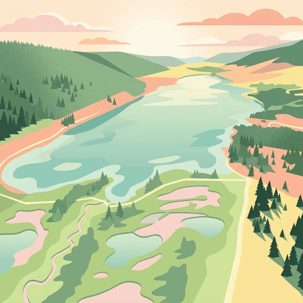
A flat-style digital illustration of a mountain landscape with a large lake and surrounding peat bogs, evergreen forests, and gently rolling hills under a soft sunset.

Tourbières et lacs de la montagne jurassienne

Wildlife reserve

Park overview

Structured park overview, official facts, and landscape profile for Tourbières et lacs de la montagne jurassienne

Tourbières et lacs de la montagne jurassienne park facts, protected area profile, and essential visitor context

Review the core facts for Tourbières et lacs de la montagne jurassienne, including designation, size, terrain, visitor scale, habitats, and operating context in one park-focused overview.

About Tourbières et lacs de la montagne jurassienne

Tourbières et lacs de la montagne jurassienne is one of France's principal mountain wetland complexes, recognised internationally through its 2021 inscription as Ramsar site no. 1266. Stretching about sixty-five kilometres through the Doubs and Jura departments, it unites 125 peatlands and 18 natural lakes in a single conservation perimeter that rises above 800 metres on the limestone plateau of the Jura Massif. The site is a direct continuation of earlier conservation work on the Bassin du Drugeon, which was first labelled under Ramsar in 2003 following a LIFE-funded watercourse restoration programme.

Beyond the Drugeon basin, the perimeter incorporates the emblematic peatland ensembles of the upper Doubs valley, the Combe de Chapelle-des-Bois and Bellefontaine, the Vallée de l'Orbe around Les Rousses and Bois d'Amont, the Haut-Doubs around Mouthe and the four-lake complex near Le Frasnois. Natural lakes such as Lac de Saint-Point, Lac de Remoray, Lac des Rousses and the lakes of Ilay, Narlay, Petit and Grand Maclu, Lamoura and l'Abbaye are integrated into the same protective frame.

The site's ecological importance is rooted in the geological history of the Jura. Glacial action on the porous karstic limestone produced a varied wetland mosaic of acidic peatlands and clear, cold-water lakes. These conditions sustain boreal relict vegetation, a rich community of bog invertebrates, and breeding populations of birds that have largely disappeared from lowland France. Twenty-two wetland habitats of European interest are present, and for two taxa the site holds the entire French population.

Managed jointly by the EPAGE Haut-Doubs Haute-Loue and the Parc naturel régional du Haut-Jura, the site is at the heart of regional conservation policy. It was shaped by a second LIFE programme, "Tourbières du Jura" (2014 to 2021), which rehabilitated more than sixty peatlands and demonstrated the strong local commitment to preserving these mountain wetlands. The 2021 Ramsar designation coincided symbolically with World Wetlands Day and the fiftieth anniversary of the Ramsar Convention, reflecting both the maturity of local conservation efforts and the international significance of the site.

Quick facts and research context for Tourbières et lacs de la montagne jurassienne

The site covers roughly 12,156 hectares across 52 communes in the Doubs and Jura departments of the Bourgogne-Franche-Comté region. It consists of 125 peat bogs totalling at least 1,915 hectares and 18 natural lakes totalling about 1,051 hectares, all lying above approximately 800 metres elevation in the Jura Massif.

Designated as Ramsar site no. 1266 on 2 February 2021, the date of World Wetlands Day and the fiftieth anniversary of the Ramsar Convention, it extends the earlier 2003 Bassin du Drugeon designation. It overlaps with twelve Natura 2000 sites and four nature reserves, and is managed jointly by the EPAGE Haut-Doubs Haute-Loue and the Parc naturel régional du Haut-Jura.

Protection and recognition

Documented terrestrial protection scope, 2021 designation history, and international wetland recognition records.

Tourbières et lacs de la montagne jurassienne Protection Status and Ramsar Recognition

Terrestrial protection status, designation history, and Ramsar wetland recognition records for Tourbières et lacs de la montagne jurassienne are compiled here. Documented conservation records provide structured insight into the international recognition and protection scope established for the protected area.

International recognition

Protection details

Protection scope
Terrestrial
Designated year
2021
Transboundary protection
No
Park context

Deeper park guide and search-rich context for Tourbières et lacs de la montagne jurassienne

Tourbières et lacs de la montagne jurassienne history, landscape, wildlife, and travel context

Explore Tourbières et lacs de la montagne jurassienne through its history, landscape character, ecosystems, wildlife, conservation priorities, cultural context, and seasonal travel timing in a structured park guide built for atlas discovery and search intent.

Why Tourbières et lacs de la montagne jurassienne stands out

The site is best known for the exceptional density and diversity of its mountain peatlands and for the collection of glacial lakes that punctuate the Haut-Jura plateau. It represents roughly a third of all peatlands in the entire Franco-Swiss Jura Massif and two thirds of those in Franche-Comté, making it a conservation benchmark for this habitat type in France. It is equally recognized for its rare peatland-dependent wildlife, from bog-specialist dragonflies and butterflies to breeding populations of vulnerable birds such as the corncrake, ruff and snipe, and for the concentration of Natura 2000 areas and nature reserves that it brings together under a single Ramsar designation.
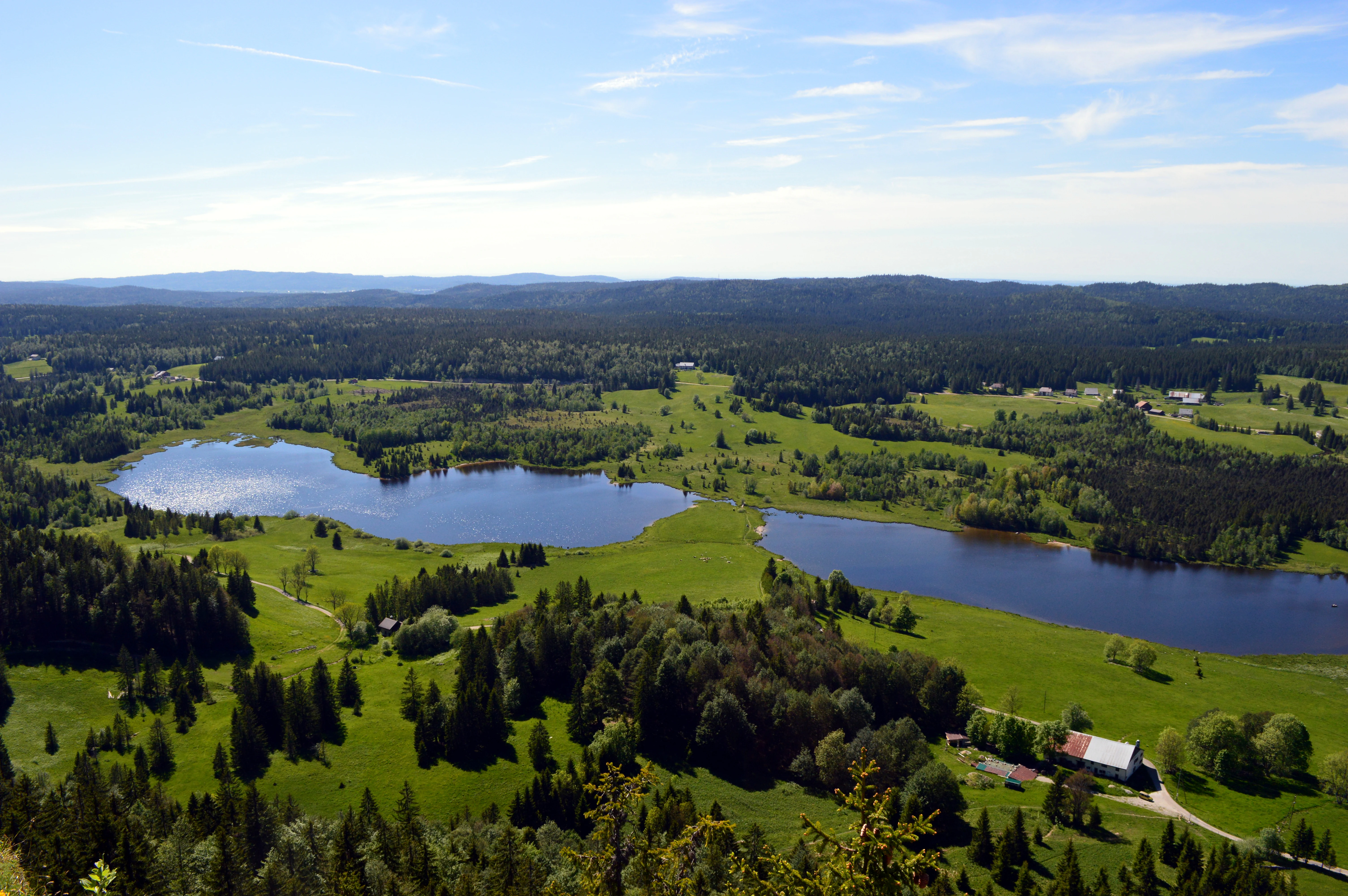
A high-angle scenic view from a viewpoint looking down over two dark blue lakes surrounded by green meadows and dense evergreen forests in the Jura Mountains.
Panoramic view of Lac de Bellefontaine and Lac des Mortes from the Roche Bernard viewpoint in the Jura Mountains.

Tourbières et lacs de la montagne jurassienne history and protected-area timeline

The conservation history of the site begins with the early recognition of the Drugeon basin and the LIFE-funded project that restored about thirty kilometres of watercourses across twelve communes, a programme that paved the way for the 2003 Ramsar designation of the Bassin du Drugeon. This initial labelling established the area as a reference for mountain peatland conservation in France and provided a foundation on which the much larger 2021 site could be built.

From 2014 to 2021, a second LIFE programme, Tourbières du Jura, extended restoration work across more than sixty peatlands in the Doubs and the Jura, marking a renewed commitment to the rehabilitation of high-altitude bog habitats. Local actors began to envision a broader Ramsar designation following a 2017 seminar of the Ramsar France association at Labergement-Sainte-Marie, where forty communes expressed interest in joining the site.

The formal candidature was submitted to the French state in March 2020, and on 2 February 2021 the Tourbières et lacs de la montagne jurassienne were officially inscribed as Ramsar site no. 1266. The chosen date deliberately marked World Wetlands Day and the fiftieth anniversary of the Ramsar Convention, reinforcing the symbolic importance of the designation for French wetland conservation.

Tourbières et lacs de la montagne jurassienne landscape and geographic character

The landscape of the site reflects the cold, karstic character of the Jura Massif, where glacial action on porous limestone produced an unusually rich mosaic of wetlands. The site lies almost entirely above 800 metres elevation, and its terrain is shaped by deep combes, broad high plateaus, glacial moraines and natural lakes filling former glacial hollows. The peatlands occupy depressions and gentle slopes where waterlogging has accumulated over thousands of years, often bordered by spruce forests typical of the Jura highlands.

The lakes are an integral part of the scenery. Lac de Saint-Point, the largest natural lake in the Jura, anchors the centre of the site, while clusters of smaller lakes such as Ilay, Narlay, Petit and Grand Maclu, Bellefontaine and Mortes, Lamoura, l'Abbaye and the Rousses lake create a chain of clear-water basins across the plateau. These lakes, together with peatlands in the upper Doubs valley, the Drugeon basin, the Vallée de l'Orbe and the Combe de Chapelle-des-Bois, define the visual identity of this part of the Haut-Jura: a horizon of forests, raised bogs, open water and damp meadows under a typically mountain climate.
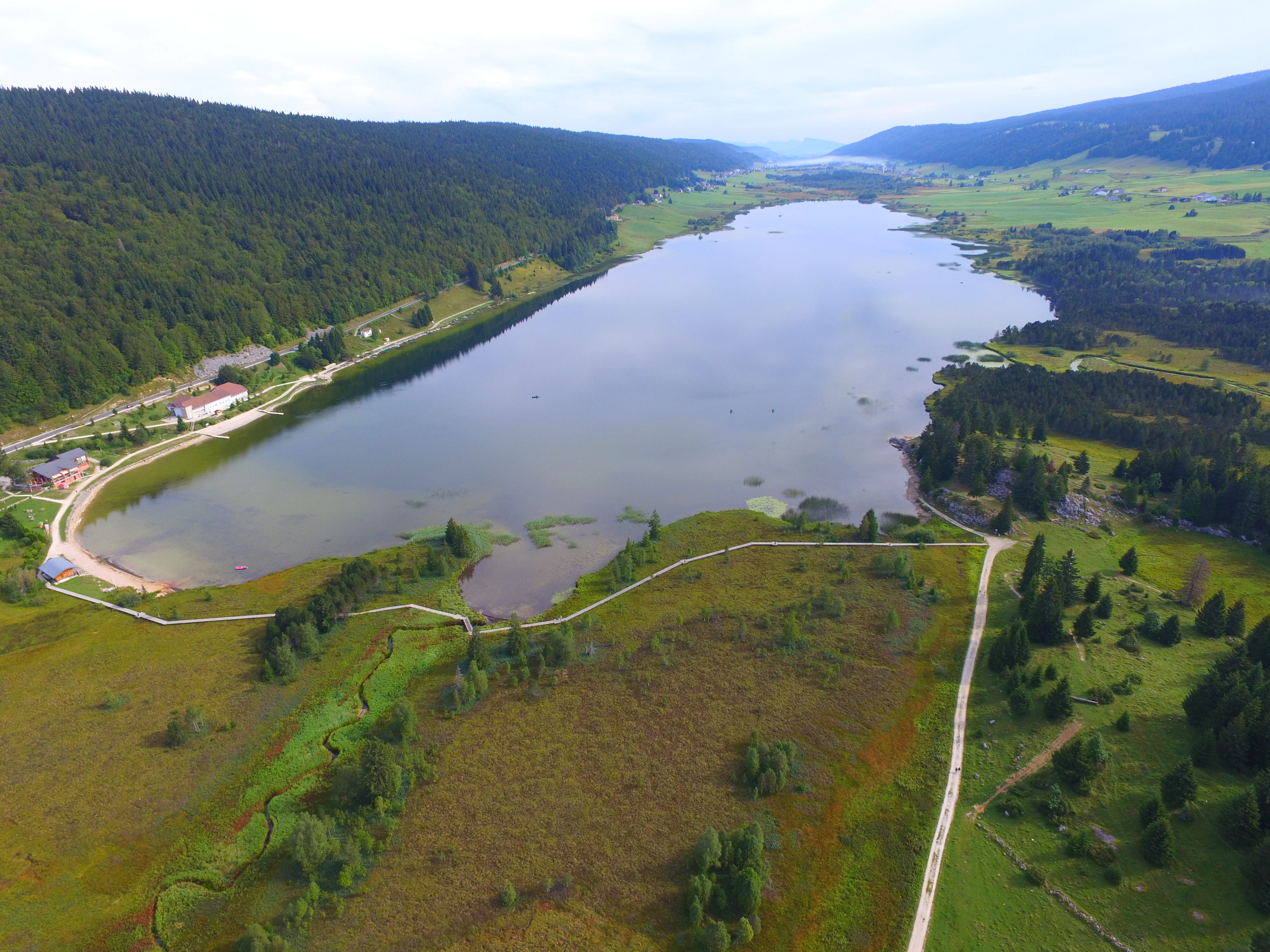
An aerial view of an elongated mountain lake surrounded by dense green forests and wetlands in the Jura Mountains.
Aerial view of Lac des Rousses, a significant natural lake within the Tourbières et lacs de la montagne jurassienne protected area.

Tourbières et lacs de la montagne jurassienne ecosystems, habitats, and plant life

Ecologically, the site represents the most complete set of mountain peatland habitats in the French Jura and one of the most complete in France. Cold, acidic and nutrient-poor conditions in the peatlands support bog mosses, sedges, cottongrass and sphagnum communities, alongside boreal relicts such as dwarf birch, crowberry and a range of rare sedges and orchids. The lakes, fed by karstic springs, sustain clear, oxygen-rich waters that are favourable to sensitive aquatic species.

At a broader ecological level, the complex functions as a critical carbon store and a major reservoir for the regional water resource, while also providing habitat connectivity across the high Jura. Twenty-two wetland habitats of European interest are present, and many of the species recorded here have their main or even sole French population within the site.
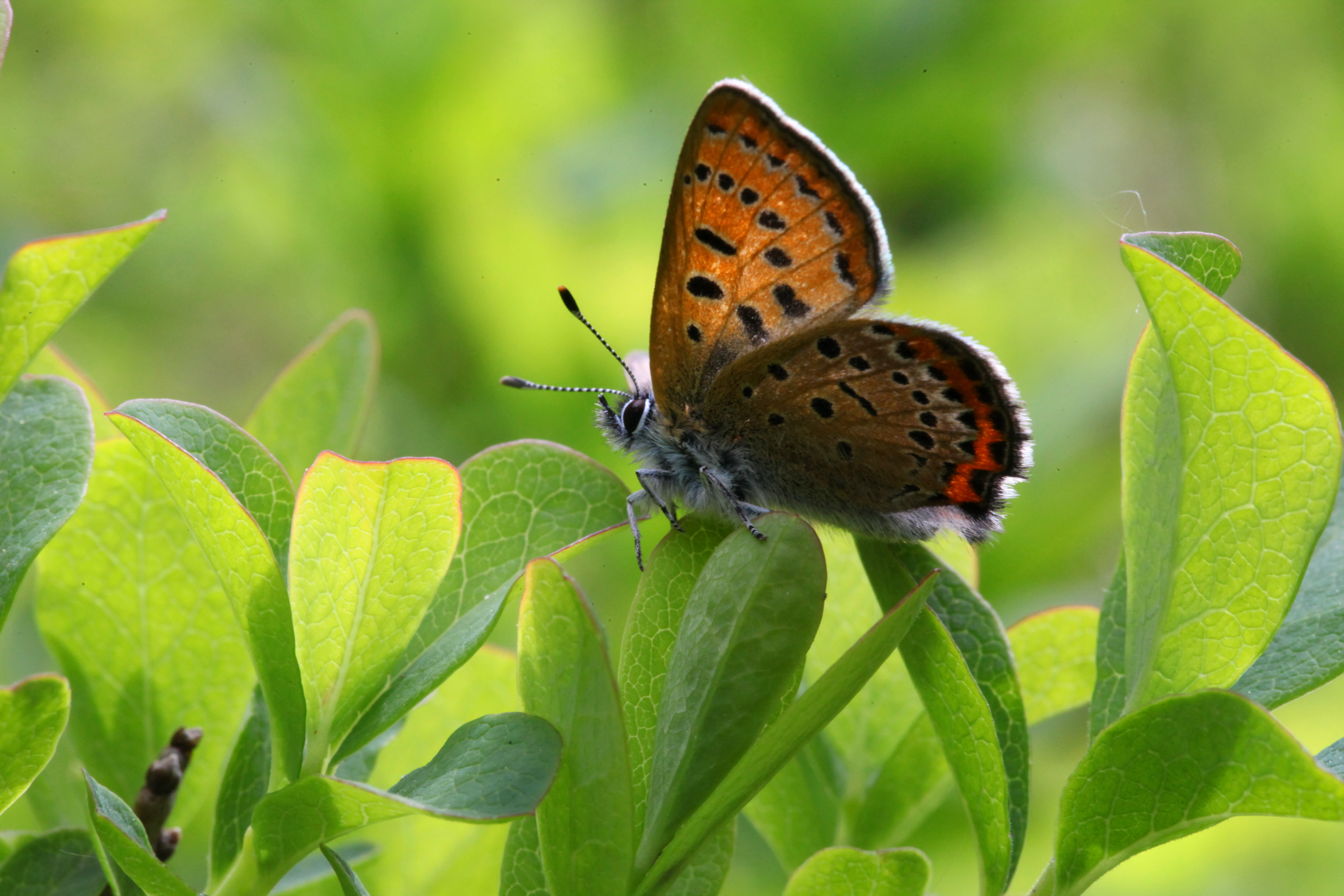
A close-up photograph of a small orange butterfly with black spots resting on bright green leaves.
A violet copper butterfly, a protected species, resting on foliage within the Jura mountains.

Tourbières et lacs de la montagne jurassienne wildlife and species highlights

The fauna of the site is remarkable for its peatland-specialist character. Among breeding or regularly occurring birds, rare species such as the greater spotted eagle, common rosefinch, corncrake, snipe, Eurasian curlew, spotted crake and northern lapwing reflect the open, wet conditions that this habitat complex preserves at altitude. Invertebrates are equally distinctive: dragonflies such as the subarctic hawker, white-faced and large white-tailed darters, and butterflies including the bog fritillary, moorland clouded yellow, large heath, scarce copper and cranberry fritillary depend directly on bog vegetation.

Amphibians are well represented by the natterjack toad, northern crested newt and palmate newt, while reptiles include the adder. Aquatic fauna is also notable, with confirmed breeding of pike, lake trout, powan and the highly threatened white-clawed crayfish. White-clawed crayfish populations in particular underline the excellent water quality maintained across much of the site's lake and stream network.
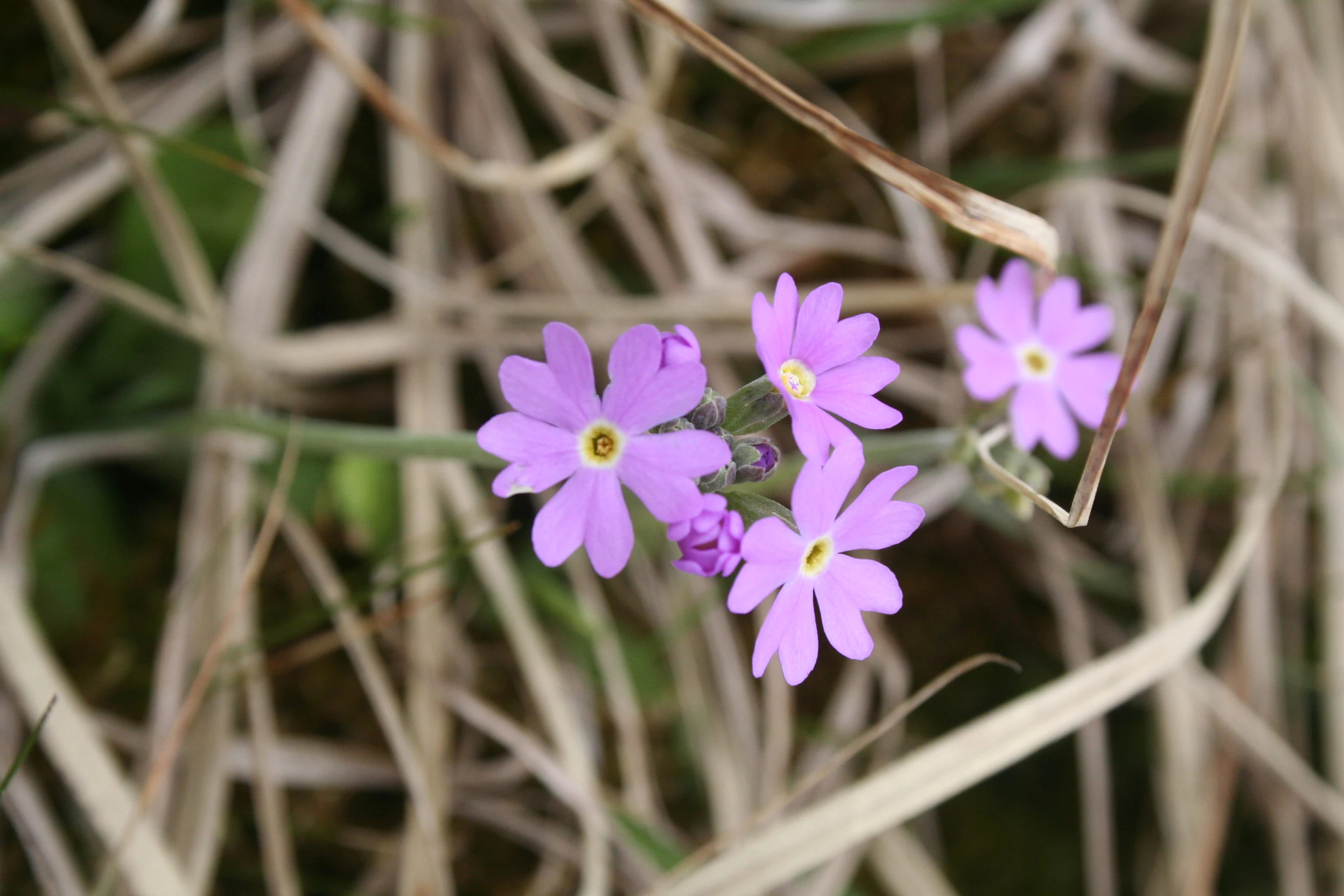
A group of small, light purple flowers with yellow centers, known as Birdseye primrose, blooming amidst dry, tan-colored stalks of grass.
A close-up of Birdseye primrose (Primula farinosa) flowers, a species found in the wetland and peatland ecosystems of the Jura mountains.

Tourbières et lacs de la montagne jurassienne conservation status and protection priorities

The site is one of the most important French entries in the Ramsar Convention and acts as a cornerstone of wetland policy in the Bourgogne-Franche-Comté region. Its designation in 2021 extended a conservation framework that already covered the Bassin du Drugeon and brought twelve Natura 2000 sites and four nature reserves under a single ecological umbrella, ensuring coherent management of habitats that were previously treated in isolation.

Conservation value rests on climate regulation through carbon storage, on the protection of a major regional water resource fed by karstic aquifers, and on the safeguarding of relict bog and lake ecosystems that cannot easily be recreated once damaged. The success of two successive LIFE programmes, restoring tens of kilometres of watercourses and rehabilitating more than sixty peatlands, demonstrates an unusually sustained local commitment to active management rather than purely passive protection.

Tourbières et lacs de la montagne jurassienne cultural meaning and human context

The wetland complex is intertwined with the traditional countryside of the Haut-Jura, where peat cutting, small-scale agriculture and forestry have shaped the rural landscape for centuries. Former peat-extraction basins, such as those visible around Frasne, have been progressively integrated into conservation management and now serve as recognised biodiversity sites rather than abandoned industrial scars.

The region also carries a strong identity rooted in lake and mountain culture, with villages such as Les Rousses, Lamoura, Chapelle-des-Bois, Labergement-Sainte-Marie and Saint-Claude anchoring a long tradition of wetland-aware rural life. The Ramsar designation recognised this pre-existing local culture and the willingness of communes to engage collectively in protecting it.
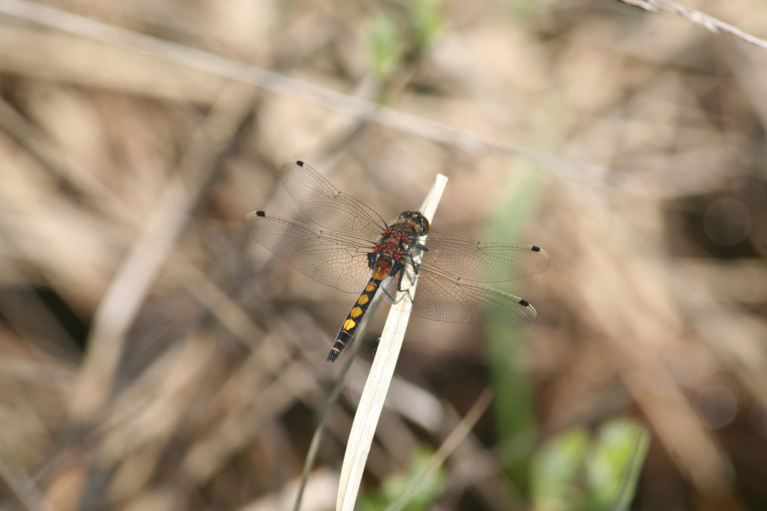
A close-up view of a Leucorrhinia pectoralis dragonfly with distinctive yellow spots on its abdomen, resting on a single vertical piece of dry grass.
A yellow-spotted whiteface dragonfly perched on a dry reed in the Drugeon valley.

Top sights and standout views in Tourbières et lacs de la montagne jurassienne

The site's most striking feature is its sheer concentration of high-altitude peatlands, which together represent about a third of the entire Franco-Swiss Jura Massif's bog resource. It is also unusual in linking major glacial lakes such as Lac de Saint-Point and Lac de Remoray with extensive bog systems in a single internationally protected perimeter, creating integrated lake-peatland landscapes of rare coherence.
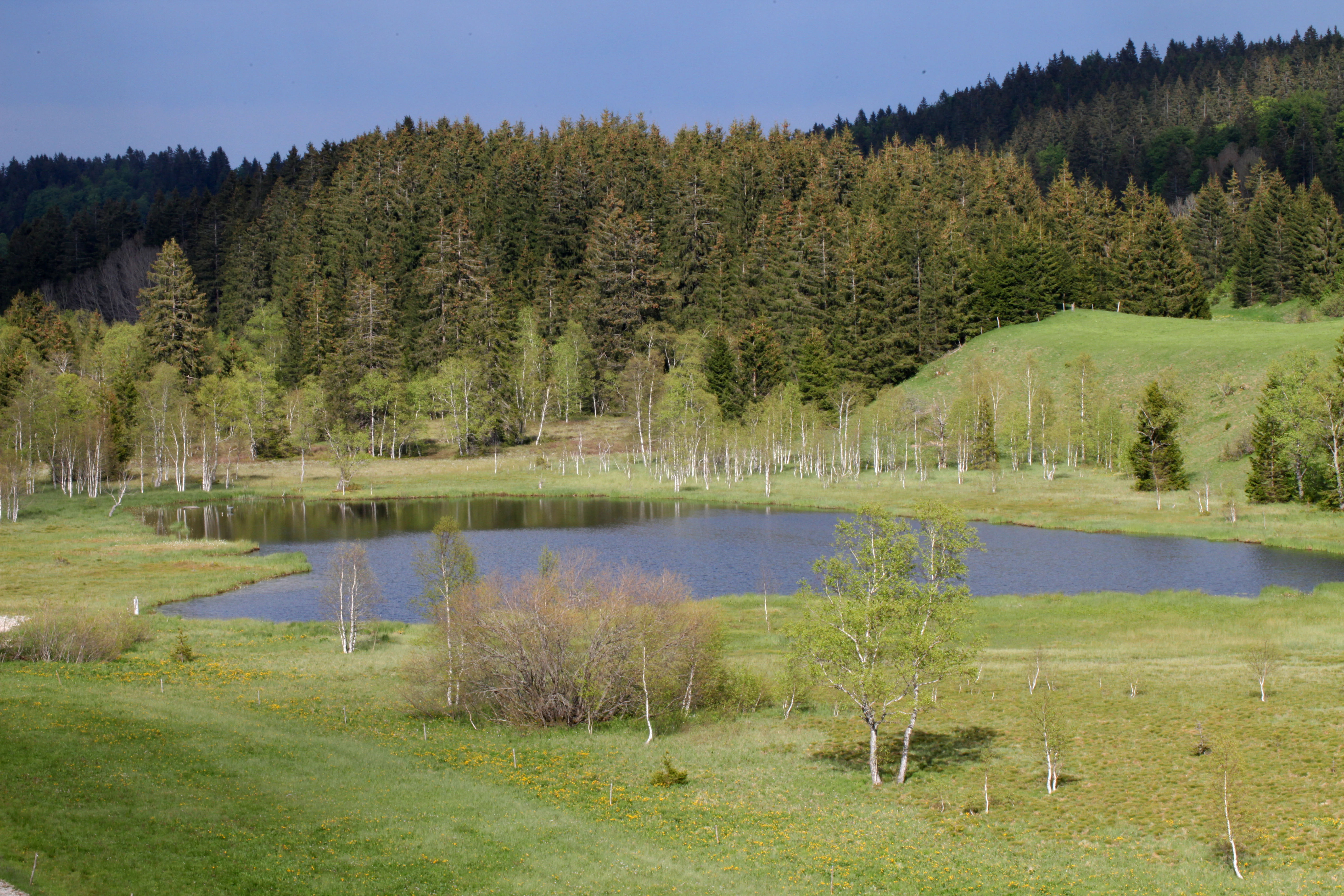
A peaceful landscape view of a small, still pond at Etang des Pontets, bordered by green meadows, scattered trees, and a dense evergreen forest on a hillside.
The Etang des Pontets, a tranquil pond surrounded by forests and meadows in the Jura mountains.

Best time to visit Tourbières et lacs de la montagne jurassienne

Late spring and early summer are the most rewarding seasons for appreciating the site, when wetland vegetation is at its most visible, dragonflies and butterflies are active around the bogs, and many of the characteristic breeding birds can be heard in surrounding meadows and reedbeds. Late summer offers warmer lake conditions and rich displays of bog flora. Winter visits can be atmospheric, with snow-covered peatlands and frozen lakes, though many minor access roads may be limited by mountain weather.

Monthly climate preview

Representative long term temperature and precipitation records for regional terrain analysis

Tourbières et lacs de la montagne jurassienne Climate Normals and Monthly Weather Patterns

Representative coordinate measurements reveal the multiyear thermal rhythm and daily precipitation averages for Tourbières et lacs de la montagne jurassienne across twelve recorded intervals. Examining the complete monthly climate profile provides deeper context on long term temperature ranges and precipitation totals.
Annual mean9 °C
-1 °C18 °C
Jan-1°
Feb
Mar
Apr
May12°
Jun16°
Jul18°
Aug18°
Sep14°
Oct10°
Nov
Dec
Warmest month
July

18.5 °C

Coolest month
January

-0.6 °C

Wettest month
May

3.7 mm/day

Driest month
March

2.7 mm/day

Park location guide

Geography guide, regional context, and park location map for Tourbières et lacs de la montagne jurassienne

Tourbières et lacs de la montagne jurassienne park geography, regions, and map view in France

Understand where Tourbières et lacs de la montagne jurassienne sits in France through a broader geographic reading of the surrounding landscape, nearby location context, and its mapped position within the national park landscape.

How Tourbières et lacs de la montagne jurassienne fits into France

France is a unitary semi-presidential republic and one of the world's largest economies. It borders Belgium, Luxembourg, Germany, Switzerland, Italy, Monaco, Andorra, and Spain, with a maritime border to the United Kingdom. The country is known for its cultural influence, art, cuisine, and political history spanning centuries.

Wider geography shaping Tourbières et lacs de la montagne jurassienne in France

France is located in Western Europe. Metropolitan France extends from the Rhine to the Atlantic Ocean and from the Mediterranean Sea to the English Channel and North Sea. The country borders Belgium, Luxembourg, Germany, Switzerland, Italy, Monaco, Andorra, Spain, and has a maritime border with the United Kingdom.

Map view of Tourbières et lacs de la montagne jurassienne

Use this park location map to pinpoint Tourbières et lacs de la montagne jurassienne in France, understand its exact geographic position, and read its mapped placement within the surrounding landscape more clearly.

Pigeon | © OpenStreetMap contributors

Location context for Tourbières et lacs de la montagne jurassienne

Bourgogne-Franche-Comté
Recorded earthquake history

Explore Historical Earthquake Records for Tourbières et lacs de la montagne jurassienne

Consult our structured database of recorded seismic events associated with the geography of Tourbières et lacs de la montagne jurassienne. MoriAtlas provides a clear view of historical earthquake magnitudes and epicentre distances for this protected landscape to support informed geographic study.

Tourbières et lacs de la montagne jurassienne Earthquakes

Catalogued events

71 events

Strongest magnitude

Magnitude 5.1

Most recent event

Mar 29, 2006

This history includes earthquakes recorded inside the park or within 50 km of its borders

Visual exploration of mountain peatlands, glacial lakes, and protected Jura habitats.

Tourbières et lacs de la montagne jurassienne Photos and Landscape Scenery

Visual documentation reveals the distinct topography and glacial lake networks defining the protected landscape character of Tourbières et lacs de la montagne jurassienne. Detailed photography exposes the high-altitude terrain, diverse wetland habitats, and expansive peatland ecosystems shaping the French Jura Massif.

A high-angle scenic view from a viewpoint looking down over two dark blue lakes surrounded by green meadows and dense evergreen forests in the Jura Mountains.

A close-up view of a butterfly with orange and grey wings perched on a green plant stem.

An aerial view of an elongated mountain lake surrounded by dense green forests and wetlands in the Jura Mountains.

A close-up photograph of a small orange butterfly with black spots resting on bright green leaves.

A group of small, light purple flowers with yellow centers, known as Birdseye primrose, blooming amidst dry, tan-colored stalks of grass.

High-angle view of two serene natural lakes surrounded by dense green forest and rolling hills under a bright sky.

A close-up view of a Leucorrhinia pectoralis dragonfly with distinctive yellow spots on its abdomen, resting on a single vertical piece of dry grass.

A peaceful landscape view of a small, still pond at Etang des Pontets, bordered by green meadows, scattered trees, and a dense evergreen forest on a hillside.

A common snipe with distinct brown and cream patterned feathers resting in marsh grass.

A calm lake reflects a clear blue sky, a dense conifer forest, and small farm buildings on the shoreline.

A close-up view of a single bright yellow Saxifraga hirculus flower in bloom, surrounded by blurred grassy vegetation.

A wide view of a golden-brown peatland marsh with scattered small trees, backed by a dense line of coniferous forest under a clear blue sky.

An aerial view showing a long, blue lake stretching through a valley in the Jura Mountains, surrounded by green fields, dense forests, and small village settlements.

A calm, narrow water channel reflects a cloudy sky, surrounded by low-lying vegetation, grasses, and a distant tree line within a peat bog.

Two purple Siberian iris flowers in full bloom, standing in a lush green grass meadow under bright sunlight.

A wide-angle landscape shot of the Crossat peatland, showing a meandering stream cutting through brown, marshy grasslands, with a line of bare-branched birch trees separating the wetland from a lake.

Park atlas

Compare surrounding regional geography and connected protected landscapes

Parks Near Tourbières et lacs de la montagne jurassienne and Related Protected Areas

Browsing other parks near Tourbières et lacs de la montagne jurassienne reveals broader regional wetland networks and high-altitude karst terrain. Extending the search helps connect isolated glacial lake habitats to wider protected landscapes across the Jura Massif.
A horizontal watercolor painting showing a soft, misty landscape with coniferous trees, grassy wetlands, and rolling hills in the background, executed in a muted color palette.
Nature reserveBourgogne-Franche-Comté
Mapped location lies within the park boundary#1 closest

North

Réserve naturelle régionale de la Seigne des Barbouillons Protected Landscape Atlas

Geography and wetland boundaries in the Jura plateau of France

The Réserve naturelle régionale de la Seigne des Barbouillons protects a characteristic raised bog ecosystem in the Mignovillard commune. This compact area serves as a vital reference point for understanding the distribution of sphagnum mires and specialized butterfly habitats across the Jura plateau, illustrating the contrast between protected peatlands and their surrounding agricultural environment.

Area
0.346 km²
Established
2014
IUCN
IV
Relief
Upland
A watercolor illustration of a landscape with green forest, wetland grasses, and pale mountains in the background, set against a clean white background.
Nature reserveBourgogne-Franche-Comté
Mapped location lies within the park boundary#2 closest

North

Réserve naturelle régionale des tourbières de Frasne-Bouverans Protected Landscape Atlas

Peatland mosaic geography in the Drugeon valley of Bourgogne-Franche-Comté

Trace the boundaries and ecological features of this significant regional nature reserve. Spanning the Forbonnet massif and the wider Drugeon basin, the area features a dense concentration of raised bogs, woodlands, and mire habitats defined by complex glacial geology.

Area
2.926 km²
Established
1986
IUCN
IV
Visitors
17.5K annual
A horizontal watercolor painting depicting a soft, layered landscape with distant hills, gentle slopes, and clusters of evergreen trees in shades of green and purple.
Nature reserveBourgogne-Franche-Comté
Mapped location lies within the park boundary#3 closest

Southwest

Réserve naturelle régionale des tourbières du bief du Nanchez: Protected Jura Mountain Peatlands

Mapping bog systems and wet grassland geography in Eastern France

Located in the Jura department, this regional nature reserve preserves forty-nine hectares of vital peatland, including diverse mire communities and forested slopes. The site provides a critical look at montane landscape restoration, documenting significant bog flora and complex hydrological patterns along the Combe du Nanchez valley floor.

Area
0.488 km²
Established
2021
IUCN
IV
Relief
Upland
A soft, horizontal watercolor painting depicting a winding river flowing through a lush, green landscape with distant hills and sparse trees.
Nature reserveVaud
About 21 km away#4 closest

Southeast

Chanivaz, Delta de l’Aubonne: Geography, Map, and Protected Landscape Context

A rare glacial geotope and river delta on Lake Geneva.

Chanivaz, Delta de l’Aubonne provides a rich look at the alluvial fan of the River Aubonne. Explore its layered terrace terrain, protected reedbeds, and riparian forests in the canton of Vaud, representing one of the best-preserved natural river mouths remaining on the northern shore of Lake Geneva.

Area
3 km²
Established
2003
Relief
Lowland
Climate
Temperate
A horizontal watercolor painting depicting a soft-edged, green-and-white landscape of rolling hills and distant limestone ridgelines.
Nature reserveBourgogne-Franche-Comté
About 21 km away#5 closest

North

Réserve naturelle nationale du ravin de Valbois: Protected Jura Blind Valley and Limestone Ravines

Geographic landscape exploration of the Doubs department's protected natural reserve.

Spanning 235 hectares, this protected nature reserve in Bourgogne-Franche-Comté preserves a textbook Jura reculée. The terrain showcases vertical limestone cliffs, deep forested ravines, and a 40-meter cascade. As a hotspot for butterfly diversity and Mediterranean-montane vegetation, the area offers a significant study in microclimatic gradients and old-growth forest conservation within the French landscape.

Area
2.35 km²
Established
1983
IUCN
IV
Relief
Mountain
A watercolor landscape painting showing green hills, trees, and marshy river banks.
Nature reserveGeneva
About 23 km away#6 closest

South

Naturschutzgebiet Moulin de Vert: Protected Wetland and Forest Geography in Geneva

Detailed nature reserve map and regional landscape context

The Naturschutzgebiet Moulin de Vert nature reserve protects a mosaic of riverside woodland, meadows, and managed pond systems along the Rhône in the Canton of Geneva. Spanning approximately 132 hectares, this conservation area is recognized for supporting extensive biodiversity, from nesting peregrine falcons to diverse amphibian populations. Access this detailed geographic perspective to visualize the park boundaries, internal terrain features, and its ecological connection to the broader Swiss river landscape.

Area
1.32 km²
Established
2001
IUCN
IV
Nature reserveAuvergne-Rhône-Alpes
About 23 km away#7 closest

Southwest

Réserve naturelle régionale du récif fossile de Marchon - Christian Gourrat Geological Site

A protected Jurassic fossil reef in the Auvergne-Rhône-Alpes region

Located in the Ain department, this small nature reserve is scientifically renowned for its Kimmeridgian reef outcrop. The site protects a fossilized coral and rudist assemblage within the forêt de Marchon, offering a quiet, forested setting for studying France's ancient marine geological history.

Area
0.001 km²
Established
2015
IUCN
IV
Scope
Terrestrial
A pale, minimalist watercolor painting depicting rolling hills and mountains in shades of soft green, purple, and yellow against a white background.
Natural monumentNeuchâtel
About 23 km away#8 closest

Northeast

Creux du Van et Gorges de l’Areuse Natural Monument and Regional Protected Landscape

Geological exploration of the Folded Jura and Areuse river valley

Spanning the Cantons of Neuchâtel and Vaud, this protected area unites the dramatic rock bowl of the Creux du Van with the narrow, cascading passages of the Gorges de l’Areuse. The site provides a comprehensive view of Jura mountain landforms, highlighting millions of years of river erosion, glacial activity, and karst weathering in a singular, well-defined geographic corridor.

Area
21.21 km²
Established
1876
Relief
Mountain
Climate
Temperate

Common questions about visiting, size, designation, and location context for Tourbières et lacs de la montagne jurassienne

Tourbières et lacs de la montagne jurassienne FAQs for park facts, access, geography, and protected area context

Find quick answers about Tourbières et lacs de la montagne jurassienne, including protected-area facts, park geography, trail and visitor context, and how the park fits into its surrounding country and regional landscape.
MoriAtlas Explorer

Continue Your Protected Areas Search Across the Global Atlas

Deepen your exploration by continuing the structured search for national parks and protected areas worldwide. Utilize the comprehensive filtering capabilities to compare different conservation landscapes and refine your understanding of global park geography. Discover more about the distribution and characteristics of protected natural areas.

Global natural geography