
Mori Atlas logo
Nature reserveRéserve naturelle régionale des tourbières du bief du Nanchez

A mapped overview of protected mountain bogs, wet meadows, and Jura valley terrain

Réserve naturelle régionale des tourbières du bief du Nanchez: Jura Mountain Landscape and Peatland Geography

(Réserve naturelle régionale des tourbières du bief du Nanchez (RNR332))

The Réserve naturelle régionale des tourbières du bief du Nanchez protects a dense mosaic of peatlands, mires, and wet grasslands across the Bief du Nanchez valley in the Jura mountains. Situated at 900 metres elevation, this Bourgogne-Franche-Comté reserve showcases mature bog systems, re-meandered streams, and forested slopes. Its compact boundaries support complex hydrological features and diverse montane flora within an area shaped by ancient geological ridges and glacial deposits.

peatlandbogmirewet meadowforested slopemountain reserve
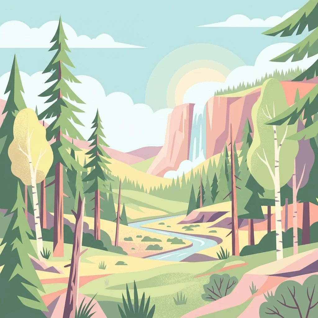
A flat-design illustration depicting a vibrant mountain valley with a winding river, a waterfall flowing from a cliff, and various evergreen and deciduous trees under a light sky.

Réserve naturelle régionale des tourbières du bief du Nanchez

Nature reserve

Park overview

Structured park overview, official facts, and landscape profile for Réserve naturelle régionale des tourbières du bief du Nanchez

Réserve naturelle régionale des tourbières du bief du Nanchez park facts, protected area profile, and essential visitor context

Review the core facts for Réserve naturelle régionale des tourbières du bief du Nanchez, including designation, size, terrain, visitor scale, habitats, and operating context in one park-focused overview.

About Réserve naturelle régionale des tourbières du bief du Nanchez

The Réserve naturelle régionale des tourbières du bief du Nanchez is a recently created French regional nature reserve that protects a representative sample of the peatland landscapes of the Jura mountains. Located on the north side of the Bief du Nanchez valley in the commune area of Grande-Rivière Château and Nanchez, the reserve sits at the upper edge of the montane belt of the western second Jura plateau. Although its footprint is modest at roughly 49 hectares, the site compresses an unusually wide range of habitats into a small area, which is part of what makes it ecologically significant.

At the core of the reserve lie mature peat bogs and mires, accompanied by wet meadows, tall herb vegetation (mégaphorbiaies), dry grasslands, two small streams (the Nanchez and the Trémontagne), and a forested slope dominated by spruce and mountain pine (Pinus uncinata). This juxtaposition of bog, open wet meadow, dry meadow, and coniferous forest on a single hillside gives the reserve a distinct ecological identity and supports a rich flora and fauna for its size.

Beyond the habitat mosaic, the reserve is part of a broader landscape framework. The surrounding Combe du Nanchez has been a Natura 2000 site since 2004, and the ZNIEFF inventory lists the peatland, lake, and marsh complex of Prénovel. The reserve is managed by the Parc naturel régional du Haut-Jura, which has coordinated habitat inventories, stream restoration, and the installation of a boardwalk trail with interpretation panels for visitors and school groups.

Its relatively recent status as a regional nature reserve, dated 17 December 2021, reflects an evolution from a smaller voluntary nature reserve established in 1992 under the former commune of Prénovel. That earlier protection helped launch natural inventories and visitor infrastructure, while subsequent European LIFE programme support for Jura peatlands has reinforced conservation, hydrological rehabilitation, and public interpretation.

Quick facts and research context for Réserve naturelle régionale des tourbières du bief du Nanchez

The Réserve naturelle régionale des tourbières du bief du Nanchez is a French regional nature reserve classified in December 2021, covering 48.81 hectares in the Jura department and Bourgogne-Franche-Comté region. It lies on the north part of the south-facing slope of the Bief du Nanchez valley, on the communes of Grande-Rivière Château and Nanchez, at approximately 900 metres altitude in the upper montane zone on the western edge of the second Jura plateau. The reserve is managed by the Parc naturel régional du Haut-Jura, is part of the ZNIEFF inventory, and lies within the Combe du Nanchez Natura 2000 site. Around four hundred species are documented within a small footprint dominated by mature peatlands and supporting wet meadows, mires, streams, dry meadows, and forested slopes.

Protection and recognition

Documented terrestrial protection scope, administrative details, and official designation metrics

Réserve naturelle régionale des tourbières du bief du Nanchez Protection Status and WDPA Records

Terrestrial protection status, baseline designation details, and international database identifiers provide clear context for Réserve naturelle régionale des tourbières du bief du Nanchez. Structured conservation records outline management scope and administrative parameters without external assumptions.

Protection details

Protection scope
Terrestrial
Transboundary protection
No
WDPA ID
555738137
Park context

Deeper park guide and search-rich context for Réserve naturelle régionale des tourbières du bief du Nanchez

Réserve naturelle régionale des tourbières du bief du Nanchez history, landscape, wildlife, and travel context

Explore Réserve naturelle régionale des tourbières du bief du Nanchez through its history, landscape character, ecosystems, wildlife, conservation priorities, cultural context, and seasonal travel timing in a structured park guide built for atlas discovery and search intent.

Why Réserve naturelle régionale des tourbières du bief du Nanchez stands out

The reserve is best known for its mature, well-preserved peat bogs set within a small Jura valley system, and for the contrast between those bogs and the surrounding mosaic of wet meadows, dry grasslands, and forested slopes. It is also recognised for peatland restoration work along the Bief du Nanchez and the Trémontagne streams, including the re-meandering of channels that had been straightened in the twentieth century, and for its bog flora including round-leaved sundew (Drosera rotundifolia), bog-rosemary (Andromeda polifolia), and Loesel's twayblade. Its secondary reputation comes from being a place where peatland conservation, Jura mountain landscape, and educational interpretation come together through a boardwalk trail and interpretation panels, all within a compact territory of about 49 hectares.
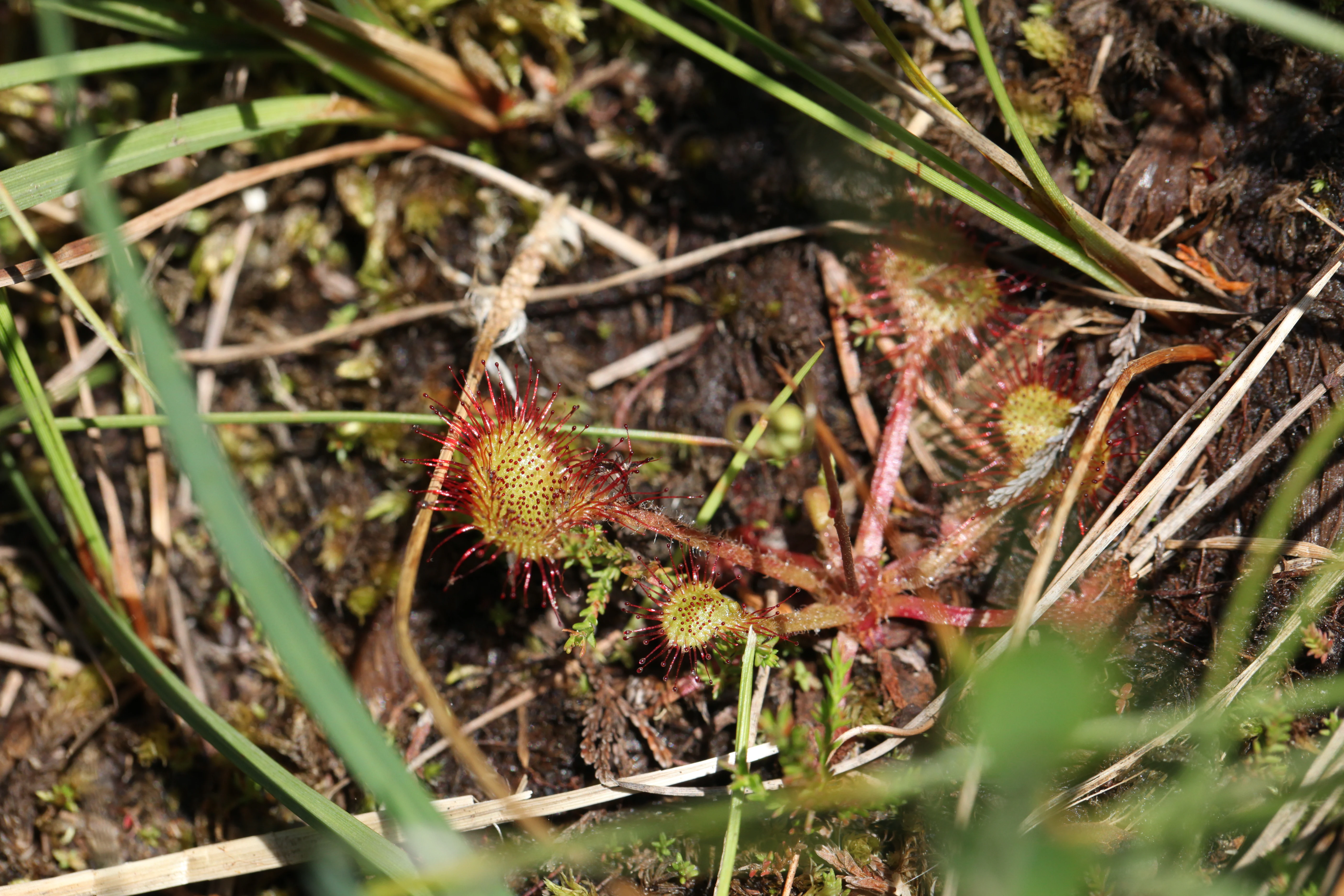
A close-up view of a sundew plant with small, circular, sticky red-glandular leaves growing in wet soil among grasses and mosses.
A sundew plant, a carnivorous species typical of the peatland ecosystem in the Nanchez nature reserve.

Réserve naturelle régionale des tourbières du bief du Nanchez history and protected-area timeline

Protection of the Bief du Nanchez peatlands began in 1992, when the site was classified as a voluntary nature reserve covering 28 hectares at the initiative of the former commune of Prénovel. The Parc naturel régional du Haut-Jura took on management responsibility, oversaw the first natural inventories, and developed an interpretation trail for visitors and school groups.

In 1999, the Nanchez stream itself became the focus of ecological restoration: old meanders were reactivated and the banks were revegetated to reverse the damage caused by earlier channel-straightening works. The wider landscape context strengthened in 2004, when the 470 hectare Combe du Nanchez site joined the European Natura 2000 network.

The peatland conservation effort expanded further under the LIFE programme's Tourbières du massif jurassien project in 2016, which funded additional hydraulic rehabilitation work and renewed the boardwalk and interpretation panels. By December 2020, communal ownership covered 98 percent of the parcels covered by the future reserve, paving the way for the formal creation of the Réserve naturelle régionale des tourbières du bief du Nanchez on 17 December 2021 by decision of the regional council.

Réserve naturelle régionale des tourbières du bief du Nanchez landscape and geographic character

The reserve is shaped by a north-south Jura valley, the Combe du Nanchez, with the protected area occupying the northern portion of its south-facing slope. The site sits at around 900 metres altitude in the upper montane zone, on the western edge of the second Jura plateau. Two anticlinal ridges, of Bajocian, Bathonian, and Callovian age to the west and Rauracian, Argovian, and Sequanian age to the east, frame the valley; between them lie Quaternary alluvium and glacial deposits where the bogs have developed.

The visible terrain is a compact mosaic: open bogs and wet mires, grassy meadows, and dry slopes meeting a forested flank dominated by spruce and mountain pine. A small marl-limestone crest partially separates the main Nanchez stream from the peatland system, adding to the hydrological complexity of the valley.
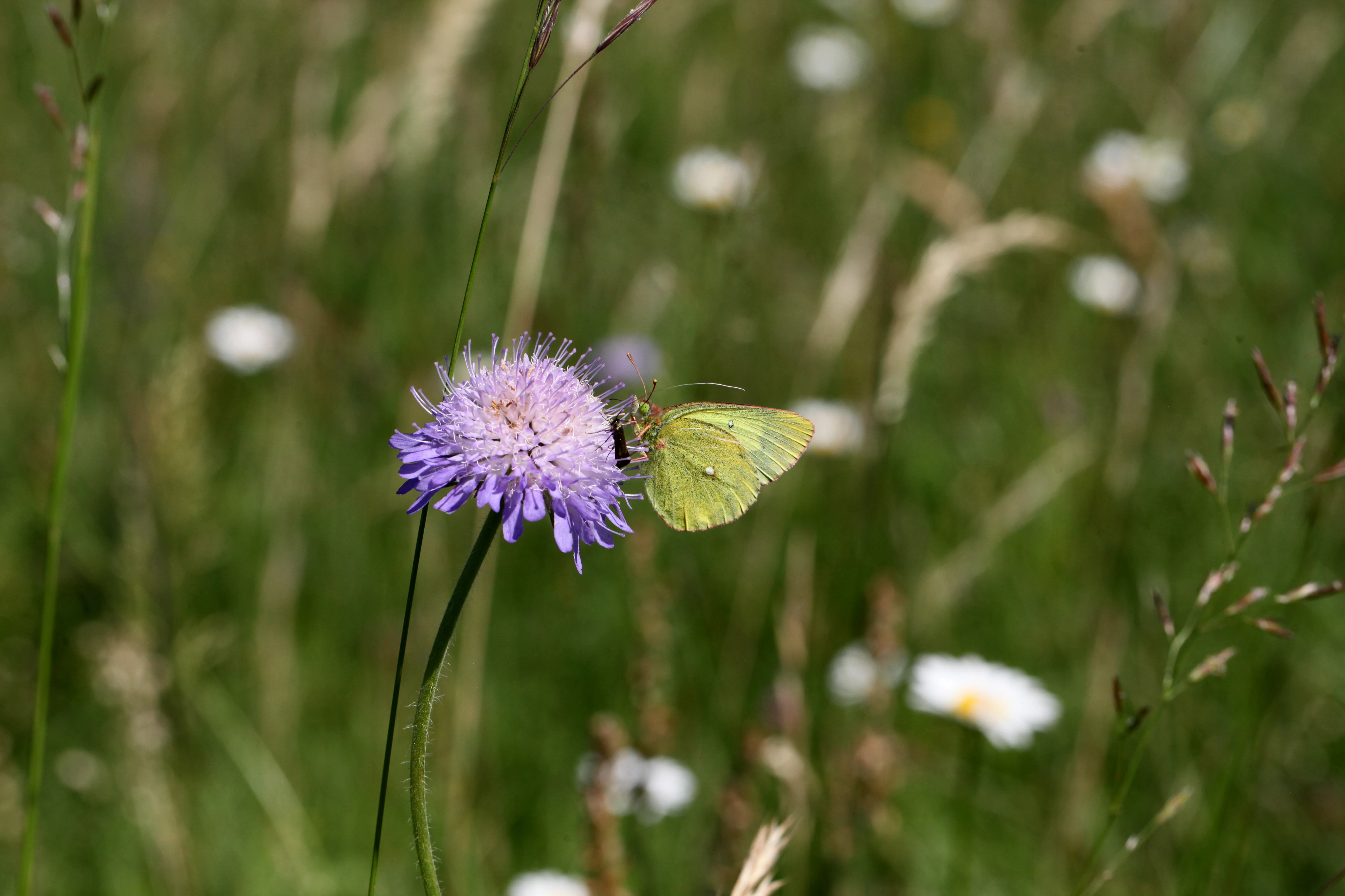
A pale yellow butterfly, specifically a Moorland Clouded Yellow, perched on a light purple scabious flower in a green meadow.
A Moorland Clouded Yellow butterfly feeding on a scabious flower within the Nanchez peatlands.

Réserve naturelle régionale des tourbières du bief du Nanchez ecosystems, habitats, and plant life

Ecologically, the reserve protects a remarkable concentration of habitats for its size. The defining element is a series of mature, relatively undisturbed peatlands, surrounded by wet meadows, tall herb communities (mégaphorbiaies), dry grasslands, and a forested slope that frames the whole system on the east. Two streams, the Bief du Nanchez and the Bief de Trémontagne, run through or alongside the site, and their water balance underpins the bogs.

The wet habitats form the core of the reserve's interest, with peatland communities that have been allowed to develop with minimal recent disturbance. Surrounding dry meadows and rocky slopes support different plant communities, while the forested slope adds coniferous woodland to the habitat mix. A small number of species reported as approximately four hundred across the site underlines how densely biodiversity is packed into the territorial footprint. The hydrological system is integral to the ecology: the Bief du Nanchez rises a few kilometres upstream, flows north through the valley, and then turns east through a cluse before draining into a network of dolines, while past channel straightening and subsequent remeandering have shaped both the streamscape and the bog margins.
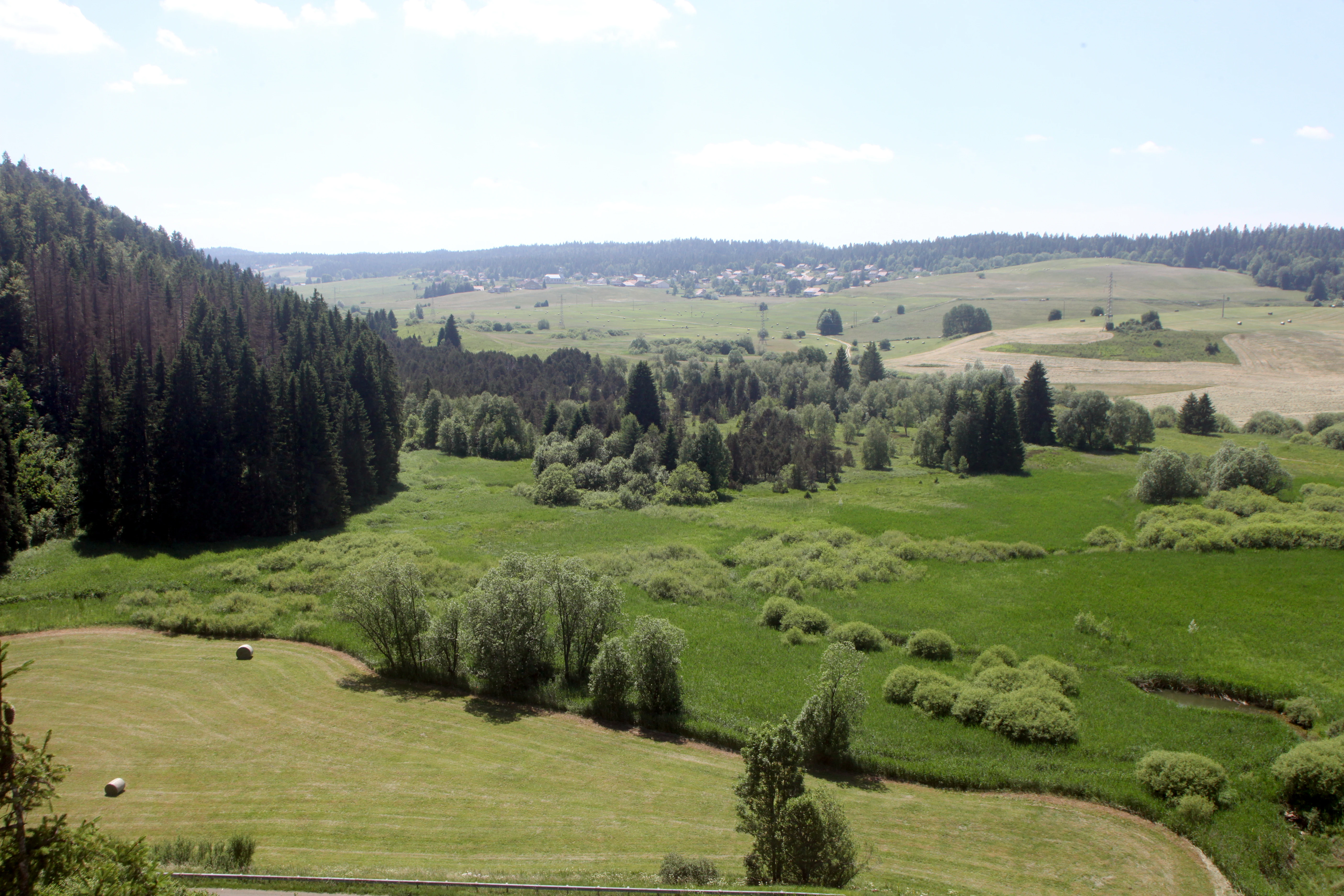
A wide, high-angle landscape shot showing a green valley with a mix of wetlands, scattered trees, dense conifer forest, and open meadowland under a clear sky.
Panoramic view of the peatlands and surrounding agro-pastoral landscape at the Réserve naturelle régionale des tourbières du bief du Nanchez.

Réserve naturelle régionale des tourbières du bief du Nanchez wildlife and species highlights

The reserve's fauna reflects its combination of bogs, wet meadows, dry meadow, and forest. Among birds regularly associated with the site are the reed bunting, red kite, and red-backed shrike, all of which use different parts of the habitat mosaic. The peatland and wet meadow complex is particularly notable for butterflies and dragonflies tied to bog habitats, including the moorland clouded yellow (Colias palaeno), the cranberry fritillary (Boloria aquilonaris), the large heath fritillary linked to bistort habitats, and the white-faced and large white-faced darter dragonflies (Leucorrhinia dubia and Leucorrhinia pectoralis). Because the protected area is small and sits within a wider Natura 2000 landscape, the reserve functions as a core refuge within a broader ecological network for the Jura mountains.
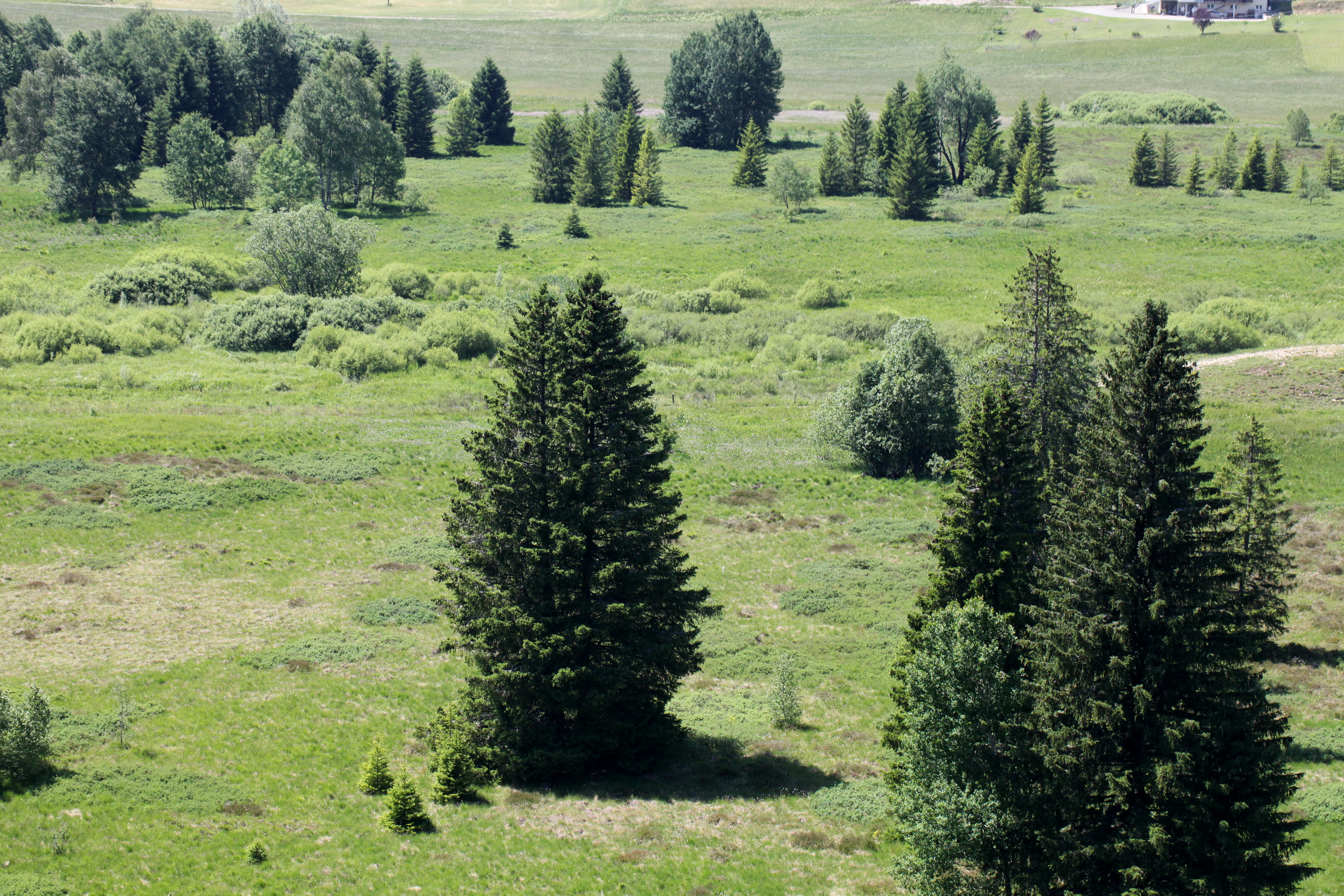
A wide, high-angle view of a green valley dotted with scattered evergreen trees and wetlands, as seen from an overlook.
A scenic view of the Bief du Nanchez peat bog, featuring its characteristic mix of wetlands, meadows, and conifers.

Réserve naturelle régionale des tourbières du bief du Nanchez conservation status and protection priorities

The reserve matters primarily as a conservation foothold for Jura peatlands in a region where peat bogs have been heavily altered by drainage and land use change. It protects mature, relatively undisturbed bog and mire communities alongside the streams and slope habitats that sustain them, preserving a sample of bog dynamics that is increasingly rare at low altitudes in Europe.

Conservation work has combined legal protection, habitat restoration, and public engagement. The site has progressed from a 1992 voluntary nature reserve to formal regional nature reserve status in 2021, with the intervening decades used to remeander straightened sections of the Nanchez stream, restore peatland hydrology through the LIFE Tourbières du massif jurassien programme, and consolidate land in communal ownership. It also sits within the broader Combe du Nanchez Natura 2000 site and a ZNIEFF inventory area, reinforcing its role in regional ecological connectivity for the Jura plateau.

Réserve naturelle régionale des tourbières du bief du Nanchez cultural meaning and human context

The reserve is closely tied to the identity of the Haut-Jura and the Grandvaux landscape, an area historically shaped by Jura mountain agriculture, forestry, and small mountain communities. The former commune of Prénovel, now part of Nanchez, initiated the original protection effort in 1992, reflecting local engagement with peatland stewardship. School groups and visitors have long been part of the site's story through the interpretation trail, which connects peatland ecology with broader themes of Jura mountain heritage and traditional land use.
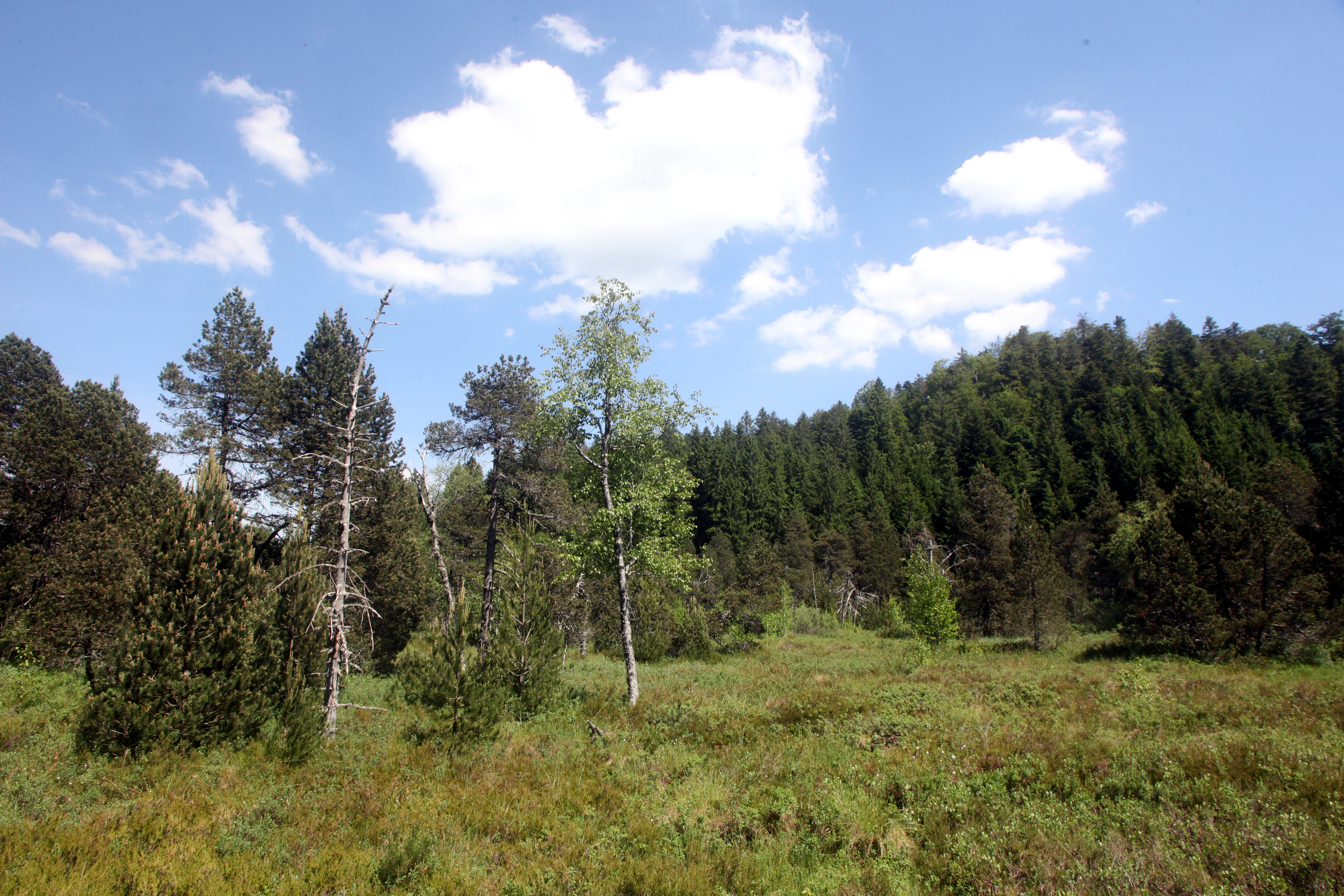
A meadow of low green vegetation and small trees under a blue sky with scattered white clouds, backed by a dense forested hillside.
A summer view of the marshy peatland habitat within the Nanchez Peatlands Regional Nature Reserve.

Top sights and standout views in Réserve naturelle régionale des tourbières du bief du Nanchez

A compact Jura peatland reserve combining mature bogs, wet meadows, dry grasslands, and forested slopes on a single hillside, supported by stream restoration and a boardwalk trail with interpretation panels. Within just under 49 hectares it documents roughly four hundred species, including characteristic bog plants such as Drosera rotundifolia and Andromeda polifolia, bog-dependent dragonflies and butterflies, and wider Jura wildlife such as red kite and red-backed shrike.
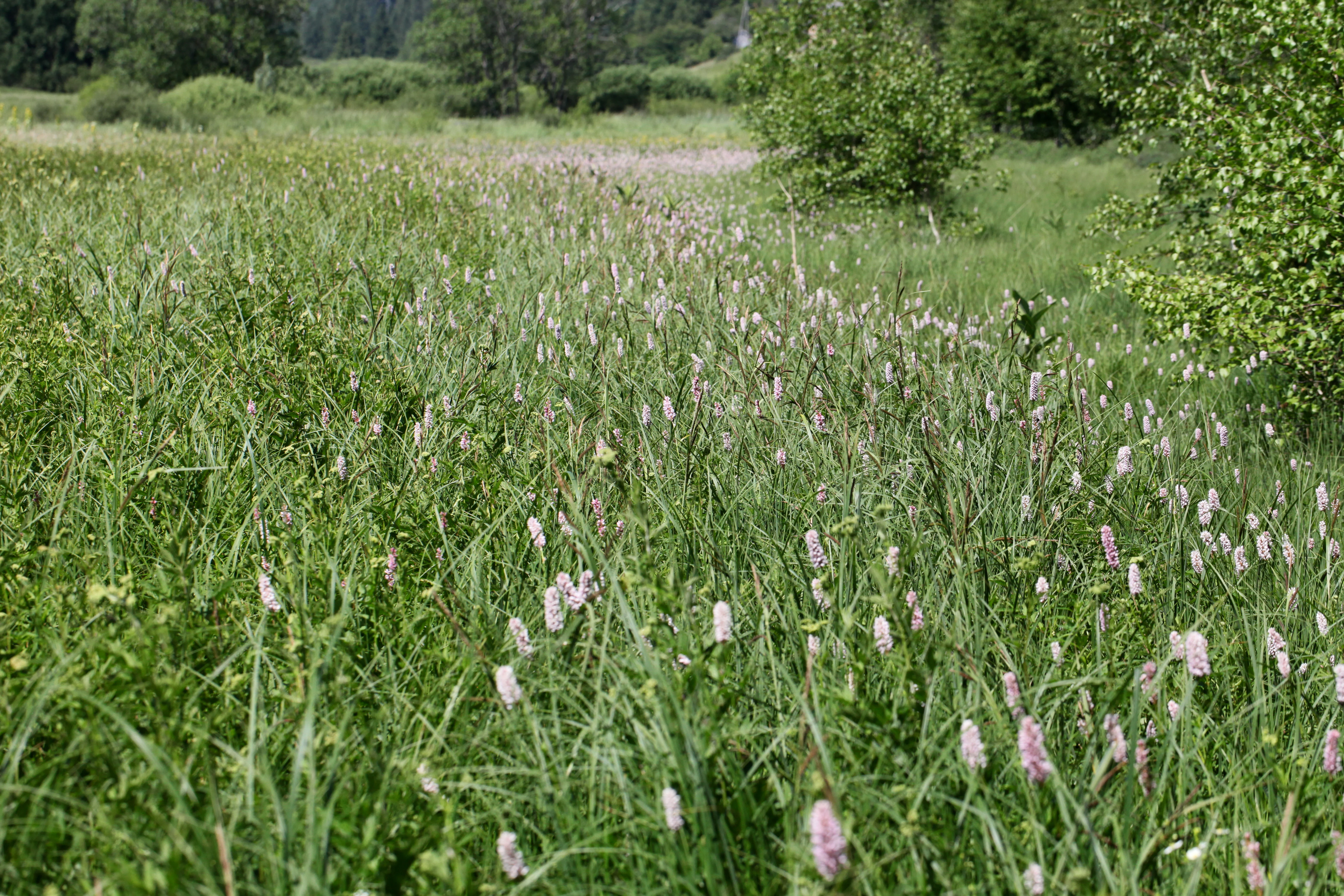
A wide-angle, slightly elevated view of a vibrant green meadow filled with tall grass and clusters of pale pink wildflowers, with shrubs and forest visible in the background.
A meadow landscape within the Réserve naturelle régionale des tourbières du bief du Nanchez, featuring wildflowers and tall grasses typical of Jura mountain wetlands.

Best time to visit Réserve naturelle régionale des tourbières du bief du Nanchez

Late spring and early summer generally bring the richest combination of flowering bog plants and active dragonfly and butterfly seasons, while still offering workable boardwalk conditions on the peatlands. Late summer through early autumn can be quieter and still rewarding for bog vegetation and birdlife, though the Jura climate is wet and cool, so weather is an important factor at any time. Winter brings persistent snow cover and limited access on the wet boardwalk sections and is generally less suited to exploring the bog communities.


Monthly climate preview

Long-term temperature ranges and monthly precipitation patterns derived from representative regional coordinates

Annual Climate Normals and Weather by Month for Réserve naturelle régionale des tourbières du bief du Nanchez

Measured temperature and precipitation normals for Réserve naturelle régionale des tourbières du bief du Nanchez reveal a distinct annual rhythm across twelve recorded intervals. Accessing the complete monthly profile provides deeper analytical context on long-term thermal variations and precipitation distribution.
Annual mean9 °C
0 °C19 °C
Jan
Feb
Mar
Apr
May13°
Jun16°
Jul19°
Aug19°
Sep14°
Oct10°
Nov
Dec
Warmest month
July

18.6 °C

Coolest month
January

0.1 °C

Wettest month
December

3.9 mm/day

Driest month
March

2.8 mm/day

Park location guide

Geography guide, regional context, and park location map for Réserve naturelle régionale des tourbières du bief du Nanchez

Réserve naturelle régionale des tourbières du bief du Nanchez park geography, regions, and map view in France

Understand where Réserve naturelle régionale des tourbières du bief du Nanchez sits in France through a broader geographic reading of the surrounding landscape, nearby location context, and its mapped position within the national park landscape.

How Réserve naturelle régionale des tourbières du bief du Nanchez fits into France

France is a unitary semi-presidential republic and one of the world's largest economies. It borders Belgium, Luxembourg, Germany, Switzerland, Italy, Monaco, Andorra, and Spain, with a maritime border to the United Kingdom. The country is known for its cultural influence, art, cuisine, and political history spanning centuries.

Wider geography shaping Réserve naturelle régionale des tourbières du bief du Nanchez in France

France is located in Western Europe. Metropolitan France extends from the Rhine to the Atlantic Ocean and from the Mediterranean Sea to the English Channel and North Sea. The country borders Belgium, Luxembourg, Germany, Switzerland, Italy, Monaco, Andorra, Spain, and has a maritime border with the United Kingdom.

Map view of Réserve naturelle régionale des tourbières du bief du Nanchez

Use this park location map to pinpoint Réserve naturelle régionale des tourbières du bief du Nanchez in France, understand its exact geographic position, and read its mapped placement within the surrounding landscape more clearly.

Pigeon | © OpenStreetMap contributors

Location context for Réserve naturelle régionale des tourbières du bief du Nanchez

Bourgogne-Franche-Comté

Visualizing the peat bogs, wet meadows, and forested slopes of the Jura mountain reserve

Réserve naturelle régionale des tourbières du bief du Nanchez Landscape and Scenery Photos

Photographs capture the diverse terrain, mature peat bogs, and fragile wetland habitats of Réserve naturelle régionale des tourbières du bief du Nanchez. Visual documentation helps visitors understand the protected ecosystem and valley geography without relying on physical exploration.

A close-up view of a sundew plant with small, circular, sticky red-glandular leaves growing in wet soil among grasses and mosses.

A vibrant blue-green metallic damselfly with dark wings resting on a thin dry plant stem above a blurred water surface.

A pale yellow butterfly, specifically a Moorland Clouded Yellow, perched on a light purple scabious flower in a green meadow.

A wide, high-angle landscape shot showing a green valley with a mix of wetlands, scattered trees, dense conifer forest, and open meadowland under a clear sky.

A wide, high-angle view of a green valley dotted with scattered evergreen trees and wetlands, as seen from an overlook.

A wooden boardwalk trail snakes through a lush green landscape with low-lying vegetation and a small information sign mounted on a post at the trailside.

A meadow of low green vegetation and small trees under a blue sky with scattered white clouds, backed by a dense forested hillside.

A wide-angle, slightly elevated view of a vibrant green meadow filled with tall grass and clusters of pale pink wildflowers, with shrubs and forest visible in the background.

A high-angle scenic view of a valley filled with grasslands, patches of forest, and a small water body in the Jura mountains.

Close-up view of bright yellow globeflowers with spherical petals growing in a lush green meadow, with a soft-focus forest background.

An information sign stands in a grassy meadow with a coniferous forest and rolling hills in the background.

Park atlas

Compare surrounding regional reserves, valley ecosystems, and protected mountain landscapes

Explore Parks Near Réserve naturelle régionale des tourbières du bief du Nanchez

Browse protected areas and regional nature reserves located close to Réserve naturelle régionale des tourbières du bief du Nanchez. Compare surrounding Jura mountain terrain, peatland habitats, and valley ecosystems to understand broader regional conservation contexts.
Wildlife reserveBourgogne-Franche-Comté
Mapped location lies within the park boundary#1 closest

Northeast

Tourbières et lacs de la montagne jurassienne: Mapping High-Altitude Wetlands and Glacial Landscapes

A vast protected wildlife reserve in the Bourgogne-Franche-Comté region

Covering more than 12,000 hectares, this wildlife reserve forms a crucial conservation benchmark for peatland and glacial lake systems in the Jura Massif. The landscape encompasses deep combes, broad plateaus, and clear-water basins like Lac de Saint-Point, providing a vital habitat mosaic for diverse flora and fauna across the French highlands.

Area
121.56 km²
Established
2021
Relief
Mountain
Climate
Temperate
Nature reserveBourgogne-Franche-Comté
About 28 km away#2 closest

Northwest

Réserve naturelle nationale de la grotte de Gravelle: Underground Protected Nature Reserve

A limestone cave sanctuary in the Bourgogne-Franche-Comté region

This protected area represents a specialized subterranean habitat in the French Jura, preserving essential maternity and hibernation roosts for eleven bat species. The reserve, set within forested limestone cliffs, remains a key node in the regional network of protected underground sites, emphasizing the conservation of fragile environments.

Area
0.014 km²
Established
1992
IUCN
IV
Relief
Upland
A soft watercolor illustration depicting rolling green hills, gentle slopes, and small clusters of trees against a light, neutral background.
Nature reserveBourgogne-Franche-Comté
About 28 km away#3 closest

Northwest

Réserve naturelle régionale de la côte de Mancy: Protected Landscapes and Geography

Limestone escarpments and calcareous grasslands in eastern France

Delve into the geography of Réserve naturelle régionale de la côte de Mancy, a 49-hectare nature reserve in the Jura department. This site features Jurassic limestone cliffs, thin calcareous soils, and scrubby woodlands, documenting a rich intersection of habitats that preserve rare reptiles and diverse butterfly populations within the Revermont.

Area
0.492 km²
Established
2010
IUCN
IV
Relief
Upland
Nature reserveAuvergne-Rhône-Alpes
About 31 km away#4 closest

Southwest

Réserve naturelle régionale du récif fossile de Marchon - Christian Gourrat Geological Site

A protected Jurassic fossil reef in the Auvergne-Rhône-Alpes region

Located in the Ain department, this small nature reserve is scientifically renowned for its Kimmeridgian reef outcrop. The site protects a fossilized coral and rudist assemblage within the forêt de Marchon, offering a quiet, forested setting for studying France's ancient marine geological history.

Area
0.001 km²
Established
2015
IUCN
IV
Scope
Terrestrial
A horizontal watercolor painting depicting a soft, impressionistic landscape with rolling green hills, pale yellow fields, and a sparse line of trees against a white background.
Nature reserveBourgogne-Franche-Comté
About 36 km away#5 closest

North

Réserve naturelle régionale des grottes de la côte de la Baume, Jura Regional Nature Reserve

Karst caves and cliff-slope forest geography in France

Located in the Bourgogne-Franche-Comté region, this nature reserve protects a vital network of karst caves and unmanaged scree-slope ash forests. The site represents a specialized conservation effort centered on cliff-side habitats and underground sanctuaries within the Jura limestone landscape.

Area
0.054 km²
Established
2017
IUCN
IV
Relief
Upland
A horizontal watercolor painting showing a soft, misty landscape with coniferous trees, grassy wetlands, and rolling hills in the background, executed in a muted color palette.
Nature reserveBourgogne-Franche-Comté
About 37 km away#6 closest

Northeast

Réserve naturelle régionale de la Seigne des Barbouillons Protected Landscape Atlas

Geography and wetland boundaries in the Jura plateau of France

The Réserve naturelle régionale de la Seigne des Barbouillons protects a characteristic raised bog ecosystem in the Mignovillard commune. This compact area serves as a vital reference point for understanding the distribution of sphagnum mires and specialized butterfly habitats across the Jura plateau, illustrating the contrast between protected peatlands and their surrounding agricultural environment.

Area
0.346 km²
Established
2014
IUCN
IV
Relief
Upland
A watercolor landscape painting showing green hills, trees, and marshy river banks.
Nature reserveGeneva
About 39 km away#7 closest

South

Naturschutzgebiet Moulin de Vert: Protected Wetland and Forest Geography in Geneva

Detailed nature reserve map and regional landscape context

The Naturschutzgebiet Moulin de Vert nature reserve protects a mosaic of riverside woodland, meadows, and managed pond systems along the Rhône in the Canton of Geneva. Spanning approximately 132 hectares, this conservation area is recognized for supporting extensive biodiversity, from nesting peregrine falcons to diverse amphibian populations. Access this detailed geographic perspective to visualize the park boundaries, internal terrain features, and its ecological connection to the broader Swiss river landscape.

Area
1.32 km²
Established
2001
IUCN
IV
A soft, light watercolor painting of a winding river flowing through a gentle, rolling landscape with trees and distant hills against a pale, warm sky.
Nature reserveAuvergne-Rhône-Alpes
About 40 km away#8 closest

South

Réserve naturelle régionale de la galerie du Pont-des-Pierres Regional Nature Reserve

Protected gorge landscapes and underground habitats in France

An essential record of the Réserve naturelle régionale de la galerie du Pont-des-Pierres, detailing its critical role in safeguarding cliff and underground habitats within the Valserine gorges. This protected land in the Ain department represents a vital ecological intersection of geological features and specialized faunal refuges.

Area
0.093 km²
Established
2009
IUCN
IV
Relief
Mountain

Common questions about visiting, size, designation, and location context for Réserve naturelle régionale des tourbières du bief du Nanchez

Réserve naturelle régionale des tourbières du bief du Nanchez FAQs for park facts, access, geography, and protected area context

Find quick answers about Réserve naturelle régionale des tourbières du bief du Nanchez, including protected-area facts, park geography, trail and visitor context, and how the park fits into its surrounding country and regional landscape.
MoriAtlas Explorer

Continue Your Protected Areas Search Across the Global Atlas

Deepen your exploration by continuing the structured search for national parks and protected areas worldwide. Utilize the comprehensive filtering capabilities to compare different conservation landscapes and refine your understanding of global park geography. Discover more about the distribution and characteristics of protected natural areas.

Global natural geography