
Mori Atlas logo
Nature reserveRéserve naturelle régionale de la Seigne des Barbouillons

Mapping the distinctive raised bog landscapes and wetland ecology of eastern France

Réserve naturelle régionale de la Seigne des Barbouillons: Protected Jura Plateau Peatlands

(Réserve naturelle régionale de la Seigne des Barbouillons (RNR281))

Réserve naturelle régionale de la Seigne des Barbouillons sits within the Bourgogne-Franche-Comté region as a vital reference site for Jura plateau ecology. This protected area preserves a rare dome-shaped peatland mosaic, encompassing sphagnum-rich mires and transitional wet meadows. By examining the mapped terrain and natural boundaries of this site, one gains deeper insight into the conservation of isolated bog ecosystems surrounded by agricultural pastureland.

raised bogpeatlandsphagnum mirewet meadowbutterfly habitatJura plateau
A flat-style digital illustration of a wetland scene. A small cluster of evergreen and birch trees sits in the center of a marshy landscape. A winding light-blue stream cuts through colorful foreground flora, including pink and purple marsh flowers, with distant rolling hills under a pale sky.

Réserve naturelle régionale de la Seigne des Barbouillons

Nature reserve

Park overview

Structured park overview, official facts, and landscape profile for Réserve naturelle régionale de la Seigne des Barbouillons

Réserve naturelle régionale de la Seigne des Barbouillons park facts, protected area profile, and essential visitor context

Review the core facts for Réserve naturelle régionale de la Seigne des Barbouillons, including designation, size, terrain, visitor scale, habitats, and operating context in one park-focused overview.

About Réserve naturelle régionale de la Seigne des Barbouillons

The Réserve naturelle régionale de la Seigne des Barbouillons protects a small but ecologically rich raised bog in the French Jura. Situated southwest of the Drugeon basin on the commune of Mignovillard, the reserve centers on an isolated dome-shaped peatland, or seigne, encircled by meadows and pastures typical of the Haut-Doubs plateau. Its 34.6 hectares capture a complete microcosm of Jurassian bog environments, from active sphagnum lawns to peripheral wet zones that buffer and support the core peat mass.

Beyond its role in conserving a vanishing habitat type, the reserve serves as a living reference site for the history of peatland use in the Jura. The bog was exploited for fuel and horticultural peat from the mid-eighteenth century onwards, and traces of this long human relationship with the land remain embedded in the landscape. Today, the reserve's combination of scientific, educational, and cultural values places it firmly within the broader network of peatland protection in eastern France.

Its integration into the Ramsar site "Tourbières et lacs de la montagne jurassienne" in 2021 underlines its international wetland significance and links it to a wider strategy for preserving the mires, lakes, and hydrological systems of the Jura range. Together, these qualities make the Seigne des Barbouillons a small but meaningful landmark within the regional conservation network of Bourgogne-Franche-Comté.

Quick facts and research context for Réserve naturelle régionale de la Seigne des Barbouillons

The Seigne des Barbouillons is a regional nature reserve (réserve naturelle régionale, code RNR281) in the Jura department of eastern France, on the territory of the commune of Mignovillard in Bourgogne-Franche-Comté. It covers 34.6 hectares and protects a raised bog, locally known as a seigne, embedded within a patchwork of wet meadows and pastures.

It was first recognized as a voluntary nature reserve in 1987 over 14.6 hectares and was reclassified under the regional nature reserve framework by the Bourgogne-Franche-Comté Regional Council in November 2014. It is managed jointly by the Association Gestion Seigne Barbouillons and the Syndicat mixte des milieux aquatiques du Haut-Doubs (SMMAHD), and has been part of the Ramsar site "Tourbières et lacs de la montagne jurassienne" since February 2021.

Protection and recognition

Review documented terrestrial protection scope and official recognition records for this protected area.

Réserve naturelle régionale de la Seigne des Barbouillons Protection Status and Official Designation History

Terrestrial protection status records for Réserve naturelle régionale de la Seigne des Barbouillons outline the official designation history established in 2021. Structured database entries organize administrative data without asserting unverified conservation outcomes or external recognition programs.

Protection details

Protection scope
Terrestrial
Designated year
2021
Transboundary protection
No
WDPA ID
555561923
Park context

Deeper park guide and search-rich context for Réserve naturelle régionale de la Seigne des Barbouillons

Réserve naturelle régionale de la Seigne des Barbouillons history, landscape, wildlife, and travel context

Explore Réserve naturelle régionale de la Seigne des Barbouillons through its history, landscape character, ecosystems, wildlife, conservation priorities, cultural context, and seasonal travel timing in a structured park guide built for atlas discovery and search intent.

Why Réserve naturelle régionale de la Seigne des Barbouillons stands out

The reserve is best known for protecting one of the characteristic raised bogs of the Jura plateau: an isolated, dome-shaped peatland formed atop accumulated sphagnum mosses and surrounded by farmland. The site is valued as a reference example of the seigne landscape type that gives the broader Drugeon basin and Haut-Doubs region its identity. It is also recognized for the exceptional diversity of butterflies associated with its bog habitats, including protected species such as the Large Copper (Cuivré de la bistorte) and the Cranberry Fritillary (Nacré de la canneberge), which depend on the wet, acidic conditions maintained by the peatland.
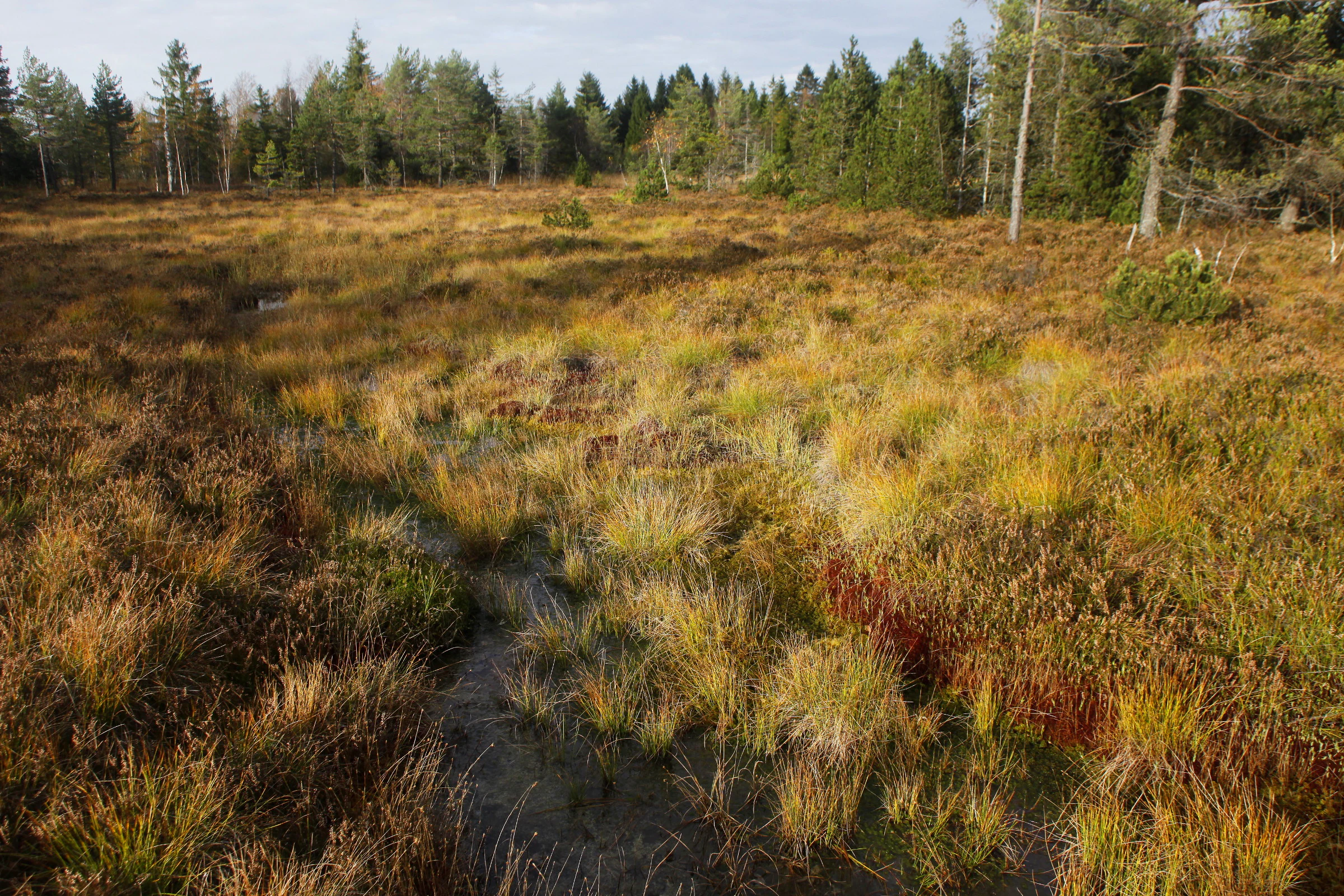
A wide view of a raised peat bog landscape with golden grasses and shrubs in the foreground, backed by a dense forest line under a bright sky.
A view of the raised bog at Réserve naturelle régionale de la Seigne des Barbouillons.

Réserve naturelle régionale de la Seigne des Barbouillons history and protected-area timeline

The landscape of the Seigne des Barbouillons carries more than two and a half centuries of human interaction. The bog was first exploited on an organized basis from 1760, when peat extraction began to supply the surrounding communities with fuel and other raw materials. This long history of use shaped both the physical structure of the peatland and the cultural memory of the area.

Formal protection arrived relatively late in the bog's modern history. On 19 February 1987, the core of the site was recognized as a réserve naturelle volontaire, covering 14.6 hectares and establishing an early legal safeguard over the seigne. Decades later, in recognition of the site's regional ecological importance, the Bourgogne-Franche-Comté Regional Council voted on 14 November 2014 to create the current regional nature reserve, expanding the protected area to 34.6 hectares under the réserve naturelle régionale framework for a renewable ten-year term.

In February 2021 the reserve became part of the larger Ramsar wetland site "Tourbières et lacs de la montagne jurassienne," elevating its profile from a local conservation initiative to a component of an internationally recognized wetland complex. Throughout this evolution, management has rested with the Association Gestion Seigne Barbouillons in partnership with the Syndicat mixte des milieux aquatiques du Haut-Doubs.

Réserve naturelle régionale de la Seigne des Barbouillons landscape and geographic character

The reserve's landscape is dominated by a single, visually distinct landform: a raised bog rising gently above the otherwise flat agricultural plateau of the Haut-Doubs. The seigne takes the form of a low, rounded dome of accumulated peat, colonised by sphagnum mosses and framing a darker, wetter core than the surrounding fields. Its isolation among pastures gives the site an almost island-like character.

Around the central dome, the terrain grades into a transitional halo of wet meadows, marshy hollows, and small pools, before meeting the drier agricultural land that defines much of the commune of Mignovillard. A small pinewood, including scattered bog pines (pins à crochet), adds structural variety and contributes to the visual contrast between the bog and its cultivated surroundings. Sphagnum cover turns golden and russet in autumn, sharpening the seasonal character of the site.

This compact landscape mosaic, a convex peat body nestled within a flatter, human-shaped matrix, is a textbook expression of the Jura seigne scenery and helps explain why the area was singled out for protection in the first place.
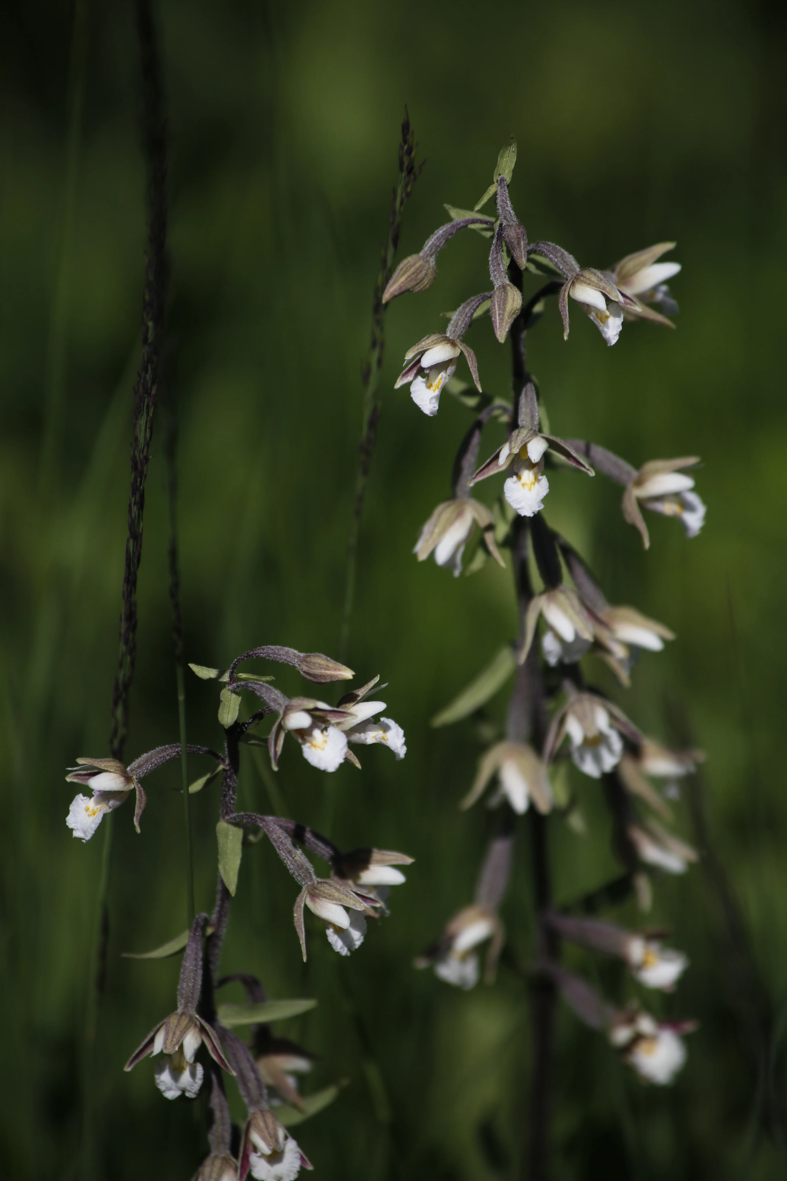
Close up vertical shot of two Marsh Helleborine orchid stalks with small white and brown flowers against a soft green background.
Marsh Helleborine (Epipactis palustris) in bloom within the wetland environment of Seigne des Barbouillons.

Réserve naturelle régionale de la Seigne des Barbouillons ecosystems, habitats, and plant life

Ecologically, the reserve is built around a classic sphagnum-rich raised bog ecosystem. The seigne supports a mosaic of microhabitats typical of Jurassian peatlands: active bog pools, sphagnum hummocks and lawns, ericaceous shrub layers, peripheral wet meadows, and patches of bog woodland. The acidic, nutrient-poor, waterlogged conditions sustain plant communities that cannot survive in the surrounding agricultural lands.

Within this bog matrix, ericaceous shrubs such as heathers and bog rosemary (Andromeda polifolia) form a recognizable low canopy, while specialized carnivorous plants including sundews (Drosera) thrive in the wettest, most nutrient-limited microsites. Bog cottongrasses (linaigrettes) and marsh helleborine (Epipactis palustris) are among the other characteristic species recorded on the site.

These habitats also generate the specific microclimates that the reserve's invertebrate fauna requires. The wet, sun-exposed margins where the bog meets the surrounding grasslands are particularly important for bog specialist insects, which depend on this combination of host plants, humidity, and warmth to complete their life cycles.
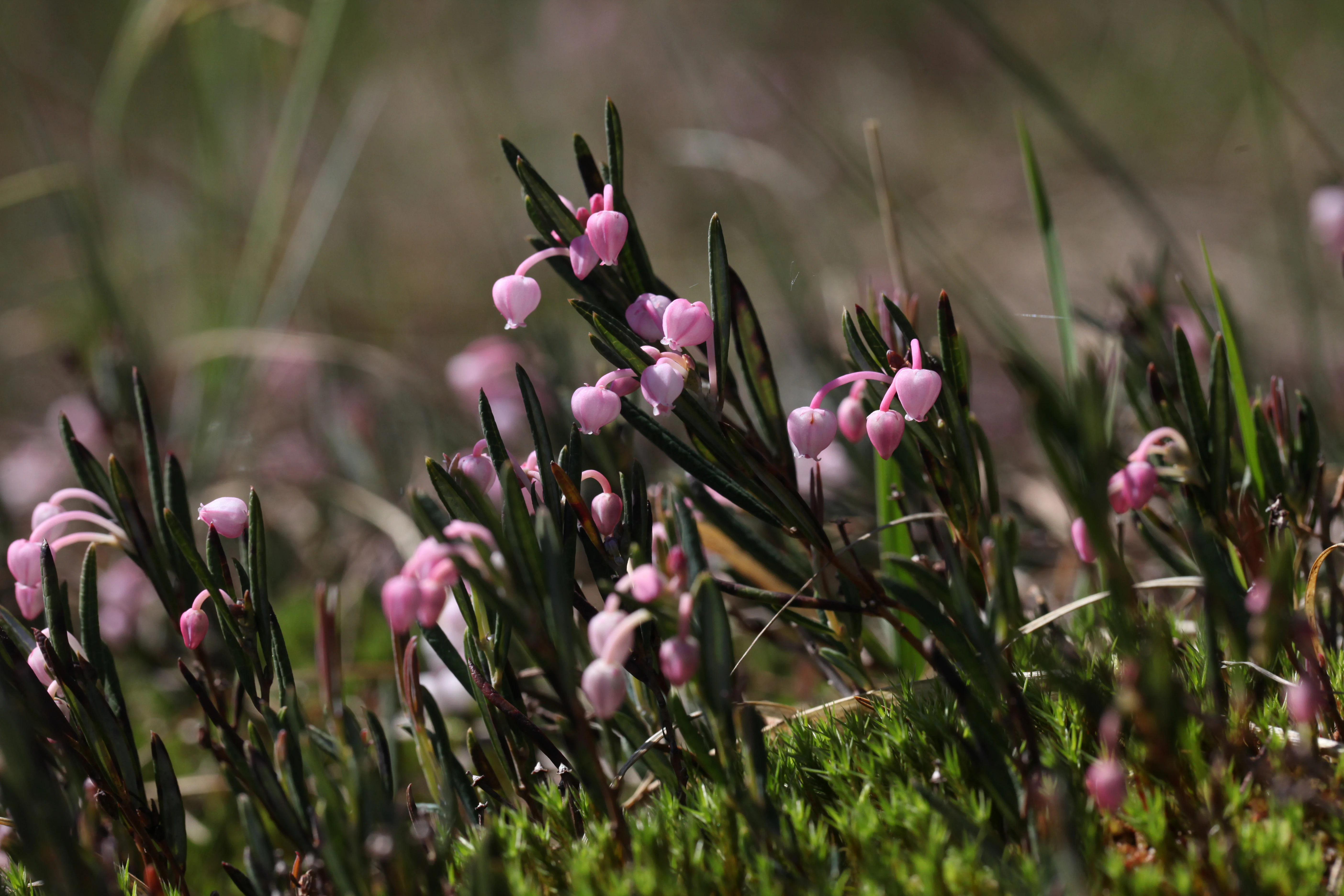
A close-up view of small pink bell-shaped flowers of bog-rosemary growing among dark green leaves and moss.
Andromeda polifolia, commonly known as bog-rosemary, blooming in the peatland habitat of the reserve.

Réserve naturelle régionale de la Seigne des Barbouillons wildlife and species highlights

The Seigne des Barbouillons is best known among naturalists for its remarkable butterfly diversity. The mosaic of bog vegetation and adjacent wet meadows supports a dense and species-rich lepidopteran community, including protected specialists such as the Large Copper (Cuivré de la bistorte) and the Cranberry Fritillary (Nacré de la canneberge). These species are tightly tied to bog plants and have disappeared from much of the surrounding landscape.

Other invertebrate groups also benefit from the site's hydrology and vegetation structure. Dragonflies, including species such as the doubtful whiteface (Leucorrhine douteuse), exploit the bog pools and wet edges, while a wider range of bog-associated moths, beetles, and spiders finds refuge in the undisturbed sphagnum mats.

The reserve's vertebrate interest is comparatively modest, but the mosaic of bog, meadow, pinewood, and surrounding farmland collectively supports typical Haut-Doubs fauna, including common bog and forest birds, amphibians breeding in the wet hollows, and small mammals that move between the bog and adjacent habitats.
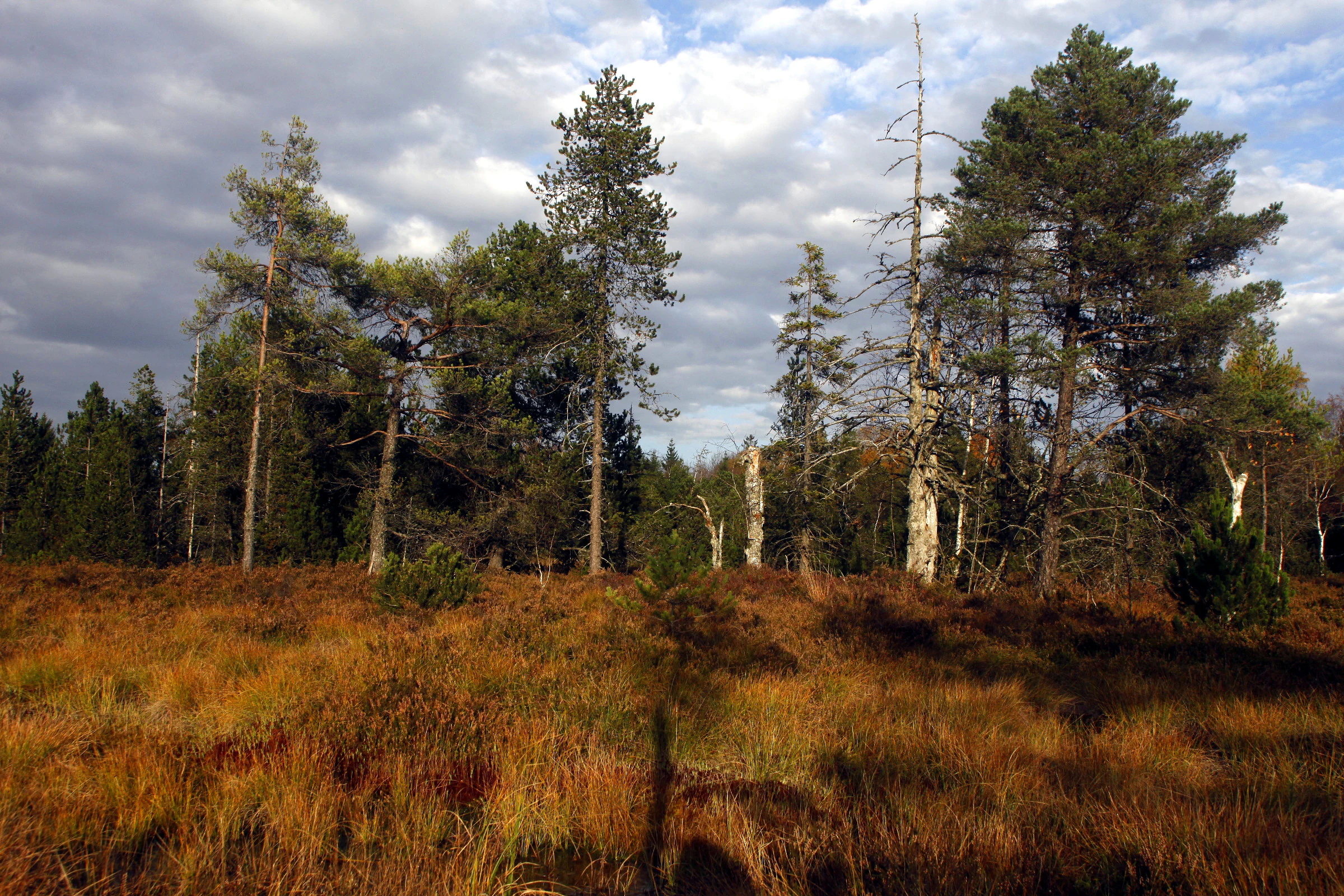
A wide, eye-level shot of a peat bog landscape featuring scattered pine trees and dense, orange-brown grasses under a cloudy sky.
A view of the raised bog and pine trees in the Réserve naturelle régionale de la Seigne des Barbouillons.

Réserve naturelle régionale de la Seigne des Barbouillons conservation status and protection priorities

The conservation significance of the Seigne des Barbouillons lies in its role as a refuge for a habitat type that has been almost entirely lost across much of the Jura. Raised bogs of this size and integrity are increasingly rare in lowland France, where drainage, peat cutting, and agricultural intensification have eliminated or degraded most historical peatlands. Protecting an intact seigne, together with its surrounding wet buffer, offers a comparatively affordable way of safeguarding an entire ecological complex.

The reserve's value is reinforced by its inclusion in the Ramsar site "Tourbières et lacs de la montagne jurassienne," which connects it to a wider strategy for preserving the hydrology, biodiversity, and ecosystem services of the Jura peatland network. This international designation also highlights the role of the site in carbon storage, water regulation, and biodiversity conservation at a landscape scale.

At a regional level, the reserve contributes to the conservation strategy of Bourgogne-Franche-Comté by representing the seigne habitat type within the network of regional nature reserves. Joint management by a dedicated local association and the Haut-Doubs aquatic environments syndicate ensures attention both to the bog's internal ecology and to the broader water regime that sustains it.

Réserve naturelle régionale de la Seigne des Barbouillons cultural meaning and human context

The Seigne des Barbouillons sits within a landscape shaped by long-standing rural land use. Peat extraction from 1760 onward tied local communities directly to the bog as a source of fuel, soil amendment, and eventually horticultural peat. This heritage is reflected in the cultural memory of the Drugeon basin, where mires and lakes have long defined both the economy and the identity of the Haut-Doubs villages.

Today, the reserve frames a different kind of cultural relationship: an emerging public familiarity with peatlands as ecological and historical landmarks, supported by signage, marked trails, and educational outreach around the reserve. The site's integration into regional and international conservation frameworks has helped transform a working peatland into a shared natural and cultural reference point for the area.
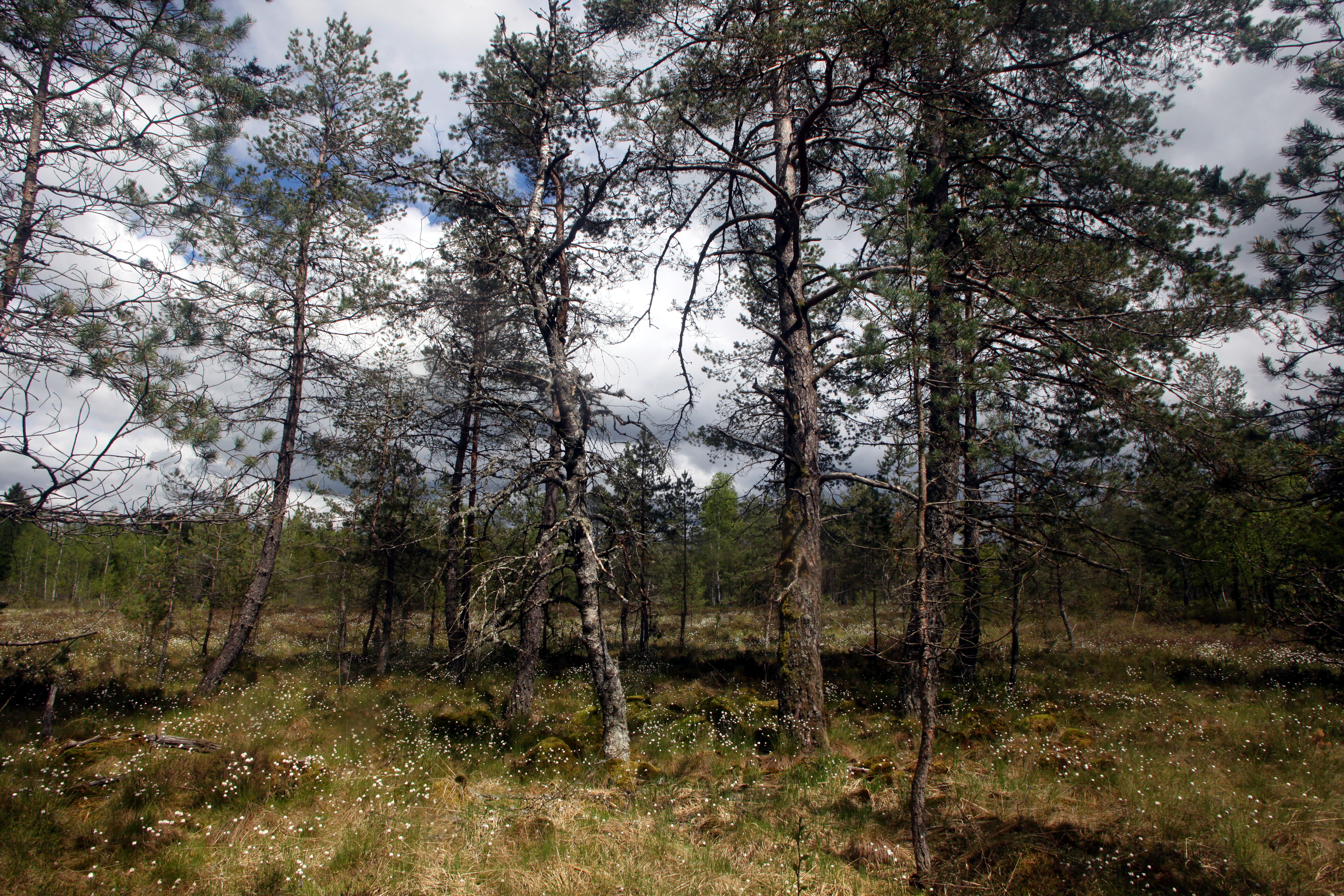
A wide shot of a peat bog featuring scattered thin pine trees, low shrubs, and small white cotton grass tufts under a cloudy sky.
Mountain pines standing amidst the wetlands of the Seigne des Barbouillons nature reserve.

Top sights and standout views in Réserve naturelle régionale de la Seigne des Barbouillons

A classic Jura raised bog, the Seigne des Barbouillons offers an unusually complete example of the seigne habitat type in a compact setting. Its mosaic of sphagnum mires, ericaceous shrubs, bog pools, and surrounding wet meadows supports specialized flora such as Andromeda polifolia and Drosera, alongside protected butterflies like the Cuivré de la bistorte and Nacré de la canneberge.

The reserve's combination of small size, ecological richness, and accessibility makes it a widely cited reference site for understanding and interpreting the peatland heritage of the Jura, and its integration into the "Tourbières et lacs de la montagne jurassienne" Ramsar site anchors it firmly within a major international wetland complex.
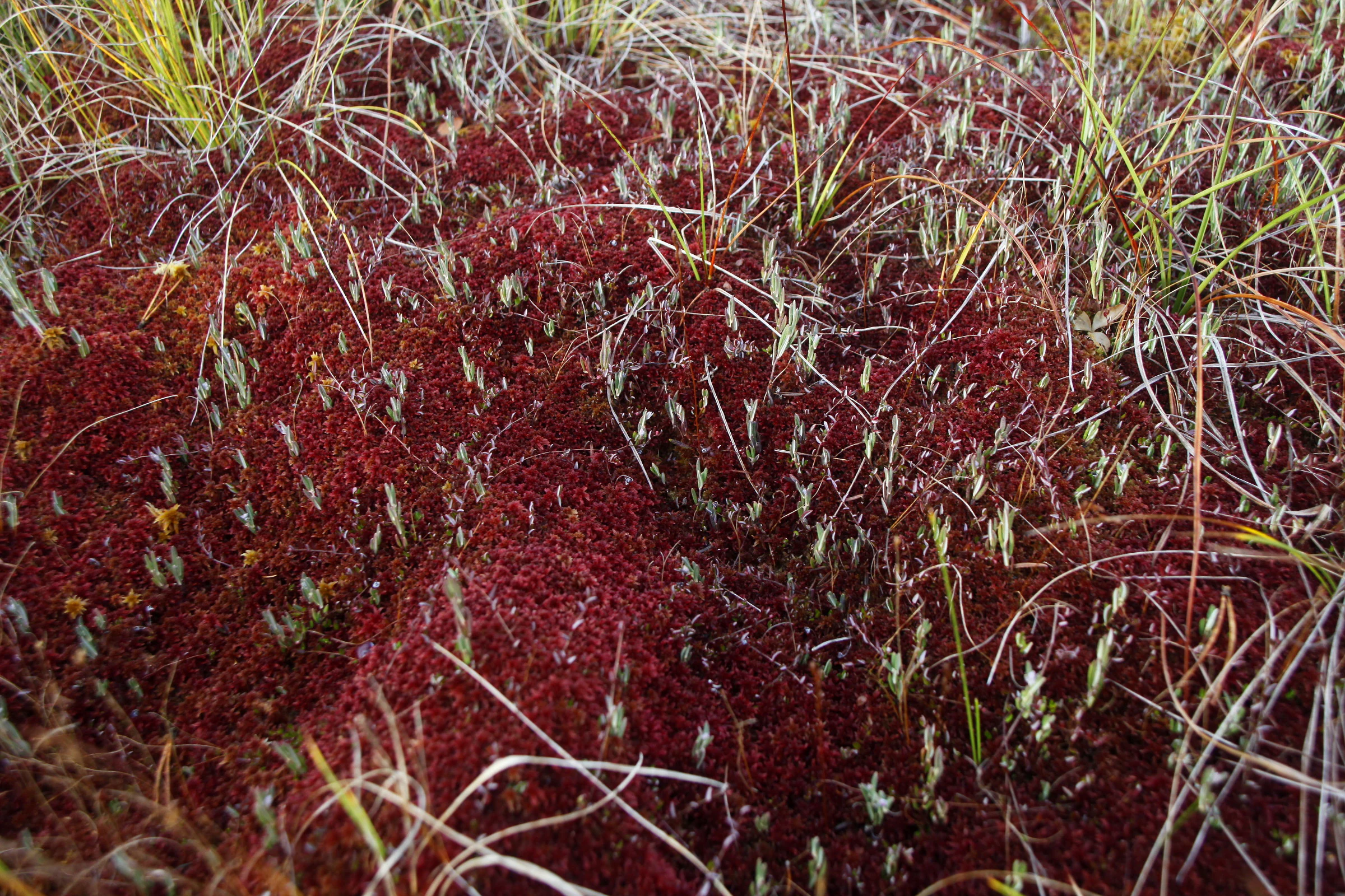
A close-up view of deep red sphagnum moss growing in a boggy habitat, interspersed with blades of green grass.
Sphagnum moss in the Seigne des Barbouillons Regional Nature Reserve.

Best time to visit Réserve naturelle régionale de la Seigne des Barbouillons

The reserve can be appreciated across much of the year, though each season highlights a different aspect of the bog. Late spring and early summer bring the richest display of bog flowers and peak butterfly activity at the margins of the seigne, when warm conditions coincide with adult insect emergence. Autumn transforms the sphagnum carpets into striking russet and gold tones, sharpening the visual contrast between the bog and the surrounding pastures.

Winter visits offer a quieter, more atmospheric experience, with frost and occasional snow accentuating the domed shape of the seigne and the open feel of the surrounding plateau. Because the site is managed for conservation rather than mass tourism, visitors generally encounter a calm, contemplative landscape at any time of year suitable for outdoor walking on the marked trails.


Monthly climate preview

Long-term representative monthly averages for temperature and precipitation across the protected area coordinate

Annual Climate Normals and Temperature Rhythms for Réserve naturelle régionale de la Seigne des Barbouillons

Representative baseline records for Réserve naturelle régionale de la Seigne des Barbouillons track measured long-term temperature swings from sub-zero winter minimums to warm summer maximums alongside steady daily precipitation amounts. Examining the complete twelve-month sequence reveals the full range of historical weather patterns recorded at this specific elevation coordinate.
Annual mean8 °C
0 °C18 °C
Jan
Feb
Mar
Apr
May12°
Jun16°
Jul18°
Aug18°
Sep14°
Oct
Nov
Dec
Warmest month
August

17.7 °C

Coolest month
January

-0.5 °C

Wettest month
December

3.9 mm/day

Driest month
March

2.9 mm/day

Park location guide

Geography guide, regional context, and park location map for Réserve naturelle régionale de la Seigne des Barbouillons

Réserve naturelle régionale de la Seigne des Barbouillons park geography, regions, and map view in France

Understand where Réserve naturelle régionale de la Seigne des Barbouillons sits in France through a broader geographic reading of the surrounding landscape, nearby location context, and its mapped position within the national park landscape.

How Réserve naturelle régionale de la Seigne des Barbouillons fits into France

France is a unitary semi-presidential republic and one of the world's largest economies. It borders Belgium, Luxembourg, Germany, Switzerland, Italy, Monaco, Andorra, and Spain, with a maritime border to the United Kingdom. The country is known for its cultural influence, art, cuisine, and political history spanning centuries.

Wider geography shaping Réserve naturelle régionale de la Seigne des Barbouillons in France

France is located in Western Europe. Metropolitan France extends from the Rhine to the Atlantic Ocean and from the Mediterranean Sea to the English Channel and North Sea. The country borders Belgium, Luxembourg, Germany, Switzerland, Italy, Monaco, Andorra, Spain, and has a maritime border with the United Kingdom.

Map view of Réserve naturelle régionale de la Seigne des Barbouillons

Use this park location map to pinpoint Réserve naturelle régionale de la Seigne des Barbouillons in France, understand its exact geographic position, and read its mapped placement within the surrounding landscape more clearly.

Pigeon | © OpenStreetMap contributors

Location context for Réserve naturelle régionale de la Seigne des Barbouillons

Bourgogne-Franche-Comté

Photographic reference for the raised bog terrain, sphagnum mires, and protected habitats of the Jura plateau.

Visualizing Réserve naturelle régionale de la Seigne des Barbouillons Photos and Landscape Scenery

Visual records reveal the rounded peat dome, wet meadows, and distinct vegetative mosaics that define this protected landscape. Studying park imagery provides clear insight into the fragile wetland ecosystems and rare habitats preserved across the Haut-Doubs region.

A wide view of a raised peat bog landscape with golden grasses and shrubs in the foreground, backed by a dense forest line under a bright sky.

A close-up view of a white-faced darter dragonfly perched on tall green grass blades.

Close up vertical shot of two Marsh Helleborine orchid stalks with small white and brown flowers against a soft green background.

A close-up view of small pink bell-shaped flowers of bog-rosemary growing among dark green leaves and moss.

A wide, eye-level shot of a peat bog landscape featuring scattered pine trees and dense, orange-brown grasses under a cloudy sky.

A wide view of a marshy landscape with a foreground field of white-tufted cotton grass, backed by a dense forest of evergreen and deciduous trees under a cloudy sky.

A wide shot of a peat bog featuring scattered thin pine trees, low shrubs, and small white cotton grass tufts under a cloudy sky.

A close-up view of deep red sphagnum moss growing in a boggy habitat, interspersed with blades of green grass.

A wide, panoramic view of a marshy wetland area featuring colorful mosses and grasses in the foreground, leading to a treeline in the background.

Park atlas

Compare adjacent wetland reserves, peatlands, and protected landscapes across the Jura plateau.

Parks Near Réserve naturelle régionale de la Seigne des Barbouillons and Regional Protected Areas

Browse other protected areas near Réserve naturelle régionale de la Seigne des Barbouillons to examine related wetland habitats and regional landforms. Comparing these surrounding conservation spaces reveals broader ecological patterns across the broader Jura mountain geography.
Wildlife reserveBourgogne-Franche-Comté
Mapped location lies within the park boundary#1 closest

South

Tourbières et lacs de la montagne jurassienne: Mapping High-Altitude Wetlands and Glacial Landscapes

A vast protected wildlife reserve in the Bourgogne-Franche-Comté region

Covering more than 12,000 hectares, this wildlife reserve forms a crucial conservation benchmark for peatland and glacial lake systems in the Jura Massif. The landscape encompasses deep combes, broad plateaus, and clear-water basins like Lac de Saint-Point, providing a vital habitat mosaic for diverse flora and fauna across the French highlands.

Area
121.56 km²
Established
2021
Relief
Mountain
Climate
Temperate
A watercolor illustration of a landscape with green forest, wetland grasses, and pale mountains in the background, set against a clean white background.
Nature reserveBourgogne-Franche-Comté
About 6.2 km away#2 closest

Northeast

Réserve naturelle régionale des tourbières de Frasne-Bouverans Protected Landscape Atlas

Peatland mosaic geography in the Drugeon valley of Bourgogne-Franche-Comté

Trace the boundaries and ecological features of this significant regional nature reserve. Spanning the Forbonnet massif and the wider Drugeon basin, the area features a dense concentration of raised bogs, woodlands, and mire habitats defined by complex glacial geology.

Area
2.926 km²
Established
1986
IUCN
IV
Visitors
17.5K annual
A horizontal watercolor painting depicting a soft, impressionistic landscape with rolling green hills, pale yellow fields, and a sparse line of trees against a white background.
Nature reserveBourgogne-Franche-Comté
About 31 km away#3 closest

West

Réserve naturelle régionale des grottes de la côte de la Baume, Jura Regional Nature Reserve

Karst caves and cliff-slope forest geography in France

Located in the Bourgogne-Franche-Comté region, this nature reserve protects a vital network of karst caves and unmanaged scree-slope ash forests. The site represents a specialized conservation effort centered on cliff-side habitats and underground sanctuaries within the Jura limestone landscape.

Area
0.054 km²
Established
2017
IUCN
IV
Relief
Upland
A horizontal watercolor painting depicting a soft-edged, green-and-white landscape of rolling hills and distant limestone ridgelines.
Nature reserveBourgogne-Franche-Comté
About 32 km away#4 closest

North

Réserve naturelle nationale du ravin de Valbois: Protected Jura Blind Valley and Limestone Ravines

Geographic landscape exploration of the Doubs department's protected natural reserve.

Spanning 235 hectares, this protected nature reserve in Bourgogne-Franche-Comté preserves a textbook Jura reculée. The terrain showcases vertical limestone cliffs, deep forested ravines, and a 40-meter cascade. As a hotspot for butterfly diversity and Mediterranean-montane vegetation, the area offers a significant study in microclimatic gradients and old-growth forest conservation within the French landscape.

Area
2.35 km²
Established
1983
IUCN
IV
Relief
Mountain
A horizontal watercolor painting depicting a soft, layered landscape with distant hills, gentle slopes, and clusters of evergreen trees in shades of green and purple.
Nature reserveBourgogne-Franche-Comté
About 37 km away#5 closest

Southwest

Réserve naturelle régionale des tourbières du bief du Nanchez: Protected Jura Mountain Peatlands

Mapping bog systems and wet grassland geography in Eastern France

Located in the Jura department, this regional nature reserve preserves forty-nine hectares of vital peatland, including diverse mire communities and forested slopes. The site provides a critical look at montane landscape restoration, documenting significant bog flora and complex hydrological patterns along the Combe du Nanchez valley floor.

Area
0.488 km²
Established
2021
IUCN
IV
Relief
Upland
Watercolor painting of a hilly landscape featuring green rolling hills, a rocky cliff formation to the right, and trees against a soft white background.
Nature reserveBourgogne-Franche-Comté
About 40 km away#6 closest

North

Réserve naturelle régionale des grottes de Chenecey: Protected Karst and Limestone Cliffs

Regional Nature Reserve in the Doubs, France

This nature reserve protects a diverse mosaic of habitats along the Loue valley. The site integrates surface calcareous grasslands with fragile underground cave galleries, providing critical refuge for rare bat species. It represents a significant conservation effort in the Jura region, mapping the intersection of subterranean voids and exposed limestone terrain.

Area
0.214 km²
Established
2017
IUCN
IV
Relief
Upland
A soft, horizontal watercolor painting depicting a winding river flowing through a lush, green landscape with distant hills and sparse trees.
Nature reserveVaud
About 42 km away#7 closest

Southeast

Chanivaz, Delta de l’Aubonne: Geography, Map, and Protected Landscape Context

A rare glacial geotope and river delta on Lake Geneva.

Chanivaz, Delta de l’Aubonne provides a rich look at the alluvial fan of the River Aubonne. Explore its layered terrace terrain, protected reedbeds, and riparian forests in the canton of Vaud, representing one of the best-preserved natural river mouths remaining on the northern shore of Lake Geneva.

Area
3 km²
Established
2003
Relief
Lowland
Climate
Temperate
Nature reserveBourgogne-Franche-Comté
About 44 km away#8 closest

Northwest

Réserve naturelle régionale du gouffre du Creux à Pépé: Protected Karst and Bat Landscapes

Jura foothills nature reserve with critical cave habitats

Located in the Doubs department, the Réserve naturelle régionale du gouffre du Creux à Pépé protects a rare limestone sinkhole within a mosaic of dry calcareous grassland. This site stands as a key node in regional bat conservation efforts, providing essential wintering and spring transit roosts within the Jura mountain foothills, all anchored by a dense network of biotope and Natura 2000 protective instruments.

Area
0.007 km²
Established
2015
IUCN
IV
Relief
Upland

Common questions about visiting, size, designation, and location context for Réserve naturelle régionale de la Seigne des Barbouillons

Réserve naturelle régionale de la Seigne des Barbouillons FAQs for park facts, access, geography, and protected area context

Find quick answers about Réserve naturelle régionale de la Seigne des Barbouillons, including protected-area facts, park geography, trail and visitor context, and how the park fits into its surrounding country and regional landscape.
MoriAtlas Explorer

Continue Your Protected Areas Search Across the Global Atlas

Deepen your exploration by continuing the structured search for national parks and protected areas worldwide. Utilize the comprehensive filtering capabilities to compare different conservation landscapes and refine your understanding of global park geography. Discover more about the distribution and characteristics of protected natural areas.

Global natural geography