
Why Regionaler Naturpark Gantrisch stands out
Gantrisch is best known for combining a wide spectrum of Swiss landscapes in a single protected area, from rolling plateau hills and glacial moraines to forested gorges and Pre-Alpine ridges. The Gantrisch range itself, which gives the park its name, forms a defining southern skyline and supplies the headwaters of the Gürbe. The park is also recognized for the dramatic Breccaschlund gorge and the Schwarzsee lake area in the southwest, as well as the deep gorges of the Sense and Schwarzwasser rivers in the Schwarzenburgerland. These contrasting environments, ranging from lowland agricultural country to rugged Pre-Alpine terrain, give Gantrisch a layered character unusual for a regional nature park so close to major Swiss cities.
Regionaler Naturpark Gantrisch history and protected-area timeline
The Regionaler Naturpark Gantrisch was formally founded in 2012 as part of Switzerland's program of parks of national significance. It builds on a long history of regional identity in the area between Bern, Thun, and Fribourg, where communities have historically shared agricultural land, river valleys, and mountain pastures. The park's creation reflects the federal framework for nature and homeland protection, particularly the federal inventory of landscapes and natural monuments of national significance, two of which fall within its boundaries.
Two of these federally inventoried landscapes shape the park's conservation status: the Schwarzenburgerland with the Sense and Schwarzwasser gorges (inventory entry 1320) and the Breccaschlund (inventory entry 1514). Their inclusion gave the area a strong justification for formal protection and contributed to the political momentum behind founding the park.
The cooperation across nineteen municipalities is central to the park's history. By uniting communities from two cantons, Bern and Fribourg, the Gantrisch park became an early example of cross-cantonal nature park governance in Switzerland. Over time, the park has expanded its role beyond landscape conservation into regional development, supporting local agriculture, sustainable tourism, and the preservation of cultural heritage in villages like Schwarzenburg and Riggisberg.
Regionaler Naturpark Gantrisch landscape and geographic character
The landscape of the Gantrisch Nature Park is defined by a clear altitudinal gradient that moves from gentle plateau country in the north to rugged Pre-Alpine terrain in the south. At the northern edge, elevations near 510 meters, around Bern-Belp Airport, give way to undulating ridges such as the Belpberg and the Längenberg. Both of these landforms are lateral moraines of the former Aare glacier and carry the soft, rounded character typical of glacially deposited terrain, with mixed woodland, meadows, and farmland.
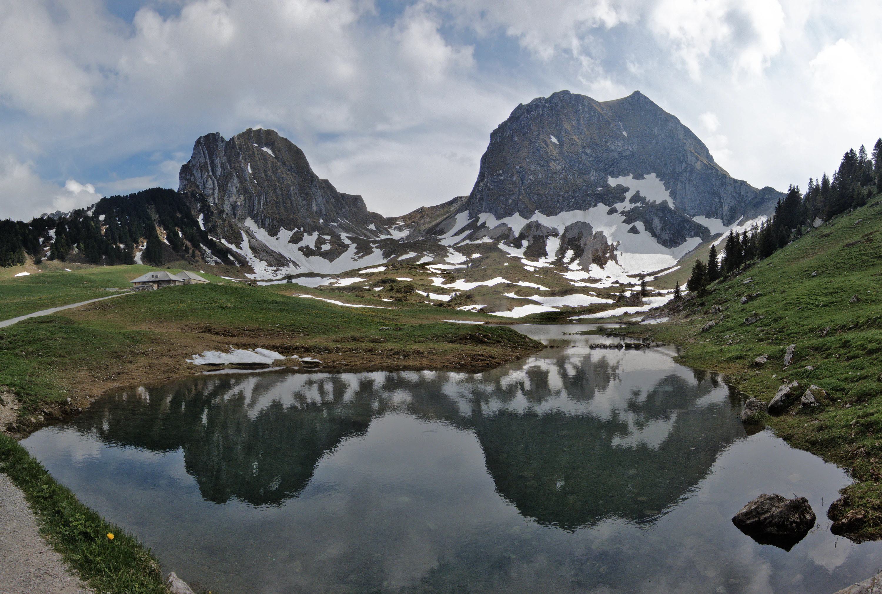
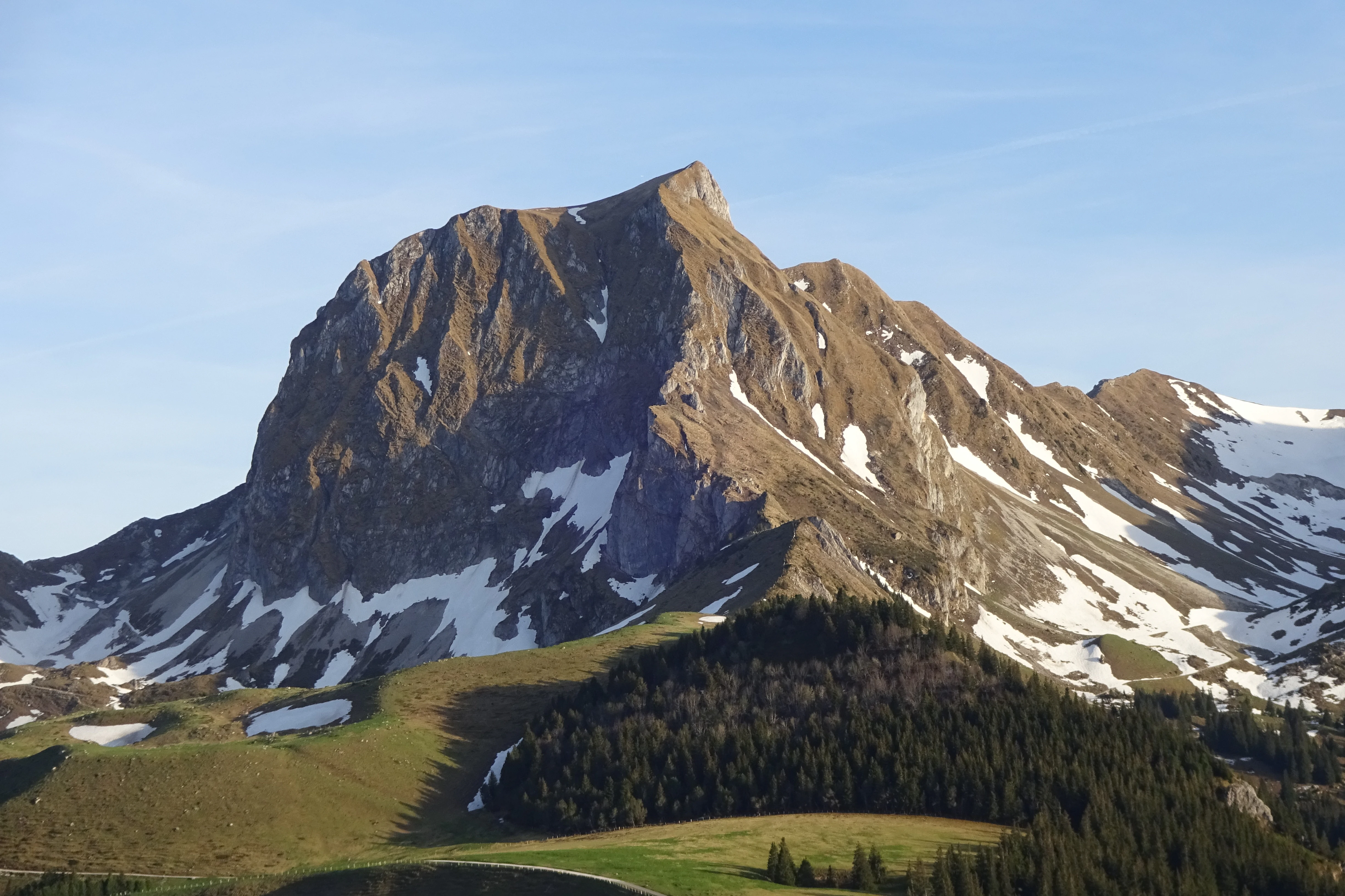
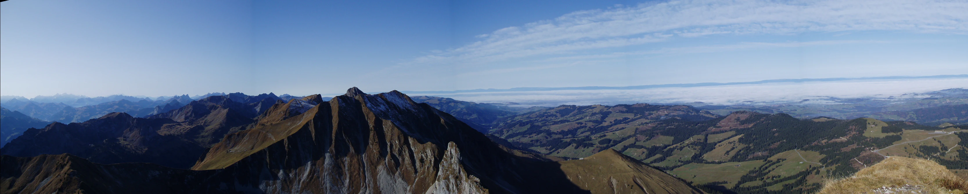
Toward the south, the land becomes visibly steeper. The Gantrisch mountain chain rises as a near-continuous ridge and marks the park's southern boundary. The Gürbe originates on these slopes and carves downward, joined in its descent by the Schwarzwasser and the Sense. These three rivers have created a network of gorges and forested valleys that cross the heart of the park, particularly the Schwarzwasser and Sense gorges, which are recognized as federal landscape monuments within the Schwarzenburgerland.
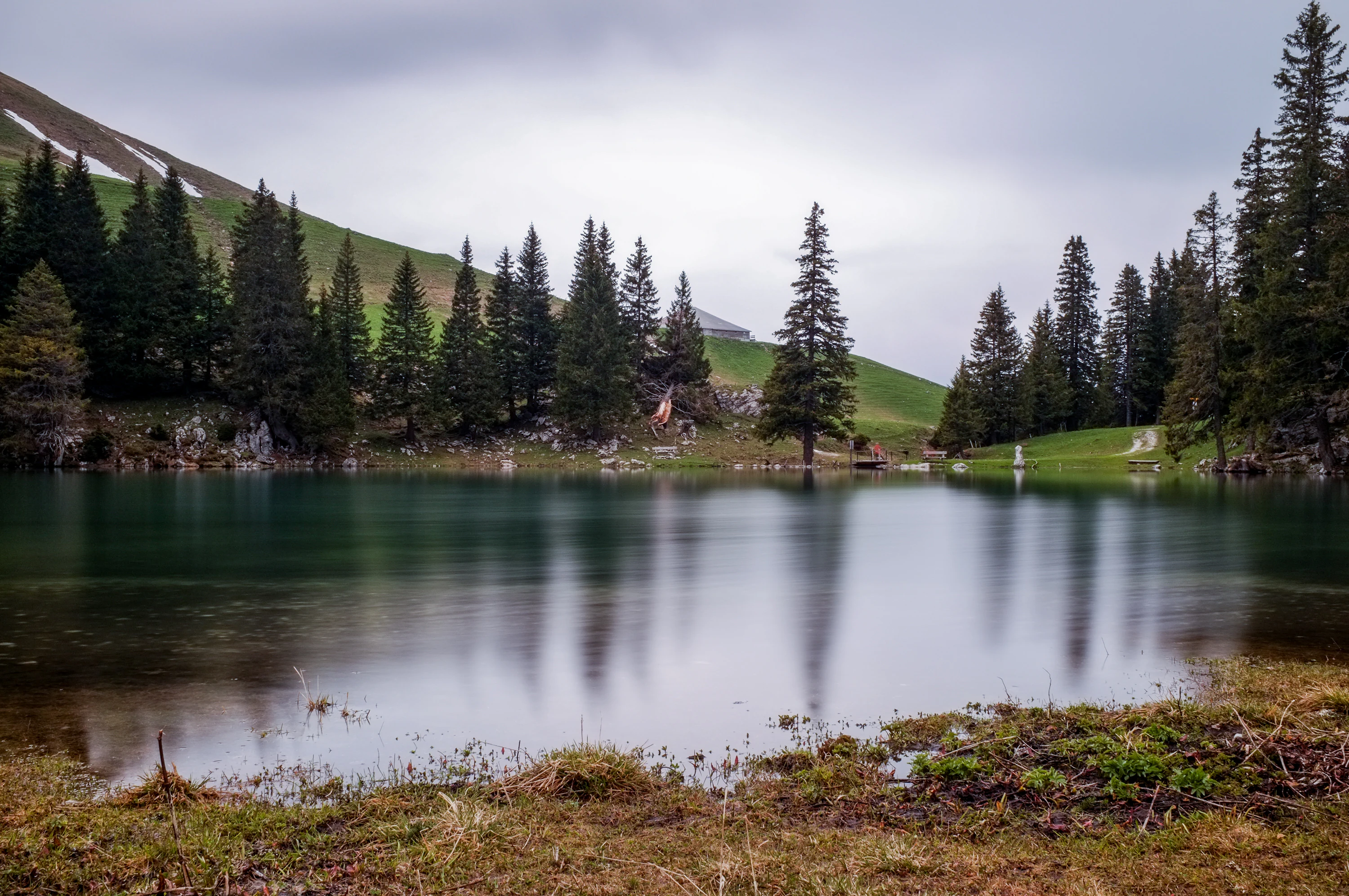
In the southwest, the landscape shifts again with the Schwarzsee lake and, beyond it, the Breccaschlund. The Breccaschlund is one of the park's most distinctive features: a steep, forested gorge regarded as an almost untouched natural landscape. Across the area, smaller lakes such as the Gerzensee and the Dittligsee add quieter water features to the broader scenery, while peaks like the Gantrisch and the Kaiseregg provide the high points that anchor the visual identity of the park.
Regionaler Naturpark Gantrisch ecosystems, habitats, and plant life
Gantrisch's ecological character reflects its geographic transition from the lower Swiss Plateau to the Pre-Alps. The lower elevations support a typical mix of mixed deciduous and coniferous forest, agricultural land, and small wetland features, while the higher slopes around the Gantrisch range transition toward subalpine woodland, alpine pastures, and rocky summit terrain. The altitudinal span of more than 1,700 meters within a single park gives it strong habitat diversity despite its regional rather than national scope.
The river corridors of the Gürbe, the Schwarzwasser, and the Sense are ecologically central. Their gorges, especially the Sense and Schwarzwasser gorges within the federally inventoried Schwarzenburgerland, preserve relatively undisturbed forest cover and shoreline habitat that have been shaped by water rather than settlement. The Breccaschlund in the southwest represents a different ecological regime: a steep, rocky gorge with little human intervention and a high degree of naturalness. Lakes such as the Gerzensee, Dittligsee, and Schwarzsee add freshwater habitat types and contribute to the range of ecological conditions the park conserves.
Regionaler Naturpark Gantrisch wildlife and species highlights
Wildlife in the Gantrisch Nature Park is shaped by the same altitudinal and habitat diversity that defines the park as a whole. The mountain forests of the Gantrisch chain and the gorge forests of the Sense and Schwarzwasser provide habitat for typical Swiss forest species, while the edges between woodland, pasture, and settlement in the lower parts of the park create additional niches for smaller mammals and birds. Aquatic species depend on the river corridors and on the park's lakes, including the Gerzensee, Dittligsee, and Schwarzsee.
Regionaler Naturpark Gantrisch conservation status and protection priorities
The Gantrisch Nature Park sits inside a coherent conservation framework grounded in Swiss federal law. Its territory includes two areas recognized under the federal inventory of landscapes and natural monuments of national significance: the Schwarzenburgerland with the Sense and Schwarzwasser gorges (inventory number 1320) and the Breccaschlund (inventory number 1514). These designations give the site's conservation status a firm legal anchor rather than relying solely on the park designation itself.
As a regional park of national significance, Gantrisch combines habitat and landscape conservation with regional development goals. Its work includes promoting sustainable land use across farmland and forest, supporting traditional farming in the more marginal upper valleys, coordinating conservation across nineteen municipalities in two cantons, and helping maintain the visual and ecological integrity of its most sensitive areas, particularly the Breccaschlund and the deep river gorges of the Schwarzenburgerland.
Regionaler Naturpark Gantrisch cultural meaning and human context
The cultural landscape of the Gantrisch area reflects centuries of rural settlement in a transition zone between plateau and Pre-Alps. The region's castles, monasteries, and manor houses, such as Schloss Schwarzenburg, the Grasburg, the Kloster Rüeggisberg, and the castles around Gerzensee, illustrate the area's medieval and early modern history, when routes between Bern, Thun, and Fribourg passed through these valleys.
Traditional crafts and rural heritage remain visible in the park's museums and cultural institutions. The Abegg-Stiftung holds important textile and embroidery collections associated with the region's history of home-based craft production. The Vreneli-Museum and the Regionalmuseum Gantrisch preserve regional memory, including the cultural figure of Vreneli, a popular Bernese folk character. Across the nineteen member municipalities, local festivals, agricultural traditions, and village architecture continue to shape the daily identity of the park.
Top sights and standout views in Regionaler Naturpark Gantrisch
The Gantrisch Nature Park's standout qualities include the dramatic contrast between soft glacial moraine country in the north and the steep Gantrisch ridge in the south, the deep Sense and Schwarzwasser gorges of the Schwarzenburgerland, and the near-pristine Breccaschlund wilderness in the southwest. Its three main rivers, Gürbe, Schwarzwasser, and Sense, anchor the park's hydrology and shape much of its scenery.
Cultural landmarks such as the Abegg-Stiftung, the Kloster Rüeggisberg, Schloss Schwarzenburg, and the castles around Gerzensee add a strong historical dimension. The combination of historic castles, textile heritage, traditional farming villages, and panoramic Pre-Alpine viewpoints makes the park distinctive within Switzerland's portfolio of regional nature parks.
Best time to visit Regionaler Naturpark Gantrisch
Because Gantrisch spans both lowland and Pre-Alpine elevations, the character of a visit changes meaningfully with the seasons. Spring and early summer bring fresh greenery to the forests and clear views from the lower viewpoints, with rising temperatures making the higher trails progressively accessible. Midsummer is traditionally the most flexible period for combining valley-level visits around castles and museums with higher excursions toward the Gantrisch range and the Schwarzsee area.
Autumn tends to be a particularly rich time for landscape atmosphere, with visible color change in the mixed forests and clearer conditions over the ridgelines. In winter, the higher parts of the park, especially around the Schwarzsee region, can take on an alpine character with snow, while the lower valleys remain more accessible. Any season can anchor a different kind of visit: cultural and lower-elevation routes in cooler months, and broader landscape and high-point experiences in the warmer half of the year.