
Why Landschaftspark Binntal stands out
Landschaftspark Binntal is best known for its extraordinary mineralogical heritage, with the Binntal recognized worldwide as a classic mineral locality and the Lengenbach quarry regarded as one of the most significant mineral sites on Earth. More than 320 mineral species have been recorded, and 40 have their type locality in the valley, including the sulfide mineral lengenbachite. The park is equally defined by its mosaic of Alpine habitats and traditional mountain farming culture. Visitors encounter deep side valleys such as the Lengtal, Saflischtal, Mättital, and Chriegalptal, glaciated peaks, mountain lakes like the Blausee and Geisspfadsee, and high alpine pastures where cooperative dairies still produce regional Alpkäse Binntal. Together, these features give the park a dual character: a scientifically important geological and ecological reserve, and a living Alpine cultural landscape.
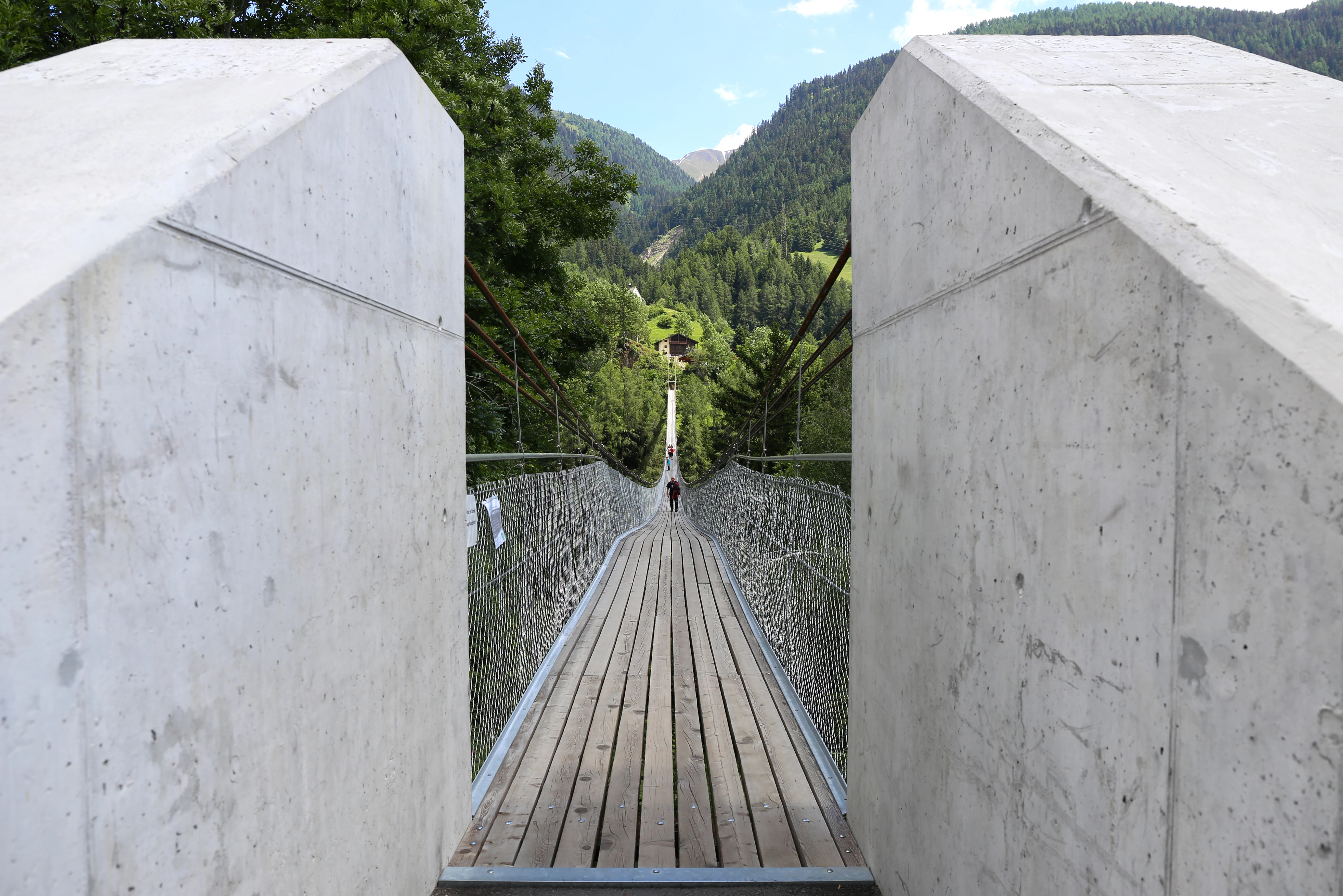
Landschaftspark Binntal history and protected-area timeline
The history of Landschaftspark Binntal begins with a 1964 protection contract between the municipality of Binn, the Walliser Bund für Naturschutz (today Pro Natura Wallis) and the Monte Rosa section of the Swiss Alpine Club. This 100 year agreement placed about 46.5 km² of the upper Binntal under protection, including a binding commitment to withhold the area from hydropower development and to prevent the construction of large tourism infrastructure. The decision was approved by the village assembly of Binn on 17 September 1964 and became one of the earliest large-scale local conservation commitments in the Swiss Alps.
In 1977 the upper Binntal, covering 5090 ha, was added to the federal Inventory of Landscapes and Natural Monuments of National Importance (BLN), giving it a formal federal protection status. The canton of Valais subsequently protected the Albrun moor landscape and the Oxefeld and Blatt flat moors in 1999, reinforcing the conservation framework at cantonal level. In 2002 the communities of Binn, Ernen, and Grengiols launched a formal project to establish a broader nature park covering roughly 160 km².
The legal foundation for Swiss parks of national importance was created by the federal parliament in 2007 through articles in the Federal Act on the Protection of Nature and Cultural Heritage and its implementing ordinances. The Binntal park was recognized as a regional nature park by the federal government and the canton in 2008, and its perimeter was expanded in 2009 to include the communities of Blitzingen, Niederwald, and Bister, reaching 180 km². In 2011 the park was awarded the definitive federal label as a Regional Natural Park.
A formal evaluation of the park took place in 2020 and 2021. Following approval of a new park contract by the communities of Binn, Ernen, Grengiols, and Bister, the Federal Office for the Environment confirmed continuation of the park label until 2031. Because only entire municipalities may belong to the park perimeter, the villages of Niederwald and Blitzingen, which had merged into the municipality of Goms, left the park area as of 2020.
Landschaftspark Binntal landscape and geographic character
The landscape of Landschaftspark Binntal is a classic Alpine landscape of deep valleys, steep rocky flanks, and glaciated high peaks shaped by the touchstone of the Lepontine and Pennine Alps. The park follows the Binna and its tributaries deep into a system of southern side valleys, including the Lengtal, Saflischtal, Mättital, and Chriegalptal, before the terrain eventually climbs to the Alpine main ridge that forms the Swiss-Italian border. On the Italian side this landscape continues directly into the Parco Naturale Alpe Veglia e dell'Alpe Devero, the oldest nature park in Piedmont.
The valley floor of the Rhone, locally called the Rotten, marks the lower edge of the park. A 15 kilometer stretch of the southern Rhone slope, from Blitzingen in the west to Bister in the east, was historically included in the park area. Small mountain villages such as Schmidigehischere, Wileren, Deisch, and Fäld are scattered across the slopes, while the larger settlements of Binn, Ernen, Grengiols, and Bister sit on terraces rising above the main valley. Mountain streams and ten wild creeks descend from the south into the Rhone through this section, carving gorges such as the Twingischlucht and shaping the valley floor.
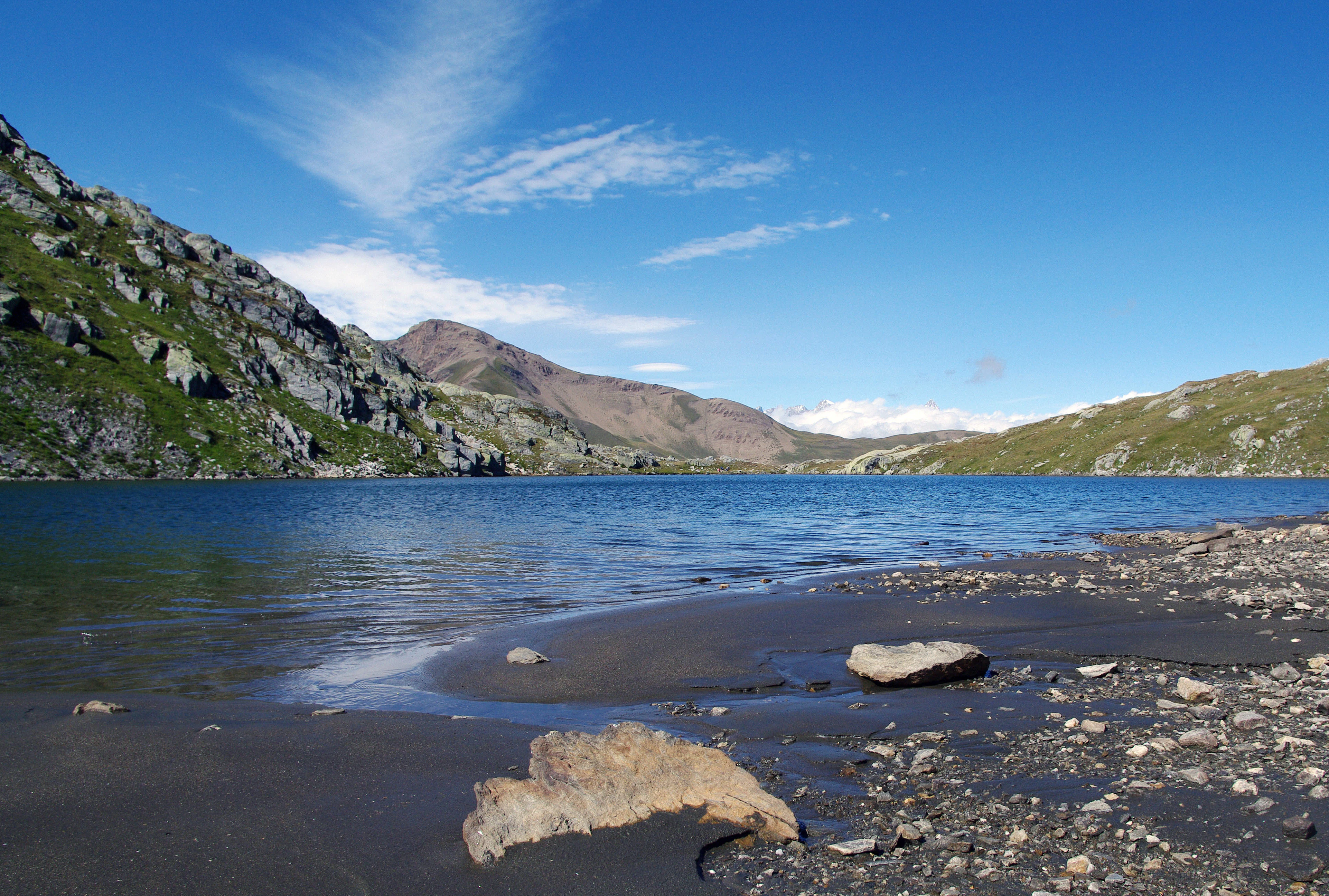
The highest elevations lie in the Monte Leone and Blinnenhorn group of the Walliser Alps. The park's highest point is the Helsenhorn at 3272 m above sea level, and several smaller glacier remnants, including the Rappegletscher, Fäldbachgletscher, the Mättitalgletscher, and the Hillegletscher, still survive on the highest faces. Small mountain lakes such as the Blausee in the Saflischtal near Grengiols, the Chumme reservoir at Alp Chumme, the Geisspfadsee near the Geisspfadpass, and the Feldbachsee add to the diversity of the high-altitude terrain, and their waters are listed in the inventory of lakes of the canton of Valais.
Landschaftspark Binntal ecosystems, habitats, and plant life
Landschaftspark Binntal is defined by an unusually compressed zonation of habitats, spanning a vertical range from the Rhone valley all the way to the high alpine zone above 3000 m. This vertical gradient, combined with strong local differences in geology, exposure, and climate, creates a mosaic of biotopes within a relatively small footprint. Flat moors, dry meadows, spruce forests, stone pine forests, alpine pastures, glacier forelands, rock steppes, mountain lakes, and alpine alluvial formations all occur within the park.
Coniferous forests are a central element of the natural landscape, with spruce woodlands on many intermediate slopes and distinct stone pine forests on warmer, drier rocky flanks. Where the rock is unstable or the climate too harsh for trees, the vegetation shifts to open rock steppes and high alpine meadows. Flat moors, such as those around the Albrun area, and the small wet habitats around the Saflischtal and Oxefeld represent some of the more ecologically sensitive environments and are protected at cantonal level. Above these zones lie glacier forelands and alpine floodplains that document ongoing landscape change.
The mosaic character of habitats is reinforced by traditional land use. Centuries of mountain agriculture have shaped forest edges, meadow composition, and pasture patterns, so that many of the most species-rich areas of the park are semi-natural landscapes rather than untouched wilderness. This combination of natural habitat diversity and a long agricultural history makes Landschaftspark Binntal function ecologically as both a high-mountain reserve and a cultural landscape with high biodiversity, supporting a remarkable number of Red List plant and animal species for its area.
Landschaftspark Binntal wildlife and species highlights
The diversity of habitats in Landschaftspark Binntal supports a rich and varied Alpine fauna, with documented occurrences of 184 Red List animal and plant species. The vertical range of the park, extending from valley-floor meadows to high alpine rock terrain, creates seasonal niches for very different groups of animals, while the patchwork of dry meadows, moors, alder and larch woodlands, and alpine pastures provides year-round resources for insects, birds, and mammals.
The mixed forests of the lower valley, the extensive alpine pastures in the side valleys such as the Saflischtal, Mättital, and Lengtal, and the rocky areas near the Helgenhorn and the surrounding peaks each host characteristic species communities. Typical Alpine wildlife groups include chamois and ibex on the high rocky slopes, red deer and roe deer in the forested zones, marmots across the open alpine meadows, and a wide variety of breeding and migratory birds using moors, alpine meadows, and cliffs as habitat. Raptor species, alpine specialist birds, and ground-nesting meadowbirds benefit from the blend of open pasture and rock habitats.
The park's moor landscapes and flat moors are particularly important for invertebrates, amphibians, and moisture-dependent plants, while the alpine forelands and glacier retreat zones provide habitat for pioneer species typical of recently deglaciated terrain. The combination of protected reserves, extensive traditional grazing, and very limited large-scale infrastructure means that the area retains a strong functional ecological network, allowing wildlife to move between valley-floor and high-alpine habitats across seasons.
Landschaftspark Binntal conservation status and protection priorities
Landschaftspark Binntal is significant from a conservation perspective as a layered system of overlapping protection designations. Its foundation is the 1964 protection contract for the upper Binntal, which under Swiss law committed the area to long-term protection from hydropower development and large-scale tourism infrastructure. This was followed in 1977 by inclusion of the upper Binntal in the federal Inventory of Landscapes and Natural Monuments of National Importance (BLN), and in 1999 by cantonal protection of the Albrun moor landscape and the Oxefeld and Blatt flat moors.
These historic protections were complemented by the 2007 federal park legislation and the 2008 recognition of Landschaftspark Binntal as a regional nature park of national importance, formalizing its role within the Swiss system of parks of national significance. In addition, a substantial proportion of the park is covered by cantonal nature and landscape protection zones, hunting reserves, archaeological protection areas, and municipal protection zones and agricultural reserves, creating a dense network of overlapping conservation categories.
Beyond legal protection, the park's conservation value lies in how it integrates ecological goals with cultural landscape management. The continuation of traditional alpine farming, cooperative dairy operations on high pastures, and careful forest management are viewed as essential to maintaining the open habitats, species-rich meadows, and traditional settlement pattern. The park is also important at the European level for its mineralogical significance, particularly at the Lengenbach deposit, which functions as a global reference site for sulfide mineralogy. Together, these factors make Landschaftspark Binntal a conservation landscape that protects both natural processes and a centuries-old Alpine cultural heritage.
Landschaftspark Binntal cultural meaning and human context
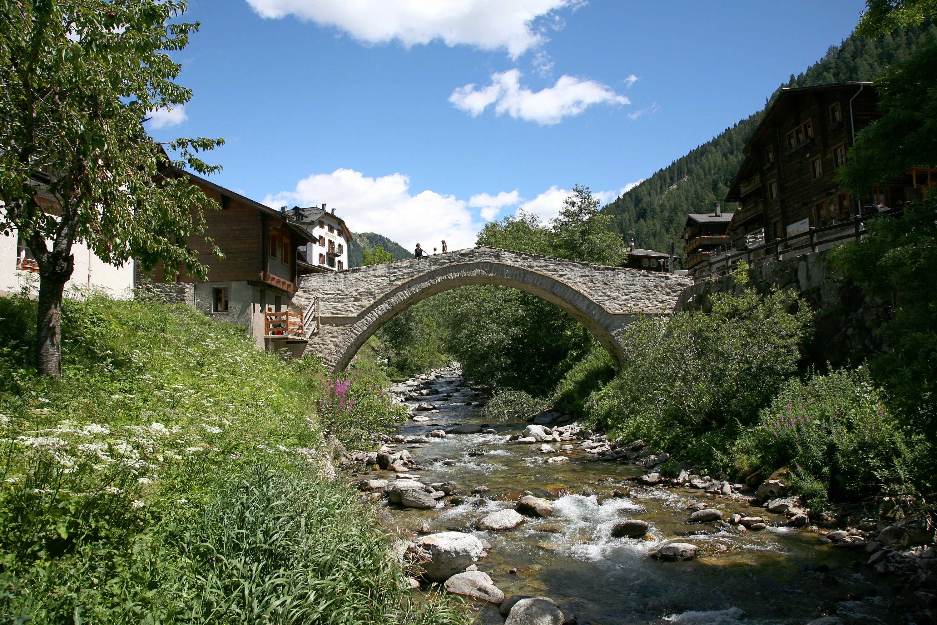
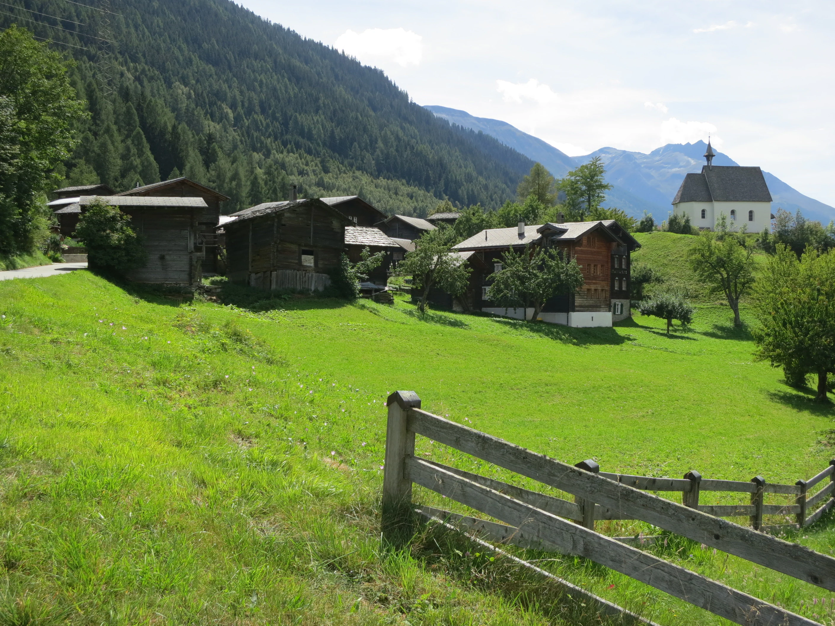
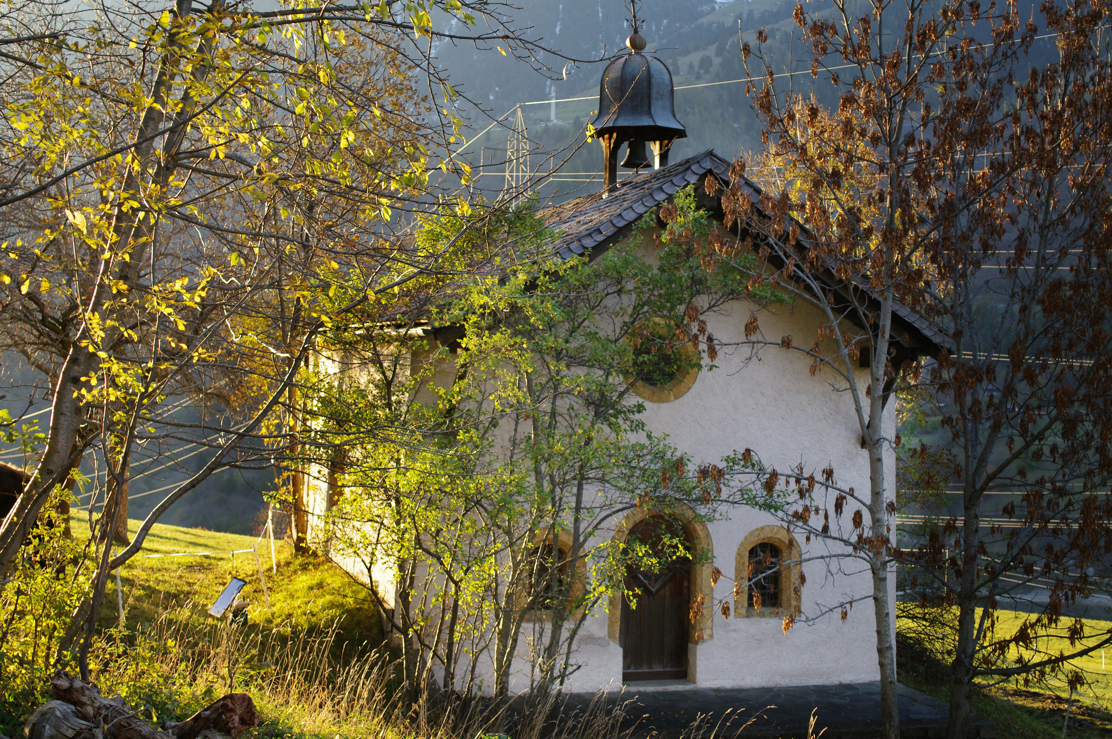
The cultural landscape of Landschaftspark Binntal reflects centuries of mountain farming, transhumance, and Alpine trade. Settlements such as Binn, Ernen, Grengiols, and Bister preserve historic wooden architecture using local larch, and several hamlets are recognized for their intact village appearance. Ernen received the Wakker Prize from the Schweizer Heimatschutz in 1979, and Mühlebach near Ernen is noted as containing the oldest timber village core in Switzerland. Numerous chapels, churches, storehouses, and stables are inventoried as cultural heritage of cantonal and national importance.
Mountaineering and alpine dairy traditions are central to the identity of the region. Alpine pastures such as Furgge above Grengiols, where one of Switzerland's highest alpine cheese dairies sits at around 2430 m, and the cooperative alpages around Binn produce the regional Alpkäse Binntal. Historic alpine paths, including the Albrunpass route, have linked the valley to Italy since at least the Iron Age, used for trade, migration, and seasonal movement of livestock. The valley is also historically significant as a launching point for Walser settlement into the Valle d'Ossola from the 13th century onward.
The cultural heritage of the valley is strongly intertwined with its mineralogical fame. English and European mineral collectors began visiting in the second half of the 19th century, and the Hotel Ofenhorn opened in 1883 to serve this early tourism. Today the mineral collection at the local museum and the Mineralienmuseum in Fäld preserve this legacy, while the Jost-Sigristen-Museum in Ernen, the Zendenrathaus, and the church museum at Ernen interpret the political, religious, and domestic history of the former Republic of the Valais.
Top sights and standout views in Landschaftspark Binntal
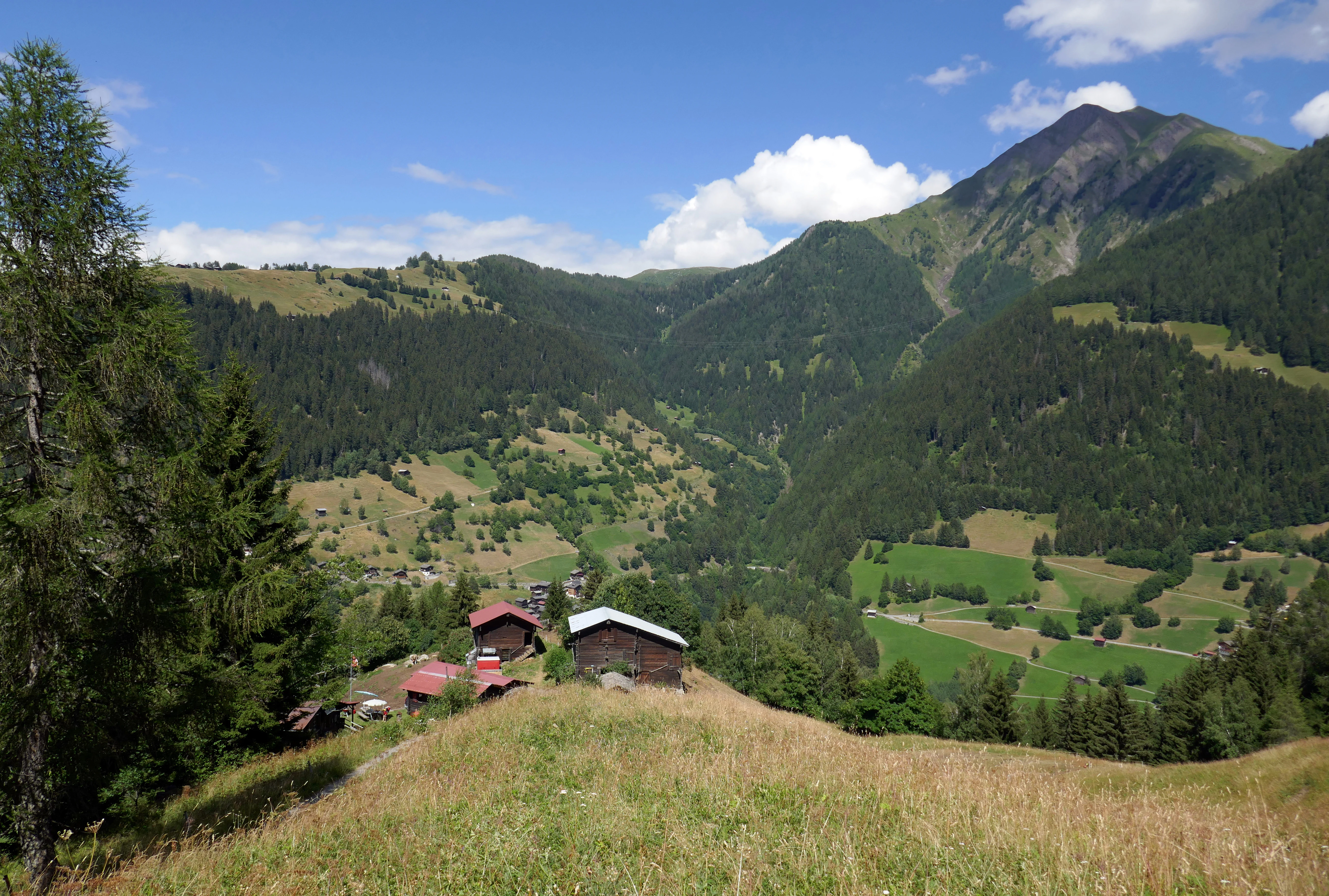
The defining highlights of Landschaftspark Binntal are its deep Alpine valley mosaic, its world-class mineralogical sites, and its exceptionally preserved mountain villages. Visitors encounter vertical layers of landscape in a compact area, from the Rhone valley floor and historic wooden villages up through spruce and stone pine forests, alpine pastures, small mountain lakes, glacier remnants, and 3000 meter peaks along the Italian border.
Equally distinctive is the blend of nature protection and living tradition, including cooperative alpine dairies such as Furgge above Grengiols, the Hanschbiel alpine dairy museum, historic larch architecture in Ernen, and the regional museums in Binn and Ernen that connect mining history, mineralogy, and Alpine village life. The park is also a notable destination for trekking between Switzerland and Italy via the Albrunpass and for winter ski touring in protected terrain.
Best time to visit Landschaftspark Binntal
Landschaftspark Binntal has a clear Alpine seasonality that shapes the experience of the landscape. Summer and early autumn are the most rewarding periods for exploring the park on foot, when the alpine pastures are grazed, the high trails over passes such as the Albrunpass are free of snow, and the contrast between green meadows, dark forests, and bare rock peaks is at its sharpest. These months are also the best time for visiting the high pastures, regional museums, and the historic villages, which are linked by an extensive network of marked trails.
Winter transforms the park into a quieter, snow-covered landscape well suited to ski touring, snowshoeing, and visits to the valley villages. The traditional sledding and ski-tour terrain near Ärnergale, as well as routes toward the Albrunpass, are best used in the deep snow season when avalanche conditions allow, though visitors should treat such unmarked alpine routes with caution. Spring is generally less favorable for high routes due to lingering snow, but offers attractive blossom and forest light in the lower villages such as Ernen.