
Why Rhonegletschervorfeld stands out
The Rhonegletschervorfeld is best known as one of the clearest, most photographed, and most scientifically documented examples of alpine glacier retreat in the world. The pyramidal stone markers placed in the valley of Gletsch since the early nineteenth century, each engraved with a year, allow visitors to read the glacier's historical extent directly from the landscape. Equally important is the site's role in the history of glaciology. The Rhone Glacier was among the first alpine glaciers to be systematically measured, starting with the engineer Gosset in 1874, and the resulting observational series, together with Paul-Louis Mercanton's classic 1916 study, made it a foundational reference for the discipline. The forefield thus reads simultaneously as a tourist destination, a historical record of ice loss, and a baseline site for modern climate-related glacier research.
Rhonegletschervorfeld history and protected-area timeline
The history of the Rhonegletschervorfeld is inseparable from the history of the Rhone Glacier's retreat after the Little Ice Age. During the nineteenth century and into the early twentieth century, the glacier's tongue extended well past today's snout, descending the steep rock step and reaching almost to the settlement of Gletsch at roughly 1800 meters above sea level. Visitors traveling over the Furka Pass during that period encountered ice essentially at the roadside.
The high-water mark of 1856 is still legible in the landscape through smoothed bare rock faces and conspicuous moraine material deposited along the valley walls. Since that point, the ice has retreated continuously. The pyramidal stone columns, some carrying dates from 1815 onward, now standing in the valley of Gletsch are physical markers of that progression, turning the forefield into an open-air chronology of ice loss.
Scientifically, the forefield's importance dates from the early triangulation campaigns of 1874, which produced one of the earliest continuous monitoring series for any alpine glacier. Paul-Louis Mercanton's later synthesis of these measurements, published in 1916, became a standard reference in glaciology. Subsequent research programs, including combined ice, water, and energy-balance studies coordinated from ETH Zurich, have kept the site at the center of alpine cryosphere research into the present. In the early twenty-first century, experimental work on katabatic winds and cold-air pooling was carried out directly on the glacier and its forefield, extending the site's role beyond passive observation.
Rhonegletschervorfeld landscape and geographic character
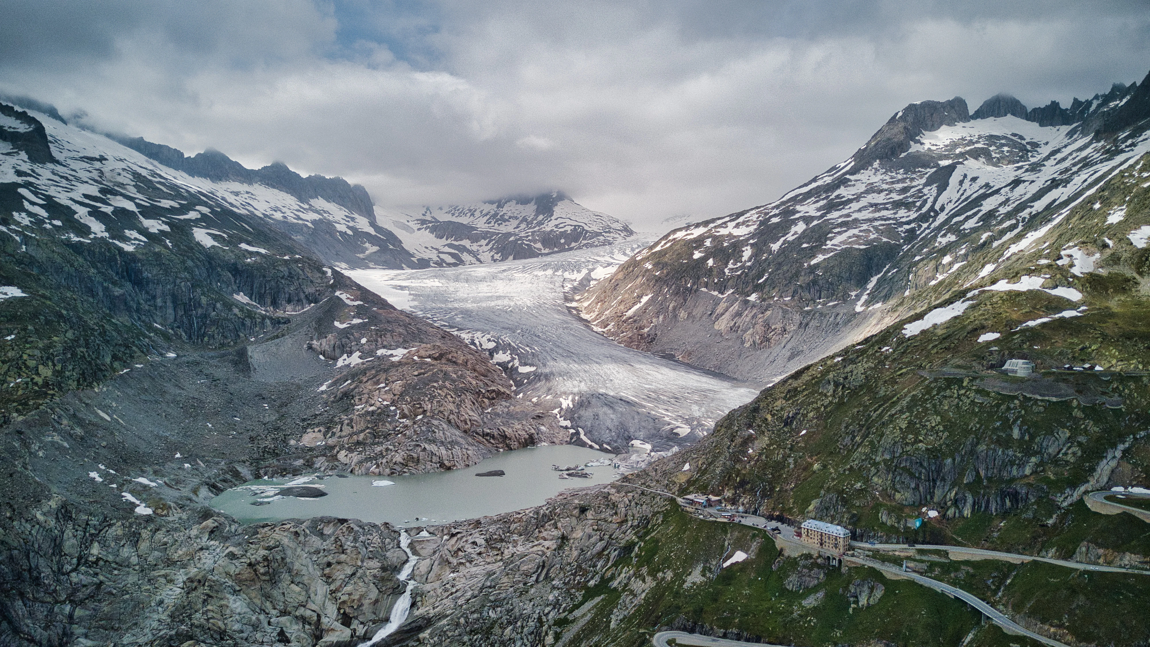
The landscape of the Rhonegletschervorfeld is shaped by rapid deglaciation rather than by stable terrain. The valley walls on either side rise sharply, with peaks such as the Tieralplistock and the Gärstenhörner to the west and the Galenstock to the east framing the scene. Between these flanks lies the comparatively flat valley floor of Gletsch, into which the glacier once flowed directly.
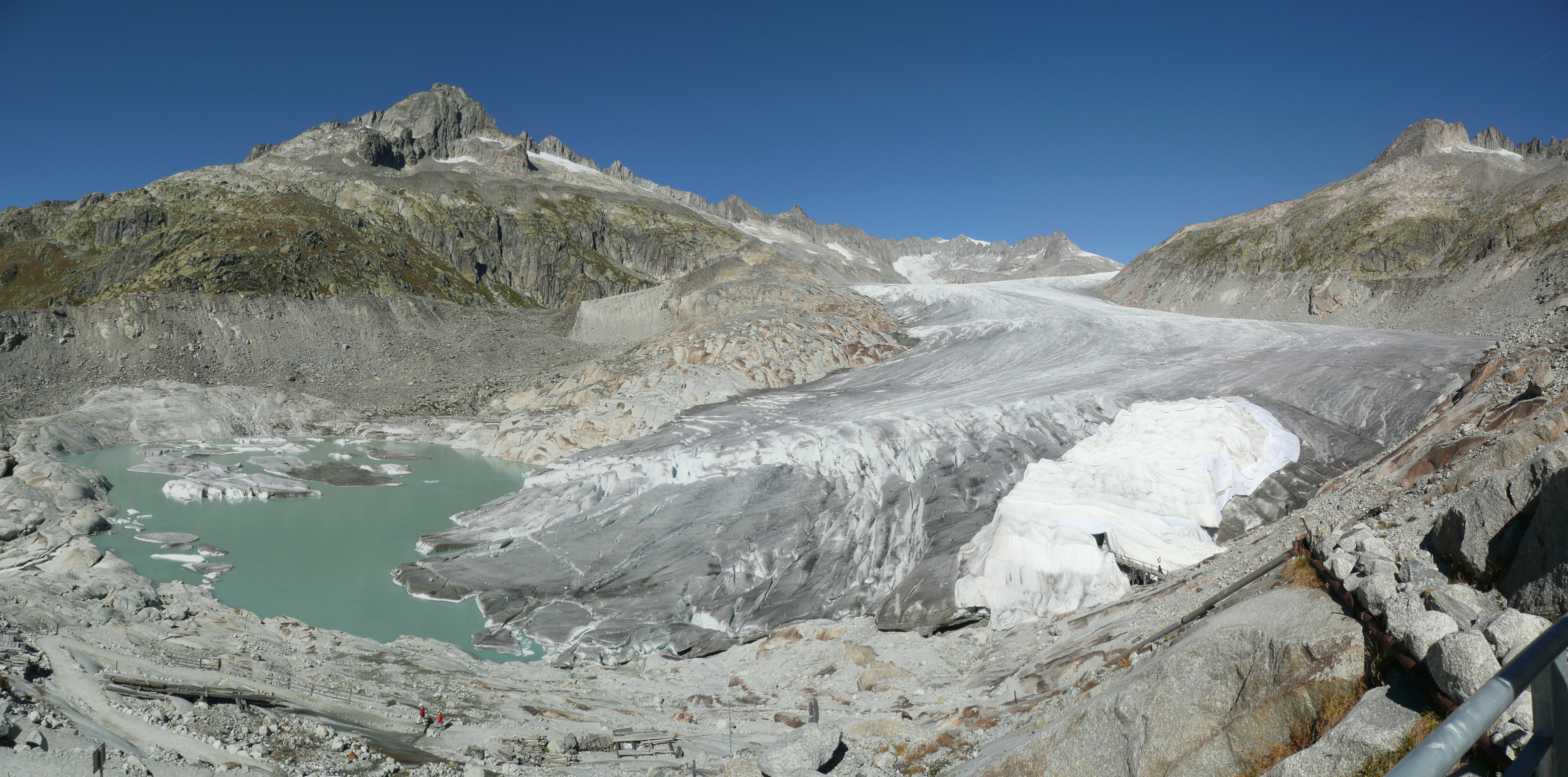
The forefield itself is a transitional, often unstable surface. It is dominated by freshly exposed bedrock that was scoured smooth during the Little Ice Age, together with loose moraine debris and the occasional remnants of lateral moraines marking earlier, higher ice levels. Drainage is poorly organized; meltwater crosses the surface in shifting braided channels that have not yet cut stable beds.
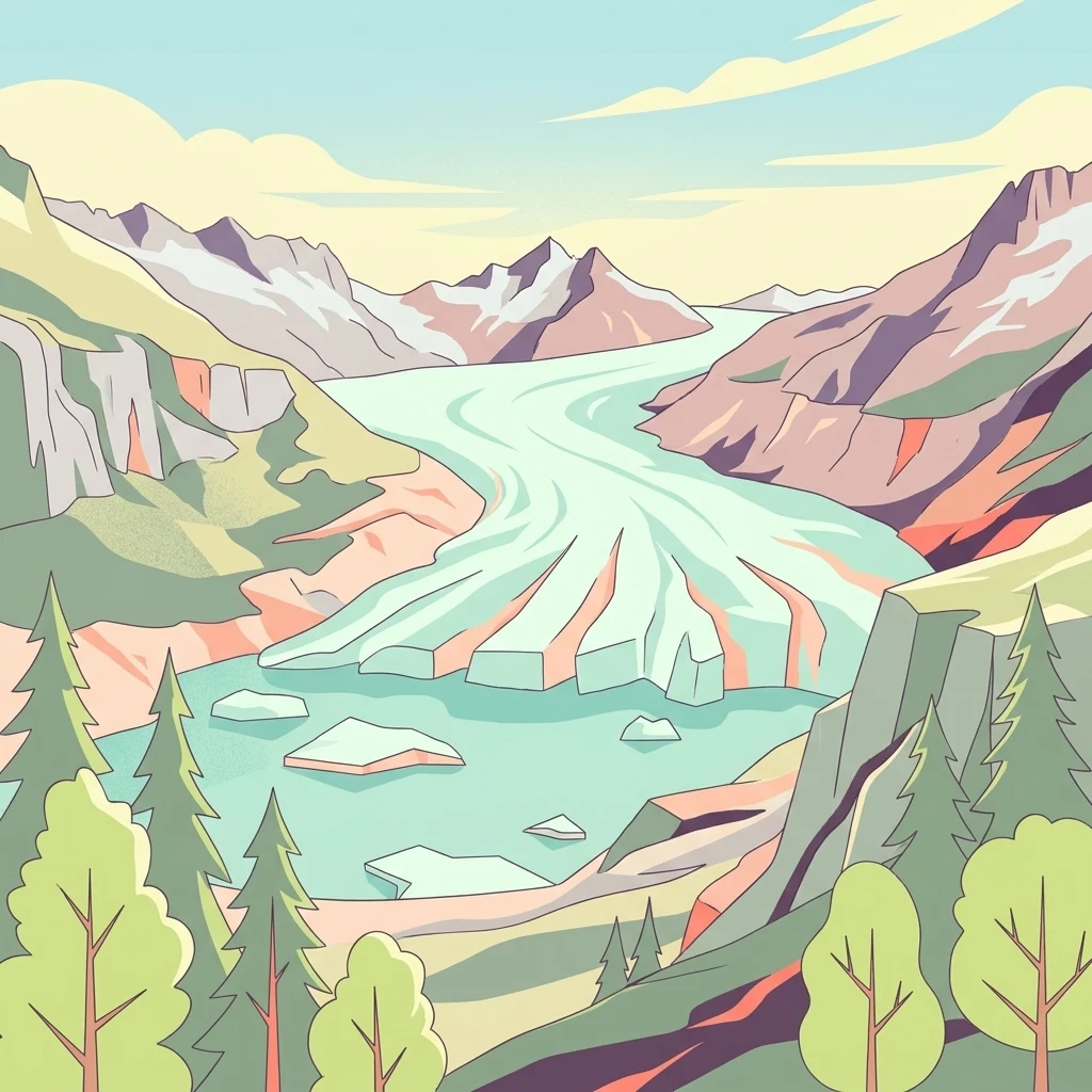
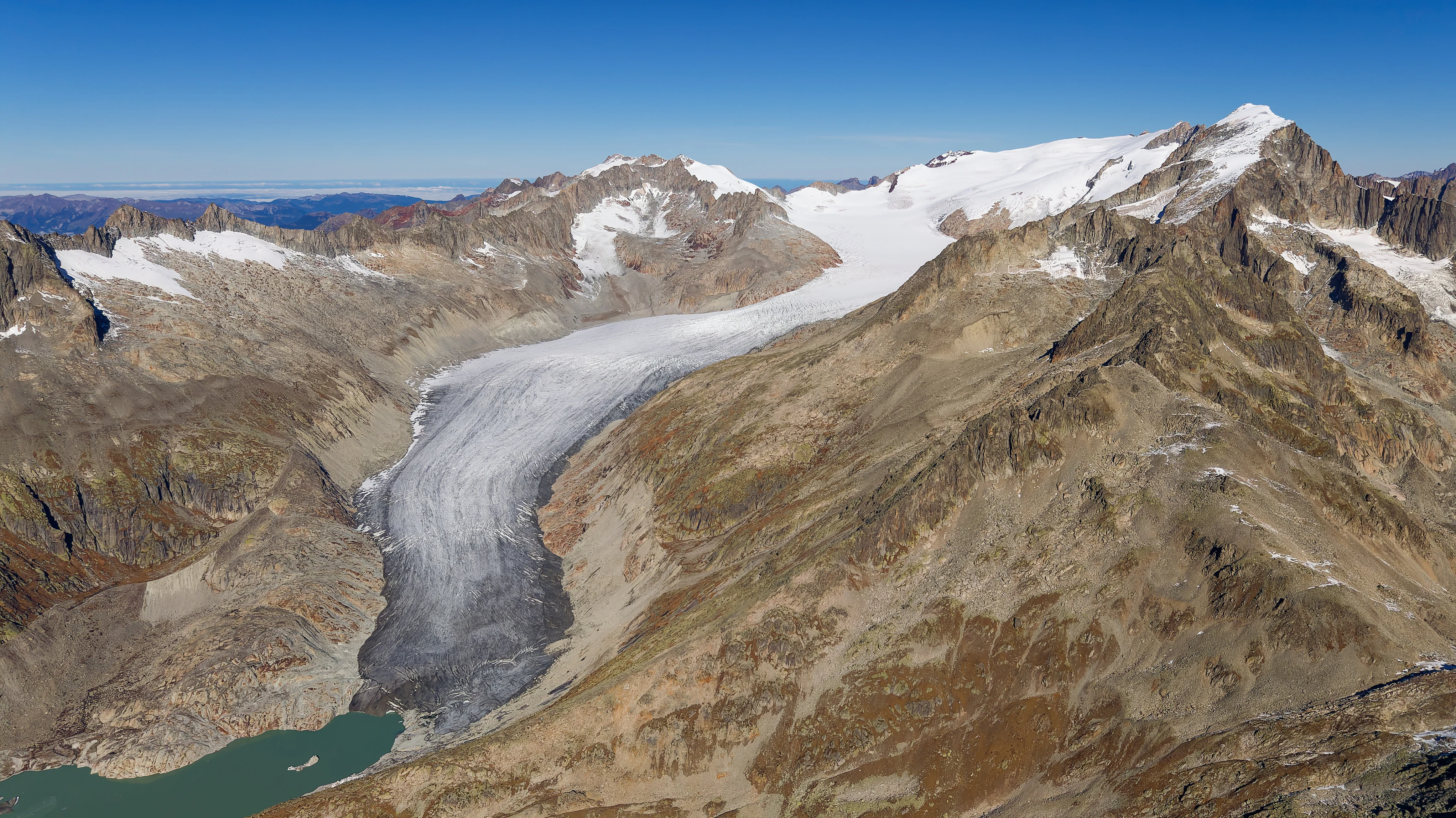
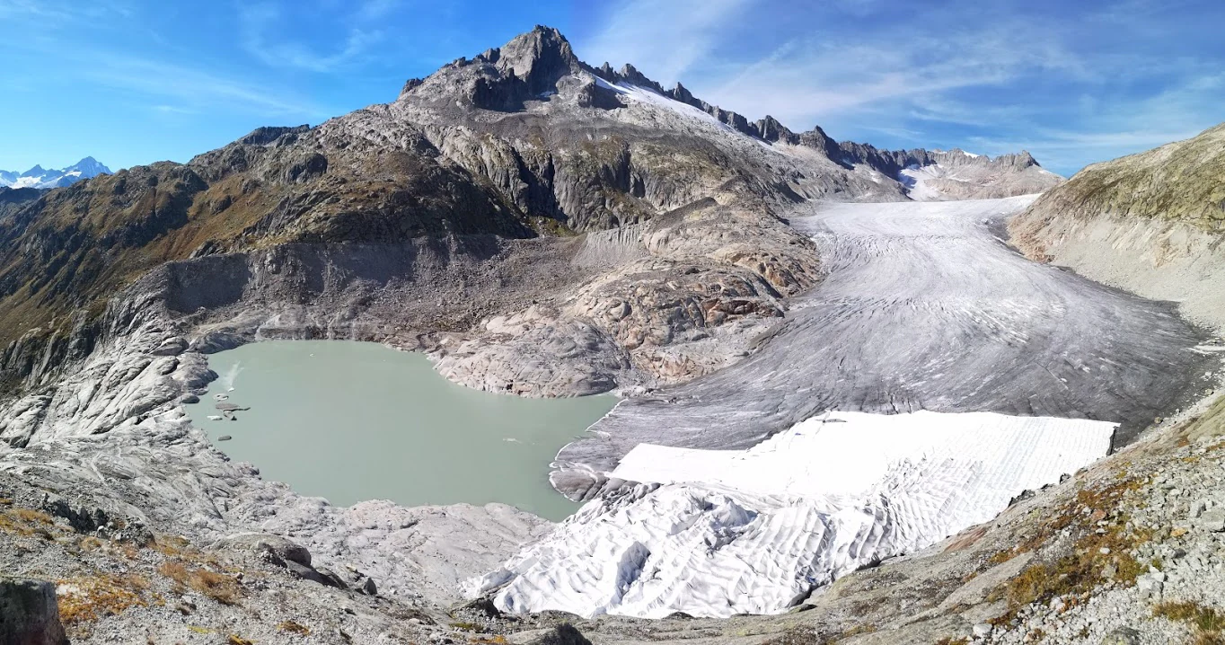
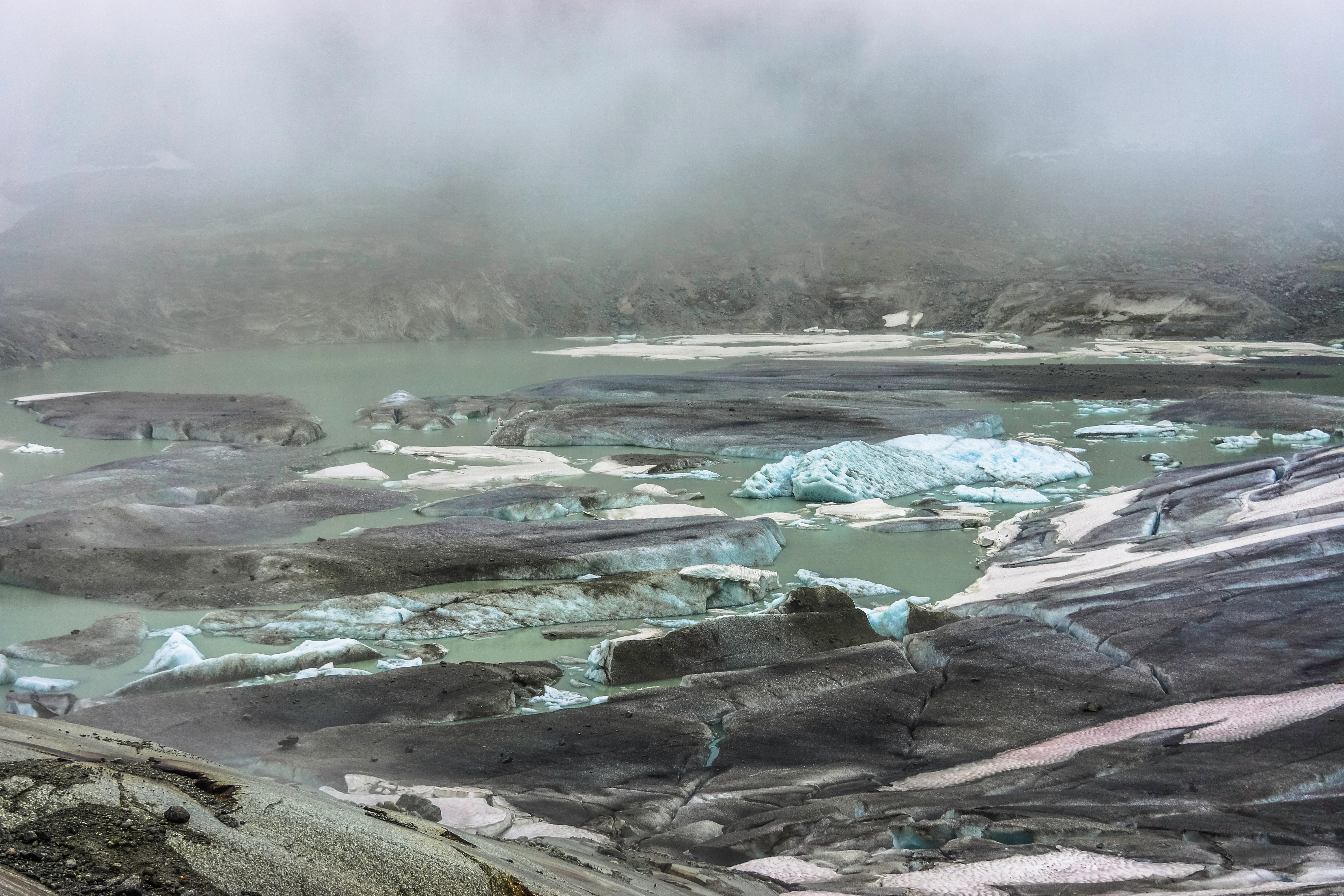
At the upper end of the forefield, a steep rock step separates the current glacier tongue from the valley below. As the ice has thinned and pulled back, a proglacial lake, the so-called Gletschersee, has begun to form behind this threshold. Since around 2006 to 2007, this lake has expanded year by year, transforming what was previously dry forefield into a partially flooded landscape and indicating the direction the terrain will take if retreat continues.
Rhonegletschervorfeld ecosystems, habitats, and plant life
Ecologically, the Rhonegletschervorfeld represents an active example of primary succession on freshly deglaciated terrain. The substrate is young, nutrient-poor, and coarse-textured, with much of the surface still dominated by rock, gravel, and moraine rather than developed soil. Soil formation is in its earliest stages, and biological colonization proceeds through the classic stages of glacier forelands: pioneer mosses and lichens first, followed by scattered forbs, grasses, and eventually, in marginal positions near older moraines, low shrubs.
The drainage network is unstable and largely depends on summer melt. Because the catchment is heavily glaciated, the microclimate in the forefield is colder than comparable non-glacial sites in the upper Rhone valley, and plant communities here resemble those found at higher elevations, with cover generally remaining sparse and fragmentary for decades after ice withdrawal.
Wildlife in the forefield itself is limited by the harsh, mobile substrate, but the broader catchment, including the adjacent glacier surface, the snowfields above, and the partially forested slopes below Gletsch, supports a richer set of alpine species. Birds typical of the upper alpine zone, such as alpine choughs and snow finches, are often seen near the ice, while ibex, chamois, and marmots use the surrounding rocky meadows. The lake forming at the base of the tongue is beginning to introduce an additional aquatic component into what was previously a mostly terrestrial forefield.
Rhonegletschervorfeld wildlife and species highlights
Wildlife is sparse in the heart of the Rhonegletschervorfeld itself, where the unstable, freshly deglaciated ground offers little habitat. Yet the surrounding mosaic of rock, snow, meltwater, and adjacent alpine meadow supports a recognizable set of high-altitude species.
Along the margins of the forefield and on the steep talus slopes that flank the glacier, alpine choughs and snow finches forage, taking advantage of the open, ice-rich environment. Higher on the slopes, chamois and the more specialized alpine ibex are characteristic of the rocky terrain. Marmots occupy the better-drained alpine meadows near the Furka road and the upper valley edges, and red foxes are frequent visitors to the forefield in search of carrion and small prey.
The growing proglacial lake since the late 2000s has added a new element to this fauna. As the water body expands, it is expected to attract waterbirds and to develop the early stages of a cold-tolerant aquatic community. Even before that, meltwater pools and braided streams in the forefield already provide habitat for cold-adapted invertebrates, which in turn feed the birds that patrol the ice margin.
Rhonegletschervorfeld conservation status and protection priorities
The Rhonegletschervorfeld is significant from a conservation perspective primarily as a record of climate-driven landscape change rather than as a habitat for rare species. Because the Rhone Glacier is one of the most continuously monitored glaciers in the world, the forefield serves as an open reference site where long-term observations of glacial, hydrological, and ecological change can be tied directly to on-the-ground conditions.
Geomorphological features, including the 1856 moraines, polished bedrock, and relict lateral moraines higher up, are themselves regarded as part of the scientific value of the site. They document, step by step, the response of an alpine valley glacier to post-Little Ice Age climate change, and they have been drawn upon in major reconstructions of the prehistoric Rhone Glacier and its role in shaping the Swiss Mittelland.
While the area is not a strict nature reserve, conservation interest centers on preserving its unprotected, dynamic character. The Swiss federal and cantonal authorities continue to monitor glacier retreat and its physical consequences, and the continuous observation programs around the Rhone Glacier are widely regarded as assets for understanding alpine cryosphere change globally. The forefield's near-iconic status in glacier education and outreach gives it additional value as a baseline for public communication about alpine environmental change.
Rhonegletschervorfeld cultural meaning and human context
The Rhonegletschervorfeld sits at a historic crossroads of Alpine travel. The Furka Pass road, which passes directly by the site, was a classic nineteenth-century route through the Swiss Alps, and the nearby hamlet of Gletsch, together with the Hotel Belvédère, was once a focal point of early glacier tourism. At the height of the Little Ice Age maximum, travelers could step from the road onto glacier ice, and that proximity helped convert the Rhone Glacier into one of the most depicted alpine glaciers of its era.
That long association with Romantic-era alpine imagery, especially the visual tradition documented in nineteenth-century paintings, prints, and travel accounts, has left a strong imprint on how the forefield and the rhone glacier are now perceived. The now-famous stone pillars in the valley of Gletsch, recording retreat year by year since the early nineteenth century, double as both scientific markers and as cultural memorials of a vanished landscape. They reflect the unusually close entanglement this site has with the history of alpine exploration and the development of glaciology as a discipline.
Top sights and standout views in Rhonegletschervorfeld
The most striking feature of the Rhonegletschervorfeld is the visible continuity it offers between a vanished Little Ice Age landscape and a glacier in active retreat. From a single viewpoint, one can see the rounded, freshly scoured bedrock of the 1850s maximum, the lower-elevation stone columns marking intermediate stages, the steep rock step with the modern glacier tongue, and the new proglacial lake forming at the base of the ice.
Equally distinctive is the combination of accessibility and depth of documentation. Few other alpine glacier forelands can be reached by a short walk directly from a major pass road while also offering one of the longest and most complete observational records for any glacier outside the polar regions. The site also carries strong historical resonance, having played a central role in early glaciology and in the visual culture of the Swiss Alps.
Best time to visit Rhonegletschervorfeld
The character of the Rhonegletschervorfeld changes markedly with the seasons, even though the underlying story of glacial retreat continues year-round. Summer is the most informative period: snow has largely melted from the lower forefield, the proglacial lake is open and growing, and the differences between old moraines, exposed bedrock, and current ice are at their clearest. Long daylight hours also make it easier to read the progression of retreat markers in the valley of Gletsch.
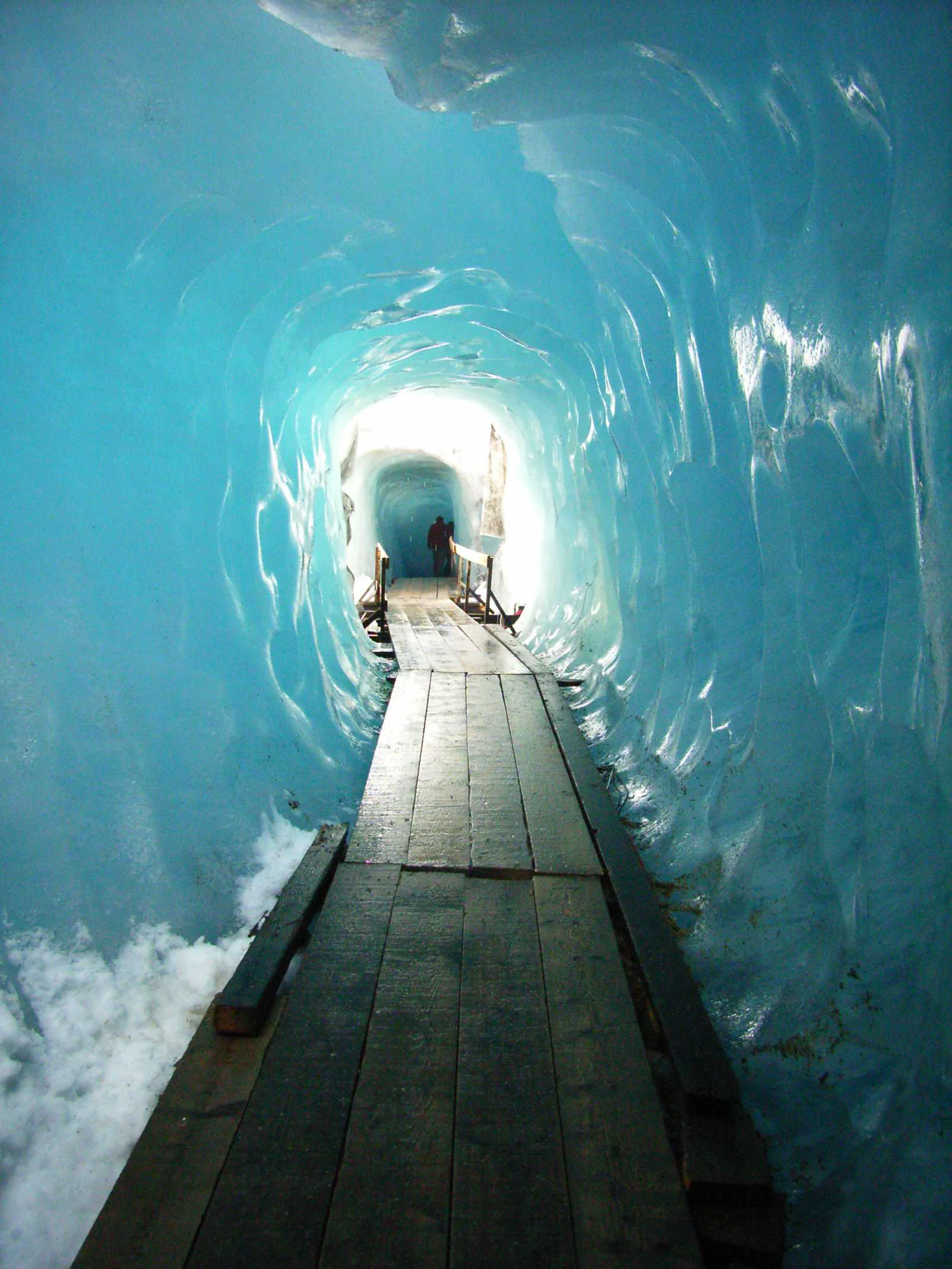
In winter, the forefield is buried under deep snow, the lake is frozen, and direct access to the glacier margin becomes limited or impossible. Spring and late autumn offer quieter shoulder periods, with thinner crowds but also more variable conditions; the ice grotto and walkways near the former Hotel Belvédère, where they are open, are typically most attractive in late spring and early summer, before the high-season traffic peak.