
Mori Atlas logo
Nature reserveNaturschutzgebiet Gauligletscher

A dynamic nature reserve in the Bernese Oberland shaped by ongoing glacial retreat

Naturschutzgebiet Gauligletscher: High Alpine Glacier Foreland and Protected Landscape

Naturschutzgebiet Gauligletscher sits within the upper Urbachtal in the canton of Bern, serving as a critical protected glacier foreland. This landscape features a dense assembly of moraines, fluvial deposits, and high-altitude basins where retreating ice continues to reshape the terrain. As a protected floodplain, the area provides a window into rapid ecological colonization and the shifting boundaries of alpine environments throughout the twenty-first century.

glacier forelandfloodplainhigh alpine landscapeBernese Oberlandglacial lakemoraines
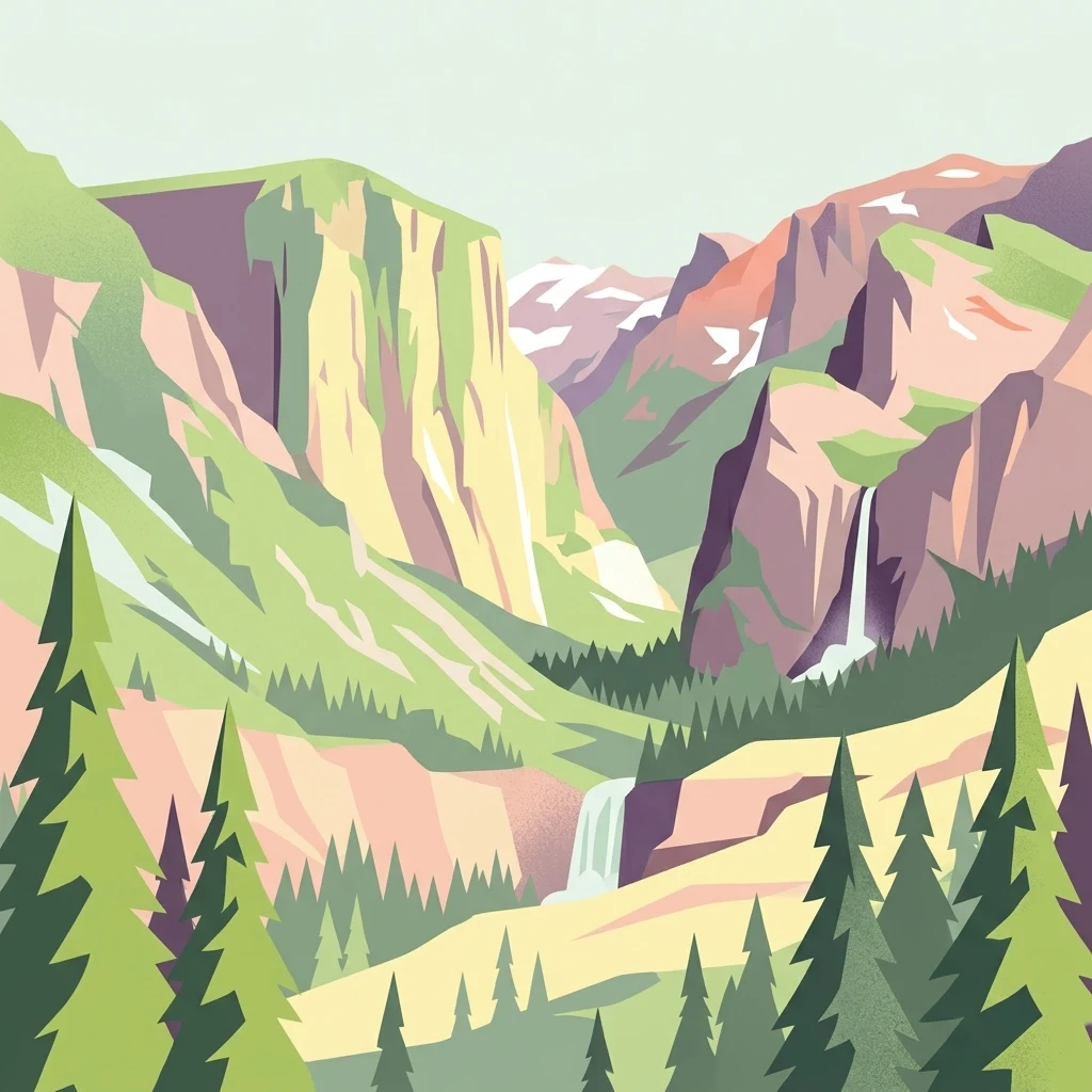
A flat vector-style illustration of a deep mountain valley with steep cliffs, two visible waterfalls, and coniferous trees in the foreground.

Naturschutzgebiet Gauligletscher

Nature reserve

Park overview

Structured park overview, official facts, and landscape profile for Gauligletscher Nature Reserve

Gauligletscher Nature Reserve park facts, protected area profile, and essential visitor context

Review the core facts for Gauligletscher Nature Reserve, including designation, size, terrain, visitor scale, habitats, and operating context in one park-focused overview.

About Gauligletscher Nature Reserve

The Gauligletscher Nature Reserve sits in the southeastern Bernese Oberland, in the southernmost side valley of Innertkirchen. Its setting is one of the most remote and geologically expressive landscapes in the canton of Bern, defined by a deep, U-shaped glacial amphitheater surrounded by jagged peaks of the northern Aarmassiv. The valley opens toward the hamlet of Innertkirchen along the upper reaches of the Ürbachwasser, whose course, falls, and pools structure the lower portion of the reserve.

Geologically, the protected area lies within a varied zone at the northern edge of the Aarmassiv, where ancient basement rocks were uplifted and folded during the Alpine orogeny. The dominant bedrock beneath the reserve is gneiss belonging to the Ferden-Guttannen zone, a roughly two-kilometer-wide band running southwest to northeast through the valley. The southern ridge belongs mostly to the Central Aare Granite, while gneiss and schist of the Sustenhorn zone appear in the Hindertelltihorn group, and gneisses of the Erstfeld zone form the peaks northwest of the Gauligletscher. Materials from all of these units now lie scattered through the foreland as talus, moraines, and river sediments.

The defining feature of the reserve is its status as one of Switzerland's most significant glacier forelands. Around 1900 the Gauligletscher's tongue extended far down the valley and, together with tributary glaciers from the south, covered nearly the entire area that is now protected. Over the course of the 20th century the ice thinned, fragmented, and retreated high onto the flanks, exposing a landscape where every step reveals another stage of glacial retreat. The Gaulisee, at about 2140 m elevation, formed in a basin hollowed by the glacier and has since become a glacier-marginal lake no longer reached by ice. Below the reserve, the Ürbachwasser is impounded by the Mattenalpsee, an artificial reservoir built and operated by the Kraftwerke Oberhasli (KWO) since the 1950s; the protected boundary was deliberately drawn outside the reservoir's shoreline so hydroelectric operations remain unaffected.

The reserve's terrain is rich in glacial morphology: lateral moraines flank the former Gauligletscher tongue, an impressive medial moraine marks where the Grünbergligletscher and Hubelgletscher once met, and rock ribs and roches moutonnées divide the valley floor between Mattenalpsee and Gaulisee into a network of channels, pools, and small waterfalls. Tributary streams such as the Chammlibach flow in from the northwest, and steep talus cones descend from the surrounding walls. The dramatic combination of still-active glacier retreat, freshly exposed moraines, and a young alpine river system makes the Gauligletscher reserve a defining example of Switzerland's dynamic high-alpine protected landscapes.

Quick facts and research context for Gauligletscher Nature Reserve

The Gauligletscher Nature Reserve covers about 570 hectares in the canton of Bern, Switzerland, within the upper Urbachtal south of Innertkirchen. Elevation within the protected zone ranges roughly from 1880 m to 2850 m above sea level. The reserve is catalogued in the Federal Inventory of Floodplains of National Importance and is registered in the World Database on Protected Areas under WDPA ID 347591 (IUCN Category IV). It belongs to the Landschaftsschutzgebiet Innertkirchen, alongside the Sandey floodplain, the Träjen raised bog, and the Sandey dry meadows.

Protection and recognition

Explore the documented terrestrial protection scope and baseline administration metrics.

Naturschutzgebiet Gauligletscher Protection Status and Conservation Data

Naturschutzgebiet Gauligletscher maintains a documented terrestrial protection status within the global protected area registry framework. Official records compile administrative boundaries, conservation scopes, and baseline recognition data without international designations.

Protection details

Protection scope
Terrestrial
Transboundary protection
No
WDPA ID
347591
Park context

Deeper park guide and search-rich context for Gauligletscher Nature Reserve

Gauligletscher Nature Reserve history, landscape, wildlife, and travel context

Explore Gauligletscher Nature Reserve through its history, landscape character, ecosystems, wildlife, conservation priorities, cultural context, and seasonal travel timing in a structured park guide built for atlas discovery and search intent.

Why Gauligletscher Nature Reserve stands out

The reserve is best known for being a protected glacier foreland, an area still shaped by recently retreating ice, glacier-margin lakes, and active river dynamics. The Gauligletscher itself, with a surface of roughly 10 square kilometers, is the dominant ice body that has sculpted the surrounding valley, while the smaller Grünbergligletscher, Hubelgletscher, and Hiendertelltigletscher once flowed into it. Their combined retreat has exposed a wide amphitheater of moraines, rock ribs, roches moutonnées, and water channels that define the area's distinct high-alpine character. The site is also notable for illustrating how alpine floodplain ecosystems emerge directly from deglaciation. As ice has pulled back over the 20th and early 21st centuries, pioneer plants, lichens, dwarf shrubs, and gradually richer alpine vegetation have colonized the newly exposed ground around the Gaulisee and along the Ürbachwasser river. This makes the reserve a textbook example of a glacier-derived floodplain system still in active formation.
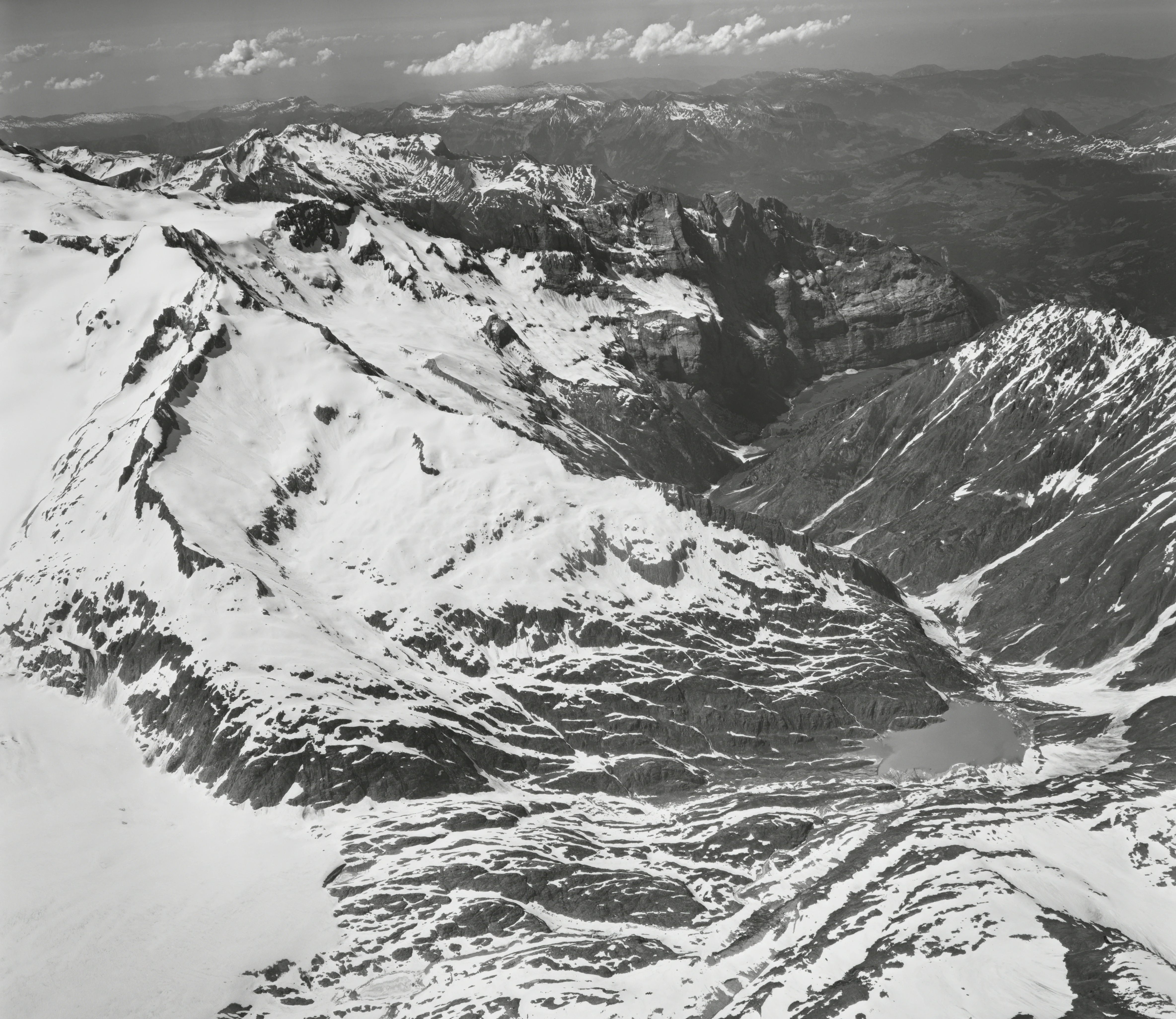
A black and white aerial photograph showing the Gauligletscher glacier flowing into the Urbachtal valley, surrounded by jagged snow-covered mountains.
Aerial view of the Urbachtal valley, Gauligletscher glacier, and surrounding peaks in the Bernese Oberland.

Gauligletscher Nature Reserve history and protected-area timeline

The Gauligletscher Nature Reserve was formally established in 2001 under the Swiss federal regulation Verordnung über den Schutz der Auengebiete von nationaler Bedeutung, the ordinance governing the protection of floodplains of national significance. With this designation, the area became part of the Federal Inventory of Floodplains of National Importance and was simultaneously recorded in the World Database on Protected Areas with the identifier 347591 classified as IUCN Category IV.

The reserve's history is inseparable from the dramatic retreat of the local glaciers. Around 1900, the Gauligletscher and its tributary glaciers, the Grünbergligletscher, Hubelgletscher, and Hiendertelltigletscher, still filled the entire southern Urbachtal and flowed together as a single ice stream. Their progressive melting throughout the 20th century gradually unveiled the valley that the reserve now protects, with parts of the protected zone still under ice when the designation was made in 2001. By the early 2020s, the ice margin had retreated so far upslope that entirely new periglacial terrain lay beyond the original boundary.

The reserve also overlaps with a broader cultural history: it sits within the Landschaftsschutzgebiet Innertkirchen and shares its protection framework with the Sandey floodplain, the Träjen mire, and the Sandey dry meadows. A monument near the Chammligrat commemorates the 1946 plane crash on the Gauligletscher, reminding visitors that this remote landscape has long been a stage for both natural and human events. Just outside the protected boundary stands the Gaulihütte of the Swiss Alpine Club, marking the area's long tradition of alpine exploration.

Gauligletscher Nature Reserve landscape and geographic character

The Gauligletscher reserve is shaped by an exceptionally well-preserved glacial amphitheater in the upper Urbachtal. The valley is enclosed by a near-continuous wall of peaks: the Ränfenhorn, Hangendgletscherhorn, and Tälligrat define the northern rim; the Bärglistock and Ewigschneehorn close the west; the chain of Hubelhorn, Hienderstock, and Bächlistock rises to the south; and the Grosser Diamantstock, Hindertelltihorn, and Golegghorn form the southeastern crest. Below these ridges lies a wide U-shaped basin whose floor is still visibly sculpted by ice.

Between the forested slopes and the glacier tongue, the valley floor presents a dense mosaic of glacial landforms. Rock ribs and rounded roches moutonnées create natural dams and pools, allowing the Ürbachwasser to tumble over small steps in a series of waterfalls. The Chammlibach descends from the northwest and feeds into the Mattenalpsee, while the meltwater stream of the Hindertelltigletscher has built a delta that nearly splits the Gaulisee in two. Impressive lateral moraines line the former course of the Gauligletscher, and a clearly visible medial moraine records the former junction of the Grünbergligletscher and Hubelgletscher.

The slopes themselves are marked by extensive talus and scree cones, composed of rockfall and moraine material derived from the surrounding gneiss, granite, and schist massifs. Because the glacier has only recently retreated from much of this basin, very little soil has accumulated, leaving a stark, mineral-dominated surface that is gradually being colonized by vegetation. The combination of narrow valley floor, vertical rock walls, and exposed high-alpine tundra gives the reserve its distinctive character.

Gauligletscher Nature Reserve ecosystems, habitats, and plant life

The natural environment of the Gauligletscher Nature Reserve is defined by the interaction between retreating ice and a young, developing ecosystem. Within the protected zone, the upper Ürbachwasser valley contains an exceptionally fresh glacier foreland whose vegetation succession is still in its earliest stages. Pioneer plants and lichens have already colonized some of the highest ridges of Chammliegg and Grienbärgli, which have been ice-free since the 19th century, while freshly exposed areas near the Gaulisee are still in the earliest phases of biological colonization.

The ecological mosaic of the reserve is unusually rich for such a high-alpine setting. Narrow valley floor terraces above the Mattenalpsee and along the upper slopes support established alpine flora, with dwarf shrubs spreading into many areas and shrubs forming denser stands on the warmer southern flank near the reservoir. Mountain streams periodically deposit sediment and plant material onto the alluvial plain through floods and debris flows, continually resetting parts of the floodplain ecosystem and renewing opportunities for colonization.

Because the landscape is so raw and exposed, large portions of the reserve function as a relatively undisturbed alpine habitat, with limited direct human pressure apart from seasonal sheep grazing on the higher grassy terraces. The reserve's combination of glacier, lake, alpine river, moraine, scree, and immature vegetation makes it a particularly valuable site for monitoring ecological processes in real time as the climate continues to alter the high Alps.

Gauligletscher Nature Reserve conservation status and protection priorities

The Gauligletscher Nature Reserve is significant in Switzerland's conservation system because it safeguards one of the largest and most intact glacier foreland floodplains in the country. Through its 2001 inclusion in the Federal Inventory of Floodplains of National Importance, the area received binding protection under the federal ordinance on floodplain conservation, ensuring that its dynamic geomorphological and ecological processes are preserved as a national natural heritage.

Its conservation value is closely tied to the ongoing retreat of the glaciers. The site captures an actively transforming alpine landscape: moraines, glacial lakes, meltwater channels, and young vegetation are all evolving together, providing a long-term reference site for studying climate-driven environmental change in high-mountain environments. The Federal Office for the Environment regularly publishes an object sheet for the Gauligletscher site that documents its status within the national floodplain inventory.

The reserve is also part of the broader Landschaftsschutzgebiet Innertkirchen, where it forms one component of a regional mosaic of protected habitats alongside the Sandey floodplain, the Träjen raised bog, and the Sandey dry meadows. Although hydroelectric infrastructure operated by the Kraftwerke Oberhasli is present at the Mattenalpsee below the reserve, the boundary was deliberately drawn so that hydroelectric use is not legally restricted by the nature reserve designation, illustrating how high-alpine conservation in Switzerland can be coordinated with energy production.

Gauligletscher Nature Reserve cultural meaning and human context

The Gauligletscher reserve lies within the upper Urbachtal, a remote and historically isolated part of the municipality of Innertkirchen in the Bernese Oberland. Like other side valleys of the Haslital, it has long been associated with alpine pasturing, glacier travel, and the regional identity of mountain communities whose livelihoods were tied to alpine summer grazing and high-mountain paths. Seasonal sheep grazing continues on the upper grassy terraces of the reserve, linking the protected landscape to older patterns of land use.

The valley also has a place in the history of Swiss alpinism and aviation. The Swiss Alpine Club's Gaulihütte, located just outside the reserve near the Chammlibach, has served mountaineers and hikers exploring the surrounding peaks and glaciers for many decades, anchoring the area within the cultural geography of Swiss alpine huts. A monument near the Chammligrat commemorates the 1946 Gauligletscher aircraft accident, marking the site as a location where dramatic human events briefly intersected with the otherwise quiet high-alpine landscape.

Top sights and standout views in Gauligletscher Nature Reserve

The Gauligletscher Nature Reserve's key qualities lie in the unusual freshness of its glacial landforms and the speed at which its alpine ecosystem is still being formed. The Gauligletscher itself remains the dominant ice mass shaping the basin, while the older traces of its former tributary glaciers are preserved as lateral and medial moraines, rock ridges, and meltwater lakes. The Gaulisee, perched high in the valley at about 2140 m, is a textbook example of a glacier-formed lake that continues to evolve.

Equally important is the reserve's role as a living record of climate change in the Swiss Alps: its perimeter, drawn when some areas were still ice-covered in 2001, is already being outpaced by the ongoing retreat of the glaciers. Its position within the Federal Inventory of Floodplains of National Importance and the Landschaftsschutzgebiet Innertkirchen elevates its profile as part of a coherent regional system of high-alpine habitat protection.

Best time to visit Gauligletscher Nature Reserve

The Gauligletscher Nature Reserve is most accessible in the alpine summer season, when the snowline is high and the upper valley is largely free of winter snow. Mid to late summer is typically the period when the full expression of the glacier foreland and the alpine flora is visible, and when the hiking routes connecting Innertkirchen, the Gaulihütte, and the surrounding passes are most safely traversable. The early autumn months can also bring clearer visibility, though seasonal snowfall may begin to close higher trails earlier in this high-altitude setting.

Monthly climate preview

Long-term temperature ranges and monthly precipitation patterns recorded at baseline elevation

Naturschutzgebiet Gauligletscher Climate Normals and Annual Weather Rhythm

Representative coordinate records show an annual temperature range spanning severe sub-zero winter lows to moderate summer maximums alongside varying monthly precipitation rates. Detailed monthly climate normals provide a complete breakdown of long-term averages for analyzing specific seasonal shifts across the protected terrain.
Annual mean2 °C
-8 °C12 °C
Jan-8°
Feb-8°
Mar-4°
Apr
May
Jun10°
Jul12°
Aug12°
Sep
Oct
Nov-3°
Dec-7°
Warmest month
July

11.8 °C

Coolest month
January

-8 °C

Wettest month
June

5 mm/day

Driest month
February

2.5 mm/day

Park location guide

Geography guide, regional context, and park location map for Gauligletscher Nature Reserve

Gauligletscher Nature Reserve park geography, regions, and map view in Switzerland

Understand where Gauligletscher Nature Reserve sits in Switzerland through a broader geographic reading of the surrounding landscape, nearby location context, and its mapped position within the national park landscape.

How Gauligletscher Nature Reserve fits into Switzerland

Switzerland is a landlocked federal republic in Central Europe comprising 26 cantons, with Bern as the federal city and Zurich as the largest city. The country features the Swiss Alps, Swiss Plateau, and Jura Mountains, with German, French, Italian, and Romansh as official languages. It is noted for its political neutrality, direct democracy traditions, and strong economy.

Wider geography shaping Gauligletscher Nature Reserve in Switzerland

Switzerland is located in Central Europe at the intersection of Western and Southern Europe. It is bordered by Germany to the north, France to the west, Austria and Liechtenstein to the east, and Italy to the south. The country is geographically divided among the Swiss Alps (covering most of the territory), the Swiss Plateau (where most of the population resides), and the Jura Mountains. Switzerland is landlocked.

Map view of Gauligletscher Nature Reserve

Use this park location map to pinpoint Gauligletscher Nature Reserve in Switzerland, understand its exact geographic position, and read its mapped placement within the surrounding landscape more clearly.

Pigeon | © OpenStreetMap contributors

Location context for Gauligletscher Nature Reserve

Bern

Visualizing glacier forelands, moraines, and protected valley habitats

Naturschutzgebiet Gauligletscher Photos and High Alpine Landscapes

Visual documentation captures the stark mineral terrain, retreating ice masses, and evolving glacial lakes of Naturschutzgebiet Gauligletscher. Detailed photography reveals the rugged topography and active ecological succession shaping this protected alpine environment.

A black and white aerial photograph showing the Gauligletscher glacier flowing into the Urbachtal valley, surrounded by jagged snow-covered mountains.

Park atlas

Compare surrounding high-alpine terrain, glacier forelands, and regional reserves

Other Parks and Protected Areas Near Naturschutzgebiet Gauligletscher

Browse nearby national parks and protected landscapes situated close to Naturschutzgebiet Gauligletscher in the eastern Bernese Oberland. Comparing these adjacent glacial basins provides deeper geographic context into regional alpine topography and evolving floodplain habitats.
Watercolor painting of soft, rolling alpine terrain, green vegetation, and distant purple-toned mountains under a pale sky.
Nature reserveBern
About 11 km away#1 closest

Southeast

Naturschutzgebiet Mederlouwenen: Alpine Moor and Protected Glacial Terrain in the Bernese Oberland

A high-elevation nature reserve featuring rare flat-moor vegetation and peat-forming bogs.

Naturschutzgebiet Mederlouwenen occupies a distinctive series of glacial granite terraces in the Bernese Oberland, where high-altitude slope bogs and relict conifer forests create a vital refuge for rare alpine flora. This protected area stands as a primary example of Swiss mountain ecology, blending ancient geological history with the fragile, moisture-dependent ecosystems found at the head of the Aare valley.

Area
0.053 km²
Established
2004
IUCN
IV
Relief
Mountain
A soft watercolor painting of a panoramic landscape featuring a marshy fen area in the foreground with distant mountain ranges in the background, rendered in pastel greens, purples, and yellows.
Nature reserveBern
About 13 km away#2 closest

East

Chessibidmer Nature Reserve: Glacial Granite and Protected Alpine Moorland Landscapes

Protected alpine bog and granite terrace in the Bernese Oberland

Chessibidmer offers a detailed look at a nationally significant flat bog and moorland landscape situated above the upper Aare valley in the Bernese Oberland. The area provides an exceptional map of glacial geomorphology, featuring granite domes, rock-bound tarns, and successional peatlands that sit as a protected mosaic within the surrounding high-alpine terrain of the Swiss Alps.

Area
0.5 km²
Established
1998
IUCN
IV
Relief
Mountain
Watercolor painting of a green landscape with rolling hills, meadows, and a water body in the foreground against a light background.
Protected areaSwitzerland
About 16 km away#3 closest

East

Rhonegletschervorfeld Protected Area: Alpine Glacier Geography and Mapping

Proglacial landscape and glacial history in the Swiss Alps.

The Rhonegletschervorfeld provides an unparalleled view into the geomorphology of the Swiss Alps, showcasing a continuous record of ice loss through moraines, exposed bedrock, and emerging meltwater systems. Situated near the Furka Pass, this protected area serves as an essential reference for glaciology, offering a clear visual timeline of glacier retreat that has shaped modern alpine tourism and climate science. Explore the mapped terrain where the Rhone River headwaters emerge from the retreating ice.

Area
13.58 km²
Relief
Mountain
Climate
Alpine
Access
Easy access
A soft watercolor painting of rolling hills and distant mountains in light green and muted tones.
Biosphere reserveLucerne
About 22 km away#4 closest

Northwest

Entlebuch Biosphere Reserve: Mapped Protected Landscapes in the Canton of Lucerne

Exploring karst formations and alpine wetland ecosystems

Entlebuch stands as a pioneering example of community-driven conservation in the Swiss Alps. This protected landscape encompasses extensive peatlands, forested slopes, and the iconic Schrattenfluh karst massif. Use this geographic entry to understand the regional topography and the spatial distribution of protected habitats throughout this central Swiss valley.

Area
397 km²
Established
2001
Relief
Mountain
Climate
Alpine
Nature reserveKanton Luzern
About 24 km away#5 closest

Northwest

Naturschutzgebiet Laubersmad - Salwidili: Exploring a Vast Swiss Moorland and Alpine Reserve

A critical moorland complex in the heart of Kanton Luzern

Spanning over 1,300 hectares, this protected nature reserve in Kanton Luzern constitutes the largest contiguous moorland landscape in Switzerland. The area is defined by a unique geological flysch trough that supports a rich diversity of peatland types, including raised bogs and fens, alongside spruce forest and alpine pasture. As an IUCN Category IV area, it provides essential habitat for endangered mire flora and high-altitude wildlife in a remarkably intact hydrological setting.

Area
13.76 km²
IUCN
IV
Relief
Mountain
Scope
Terrestrial
A watercolor illustration of a soft, rolling alpine landscape with a winding path and distant mountain peaks against a pale yellow sky.
Regional parkValais
About 27 km away#6 closest

South

Landschaftspark Binntal: Alpine Geography and Regional Protected Area in Valais, Switzerland

Mapping deep mountain valleys and glacial alpine terrain

Landschaftspark Binntal serves as a vital protected area in the Valais Alps, showcasing a vertical sequence of ecosystems from river gorges to 3000 meter peaks. The park preserves a living cultural landscape alongside significant mineralogical heritage, offering a detailed view into the high-altitude geography and remote valleys that define this distinctive corner of the Swiss mountain landscape.

Area
180 km²
Established
2008
Relief
Mountain
Climate
Alpine
A watercolor painting of a panoramic mountain landscape featuring a foreground of green trees and distant purple mountain ridges under a soft light.
Nature reserveValais
About 28 km away#7 closest

Southwest

Aletschwald Nature Reserve: Geographic Insights and Protected Alpine Landscape Context

An ancient high-elevation forest ecosystem in the Swiss Valais.

Situated between 1,600 and 2,200 meters, Aletschwald represents one of the few remaining managed-free subalpine forests in the Alps. The reserve maps the interaction between glacial retreat and forest advancement, featuring a dense mosaic of Arolla pines, larch, and pioneer mosses across diverse lateral moraine formations.

Area
4 km²
Established
1933
Relief
Mountain
Climate
Alpine
A watercolor painting showing a panoramic view of layered rolling hills and mountains in purple, green, and yellow hues against a white background.
Protected landscapeSwitzerland
About 51 km away#8 closest

West

Diemtigtal: Protected Alpine Landscape in the Bernese Oberland, Switzerland

Mapped valley geography and mountain terrain context

Explore the structured geography of Diemtigtal, a regional nature park in the Bernese Oberland. This valley landscape is defined by its enclosed U-shaped topography, the Niesenkette skyline, and a network of traditional settlements nested between mountain ridges and alpine streams. Gain insight into the protected boundaries and the distinctive terrain of this Swiss Alpine region.

Established
2009
Relief
Mountain
Climate
Alpine
Scope
Terrestrial

Common questions about visiting, size, designation, and location context for Gauligletscher Nature Reserve

Gauligletscher Nature Reserve FAQs for park facts, access, geography, and protected area context

Find quick answers about Gauligletscher Nature Reserve, including protected-area facts, park geography, trail and visitor context, and how the park fits into its surrounding country and regional landscape.
MoriAtlas Explorer

Continue Your Protected Areas Search Across the Global Atlas

Deepen your exploration by continuing the structured search for national parks and protected areas worldwide. Utilize the comprehensive filtering capabilities to compare different conservation landscapes and refine your understanding of global park geography. Discover more about the distribution and characteristics of protected natural areas.

Global natural geography