
Why Chessibidmer stands out
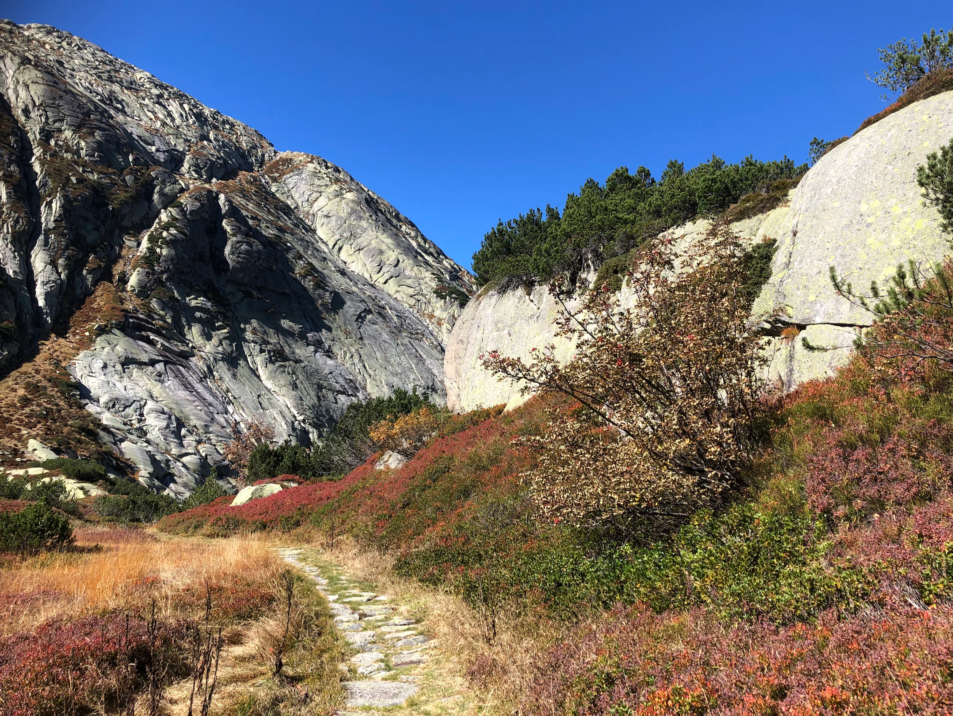
Chessibidmer is best known for combining a nationally protected species-rich alpine flat bog with a strongly glacially sculpted granite landscape. The site stands out for the way in which small bog pools, peat-forming hollows, and successional wetland nestle among roches moutonnées, erratics, and rock basins formed by the ancient Aare glacier. Visitors and researchers value the terrace for its rich alpine vegetation on nutrient-poor silicate rock and peat substrates, for the visible glacial polish on the granite, and for the contrast between the deeply incised Aare gorge at Spittellamm and the open, hummocky moorland plateau above it. It is also a key component of the broader Grimsel protected area complex, tying together cantonal, national flat-bog, and moorland landscape designations.
Chessibidmer history and protected-area timeline
The Grimsel region has been recognized for its natural heritage for nearly a century. Following decisions of the Cantonal Government of Bern on 24 April 1934, 6 June 1950, and 1 August 1958, the broader Grimsel landscape became a cantonal nature reserve, establishing the institutional framework within which Chessibidmer would later be protected at the national level.
In 1998, the bog area of Chessibidmer was formally entered into the federal inventory of flat bogs of national importance, giving it formal protection under Swiss national bog legislation. In 2004, the Swiss Federal Council integrated the broader area, including Chessibidmer and the Mederlouwenen nature reserve on Lake Grimsel, into the federal inventory of moor landscapes of particular beauty and of national importance under the designation Moorlandschaft Grimsel (Sunnig Aar). A cantonal forest reserve in the Grimsel area was also designated on the northwestern slope above Chessibidmer, reinforcing the site's overall protection.
Earlier scientific interest in the area dates to the early twentieth century, with Eduard Frey's 1921 study of the vegetation of the Grimsel area in relation to the planned reservoir expansion, and Emil Hess's 1919 plant-geographical observations from the upper Aare valley, both of which contributed to the understanding of the alpine and silicate-rough vegetation patterns that underpin the present-day protection.
Chessibidmer landscape and geographic character
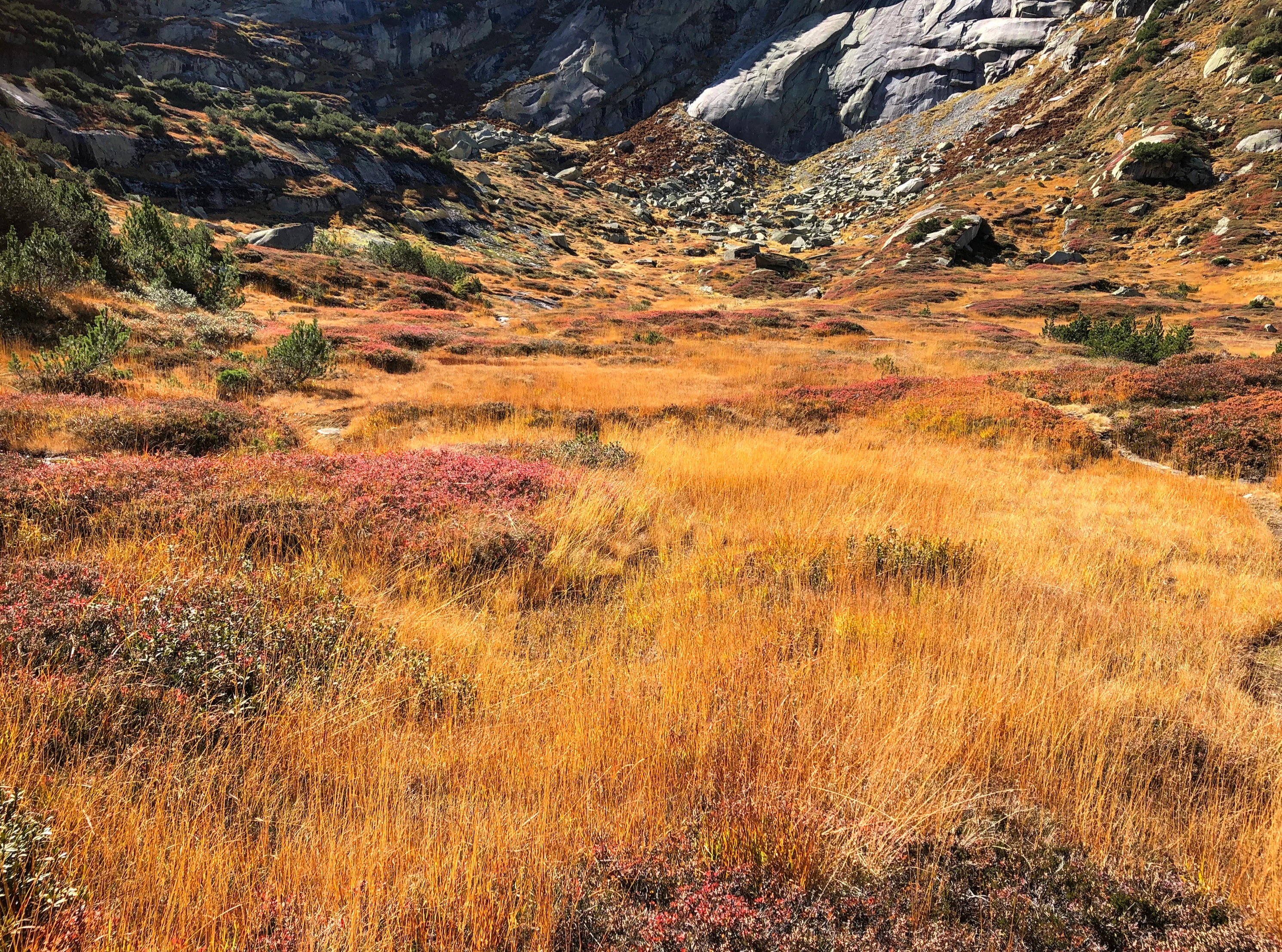
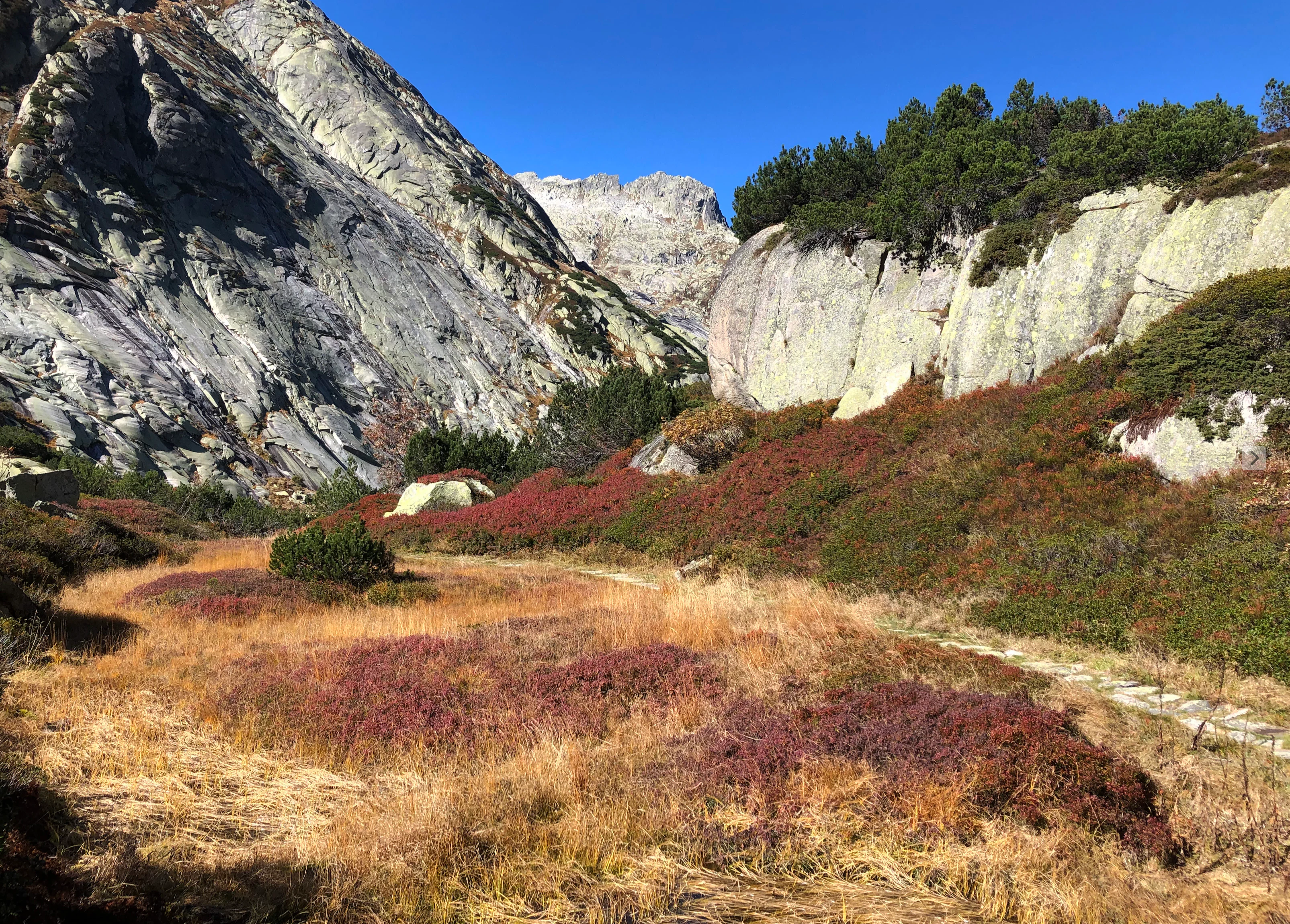
Chessibidmer occupies a roughly fifty-hectare terrace immediately east of the Juchlistock (2594 m), with the steep rock face of the Juchlihubel rising in the southwest. The terrain is built up from the Grimsel granodiorite, with only the small hill north of the protected area belonging to the central Aare granite. The terrace is dissected by rock bands, escarpments, small valleys, and the characteristic rounded whaleback forms of roches moutonnées, producing a complex topography within a relatively small area.
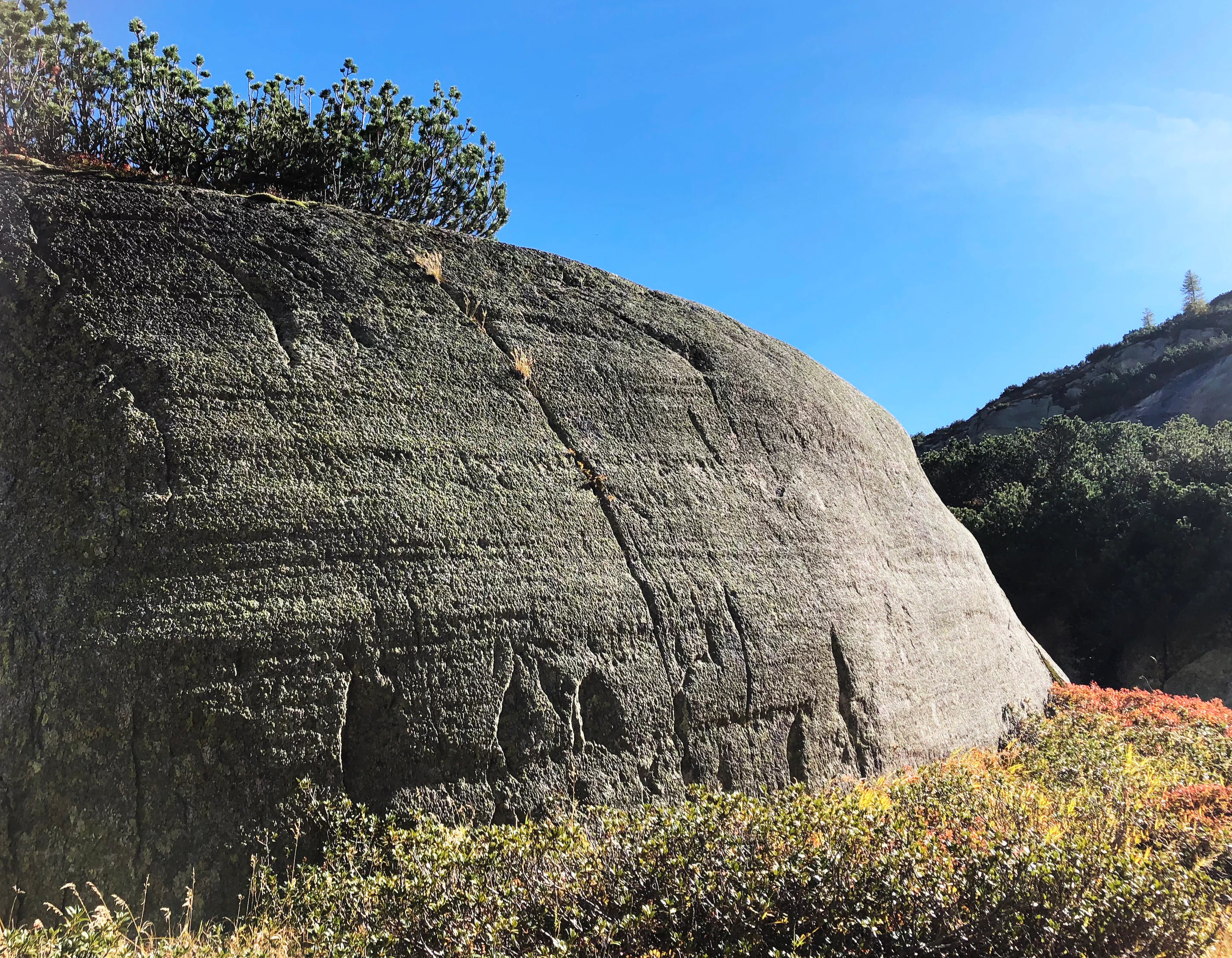
Geologically, the dominant features were carved by the powerful Aare glacier of the ice ages, which at its peak buried the landscape under some 700 meters of ice and incorporated flow from a side branch of the Rhone glacier via the present-day Grimsel Pass. The glacier polished the granite surfaces and left visible glacial striations on the outcropping rock. It failed to quarry away the rock barrier between the Juchlistock and the Gärstenhörner (2831 m), so the Juchlihubel and the isolated Spittelnollen hill (1980 m) survived as prominent landmarks, while the Aare was forced to cut the dramatic Spittellamm gorge and the narrow Summerloch on the eastern flank. Scattered erratics and lateral moraines line the edges of the area, with many of the small mountain lakes and tarns sitting in the depressions between granite domes.
The two main flat sections in the middle and northern parts of the terrace form the open stage on which the bog, bog pools, transitional marsh, and shallow upland waters have developed. From the western edge the land rises toward the Juchlihubel; to the east the Spittellamm gorge and the broader valley of the upper Aare define the boundary, while the lakes of the Kraftwerke Oberhasli hydroelectric system, including the Grimselsee and the Räterichsbodensee, frame the wider setting about sixty meters below the moorland level.
Chessibidmer ecosystems, habitats, and plant life
Chessibidmer is defined ecologically by the combination of a nutrient-poor silicate rock environment with a small but richly developed wetland system. The terrace supports classic alpine vegetation on acidic granitic substrates, alongside peatland and transitional wetland communities that have developed in the flatter, water-retaining hollows between the granite outcrops. This juxtaposition of dry rocky habitats, wet peatlands, and small open-water tarns on a single compact terrace is the core of the site's ecological identity.
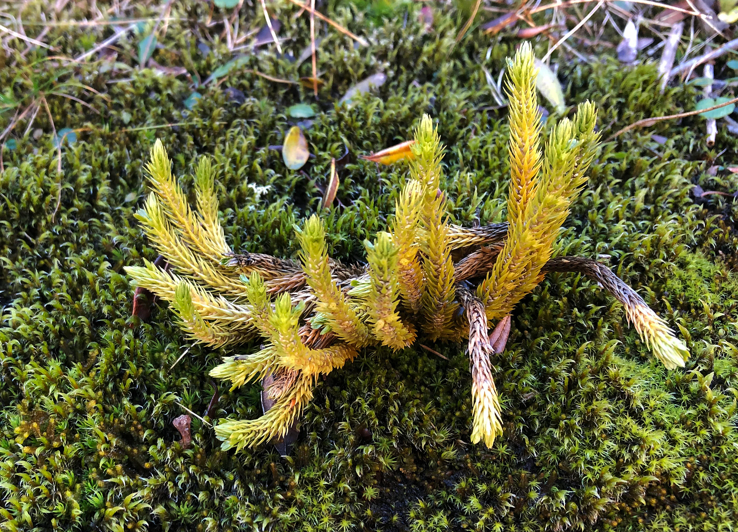
The vegetation is influenced strongly by underlying bedrock chemistry. The Grimsel granodiorite and the central Aare granite weather into acidic, base-poor soils that favor a distinctive flora typical of alpine silicate environments. Early twentieth-century studies by Eduard Frey and Emil Hess already documented this specialization, and the site continues to be valued for its species-rich alpine plant communities, including rare and sensitive bog species such as the marsh clubmoss (Lycopodiella inundata). The mosaic of bog, bog pools, successional wetland, mountain tarns, dry rock vegetation, and subalpine grassland gives the seven-hectare core area a disproportionately high ecological richness relative to its size.
The wider landscape within which Chessibidmer sits, the Moorlandschaft Grimsel (Sunnig Aar), is recognized as a nationally important moor landscape of particular beauty, indicating that the ecological value of the Chessibidmer terrace is not only in its species lists but also in the broader pattern of habitats, water features, and open moorland scenery that it contributes to the Grimsel landscape as a whole.
Chessibidmer wildlife and species highlights
The source material places strong emphasis on the botanical, hydrological, and geological character of Chessibidmer rather than on its vertebrate fauna. The rare and sensitive marsh clubmoss (Lycopodiella inundata) is explicitly noted as occurring in the area, alongside the broader spectrum of bog, peatland, and nutrient-poor silicate alpine plant communities that have been the subject of scientific study since the early twentieth century.
The small upland tarns and bog pools between the roches moutonnées and the peat-forming hollows provide breeding and feeding habitat for typical alpine moorland invertebrates and amphibians that depend on these open, cold, slightly acidic waters. The wider landscape mosaic of dry rock vegetation, mossy bog surfaces, transitional marsh, and small open water also offers feeding and shelter conditions for the bird communities typical of the upper Aare valley and the surrounding Bernese High Alps, even though specific bird inventories are not detailed in the available sources. There is no wish to invent species lists here; rather, the wildlife significance of Chessibidmer lies in the persistence of an unusually complete small-scale alpine wetland and moorland habitat complex within a heavily glaciated and historically utilized alpine valley.
Chessibidmer conservation status and protection priorities
Chessibidmer is protected primarily under Swiss national bog legislation and within a layered system of federal and cantonal nature and landscape inventories. The seven-hectare core area has been a federally registered flat bog of national importance since 1998 and carries the federal object sheet number BE2638. The broader landscape of approximately fifty hectares has been part of the cantonal Grimsel nature reserve since the mid-twentieth century, and in 2004 was incorporated into the federal inventory of moor landscapes of particular beauty and of national importance as part of the Moorlandschaft Grimsel (Sunnig Aar).
In addition, Chessibidmer falls within the federally designated landscape protection area of the Bernese High Alps and the Aletsch-Bietschhorn region (northern part), which is part of the federal inventory of landscapes and natural monuments of national importance (BLN). A cantonal forest reserve has also been designated on the northwestern slope above the area, extending the protected status to the forested mountain slope around the moorland. The site is registered internationally in the World Database on Protected Areas under object number 168925.
The conservation significance of Chessibidmer is layered. The bog itself, with its species-rich peatland and bog pool complexes on an acidic silicate substrate, is a representative example of an alpine flat bog of national importance. Beyond the technical protection of the bog habitat, the area contributes a structurally important section to the larger Moorlandschaft Grimsel, an inventory entry that specifically recognizes the combined ecological and scenic value of Swiss moorland landscapes. The site's overlap with major hydroelectric and historic military infrastructure, including the Kraftwerke Oberhasli installations, the Räterichsbodensee, and the Artilleriewerk Grimsel, also makes it a notable case study in conserving high-value wetland and moorland within a working alpine infrastructure landscape.
Chessibidmer cultural meaning and human context
The name Chessibidmer itself reflects the cultural and linguistic layering of the Swiss alpine landscape. The element Bidmer is the plural of Bidem, a dialectal form derived from Boden and used to describe a small flat place or depression in the terrain; similar names are widespread across the Bernese, Valais, Grisons, and St. Gallen alpine regions. The prefix Chessi relates to the high-German term Kessel, denoting a felsige Geländevertiefung, a rocky depression, which here references the deep water-filled hollows between the rock ribs of the terrace.
The area also carries a strong history of human use for travel and infrastructure. The old Saumpfad packhorse trail from the Räterichsboden to the Grimsel hospice once passed along the eastern side of the area, crossing above the Spittellamm gorge. In the 1890s the Canton of Bern built a new driving road from Innertkirchen to the cantonal border along the opposite side of the valley, and the original trail remained in use as a walking escape from road traffic. In the 1960s the flooding of the Räterichsbodensee interrupted the traditional route, leading the canton to construct the current footpath that crosses the moorland landscape of Chessibidmer, today forming part of the long-distance hiking route over the Grimsel.
The site also includes twentieth-century military heritage. During the Second World War, the Swiss Army built the Artilleriewerk Grimsel, a fortress with underground galleries and external support positions, including the Infantry Bunker Chessibidmer on a hill south-east of the moorland, linked to the road by the Artilleriewerk bridge across the Aare and reached via a funicular railway. Even after the war, the cantonal protection ordinance of 1958 explicitly allowed shooting and blasting exercises in the Chessibidmer area, a practice that only ceased once the later national moor protection measures came into force, illustrating the layered coexistence of conservation, hydroelectric development, and historical military use that characterizes this stretch of the upper Aare valley.
Top sights and standout views in Chessibidmer
The standout feature of Chessibidmer is the tight integration of a nationally protected species-rich flat bog with a glacially sculpted alpine granite landscape, packed into a terrace of just a few dozen hectares above the upper Aare. Within walking distance of the Grimsel Pass, it offers a clear geological record of the Aare glacier in the form of roches moutonnées, glacial striations, erratics, and small upland tarns, alongside peatland, bog pools, and transitional wetland habitats typical of the Swiss federal flat-bog inventory.
The site forms a key structural segment of the broader Moorlandschaft Grimsel (Sunnig Aar) inventory, links the cantonal Grimsel nature reserve with the national flat-bog inventory, and contributes to the Bernese High Alps and Aletsch-Bietschhorn federal landscape protection area. The moorland lies just above one of Switzerland's most iconic reservoir staircases, with the Grimselsee, the Räterichsbodensee, and the Kraftwerke Oberhasli infrastructure, and it is crossed by the modern section of the long-distance hiking route over the Grimsel that was rerouted here after the filling of the Räterichsbodensee in the 1960s.
Best time to visit Chessibidmer
Chessibidmer sits at around 1800 meters in the upper Aare valley within the eastern Bernese Oberland, an environment where the alpine calendar strongly shapes the visitor experience. A practical time to experience the area lies in the late spring through early autumn, when the higher valley trails are normally snow-free and the bog, bog pools, and subalpine vegetation become accessible along the long-distance footpath that crosses the moorland.
During the warmer months the contrast between the glacially polished granite domes and the green, flowering bog vegetation is most visible. In winter the area lies under deep snow at this elevation, and access is generally limited to experienced winter hikers; the bog itself becomes a quiet, frozen wetland within an otherwise snow-covered terrace. Visitors interested in the bog botany will generally find the most expressive displays of plant life in early to mid-summer, when the peatland and marsh clubmoss communities are most active.