
Mori Atlas logo
Nature reserveNaturschutzgebiet Mederlouwenen

A rare mosaic of protected peat-forming bogs, wet meadows, and relict stone pine forests above Lake Grimsel.

Naturschutzgebiet Mederlouwenen: High Alpine Nature Reserve and Glacial Landscape in the Bernese Oberland

Naturschutzgebiet Mederlouwenen sits on sun-warmed granite terraces above the Aare valley, preserving an exceptionally undisturbed alpine flat-moor environment shaped by ancient glaciation. As a vital conservation site in the Bernese Oberland, the reserve protects a complex interplay of Sphagnum-rich bog communities, dwarf-shrub heaths, and insectivorous plant life. This high-mountain landscape offers deep insight into the ecological heritage of the Swiss Alps, framing a unique collection of geological features and sensitive botanical habitats within a significant regional watershed.

flat-mooralpine bogpeatlandSphagnumglacial landscapehigh mountains
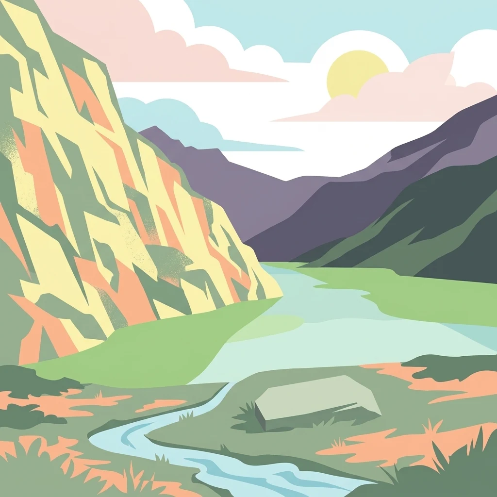
A flat-style vector illustration depicting a mountain valley with steep slopes, a central river, and a light sun behind clouds.

Naturschutzgebiet Mederlouwenen

Nature reserve

Park overview

Structured park overview, official facts, and landscape profile for Mederlouwenen Nature Reserve

Mederlouwenen Nature Reserve park facts, protected area profile, and essential visitor context

Review the core facts for Mederlouwenen Nature Reserve, including designation, size, terrain, visitor scale, habitats, and operating context in one park-focused overview.

About Mederlouwenen Nature Reserve

The Mederlouwenen Nature Reserve is a nationally protected flat-moor in the Swiss Bernese Oberland, occupying a narrow band of terraces above the northern shore of Lake Grimsel in the municipality of Guttannen. Although the reserve itself is small, the terrain it conserves encapsulates the geological and ecological character of the headwaters of the Aare, which rise from glaciers and high-mountain streams just a short distance away.

The site lies within the UNESCO Swiss Alps Jungfrau-Aletsch World Heritage property and forms a key piece of the broader Grimsel protected landscape that includes the Sunnig Aar slope and the BLN-listed "Berner Hochalpen und Aletsch-Bietschhorn-Gebiet". Its terraces were sculpted by the ancient Aare glacier, which scoured the bedrock into rounded granite ridges, polished slabs, and small depressions, while leaving scattered erratic blocks and slope debris on the surface. Today, those glacially formed features frame remarkable bog and meadow communities that have remained largely undisturbed.

Ecologically, Mederlouwenen represents an unusually well-preserved example of a high-altitude flat-moor. Open meadows of flowering grasses sit alongside wetland zones of small and large sedges, raised Sphagnum hummocks, and wet flushes fed by springs. Around the open peatland, a mosaic of low shrubs, including alpine juniper, bilberry, alpenrose, and crowberry, frames the bog, while the lake-shore edge of the site is gradually being colonised by green alder and willow scrub. On the western margin, birches reach unusually high into the alpine zone, climbing to roughly 2030 metres.

To the east, the protected area flows into the larger "Meder" landscape and the "Sunnig Aar" slope, where an old-growth forest of Swiss stone pine and larch survives as a relic of a formerly more widespread high-alpine woodland. This forest once supplied timber for the Unteraar alp and the historic Grimsel hospice near the Spittellamm, and it is recognised in the Swiss moor landscape inventory as among the most beautiful stone-pine forests in the Bernese Oberland.

Quick facts and research context for Mederlouwenen Nature Reserve

Mederlouwenen lies in the canton of Bern in the Bernese Oberland, on the northern shore of the artificial Lake Grimsel, which is operated by the Kraftwerke Oberhasli (KWO) hydroelectric company. The reserve covers approximately 5.3 hectares of terraced terrain on the southern slope beneath the Brünberg, at the western edge of the Bächlistock group of the eastern Bernese Alps.

It is a federal flat-moor of national importance, listed in the Swiss Federal Inventory of Flat Moors and inscribed within the larger Grimsel moor landscape. The reserve also falls inside the UNESCO World Natural Heritage property Swiss Alps Jungfrau-Aletsch and the BLN federal landscape inventory area "Berner Hochalpen und Aletsch-Bietschhorn-Gebiet". The protected designation is rooted in the 1990s Swiss moor-protection framework developed after the Rothenthurm Initiative, and the site is registered in the World Database on Protected Areas under ID 168936 with an IUCN management category IV designation.

Protection and recognition

Documented terrestrial protection scope, designation year, and official records

Naturschutzgebiet Mederlouwenen Protection Status and Designation History

Terrestrial protection status for Naturschutzgebiet Mederlouwenen includes established records dating back to 1958. Official conservation data compiles management scope, historical designation timelines, and protected area parameters.

Protection details

Protection scope
Terrestrial
Designated year
1958
Transboundary protection
No
WDPA ID
168936
Park context

Deeper park guide and search-rich context for Mederlouwenen Nature Reserve

Mederlouwenen Nature Reserve history, landscape, wildlife, and travel context

Explore Mederlouwenen Nature Reserve through its history, landscape character, ecosystems, wildlife, conservation priorities, cultural context, and seasonal travel timing in a structured park guide built for atlas discovery and search intent.

Why Mederlouwenen Nature Reserve stands out

Mederlouwenen is best known for its exceptionally undisturbed alpine flat-moor vegetation, which has developed on glacially shaped granite terraces and slope bogs at around 1900 metres elevation. The reserve preserves a layered mosaic of sedge fens, dwarf-shrub heaths with alpine juniper, blueberry and alpenrose, and richly developed Sphagnum moss communities, including peat-forming cushions characteristic of high-alpine bog formation. Its rare botanical interest is heightened by the presence of the long-leaved sundew, an insectivorous plant that thrives in the nutrient-poor bog environment, and by the proximity of one of the finest stone pine woods in the Bernese Oberland. The combination of high-alpine moor, relict conifer forest, glacial landforms, and scenic position above Lake Grimsel gives the site a distinctive profile within Switzerland's network of nationally important flat-moors.
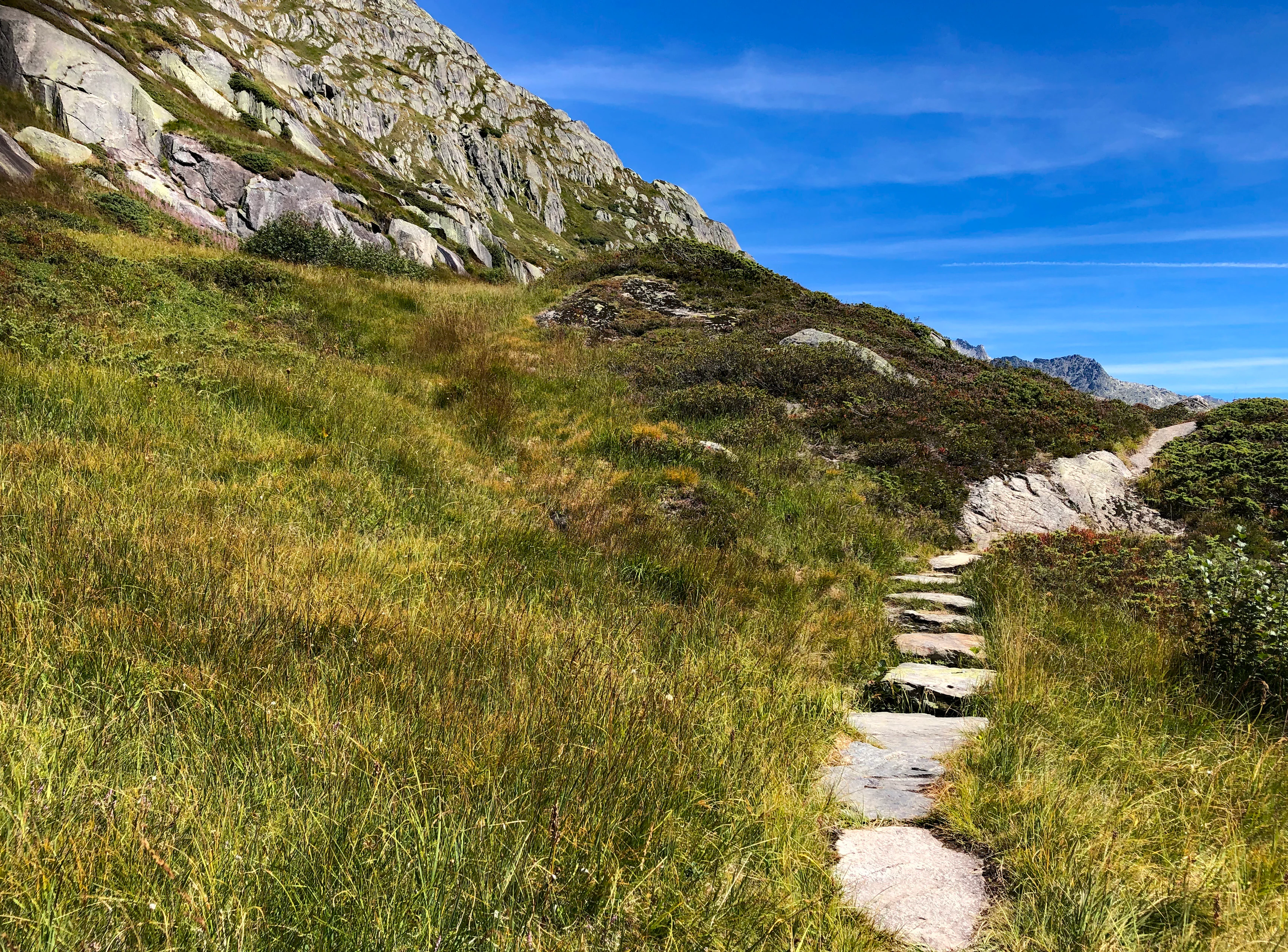
A narrow hiking trail composed of flat stone slabs winding through a lush green alpine meadow, set against a rocky mountain slope and a clear blue sky.
A stone-paved alpine hiking trail winding through the grassy, rocky slopes of the Mederlouwenen nature reserve.

Mederlouwenen Nature Reserve history and protected-area timeline

The broader Grimsel landscape has carried protected status since 1 August 1958, when the cantonal government of Bern declared the area around the KWO reservoirs a cantonal nature reserve. The smaller and more ecologically focused "Mederlouwenen" component gained national recognition considerably later, through a combination of legal, political, and ecological developments tied to the modernisation of Swiss moor protection.

A legal opinion by the constitutional scholar Alfred Kölz in 1995 provided the doctrinal foundation for including the moor landscape of "Sunnig Aar" within Switzerland's federal moor landscape inventory, which had been established under the framework of the Rothenthurm Initiative. In 1998, the federal government issued a protection order covering Mederlouwenen, but the formal designation was delayed by lengthy disputes over the environmental acceptability of successive hydroelectric expansion projects at Lake Grimsel, including the planned "Grimsel West" reservoir and later proposals to raise the existing dam.

In 2004, the Federal Council revised the Flat-Moor Ordinance and the Moor Landscape Ordinance. As part of that revision, the moor landscape of the Grimsel was inscribed in the federal moor landscape inventory at a slightly reduced extent, while the Mederlouwenen itself was formally included in the federal flat-moor inventory as a nationally important site, establishing the present configuration of the reserve.

Mederlouwenen Nature Reserve landscape and geographic character

Mederlouwenen occupies a steep, sun-facing slope that descends from the Brünberg ridge toward the artificial Lake Grimsel. The terrain consists of a series of small terraces cut into the mountainside, which are interrupted by polished granite ridges, rock steps, gentle slopes, shallow depressions, and localised accumulations of scree and large fallen boulders. These landforms are the result of glacial action over multiple ice ages, with the former Aare glacier having scoured the bedrock and left a characteristic surface of rounded knobs and small basins.

The lower limit of the reserve lies well above the modern lake surface, which is regulated between approximately 1870 and 1908 metres elevation when full, and the terraced meadows and bogs sit roughly thirty metres above the highest water level. To the west, the open ground ends abruptly at the imposing rock face of the Bärenritz, while to the east the moor transitions into the broader "Meder" landscape and onto the "Sunnig Aar" slope clad in stone pine and larch.

The surrounding mountain environment includes prominent peaks of the Bächlistock group in the eastern Bernese Alps. From west to east, the skyline is shaped by the Bächlistock and Ewigschneehorn, with the ridge continuing toward the Juchlistock. This ridge forms the northern edge of the Unteraar glacier and the wider catchment of the headwaters of the Aare.
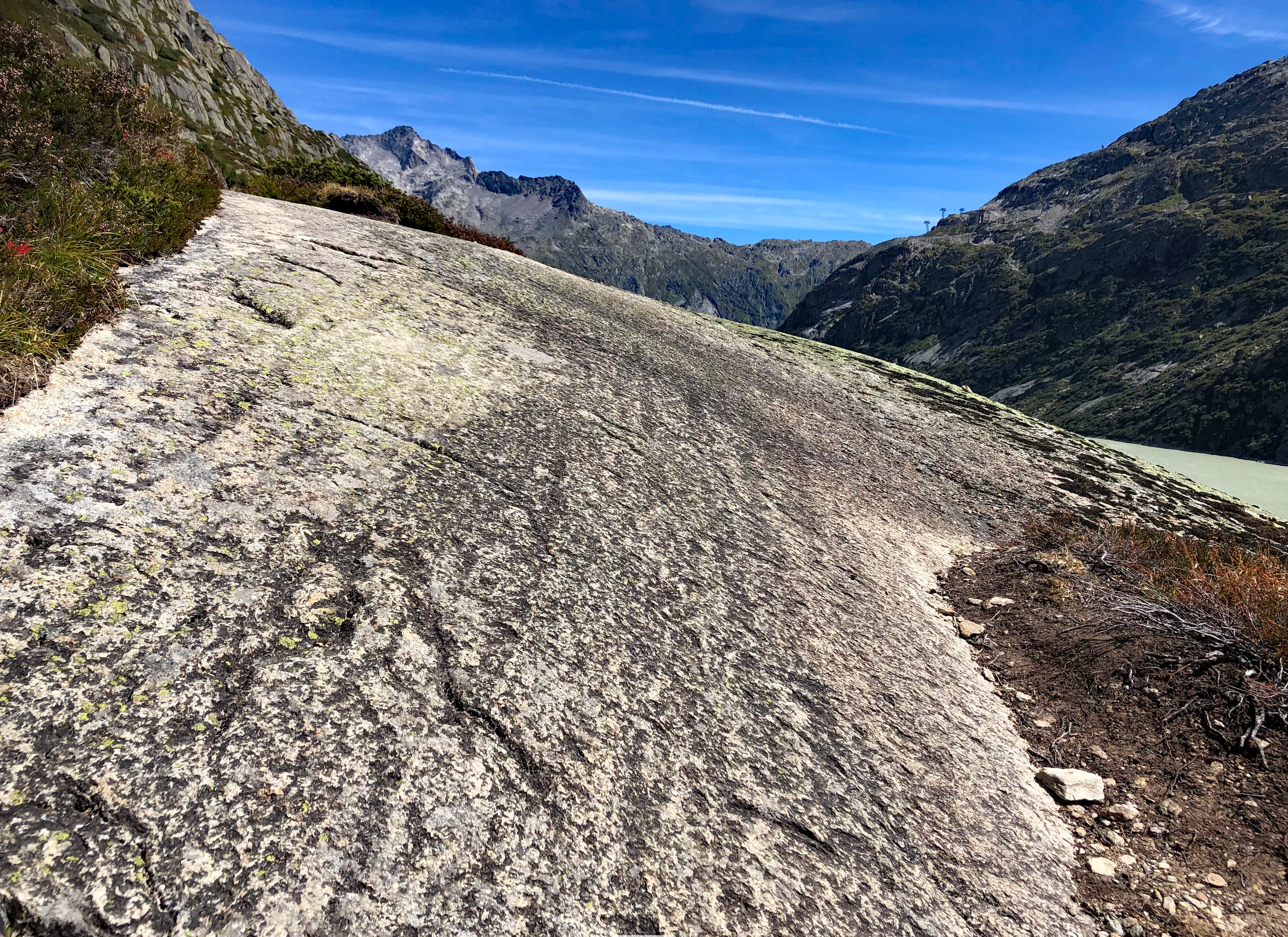
A wide angle shot of a large, smooth glacial-polished rock slab in the Swiss Alps, with mountainous terrain and a section of a turquoise lake visible in the background.
Glacial polished rock slab and alpine terrain at Mederlouwenen near Lake Grimsel.

Mederlouwenen Nature Reserve ecosystems, habitats, and plant life

The reserve's ecological identity rests on its unusually well-developed high-altitude flat-moor vegetation. On several of the slope terraces, undisturbed communities of grasses and flowering plants, including the Blue Moor-grass, coexist with zones dominated by alpine juniper, bilberry, alpenrose, common heather, and bog bilberry, as well as other characteristic dwarf shrubs. Wetland zones host small-sedge and large-sedge communities, while spring-fed flushes have produced extensive Sphagnum carpets, including compact and hair-like peat mosses, that have built genuine peat layers and raised bog hummocks on the slope.

A particularly noteworthy element is the presence of the long-leaved sundew, a rare insectivorous plant adapted to the nutrient-poor bog environment. Beyond the bog proper, spring-fed channels sustain distinctive spring flora, and small pools that have formed in glacial hollows host aquatic and marsh plants that gradually develop into terrestrial vegetation as the basins silt up. Exposed weathered rock, moraine debris, and large boulders carry a diverse lichen flora.

On the margins of the reserve, successional processes are visible as shrubs such as green alder and Swiss willow encroach from the lake shore into the open meadows, while birch reaches unusually high elevations on the western edge.
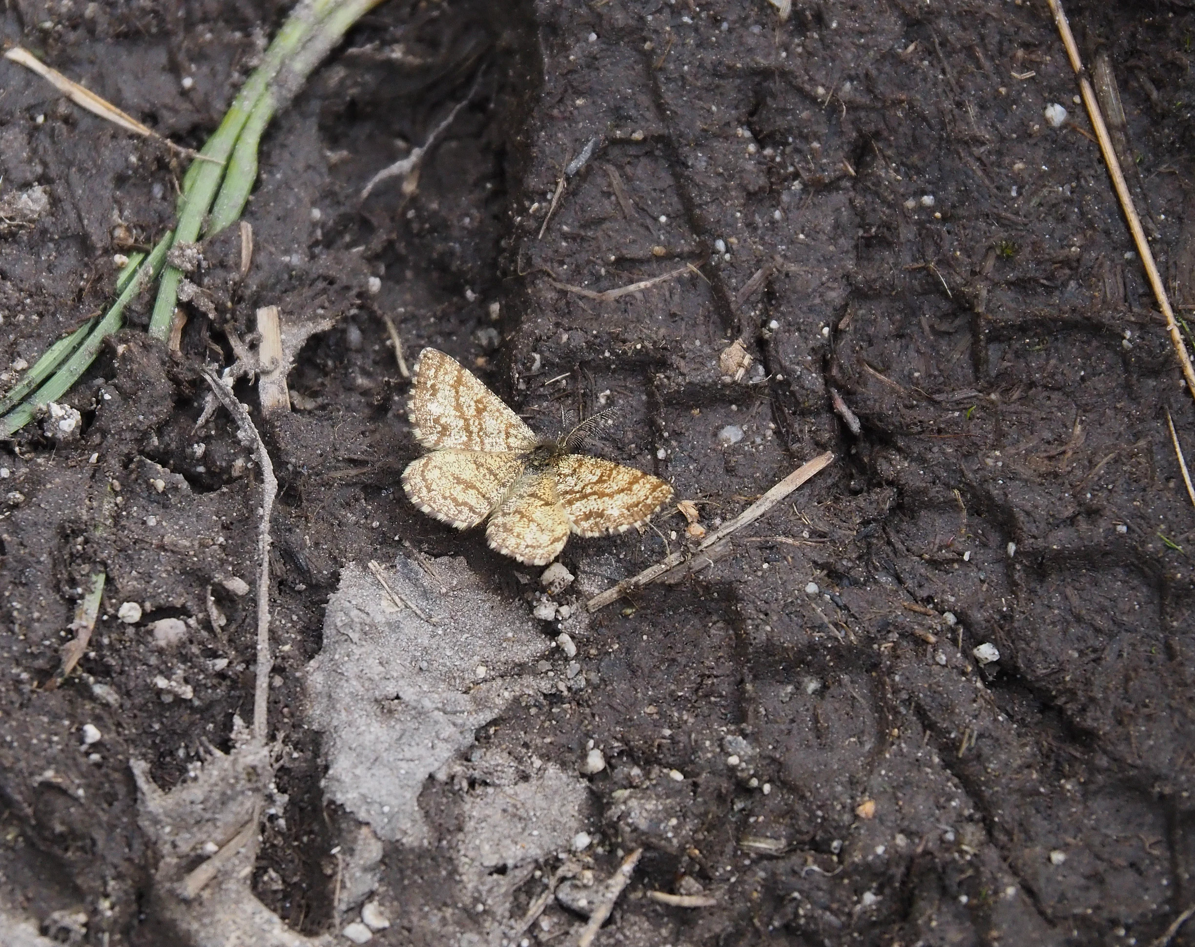
A brown-patterned common heath moth sitting on dark, muddy ground with visible boot prints.
A common heath moth resting on moist, dark soil along a trail in the Naturschutzgebiet Mederlouwenen.

Mederlouwenen Nature Reserve wildlife and species highlights

The reserve preserves habitat for a range of alpine invertebrate life. Various insect species have been documented on the slope above the lake, including rare butterflies, notably the heath moth, which occurs along the Lauteraar trail within the broader protected landscape. The presence of sundews and peat-bog flora supports the small but specialised invertebrate communities typical of high-alpine mires, although detailed wildlife inventories for the site itself are not well documented.

The broader landscape context, including adjacent forests, rocky cliffs, and the lake shore, suggests additional wildlife interest beyond the strictly bog-dependent fauna, but bogs and open meadows remain the primary wildlife feature of the protected area.
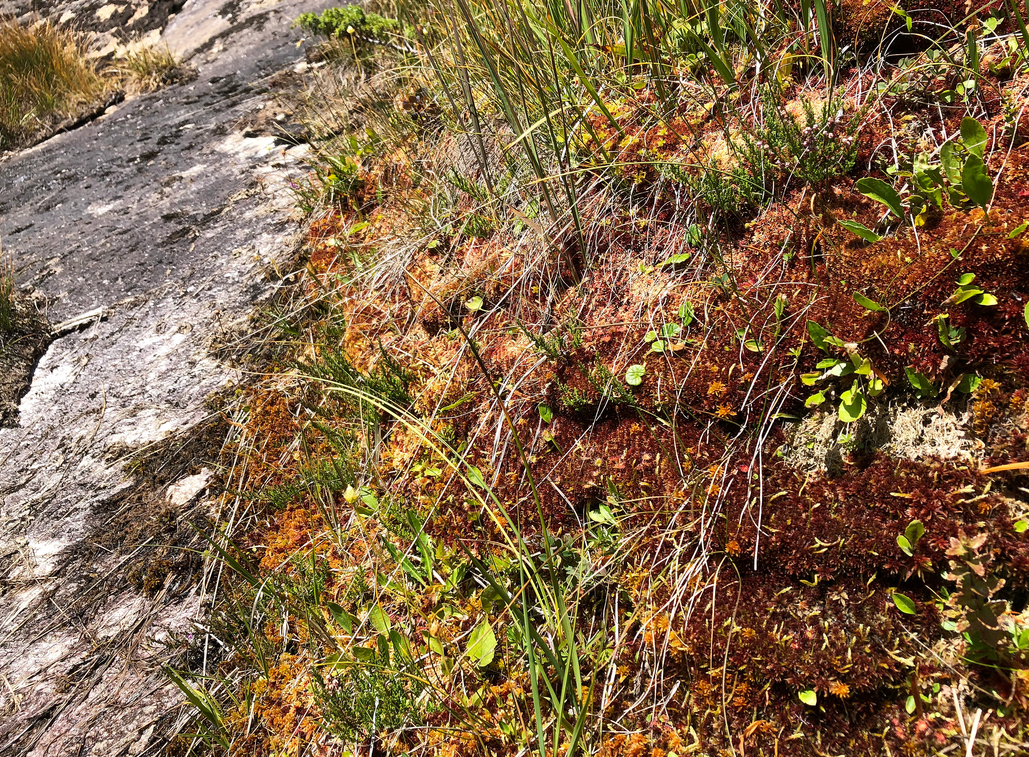
A close-up, high-angle view showing alpine moor vegetation growing next to a weathered, light-grey rock face. The vegetation consists of vibrant orange-red mosses, patches of green alpine grasses, and low-lying leafy plants.
Moor vegetation characteristic of the alpine environment in the Naturschutzgebiet Mederlouwenen.

Mederlouwenen Nature Reserve conservation status and protection priorities

Mederlouwenen's conservation significance lies in its role as one of the high-elevation reference sites within Switzerland's federal flat-moor network. Its 5.3 hectares protect a complete and largely undisturbed mosaic of bog, fen, heath, and seepage vegetation at an elevation where such communities are scarce and ecologically vulnerable. By being embedded within the Grimsel moor landscape and the UNESCO Swiss Alps Jungfrau-Aletsch World Heritage area, it contributes to a layered conservation framework that combines federal habitat inventories, cantonal protection, landscape-scale designation under the BLN inventory, and international World Heritage recognition.

Protection of the site is also closely tied to the broader ecological management of the Grimsel hydroelectric infrastructure operated by the Kraftwerke Oberhasli, with coordinated land-use and habitat safeguarding between the cantonal nature inspectorate and the operator. The reserve's designation followed a sustained legal and political effort, including a 1995 legal opinion supporting moor protection under the spirit of the Rothenthurm Initiative and protracted negotiation over the environmental compatibility of regional hydropower expansion.

Mederlouwenen Nature Reserve cultural meaning and human context

The reserved landscape carries a strong imprint of historical alpine pastoralism. Before the Grimsel reservoir was constructed in the 1930s, the valley floor hosted the Unteraar alp, whose huts stood below the Mederlouwenen meadows on the floodplain of the Aare known locally as the "Aarboden". The terraced meadows at Mederlouwenen served as wild hay meadows, used by alpine herders to supplement the limited grazing of the narrow, stony valley floor near the Unteraar glacier.

The Unteraar alp also functioned as a pre-alpine pasture, or Vorsäss, and as a refuge area for cattle from the higher Oberaar alp during snow conditions. The name "Mederlouwenen" itself derives from the local Bernese dialect: "Meder" refers to hay meadows and "Louwene" to avalanches, reflecting both the agricultural use of the terraces and their position beneath an avalanche track on the Brünberg. Once the lake was built and the valley bottom flooded, traditional pastoral use of these meadows ended, allowing the area to revert to a more natural state, which now forms the basis of its conservation value.

Top sights and standout views in Mederlouwenen Nature Reserve

Among the standout features of Mederlouwenen are its peat-forming Sphagnum communities, including raised boulder-like hummocks, on a south-facing alpine slope; the long-leaved sundew, one of the reserve's botanical rarities; and a striking Landschaft mosaic that packages glacially scoured granite terraces, slope bogs, dwarf-shrub heaths, and relict stone pine forest within a single accessible site. Its position within the UNESCO Swiss Alps Jungfrau-Aletsch World Heritage area and the BLN "Berner Hochalpen" landscape gives it added regional weight, while its proximity to the historic Lauteraar trail allows visitors to experience the bog within a wider high-alpine context.

Best time to visit Mederlouwenen Nature Reserve

Mederlouwenen is a high-alpine site above 1900 metres in the Bernese Oberland, and the most rewarding visits typically occur in the alpine summer, when the snow has melted from the terraces, the bog flora is in active growth, and the Lauteraar trail above the lake is easily walkable. Late summer in particular brings flowering grasses and visible sundew rosettes in the open peatland. Outside this window, lingering snow, unstable avalanche-prone slopes on the Brünberg above, and limited daylight make the area much less suitable for an unhurried exploration of the protected area.

Monthly climate preview

Long-term representative measurements of monthly temperature and precipitation rhythm

Naturschutzgebiet Mederlouwenen Climate Normals and Annual Temperature Patterns

Representative coordinates record distinct annual temperature swings alongside sustained precipitation patterns across twelve months of historical climatology data. Examining the complete monthly climate profile reveals deeper variations in temperature extremes and precipitation averages.
Annual mean2 °C
-8 °C12 °C
Jan-8°
Feb-8°
Mar-4°
Apr
May
Jun10°
Jul12°
Aug12°
Sep
Oct
Nov-3°
Dec-7°
Warmest month
July

11.8 °C

Coolest month
January

-8 °C

Wettest month
June

5 mm/day

Driest month
February

2.5 mm/day

Park location guide

Geography guide, regional context, and park location map for Mederlouwenen Nature Reserve

Mederlouwenen Nature Reserve park geography, regions, and map view in Switzerland

Understand where Mederlouwenen Nature Reserve sits in Switzerland through a broader geographic reading of the surrounding landscape, nearby location context, and its mapped position within the national park landscape.

How Mederlouwenen Nature Reserve fits into Switzerland

Switzerland is a landlocked federal republic in Central Europe comprising 26 cantons, with Bern as the federal city and Zurich as the largest city. The country features the Swiss Alps, Swiss Plateau, and Jura Mountains, with German, French, Italian, and Romansh as official languages. It is noted for its political neutrality, direct democracy traditions, and strong economy.

Wider geography shaping Mederlouwenen Nature Reserve in Switzerland

Switzerland is located in Central Europe at the intersection of Western and Southern Europe. It is bordered by Germany to the north, France to the west, Austria and Liechtenstein to the east, and Italy to the south. The country is geographically divided among the Swiss Alps (covering most of the territory), the Swiss Plateau (where most of the population resides), and the Jura Mountains. Switzerland is landlocked.

Map view of Mederlouwenen Nature Reserve

Use this park location map to pinpoint Mederlouwenen Nature Reserve in Switzerland, understand its exact geographic position, and read its mapped placement within the surrounding landscape more clearly.

Pigeon | © OpenStreetMap contributors

Location context for Mederlouwenen Nature Reserve

Bern

Visualizing the high mountain terrain, glacial terraces, and bog habitats of the Bernese Oberland

Naturschutzgebiet Mederlouwenen Photos and Alpine Scenery

Visual records document the distinct ecological character of Naturschutzgebiet Mederlouwenen across glacially scoured granite terraces and slope bogs. Photographic archives reveal the high alpine terrain, Sphagnum peat cushions, and relict stone pine forests shaping this protected reserve.

A narrow hiking trail composed of flat stone slabs winding through a lush green alpine meadow, set against a rocky mountain slope and a clear blue sky.

A narrow stone-paved trail curves through a grassy, alpine hillside toward a large, craggy mountain peak; a pale, turquoise-colored glacial lake is visible to the left.

A wide angle shot of a large, smooth glacial-polished rock slab in the Swiss Alps, with mountainous terrain and a section of a turquoise lake visible in the background.

A brown-patterned common heath moth sitting on dark, muddy ground with visible boot prints.

A close-up, high-angle view showing alpine moor vegetation growing next to a weathered, light-grey rock face. The vegetation consists of vibrant orange-red mosses, patches of green alpine grasses, and low-lying leafy plants.

A sloped alpine moorland with patches of grasses, sedges, and low-lying shrubs, containing a single large flat stone, situated above a light-colored reservoir lake.

Park atlas

Compare nearby alpine reserves and connected mountain protected areas

Parks Near Naturschutzgebiet Mederlouwenen And Surrounding Protected Landscapes

Browse other protected areas near Naturschutzgebiet Mederlouwenen to examine similar high-altitude bog ecosystems and glacial mountain terrain. Comparing adjacent Bernese Oberland reserves reveals broader patterns of alpine plant distribution and regional conservation landscapes.
A soft watercolor painting of a panoramic landscape featuring a marshy fen area in the foreground with distant mountain ranges in the background, rendered in pastel greens, purples, and yellows.
Nature reserveBern
About 3.4 km away#1 closest

Northeast

Chessibidmer Nature Reserve: Glacial Granite and Protected Alpine Moorland Landscapes

Protected alpine bog and granite terrace in the Bernese Oberland

Chessibidmer offers a detailed look at a nationally significant flat bog and moorland landscape situated above the upper Aare valley in the Bernese Oberland. The area provides an exceptional map of glacial geomorphology, featuring granite domes, rock-bound tarns, and successional peatlands that sit as a protected mosaic within the surrounding high-alpine terrain of the Swiss Alps.

Area
0.5 km²
Established
1998
IUCN
IV
Relief
Mountain
Watercolor painting of a green landscape with rolling hills, meadows, and a water body in the foreground against a light background.
Protected areaSwitzerland
About 5.7 km away#2 closest

Northeast

Rhonegletschervorfeld Protected Area: Alpine Glacier Geography and Mapping

Proglacial landscape and glacial history in the Swiss Alps.

The Rhonegletschervorfeld provides an unparalleled view into the geomorphology of the Swiss Alps, showcasing a continuous record of ice loss through moraines, exposed bedrock, and emerging meltwater systems. Situated near the Furka Pass, this protected area serves as an essential reference for glaciology, offering a clear visual timeline of glacier retreat that has shaped modern alpine tourism and climate science. Explore the mapped terrain where the Rhone River headwaters emerge from the retreating ice.

Area
13.58 km²
Relief
Mountain
Climate
Alpine
Access
Easy access
A soft watercolor painting of a green landscape featuring rolling hills and a winding river with distant mountains in the background.
Nature reserveBern
About 11 km away#3 closest

Northwest

Naturschutzgebiet Gauligletscher: Glacial Landscape and Nature Reserve in Bern

A high-alpine protected area in the Bernese Oberland

Discover the unique geography of Naturschutzgebiet Gauligletscher, a protected area in Bern featuring a wide amphitheater of moraines, glacial lakes, and retreating ice. This site functions as an active laboratory for river dynamics and alpine vegetation colonization across an expansive, mineral-dominated valley floor.

Area
5.7 km²
Established
2001
IUCN
IV
Relief
Mountain
A watercolor illustration of a soft, rolling alpine landscape with a winding path and distant mountain peaks against a pale yellow sky.
Regional parkValais
About 22 km away#4 closest

South

Landschaftspark Binntal: Alpine Geography and Regional Protected Area in Valais, Switzerland

Mapping deep mountain valleys and glacial alpine terrain

Landschaftspark Binntal serves as a vital protected area in the Valais Alps, showcasing a vertical sequence of ecosystems from river gorges to 3000 meter peaks. The park preserves a living cultural landscape alongside significant mineralogical heritage, offering a detailed view into the high-altitude geography and remote valleys that define this distinctive corner of the Swiss mountain landscape.

Area
180 km²
Established
2008
Relief
Mountain
Climate
Alpine
A watercolor painting of a panoramic mountain landscape featuring a foreground of green trees and distant purple mountain ridges under a soft light.
Nature reserveValais
About 29 km away#5 closest

Southwest

Aletschwald Nature Reserve: Geographic Insights and Protected Alpine Landscape Context

An ancient high-elevation forest ecosystem in the Swiss Valais.

Situated between 1,600 and 2,200 meters, Aletschwald represents one of the few remaining managed-free subalpine forests in the Alps. The reserve maps the interaction between glacial retreat and forest advancement, featuring a dense mosaic of Arolla pines, larch, and pioneer mosses across diverse lateral moraine formations.

Area
4 km²
Established
1933
Relief
Mountain
Climate
Alpine
A soft watercolor painting of rolling hills and distant mountains in light green and muted tones.
Biosphere reserveLucerne
About 31 km away#6 closest

Northwest

Entlebuch Biosphere Reserve: Mapped Protected Landscapes in the Canton of Lucerne

Exploring karst formations and alpine wetland ecosystems

Entlebuch stands as a pioneering example of community-driven conservation in the Swiss Alps. This protected landscape encompasses extensive peatlands, forested slopes, and the iconic Schrattenfluh karst massif. Use this geographic entry to understand the regional topography and the spatial distribution of protected habitats throughout this central Swiss valley.

Area
397 km²
Established
2001
Relief
Mountain
Climate
Alpine
Nature reserveKanton Luzern
About 34 km away#7 closest

Northwest

Naturschutzgebiet Laubersmad - Salwidili: Exploring a Vast Swiss Moorland and Alpine Reserve

A critical moorland complex in the heart of Kanton Luzern

Spanning over 1,300 hectares, this protected nature reserve in Kanton Luzern constitutes the largest contiguous moorland landscape in Switzerland. The area is defined by a unique geological flysch trough that supports a rich diversity of peatland types, including raised bogs and fens, alongside spruce forest and alpine pasture. As an IUCN Category IV area, it provides essential habitat for endangered mire flora and high-altitude wildlife in a remarkably intact hydrological setting.

Area
13.76 km²
IUCN
IV
Relief
Mountain
Scope
Terrestrial
Watercolor painting of a meandering river flowing through a lush green valley with distant hills and foreground grasses.
Nature reserveCanton Ticino
About 41 km away#8 closest

Southeast

Auenschutzgebiet Maggia: Protected Floodplain Geography and Alpine River Dynamics

Nature reserve located within the Canton Ticino, Switzerland

Investigate the natural topography of Auenschutzgebiet Maggia, a protected floodplain system spanning thirteen kilometers through the Lepontine Alps. This reserve provides a detailed look at how alpine hydrology maintains a diverse mosaic of gravel islands, wet meadows, and riparian forests in a high-energy mountainous environment.

Common questions about visiting, size, designation, and location context for Mederlouwenen Nature Reserve

Mederlouwenen Nature Reserve FAQs for park facts, access, geography, and protected area context

Find quick answers about Mederlouwenen Nature Reserve, including protected-area facts, park geography, trail and visitor context, and how the park fits into its surrounding country and regional landscape.
MoriAtlas Explorer

Continue Your Protected Areas Search Across the Global Atlas

Deepen your exploration by continuing the structured search for national parks and protected areas worldwide. Utilize the comprehensive filtering capabilities to compare different conservation landscapes and refine your understanding of global park geography. Discover more about the distribution and characteristics of protected natural areas.

Global natural geography