Mori Atlas logo
Park earthquake history

A chronological catalogue of seismic events correlated with the proglacial geography of the Swiss Alps.

Recorded Historical Earthquake Activity Near the Rhonegletschervorfeld Protected Landscape

This archival collection compiles publicly recorded seismic events associated by proximity with the Rhonegletschervorfeld in the Swiss Alps. Each entry includes event date, magnitude, depth, and epicentre location to provide a baseline record of regional seismic occurrences near this significant proglacial landscape. The data presented reflects past recorded history rather than current seismic hazard or predictive risk for the valley.

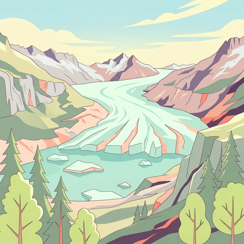
A stylized digital illustration of a valley with a light blue glacier flowing from distant snow-capped mountains into a turquoise glacial lake containing small icebergs, surrounded by coniferous trees and rocky slopes.

The shrinking forefield of the Rhone Glacier in the central Swiss Alps, a visible record of more than a century of glacial retreat.

Rhonegletschervorfeld

The Rhonegletschervorfeld is the proglacial landscape lying in front of the snout of the Rhone Glacier, one of the largest valley glaciers in the Swiss Alps. Located in the uppermost part of the Canton of Valais near the village of Gletsch, it lies at the foot of the Furka Pass road, where the headwaters of the Rhone River emerge from beneath the retreating ice. What makes this forefield significant is the unusually clear and well-documented record of glacier retreat it preserves. Since the Little Ice Age maximum in the mid-nineteenth century, the Rhone Glacier has lost a substantial share of its length and thickness, exposing bare rock, moraines, meltwater channels, and a growing proglacial lake. The forefield is therefore not only a remnant of the glacier itself, but also a living laboratory for understanding alpine landscape change in a warming climate. Beyond its scientific role, the area is closely tied to the history of early Alpine tourism. Once the glacier tongue descended almost to the hotels of Gletsch, the site became an icon of nineteenth-century glacier travel; today it stands as one of the most visited and most studied examples of glacier retreat in the Alps.

Location
Switzerland
Park type
Protected area
Area
13.6 km²
Highest point
3,620 m
Rhonegletschervorfeld Protected Area Geography

Compare Rhonegletschervorfeld earthquake records by distance

Explore recorded earthquakes around Rhonegletschervorfeld

Rhonegletschervorfeld rises from 2,208 to 3,620 metres across 13.58 km² of Swiss alpine mountains, cliffs, lakes, rivers, and glacier terrain. The associated earthquake catalogue records chronology and spatial relationship without proving glacier-forefield effects, active hazard, or future activity.

Sort by
Magnitude
Location

This page describes catalogued earthquakes associated with the park by epicentre location and distance. It does not establish causation, assess current danger, or predict future earthquakes.

No earthquake records match the current filters

Park atlas

Move past Rhonegletschervorfeld earthquake history

Browse other protected places beyond Rhonegletschervorfeld

Rhonegletschervorfeld rises from 2,208 to 3,620 metres across 13.58 km² of Swiss alpine mountains, cliffs, lakes, rivers, and glacier terrain. Its related park links enable comparison with separate earthquake histories but do not establish shared geology, equal effects, current risk, or a forecast.
A soft watercolor painting of a panoramic landscape featuring a marshy fen area in the foreground with distant mountain ranges in the background, rendered in pastel greens, purples, and yellows.
Nature reserveBern
About 3.1 km away#1 closest

Southwest

Chessibidmer Nature Reserve: Glacial Granite and Protected Alpine Moorland Landscapes

Protected alpine bog and granite terrace in the Bernese Oberland

Chessibidmer offers a detailed look at a nationally significant flat bog and moorland landscape situated above the upper Aare valley in the Bernese Oberland. The area provides an exceptional map of glacial geomorphology, featuring granite domes, rock-bound tarns, and successional peatlands that sit as a protected mosaic within the surrounding high-alpine terrain of the Swiss Alps.

Area
0.5 km²
Established
1998
IUCN
IV
Relief
Mountain
Watercolor painting of soft, rolling alpine terrain, green vegetation, and distant purple-toned mountains under a pale sky.
Nature reserveBern
About 5.7 km away#2 closest

Southwest

Naturschutzgebiet Mederlouwenen: Alpine Moor and Protected Glacial Terrain in the Bernese Oberland

A high-elevation nature reserve featuring rare flat-moor vegetation and peat-forming bogs.

Naturschutzgebiet Mederlouwenen occupies a distinctive series of glacial granite terraces in the Bernese Oberland, where high-altitude slope bogs and relict conifer forests create a vital refuge for rare alpine flora. This protected area stands as a primary example of Swiss mountain ecology, blending ancient geological history with the fragile, moisture-dependent ecosystems found at the head of the Aare valley.

Area
0.053 km²
Established
2004
IUCN
IV
Relief
Mountain
A soft watercolor painting of a green landscape featuring rolling hills and a winding river with distant mountains in the background.
Nature reserveBern
About 16 km away#3 closest

West

Naturschutzgebiet Gauligletscher: Glacial Landscape and Nature Reserve in Bern

A high-alpine protected area in the Bernese Oberland

Discover the unique geography of Naturschutzgebiet Gauligletscher, a protected area in Bern featuring a wide amphitheater of moraines, glacial lakes, and retreating ice. This site functions as an active laboratory for river dynamics and alpine vegetation colonization across an expansive, mineral-dominated valley floor.

Area
5.7 km²
Established
2001
IUCN
IV
Relief
Mountain
A watercolor illustration of a soft, rolling alpine landscape with a winding path and distant mountain peaks against a pale yellow sky.
Regional parkValais
About 25 km away#4 closest

Southwest

Landschaftspark Binntal: Alpine Geography and Regional Protected Area in Valais, Switzerland

Mapping deep mountain valleys and glacial alpine terrain

Landschaftspark Binntal serves as a vital protected area in the Valais Alps, showcasing a vertical sequence of ecosystems from river gorges to 3000 meter peaks. The park preserves a living cultural landscape alongside significant mineralogical heritage, offering a detailed view into the high-altitude geography and remote valleys that define this distinctive corner of the Swiss mountain landscape.

Area
180 km²
Established
2008
Relief
Mountain
Climate
Alpine
A watercolor painting of a panoramic mountain landscape featuring a foreground of green trees and distant purple mountain ridges under a soft light.
Nature reserveValais
About 33 km away#5 closest

Southwest

Aletschwald Nature Reserve: Geographic Insights and Protected Alpine Landscape Context

An ancient high-elevation forest ecosystem in the Swiss Valais.

Situated between 1,600 and 2,200 meters, Aletschwald represents one of the few remaining managed-free subalpine forests in the Alps. The reserve maps the interaction between glacial retreat and forest advancement, featuring a dense mosaic of Arolla pines, larch, and pioneer mosses across diverse lateral moraine formations.

Area
4 km²
Established
1933
Relief
Mountain
Climate
Alpine
A soft watercolor painting of rolling hills and distant mountains in light green and muted tones.
Biosphere reserveLucerne
34 km away#6 closest

West

Entlebuch Biosphere Reserve: Mapped Protected Landscapes in the Canton of Lucerne

Exploring karst formations and alpine wetland ecosystems

Entlebuch stands as a pioneering example of community-driven conservation in the Swiss Alps. This protected landscape encompasses extensive peatlands, forested slopes, and the iconic Schrattenfluh karst massif. Use this geographic entry to understand the regional topography and the spatial distribution of protected habitats throughout this central Swiss valley.

Area
397 km²
Established
2001
Relief
Mountain
Climate
Alpine
Watercolor painting of a meandering river flowing through a lush green valley with distant hills and foreground grasses.
Nature reserveCanton Ticino
About 37 km away#7 closest

Southeast

Auenschutzgebiet Maggia: Protected Floodplain Geography and Alpine River Dynamics

Nature reserve located within the Canton Ticino, Switzerland

Investigate the natural topography of Auenschutzgebiet Maggia, a protected floodplain system spanning thirteen kilometers through the Lepontine Alps. This reserve provides a detailed look at how alpine hydrology maintains a diverse mosaic of gravel islands, wet meadows, and riparian forests in a high-energy mountainous environment.

Nature reserveKanton Luzern
About 38 km away#8 closest

Northwest

Naturschutzgebiet Laubersmad - Salwidili: Exploring a Vast Swiss Moorland and Alpine Reserve

A critical moorland complex in the heart of Kanton Luzern

Spanning over 1,300 hectares, this protected nature reserve in Kanton Luzern constitutes the largest contiguous moorland landscape in Switzerland. The area is defined by a unique geological flysch trough that supports a rich diversity of peatland types, including raised bogs and fens, alongside spruce forest and alpine pasture. As an IUCN Category IV area, it provides essential habitat for endangered mire flora and high-altitude wildlife in a remarkably intact hydrological setting.

Area
13.76 km²
IUCN
IV
Relief
Mountain
Scope
Terrestrial
MoriAtlas Explorer

Explore the Rhonegletschervorfeld Glacial Landscape and Alpine Geography

Uncover the complex geography of the Rhonegletschervorfeld through detailed mapping of its proglacial terrain and historical glacier boundaries. MoriAtlas provides a structured look at this significant Swiss site, allowing for deeper engagement with the history of glaciology and the ongoing evolution of the Alpine landscape.