

Mori Atlas logo
Wildlife reserveEl Sira Communal Reserve

Mapping the altitudinal gradients and tropical forest mosaic of the Sira Mountain range

El Sira Communal Reserve: A Comprehensive Geographic Atlas of Peru's Sub-Andean Protected Landscapes

(Reserva Comunal El Sira)

El Sira Communal Reserve preserves a vital transitional zone between the Andean highlands and the Amazon basin in east-central Peru. This protected area spans a vertical gradient from low-elevation tropical rainforest to highland montane forests, sheltering significant biodiversity across the Pachitea River watershed. The reserve acts as a critical ecological refuge where terrain complexity supports a wide array of endemic species and habitats within the larger Sira Mountain range.

Peruvian Amazonsub-Andean forestrainforest reservecommunal reservewatershed protectionSira Mountains
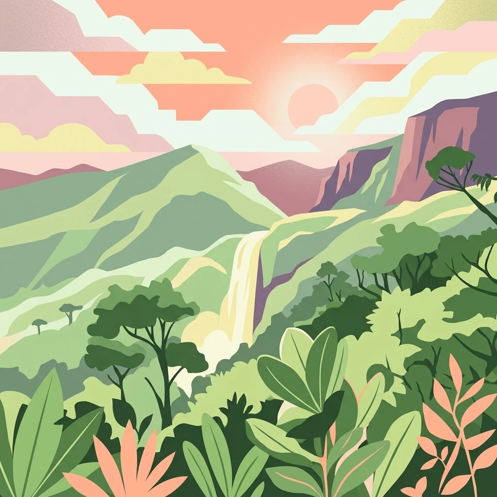
A flat-style digital illustration showing a tropical mountain landscape with a waterfall, dense forest, and a setting sun in the background.

El Sira Communal Reserve

Wildlife reserve

Park overview

Structured park overview, official facts, and landscape profile for El Sira Communal Reserve

El Sira Communal Reserve park facts, protected area profile, and essential visitor context

Review the core facts for El Sira Communal Reserve, including designation, size, terrain, visitor scale, habitats, and operating context in one park-focused overview.

About El Sira Communal Reserve

El Sira Communal Reserve is an expansive Peruvian protected area established to unite two intertwined conservation goals: preserving the rich biodiversity of the Sira Mountain range and supporting the continued sustainable and ancestral use of the landscape by the indigenous peoples who live in and around it. Positioned in east-central Peru, the reserve stretches across the administrative regions of Huánuco, Pasco, and Ucayali, encompassing parts of Puerto Inca Province, Oxapampa Province, Atalaya Province, and Coronel Portillo Province. Its designated area reflects the scale of the ecological systems it is intended to safeguard, with hundreds of thousands of hectares of continuous forest linked to the Andean foothills of the Eastern Cordillera.

Geographically, the reserve lies within the sub-Andean belt, where the Andes descend toward the Amazon basin. It occupies a steep altitudinal gradient from approximately 130 meters to about 2,250 meters above sea level, producing a layered mosaic of warm lowland rainforest, mid-elevation humid forest, and cooler, semi-humid highland forests. The climate varies accordingly, with hot and rainy conditions at lower elevations and increasingly humid, cooler conditions higher up. This vertical and climatic diversity is the foundation for the reserve's ecological richness and supports distinct plant and animal communities at different elevations.

El Sira also plays a vital role in regional hydrology. The Ucayali River forms much of its eastern boundary, while the Pachitea and Pichis rivers define parts of its western flank. Within the reserve lie the upper and middle sectors of key tributaries feeding these major rivers, protecting the headwaters that sustain broader lowland river systems and supplying water to surrounding communities. The Pachitea River, formed by the union of the Pichis and Palcazu rivers, borders the northern sector of the range, and the Pichis River traces the center-south sector. These rivers are also historically important transport corridors, connecting remote communities and feeding navigable routes toward Pucallpa and Atalaya.

What distinguishes El Sira from many strictly protected reserves is its institutional purpose: as a communal reserve, it is designed not only to conserve ecosystems but also to recognize the connections between indigenous communities and the land. Created in 2001, the reserve has since been incorporated into the broader Oxapampa-Asháninka-Yánesha Biosphere Reserve recognized by UNESCO in 2010. The protected area therefore functions simultaneously as a biodiversity stronghold, a watershed protector, and a cultural landscape where conservation and indigenous presence are deliberately sustained together.

Quick facts and research context for El Sira Communal Reserve

El Sira Communal Reserve is a Peruvian communal reserve located in the Sira Mountains of the Eastern Cordillera, covering roughly 616,413 hectares across the Huánuco, Pasco, and Ucayali regions. Created on June 22, 2001, it is classified under IUCN Category VI as a protected area with sustainable use of natural resources, and it is administered by SERNANP, Peru's national service of natural protected areas.

The reserve contains the upper basins of the Ucayali, Pachitea, and Pichis river systems, with elevations ranging from about 130 to 2,250 meters above sea level, giving it a gradient from warm lowland rainforest to cooler, semi-humid highland forest. In 2010 it became a core zone of the Oxapampa-Asháninka-Yánesha Biosphere Reserve recognized by UNESCO. Its protected status combines rainforest conservation with recognition of ancestral indigenous resource use by communities living in and around the reserve.

Protection and recognition

Documented terrestrial protection metrics, designation year, and management scope overview.

El Sira Communal Reserve Protection Status and Designated History

El Sira Communal Reserve maintains documented terrestrial protection status established in the year 2010. Structured designation history details, management scope, and recognition data provide an objective baseline for conservation review.

Protection details

Protection scope
Terrestrial
Designated year
2010
Transboundary protection
No
Park context

Deeper park guide and search-rich context for El Sira Communal Reserve

El Sira Communal Reserve history, landscape, wildlife, and travel context

Explore El Sira Communal Reserve through its history, landscape character, ecosystems, wildlife, conservation priorities, cultural context, and seasonal travel timing in a structured park guide built for atlas discovery and search intent.

Why El Sira Communal Reserve stands out

El Sira Communal Reserve is best known for protecting an exceptionally biodiverse transitional zone where the Andes meet the Amazon basin, ranging from lowland tropical forest to highland rainforest across a vertical span of more than two kilometers. The Sira Mountains harbor endemic birdlife such as the Sira tanager and Sira curassow, as well as large Amazonian mammals including jaguar, South American tapir, puma, spectacled bear, and brown woolly monkey. The reserve is equally recognized for safeguarding the headwaters of the Pachitea River and major tributaries of the Ucayali and Pichis rivers, anchoring a watershed that feeds the broader Ucayali River system. The combination of indigenous-led conservation, recognized through both its communal reserve designation and inclusion in a UNESCO Biosphere Reserve, also gives the protected area a distinctive cultural and institutional character.
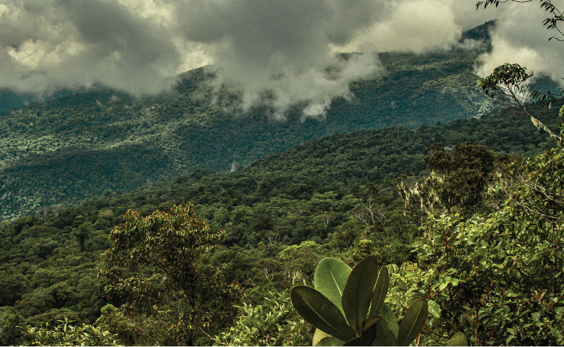
A wide, mountainous landscape covered in dense green forest, with clouds clinging to the slopes and ridge lines.
A view of the dense, cloud-covered montane forest within El Sira Communal Reserve.

El Sira Communal Reserve history and protected-area timeline

El Sira Communal Reserve was formally established on June 22, 2001, as a Peruvian protected area under the country's national system of natural protected areas. Its creation reflected a growing recognition that the Sira Mountains of the Eastern Andean foothills held extraordinary ecological value, particularly as a buffer zone between the Andes and the Amazon basin, and as the source region for major tributaries of the Ucayali and Pachitea river systems.

Beyond ecological motivations, the reserve was established to acknowledge and protect the ancestral and sustainable use of natural resources by the indigenous peoples living in and around the Sira Mountains. Its designation as a communal reserve, rather than a strictly protected national park, embedded this cultural and land-use dimension directly into its institutional identity. The reserve is administered by SERNANP, Peru's Servicio Nacional de Áreas Naturales Protegidas por el Estado.

A significant milestone in the reserve's history came in 2010, when UNESCO included El Sira Communal Reserve as part of the Oxapampa-Asháninka-Yánesha Biosphere Reserve. This recognition linked the reserve with neighboring protected landscapes of related cultural and ecological importance, situating El Sira within an internationally recognized framework for combining biodiversity conservation with sustainable human presence in the landscape.

El Sira Communal Reserve landscape and geographic character

The landscape of El Sira Communal Reserve is defined by the Sira Mountain range, a sub-Andean cordillera forming part of the Eastern Andes of Peru. The terrain descends westward from the highlands toward the Amazon basin, producing a dramatic altitudinal gradient from approximately 130 meters up to about 2,250 meters above sea level. This range encompasses pre-montane forest, montane forest, and lowland tropical forest, all integrated into a single protected mosaic within the reserve's borders.

The reserve's western flank receives significant cloud condensation, while the eastern side drains more directly toward the Ucayali basin and experiences slightly different climatic conditions. In the southern reaches of the reserve lies the landscape known as Gran Pajonal, an area of somewhat cooler and less humid terrain that contrasts with the hotter lowland forests found elsewhere.

Rivers shape the character of the landscape as much as the mountains do. The Ucayali River hugs the eastern edge of the Sira range along a south-to-north course, forming meanders and abandoned oxbow lakes known locally as tipishcas. The Pachitea River traces the western side of the northern sector, while the Pichis River, joining with the Palcazu, defines the center-west portion of the reserve. Together, these watercourses give the protected area a deeply dissected geography of ridges, valleys, river terraces, and forested lowlands.

El Sira Communal Reserve ecosystems, habitats, and plant life

Ecologically, El Sira Communal Reserve occupies a transitional position between the Andes and the Amazon, and this position is reflected in the diversity of its vegetation. The dominant ecosystem types are tropical lowland forest and highland rainforest, distributed across a vertical gradient that spans roughly 2,000 meters of elevation. This layering of habitats supports more than 500 recorded tree species, including Sapium glandulosum, Bunchosia armeniaca, Iriartea deltoidea, Weinmannia species, Manilkara bidentata, Pourouma cecropiifolia, various Ilex species, Theobroma cacao, Nectandra species, Ceiba pentandra, Pouteria caimito, Brosimum alicastrum, and multiple Inga species.

The altitudinal variation creates distinct vegetation bands. Lower elevations below roughly 1,000 meters feature warm, wet rainforest consistent with the western Amazon. Higher zones above 1,000 meters shift toward semi-humid to very humid forest with cooler conditions, including the more temperate landscape of the southern Gran Pajonal region. This combination of lowland and montane forest types within a single protected area allows species from both biomes to overlap and supports a high degree of plant endemism.

The reserve's vegetation contributes directly to its hydrological function. Forested watersheds slow runoff, sustain base flow in rivers, and stabilize soils along steep Andean slopes, reinforcing the ecological link between forest cover and the downstream river systems of the Pachitea, Pichis, and Ucayali.

El Sira Communal Reserve wildlife and species highlights

The diverse habitats of El Sira Communal Reserve support an unusually rich fauna shaped by the convergence of Andean and Amazonian environments. Mammals documented in the reserve include large charismatic species such as the jaguar, puma, South American tapir, and spectacled bear, along with brown woolly monkey, brown-mantled tamarin, southern two-toed sloth, nine-banded armadillo, pacarana, lowland paca, Brazilian cottontail, Bolivian squirrel, collared peccary, red brocket, giant otter, and capybara.

Birdlife is particularly notable and includes species with restricted ranges in the Sira Mountains. Among the birds documented are the red-and-green macaw, Andean cock-of-the-rock, sickle-winged guan, southern mealy amazon, fiery-throated fruiteater, scarlet-breasted fruiteater, Peruvian tyrannulet, violet-fronted brilliant, black-streaked puffbird, Koepcke's hermit, and the endemic Sira tanager and Sira curassow, which are of particular scientific interest because of their limited distribution.

The reserve's herpetofauna and freshwater fauna are also significant. Roughly 105 reptile species have been recorded, spanning worm lizards, saurians, and especially snakes, while about 68 amphibian species, dominated by toads and frogs in the families Hylidae and Leptodactylidae, are documented. The aquatic systems of the reserve and its rivers sustain approximately 111 species of bony fish, with the order Characiformes being the most diverse component of this freshwater community.

El Sira Communal Reserve conservation status and protection priorities

Conservation significance at El Sira Communal Reserve operates at multiple levels. At a regional scale, the reserve protects a sizeable portion of the sub-Andean Amazon transition zone that would otherwise be vulnerable to logging, agricultural expansion, and resource extraction pressures. Its altitudinal and habitat diversity provides a refuge for species of both lowland and montane forest, including endemics tied specifically to the Sira range.

Watershed protection is a defining element of the reserve's conservation value. By encompassing the headwaters and middle tributaries of the Pachitea, Pichis, and Ucayali river systems, El Sira contributes directly to maintaining downstream water quality, sediment regulation, and seasonal flow regimes in rivers that supply communities across central Peruvian Amazonia. The forested watersheds within the reserve also buffer against erosion and help stabilize river courses, including the meandering Ucayali and Pachitea channels.

The reserve's international profile was strengthened in 2010 through its inclusion in the UNESCO-recognized Oxapampa-Asháninka-Yánesha Biosphere Reserve. This designation affirmed the site's dual value as a biodiversity stronghold and as a landscape where traditional indigenous land use continues to coexist with conservation objectives. As an IUCN Category VI protected area, El Sira combines biodiversity protection with the regulated sustainable use of natural resources, reinforcing its conservation role as a place where ecological and cultural sustainability are pursued together.

El Sira Communal Reserve cultural meaning and human context

El Sira Communal Reserve was created explicitly to recognize and protect the ancestral and sustainable use of natural resources by indigenous peoples living in and around the Sira Mountains. Its communal reserve designation reflects a conservation approach that treats indigenous presence as a foundational component of the landscape rather than as a competing pressure on it. The reserve sits alongside related indigenous-territory protected areas in the region, such as the Asháninka Communal Reserve and the Yanesha Communal Reservation, and together these areas form a network of indigenous-rooted conservation landscapes.

The reserve's inclusion in the Oxapampa-Asháninka-Yánesha Biosphere Reserve in 2010 further embedded this cultural dimension into an internationally recognized framework. The rivers that cross and border the reserve, including the Ucayali, Pachitea, and Pichis, historically function as the principal communication channels for communities throughout the region, linking settlements such as Puerto Bermúdez, Pucallpa, and Atalaya. The cultural identity of the area is therefore tightly connected to river access and to a forest landscape that sustains traditional livelihoods and resource practices.

Top sights and standout views in El Sira Communal Reserve

El Sira Communal Reserve's defining qualities include its position as one of Peru's largest communal reserves, stretching across more than 600,000 hectares of Andean-Amazon transitional forest. It protects the Sira Mountains, a range notable for hosting both Amazonian lowland species and Andean foothill species within a single contiguous landscape, and for harboring range-restricted birds such as the Sira tanager and Sira curassow.

Equally important are the reserve's hydrological role, encompassing the upper basins of the Pachitea, Pichis, and Ucayali rivers, and its recognition as part of the UNESCO Oxapampa-Asháninka-Yánesha Biosphere Reserve. The combination of high biodiversity, indigenous-led conservation governance, and large-scale watershed protection gives El Sira a distinctive profile within Peru's protected-area system.

Best time to visit El Sira Communal Reserve

The climate of El Sira Communal Reserve is warm and humid overall, with average annual temperatures near 25.5 degrees Celsius. Seasonal variation is modest in temperature but more pronounced in rainfall, with the first and last trimesters of the year bringing the highest precipitation and the second and third trimesters corresponding to the drier period, when monthly rainfall may drop to around 100 millimeters in some localities. Rainfall totals also differ across the reserve, with the western flank receiving notably more precipitation than parts of the eastern Ucayali basin.

For visitors and researchers, periods with reduced rainfall can offer more accessible river and trail conditions, while wetter months intensify the rainforest character of the landscape and the activity of its rivers. The highland areas, including the southern Gran Pajonal region, are noticeably cooler than the lowlands. Given the reserve's remote character and ecological focus, any visit should be understood in the context of seasonal river navigability, forest conditions, and the broader logistics of accessing such an expansive and rugged protected area.

Monthly climate preview

Long-term monthly temperature and precipitation patterns across representative coordinates

El Sira Communal Reserve Climate Normals and Annual Temperature Rhythm

Representative coordinate records show measured monthly temperature averages alongside recorded precipitation rates across the landscape. Examining the complete twelve-month sequence reveals detailed fluctuations in regional temperature and rainfall patterns over time.
Annual mean25 °C
23 °C27 °C
Jan24°
Feb24°
Mar23°
Apr24°
May24°
Jun24°
Jul25°
Aug26°
Sep27°
Oct26°
Nov25°
Dec24°
Warmest month
September

26.6 °C

Coolest month
March

23.4 °C

Wettest month
February

4.4 mm/day

Driest month
August

0.8 mm/day

Park location guide

Geography guide, regional context, and park location map for El Sira Communal Reserve

El Sira Communal Reserve park geography, regions, and map view in Peru

Understand where El Sira Communal Reserve sits in Peru through a broader geographic reading of the surrounding landscape, nearby location context, and its mapped position within the national park landscape.

How El Sira Communal Reserve fits into Peru

Peru is a megadiverse country in western South America with a population of over 34 million. It spans three distinct geographic regions: the Pacific coastal desert in the west, the Andes mountains running north to south, and the Amazon rainforest in the east. The country has one of the longest histories of civilization in the world, tracing back to the Caral-Supe civilization of the 10th millennium BCE, and was home to the Inca Empire before Spanish colonization in the 16th century.

Wider geography shaping El Sira Communal Reserve in Peru

Peru is located in western South America along the Pacific coast. The country encompasses three major geographic regions: the coastal desert plains along the Pacific, the Andes mountain range extending from north to southeast, and the Amazon basin rainforest in the eastern interior. It shares borders with Ecuador and Colombia to the north, Brazil to the east, Bolivia to the southeast, and Chile to the south.

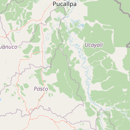
Map view of El Sira Communal Reserve

Use this park location map to pinpoint El Sira Communal Reserve in Peru, understand its exact geographic position, and read its mapped placement within the surrounding landscape more clearly.

Pigeon | © OpenStreetMap contributors
Recorded earthquake history

Review the El Sira Communal Reserve Historical Earthquake Catalogue

Examine the record of past seismic activity mapped to the geographic coordinates of El Sira Communal Reserve. This MoriAtlas catalogue provides event dates and technical parameters to assist in understanding the regional seismic context of the Sira Mountains and surrounding Amazonian basins.

El Sira Communal Reserve Earthquake History

Catalogued events

409 events

Strongest magnitude

Magnitude 6.7

Most recent event

Aug 9, 2026

This history includes earthquakes recorded inside the park or within 50 km of its borders

Visual reference for sub Andean rainforest habitats and mountain terrain

El Sira Communal Reserve Landscape and Scenery Photography

El Sira Communal Reserve imagery reveals the rugged topography and vertical altitudinal gradient where Andean slopes meet the Amazon basin. Protected forest habitats, river networks, and mountainous terrain emerge across the visual record for deep ecological research.

A wide, mountainous landscape covered in dense green forest, with clouds clinging to the slopes and ridge lines.

Park atlas

Compare nearby national parks, sub Andean reserves, and regional conservation areas

Parks Near El Sira Communal Reserve and Adjacent Protected Landscapes in Peru

Browsing other parks near El Sira Communal Reserve reveals connected Andean Amazon transitional forests and watershed corridors across east central Peru. Expanding the comparison across regional protected landscapes helps map broader ecological gradients and adjacent conservation territories.
A horizontal watercolor painting showing rolling green hills and pinkish ground vegetation under a soft, light-yellow sky.
Protected areaPasco Region
14 km away#1 closest

Southwest

San Matías, San Carlos Protection Forest: Geographic Boundaries and Protected Landscape Context

A vital watershed corridor in the Pasco Region of central Peru.

San Matías, San Carlos Protection Forest protects fragile mountain soils and downstream infrastructure from erosion and flooding. Stretching from 300 to 2,250 metres in elevation, the reserve supports a continuous block of highland habitat that serves as a bridge between the Peruvian Yungas and Ucayali moist forest ecoregions, while acting as a cornerstone of the Oxapampa-Asháninka-Yánesha Biosphere Reserve.

Area
1,458 km²
Established
1987
IUCN
VI
Relief
Mountain
Protected areaOxapampa Province
46 km away#2 closest

Southwest

Yanesha Communal Reserve: Geography and Protected Area Context in Oxapampa Province

A vital transition zone between the Andes and the Amazon

Gain insight into the physical character of Yanesha Communal Reserve, where humid tropical forests and river channels converge to form a complex ecosystem. This protected area offers a look at how sustainable land use and conservation intersect within the Palcazu River basin. Browse the geographic boundaries and mapped landscape features that define this essential region in central Peru.

Area
347.45 km²
Established
1988
IUCN
VI
Scope
Terrestrial
National parkPasco Region
51 km away#3 closest

Southwest

Yanachaga, Chemillén National Park: Protected Area in Pasco Region, Peru

Mapped terrain, Pleistocene refuge, and rich biodiversity.

Yanachaga, Chemillén National Park, a national park situated in Peru's Pasco Region, preserves over 122,000 hectares of mountainous cloud forest and rainforest ecosystems. Its landscape is characterized by dramatic canyons and steep forested slopes, creating significant altitudinal variation from 460 to 3,643 meters. Recognized as a Pleistocene refuge, the park shelters ancient forest remnants and harbors exceptional biodiversity, including hundreds of bird species and iconic mammals, offering rich context for geographic and protected-area exploration.

Area
1,220 km²
Established
1986
IUCN
II
Relief
Mountain
National parkPeru
79 km away#4 closest

Southeast

Otishi National Park: A Protected National Park Landscape in Peru's Geography

Explore the mapped boundaries and regional landscape of Otishi National Park.

Otishi National Park represents a significant protected area within Peru, offering a unique lens through which to explore regional geography and conservation landscapes. As a designated national park, it highlights the mapped boundaries and the natural terrain that defines this part of South America. Understanding Otishi National Park provides essential context for regional park discovery and the broader atlas of protected lands in Peru.

Area
3,059.73 km²
Established
2003
IUCN
II
Relief
Mountain
National parkPeru
91 km away#5 closest

North

Sierra del Divisor National Park: Peru's Sacred Amazonian Protected Landmark

Explore dramatic mountain terrain and protected lowland rainforest.

Sierra del Divisor National Park in Peru is a vital protected area conserving over 1.35 million hectares of Amazon rainforest. Characterized by the unique Sierra del Divisor mountain range and the sacred pyramid peak of Cerro El Cono, the park offers a distinct landscape within the broader Amazon basin. As one of Peru's newer national parks, it represents a significant commitment to preserving critical biodiversity corridors and understanding the geographic context of protected lands in a region facing environmental pressures.

Area
13,544.8 km²
Established
2015
IUCN
II
Relief
Mixed relief
National parkPeru
111 km away#6 closest

Northwest

Cordillera Azul National Park: A National Park for Geographic Discovery in Peru

Explore Peru's protected landscape and regional map context.

Cordillera Azul National Park serves as a dedicated entry point for understanding Peru's protected natural areas through a geographic lens. This park's identity is tied to its specific mapped boundaries and its contribution to the nation's diverse terrain. Focusing on Cordillera Azul National Park allows for detailed atlas exploration of its unique landscape context within western South America, providing factual data for geographic understanding.

Area
13,531.9 km²
Established
2001
IUCN
II
Relief
Mountain
National parkHuánuco Region
126 km away#7 closest

West

Tingo María National Park: National Park Protected Landscape in Huánuco Region, Peru

Atlas exploration of park boundaries and regional geography.

Investigate Tingo María National Park, a key protected area situated in the Huánuco Region of Peru. This national park designation signifies its importance for understanding the country's natural landscapes and mapped geography. Explore its protected territory and discover its place within the regional atlas.

Area
47.778 km²
Established
1965
IUCN
II
Relief
Mountain
National parkPeru
175 km away#8 closest

East

Alto Purús National Park: Peru's Protected National Park Landscape

Mapped boundaries and regional geographic context.

Investigate Alto Purús National Park, a designated national park within Peru. This detailed page provides essential context for understanding the park's geographic location, its protected status, and its role within the broader landscape of western South America. Explore the mapped features and regional setting that define this important conservation area.

Area
25,106.9 km²
Established
2004
IUCN
II
Relief
Mixed relief

Common questions about visiting, size, designation, and location context for El Sira Communal Reserve

El Sira Communal Reserve FAQs for park facts, access, geography, and protected area context

Find quick answers about El Sira Communal Reserve, including protected-area facts, park geography, trail and visitor context, and how the park fits into its surrounding country and regional landscape.
MoriAtlas Explorer

Continue Your Protected Areas Search Across the Global Atlas

Deepen your exploration by continuing the structured search for national parks and protected areas worldwide. Utilize the comprehensive filtering capabilities to compare different conservation landscapes and refine your understanding of global park geography. Discover more about the distribution and characteristics of protected natural areas.

Global natural geography