
Natural springs
Park geography
Technical analysis of regional landscape features and territorial dimensions
Geographic Profile and Mapped Boundaries of Elsey National Park in the Northern Territory
Explore the structured geographic data for Elsey National Park, encompassing its total area of 138.96 square kilometers and its defined perimeter within the Northern Territory. This profile identifies key terrain features, including the Roper River and Bitter Springs thermal systems, while providing spatial context for its tropical woodland and riparian habitats.
Related tags
Thermal SpringsTropical SavannaNorthern TerritoryWetlandsRiparian Forest
Thermal springs and wetland wilderness in Australia's Northern Territory
Elsey National Park
Elsey National Park is a protected area in the Northern Territory of Australia, situated approximately 378 kilometers southeast of Darwin and extending from 2 to 19 kilometers east of the town of Mataranka. The park covers an area of 138.96 square kilometers and was established in 1991 under the management of the Parks and Wildlife Commission of the Northern Territory. The park is renowned for its thermal springs, notably the Mataranka Thermal Pools, which draw significant visitor interest to the region. The landscape features a mix of floodplains, paperbark woodlands, and riverine environments characteristic of tropical northern Australia, with the Roper River system playing a key hydrological role in the area.
- Location
- Australia
- Park type
- National park
- Established
- 1991
- Area
- 139 km²
Location overview
Administrative boundaries and territorial status in Northern Territory
Geographic Location and Regional Setting of Elsey National Park
Elsey National Park is located entirely within the Northern Territory of Australia. Verified records outline its regional alignment and administrative status as an inland protected area.
- Countries
- Australia
- Regions
- Northern Territory
- Primary location
- Northern Territory
- Geographic setting
- Inland
Boundary and coordinates
Exploring the spatial extent and 138.96 square kilometer coverage
Elsey National Park Geographic Boundary and Spatial Mapping
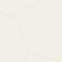
Interactive spatial mapping outlines the physical footprint of Elsey National Park to establish regional placement. Accompanying data lists the calculated area of 138.96 square kilometers alongside center coordinates and geographic spans.
- Boundary area
- 139 km²
- Boundary perimeter
- 73 km
- Northernmost point
- 14.9013° S
- Southernmost point
- 15.0163° S
- Easternmost point
- 133.2517° E
- Westernmost point
- 133.0851° E
- Geographic centre
- 14.9581° S, 133.1887° E
- North–south span
- 12.7 km
- East–west span
- 17.9 km
Terrain and natural features
Mapped rivers, springs, and waterfalls across the protected landscape
Elsey National Park Terrain and Named Natural Features
Recorded natural features include Bitter Springs Thermal Pools, Mataranka Falls, and surrounding river systems located within the protected area. Linked feature cards supply names, types, measurements, and spatial relationships for each mapped geographic element.
Selected named natural features
Viewpoints
Korowan (Mataranka Falls)
Waterfalls
Mataranka Falls
Rivers
Waterhouse River
Natural springs
Rainbow Spring
Rivers
Salt Creek
Environmental setting
Tropical climate zones, major water systems, and sparse forest cover
Elsey National Park Environmental Settings and Landscape Classifications
Recorded landscape features and tropical habitat types provide complementary perspectives on the physical setting of Elsey National Park. Stored categories link directly to relevant atlas destinations for systematic regional comparison.
- Climate
- Tropical
- Water
- Major water bodies
- Forest cover
- Sparse forest
Landscape features
Rivers · Waterfalls · Forest · Woodland · Wetland
Habitat types
Tropical forest · Savanna · Wetland · Riverine habitat
Park atlas
Discover surrounding protected landscapes, thermal springs, and tropical savanna environments across Australia's Northern Territory.
Explore Other National Parks and Protected Areas Near Elsey National Park
Continue your exploration beyond Elsey National Park to find other protected areas and national parks across the diverse Northern Territory, tracing the geographic spread of thermal springs, riparian forests, and savanna woodlands. This focused view allows for direct comparison of conservation landscapes and unique natural features found within the broader tropical Australian region.
National parkNorthern Territory
65 km away#1 closest
Northwest

Nitmiluk National Park: Detailed Protected Landscape and Geographic Context
Explore mapped park boundaries and regional terrain.
Delve into the specifics of Nitmiluk National Park, a designated national park within the Northern Territory of Australia. This section focuses on its protected-area status and how its geography contributes to the regional landscape. Users can explore the park's mapped extent and understand its placement within the broader geographical atlas, highlighting its importance as a distinct protected natural area.
- Area
- 2,946.64 km²
- Established
- 1977
- IUCN
- II
- Visitors
- 309.8K annual
Nature reserveNorthern Territory
About 76 km away#2 closest
Northwest
Cutta Cutta Caves Nature Park: A Tropical Karst and Cave Reserve in Northern Territory
Protected tropical limestone karst and subterranean landscape geography.
Cutta Cutta Caves Nature Park is a specialized protected area in Australia, safeguarding a unique tropical limestone karst landscape near Katherine. This reserve manages subterranean cave systems, mineral-rich chambers, and the surrounding woodland terrain. As a significant ecological site, it provides essential habitat for rare wildlife, highlighting the complex intersection of geological formations and tropical biodiversity within the Northern Territory.
- Area
- 14.99 km²
- Established
- 1967
- IUCN
- III
- Visitors
- 17.2K annual
National parkAustralia
100 km away#3 closest
North
Kakadu National Park: Australia's Protected Landscape and Regional Geography
Explore Kakadu National Park's mapped boundaries and natural terrain.
Kakadu National Park stands as a significant national park entity within Australia, providing rich geographic context for atlas discovery. This page details the park's protected area identity, its mapped natural landscapes, and its place within the broader Australian continent's geography. Understand the unique regional setting and the specific topographic features that define Kakadu National Park for detailed exploration and comparative geographic analysis.
- Area
- 19,804 km²
- Established
- 1979
- IUCN
- II
- Visitors
- 250K annual
Protected landscapeNorthern Territory
About 113 km away#4 closest
Northwest
Kintore Caves Conservation Reserve: Karst Geography and Protected Landscape Analysis
Mapping subterranean terrain and cultural heritage in Australia's Northern Territory.
Kintore Caves Conservation Reserve in the Northern Territory is a vital protected area defined by its rare limestone karst geology and extensive cave networks. This site provides a concentrated look at subterranean biodiversity and archaeological history within a transitional rural setting near Katherine, showcasing the importance of focused conservation boundaries in safeguarding geological and human-linked landscapes.
- Area
- 4.23 km²
- Established
- 1965
- IUCN
- V
- Access
- Access unknown
National parkNorthern Territory
137 km away#5 closest
East
Limmen National Park: Explore Australia's Northern Territory National Park & Protected Landscape
Discover mapped geography and regional context for this protected area.
Limmen National Park stands as a distinct protected area within the Northern Territory, offering valuable insights for geographic exploration. This national park serves as a focal point for understanding the mapped landscape and the broader regional context of protected lands in Northern Australia. Its identity as a national park contributes significantly to the geographic narrative of the territory, making it a crucial point for atlas-based discovery.
- Area
- 9,369.26 km²
- Established
- 2012
- IUCN
- II
- Relief
- Upland
Nature reserveNorthern Territory
About 159 km away#6 closest
Northeast
Wongalara Sanctuary: Protected Landscapes and Top End Geography
Nature reserve featuring sandstone escarpments and savannah woodlands
Wongalara Sanctuary acts as a vital nature reserve and ecological refuge within Australia's Northern Territory. Spanning rugged sandstone plateaus, monsoon rainforests, and seasonal wetlands, the protected area maintains a rare, feral herbivore-free environment that supports extensive biodiversity across its mapped river corridors.
- Area
- 1,910 km²
- Established
- 2007
- Relief
- Upland
- Climate
- Tropical
Nature reserveNorthern Territory
About 160 km away#7 closest
West
Giwining / Flora River Nature Park: Protected Limestone Landscapes of Northern Territory
Geological spring systems and tropical riverine corridors.
The landscape of Giwining / Flora River Nature Park is defined by a network of calcium-rich springs emerging from Tindall Limestone. These waters have sculpted tufa dams and cascading waterfalls along the Flora River, creating a unique geological environment within the savanna woodlands of the Northern Territory.
- Area
- 78.24 km²
- Established
- 1993
- IUCN
- V
- Relief
- Lowland
National parkNorthern Territory
194 km away#8 closest
Southwest
Judbarra National Park: Northern Territory National Park Protected Landscape and Geography
Discover its mapped terrain and ancient Indigenous rock art.
Judbarra National Park is a major national park in Australia's Northern Territory, recognized for its extensive Indigenous rock art, which constitutes a significant artistic province. Spanning a vast area with two distinct geographic sections, the park showcases a transition between tropical and semi-arid ecosystems. Users can explore its rugged terrain, sandstone escarpments, and mapped park boundaries to understand its unique regional geographic context and rich cultural heritage.
- Area
- 13,004.1 km²
- Established
- 1990
- IUCN
- II
- Relief
- Mixed relief
MoriAtlas Explorer
Continue Exploring Elsey National Park's Geographic Identity and Mapped Protected Landscapes
Dive deeper into the specific geographic context and protected landscape features of Elsey National Park. Understanding its place within the Northern Territory's atlas of natural areas allows for a more comprehensive appreciation of its unique terrain, riparian systems, and the mapped boundaries that define this protected national park.
Browse next
Global natural geography
Explore related park routes
Explore MoriAtlas Global ParksBrowse All MoriAtlas ParksGlobal Park Map DiscoveryMoriAtlas: Browse All CountriesBrowse All MoriAtlas ContinentsNational Park Environment AtlasGrand Canyon National Park AtlasYellowstone National Park AtlasYosemite National Park Atlas and GeographySerengeti National Park AtlasGalápagos National Park Protected LandscapeBanff National Park Geography and AtlasKruger National Park Atlas EntryUluṟu-Kata Tjuṯa National Park AtlasExplore Uluru-Kata Tjuta National Park GeographyPlitvice Lakes National Park AtlasFiordland National Park Protected LandscapeGreat Smoky Mountains National Park AtlasAfghanistan National Parks and Protected AreasAlbania National Parks and Protected AreasAlgeria National Parks and Protected AreasAmerican Samoa National Parks and Protected AreasAndorra National Parks and Protected AreasAngola National Parks and Protected AreasAntarctica National Parks and Protected AreasAntigua and Barbuda Park List