
Streams
Park geography
Technical analysis of park boundaries, elevation ranges, and mountain landscapes
Comprehensive Geographic and Terrain Profile of Eungella National Park in Queensland Australia
Examine the detailed geographic structure of Eungella National Park, spanning 517 square kilometers across the rugged terrain of Queensland. This profile outlines precise boundary coordinates, identifies the highest recorded elevations reaching 1259 meters, and maps the distribution of diverse natural features including mountain peaks, deep gorges, and cascading waterfalls.
Related tags
Subtropical RainforestMountain Protected AreaEndemic SpeciesPlatypus HabitatQueensland Parks
Land of the clouds: Australia's longest continuous subtropical rainforest sanctuary
Eungella National Park
Eungella National Park is a protected area in north-central Queensland, Australia, located approximately 80 kilometres west of Mackay on the Clarke Range. The park encompasses 517 square kilometres of mountainous terrain, centred on the Eungella Plateau which rises to 1259 metres at Mount Dalrymple. The name Eungella derives from an Aboriginal word meaning 'land of the cloud', a fitting description for an area that receives an average annual rainfall of 2240 millimetres and is frequently shrouded in mist. The park is notable for preserving the longest continuous stretch of subtropical rainforest in Australia, representing roughly half of the rainforest cover that existed in the region at the time of European settlement. This isolated mountain massif supports an exceptional concentration of endemic species and serves as a critical refuge for Queensland's rainforest biodiversity.
- Location
- Australia
- Park type
- National park
- Established
- 1941
- Area
- 517 km²
- Highest point
- 1,259 m
Location overview
Administrative placement within Queensland, Australia
Geographic Profile and Regional Location of Eungella National Park
Eungella National Park is situated within the administrative state of Queensland in Australia. Official geographic records position the terrestrial reserve entirely within a single country and region.
- Countries
- Australia
- Regions
- Queensland
- Primary location
- Queensland
- Geographic setting
- Inland
Boundary and coordinates
Geographic extent and measurements across 517 square kilometers
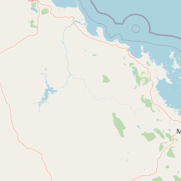
Geographic Boundaries and Interactive Mapping of Eungella National Park
Interactive boundary geometry provides a clear spatial outline of the protected landscape. Geographic statistics clarify the central coordinates, regional spans, and total calculated area of 517 square kilometers.
- Boundary area
- 600.4 km²
- Boundary perimeter
- 338.5 km
- Northernmost point
- 20.8421° S
- Southernmost point
- 21.1966° S
- Easternmost point
- 148.7406° E
- Westernmost point
- 148.4116° E
- Geographic centre
- 20.9952° S, 148.567° E
- North–south span
- 39.3 km
- East–west span
- 34.2 km
Elevation and terrain
Mountain relief metrics and recorded natural watercourses
Eungella National Park Terrain and Elevation Profile
This park elevation summary records a peak altitude of 1259 meters across rugged terrain. Individual feature cards list names, types, and spatial relationships for recorded streams and peaks.
- Maximum elevation
- 1,259 m
- Highest point
- 1,259 m
Selected named natural features
Peaks
Mount Omega
800 m
Streams
Barren Creek Left Branch
Streams
Boulder Creek
Peaks
Bull Mount
Streams
Quandong Creek
Environmental setting
Subtropical mountain relief, dominant forest cover, and diverse habitat types
Eungella National Park Environmental Classifications and Physical Settings
Recorded landscape features and habitat types frame the physical setting of Eungella National Park across diverse subtropical elevations. Stored classifications connect directly to relevant atlas destinations to trace broader environmental patterns.
- Relief
- Mountain
- Climate
- Subtropical
- Water
- Minor water
- Forest cover
- Dense forest cover
- Seasonality
- Year-round
Landscape features
Mountains · Forest · Valleys · Rivers · Waterfalls · Cave
Habitat types
Temperate broadleaf forest · Tropical forest · Montane forest · Riverine habitat · Wetland
Park atlas
Explore contiguous protected landscapes and regional park geography for comparison after Eungella National Park.
Discover Other Protected Areas Near Eungella National Park: Explore Adjacent Queensland Landscapes
Browse a curated list of national parks and protected areas near Eungella National Park, encompassing adjacent subtropical rainforests, mountainous terrain, and unique conservation landscapes. Compare regional protected areas by their distinct ecological features, geographic spread, and conservation status, revealing the broader network of Australian protected lands.
National parkQueensland
6.5 km away#1 closest
East

Mount Ossa National Park: A Protected Landscape within Queensland's Natural Atlas
Discover its mapped boundaries and regional geographic context.
Mount Ossa National Park stands as a key protected entity within Queensland, Australia, offering rich opportunities for atlas-based exploration. This page details its designation as a national park and provides context for its mapped landscape, allowing for a deeper understanding of its geographic significance in northeastern Australia. Explore the park's role in the regional conservation effort and its place within the broader Australian protected areas network.
- Area
- 4.96 km²
- Established
- 1994
- IUCN
- II
- Relief
- Mountain
National parkIsaac Region
11 km away#2 closest
South
Homevale National Park: Central Queensland's Protected Sandstone and Fossil Landscape
Explore dramatic cliffs, peaks, and ancient Permian fossil sites.
Homevale National Park in Australia's Isaac Region is a testament to geological time and conservation. Its landscape is defined by striking sandstone formations, including dramatic cliffs, rugged peaks, and distinctive spires. Beyond its visual appeal, the park is scientifically vital for its Permian-period fossil discoveries, dating back 280 to 225 million years. This protected area offers a unique glimpse into ancient marine environments and the geological evolution of Central Queensland, making it a key destination for atlas-driven landscape discovery.
- Area
- 218 km²
- Established
- 1995
- IUCN
- II
- Relief
- Mountain
National parkQueensland
12 km away#3 closest
Southeast
Mount Martin National Park: A Protected National Park in Queensland's Natural Landscape
Explore its mapped boundaries and regional geographic context.
Mount Martin National Park represents a distinct protected area within the Australian state of Queensland. This page offers focused insight into its role as a national park, providing users with a clear understanding of its geographic setting and mapped boundaries. Delve into the specific landscape characteristics and conservation context that define Mount Martin National Park, enriching your atlas exploration of Queensland's protected regions.
- Area
- 4.76 km²
- Established
- 1994
- IUCN
- II
- Relief
- Mountain

Marine protected areaQueensland
14 km away#4 closest
North
Great Barrier Reef Marine Park: Atlas and Geographic Context for Queensland Protected Waters
Exploring the reef system and marine conservation zones in northeastern Australia
The Great Barrier Reef Marine Park stands as an internationally significant marine protected area. By spanning a massive stretch of the Queensland coast, this protected landscape provides a critical framework for marine governance and reef conservation. Users can examine the unique zoning and distribution of coral reef habitats that define this extensive tropical ecosystem.
- Area
- 343,966 km²
- Established
- 1975
- Climate
- Tropical
- Scope
- Marine
National parkQueensland
18 km away#5 closest
East
Pioneer Peaks National Park: Queensland National Park Geography and Mapped Boundaries
Explore its protected landscape and regional context.
Pioneer Peaks National Park represents a distinct protected area within Queensland, Australia, offering valuable insights into regional geography and mapped natural landscapes. This canonical page focuses on the park's identity as a national park, detailing its geographic setting and the significance of its protected boundaries. It serves as a crucial point for understanding its place within the Australian atlas and the broader context of conservation landscapes.
- Area
- 18.4 km²
- Established
- 1992
- IUCN
- II
- Relief
- Mountain
National parkQueensland
20 km away#6 closest
East
Newry Islands National Park: A Mapped Protected Landscape in Queensland's Atlas
Explore the geographic boundaries and regional context of this national park.
Newry Islands National Park is a significant protected area located within Queensland, Australia. As a national park, it serves as a crucial point for understanding the distribution of protected lands and the diverse geography of northeastern Australia. This page provides a focused view on its mapped landscape, allowing for detailed atlas-based exploration of its protected boundaries and regional setting. Engage with the specific geographic identity of this Queensland natural landscape.
- Area
- 4.64 km²
- Established
- 1938
- IUCN
- II
- Climate
- Tropical
National parkQueensland
24 km away#7 closest
East
Cape Hillsborough National Park: Queensland's Volcanic Peninsula National Park
Mapped geography and protected landscape context in Central Queensland.
Cape Hillsborough National Park is a notable protected area defined by its unique volcanic peninsula landform in Queensland. Its rugged terrain features dense rainforest interiors that contrast with the surrounding coastal environments and tidal zones. As a national park, it offers an excellent opportunity to study landscape context, mapped geological features, and the distribution of protected natural areas within the Central Queensland region.
- Area
- 10.22 km²
- Established
- 1985
- IUCN
- II
- Relief
- Upland
National parkQueensland
32 km away#8 closest
Northeast
Repulse Island National Park: Queensland's Coastal Protected Area and Mapped Geography
Explore this key national park's mapped boundaries and island landscape.
Repulse Island National Park is an important protected natural area offering unique insights into coastal island geography within Queensland's expansive conservation network. Established as a national park, it signifies a commitment to preserving representative natural landscapes. This page focuses on the mapped boundaries, regional geographic context, and the protected landscape identity of Repulse Island National Park, providing a detailed entry point for atlas-driven discovery of Australia's protected areas.
- Area
- 1.51 km²
- Established
- 1994
- IUCN
- II
- Scope
- Terrestrial
MoriAtlas Explorer
Continue Exploring Eungella National Park's Mapped Geography and Landscape Context
Deepen your understanding of Eungella National Park by exploring its specific geographic features and protected landscape identity. This destination within MoriAtlas offers a structured way to investigate the park's boundaries and its setting within Queensland's broader natural geography. Continue your atlas exploration to see how Eungella National Park fits into the larger map of protected areas.
Browse next
Global natural geography
Explore related park routes
Explore MoriAtlas Global ParksBrowse All MoriAtlas ParksGlobal Park Map DiscoveryMoriAtlas: Browse All CountriesBrowse All MoriAtlas ContinentsNational Park Environment AtlasGrand Canyon National Park AtlasYellowstone National Park AtlasYosemite National Park Atlas and GeographySerengeti National Park AtlasGalápagos National Park Protected LandscapeBanff National Park Geography and AtlasKruger National Park Atlas EntryUluṟu-Kata Tjuṯa National Park AtlasExplore Uluru-Kata Tjuta National Park GeographyPlitvice Lakes National Park AtlasFiordland National Park Protected LandscapeGreat Smoky Mountains National Park AtlasAfghanistan National Parks and Protected AreasAlbania National Parks and Protected AreasAlgeria National Parks and Protected AreasAmerican Samoa National Parks and Protected AreasAndorra National Parks and Protected AreasAngola National Parks and Protected AreasAntarctica National Parks and Protected AreasAntigua and Barbuda Park List