

Mori Atlas logo
National parkMount Martin National Park

Mapping the protected boundaries and natural terrain of this key Australian National Park.

Mount Martin National Park: Queensland's Protected Landscape Identity and Geographic Context

Mount Martin National Park stands as a significant protected landscape within the varied geography of Queensland, Australia. As a designated National Park, its boundaries are integral to understanding the regional conservation efforts and the natural terrain it encompasses. This entry provides essential geographic context and atlas-level detail, allowing for focused discovery of its protected area status and its place within the broader landscape of northeastern Australia.

National ParkQueenslandProtected AreaAustraliaIUCN Category IICoastal Queensland

Mount Martin National Park

National park

Park overview

Structured park overview, official facts, and landscape profile for Mount Martin National Park

Mount Martin National Park park facts, protected area profile, and essential visitor context
Review the core facts for Mount Martin National Park, including designation, size, terrain, visitor scale, habitats, and operating context in one park-focused overview.

About Mount Martin National Park

Mount Martin National Park is a relatively small but significant protected area in the state of Queensland, Australia. Established in 1994, the park represents one of Queensland's newer national parks and contributes to the state's comprehensive network of protected areas that preserve the nation's natural biodiversity and landscapes. The park's establishment reflected ongoing efforts by Queensland's conservation authorities to identify and protect areas of ecological significance across the state.

The park is situated in a region characterized by Australia's distinctive coastal and subtropical environments. While the available source material does not provide detailed information about the park's specific topography, vegetation communities, or visitor facilities, its designation as a national park indicates that it contains natural values worthy of protection at the national level. The Queensland Parks and Wildlife Service, as the governing body, manages the park according to the standards and regulations applicable to IUCN Category II protected areas.

National parks in Australia serve multiple purposes, including the preservation of representative ecosystems, protection of biodiversity, and provision of outdoor recreation opportunities for visitors. Mount Martin National Park, despite its modest size, contributes to these objectives within the Queensland protected area system.

Quick facts and research context for Mount Martin National Park

Mount Martin National Park is located in Queensland, Australia, roughly 829 kilometers northwest of Brisbane. The protected area spans 4.76 square kilometers (1.84 square miles) and was formally established in 1994. The park is managed by the Queensland Parks and Wildlife Service and holds IUCN Category II designation as a national park. The area is situated in coastal Queensland, a region known for its subtropical landscapes and biodiversity.

Park context

Deeper park guide and search-rich context for Mount Martin National Park

Mount Martin National Park history, landscape, wildlife, and travel context
Explore Mount Martin National Park through its history, landscape character, ecosystems, wildlife, conservation priorities, cultural context, and seasonal travel timing in a structured park guide built for atlas discovery and search intent.

Mount Martin National Park history and protected-area timeline

Mount Martin National Park was established in 1994, making it a relatively recent addition to Queensland's network of national parks. The park's creation during the early 1990s reflects a period when Australia was actively expanding its protected area estate as part of national and state conservation strategies. During this era, Queensland's park management authorities identified various landscapes across the state that warranted formal protection as national parks, recognizing their ecological, scenic, or scientific values.

The park was designated under Queensland's protected area legislation and placed under the management of the Queensland Parks and Wildlife Service. This government agency is responsible for the administration and stewardship of Queensland's national parks and other protected areas, ensuring their natural values are maintained while providing appropriate opportunities for public enjoyment and environmental education.

Mount Martin National Park conservation status and protection priorities

Mount Martin National Park is classified as an IUCN Category II protected area, which represents national parks established primarily for ecosystem conservation and protection. This international designation indicates that the park contains natural habitats and ecological communities of significance that warrant protection at a national level. The Category II classification is one of the most recognized protected area categories globally and signifies that the area is managed specifically for the preservation of natural landscapes and the biodiversity they support.

As part of Queensland's national park system, Mount Martin contributes to the state's commitment to biodiversity conservation. Australia's national parks network collectively protects representative examples of the country's diverse ecosystems, from tropical rainforests to arid deserts and coastal environments. While specific details about the park's ecological values are not detailed in available sources, its inclusion in the national park system reflects its recognition as a area with conservation significance worthy of permanent protection.

Top sights and standout views in Mount Martin National Park

Mount Martin National Park is a 4.76 square kilometer protected area in coastal Queensland, established in 1994 and managed by the Queensland Parks and Wildlife Service. Located approximately 829 kilometers northwest of Brisbane, the park represents Queensland's commitment to biodiversity conservation within its national park network. The park holds IUCN Category II designation, reflecting its status as a nationally significant protected area focused on ecosystem conservation.

Park location guide

Geography guide, regional context, and park location map for Mount Martin National Park

Mount Martin National Park park geography, regions, and map view in Australia
Understand where Mount Martin National Park sits in Australia through a broader geographic reading of the surrounding landscape, nearby location context, and its mapped position within the national park landscape.

How Mount Martin National Park fits into Australia

Australia is a constitutional monarchy and federal parliamentary democracy comprising six states and ten territories. With a population of nearly 28 million, it is one of the world's most urbanised countries, with most people concentrated on the eastern seaboard. The country has a high Human Development Index and is known for its cultural diversity, ancient Aboriginal heritage, and unique wildlife.

Wider geography shaping Mount Martin National Park in Australia

Australia occupies the entire Australian continent, the island of Tasmania, and numerous smaller islands. It is the world's flattest and driest inhabited continent, featuring vast deserts in the interior (the Outback), tropical rainforests along the eastern coast, and a coastline bordering the Indian and Pacific Oceans.

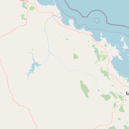
Map view of Mount Martin National Park

Use this park location map to pinpoint Mount Martin National Park in Australia, understand its exact geographic position, and read its mapped placement within the surrounding landscape more clearly.

Pigeon | © OpenStreetMap contributors

Location context for Mount Martin National Park

Queensland
Park atlas

Trace the interconnected protected landscapes surrounding Mount Martin National Park, revealing regional park geography.

Explore Other National Parks and Protected Areas Near Mount Martin National Park, Queensland
Continue your park discovery beyond Mount Martin National Park by exploring other protected areas and national parks in its surrounding Queensland region. This comparison reveals the broader protected landscape, allowing users to map diverse conservation zones and understand their geographic relationships.
National parkQueensland

Mount Ossa National Park: A Protected Landscape within Queensland's Natural Atlas

Discover its mapped boundaries and regional geographic context.

Mount Ossa National Park stands as a key protected entity within Queensland, Australia, offering rich opportunities for atlas-based exploration. This page details its designation as a national park and provides context for its mapped landscape, allowing for a deeper understanding of its geographic significance in northeastern Australia. Explore the park's role in the regional conservation effort and its place within the broader Australian protected areas network.

Area
4.96 km²
Established
1994
IUCN
II
Relief
Mountain
National parkQueensland

Pioneer Peaks National Park: Queensland National Park Geography and Mapped Boundaries

Explore its protected landscape and regional context.

Pioneer Peaks National Park represents a distinct protected area within Queensland, Australia, offering valuable insights into regional geography and mapped natural landscapes. This canonical page focuses on the park's identity as a national park, detailing its geographic setting and the significance of its protected boundaries. It serves as a crucial point for understanding its place within the Australian atlas and the broader context of conservation landscapes.

Area
18.4 km²
Established
1992
IUCN
II
Relief
Mountain
National parkQueensland

Cape Hillsborough National Park: Queensland's Volcanic Peninsula National Park

Mapped geography and protected landscape context in Central Queensland.

Cape Hillsborough National Park is a notable protected area defined by its unique volcanic peninsula landform in Queensland. Its rugged terrain features dense rainforest interiors that contrast with the surrounding coastal environments and tidal zones. As a national park, it offers an excellent opportunity to study landscape context, mapped geological features, and the distribution of protected natural areas within the Central Queensland region.

Area
10.22 km²
Established
1985
IUCN
II
Relief
Upland
National parkQueensland

Reliance Creek National Park: Preserving Queensland's Coastal Palm Forest Ecosystem

Mapped protected landscape on Queensland's central coast.

Reliance Creek National Park is a critical conservation site in Queensland, safeguarding the most significant remaining area of coastal palm forest. This compact national park protects a unique subtropical ecosystem that has largely vanished from the surrounding regional landscape. Users can explore its precise location and geographic context, understanding its importance as a preserved natural heritage and a testament to the original coastal plain environment.

Area
0.14 km²
Established
1980
IUCN
II
Access
Remote access
National parkQueensland

Eungella National Park: National Park Protected Landscape and Queensland Geography

Explore mapped boundaries and regional landscape context.

Gain a detailed understanding of Eungella National Park as a protected landscape within Queensland. This page focuses on its mapped boundaries and geographic positioning, offering an atlas-oriented view for those interested in regional park discovery. Delve into the specific natural terrain and protected area context that characterizes Eungella National Park, enhancing your geographic comprehension.

Area
517 km²
Established
1941
IUCN
II
Relief
Mountain
National parkQueensland

Round Top Island National Park: Protected Island Landscape in Queensland

Explore mapped boundaries and regional conservation context.

Round Top Island National Park preserves the natural character of a small coastal island in Queensland's Coral Sea region. This national park offers a clear example of an entire island protected area, contributing to the broader atlas of Australian conservation landscapes. Understanding its mapped boundaries and its place within North Queensland's geography provides insight into the diversity of protected island ecosystems preserved for their ecological significance.

Area
0.19 km²
IUCN
II
Relief
Mixed relief
Scope
Mixed
National parkIsaac Region

Homevale National Park: Central Queensland's Protected Sandstone and Fossil Landscape

Explore dramatic cliffs, peaks, and ancient Permian fossil sites.

Homevale National Park in Australia's Isaac Region is a testament to geological time and conservation. Its landscape is defined by striking sandstone formations, including dramatic cliffs, rugged peaks, and distinctive spires. Beyond its visual appeal, the park is scientifically vital for its Permian-period fossil discoveries, dating back 280 to 225 million years. This protected area offers a unique glimpse into ancient marine environments and the geological evolution of Central Queensland, making it a key destination for atlas-driven landscape discovery.

Area
218 km²
Established
1995
IUCN
II
Relief
Mountain
National parkQueensland

Repulse Island National Park: Queensland's Coastal Protected Area and Mapped Geography

Explore this key national park's mapped boundaries and island landscape.

Repulse Island National Park is an important protected natural area offering unique insights into coastal island geography within Queensland's expansive conservation network. Established as a national park, it signifies a commitment to preserving representative natural landscapes. This page focuses on the mapped boundaries, regional geographic context, and the protected landscape identity of Repulse Island National Park, providing a detailed entry point for atlas-driven discovery of Australia's protected areas.

Area
1.51 km²
Established
1994
IUCN
II
Scope
Terrestrial

Common questions about visiting, size, designation, and location context for Mount Martin National Park

Mount Martin National Park FAQs for park facts, access, geography, and protected area context
Find quick answers about Mount Martin National Park, including protected-area facts, park geography, trail and visitor context, and how the park fits into its surrounding country and regional landscape.
MoriAtlas Explorer

Continue Your Protected Areas Search Across the Global Atlas

Deepen your exploration by continuing the structured search for national parks and protected areas worldwide. Utilize the comprehensive filtering capabilities to compare different conservation landscapes and refine your understanding of global park geography. Discover more about the distribution and characteristics of protected natural areas.

Global natural geography