

Mori Atlas logo
National parkGloucester National Park

Discover the mapped boundaries and protected landscape of this key Australian National Park.

Gloucester National Park: A National Park in Western Australia's Geographic Context

Gloucester National Park represents a significant protected area within the diverse geography of Western Australia. As a designated national park, its primary value lies in its mapped boundaries and contribution to the region's natural landscape context. This entry provides essential geographic details and atlas-oriented information, enabling a deeper understanding of Gloucester National Park's role as a protected natural area in Western Australia.

Karri ForestFire Lookout TreeWestern AustraliaTall Eucalyptus ForestWaterfallForest Walking

Gloucester National Park

National park

Park overview

Structured park overview, official facts, and landscape profile for Gloucester National Park

Gloucester National Park park facts, protected area profile, and essential visitor context
Review the core facts for Gloucester National Park, including designation, size, terrain, visitor scale, habitats, and operating context in one park-focused overview.

About Gloucester National Park

Gloucester National Park occupies a significant position in the conservation landscape of Western Australia's southern forests. The park's creation in 1993 formalized protection for an area that had long been recognized for its outstanding karri forest and cultural landmarks. Karri trees, scientifically known as Eucalyptus diversicolor, grow to heights exceeding eighty meters and form the dominant canopy of the forest that fills the park. These trees are endemic to a relatively small region of southwestern Australia, making the park's karri forest a representation of a rare and limited ecosystem type. Beyond the iconic Gloucester Tree, the park contains additional karri specimens of impressive dimensions, though none quite matching the fame of the namesake tree. The landscape surrounding the forest includes typical understory species of the karri forest type, including various shrubs, ferns, and grasses adapted to the relatively high rainfall of the region. The park's accessibility from Pemberton, a small forest town that serves as a regional hub for tourism and outdoor recreation, makes it a practical destination for visitors exploring the southern forest district. The combination of easy access, a unique climbing experience, and the visual impact of towering karri trees creates a park offering that is both distinctive and widely recognized across Western Australia.

Quick facts and research context for Gloucester National Park

Gloucester National Park is located in the southern forest region of Western Australia, near the town of Pemberton. The park was formally established in 1993 and covers an area of 8.78 square kilometers. It is classified as an IUCN Category II protected area, reflecting its national park status. The dominant landscape feature is karri forest, a tall eucalyptus forest type found only in the southwest of Western Australia. The park is managed by the Western Australia Department of Environment and Conservation.

Park context

Deeper park guide and search-rich context for Gloucester National Park

Gloucester National Park history, landscape, wildlife, and travel context
Explore Gloucester National Park through its history, landscape character, ecosystems, wildlife, conservation priorities, cultural context, and seasonal travel timing in a structured park guide built for atlas discovery and search intent.

Why Gloucester National Park stands out

Gloucester National Park is best known for the Gloucester Tree, one of the most famous karri trees in Western Australia and a iconic example of the state's giant tree species. The tree stands as a living monument to both natural grandeur and early forest management practices. Visitors come specifically to climb the steel ladder system embedded in the tree's trunk, ascending sixty meters to a viewing platform that provides commanding views over the surrounding karri forest. This climbing experience, unique among the world's natural attractions, has drawn visitors for decades and remains the park's primary draw. The Cascades waterfall on Lefroy Brook provides a secondary attraction, offering a contrasting natural spectacle within the same protected landscape.

Gloucester National Park history and protected-area timeline

The history of Gloucester National Park is closely tied to the Gloucester Tree itself, which provided the foundation for the area's significance long before formal protected area status was established. The tree was named in 1946 after the city of Gloucester in England, reflecting the naming conventions common in the colonial-era surveying and administration of Western Australia's southwest. Prior to its use as a visitor attraction, the tree served a practical forest management function as a fire lookout. In 1947, a wooden platform and cabin were constructed at the height of approximately sixty meters, along with climbing pegs that allowed access to this elevated structure. This installation was part of a broader network of eight similar lookout trees constructed throughout the region between 1937 and 1952, each serving as fire detection stations during an era before extensive radio communication. The Gloucester Tree proved particularly popular with the public, and by 1963 it was estimated that more than three thousand people had climbed to the viewing platform. In 1973, the original wooden cabin was demolished and replaced with a more durable aluminium and steel structure, ensuring the longevity of the attraction while accommodating increasing visitor numbers. The formal establishment of Gloucester National Park in 1993 consolidated protection for the tree and surrounding forest, creating the contemporary protected area that encompasses both the Gloucester Tree and the Cascades waterfall area.

Gloucester National Park landscape and geographic character

The landscape of Gloucester National Park is defined by its karri forest, a distinctive tall forest ecosystem that characterizes much of the southern Western Australia coastline. The karri trees dominate the canopy, their straight grey-brown trunks rising dozens of meters before branching into a dense crown of dark green foliage. The forest floor varies from relatively clear areas where larger trees dominate to denser understory sections containing shrubs and smaller trees. The terrain is gently undulating, consistent with the ancient, weathered landscape of the southwest Australian region. Lefroy Brook flows through the park, creating the conditions for The Cascades waterfall, where the watercourse drops over a series of rock steps. The surrounding area outside the park continues the forest pattern, with karri and other eucalypt species forming an interconnected forest landscape that extends across much of the Pemberton region. The visual character of the park shifts with the seasons, from the fresh green of winter and spring growth to the deeper, more subdued greens of summer.

Gloucester National Park ecosystems, habitats, and plant life

The karri forest of Gloucester National Park represents one of the most distinctive forest types in Australia, characterized by the towering eucalyptus species Eucalyptus diversicolor. Karri forests occur only in the southwest of Western Australia, where they grow in soils derived from laterite and granite substrates. The forest structure features karri as the dominant overstory species, typically growing in pure stands or with mixtures of other eucalypts such as marri and jarrah. The understory varies depending on canopy density, light availability, and moisture conditions, featuring various wattles, grass trees, and ferns. The forest ecosystem supports a range of bird species adapted to tall forest environments, including cockatoos, parrots, and honeyeaters. The karri trees themselves provide important habitat for hollow-dependent species including various marsupials and birds that require tree hollows for nesting and shelter. The forest exists within a Mediterranean climate zone characterized by wet winters and dry summers, with annual rainfall supporting the dense forest growth that defines the landscape.

Gloucester National Park wildlife and species highlights

The karri forest environment of Gloucester National Park supports diverse wildlife adapted to tall forest habitats. Birdlife is particularly notable, with species such as black cockatoos, ringnecks, and various honeyeaters commonly observed in the canopy. The large hollows that develop in mature karri trees provide nesting sites for cockatoos and owls, while the forest floor supports ground-dwelling birds including quail and rail species. Mammals present in the forest include western grey kangaroos and various possum species that use tree hollows for shelter during daylight hours. The dense understory provides habitat for smaller mammals including bandicoots and melomys. Reptiles including skinks and dragons inhabit the forest floor and basking sites among fallen logs and rock outcrops. TheLepidoptera, including various butterfly and moth species, are represented throughout the forest, particularly during the warmer months when flowering plants provide nectar sources.

Gloucester National Park conservation status and protection priorities

Gloucester National Park contributes to the conservation of Western Australia's southwestern forest ecosystems, an environment that has been significantly modified by historical logging and land clearing. The park protects a representative sample of karri forest, ensuring that this distinctive ecosystem type retains protected status within the regional landscape. The karri forest is recognized as a globally limited ecosystem, occurring only in southwestern Australia where climate and soil conditions support its development. Conservation of the park also protects the habitat values provided by the older growth karri trees, particularly the large hollow-bearing specimens that support hollow-dependent fauna. The park's management under the Department of Environment and Conservation ensures that visitor activities are managed to minimize ecological impact while providing opportunities for public appreciation of the forest environment. The presence of the Gloucester Tree adds a cultural conservation dimension, preserving an example of early forest management practice and a landmark of regional significance.

Gloucester National Park cultural meaning and human context

The Gloucester Tree represents a unique blend of natural and cultural heritage, combining the inherent significance of a magnificent karri tree with the cultural history of fire management in Western Australia's forests. The tree's use as a fire lookout from 1947 reflects an era when visual observation from elevated positions was a primary method of detecting bushfires across the extensive forest estate of the southwest. The installation of climbing infrastructure transformed the tree from a purely functional forest management tool into a visitor attraction, creating a tradition of tree climbing that continues today. The naming of the tree and park after Gloucester, England reflects the strong colonial ties and naming conventions of British administration in Western Australia. The local Noongar people, the Traditional Owners of the southwestern Australian landscape, have historical connections to the forest environments of the region, though the specific cultural associations with the Gloucester Tree area are not extensively documented in available sources.

Top sights and standout views in Gloucester National Park

The Gloucester Tree stands as the park's central highlight, a karri giant offering visitors the unique experience of climbing inside the tree to a platform sixty meters above ground. This climb, using permanent steel rungs embedded in the trunk, provides both physical challenge and spectacular forest views, making it the park's signature experience. The Cascades waterfall offers a contrasting attraction, with Lefroy Brook tumbling over rock steps to create a scenic cascade that can be viewed from a nearby platform. The karri forest environment itself is a highlight, providing the atmospheric setting of towering trees, dappled light, and forest atmosphere that defines the park experience. The combination of natural wonder and accessible adventure, all within a short distance from Pemberton, makes Gloucester National Park a must-visit destination for anyone exploring the southern forest region.

Best time to visit Gloucester National Park

Gloucester National Park can be visited throughout the year, though different seasons offer distinct experiences for visitors. The summer months of December through February bring warmer temperatures and longer days, making them popular for climbing the Gloucester Tree and exploring the forest trails. Autumn, from March to May, often features mild temperatures and somewhat reduced visitor numbers, providing a quieter experience of the park. Winter brings regular rainfall to the southwest forest region, which maintains the lush green appearance of the forest understory and contributes to water flow at The Cascades waterfall. Spring, from September to November, brings wildflower blooms throughout the forest, adding color to the landscape while temperatures remain comfortable for outdoor activity. The park is accessible year-round, though visitors should be aware that heavy rainfall may affect trail conditions and that the forest environment can be cooler than expected during winter months.
Park location guide

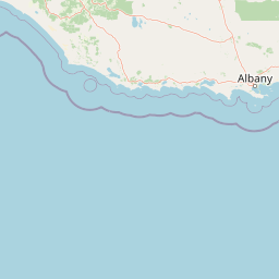
Geography guide, regional context, and park location map for Gloucester National Park

Gloucester National Park park geography, regions, and map view in Australia
Understand where Gloucester National Park sits in Australia through a broader geographic reading of the surrounding landscape, nearby location context, and its mapped position within the national park landscape.

How Gloucester National Park fits into Australia

Australia is a constitutional monarchy and federal parliamentary democracy comprising six states and ten territories. With a population of nearly 28 million, it is one of the world's most urbanised countries, with most people concentrated on the eastern seaboard. The country has a high Human Development Index and is known for its cultural diversity, ancient Aboriginal heritage, and unique wildlife.

Wider geography shaping Gloucester National Park in Australia

Australia occupies the entire Australian continent, the island of Tasmania, and numerous smaller islands. It is the world's flattest and driest inhabited continent, featuring vast deserts in the interior (the Outback), tropical rainforests along the eastern coast, and a coastline bordering the Indian and Pacific Oceans.

Map view of Gloucester National Park

Use this park location map to pinpoint Gloucester National Park in Australia, understand its exact geographic position, and read its mapped placement within the surrounding landscape more clearly.

Pigeon | © OpenStreetMap contributors

Location context for Gloucester National Park

Western Australia
Park atlas

Browse the diverse karri forest landscapes and broader protected areas surrounding Pemberton

Explore National Parks and Protected Areas Near Gloucester National Park, Western Australia
Continue your exploration from Gloucester National Park by browsing other national parks and protected areas across Western Australia's southern forest region. Compare the unique karri forest ecosystems, waterfalls, and other conservation landscapes adjacent to the Pemberton area to understand the regional spread of protected terrain.
National parkWestern Australia

Brockman National Park: Western Australia National Park for Protected Landscape Discovery

Explore mapped boundaries and natural terrain.

Brockman National Park is a significant protected area within Western Australia, recognized as a national park. This detail page focuses on its role as a conserved landscape, offering insight into its natural geography and mapped extent. Engage with structured data to understand the park's context within the broader regional atlas of Western Australia's protected lands.

Area
0.52 km²
Established
1977
IUCN
II
Relief
Highland
National parkWestern Australia

Warren National Park: A Protected Landscape of Ancient Karri Forests in Western Australia

Explore mapped forest boundaries and river geography.

Warren National Park offers an unparalleled glimpse into the grandeur of old-growth karri forests, showcasing some of Western Australia's most towering trees. Situated in the South West region, this national park protects a vital tract of temperate forest ecosystem, characterized by rolling terrain and the scenic Warren River. Its mapped landscape and protected-area status highlight the critical importance of preserving these magnificent natural environments for atlas-based geographic discovery.

Area
29.81 km²
Established
1977
IUCN
II
Scope
Terrestrial
National park

Greater Hawke National Park: Mapped Boundaries of Old Growth Forest Landscape

Explore the protected forest and regional geography.

Greater Hawke National Park offers a significant atlas exploration opportunity for understanding Australia's protected forest ecosystems. This national park preserves critical old growth stands of karri and jarrah trees, showcasing the unique landscape of the Warren bioregion. Its Class A reserve status and adjacency to D'Entrecasteaux National Park highlight its importance as a conservation corridor within the South West of Western Australia. Users can examine the park's geographic setting and its protected-area identity.

Area
140.04 km²
Established
2004
Climate
Mediterranean
Access
Moderate access
National parkWestern Australia

Sir James Mitchell National Park: National Park, Western Australia - Geographic Atlas View

Mapped protected area with regional landscape context.

Gain a structured understanding of Sir James Mitchell National Park as a key protected landscape within Western Australia. This atlas entry focuses on the park's geographic extent, its status as a national park, and its position within the diverse regional geography of Western Australia, offering clear insights for map-based exploration and conservation landscape analysis.

Area
2.47 km²
Established
1969
IUCN
II
Access
Access unknown
National parkWestern Australia

Greater Beedelup National Park: Western Australia's National Park Landscape

Discover Protected Areas and Regional Geography

Explore Greater Beedelup National Park, a key protected landscape within Western Australia. This national park offers a focus for understanding mapped natural features and the regional distribution of conservation areas. It serves as a vital point for atlas-based discovery, providing structured insights into the park's geographic setting and its identity as a protected natural area.

Area
17.83 km²
Established
1915
IUCN
II
Relief
Upland
National park

Jane National Park: Western Australia's Protected Old-Growth Forest Landscape

Mapped forest ecosystems in the South West bioregion.

Jane National Park represents a key protected landscape in the South West of Western Australia, recognized for its significant old-growth forest ecosystems. This Class A reserve preserves mature stands of karri and jarrah trees, offering a glimpse into the region's undisturbed natural heritage. Its landscape is characterized by dense, ancient forests dominating gentle terrain, making it an important site for understanding the conservation value of this bioregion and exploring its mapped natural context.

Area
68.63 km²
Established
2004
IUCN
II
Scope
Terrestrial
National park

Boorara-Gardner National Park: Mapped Old Growth Forest and Protected Landscape

Western Australia's protected area and regional geography.

Boorara-Gardner National Park is a vital national park in Western Australia, recognized for its stands of old-growth forest and its stunning spring wildflower displays. Delve into the park's specific geographic features, mapped terrain, and its identity as a key protected area within the South West region. Understand its place in the contiguous network of conservation lands through detailed atlas-style exploration.

Area
110.08 km²
Established
2004
Relief
Mixed relief
Climate
Mediterranean
National parkWestern Australia

Shannon National Park: A Protected Landscape in Western Australia's Geography

Discover the mapped boundaries and regional park context.

Shannon National Park represents a key protected area within the vast geographic expanse of Western Australia. This entry focuses on understanding its identity as a national park, highlighting its specific landscape character and its contribution to the regional atlas. Through detailed mapping and geographic context, users can explore the protected boundaries and natural setting of Shannon National Park.

Area
525.98 km²
Established
1988
IUCN
II
Relief
Mixed relief

Common questions about visiting, size, designation, and location context for Gloucester National Park

Gloucester National Park FAQs for park facts, access, geography, and protected area context
Find quick answers about Gloucester National Park, including protected-area facts, park geography, trail and visitor context, and how the park fits into its surrounding country and regional landscape.
MoriAtlas Explorer

Continue Your Protected Areas Search Across the Global Atlas

Deepen your exploration by continuing the structured search for national parks and protected areas worldwide. Utilize the comprehensive filtering capabilities to compare different conservation landscapes and refine your understanding of global park geography. Discover more about the distribution and characteristics of protected natural areas.

Global natural geography