

Mori Atlas logo
National parkBrockman National Park

Discover the mapped boundaries and natural terrain of this Western Australia national park.

Brockman National Park: Protected Landscape, Geographic Context, and Atlas Exploration

Brockman National Park stands as a protected national park within the vast geographic expanse of Western Australia. This dedicated entry offers an atlas-driven view, highlighting the park's role as a conservation landscape and providing context for its natural terrain and mapped boundaries. Understand its place within the regional geography of Western Australia through structured exploration.

Karri ForestEucalypt ForestWestern AustraliaSouth West AustraliaTall TreesOld-Growth Forest

Brockman National Park

National park

Park overview

Structured park overview, official facts, and landscape profile for Brockman National Park

Brockman National Park park facts, protected area profile, and essential visitor context
Review the core facts for Brockman National Park, including designation, size, terrain, visitor scale, habitats, and operating context in one park-focused overview.

About Brockman National Park

Brockman National Park protects a concentrated example of the karri forest ecosystem that once covered extensive areas of Western Australia's South West region. The park's eucalypt forest is dominated by karri (Eucalyptus diversicolor), a species renowned for reaching heights exceeding 60 metres, making it one of the tallest tree species in the world. Marri (Corymbia calophylla) trees are interspersed throughout the forest, adding to the structural complexity and ecological diversity of the area. The forest floor supports a distinctive understorey community adapted to the damp, shaded conditions beneath the canopy, featuring species such as swamp peppermint (Taxandria linearifolia), karri hazel, karri wattle (Acacia pentadenia), and the karri sheoak (Allocasuarina decussata). These understorey species thrive in the moist conditions maintained by the forest's structure and the proximity to the Warren River, which forms the park's northern boundary. The park's relatively small size of 52 hectares belies its conservation significance, as it represents a preserved fragment of forest that was heavily cleared for agriculture and timber extraction throughout the surrounding landscape. Visitors travelling between Pemberton and Northcliffe can access the park directly from the main road, though the experience remains essentially a natural one with no built facilities provided.

Quick facts and research context for Brockman National Park

Brockman National Park occupies 52 hectares (130 acres) of eucalypt forest in the South West of Western Australia. The park was formally established in 1977 and is managed by the Department of Environment and Conservation. It lies approximately 10 kilometres south of Pemberton and is bordered to the north by the Warren River, with Warren National Park adjacent to its western edge. The park features tall karri trees as its dominant canopy species, interspersed with marri trees, and supports a diverse understorey of moisture-loving plants. No visitor facilities or entry fees are provided at this location.

Park context

Deeper park guide and search-rich context for Brockman National Park

Brockman National Park history, landscape, wildlife, and travel context
Explore Brockman National Park through its history, landscape character, ecosystems, wildlife, conservation priorities, cultural context, and seasonal travel timing in a structured park guide built for atlas discovery and search intent.

Why Brockman National Park stands out

Brockman National Park is best known for its stands of karri trees (Eucalyptus diversicolor), one of the world's tallest flowering trees and a defining species of Western Australia's south-west forests. The park protects a relatively intact example of karri forest ecosystem, with the trees interspersed with marri (Corymbia calophylla) and supporting a rich understorey of native plants including swamp peppermint, karri hazel, karri wattle, and karri sheoak. This combination of towering eucalypts and diverse understorey vegetation makes the park a representative example of the unique karri forest biome.

Brockman National Park history and protected-area timeline

The park was established in 1977 as a protected area dedicated to preserving the karri forest ecosystem of the South West region. The name Brockman derives from the nearby Yeagarup Homestead, which was historically known as Brockman Station. This naming reflects the pastoral history of the area, which predates its designation as a national park. The establishment of the park in the late 1970s came during a period of increased recognition in Western Australia of the need to protect remaining fragments of old-growth forest, particularly the iconic karri stands that had been extensively logged throughout the twentieth century. The land was set aside under the administration of what is now the Department of Environment and Conservation to ensure the forest's long-term preservation.

Brockman National Park landscape and geographic character

The park occupies a landscape dominated by tall eucalypt forest on gently undulating terrain in the South West of Western Australia. The forest canopy reaches impressive heights, with mature karri trees towering above the understorey to create a typically dense canopy. The terrain is influenced by the nearby Warren River, which marks the northern boundary of the park and contributes to the moisture regime that supports the lush understorey vegetation. The forest floor is covered in leaf litter and decomposing material, with the soil supporting the diverse plant community that characterizes the understorey. The landscape character is one of towering trees, filtered light, and a sense of enclosure created by the dense vegetation.

Brockman National Park ecosystems, habitats, and plant life

The ecological character of Brockman National Park is defined by its karri forest ecosystem, one of the most distinctive forest types in Australia. The karri (Eucalyptus diversicolor) is the dominant canopy species and forms a tall, open forest that can reach heights of 60 to 75 metres at maturity. Interspersed with the karri are marri (Corymbia calophylla) trees, which add species diversity to the canopy layer. The understorey is particularly well-developed due to the moist, shaded conditions, featuring a mix of shrubs and small trees including swamp peppermint (Taxandria linearifolia), karri hazel, karri wattle (Acacia pentadenia), and karri sheoak (Allocasuarina decussata). This dense understorey layer contributes to the ecological complexity of the forest and provides habitat for various forest-dwelling species. The forest type is endemic to the South West of Western Australia, making the park's protection significant for maintaining representative examples of this biome.

Brockman National Park wildlife and species highlights

While the source material focuses primarily on the botanical features of the park, karri forests in the South West of Western Australia are known to support diverse wildlife communities. The tall trees provide nesting habitat for birds including cockatoos and parrots, while the dense understorey offers shelter for smaller mammals and reptiles. The proximity to the Warren River likely supports additional wildlife interest, as river systems in the region provide important habitat corridors for both terrestrial and aquatic species.

Brockman National Park conservation status and protection priorities

Brockman National Park contributes to the conservation of Western Australia's karri forest ecosystem, which has been significantly reduced by historical clearing for agriculture and timber production. The park protects a representative example of tall eucalypt forest that was once widespread across the South West region. As an IUCN Category II protected area, the park is managed primarily for ecosystem conservation and natural heritage preservation. The protection of this forest patch helps maintain biodiversity values and represents a commitment to preserving the unique tall forest landscapes that define much of the South West region's natural character.

Brockman National Park cultural meaning and human context

The park's name reflects the pastoral history of the South West region, derived from the nearby Yeagarup Homestead which was formerly known as Brockman Station. This naming connects the protected area to the broader history of European settlement and agricultural development in the region, though the park itself is now managed primarily for conservation rather than production. The surrounding landscape includes other protected areas such as Warren National Park, which together form a network of forest reserves that preserve remnants of the original South West environment.

Best time to visit Brockman National Park

The park can be visited throughout the year, though the South West of Western Australia experiences a Mediterranean climate with wet winters and dry summers. The karri forest is perhaps most atmospheric during the cooler months when the understorey remains lush and the forest benefits from regular rainfall. Summer months offer easier access on dry roads but the forest may appear more muted as moisture-loving plants become less conspicuous. The absence of visitor facilities means that visitors should be self-sufficient and prepared for a natural forest environment regardless of when they choose to visit.
Park location guide

Geography guide, regional context, and park location map for Brockman National Park

Brockman National Park park geography, regions, and map view in Australia
Understand where Brockman National Park sits in Australia through a broader geographic reading of the surrounding landscape, nearby location context, and its mapped position within the national park landscape.

How Brockman National Park fits into Australia

Australia is a constitutional monarchy and federal parliamentary democracy comprising six states and ten territories. With a population of nearly 28 million, it is one of the world's most urbanised countries, with most people concentrated on the eastern seaboard. The country has a high Human Development Index and is known for its cultural diversity, ancient Aboriginal heritage, and unique wildlife.

Wider geography shaping Brockman National Park in Australia

Australia occupies the entire Australian continent, the island of Tasmania, and numerous smaller islands. It is the world's flattest and driest inhabited continent, featuring vast deserts in the interior (the Outback), tropical rainforests along the eastern coast, and a coastline bordering the Indian and Pacific Oceans.

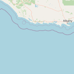
Map view of Brockman National Park

Use this park location map to pinpoint Brockman National Park in Australia, understand its exact geographic position, and read its mapped placement within the surrounding landscape more clearly.

Pigeon | © OpenStreetMap contributors

Location context for Brockman National Park

Western Australia
Park atlas

Compare regional protected areas, trace their geographic spread, and explore diverse ecosystems across Western Australia.

Compare Protected Areas and Nearby National Parks Around Brockman National Park
Continue exploring from Brockman National Park by browsing other national parks and protected areas situated within Western Australia's South West region. Compare these protected landscapes to understand the regional spread of karri forests and diverse eucalypt ecosystems, revealing broader conservation patterns and mapped geography.
National parkWestern Australia

Warren National Park: A Protected Landscape of Ancient Karri Forests in Western Australia

Explore mapped forest boundaries and river geography.

Warren National Park offers an unparalleled glimpse into the grandeur of old-growth karri forests, showcasing some of Western Australia's most towering trees. Situated in the South West region, this national park protects a vital tract of temperate forest ecosystem, characterized by rolling terrain and the scenic Warren River. Its mapped landscape and protected-area status highlight the critical importance of preserving these magnificent natural environments for atlas-based geographic discovery.

Area
29.81 km²
Established
1977
IUCN
II
Scope
Terrestrial
National park

Greater Hawke National Park: Mapped Boundaries of Old Growth Forest Landscape

Explore the protected forest and regional geography.

Greater Hawke National Park offers a significant atlas exploration opportunity for understanding Australia's protected forest ecosystems. This national park preserves critical old growth stands of karri and jarrah trees, showcasing the unique landscape of the Warren bioregion. Its Class A reserve status and adjacency to D'Entrecasteaux National Park highlight its importance as a conservation corridor within the South West of Western Australia. Users can examine the park's geographic setting and its protected-area identity.

Area
140.04 km²
Established
2004
Climate
Mediterranean
Access
Moderate access
National parkWestern Australia

Gloucester National Park: National Park in Western Australia's Geographic Landscape

Explore mapped boundaries and protected land context.

Gloucester National Park stands as a significant protected area within the vast geographic expanse of Western Australia. This entry focuses on its identity as a national park, detailing its mapped landscape features and regional context. Understanding Gloucester National Park involves appreciating its specific geographic setting and its contribution to the atlas of protected natural areas in Australia, providing foundational data for landscape exploration.

Area
8.78 km²
Established
1993
IUCN
II
Access
Moderate access
National parkWestern Australia

Greater Beedelup National Park: Western Australia's National Park Landscape

Discover Protected Areas and Regional Geography

Explore Greater Beedelup National Park, a key protected landscape within Western Australia. This national park offers a focus for understanding mapped natural features and the regional distribution of conservation areas. It serves as a vital point for atlas-based discovery, providing structured insights into the park's geographic setting and its identity as a protected natural area.

Area
17.83 km²
Established
1915
IUCN
II
Relief
Upland
National parkWestern Australia

Sir James Mitchell National Park: National Park, Western Australia - Geographic Atlas View

Mapped protected area with regional landscape context.

Gain a structured understanding of Sir James Mitchell National Park as a key protected landscape within Western Australia. This atlas entry focuses on the park's geographic extent, its status as a national park, and its position within the diverse regional geography of Western Australia, offering clear insights for map-based exploration and conservation landscape analysis.

Area
2.47 km²
Established
1969
IUCN
II
Access
Access unknown
National park

Jane National Park: Western Australia's Protected Old-Growth Forest Landscape

Mapped forest ecosystems in the South West bioregion.

Jane National Park represents a key protected landscape in the South West of Western Australia, recognized for its significant old-growth forest ecosystems. This Class A reserve preserves mature stands of karri and jarrah trees, offering a glimpse into the region's undisturbed natural heritage. Its landscape is characterized by dense, ancient forests dominating gentle terrain, making it an important site for understanding the conservation value of this bioregion and exploring its mapped natural context.

Area
68.63 km²
Established
2004
IUCN
II
Scope
Terrestrial
National park

Boorara-Gardner National Park: Mapped Old Growth Forest and Protected Landscape

Western Australia's protected area and regional geography.

Boorara-Gardner National Park is a vital national park in Western Australia, recognized for its stands of old-growth forest and its stunning spring wildflower displays. Delve into the park's specific geographic features, mapped terrain, and its identity as a key protected area within the South West region. Understand its place in the contiguous network of conservation lands through detailed atlas-style exploration.

Area
110.08 km²
Established
2004
Relief
Mixed relief
Climate
Mediterranean
National parkWestern Australia

D'Entrecasteaux National Park: Discover Western Australia's Protected National Park Landscape

Mapping protected boundaries and regional natural terrain.

D'Entrecasteaux National Park stands as a significant protected natural area, offering a focused lens for geographic discovery within Western Australia. This park's identity as a National Park provides a concrete point for understanding mapped landscapes and regional conservation efforts. Explore its specific boundaries and terrain to build a comprehensive picture of its role within the broader atlas of Western Australia's natural heritage.

Area
1,187.79 km²
Established
1980
IUCN
II
Visitors
168.5K annual

Common questions about visiting, size, designation, and location context for Brockman National Park

Brockman National Park FAQs for park facts, access, geography, and protected area context
Find quick answers about Brockman National Park, including protected-area facts, park geography, trail and visitor context, and how the park fits into its surrounding country and regional landscape.
MoriAtlas Explorer

Continue Your Protected Areas Search Across the Global Atlas

Deepen your exploration by continuing the structured search for national parks and protected areas worldwide. Utilize the comprehensive filtering capabilities to compare different conservation landscapes and refine your understanding of global park geography. Discover more about the distribution and characteristics of protected natural areas.

Global natural geography