

Mori Atlas logo
National parkSir James Mitchell National Park

Discover the mapped boundaries and geographic context of this protected landscape.

Sir James Mitchell National Park: National Park in Western Australia - MoriAtlas

Sir James Mitchell National Park represents a significant protected area within the vast geography of Western Australia. As a national park, it preserves a distinct natural landscape, offering insights into the region's environmental character. This dedicated atlas entry helps users understand the park's mapped boundaries and its place within the broader Western Australian context for structured geographic discovery.

South West AustraliaJarrah ForestProtected AreaNational ParkWestern AustraliaBiodiversity Hotspot

Sir James Mitchell National Park

National park

Park overview

Structured park overview, official facts, and landscape profile for Sir James Mitchell National Park

Sir James Mitchell National Park park facts, protected area profile, and essential visitor context
Review the core facts for Sir James Mitchell National Park, including designation, size, terrain, visitor scale, habitats, and operating context in one park-focused overview.

About Sir James Mitchell National Park

Sir James Mitchell National Park is a modest-sized protected area in the South West of Western Australia. Established in 1969, the park was created to preserve representative examples of the forest ecosystems that once covered much of this region. The South West of Western Australia is one of only 36 global biodiversity hotspots, meaning it contains an exceptional concentration of endemic species while facing significant conservation threats. The park is situated within the jarrah forest bioregion, characterised by its towering jarrah trees and the distinctive marri, or red gum, which forms part of the canopy. This forest ecosystem supports a diverse understory of shrubs, grasses, and wildflowers, many of which are found nowhere else on Earth. The park's small size means it functions primarily as a conservation component within a larger landscape that includes other protected areas, state forests, and Timber Reserve areas. Management of the park falls to the Western Australia Department of Environment and Conservation, which oversees fire management, invasive species control, and visitor access for this and other protected areas in the region.

Quick facts and research context for Sir James Mitchell National Park

Sir James Mitchell National Park is located in the South West region of Western Australia, 284 kilometres south of Perth. The park covers 2.47 square kilometres and was officially established in 1969. It is managed by the Western Australia Department of Environment and Conservation. The protected area falls within the South West Australian biodiversity hotspot, a region known for its high concentration of endemic plant species. The park is classified under IUCN Category II as a national park, indicating its primary purpose of ecosystem conservation.

Park context

Deeper park guide and search-rich context for Sir James Mitchell National Park

Sir James Mitchell National Park history, landscape, wildlife, and travel context
Explore Sir James Mitchell National Park through its history, landscape character, ecosystems, wildlife, conservation priorities, cultural context, and seasonal travel timing in a structured park guide built for atlas discovery and search intent.

Why Sir James Mitchell National Park stands out

Sir James Mitchell National Park is known for its role in protecting a portion of the South West Australian forest ecosystems. The park contributes to the preservation of jarrah and marri woodland and forest habitats that are characteristic of this region. While not as extensive as neighbouring conservation areas, the park serves as a component in the broader network of protected areas in the South West of Western Australia, an area recognised internationally for its exceptional biodiversity significance.

Sir James Mitchell National Park history and protected-area timeline

Sir James Mitchell National Park was established in 1969, joining a network of protected areas created across Western Australia during the mid-20th century. The establishment of this park reflected a growing recognition of the need to preserve representative samples of the state's unique forest ecosystems. Western Australia had already begun establishing national parks and nature reserves earlier in the century, but the post-war period saw accelerated protection efforts as awareness grew about the ecological significance of the South West forests. The park was named in honour of Sir James Mitchell, a significant figure in Western Australian history who served as Premier and contributed to the state's development during the early twentieth century. The park's creation came during a period when the value of South West forests was increasingly understood, both for their biodiversity and for their role in watershed protection and timber production. Over the decades since its establishment, the park has remained a protected area within Western Australia's conservation estate, managed according to the principles applicable to national parks in the state.

Sir James Mitchell National Park landscape and geographic character

The landscape of Sir James Mitchell National Park is characterised by gentle undulating terrain typical of the South West plateau region of Western Australia. The terrain consists of laterite soils and gravelly substrates that support the forest vegetation. The park sits at elevations that are moderate by South West standards, with the landscape marked by low ridges and shallow valleys that channel water flow during the wet winter months. The forest canopy is dominated by jarrah, a large eucalyptus species renowned for its durability and distinctive reddish bark that peels in strips, alongside marri trees with their large, gumnut-covered canopy. The understory contains a diverse mix of woody shrubs, including various species of grevillea, hakea, and banksia, which add structural complexity to the forest. The ground layer supports grasses, herbs, and seasonal wildflowers that bloom during the spring months, creating pockets of colour throughout the forest floor. The overall visual character is one of open woodland transitioning to denser forest in the more sheltered areas, typical of the jarrah forest ecosystem across this part of Western Australia.

Sir James Mitchell National Park ecosystems, habitats, and plant life

The nature of Sir James Mitchell National Park is defined by its location within the South West Australian biodiversity hotspot, one of the world's most significant regions for plant endemism. The park protects representative examples of the jarrah forest ecosystem, which supports an extraordinary diversity of plant species, many of which occur nowhere else on the planet. The jarrah-marri forest of the South West is characterised by its tall, open canopy dominated by Eucalyptus marginata (jarrah) and Corymbia calophylla (marri). This forest type occurs on the lateritic soils of the Darling Plateau and the adjacent ranges, and the park falls within this broader ecological community. The understory vegetation is exceptionally diverse, with numerous species of shrubs, grasses, and flowering plants contributing to the ecological complexity. The region experiences a Mediterranean climate with wet winters and dry summers, and this seasonal pattern shapes the ecology of the forest, influencing flowering times, wildlife behaviour, and the fire regimes that have historically shaped these ecosystems. The forest provides habitat for a range of native species, though the park's relatively small size means its ecological function is interconnected with the broader landscape.

Sir James Mitchell National Park wildlife and species highlights

The wildlife of Sir James Mitchell National Park is part of the broader South West Australian forest fauna community. The jarrah and marri forests of this region provide habitat for various bird species, including parrots, honeyeaters, and cockatoos that are characteristic of the South West. Mammals native to this forest ecosystem include several species of marsupials, though population distributions vary across the fragmented landscape of protected areas and timber production forests. The diverse understory and ground cover provide foraging resources and shelter for reptiles, insects, and small mammals that occupy the forest floor and lower vegetation layers. The South West region supports a range of endemic species that are found nowhere else in the world, a reflection of the long period of isolation that has allowed distinctive faunas to evolve in this part of Australia. While the park's small size limits the complexity of habitats it can support compared to larger conservation areas, it nonetheless contributes to the broader habitat network that supports wildlife populations across the South West forest region.

Sir James Mitchell National Park conservation status and protection priorities

Sir James Mitchell National Park contributes to the conservation estate of Western Australia's South West region, an area of global biodiversity significance. The park is classified as IUCN Category II, reflecting its designation as a national park with primary conservation objectives. The broader South West Australia biodiversity hotspot faces ongoing pressures from land clearing, climate change, invasive species, and altered fire regimes, making protected areas like this park important for maintaining representative examples of the native ecosystems. Conservation of the jarrah-marri forest ecosystem is particularly significant given the region's high endemism and the threats posed by forestry operations, mining, and urban expansion in parts of the South West. The network of protected areas, including national parks, nature reserves, and conservation parks across the region, works collectively to maintain ecological connectivity and preserve the biodiversity values of this internationally recognised hotspot.

Sir James Mitchell National Park cultural meaning and human context

The land on which Sir James Mitchell National Park sits has been part of the traditional Country of Aboriginal peoples for thousands of years. The South West of Western Australia contains some of the oldest archaeological evidence of continuous human occupation in Australia, and the Noongar people have longstanding connections to the jarrah forests and the landscapes of this region. While the specific traditional associations of the park's immediate area would be understood by the relevant Traditional Owner groups, the broader cultural context includes Aboriginal use of forest resources, cultural burning practices, and spiritual connections to Country. The park was named after Sir James Mitchell, a two-time Premier of Western Australia who served in the early twentieth century and contributed to the state's political and administrative development. Mitchell was a significant figure in Western Australian history, and his naming reflects the practice of commemorating notable state figures through place names within the conservation estate.

Top sights and standout views in Sir James Mitchell National Park

Sir James Mitchell National Park offers visitors the opportunity to experience jarrah-marri forest in a protected setting within the South West region. The park provides a modest but representative example of the forest ecosystems that make this part of Western Australia globally significant for biodiversity. The forest scenery, particularly during spring when wildflowers bloom, offers photographic and nature observation opportunities. The park forms part of a broader network of protected areas in the South West that includes larger parks such as D'Entrecasteaux, Shannon, and Walpole-Nornalup, allowing visitors to explore a range of forest and wilderness experiences across the region. The park's location, approximately 284 kilometres south of Perth, makes it accessible for day trips or as part of a broader South West touring route.

Best time to visit Sir James Mitchell National Park

The best time to visit Sir James Mitchell National Park aligns with the southern hemisphere seasons, with autumn and spring offering particularly pleasant conditions for exploring the park. Spring (September to November) brings the wildflower season, when the forest understory comes alive with blooming native flowers, adding colour to the woodland and providing excellent opportunities for nature photography. Autumn (March to May) typically offers mild temperatures and the start of the winter rainfall period, which begins to green the forest. Summer (December to February) can be warm to hot in the South West, and total fire bans may be in place during the driest periods, potentially affecting access. Winter (June to August) brings cooler temperatures and regular rainfall, which can make walking tracks muddy but also contributes to the lush appearance of the forest. The South West experiences a Mediterranean climate, so visitors should be aware that conditions vary significantly across seasons.
Park location guide

Geography guide, regional context, and park location map for Sir James Mitchell National Park

Sir James Mitchell National Park park geography, regions, and map view in Australia
Understand where Sir James Mitchell National Park sits in Australia through a broader geographic reading of the surrounding landscape, nearby location context, and its mapped position within the national park landscape.

How Sir James Mitchell National Park fits into Australia

Australia is a constitutional monarchy and federal parliamentary democracy comprising six states and ten territories. With a population of nearly 28 million, it is one of the world's most urbanised countries, with most people concentrated on the eastern seaboard. The country has a high Human Development Index and is known for its cultural diversity, ancient Aboriginal heritage, and unique wildlife.

Wider geography shaping Sir James Mitchell National Park in Australia

Australia occupies the entire Australian continent, the island of Tasmania, and numerous smaller islands. It is the world's flattest and driest inhabited continent, featuring vast deserts in the interior (the Outback), tropical rainforests along the eastern coast, and a coastline bordering the Indian and Pacific Oceans.

Map view of Sir James Mitchell National Park

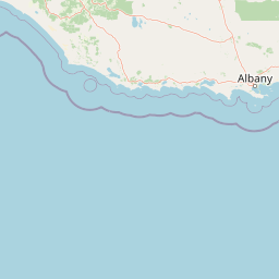
Use this park location map to pinpoint Sir James Mitchell National Park in Australia, understand its exact geographic position, and read its mapped placement within the surrounding landscape more clearly.

Pigeon | © OpenStreetMap contributors

Location context for Sir James Mitchell National Park

Western Australia
Park atlas

Compare the diverse protected landscapes and forest reserves across Western Australia's South West region.

Explore Nearby National Parks and Protected Areas Beyond Sir James Mitchell National Park
Continue your exploration from Sir James Mitchell National Park by browsing other national parks and protected areas mapped across Western Australia's South West region. Compare varied conservation landscapes, trace the extent of the jarrah forest, and understand regional protected-area distribution.
National park

Jane National Park: Western Australia's Protected Old-Growth Forest Landscape

Mapped forest ecosystems in the South West bioregion.

Jane National Park represents a key protected landscape in the South West of Western Australia, recognized for its significant old-growth forest ecosystems. This Class A reserve preserves mature stands of karri and jarrah trees, offering a glimpse into the region's undisturbed natural heritage. Its landscape is characterized by dense, ancient forests dominating gentle terrain, making it an important site for understanding the conservation value of this bioregion and exploring its mapped natural context.

Area
68.63 km²
Established
2004
IUCN
II
Scope
Terrestrial
National parkWestern Australia

Gloucester National Park: National Park in Western Australia's Geographic Landscape

Explore mapped boundaries and protected land context.

Gloucester National Park stands as a significant protected area within the vast geographic expanse of Western Australia. This entry focuses on its identity as a national park, detailing its mapped landscape features and regional context. Understanding Gloucester National Park involves appreciating its specific geographic setting and its contribution to the atlas of protected natural areas in Australia, providing foundational data for landscape exploration.

Area
8.78 km²
Established
1993
IUCN
II
Access
Moderate access
National parkWestern Australia

Shannon National Park: A Protected Landscape in Western Australia's Geography

Discover the mapped boundaries and regional park context.

Shannon National Park represents a key protected area within the vast geographic expanse of Western Australia. This entry focuses on understanding its identity as a national park, highlighting its specific landscape character and its contribution to the regional atlas. Through detailed mapping and geographic context, users can explore the protected boundaries and natural setting of Shannon National Park.

Area
525.98 km²
Established
1988
IUCN
II
Relief
Mixed relief
National parkWestern Australia

Brockman National Park: Western Australia National Park for Protected Landscape Discovery

Explore mapped boundaries and natural terrain.

Brockman National Park is a significant protected area within Western Australia, recognized as a national park. This detail page focuses on its role as a conserved landscape, offering insight into its natural geography and mapped extent. Engage with structured data to understand the park's context within the broader regional atlas of Western Australia's protected lands.

Area
0.52 km²
Established
1977
IUCN
II
Relief
Highland
National parkWestern Australia

Warren National Park: A Protected Landscape of Ancient Karri Forests in Western Australia

Explore mapped forest boundaries and river geography.

Warren National Park offers an unparalleled glimpse into the grandeur of old-growth karri forests, showcasing some of Western Australia's most towering trees. Situated in the South West region, this national park protects a vital tract of temperate forest ecosystem, characterized by rolling terrain and the scenic Warren River. Its mapped landscape and protected-area status highlight the critical importance of preserving these magnificent natural environments for atlas-based geographic discovery.

Area
29.81 km²
Established
1977
IUCN
II
Scope
Terrestrial
National park

Greater Hawke National Park: Mapped Boundaries of Old Growth Forest Landscape

Explore the protected forest and regional geography.

Greater Hawke National Park offers a significant atlas exploration opportunity for understanding Australia's protected forest ecosystems. This national park preserves critical old growth stands of karri and jarrah trees, showcasing the unique landscape of the Warren bioregion. Its Class A reserve status and adjacency to D'Entrecasteaux National Park highlight its importance as a conservation corridor within the South West of Western Australia. Users can examine the park's geographic setting and its protected-area identity.

Area
140.04 km²
Established
2004
Climate
Mediterranean
Access
Moderate access
National park

Boorara-Gardner National Park: Mapped Old Growth Forest and Protected Landscape

Western Australia's protected area and regional geography.

Boorara-Gardner National Park is a vital national park in Western Australia, recognized for its stands of old-growth forest and its stunning spring wildflower displays. Delve into the park's specific geographic features, mapped terrain, and its identity as a key protected area within the South West region. Understand its place in the contiguous network of conservation lands through detailed atlas-style exploration.

Area
110.08 km²
Established
2004
Relief
Mixed relief
Climate
Mediterranean
National parkShire of Manjimup

Boyndaminup National Park: Explore Protected Area Boundaries and Geographic Setting

An Australian national park with distinct mapped landscapes.

Boyndaminup National Park is a key protected area providing rich opportunities for geographic discovery. This atlas-focused entry details its mapped boundaries and situates it within the broader landscape context of the Shire of Manjimup. Understand the park's identity as a national park and its role in Australia's conservation network, offering specific insights for map-based exploration and regional geography.

Area
54.43 km²
Established
2004
IUCN
II
Scope
Terrestrial

Common questions about visiting, size, designation, and location context for Sir James Mitchell National Park

Sir James Mitchell National Park FAQs for park facts, access, geography, and protected area context
Find quick answers about Sir James Mitchell National Park, including protected-area facts, park geography, trail and visitor context, and how the park fits into its surrounding country and regional landscape.
MoriAtlas Explorer

Continue Your Protected Areas Search Across the Global Atlas

Deepen your exploration by continuing the structured search for national parks and protected areas worldwide. Utilize the comprehensive filtering capabilities to compare different conservation landscapes and refine your understanding of global park geography. Discover more about the distribution and characteristics of protected natural areas.

Global natural geography