Why Boyndaminup National Park stands out
Boyndaminup National Park is best known for its protection of old-growth forest ecosystems spanning two distinct biogeographic regions. The northern portions of the park contain representative areas of the Jarrah Forest bioregion, while the southern sections encompass portions of the Warren bioregion, characterized by karri and tingle forests. These old-growth forests represent some of the most ecologically significant woodland and forest communities in Australia's Southwest Australia biodiversity hotspot, a region recognized globally for its high level of endemism and unique floral assemblages.
Boyndaminup National Park history and protected-area timeline
Boyndaminup National Park was established in 2004 through the Reserves (National Parks, Conservation Parks, and Nature Reserves) Bill 2004, which redesignated former state forest lands to national park status. The park was proposed as part of Western Australia's Forest Management Plan 2004-2013, which outlined a strategy for improving the protection of old-growth forests across the state's southwest. Prior to national park designation, the land had been managed as state forest, primarily for timber production. The creation of the park coincided with the designation of the broader Walpole Wilderness Area, which encompasses multiple national parks and reserves to the south and east, creating a significant protected landscape corridor.
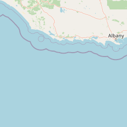
Boyndaminup National Park landscape and geographic character
The park is characterized by forested terrain situated west of Lake Muir, with the landscape shaped by the underlying geology and climate of the South West region. The park consists of two distinct land parcels, with the smaller portion located to the southwest of the main area. The terrain is typical of the jarrah-karri forest belt, featuring undulating landscapes with mixtures of open woodland and taller forest. The park is mostly surrounded by state forest lands, with direct adjacency to Shannon National Park along its western boundary, creating ecological connectivity with a larger protected area complex.
Boyndaminup National Park ecosystems, habitats, and plant life
The park straddles the boundary between two important bioregions of Southwest Australia. The northern portions fall within the Jarrah Forest bioregion, also referred to as the Southwest Australia woodlands, characterized by open forest dominated by jarrah with an understorey of diverse shrubs and herbaceous species. The southern areas belong to the Warren bioregion, known as the Jarrah-Karri forest and shrublands, where taller karri trees form the canopy. The park contains areas of old-growth forest, representing mature stands that have never been significantly disturbed by logging or other industrial activities. These old-growth communities provide critical habitat for numerous species and represent important ecological reference areas for understanding the region's natural heritage.
Boyndaminup National Park wildlife and species highlights
While the source material does not provide detailed species inventories, the park's position within the Jarrah Forest and Warren bioregions suggests it supports characteristic fauna of the Southwest Australia woodlands and forests. The old-growth forest habitats are known to provide shelter and foraging resources for a range of native species, including marsupials, birds, and invertebrates adapted to mature forest environments. The proximity to Lake Muir, a significant wetland, also suggests the park contributes to a broader ecological landscape that supports waterbird populations and aquatic species.
Boyndaminup National Park conservation status and protection priorities
Boyndaminup National Park was created specifically to address gaps in the protection of old-growth forest communities within Western Australia's Southwest Australia biodiversity hotspot. The park forms part of the Walpole Wilderness Area, a coordinated conservation landscape that brings together multiple protected areas to provide more effective conservation outcomes than isolated reserves could achieve alone. The creation of this park represented a shift in forest management philosophy, moving from production-focused use toward formal protection of ecologically significant forest types. Old-growth forests are particularly important for biodiversity conservation as they provide complex habitats, dead wood resources, and microclimatic conditions that support species not found in younger regrowth forests.
Boyndaminup National Park cultural meaning and human context
The park is situated within the traditional Country of the Noongar people, the Indigenous inhabitants of the South West region of Western Australia. While the source material does not detail specific cultural heritage sites or traditional use information, the broader South West region contains significant Indigenous cultural values associated with forested landscapes, waterways, and traditional food resources. The Noongar people have deep connections to the landscapes of what is now referred to as the South West of Western Australia, and many protected areas in the region are increasingly recognizing and incorporating Indigenous knowledge and cultural values into management approaches.
Top sights and standout views in Boyndaminup National Park
The park's primary highlight is its protection of old-growth jarrah and karri forests within a coordinated wilderness area network. The combination of two bioregions within a single protected area provides representation of diverse forest types and associated biodiversity. The park's adjacency to Shannon National Park and its position within the Walpole Wilderness Area creates opportunities for visitors to experience a larger contiguous natural landscape. The proximity to Lake Muir adds a wetland dimension to the park's conservation values.
Best time to visit Boyndaminup National Park
The South West of Western Australia experiences a Mediterranean climate with cool, wet winters and warm, dry summers. The optimal time to visit Boyndaminup National Park is during the cooler months from April to October when rainfall refreshes the landscape and forests appear lush. Spring months (September to November) bring wildflower displays across the forest understorey, offering particularly scenic conditions. Summer months can be warm and dry, with increased fire risk potentially affecting access. The park can be visited year-round, though summer conditions may limit some outdoor activities.