

Mori Atlas logo
National parkMount Frankland North National Park

Discover the geographic boundaries and protected wilderness of this significant national park.

Mount Frankland North National Park: Mapped Jarrah Forest Landscape in Western Australia

Mount Frankland North National Park stands as a vital protected area within the South West region of Western Australia, a testament to extensive Jarrah forest ecosystems and regional conservation planning. This national park, spanning over 220 square kilometres, is a key component of the Walpole Wilderness Area, preserving a significant tract of the unique Southwest Australia woodlands. Users can explore the park's mapped boundaries and understand its place within a broader landscape context, appreciating the ecological richness of one of Australia's most botanically significant regions.

National ParkJarrah ForestSouthwest AustraliaWalpole Wilderness AreaTemperate ForestProtected Area

Mount Frankland North National Park

National park

Park overview

Structured park overview, official facts, and landscape profile for Mount Frankland North National Park

Mount Frankland North National Park park facts, protected area profile, and essential visitor context
Review the core facts for Mount Frankland North National Park, including designation, size, terrain, visitor scale, habitats, and operating context in one park-focused overview.

About Mount Frankland North National Park

Mount Frankland North National Park protects a substantial area of Western Australia's renowned Jarrah forest, a ecosystem type confined almost entirely to the southwest of the continent. The park's establishment in 2004 marked a significant milestone in the conservation of this unique bioregion, as it was created alongside the broader Walpole Wilderness Area, reflecting a coordinated approach to protecting large, interconnected landscapes rather than isolated fragments. The park's position within a network of adjacent protected areas, including Mount Roe National Park, Mount Frankland National Park, and Lake Muir National Park, creates a significant conservation corridor that enables wildlife movement and supports ecological processes across a broad area. The Jarrah forest ecosystem is characterized by towering jarrah trees (Eucalyptus marginata) dominating the canopy, with a diverse understory of shrubs, herbs, and grasses adapted to the nutrient-poor soils and seasonal climate of the region. This landscape has evolved over millions of years in relative isolation, resulting in extraordinarily high levels of endemism among plants, invertebrates, and other organisms.

Quick facts and research context for Mount Frankland North National Park

Mount Frankland North National Park occupies 220.69 km² in the South West land division of Western Australia, protected under IUCN Category II as a national park. The park was established in 2004 alongside the broader Walpole Wilderness Area, representing a deliberate conservation effort to protect the Jarrah Forest bioregion. The area is managed by the Parks and Wildlife Service within the Department of Biodiversity, Conservation and Attractions. The park's location at approximately 34°39′S 116°42′E places it within the temperate climate zone of southern Western Australia, characterized by wet winters and dry summers typical of the Mediterranean climate of this region.

Park context

Deeper park guide and search-rich context for Mount Frankland North National Park

Mount Frankland North National Park history, landscape, wildlife, and travel context
Explore Mount Frankland North National Park through its history, landscape character, ecosystems, wildlife, conservation priorities, cultural context, and seasonal travel timing in a structured park guide built for atlas discovery and search intent.

Why Mount Frankland North National Park stands out

Mount Frankland North is best known for its extensive Jarrah forest ecosystems, representing one of the last remaining substantial tracts of this distinctive woodland type in southwestern Australia. The park forms an integral part of the Walpole Wilderness Area, a collection of national parks and conservation reserves that protect some of the region's most significant natural landscapes. The Jarrah forest, also referred to as the Southwest Australia woodlands, supports a remarkable diversity of plant and animal species, many of which are found nowhere else on Earth, making this area globally significant for biodiversity conservation.

Mount Frankland North National Park history and protected-area timeline

Mount Frankland North National Park was formally designated in 2004 as part of the creation of the Walpole Wilderness Area, a landmark conservation initiative that consolidated multiple protected areas in the South West of Western Australia. The establishment of the wilderness area represented years of scientific research, community advocacy, and government consultation aimed at preserving the outstanding natural values of this region. The park was carved from what had previously been state forest and other Crown land, reflecting a policy shift toward recognizing the ecological importance of retaining large areas of native vegetation. The creation of the park also acknowledged the growing scientific understanding that connectivity between protected areas is essential for long-term biodiversity conservation, particularly in regions like southwestern Australia that face multiple pressures from land clearing, climate change, and invasive species.

Mount Frankland North National Park landscape and geographic character

The landscape of Mount Frankland North National Park is dominated by the characteristicJarrah forest, a tall open woodland with jarrah trees forming a canopy typically ranging from 15 to 30 metres in height. The terrain is gently undulating, typical of the ancient, weathered landscape of the Southwest Australian landforms. The underlying geology contributes to the well-drained soils that support the dense forest cover, while small streams and seasonal wetlands add diversity to the terrain. The forest creates a park-like appearance with scattered large trees and a relatively open understory in many areas, though dense thickets of shrub species occur in other locations. The landscape retains much of its pre-European character, with limited evidence of major disturbance or modification within the park boundaries.

Mount Frankland North National Park ecosystems, habitats, and plant life

The park lies within the Jarrah Forest bioregion, also termed the Southwest Australia woodlands, recognized internationally as one of only 36 biodiversity hotspots on Earth. This ecoregion supports an extraordinary concentration of endemic species, with many plants and animals found nowhere else in the world. The jarrah forest ecosystem has developed on ancient, highly weathered soils that are low in nutrients, shaping the evolution of distinctive plant adaptations and species interactions. The forest supports a rich understory flora including numerous species of grass-trees, wattles, and heaths, while the canopy harbors diverse bird communities and arboreal marsupials. The region's climate, characterized by hot dry summers and cool wet winters, influences the seasonal patterns of vegetation growth and wildlife activity throughout the park.

Mount Frankland North National Park conservation status and protection priorities

Mount Frankland North National Park contributes to the protection of one of Australia's most significant natural landscapes, forming part of the Walpole Wilderness Area that preserves critical biodiversity values in the Southwest Australia bioregion. The park's inclusion in this larger wilderness area reflects recognition that protecting extensive, connected landscapes is more effective for conservation than protecting small, isolated fragments. The Jarrah Forest bioregion faces ongoing pressures from forestry operations, mining, agriculture, and urban development in the surrounding landscape, making protected areas like this park increasingly important for maintaining ecological processes and species populations. The park also contributes to regional conservation goals by connecting with adjacent protected areas, supporting the movement of wildlife and the maintenance of ecological corridors across the southern Western Australian landscape.

Mount Frankland North National Park cultural meaning and human context

The lands now comprising Mount Frankland North National Park fall within the traditional territory of the Noongar people, the Indigenous custodians of the South West of Western Australia. The Noongar people have lived in this region for tens of thousands of years, maintaining deep connections to the jarrah forests, wetlands, and waterways that characterize the landscape. While the park itself does not prominently feature documented archaeological sites or detailed historical accounts of traditional land use in available sources, the broader Walpole region holds cultural significance for Aboriginal communities, and this context contributes to understanding the park as part of a landscape shaped by human presence over millennia.

Top sights and standout views in Mount Frankland North National Park

The park's standout feature is its extensive, relatively intact jarrah forest, one of the best-preserved examples of this distinctive Australian woodland type. As part of the Walpole Wilderness Area, the park offers visitors the experience of remote, natural landscapes with minimal infrastructure and limited development, preserving a sense of wilderness character. The network of adjacent protected areas creates opportunities for extended exploration across multiple park boundaries, while the forest setting provides habitat for numerous native species. The park represents a successful example of conservation planning that protects both biodiversity and landscape-scale ecological processes in one of Australia's most botanically significant regions.

Best time to visit Mount Frankland North National Park

The optimal time to explore Mount Frankland North National Park is during the cooler months of autumn and winter, from April through September, when the forest environment is at its most pleasant and the landscape retains moisture from winter rains. The jarrah forest displays its strongest visual appeal during these seasons when vegetation is lush and the risk of bushfire is reduced compared to the hot, dry summer months. Summer visits, while possible, bring high temperatures and increased fire risk, which may limit some activities and access. The Mediterranean climate of the region means that most precipitation falls between May and September, creating green, productive conditions for wildlife observation during the winter months.
Park location guide

Geography guide, regional context, and park location map for Mount Frankland North National Park

Mount Frankland North National Park park geography, regions, and map view in Australia
Understand where Mount Frankland North National Park sits in Australia through a broader geographic reading of the surrounding landscape, nearby location context, and its mapped position within the national park landscape.

How Mount Frankland North National Park fits into Australia

Australia is a constitutional monarchy and federal parliamentary democracy comprising six states and ten territories. With a population of nearly 28 million, it is one of the world's most urbanised countries, with most people concentrated on the eastern seaboard. The country has a high Human Development Index and is known for its cultural diversity, ancient Aboriginal heritage, and unique wildlife.

Wider geography shaping Mount Frankland North National Park in Australia

Australia occupies the entire Australian continent, the island of Tasmania, and numerous smaller islands. It is the world's flattest and driest inhabited continent, featuring vast deserts in the interior (the Outback), tropical rainforests along the eastern coast, and a coastline bordering the Indian and Pacific Oceans.

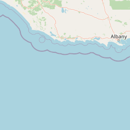
Map view of Mount Frankland North National Park

Use this park location map to pinpoint Mount Frankland North National Park in Australia, understand its exact geographic position, and read its mapped placement within the surrounding landscape more clearly.

Pigeon | © OpenStreetMap contributors

Location context for Mount Frankland North National Park

Western Australia
Park atlas

Trace connected protected landscapes and regional park geography surrounding Mount Frankland North National Park, Western Australia.

Discover Nearby National Parks and Protected Areas Beyond Mount Frankland North National Park
After exploring Mount Frankland North National Park, browse a curated selection of nearby protected areas and national parks across the Southwest region of Western Australia. Compare unique Jarrah forest ecosystems, discover adjacent conservation initiatives, and understand the broader protected geography within the Walpole Wilderness Area.
National parkWestern Australia

Mount Frankland National Park: Explore Western Australia's Old-Growth Forested Landscape

Granite peaks and unique regional geography within a protected wilderness area.

Mount Frankland National Park in Western Australia is a protected area renowned for its exceptional old-growth karri and red tingle forests, some of the world's tallest tree species. The park's landscape is shaped by low granite hills and dramatic peaks, including the 411-meter Mount Frankland, offering expansive views across the wilderness. As a key component of the Walpole Wilderness Area, this national park provides a rich geographical context for understanding conservation and mapped natural landscapes in Southwest Australia.

Area
373.59 km²
Established
1988
IUCN
II
Relief
Upland
National parkWestern Australia

Lake Muir National Park: A Ramsar-Listed Wetland National Park in Western Australia

Explore mapped boundaries and the unique paperbark woodland landscapes.

Lake Muir National Park protects a significant portion of the Muir-Byenup System, a Ramsar-designated wetland complex in Western Australia's south-west. This national park serves as a vital habitat for waterbirds and features characteristic paperbark woodlands surrounding the large inland Lake Muir. Understanding its protected area status and mapped geographic features provides crucial insight into the region's ecological importance.

Area
96.36 km²
Established
2004
IUCN
II
Access
Access unknown
National parkShire of Manjimup

Boyndaminup National Park: Explore Protected Area Boundaries and Geographic Setting

An Australian national park with distinct mapped landscapes.

Boyndaminup National Park is a key protected area providing rich opportunities for geographic discovery. This atlas-focused entry details its mapped boundaries and situates it within the broader landscape context of the Shire of Manjimup. Understand the park's identity as a national park and its role in Australia's conservation network, offering specific insights for map-based exploration and regional geography.

Area
54.43 km²
Established
2004
IUCN
II
Scope
Terrestrial
National parkGreat Southern

Mount Roe National Park: Detailed Protected Landscape and Geographic Exploration

Mapped boundaries and natural terrain of this national park.

Mount Roe National Park offers a distinct protected landscape for atlas exploration, situated within the geographic scope of the Great Southern region. This detail page provides a structured view of the park's mapped boundaries and its natural terrain. Understand how Mount Roe National Park contributes to the regional geography and the overall map of protected areas in Australia.

Area
1,278 km²
Established
2004
IUCN
II
Scope
Terrestrial
National parkWestern Australia

Mount Frankland South National Park: Western Australia's Protected Natural Landscape

Explore its mapped boundaries and regional geographic context.

Mount Frankland South National Park is a critical protected area defined by its unique natural landscape and mapped boundaries within Western Australia. This entry provides detailed insights into its geographic setting and the protected land it encompasses, offering a focused view for atlas exploration. Understand the park's significance as a protected natural reserve and its contribution to the regional geography of Western Australia, with a clear emphasis on mapped terrain and conservation landscapes.

Area
422.99 km²
Established
2004
IUCN
II
Relief
Mixed relief
National parkWestern Australia

Shannon National Park: A Protected Landscape in Western Australia's Geography

Discover the mapped boundaries and regional park context.

Shannon National Park represents a key protected area within the vast geographic expanse of Western Australia. This entry focuses on understanding its identity as a national park, highlighting its specific landscape character and its contribution to the regional atlas. Through detailed mapping and geographic context, users can explore the protected boundaries and natural setting of Shannon National Park.

Area
525.98 km²
Established
1988
IUCN
II
Relief
Mixed relief
National parkWestern Australia

Walpole-Nornalup National Park: Explore Protected Landscape and Regional Geography

Mapped boundaries and natural terrain context in Western Australia.

Walpole-Nornalup National Park offers a focused lens for understanding protected landscapes. As a designated national park in Western Australia, it provides valuable insights into regional geography and mapped natural terrain. This detailed view allows for a clear appreciation of the park's specific protected area characteristics and its place within the larger geographic atlas of the state.

Area
194.48 km²
Established
1910
IUCN
II
Visitors
158.2K annual
National park

Jane National Park: Western Australia's Protected Old-Growth Forest Landscape

Mapped forest ecosystems in the South West bioregion.

Jane National Park represents a key protected landscape in the South West of Western Australia, recognized for its significant old-growth forest ecosystems. This Class A reserve preserves mature stands of karri and jarrah trees, offering a glimpse into the region's undisturbed natural heritage. Its landscape is characterized by dense, ancient forests dominating gentle terrain, making it an important site for understanding the conservation value of this bioregion and exploring its mapped natural context.

Area
68.63 km²
Established
2004
IUCN
II
Scope
Terrestrial

Common questions about visiting, size, designation, and location context for Mount Frankland North National Park

Mount Frankland North National Park FAQs for park facts, access, geography, and protected area context
Find quick answers about Mount Frankland North National Park, including protected-area facts, park geography, trail and visitor context, and how the park fits into its surrounding country and regional landscape.
MoriAtlas Explorer

Continue Your Protected Areas Search Across the Global Atlas

Deepen your exploration by continuing the structured search for national parks and protected areas worldwide. Utilize the comprehensive filtering capabilities to compare different conservation landscapes and refine your understanding of global park geography. Discover more about the distribution and characteristics of protected natural areas.

Global natural geography