
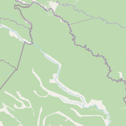
Rivers
Park geography
Detailed spatial assessment of regional terrain, wetland environments, and forest cover
Güeppi-Sekime National Park: Comprehensive Geographic Profile and Boundary Mapping Analysis
This geographic profile examines the spatial extent and environmental composition of Güeppi-Sekime National Park located in the Loreto Region of Peru. The data covers recorded boundary dimensions, major river networks such as the Río Yuracyacu and Río Angusilla, and the dominant tropical forest and wetland landscapes defining the region.
Related tags
Amazon rainforestNational parkPeru protected areasAmazonian biodiversityTropical forest
Amazonian protected area on the Peru-Ecuador border safeguarding pristine lowland rainforest and endangered species
Güeppi-Sekime National Park
Güeppi-Sekime National Park is a protected area located in the Loreto Region of Peru, situated directly on the border with Ecuador. The park encompasses approximately 203,600 hectares of tropical forest in a landscape characterized by rolling hills and seasonally flooded lowlands. Established as a national park in 2012, the area was originally designated as the Güeppi Reserved Zone in 1997 before receiving its current protected status. The park forms part of a broader network of protected areas in the western Amazon basin and serves as an important ecological corridor connecting Peruvian and Ecuadorian wilderness areas. Its remote location in one of the most biodiverse regions on Earth makes it a significant conservation area for numerous species of flora and fauna.
- Location
- Peru
- Park type
- National park
- Established
- 2012
- Area
- 2,036 km²
Location overview
Mapping recorded administrative locations across Peru and Brazil
Güeppi-Sekime National Park: Regional and National Geography
Güeppi-Sekime National Park is located within the Loreto Region and Putumayo Province of Peru and Brazil. Official registry records confirm a fully terrestrial, inland status without coastal or marine boundaries.
- Countries
- Peru
- Regions
- Loreto Region, Putumayo Province
- Primary location
- Peru
- Geographic setting
- Inland
Boundary and coordinates
Mapping the 2,036 square kilometer regional footprint and spatial coordinates.
Güeppi-Sekime National Park Boundary Mapping and Geographic Limits
Visualizing the mapped outline provides essential spatial context for Güeppi-Sekime National Park. Geographic datasets detail the estimated area of 2,036 square kilometers along with coordinate spans and center points.
- Boundary area
- 2,039.9 km²
- Boundary perimeter
- 361 km
- Northernmost point
- 0.1092° S
- Southernmost point
- 0.6997° S
- Easternmost point
- 74.8884° W
- Westernmost point
- 75.6106° W
- Geographic centre
- 0.3708° S, 75.215° W
- North–south span
- 65.3 km
- East–west span
- 80.4 km
Terrain and natural features
Mixed terrain classifications and recorded river networks
Güeppi-Sekime National Park Terrain and Named Natural Features
Stored park data outlines mixed terrain classifications alongside recorded river networks within protected boundaries. Linked feature cards provide names, types, measurements, and spatial relationships where documented.
Selected named natural features
Rivers
Quebrada Central
Rivers
Quebrada Occidental
Rivers
Río Yuracyacu
Rivers
Quebrada Norte
Environmental setting
Tropical forest zones, major river networks, and mixed relief classifications
Güeppi-Sekime National Park Environmental Classifications and Physical Settings
Recorded tropical forest habitats, major river networks, and mixed relief classifications provide complementary ways to read the physical setting of Güeppi-Sekime National Park. Stored categories link directly to relevant atlas destinations to support structured regional park discovery.
- Relief
- Mixed relief
- Climate
- Tropical
- Water
- Major water bodies
- Forest cover
- Dense forest cover
- Seasonality
- Seasonal
Landscape features
Forest · Hills · Wetland · Rivers
Habitat types
Tropical forest · Wetland · Riverine habitat
Park atlas
Discover connected protected landscapes in Peru and the broader Western Amazon basin, mapping shared ecosystems.
Explore Other National Parks Near Güeppi-Sekime National Park and the Peruvian Amazon
Browse national parks and protected areas geographically connected to Güeppi-Sekime National Park, including conservation landscapes throughout the Peruvian Amazon and along the Ecuador border. Compare diverse Amazonian ecosystems, trace the regional spread of protected areas, and map critical wildlife habitats for further geographic discovery.
Wildlife reserveLoreto Region
Park boundaries overlap#1 closest
South

Airo Pai Communal Reserve: Protected Wildlife and Amazonian Landscapes in Loreto, Peru
Analyzing the geographic character of this communal wildlife reserve
Airo Pai Communal Reserve serves as a pillar of conservation in the Loreto Region of northern Peru. This wildlife reserve features a complex hydrological mosaic of upland forest, palm-dominated swamps, and periodically flooded lowlands. By protecting these vital ecosystems, the reserve ensures the continuity of both indigenous cultural heritage and the habitats of iconic Amazonian aquatic species.
- Area
- 2,478.88 km²
- Established
- 2012
- IUCN
- VI
- Relief
- Lowland
Wildlife reserveLoreto Region
Park boundaries overlap#2 closest
Northwest
Huimeki Communal Reserve: Amazonian Geography and Protected Forest Atlas
Key wildlife reserve located in the Loreto Region, Peru
Huimeki Communal Reserve stands as a sentinel of the Putumayo basin, protecting vital lowland Amazonian environments. This reserve serves as a crucial link in a wider ecological corridor, preserving habitats that are restricted to this remote northeastern frontier of the Peruvian landscape.
- Area
- 1,412.34 km²
- Established
- 2012
- IUCN
- VI
- Relief
- Lowland
Wildlife reserveSucumbíos
Park boundaries overlap#3 closest
West

Reserva de Producción de Fauna Cuyabeno: Geography of an Amazonian Wildlife Reserve
Explore protected boundaries and flooded landscape patterns in Sucumbíos
Reserva de Producción de Fauna Cuyabeno serves as a benchmark for Amazonian conservation, characterized by its extraordinary hydrological dynamics. The landscape comprises a network of blackwater rivers and semi-permanent lagoons that sustain an immense variety of species. As a protected area within Sucumbíos, it showcases the intricate relationship between seasonally submerged forests, terra firme terrain, and the vital river arteries that define this region.
- Area
- 5,901.12 km²
- Established
- 1979
- IUCN
- VI
- Visitors
- 12K annual
National parkEcuador
46 km away#4 closest
Southwest
Yasuní National Park: Ecuador's Protected Landscape and Geographic Atlas Entry
Explore the mapped boundaries and regional terrain of this key national park.
Delve into the atlas-level details of Yasuní National Park, Ecuador's designated national park. This entry provides essential geographic context, focusing on the park's mapped boundaries and its role as a protected landscape within the region. Understand the specific terrain and protected area distribution that makes Yasuní National Park a significant point of geographic interest for atlas exploration.
- Area
- 10,227.4 km²
- Established
- 1979
- IUCN
- II
- Relief
- Lowland
Wildlife reserveSucumbíos
107 km away#5 closest
West
Reserva Biológica Limoncocha: Geography, Wetland Ecosystems, and Protected Boundaries
A vital Amazonian wildlife reserve in the Sucumbíos province.
Reserva Biológica Limoncocha is a distinctive wetland reserve defined by its intricate system of lagoons, rivers, and seasonal floodplains. Its geography provides a rare look at Amazonian biodiversity, ranging from elevated forest plateaus to permanently inundated palm swamps and vital black caiman habitats.
- Area
- 46.13 km²
- Established
- 1985
- IUCN
- VI
- Relief
- Lowland
Nature reserveSucumbíos
174 km away#6 closest
West
Reserva Ecológica Cofán-Bermejo: Mapping Amazonian and Andean Biodiversity Landscapes
Indigenous-led conservation in the Sucumbíos river headwaters.
Reserva Ecológica Cofán-Bermejo encompasses a remarkable altitudinal range from 400 to 2,200 meters, protecting intact river basins and transitional ecosystems. This nature reserve offers deep insight into the convergence of Amazonian and Andean flora, functioning as a vital refuge for threatened megafauna and rare bird populations within an indigenous-managed territory.
- Area
- 549.47 km²
- Established
- 2002
- IUCN
- Ia
- Relief
- Mountain
Protected areaColombia
About 175 km away#7 closest
Northwest

Santuario Orito Indí-Andé Fauna and Flora Sanctuary: A Protected Area's Geographic and Landscape Identity in Colombia
Explore mapped boundaries and regional natural terrain context.
Gain insight into Santuario Orito Indí-Andé Fauna and Flora Sanctuary, a vital protected area contributing to Colombia's conservation landscape. This entry focuses on its distinct geographic characteristics and mapped territory. Understand the park's place within the national atlas and its contribution to regional geographic knowledge. It provides a structured foundation for exploring the natural terrain and protected boundaries specific to this important Colombian sanctuary.
- Area
- 1,020 km²
- Established
- 2008
- Relief
- Mountain
- Access
- Access unknown
National parkEcuador
178 km away#8 closest
West
Sumaco Napo-Galeras National Park: Ecuador's Volcanic National Park Landscape
Explore protected areas and biodiversity in the Andean-Amazon transition.
Sumaco Napo-Galeras National Park protects a dramatic volcanic landscape in Ecuador, showcasing a significant elevation gradient that supports diverse cloud forest and Amazonian rainforest habitats. This national park is recognized for its endemic species and rich avifauna, offering a compelling case study for understanding protected land geography and ecological transitions within South America.
- Area
- 2,067.49 km²
- Established
- 1994
- IUCN
- II
- Relief
- Mountain
MoriAtlas Explorer
Continue exploring Güeppi-Sekime National Park's geographic and landscape context
Delve deeper into the geography and protected landscape of Güeppi-Sekime National Park, understanding its place within Peru's conservation network. By examining its mapped boundaries and regional context, you gain insight into the ecological significance of this vital Amazonian national park. This exploration reveals the interconnectedness of protected areas and the critical role they play in preserving global biodiversity, offering a structured approach to understanding complex natural territories.
Browse next
Global natural geography
Explore related park routes
Explore MoriAtlas Global ParksBrowse All MoriAtlas ParksGlobal Park Map DiscoveryMoriAtlas: Browse All CountriesBrowse All MoriAtlas ContinentsNational Park Environment AtlasGrand Canyon National Park AtlasYellowstone National Park AtlasYosemite National Park Atlas and GeographySerengeti National Park AtlasGalápagos National Park Protected LandscapeBanff National Park Geography and AtlasKruger National Park Atlas EntryUluṟu-Kata Tjuṯa National Park AtlasExplore Uluru-Kata Tjuta National Park GeographyPlitvice Lakes National Park AtlasFiordland National Park Protected LandscapeGreat Smoky Mountains National Park AtlasAfghanistan National Parks and Protected AreasAlbania National Parks and Protected AreasAlgeria National Parks and Protected AreasAmerican Samoa National Parks and Protected AreasAndorra National Parks and Protected AreasAngola National Parks and Protected AreasAntarctica National Parks and Protected AreasAntigua and Barbuda Park List