
Mori Atlas logo
Nature reserveHeider Bergsee

Mapping the protected shorelines and mixed-forest terrain within the North Rhine-Westphalia region

Heider Bergsee Nature Reserve: A Detailed Geographic Atlas of a Recovered Mining Landscape

Heider Bergsee stands as a significant example of post-mining landscape recovery within the Villeseen lake chain of North Rhine-Westphalia. This protected nature reserve features an irregular, winding shoreline characterized by extensive reed zones and a dense belt of mixed forest. Our geographic atlas provides clear insight into how this former lignite mining pit has transformed into a resilient aquatic habitat and important regional landmark.

lakepost-mining landscapeTagebaurestseeRheinland Nature Parknature reserveNatura 2000 site
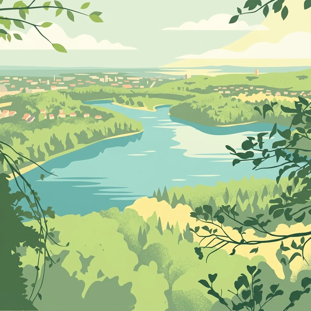
A stylized digital illustration of a lake landscape with dense green forests in the foreground, rolling hills in the distance, and light sky above.

Heider Bergsee

Nature reserve

Park overview

Structured park overview, official facts, and landscape profile for Heider Bergsee

Heider Bergsee park facts, protected area profile, and essential visitor context

Review the core facts for Heider Bergsee, including designation, size, terrain, visitor scale, habitats, and operating context in one park-focused overview.

About Heider Bergsee

Heider Bergsee is one of the more prominent lakes of the Villeseen landscape, a string of former mining lakes along the Ville ridge north of the Rhine near Cologne. Sitting in the southern portion of this chain, the lake is reached from Brühl either via the B 265 Luxemburger Straße or from Brühl's town center via the L 184 Theodor-Heuss-Straße with a turn onto Willy-Brandt-Straße. The lake's setting at the edge of the Brühl district of Heide, from which it takes its name, places it firmly within the Rheinland Nature Park.

The lake itself is striking for its irregular, winding shoreline, which creates a varied pattern of bays, inlets, and shallow water zones. The shape reflects the original outline of the lignite pit, which was not engineered into a regular basin but rather allowed to fill naturally after mining ceased. Today, the Heider Bergsee covers approximately 35 hectares, has a maximum depth of about 8.6 meters, and a mean depth of roughly 4 meters, with a total water volume of around 1.4 million cubic meters.

What distinguishes Heider Bergsee from many other post-mining lakes is the combination of protective designations and active recreation. Significant parts of the shoreline and surrounding woodland have been declared a nature reserve, while at the same time the lake hosts a long-established open-air swimming area, a year-round campsite, sailing clubs, a canoe club founded in the late 1930s, and a roughly 5.5 kilometer circular path used for walking, running, and cycling. This dual role, balancing ecological conservation with public enjoyment, makes Heider Bergsee a meaningful example of how former industrial landscapes in the Rhineland were deliberately repurposed into recreational and ecologically valuable spaces.

Quick facts and research context for Heider Bergsee

Heider Bergsee lies within the Rheinland Nature Park in the Ville ridge south of Brühl, near Cologne. The lake is a Tagebaurestsee, meaning a lake formed from a former lignite opencast mining pit that was filled after mining ended in 1964. Surrounded by mixed-species forest, the lake is part of a designated nature reserve and is part of the Natura 2000 site protecting the Heider Bergsee and the neighboring Schluchtsee in the Ville lake chain.

Protection and recognition

Examine terrestrial protection scope and documented conservation status.

Heider Bergsee Protection Status and International Recognition Record

Heider Bergsee maintains a defined terrestrial protection scope within its regional conservation landscape. Structured administrative records outline established management parameters and verified designation data for this protected area.

Protection details

Protection scope
Terrestrial
Transboundary protection
No
Park context

Deeper park guide and search-rich context for Heider Bergsee

Heider Bergsee history, landscape, wildlife, and travel context

Explore Heider Bergsee through its history, landscape character, ecosystems, wildlife, conservation priorities, cultural context, and seasonal travel timing in a structured park guide built for atlas discovery and search intent.

Why Heider Bergsee stands out

Heider Bergsee is best known as a post-mining lake that was transformed from a derelict lignite pit into a thriving lake landscape. Its stands of mixed forest, wooded shoreline, and carefully developed reed zones support birdlife such as ospreys, great crested grebes, wild geese, kingfishers, and common moorhens, while submerged plants like Myriophyllum heterophyllum, the rare Sparganium minimum, common bladderwort, and broad-leaved helleborine orchids thrive in its calcareous, nutrient-poor water.
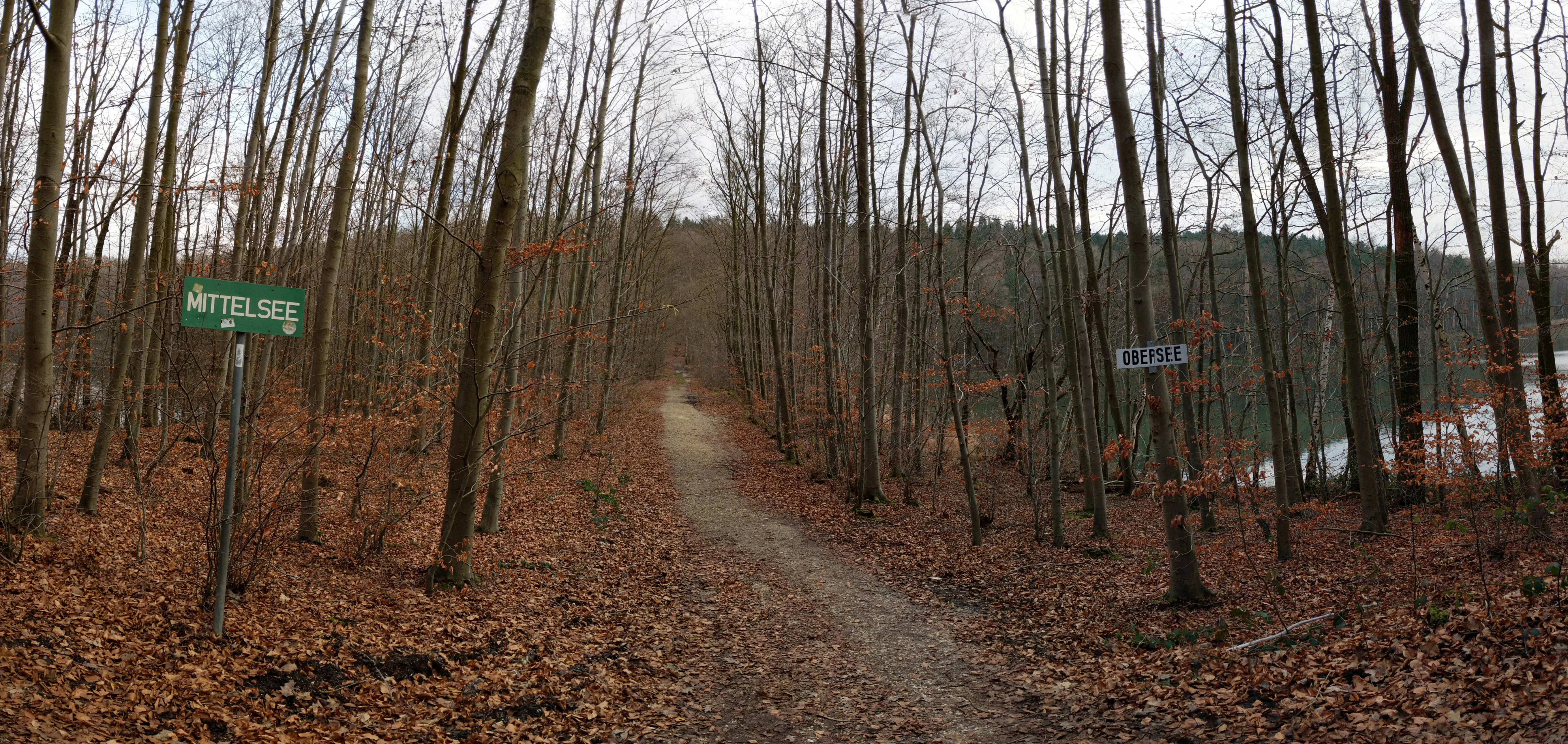
A dirt path leads through a deciduous forest in late autumn, with green trail signs labeled 'Mittelsee' and 'Obersee' visible on either side.
A woodland trail separating the Obersee and Mittelsee lakes in the Heider Bergsee park area.

Heider Bergsee history and protected-area timeline

The history of Heider Bergsee is directly tied to the lignite mining history of the Rhineland. Opencast lignite extraction had been carried out in the area since the early 19th century, supplying small-scale operations such as the Gruhlwerk and Roddergrube with coal. The local pit is also notable for producing some of the very first Union briquettes, an early pressed-coal product from the region.

Lignite extraction in the Heider Bergsee pit ended in 1964. The very next year, in 1965, the former workings began to fill with water, giving rise to the lake. This early, deliberate approach to reclaiming a former mining site has been credited to Adolf Dasbach, the mining director from neighboring Hürth, who carried out pioneering work on the recultivation of exhausted coal pits long before renaturation became a legal requirement in German mining law.

From 1967 onward, the lake began to take on a public life. A public open-air swimming area was established on the southern shore, followed in 1968 by a campsite adjacent to the bathing area. In the decades that followed, sailing, canoeing, swimming, and fishing clubs established themselves around the lake, while scientific studies, including the first documented occurrence in North Rhine-Westphalia of the aquatic plant Myriophyllum heterophyllum recorded here in 1985, confirmed that the renaturation of the site had also ecological value far beyond recreation.

Heider Bergsee landscape and geographic character

The landscape of Heider Bergsee is dominated by its setting within the Ville ridge south of Cologne. The lake lies in a gently undulating, formerly forested section of the Ville, where the underlying geology of loose sediments over coal-bearing strata has shaped both the topography and the human use of the land.

The shoreline is irregular and winding, producing numerous small bays, promontories, and reed-fringed inlets. This characteristic form, inherited from the original layout of the lignite pit, gives the lake a far more varied appearance than a regular reservoir. Photographs of the area describe sections of the shore as taking on a mangrove-like character, where wetland vegetation and shallow water zones overlap in intricate patterns.

Surrounding the lake is a near-continuous belt of mixed forest. The stands include poplars, pines, red oaks, larches, alders, beeches, black locusts, and birks, creating a richly textured woodland edge with shifting color through the seasons. Trails run along the shoreline, including a roughly 5.5 kilometer circular route used for walking, running, and cycling, and offer changing views across the lake and into the surrounding Ville countryside. The neighboring Schluchtsee, a much smaller but deeper lake reaching about 7.5 meters in depth, sits alongside Heider Bergsee as an almost incidental companion within the same lake chain.
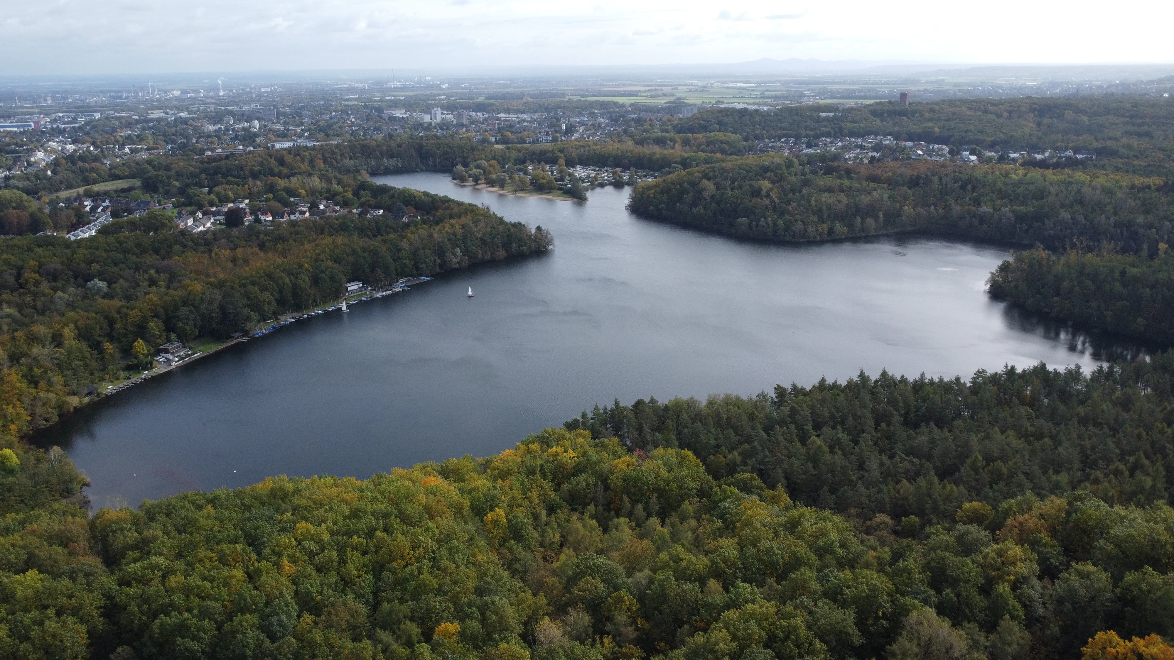
Aerial perspective of a large, dark lake surrounded by dense woodland and forest, with urban development visible in the distant background under an overcast sky.
Aerial view of Heider Bergsee, a lake surrounded by forest in North Rhine-Westphalia.

Heider Bergsee ecosystems, habitats, and plant life

Ecologically, Heider Bergsee is best described as a nutrient-poor, calcareous stillwater body with extensive shallow-water zones. Despite its artificial origin, its water chemistry resembles that of natural marl lakes, and decades of careful renaturation have allowed a diverse aquatic and wetland flora to establish itself around its edges and beneath its surface.

The riparian and aquatic vegetation includes submerged species such as Myriophyllum heterophyllum, which forms dense stands in the lake and was first scientifically documented in North Rhine-Westphalia right here in 1985. In the marginal zones, smaller and ecologically significant species such as the small bur-reed Sparganium minimum, the common bladderwort Utricularia vulgaris, and the broad-leaved helleborine orchid Epipactis helleborine can be found. Reed zones along the shoreline have been deliberately developed to extend habitat for waterbirds and amphibians, reinforcing the lake's role as a refuge within the heavily used Ville ridge.

The surrounding woodland provides additional layers of habitat. The mix of poplars, pines, red oaks, larches, alders, beeches, black locusts, and birks produces varied light, soil, and moisture conditions along the shore, supporting different insect communities, fungi, and understorey plants. Together, the open water, reed belts, and surrounding forests create a layered mosaic of habitat that has been recognized in regional conservation planning.
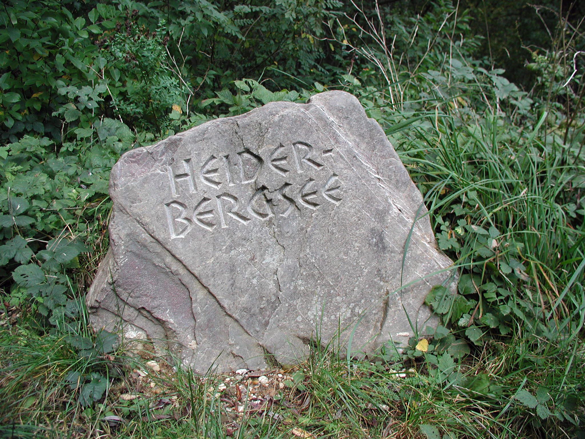
A large grey stone boulder carved with the name Heider Bergsee, surrounded by lush green foliage and grasses in a forest environment.
A stone marker identifying Heider Bergsee.

Heider Bergsee wildlife and species highlights

The animal life of Heider Bergsee reflects the lake's combination of open water, reed zones, and surrounding forest. Among breeding birds, the lake supports ospreys, great crested grebes, wild geese, common kingfishers, and common moorhens, while visiting waterfowl use the site as a stopover or wintering area as the reed zones continue to develop.

The lake's shallow, structured waters are also important for amphibians, with the natterjack toad Bufo viridis being one of the more notable species recorded in the area. Insect life is equally significant. The rare and visually striking scarlet dragonfly Ceriagrion tenellum has been documented in the reed and shoreline habitats, alongside other water-associated invertebrates.

Angling is permitted on the lake for members of the local angling and water protection club, who fish from the shore. The fish community contributes to the broader aquatic food web and helps maintain ecological balance within the lake. Together, the bird, amphibian, and insect records underline how thoroughly wildlife has re-established itself at Heider Bergsee in the decades since mining ended.
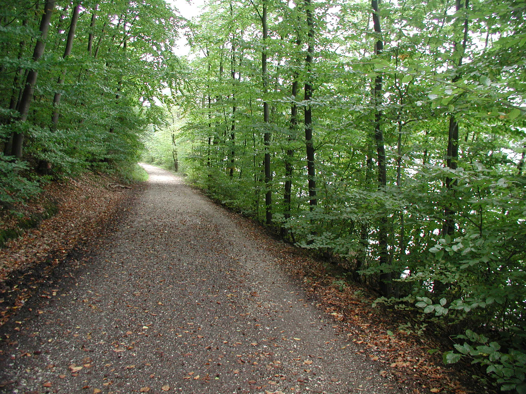
A wide gravel hiking path leads into a dense green deciduous forest, with the edge of a lake visible through the trees on the right.
A gravel path winding through the lush forest bordering Heider Bergsee.

Heider Bergsee conservation status and protection priorities

Conservation is one of the defining dimensions of Heider Bergsee. Parts of the lake and its surroundings are formally designated as a nature reserve, putting the site within Germany's stricter system of habitat protection. In addition, Heider Bergsee and the adjacent Schluchtsee are recognized together as a Natura 2000 site within the Ville lake chain, integrating the lake into the European Union's wider network of protected areas.

What makes this conservation profile particularly meaningful is its origin story. The lake is the product of one of the earliest deliberate efforts in the Rhineland mining area to reclaim an exhausted opencast pit, rather than simply abandoning it. The pioneering work of Hürth mining director Adolf Dasbach in the 1960s predated later legal obligations for renaturation, and his approach set a precedent that has since shaped how the wider Rhineland lignite mining landscape has been restored.

Today, the lake stands as a model of how a former industrial site can transition into habitat of recognized conservation value. The continued development of reed zones, the careful management of the surrounding forest, and the ongoing scientific documentation of species such as Myriophyllum heterophyllum and the scarlet dragonfly all reflect a long-term commitment to ecological recovery in a landscape that remains intensively used by people for recreation.

Heider Bergsee cultural meaning and human context

Heider Bergsee is closely bound up with the industrial and cultural history of the Rhineland lignite mining region. The pit from which the lake eventually formed was already producing coal in the early 19th century and supplied neighbouring operations such as the Gruhlwerk and Roddergrube, while also being associated with the production of the very first Union briquettes pressed from Rhineland lignite. In this sense, the lake carries the memory of a decisive phase in the region's energy and industrial history.
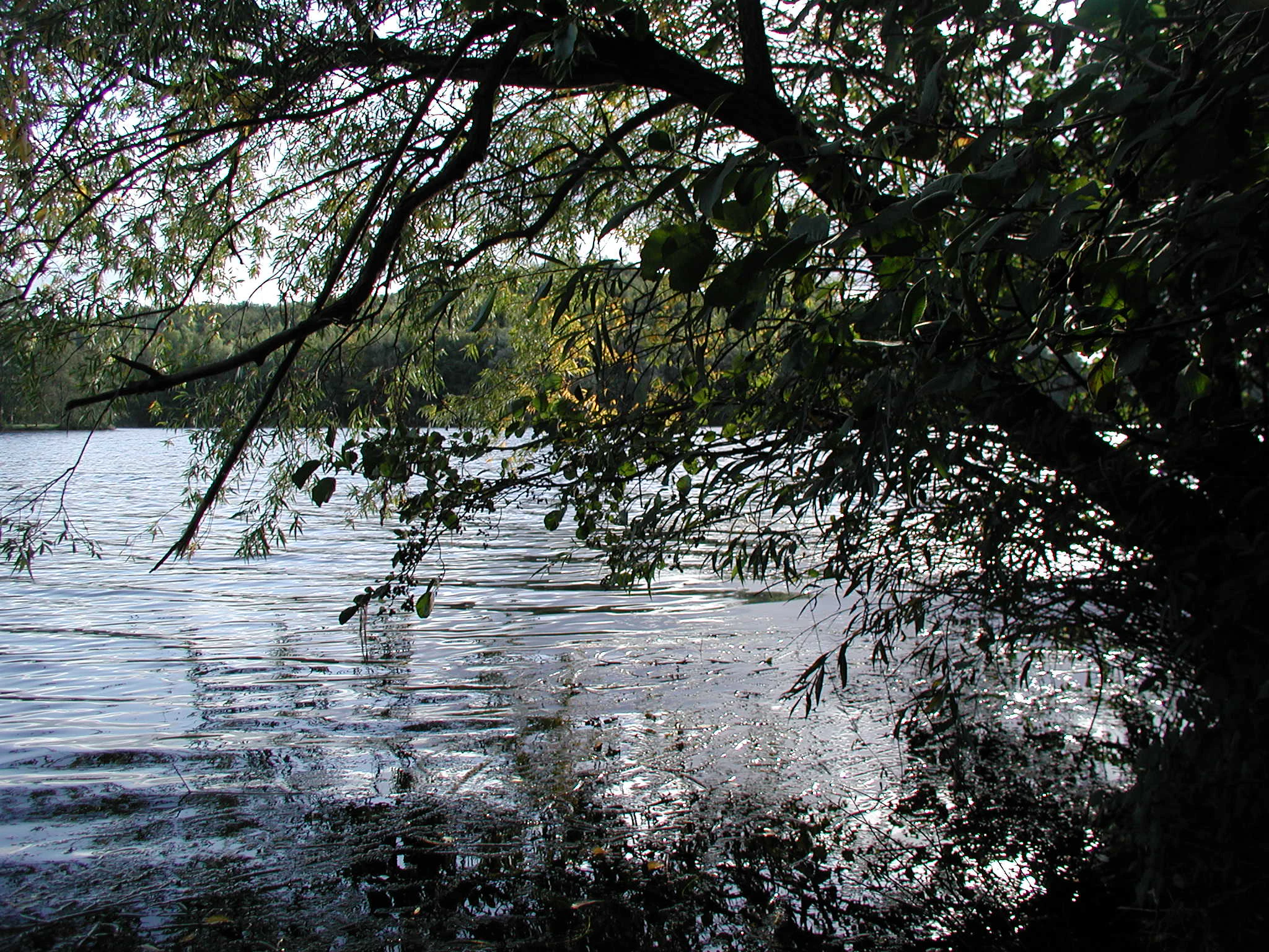
A view across the water of Heider Bergsee, framed by low-hanging branches and dense foliage in the foreground.
The tranquil waters of Heider Bergsee viewed from under the shade of overhanging trees.

Top sights and standout views in Heider Bergsee

What sets Heider Bergsee apart is its combination of ecological recovery and active recreational use. The lake offers a swimming area, campsite, sailing club, canoe club dating back to 1938, fishing grounds, and roughly 5.5 kilometers of shoreline trail, all wrapped around a nature reserve and a Natura 2000 site. Its mixed forest fringe, irregular shoreline, reed zones, and clear, nutrient-poor water together support a remarkable diversity of aquatic plants, waterbirds, amphibians, and dragonflies, all within the Rheinland Nature Park just south of Brühl.
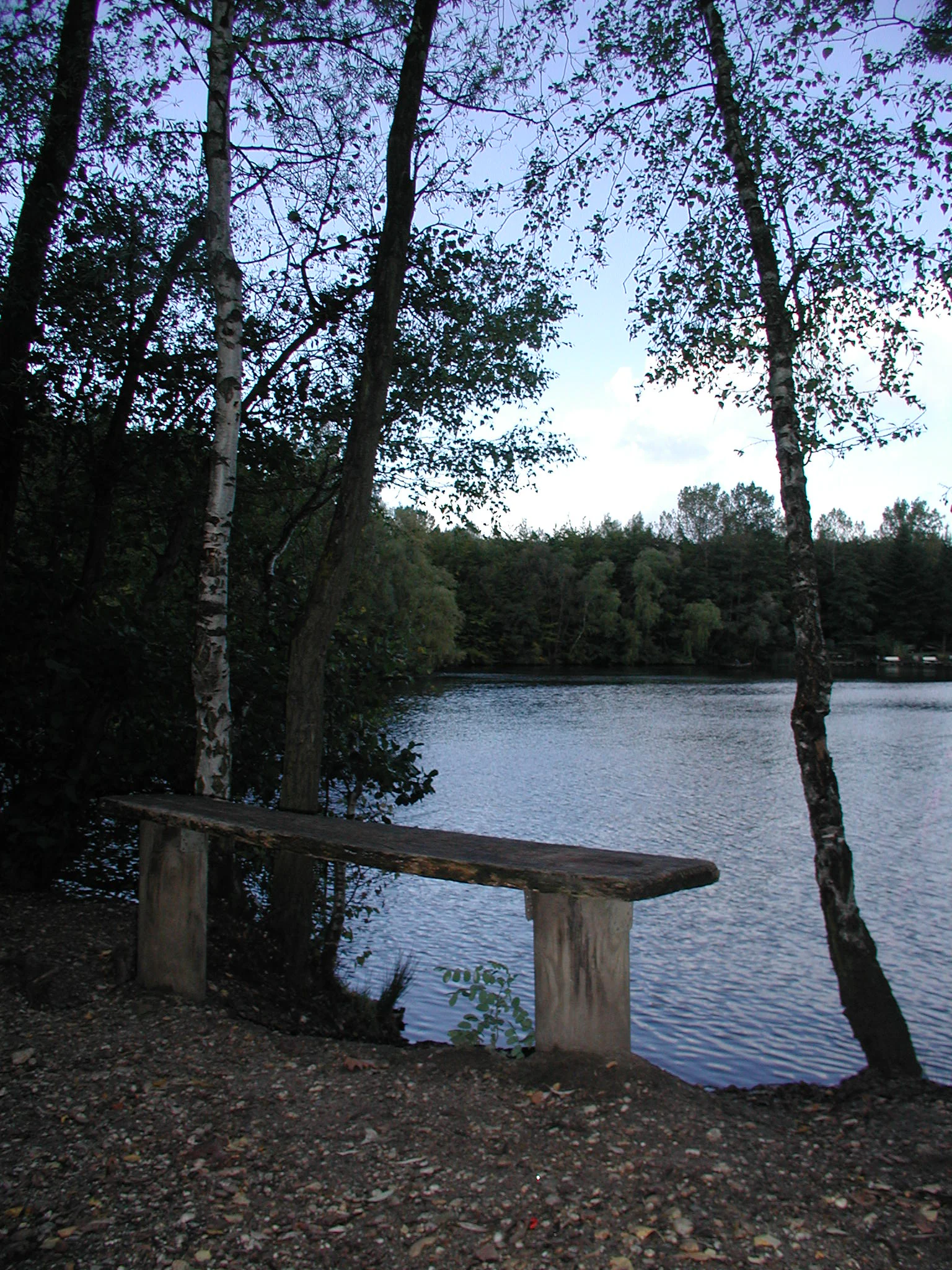
A simple wooden bench sits in the foreground, facing the calm water of Heider Bergsee, surrounded by slender birch trees.
A wooden bench overlooking the Heider Bergsee.

Best time to visit Heider Bergsee

Heider Bergsee is a year-round destination, with the lake and surrounding trails accessible through every season. Late spring and summer are particularly attractive for visitors seeking the open-air swimming area, sunbathing lawns, and busy sailing and canoeing activity on the water, when the mixed forest around the lake is in full leaf and the shoreline is most active socially.

Autumn and winter appeal more to those interested in the lake's quieter ecological character, when migratory waterfowl are drawn to the reed zones, the forest takes on russet tones, and the circular lakeside trail becomes a calm route for walking, running, or cycling. Cooler months also suit visitors looking for the distinctly peaceful atmosphere of a remade mining landscape that has fully settled into its second life.


Monthly climate preview

Long-term representative temperature ranges and precipitation rhythm for Heider Bergsee

Heider Bergsee Climate Normals and Measured Monthly Weather Patterns

Historical NASA Power climatology data records monthly temperature bounds and precipitation rates across the representative point at Heider Bergsee. Examining the complete twelve-month sequence reveals detailed climate normals and deeper shifts in long-term atmospheric patterns.
Annual mean10 °C
1 °C19 °C
Jan
Feb
Mar
Apr
May13°
Jun17°
Jul19°
Aug19°
Sep15°
Oct10°
Nov
Dec
Warmest month
July

19.2 °C

Coolest month
January

1.3 °C

Wettest month
December

2.6 mm/day

Driest month
April

1.6 mm/day

Park location guide

Geography guide, regional context, and park location map for Heider Bergsee

Heider Bergsee park geography, regions, and map view in Germany

Understand where Heider Bergsee sits in Germany through a broader geographic reading of the surrounding landscape, nearby location context, and its mapped position within the national park landscape.

How Heider Bergsee fits into Germany

Germany is a federal republic in Western and Central Europe with a population of over 83 million across sixteen constituent states. It is Europe's largest economy by nominal GDP and a major global exporter and importer. The capital is Berlin, and the country borders Denmark, Poland, Czech Republic, Austria, Switzerland, France, Luxembourg, Belgium, and the Netherlands.

Wider geography shaping Heider Bergsee in Germany

Germany is located in Western and Central Europe, spanning 357,022 km². It borders Denmark to the north, Poland and the Czech Republic to the east, Austria and Switzerland to the south, and France, Luxembourg, Belgium, and the Netherlands to the west. The country has coastlines on the Baltic Sea and North Sea to the north, with the Alps located in the southern region.

Map view of Heider Bergsee

Use this park location map to pinpoint Heider Bergsee in Germany, understand its exact geographic position, and read its mapped placement within the surrounding landscape more clearly.

Pigeon | © OpenStreetMap contributors

Location context for Heider Bergsee

Nordrhein-Westfalen

Examine protected habitats, irregular shorelines, and forest surroundings.

Heider Bergsee Photos and Landscape Scenery Visual Exploration

Visual records capture the distinctive post-mining topography, winding shorelines, and dense mixed woodland surrounding Heider Bergsee. Detailed photography reveals the intricate wetland habitats and protected aquatic environments that define this regional landscape.

A dirt path leads through a deciduous forest in late autumn, with green trail signs labeled 'Mittelsee' and 'Obersee' visible on either side.

A low-angle upward shot of a mature pine tree trunk with rough, textured bark, spiraled by green climbing vines reaching toward the blue sky.

Aerial perspective of a large, dark lake surrounded by dense woodland and forest, with urban development visible in the distant background under an overcast sky.

A large grey stone boulder carved with the name Heider Bergsee, surrounded by lush green foliage and grasses in a forest environment.

A wide gravel hiking path leads into a dense green deciduous forest, with the edge of a lake visible through the trees on the right.

A wide view across a large lake surrounded by a dense forest on the far shore, framed by overhanging branches in the foreground.

A view across the water of Heider Bergsee, framed by low-hanging branches and dense foliage in the foreground.

A simple wooden bench sits in the foreground, facing the calm water of Heider Bergsee, surrounded by slender birch trees.

Park atlas

Compare nearby protected areas and connected forest habitats in the regional lake chain

Explore Parks Near Heider Bergsee and Surrounding Regional Landscapes

Browsing parks near Heider Bergsee reveals a diverse network of post-mining reserves and protected landscapes across the surrounding region. Comparing adjacent natural habitats helps visitors trace regional ecological recovery and terrain patterns beyond a single lake.
A horizontal watercolor painting depicting a gentle, hazy green landscape with rolling hills, a line of trees, and a foreground meadow.
Protected landscapeNorth Rhine-Westphalia
Mapped location lies within the park boundary#1 closest

Southwest

Naturpark Rheinland: Geography and Protected Area Overview in North Rhine-Westphalia

A complex metropolitan nature park and lake district

Naturpark Rheinland represents a distinct convergence of reclaimed lignite mining landscapes, quiet lowland forests, and floodplain wetlands. Its mapped boundaries reveal a diverse terrain of ridges and river valleys that define the environmental character of the Cologne-Bonn metropolitan region.

Area
1,045 km²
Established
1959
Relief
Upland
Climate
Temperate
A watercolor illustration showing a landscape with a calm lake surrounded by greenery, small trees, and gently rolling hills in the background.
Nature reserveNordrhein-Westfalen
About 5.2 km away#2 closest

North

Hürther Waldsee Nature Reserve: Mapped Protected Geography and Reclaimed Mining Landscape

Ecological refuge on the Ville lake plateau of Germany

Examine the boundaries and natural features of Hürther Waldsee, a significant nature reserve in the Nordrhein-Westfalen region. This ten-hectare reclaimed mining lake offers a detailed map of post-industrial ecological recovery, featuring engineered islands, reed beds, and young beech and alder woodlands that define its protected status.

Area
0.106 km²
Established
1988
Relief
Lowland
Access
Moderate access
A soft watercolor illustration of a serene pond surrounded by gentle green hills and lush shoreline vegetation in a light, pastel color palette.
Nature reserveCologne
About 5.4 km away#3 closest

Northeast

Kiesgruben Meschenich: Geographic Analysis of a Cologne Nature Reserve Landscape

Examining the ecological terrain and mapped gravel-pit habitat network.

Kiesgruben Meschenich offers a distinct study in regional conservation, presenting a complex of excavation lakes, raw gravel substrates, and wetland fringes. This protected area stands as a primary example of how industrial remnants transform into valued ecological hubs, serving as a critical refuge for biodiversity in the densely populated Rhine landscape of North Rhine-Westphalia.

Area
0.265 km²
Established
1991
Relief
Lowland
Scope
Terrestrial
Watercolor landscape illustration showing a pale river curving through green trees with soft hills in the distance.
Nature reserveNorth Rhine-Westphalia
About 8.7 km away#4 closest

East

Langeler Auwald: A Protected Floodplain Forest in the North Rhine-Westphalia Rhine Corridor

Examining fluvial landscape patterns and riparian forest boundaries

Langeler Auwald functions as a significant nature reserve on the right bank of the Rhine in Cologne, preserving a rare mosaic of willow-poplar floodplain forest. The terrain encompasses periodically flooded gravel shores, nutrient-poor grasslands on flood dikes, and transitional orchard habitats that support a high density of protected species within the urbanized landscape of North Rhine-Westphalia.

Area
0.224 km²
Relief
Lowland
Climate
Temperate
Scope
Terrestrial
A soft watercolor illustration showing a peaceful landscape with gentle hills, trees, and small ponds reflecting light.
Nature reserveNordrhein-Westfalen
About 12 km away#5 closest

Southeast

Quarzsandgrube Nature Reserve: Geographic Profile and Protected Landscape Context

Protected mosaic of pioneer habitats in the Rhein-Sieg-Kreis

Located on the terrace slopes of the Rhein-Sieg-Kreis, Quarzsandgrube represents a significant refuge for early successional flora and fauna. The site features an uneven terrain of exposed sandy soils and water-filled hollows, providing a vital habitat corridor alongside adjacent protected areas. This detailed geographic profile maps the environmental conditions that define its current status as a protected nature reserve.

Area
0.29 km²
Established
1994
IUCN
IV
A soft watercolor painting showing a winding river with a lush green island in the middle, surrounded by soft-toned riverbanks and trees.
Nature reserveNorth Rhine-Westphalia
About 14 km away#6 closest

Southeast

Herseler Werth Nature Reserve: Geographic Overview of the Rhine River Island Landscape

A strictly protected riverine refuge in North Rhine-Westphalia

Herseler Werth represents a unique study in protected geography as the only non-publicly accessible Rhine island within North Rhine-Westphalia. Spanning 14.8 hectares, this long, narrow river island serves as a critical, human-excluded sanctuary that protects endangered species from industrial and urban disturbance. Its mapped boundaries and poplar-covered terrain illustrate the complex interaction between historical river hydrology and modern conservation efforts along the busy Bonn-Cologne corridor.

Area
0.148 km²
Established
1993
Relief
Lowland
Climate
Temperate
A soft, pale watercolor illustration of a lake with small islands and a low, distant treeline.
Nature reserveNorth Rhine-Westphalia
About 15 km away#7 closest

Northeast

Kiesgrubensee Gremberghoven Nature Reserve Geographic and Protected Area Overview

A restored industrial gravel pit ecosystem in North Rhine-Westphalia.

Kiesgrubensee Gremberghoven functions as a protected nature reserve in the Cologne metropolitan area. The site is defined by its origin as a former gravel excavation, now containing a substantial lake that attracts waterbirds and supports cliff-nesting colonies along its steep sandy slopes. This location serves as an informative case study for understanding how industrial remnants in German landscapes can be rehabilitated for conservation and ecological study.

Area
0.377 km²
Established
1989
Relief
Lowland
Climate
Temperate
Nature reserveCologne
About 15 km away#8 closest

East

Kiesgruben Paulsmaar Nature Reserve: Landscape and Geography in the Cologne Urban Fringe

A managed mosaic of post-industrial gravel pits and wetland habitats.

Kiesgruben Paulsmaar represents a distinct example of urban-edge habitat restoration in western Germany. Located near the border of Cologne, this 24-hectare nature reserve consists of three interconnected water bodies, floodplain forests, and calcareous grasslands. It serves as a regional refuge for biodiversity while documenting the conversion of former industrial land into a functioning wetland ecosystem.

Area
0.247 km²
Established
1991
Relief
Lowland
Climate
Temperate

Common questions about visiting, size, designation, and location context for Heider Bergsee

Heider Bergsee FAQs for park facts, access, geography, and protected area context

Find quick answers about Heider Bergsee, including protected-area facts, park geography, trail and visitor context, and how the park fits into its surrounding country and regional landscape.
MoriAtlas Explorer

Continue Your Protected Areas Search Across the Global Atlas

Deepen your exploration by continuing the structured search for national parks and protected areas worldwide. Utilize the comprehensive filtering capabilities to compare different conservation landscapes and refine your understanding of global park geography. Discover more about the distribution and characteristics of protected natural areas.

Global natural geography