
Peninsulas
Park geography
A structured examination of regional terrain, protected wetland, and coastal geography.
Horseshoe Bay Wilderness Geographic Profile: Mapped Boundaries and Natural Landscape Features
This geographic assessment of Horseshoe Bay Wilderness in Michigan provides a detailed analysis of its 15.33 square kilometer boundary. The profile covers the protected area, mapping its integration with the Upper Peninsula, Grosse Point, and local hydrology including Lake Huron, Foley Creek, and Martineau Creek. It serves as a resource for understanding the park's lowland relief, forest cover, and interconnected wetland and coastal habitats.
Related tags
wilderness areawetland ecosystemLake Huron shorelineGreat Lakes coastal forestriparian wetlands
A small Great Lakes wetland wilderness on the northwestern edge of Lake Huron, Michigan.
Horseshoe Bay Wilderness
Horseshoe Bay Wilderness is a 3,787-acre federally designated wilderness area located in Mackinac County in the Upper Peninsula of Michigan. The area sits along the northwestern shoreline of Lake Huron, where it borders the curved, shallow Horseshoe Bay near the Straits of Mackinac. Administered by the U.S. Forest Service as part of the Hiawatha National Forest, the wilderness is one of the smallest and most ecologically focused protected areas in Michigan's national forest system. The landscape formed after the last ice age, when falling lake levels exposed former shoreline and lakebed as a series of rolling, riparian wetlands. Today the wilderness is a forested wetland complex, dominated by moisture-tolerant tree species such as paper birch and northern whitecedar. Slow tributaries drain the wetlands into Horseshoe Bay, creating important fish spawning habitat for Lake Huron and supporting fish-eating birds such as great blue herons. Though modest in size, Horseshoe Bay Wilderness stands out for combining coastal Great Lakes scenery with a true backcountry wetland character. It is a compact example of how post-glacial landscape processes have shaped the ecological identity of the northern Lake Huron shoreline.
- Location
- United States of America
- Park type
- Wildlife reserve
- Established
- 1987
- Area
- 15.3 km²
Location overview
United States of America and Michigan administrative positioning
Horseshoe Bay Wilderness Geographic Setting and Regional Location Data
Horseshoe Bay Wilderness sits within the United States of America and Michigan regional network. Administrative records confirm its coastal protected status while outlining precise geographic memberships.
- Countries
- United States of America
- Regions
- Michigan
- Primary location
- Michigan
- Geographic setting
- Coastal
Boundary and coordinates
Interactive boundary geometry and recorded area measurements
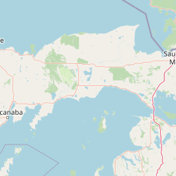
Horseshoe Bay Wilderness Boundary Map and Spatial Extent
Mapped geographic outlines provide spatial context for protected boundaries across the landscape. Associated dimensional metrics supply structured area and coordinate data for analysis.
- Boundary area
- 15.3 km²
- Boundary perimeter
- 30 km
- Northernmost point
- 46.0068° N
- Southernmost point
- 45.9333° N
- Easternmost point
- 84.6841° W
- Westernmost point
- 84.753° W
- Geographic centre
- 45.9753° N, 84.7184° W
- North–south span
- 8.2 km
- East–west span
- 5.3 km
Terrain and natural features
Lowland landscape classification and recorded natural features
Horseshoe Bay Wilderness Terrain and Named Natural Features
Recorded terrain classifications outline the lowland relief profile across Horseshoe Bay Wilderness alongside multiple connected natural features. Linked feature cards supply names, types, measurements, and spatial relationships throughout the protected area.
Selected named natural features
Capes
Grosse Point
Streams
Martineau Creek
Lakes
Lake Huron
176 m
Streams
Foley Creek
Environmental setting
Boreal forest, wetland, and coastal climate classifications across lowland terrain
Horseshoe Bay Wilderness Environmental Settings and Physical Classifications
Recorded landscape features and habitat types provide complementary ways to read the physical setting of Horseshoe Bay Wilderness. Stored environmental categories connect directly to relevant atlas destinations where available.
- Relief
- Lowland
- Climate
- Temperate
- Water
- Major water bodies
- Forest cover
- Mostly forested
- Seasonality
- Seasonal
Landscape features
Forest · Wetland · Rivers · Coast
Habitat types
Boreal forest · Wetland · Riverine habitat · Coastal habitat
Park atlas
Compare surrounding regional park geography and connected Great Lakes protected landscapes.
Parks Near Horseshoe Bay Wilderness and Related Protected Areas in the Region
Explore other protected areas near Horseshoe Bay Wilderness to examine similar post glacial wetland ecosystems and coastal Great Lakes terrain. Comparing adjacent wilderness tracts reveals broader ecological patterns across the northern Lake Huron shoreline.

Protected landscapeUpper Peninsula of Michigan
Park boundaries overlap#1 closest
West

Hiawatha National Forest: Geographic Overview and Protected Area Map of the Upper Peninsula
Coastal forest landscape and wilderness river corridors.
Hiawatha National Forest spans significant portions of the Upper Peninsula of Michigan, bridging the gap between northern hardwood forests and the boreal environments of the Great Lakes. This protected landscape encompasses extensive shorelines along Lake Superior, Lake Michigan, and Lake Huron, alongside six wilderness areas and five designated wild and scenic rivers.
- Area
- 3,621.27 km²
- Established
- 1931
- IUCN
- VI
- Relief
- Lowland
Wildlife reserveMichigan
8.2 km away#2 closest
Northwest
Mackinac Wilderness Protected Area: Glacial Terrain and River Geography in Upper Michigan
A roadless wilderness reserve within Hiawatha National Forest
Uncover the geographic significance of Mackinac Wilderness, an IUCN Category Ib protected area in Michigan. The unit provides a distinct look at northern forest recovery through a terrain of sandy ridges, aspen and birch cover, and aquatic corridors. This study examines the interplay between postglacial landforms and the ongoing natural succession occurring along the Carp River drainage basin.
- Area
- 49.5 km²
- IUCN
- Ib
- Relief
- Lowland
- Climate
- Temperate

Wildlife reserveUnited States of America
About 16 km away#3 closest
Southeast
Round Island Wilderness: Geographic Overview of the Straits of Mackinac Wildlife Reserve
Coastal marsh, conifer forest, and hardwood interior terrain
Round Island Wilderness encompasses nearly all of a 378-acre island sanctuary, distinguished by its mature beech-maple hardwood interior and boreal-leaning conifer forests. This protected land remains an essential study of Great Lakes island ecology, standing as a quiet, undisturbed wilderness edge along the transit routes of the Michigan straits.
- Area
- 1.53 km²
- Relief
- Lowland
- Climate
- Temperate
- Access
- Remote access
Marine protected areaMichigan
31 km away#4 closest
Southeast
Thunder Bay National Marine Sanctuary: Geography and Protected Maritime Landscape Context
Mapping underwater heritage in the Michigan Great Lakes region
Spanning 4,300 square miles of Lake Huron, Thunder Bay National Marine Sanctuary preserves a significant collection of shipwrecks within a glacially shaped freshwater terrain. This marine protected area offers a look at submerged geography ranging from shallow coastal bays to deep lake basins. It serves as a vital anchor for understanding maritime history and freshwater ecosystem stability across the Michigan shoreline.
- Area
- 11,000 km²
- Established
- 2000
- Relief
- Lowland
- Climate
- Temperate

National parkMichigan
130 km away#5 closest
Southwest
Sleeping Bear Dunes National Lakeshore: Atlas, Maps, and Protected Landscape Geography
Great Lakes freshwater coast and glacial dune systems
Sleeping Bear Dunes National Lakeshore showcases the unique intersection of glacial geology and freshwater ecology. This protected area features massive dunes resting on ancient glacial deposits, backed by beech and maple forests. The geographic scope includes the vast shoreline of Lake Michigan, inland waters such as Glen Lake, and the distinct maritime history found across the remote North and South Manitou Islands.
- Area
- 288.13 km²
- Established
- 1970
- IUCN
- III
- Visitors
- 1.5M annual
Natural monumentAlger County
About 137 km away#6 closest
Northwest
Pictured Rocks National Lakeshore: Geographic Atlas of Cliffs and Shoreline Terrain
Protected landscape geography in Alger County, Michigan
Pictured Rocks National Lakeshore offers a deep look into the Great Lakes coastal geography. Explore the intersection of Cambrian-era sandstone cliffs, perched dune systems, and inland forested wilderness. This area provides a clear record of glacial and lake-driven erosion, featuring unique formations like Miners Castle and Chapel Rock across its extensive Lake Superior boundary.
- Area
- 296.38 km²
- Established
- 1966
- IUCN
- III
- Visitors
- 953.1K annual
Marine protected areaMichigan
About 155 km away#7 closest
Southeast
Thunder Bay National Marine Sanctuary and Underwater Preserve: Geography and Protected Area Atlas
Maritime heritage sites and glacial freshwater geography in Lake Huron, Michigan.
Situated along the rugged northeastern coast of Lake Huron, Thunder Bay National Marine Sanctuary and Underwater Preserve protects over two hundred shipwreck sites spanning nearly two centuries of maritime history. This marine protected area offers a unique intersection of submerged archaeological resources, shallow shoals, coastal marshes, and limestone bedrock, forming a vital freshwater ecosystem in the Great Lakes region of Michigan.
- Area
- 11,000 km²
- Established
- 2000
- Relief
- Lowland
- Climate
- Temperate

Protected landscapeMichigan
About 162 km away#8 closest
South
Huron, Manistee National Forests: Geography, Protected Land, and Michigan Landscape Atlas
Exploration of glacial terrain, river basins, and coastal wilderness.
The Huron, Manistee National Forests stand as a significant protected landscape in northern Michigan, featuring a vast network of inland rivers and lakes. This atlas entry provides geographic context on its glacial geology, the rare dune ecosystems along Lake Michigan, and the distribution of pine-dominated forest habitats across the two administrative units.
- Area
- 3,960 km²
- IUCN
- VI
- Relief
- Lowland
- Climate
- Temperate
MoriAtlas Explorer
Explore the Mapped Geography and Protected Terrain of Horseshoe Bay Wilderness
Delve into the structural details and natural landscapes of Horseshoe Bay Wilderness. Through the MoriAtlas database, understand the connection between its post-glacial wetland history and the broader coastal ecology of Michigan, offering a clear perspective on how this protected reserve anchors the local Lake Huron shoreline environment.
Browse next
Global natural geography
Explore related park routes
Explore MoriAtlas Global ParksBrowse All MoriAtlas ParksGlobal Park Map DiscoveryMoriAtlas: Browse All CountriesBrowse All MoriAtlas ContinentsNational Park Environment AtlasGrand Canyon National Park AtlasYellowstone National Park AtlasYosemite National Park Atlas and GeographySerengeti National Park AtlasGalápagos National Park Protected LandscapeBanff National Park Geography and AtlasKruger National Park Atlas EntryUluṟu-Kata Tjuṯa National Park AtlasExplore Uluru-Kata Tjuta National Park GeographyPlitvice Lakes National Park AtlasFiordland National Park Protected LandscapeGreat Smoky Mountains National Park AtlasAfghanistan National Parks and Protected AreasAlbania National Parks and Protected AreasAlgeria National Parks and Protected AreasAmerican Samoa National Parks and Protected AreasAndorra National Parks and Protected AreasAngola National Parks and Protected AreasAntarctica National Parks and Protected AreasAntigua and Barbuda Park List